SlideShare una empresa de Scribd logo
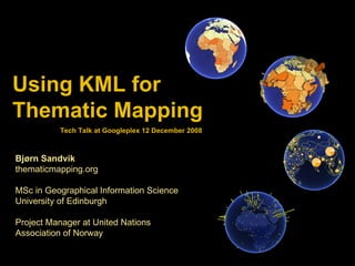
Using KML for  Thematic Mapping Bjørn Sandvik thematicmapping.org MSc in Geographical Information Science University of Edinburgh Project Manager at United Nations Association of Norway Tech Talk at Googleplex 12 December 2008
[object Object],[object Object],[object Object],[object Object],[object Object],[object Object],[object Object],[object Object],[object Object],Outline Geo- browsers Thematic mapping techniques KML standard Public datasets Visualisations
Proportional symbols
Proportional symbols #1  Scaling image icons


Mathematical scaling of 2-D point symbols: symbolSize = power(value/maxValue; 1/2) * maxSize   KML for proportional icon images <Style id='sharedStyle'> <IconStyle> <Icon> <href>files/symbol.png</href> </Icon> </IconStyle> <Style> KML <Placemark> <name>China</name> <Snippet>1,312,978,855 (2005)</Snippet> <styleUrl>#sharedStyle</styleUrl> <Style> <IconStyle> <color>e50066ff</color> <scale>7</scale> </IconStyle> </Style> <Point> <coordinates>106.514,33.42,0</coordinates> </Point> </Placemark> KML
Problem: Size affected by viewport
Not working in Google Maps
Proportional symbols #2  Drawing regular polygons
 
Problem: Complicated! function  kmlSymbolCalculator ( $longitude, $latitude, $radius, $vertices) { $EARTH_RADIUS_EQUATOR = 6378140.0; $RADIAN = 180 / pi(); $long = $longitude / $RADIAN; $lat = $latitude / $RADIAN; $f = 1/298.257; $e = 0.08181922; $kml = '<Polygon><outerBoundaryIs><LinearRing><coordinates>'; for ( $bearing = 45; $bearing <= 405; $bearing += 360/$vertices ) { $b = $bearing / $RADIAN; $R = $EARTH_RADIUS_EQUATOR * (1 - $e * $e) / pow( (1 - $e*$e *  pow(sin($lat),2)), 1.5); $psi = $distance/$R; $phi = pi()/2 - $lat; $arccos = cos($psi) * cos($phi) + sin($psi) * sin($phi) * cos($b); $latA = (pi()/2 - acos($arccos)) * $RADIAN; $arcsin = sin($b) * sin($psi) / sin($phi); $longA = ($long - asin($arcsin)) * $RADIAN; $kml .= &quot; “ . round($longA,$this->coordDecimals) . &quot;,“  . round($latA,$this->coordDecimals);  } $kml = '</coordinates></LinearRing><outerBoundaryIs></Polygon>'; return $kml; }
Proportional symbols #3  Scaling 3-D Collada objects
 
 
Mathematical scaling of 3-D point symbols: symbolSize = power(value/maxValue; 1/3) * maxSize   Making proportional Collada objects  Position   Measure / scale Colorize Google SketchUp <Placemark> <name>China</name> <Snippet>1,312,978,855 (2005)</Snippet> <Model> <Link> <href>files/object.dae</href> </Link> <altitudeMode>absolute</altitudeMode> <Location> <longitude>106.514</longitude> <latitude>33.42</latitude> <altitude>0</altitude> </Location> <Scale> <x>140000</x> <y>140000</y> <z>140000</z> </Scale> </Model> </Placemark> KML
Chart maps


Using Google Chart API in KML <Style id='sharedStyle'> <BalloonStyle> <text><![CDATA[ <img src='http://chart.apis.google.com/chart ?cht=p&chd=t:20,45,5 &amp;chd=t: $[chartValues] '> ]]></text> </BalloonStyle> </Style> KML <Placemark> <name>China</name> <Snippet>1,312,978,855 (2005)</Snippet> <styleUrl>#sharedStyle</styleUrl> <Style> <IconStyle> <scale>7</scale> <Icon>   <href> http://chart.apis.google.com/chart?cht=p&chd=t:20,45,5&chs=300x150 &amp;chf=bg,s,ffffff00</href> </Icon> </IconStyle> </Style> <Point> <coordinates>106.514,33.42,0</coordinates> </Point> <ExtendedData> <Data name=&quot;chartValues&quot;> <value>20,45,5</value> </Data> </ExtendedData> </Placemark> KML
Choropleth maps
 
Prism maps


Problem: Polygon holes
KML used in prism maps Suggestion: <Placemark> <name>China</name> <Snippet>1,312,978,855 (2005)</Snippet> <styleUrl>#sharedStyle</styleUrl> <Style> <PolyStyle> <color>DC0066FF</color> </PolyStyle> </Style> <MultiGeometry> <Polygon> <extrude>1</extrude> <altitudeMode>absolute</altitudeMode> <outerBoundaryIs> <LinearRing> <coordinates>  110.72,20.06, 2000000  109.26,19.9, 2000000 108.63,19.28, 2000000  108.69,18.51, 2000000 110.05,18.38, 2000000  111.03,19.64, 2000000 (...)  </coordinates> </LinearRing> </outerBoundaryIs> </Polygon> <Polygon> (...) </Polygon> </MultiGeometry> </Placemark> KML <Placemark> <name>China</name> <Snippet>1,312,978,855 (2005)</Snippet> <styleUrl>#sharedStyle</styleUrl> <Style> <PolyStyle> <color>DC0066FF</color> </PolyStyle> </Style> <MultiGeometry> <Polygon> <extrude>1</extrude> <altitude>2000000</altitude> <altitudeMode>clampToAltitude</altitudeMode>  <outerBoundaryIs> <LinearRing> <coordinates>  110.72,20.06 109.26,19.9 108.63,19.28 108.69,18.51 110.05,18.38 111.03,19.64 (...)  </coordinates> </LinearRing> </outerBoundaryIs> </Polygon> <Polygon> (...) </Polygon> </MultiGeometry> </Placemark> KML
3-D bar maps
3-D bars: One variable
3-D bars: Two variables
Animated maps
 
Thematic Mapping Engine
Thematic mapping parameters Web Interface PHP Library Web Processing Service KML/KMZ Thematic Mapping Engine Thematic Mapping Engine


Apache MySQL PHP Web server HTML / JavaScript Ext JS Google Earth API Web browser 1. Get list of indicators   2. Get list of available years  3. Make KML/KMZ document 4. Download KML/KMZ file  How it works
MySQL Data Connector Form Handler Database File Server Web server Web browser KML/KMZ files Web server infrastructure Thematic  Mapping  Engine
include ('TME_MySQL_DataConnector.php'); include ('TME_Engine.php'); $dataConnector = new DataConnector(); $dataStore = $dataConnector->getDataStore(68, 2005, 0);  $parameters = array( 'mapType’  => 'choropleth',   'indicator'  => 68,   'year'  => 2005,   'classification' => 'equal' ); $map = new ThematicMap($dataStore, $parameters); $file = $map->getKML(); Application Programming Interface (API)
KML structure Add KML header Technique Choropleth Prism Bar  Image Polygon Collada Type For each year For each feature Technique Choropleth Bar  Image Polygon Collada Type Prism  Add shared style Add shared style Add shared style Add shared style Colourise Collada object(s) Add style and feature Add style and feature Add style and feature Add style and feature Add style and feature Add link to Collada object Add map title and legend <Folder> <Placemark> </Placemark> </Folder> <kml> </kml> Symbol Symbol
Map legends Unclassed Equal intervals Quantiles
[object Object],[object Object],[object Object],[object Object],[object Object],[object Object],Google Earth fix!
thematic mapping.org

Más contenido relacionado

Similar a Using KML for Thematic Mapping

Google Mapy (Jaroslav Bengl)
Google Mapy (Jaroslav Bengl)Google Mapy (Jaroslav Bengl)
Google Mapy (Jaroslav Bengl)
Jiří Šmída
 
Introducing Modern Perl
Introducing Modern PerlIntroducing Modern Perl
Introducing Modern Perl
Dave Cross
 
Playing with d3.js
Playing with d3.jsPlaying with d3.js
Playing with d3.js
mangoice
 

Similar a Using KML for Thematic Mapping (20)

Rendering OpenStreetMap Data using Mapnik
Rendering OpenStreetMap Data using MapnikRendering OpenStreetMap Data using Mapnik
Rendering OpenStreetMap Data using Mapnik
 
How data rules the world: Telemetry in Battlefield Heroes
How data rules the world: Telemetry in Battlefield HeroesHow data rules the world: Telemetry in Battlefield Heroes
How data rules the world: Telemetry in Battlefield Heroes
 
Google Mapy (Jaroslav Bengl)
Google Mapy (Jaroslav Bengl)Google Mapy (Jaroslav Bengl)
Google Mapy (Jaroslav Bengl)
 
Advanced Kml
Advanced KmlAdvanced Kml
Advanced Kml
 
R Spatial Analysis using SP
R Spatial Analysis using SPR Spatial Analysis using SP
R Spatial Analysis using SP
 
Beholding the giant pyramid of application development; why Ajax applications...
Beholding the giant pyramid of application development; why Ajax applications...Beholding the giant pyramid of application development; why Ajax applications...
Beholding the giant pyramid of application development; why Ajax applications...
 
Google maps
Google mapsGoogle maps
Google maps
 
Google maps
Google mapsGoogle maps
Google maps
 
Introducing Modern Perl
Introducing Modern PerlIntroducing Modern Perl
Introducing Modern Perl
 
Windows Phone 7 Bing Maps Control
Windows Phone 7 Bing Maps ControlWindows Phone 7 Bing Maps Control
Windows Phone 7 Bing Maps Control
 
Creating Maps With Style
Creating Maps With StyleCreating Maps With Style
Creating Maps With Style
 
Python And GIS - Beyond Modelbuilder And Pythonwin
Python And GIS - Beyond Modelbuilder And PythonwinPython And GIS - Beyond Modelbuilder And Pythonwin
Python And GIS - Beyond Modelbuilder And Pythonwin
 
How Groovy Helps
How Groovy HelpsHow Groovy Helps
How Groovy Helps
 
Building Complex GUI Apps The Right Way. With Ample SDK - SWDC2010
Building Complex GUI Apps The Right Way. With Ample SDK - SWDC2010Building Complex GUI Apps The Right Way. With Ample SDK - SWDC2010
Building Complex GUI Apps The Right Way. With Ample SDK - SWDC2010
 
Playing with d3.js
Playing with d3.jsPlaying with d3.js
Playing with d3.js
 
ESRI Developer Summit 2008 - Microsoft Virtual Earth
ESRI Developer Summit 2008 - Microsoft Virtual EarthESRI Developer Summit 2008 - Microsoft Virtual Earth
ESRI Developer Summit 2008 - Microsoft Virtual Earth
 
10 Things You're Not Doing [IBM Lotus Notes Domino Application Development]
10 Things You're Not Doing [IBM Lotus Notes Domino Application Development]10 Things You're Not Doing [IBM Lotus Notes Domino Application Development]
10 Things You're Not Doing [IBM Lotus Notes Domino Application Development]
 
Pycon2011
Pycon2011Pycon2011
Pycon2011
 
Where20 2008 Ruby Tutorial
Where20 2008 Ruby TutorialWhere20 2008 Ruby Tutorial
Where20 2008 Ruby Tutorial
 
Hadoop Hive Talk At IIT-Delhi
Hadoop Hive Talk At IIT-DelhiHadoop Hive Talk At IIT-Delhi
Hadoop Hive Talk At IIT-Delhi
 

Último

Último (20)

Unpacking Value Delivery - Agile Oxford Meetup - May 2024.pptx
Unpacking Value Delivery - Agile Oxford Meetup - May 2024.pptxUnpacking Value Delivery - Agile Oxford Meetup - May 2024.pptx
Unpacking Value Delivery - Agile Oxford Meetup - May 2024.pptx
 
Extensible Python: Robustness through Addition - PyCon 2024
Extensible Python: Robustness through Addition - PyCon 2024Extensible Python: Robustness through Addition - PyCon 2024
Extensible Python: Robustness through Addition - PyCon 2024
 
The Metaverse: Are We There Yet?
The  Metaverse:    Are   We  There  Yet?The  Metaverse:    Are   We  There  Yet?
The Metaverse: Are We There Yet?
 
Salesforce Adoption – Metrics, Methods, and Motivation, Antone Kom
Salesforce Adoption – Metrics, Methods, and Motivation, Antone KomSalesforce Adoption – Metrics, Methods, and Motivation, Antone Kom
Salesforce Adoption – Metrics, Methods, and Motivation, Antone Kom
 
Choosing the Right FDO Deployment Model for Your Application _ Geoffrey at In...
Choosing the Right FDO Deployment Model for Your Application _ Geoffrey at In...Choosing the Right FDO Deployment Model for Your Application _ Geoffrey at In...
Choosing the Right FDO Deployment Model for Your Application _ Geoffrey at In...
 
IoT Analytics Company Presentation May 2024
IoT Analytics Company Presentation May 2024IoT Analytics Company Presentation May 2024
IoT Analytics Company Presentation May 2024
 
What's New in Teams Calling, Meetings and Devices April 2024
What's New in Teams Calling, Meetings and Devices April 2024What's New in Teams Calling, Meetings and Devices April 2024
What's New in Teams Calling, Meetings and Devices April 2024
 
IESVE for Early Stage Design and Planning
IESVE for Early Stage Design and PlanningIESVE for Early Stage Design and Planning
IESVE for Early Stage Design and Planning
 
10 Differences between Sales Cloud and CPQ, Blanka Doktorová
10 Differences between Sales Cloud and CPQ, Blanka Doktorová10 Differences between Sales Cloud and CPQ, Blanka Doktorová
10 Differences between Sales Cloud and CPQ, Blanka Doktorová
 
Introduction to Open Source RAG and RAG Evaluation
Introduction to Open Source RAG and RAG EvaluationIntroduction to Open Source RAG and RAG Evaluation
Introduction to Open Source RAG and RAG Evaluation
 
SOQL 201 for Admins & Developers: Slice & Dice Your Org’s Data With Aggregate...
SOQL 201 for Admins & Developers: Slice & Dice Your Org’s Data With Aggregate...SOQL 201 for Admins & Developers: Slice & Dice Your Org’s Data With Aggregate...
SOQL 201 for Admins & Developers: Slice & Dice Your Org’s Data With Aggregate...
 
Optimizing NoSQL Performance Through Observability
Optimizing NoSQL Performance Through ObservabilityOptimizing NoSQL Performance Through Observability
Optimizing NoSQL Performance Through Observability
 
Agentic RAG What it is its types applications and implementation.pdf
Agentic RAG What it is its types applications and implementation.pdfAgentic RAG What it is its types applications and implementation.pdf
Agentic RAG What it is its types applications and implementation.pdf
 
Buy Epson EcoTank L3210 Colour Printer Online.pptx
Buy Epson EcoTank L3210 Colour Printer Online.pptxBuy Epson EcoTank L3210 Colour Printer Online.pptx
Buy Epson EcoTank L3210 Colour Printer Online.pptx
 
Powerful Start- the Key to Project Success, Barbara Laskowska
Powerful Start- the Key to Project Success, Barbara LaskowskaPowerful Start- the Key to Project Success, Barbara Laskowska
Powerful Start- the Key to Project Success, Barbara Laskowska
 
UiPath Test Automation using UiPath Test Suite series, part 2
UiPath Test Automation using UiPath Test Suite series, part 2UiPath Test Automation using UiPath Test Suite series, part 2
UiPath Test Automation using UiPath Test Suite series, part 2
 
Intro in Product Management - Коротко про професію продакт менеджера
Intro in Product Management - Коротко про професію продакт менеджераIntro in Product Management - Коротко про професію продакт менеджера
Intro in Product Management - Коротко про професію продакт менеджера
 
Custom Approval Process: A New Perspective, Pavel Hrbacek & Anindya Halder
Custom Approval Process: A New Perspective, Pavel Hrbacek & Anindya HalderCustom Approval Process: A New Perspective, Pavel Hrbacek & Anindya Halder
Custom Approval Process: A New Perspective, Pavel Hrbacek & Anindya Halder
 
AI presentation and introduction - Retrieval Augmented Generation RAG 101
AI presentation and introduction - Retrieval Augmented Generation RAG 101AI presentation and introduction - Retrieval Augmented Generation RAG 101
AI presentation and introduction - Retrieval Augmented Generation RAG 101
 
Integrating Telephony Systems with Salesforce: Insights and Considerations, B...
Integrating Telephony Systems with Salesforce: Insights and Considerations, B...Integrating Telephony Systems with Salesforce: Insights and Considerations, B...
Integrating Telephony Systems with Salesforce: Insights and Considerations, B...
 

Using KML for Thematic Mapping

  • 1. Using KML for Thematic Mapping Bjørn Sandvik thematicmapping.org MSc in Geographical Information Science University of Edinburgh Project Manager at United Nations Association of Norway Tech Talk at Googleplex 12 December 2008
  • 2.
  • 4. Proportional symbols #1 Scaling image icons
  • 5.  
  • 6.  
  • 7.  
  • 8.  
  • 9.  
  • 10. Mathematical scaling of 2-D point symbols: symbolSize = power(value/maxValue; 1/2) * maxSize KML for proportional icon images <Style id='sharedStyle'> <IconStyle> <Icon> <href>files/symbol.png</href> </Icon> </IconStyle> <Style> KML <Placemark> <name>China</name> <Snippet>1,312,978,855 (2005)</Snippet> <styleUrl>#sharedStyle</styleUrl> <Style> <IconStyle> <color>e50066ff</color> <scale>7</scale> </IconStyle> </Style> <Point> <coordinates>106.514,33.42,0</coordinates> </Point> </Placemark> KML
  • 11. Problem: Size affected by viewport
  • 12. Not working in Google Maps
  • 13. Proportional symbols #2 Drawing regular polygons
  • 14.  
  • 15. Problem: Complicated! function kmlSymbolCalculator ( $longitude, $latitude, $radius, $vertices) { $EARTH_RADIUS_EQUATOR = 6378140.0; $RADIAN = 180 / pi(); $long = $longitude / $RADIAN; $lat = $latitude / $RADIAN; $f = 1/298.257; $e = 0.08181922; $kml = '<Polygon><outerBoundaryIs><LinearRing><coordinates>'; for ( $bearing = 45; $bearing <= 405; $bearing += 360/$vertices ) { $b = $bearing / $RADIAN; $R = $EARTH_RADIUS_EQUATOR * (1 - $e * $e) / pow( (1 - $e*$e * pow(sin($lat),2)), 1.5); $psi = $distance/$R; $phi = pi()/2 - $lat; $arccos = cos($psi) * cos($phi) + sin($psi) * sin($phi) * cos($b); $latA = (pi()/2 - acos($arccos)) * $RADIAN; $arcsin = sin($b) * sin($psi) / sin($phi); $longA = ($long - asin($arcsin)) * $RADIAN; $kml .= &quot; “ . round($longA,$this->coordDecimals) . &quot;,“ . round($latA,$this->coordDecimals); } $kml = '</coordinates></LinearRing><outerBoundaryIs></Polygon>'; return $kml; }
  • 16. Proportional symbols #3 Scaling 3-D Collada objects
  • 17.  
  • 18.  
  • 19. Mathematical scaling of 3-D point symbols: symbolSize = power(value/maxValue; 1/3) * maxSize Making proportional Collada objects Position Measure / scale Colorize Google SketchUp <Placemark> <name>China</name> <Snippet>1,312,978,855 (2005)</Snippet> <Model> <Link> <href>files/object.dae</href> </Link> <altitudeMode>absolute</altitudeMode> <Location> <longitude>106.514</longitude> <latitude>33.42</latitude> <altitude>0</altitude> </Location> <Scale> <x>140000</x> <y>140000</y> <z>140000</z> </Scale> </Model> </Placemark> KML
  • 21.  
  • 22.  
  • 23.  
  • 24. Using Google Chart API in KML <Style id='sharedStyle'> <BalloonStyle> <text><![CDATA[ <img src='http://chart.apis.google.com/chart ?cht=p&chd=t:20,45,5 &amp;chd=t: $[chartValues] '> ]]></text> </BalloonStyle> </Style> KML <Placemark> <name>China</name> <Snippet>1,312,978,855 (2005)</Snippet> <styleUrl>#sharedStyle</styleUrl> <Style> <IconStyle> <scale>7</scale> <Icon> <href> http://chart.apis.google.com/chart?cht=p&chd=t:20,45,5&chs=300x150 &amp;chf=bg,s,ffffff00</href> </Icon> </IconStyle> </Style> <Point> <coordinates>106.514,33.42,0</coordinates> </Point> <ExtendedData> <Data name=&quot;chartValues&quot;> <value>20,45,5</value> </Data> </ExtendedData> </Placemark> KML
  • 26.  
  • 28.  
  • 29.  
  • 30.  
  • 32. KML used in prism maps Suggestion: <Placemark> <name>China</name> <Snippet>1,312,978,855 (2005)</Snippet> <styleUrl>#sharedStyle</styleUrl> <Style> <PolyStyle> <color>DC0066FF</color> </PolyStyle> </Style> <MultiGeometry> <Polygon> <extrude>1</extrude> <altitudeMode>absolute</altitudeMode> <outerBoundaryIs> <LinearRing> <coordinates> 110.72,20.06, 2000000 109.26,19.9, 2000000 108.63,19.28, 2000000 108.69,18.51, 2000000 110.05,18.38, 2000000 111.03,19.64, 2000000 (...) </coordinates> </LinearRing> </outerBoundaryIs> </Polygon> <Polygon> (...) </Polygon> </MultiGeometry> </Placemark> KML <Placemark> <name>China</name> <Snippet>1,312,978,855 (2005)</Snippet> <styleUrl>#sharedStyle</styleUrl> <Style> <PolyStyle> <color>DC0066FF</color> </PolyStyle> </Style> <MultiGeometry> <Polygon> <extrude>1</extrude> <altitude>2000000</altitude> <altitudeMode>clampToAltitude</altitudeMode> <outerBoundaryIs> <LinearRing> <coordinates> 110.72,20.06 109.26,19.9 108.63,19.28 108.69,18.51 110.05,18.38 111.03,19.64 (...) </coordinates> </LinearRing> </outerBoundaryIs> </Polygon> <Polygon> (...) </Polygon> </MultiGeometry> </Placemark> KML
  • 34. 3-D bars: One variable
  • 35. 3-D bars: Two variables
  • 37.  
  • 39. Thematic mapping parameters Web Interface PHP Library Web Processing Service KML/KMZ Thematic Mapping Engine Thematic Mapping Engine
  • 40.  
  • 41.  
  • 42.  
  • 43. Apache MySQL PHP Web server HTML / JavaScript Ext JS Google Earth API Web browser 1. Get list of indicators 2. Get list of available years 3. Make KML/KMZ document 4. Download KML/KMZ file How it works
  • 44. MySQL Data Connector Form Handler Database File Server Web server Web browser KML/KMZ files Web server infrastructure Thematic Mapping Engine
  • 45. include ('TME_MySQL_DataConnector.php'); include ('TME_Engine.php'); $dataConnector = new DataConnector(); $dataStore = $dataConnector->getDataStore(68, 2005, 0); $parameters = array( 'mapType’ => 'choropleth', 'indicator' => 68, 'year' => 2005, 'classification' => 'equal' ); $map = new ThematicMap($dataStore, $parameters); $file = $map->getKML(); Application Programming Interface (API)
  • 46. KML structure Add KML header Technique Choropleth Prism Bar Image Polygon Collada Type For each year For each feature Technique Choropleth Bar Image Polygon Collada Type Prism Add shared style Add shared style Add shared style Add shared style Colourise Collada object(s) Add style and feature Add style and feature Add style and feature Add style and feature Add style and feature Add link to Collada object Add map title and legend <Folder> <Placemark> </Placemark> </Folder> <kml> </kml> Symbol Symbol
  • 47. Map legends Unclassed Equal intervals Quantiles
  • 48.

Notas del editor

  1. Thank Michael/Google for inviting me Introduce myself This work is based on a MSc in GIS at University of Edinburgh Currenlty working as in UN Association of Norway Making data from UN organisations more accessible to the public Globalis