SlideShare una empresa de Scribd logo
1 de 11
2010 LiDAR Collection in West Virginia’s Coal Fields  WVAGP Meeting December 7, 2010
LiDAR collection specifications ,[object Object],[object Object],[object Object],[object Object],[object Object],[object Object],[object Object],[object Object],Slide
Initially Contracted LiDAR AoI Slide  AoI polygons are watershed rather than county-based. Initial AoI encompassed about 5,000,000 acres or about 33% of the State
Project Status as of Nov. 29, 2010 Slide  1,322,454 acres 1,162,728 acres 1,162,728 acres Highest priority area of the state was about 3,000,00 acres. 2,485,182 acres have been completed collected. A B
Built an ICI ( =isolated computing island ) ,[object Object],[object Object],[object Object],[object Object],[object Object],[object Object],Slide
QCing LiDAR & LiDAR software ,[object Object],[object Object],[object Object],[object Object],[object Object],[object Object],[object Object],[object Object],Slide  Approval of software purchase still pending 10 months after start of the project …  no end in site!!!
Two Shorted URISA LiDAR Workshop Topics ,[object Object],[object Object],[object Object],Slide
LiDAR Intensity Image Slide  Produced from spring 2009 flight contracted by the Cabell County Assessor’s Office     two whole LiDAR tiles
LiDAR Intensity Image Slide  Produced from spring 2009 flight contracted by the Cabell County Assessor’s Office     two whole LiDAR tiles   Zoom in from here
LiDAR News Headlines … ,[object Object],[object Object],[object Object],[object Object],[object Object],[object Object],Slide
The end Slide  If we don’t take a shot at partnering more effectively … …  future opportunities may be lost

Más contenido relacionado

La actualidad más candente

2012 Workshop, Introduction to LiDAR Workshop, Bruce Adey and Mark Stucky (Me...
2012 Workshop, Introduction to LiDAR Workshop, Bruce Adey and Mark Stucky (Me...2012 Workshop, Introduction to LiDAR Workshop, Bruce Adey and Mark Stucky (Me...
2012 Workshop, Introduction to LiDAR Workshop, Bruce Adey and Mark Stucky (Me...GIS in the Rockies
 
A Scalable and Hybrid Cloud Framework for Evaluating Streams of Sensor Data i...
A Scalable and Hybrid Cloud Framework for Evaluating Streams of Sensor Data i...A Scalable and Hybrid Cloud Framework for Evaluating Streams of Sensor Data i...
A Scalable and Hybrid Cloud Framework for Evaluating Streams of Sensor Data i...Gabriele Di Bernardo
 
Geoverse Case Study: Using LiDAR to perform statewide inventory of sign assets
Geoverse Case Study: Using LiDAR to perform statewide inventory of sign assetsGeoverse Case Study: Using LiDAR to perform statewide inventory of sign assets
Geoverse Case Study: Using LiDAR to perform statewide inventory of sign assetsMerrick & Company
 
Rankin LiDAR presentation
Rankin LiDAR presentationRankin LiDAR presentation
Rankin LiDAR presentationJustin Farrow
 
LiDAR Aided Decision Making
LiDAR Aided Decision MakingLiDAR Aided Decision Making
LiDAR Aided Decision MakingLidar Blog
 
Lidar technology and it’s applications
Lidar technology and it’s applicationsLidar technology and it’s applications
Lidar technology and it’s applicationskarthik chegireddy
 
LiDAR Data Processing and Classification
LiDAR Data Processing and ClassificationLiDAR Data Processing and Classification
LiDAR Data Processing and ClassificationMichal Bularz
 
LiDAR and its application in civil engineering
LiDAR  and its application in civil engineeringLiDAR  and its application in civil engineering
LiDAR and its application in civil engineeringchippi babu
 
LiDAR Expected Accuracy Presentation
LiDAR Expected Accuracy PresentationLiDAR Expected Accuracy Presentation
LiDAR Expected Accuracy PresentationLidar Blog
 
Lidar campaign & products 2014
Lidar campaign & products 2014Lidar campaign & products 2014
Lidar campaign & products 2014TTI Production
 
Planet: Imaging Earth Every Day
Planet: Imaging Earth Every DayPlanet: Imaging Earth Every Day
Planet: Imaging Earth Every DaySafe Software
 
Introduction to lidar and its application
Introduction to lidar and its applicationIntroduction to lidar and its application
Introduction to lidar and its applicationVedant Srivastava
 
android.location - a tool for developers or GNSS researchers?
android.location - a tool for developers or GNSS researchers?android.location - a tool for developers or GNSS researchers?
android.location - a tool for developers or GNSS researchers?Lukasz Kosma Bonenberg
 
Applications of lidar technology
Applications of lidar technologyApplications of lidar technology
Applications of lidar technologySourabh Jain
 
Introduction to LiDAR presentation.
Introduction to LiDAR presentation.Introduction to LiDAR presentation.
Introduction to LiDAR presentation.Bob Champoux
 

La actualidad más candente (20)

2012 Workshop, Introduction to LiDAR Workshop, Bruce Adey and Mark Stucky (Me...
2012 Workshop, Introduction to LiDAR Workshop, Bruce Adey and Mark Stucky (Me...2012 Workshop, Introduction to LiDAR Workshop, Bruce Adey and Mark Stucky (Me...
2012 Workshop, Introduction to LiDAR Workshop, Bruce Adey and Mark Stucky (Me...
 
A Scalable and Hybrid Cloud Framework for Evaluating Streams of Sensor Data i...
A Scalable and Hybrid Cloud Framework for Evaluating Streams of Sensor Data i...A Scalable and Hybrid Cloud Framework for Evaluating Streams of Sensor Data i...
A Scalable and Hybrid Cloud Framework for Evaluating Streams of Sensor Data i...
 
Geoverse Case Study: Using LiDAR to perform statewide inventory of sign assets
Geoverse Case Study: Using LiDAR to perform statewide inventory of sign assetsGeoverse Case Study: Using LiDAR to perform statewide inventory of sign assets
Geoverse Case Study: Using LiDAR to perform statewide inventory of sign assets
 
Rankin LiDAR presentation
Rankin LiDAR presentationRankin LiDAR presentation
Rankin LiDAR presentation
 
LiDAR Aided Decision Making
LiDAR Aided Decision MakingLiDAR Aided Decision Making
LiDAR Aided Decision Making
 
Lidar technology and it’s applications
Lidar technology and it’s applicationsLidar technology and it’s applications
Lidar technology and it’s applications
 
LiDAR Data Processing and Classification
LiDAR Data Processing and ClassificationLiDAR Data Processing and Classification
LiDAR Data Processing and Classification
 
LiDAR and its application in civil engineering
LiDAR  and its application in civil engineeringLiDAR  and its application in civil engineering
LiDAR and its application in civil engineering
 
LiDAR Expected Accuracy Presentation
LiDAR Expected Accuracy PresentationLiDAR Expected Accuracy Presentation
LiDAR Expected Accuracy Presentation
 
LIDAR
LIDARLIDAR
LIDAR
 
Lidar campaign & products 2014
Lidar campaign & products 2014Lidar campaign & products 2014
Lidar campaign & products 2014
 
Planet: Imaging Earth Every Day
Planet: Imaging Earth Every DayPlanet: Imaging Earth Every Day
Planet: Imaging Earth Every Day
 
LiDAR
LiDARLiDAR
LiDAR
 
LIDAR
LIDARLIDAR
LIDAR
 
Introduction to lidar and its application
Introduction to lidar and its applicationIntroduction to lidar and its application
Introduction to lidar and its application
 
android.location - a tool for developers or GNSS researchers?
android.location - a tool for developers or GNSS researchers?android.location - a tool for developers or GNSS researchers?
android.location - a tool for developers or GNSS researchers?
 
BATHYMETRIC LIDAR
BATHYMETRIC LIDARBATHYMETRIC LIDAR
BATHYMETRIC LIDAR
 
LIDAR
LIDARLIDAR
LIDAR
 
Applications of lidar technology
Applications of lidar technologyApplications of lidar technology
Applications of lidar technology
 
Introduction to LiDAR presentation.
Introduction to LiDAR presentation.Introduction to LiDAR presentation.
Introduction to LiDAR presentation.
 

Destacado (8)

Monongalia County GIS Implementation (3Nov2011)
Monongalia County GIS Implementation (3Nov2011)Monongalia County GIS Implementation (3Nov2011)
Monongalia County GIS Implementation (3Nov2011)
 
WVAGP/EPan GIS Event Agenda 2011
WVAGP/EPan GIS Event Agenda 2011WVAGP/EPan GIS Event Agenda 2011
WVAGP/EPan GIS Event Agenda 2011
 
Census Data Boot Camp (epan 2011)
Census Data Boot Camp (epan 2011)Census Data Boot Camp (epan 2011)
Census Data Boot Camp (epan 2011)
 
WV Pictometry Project (3Nov2011)
WV Pictometry Project (3Nov2011)WV Pictometry Project (3Nov2011)
WV Pictometry Project (3Nov2011)
 
WVAGP Welcome Day 2 (epan 2011)
WVAGP Welcome Day 2 (epan 2011)WVAGP Welcome Day 2 (epan 2011)
WVAGP Welcome Day 2 (epan 2011)
 
WV Geo Explorer Project (epan 2011)
WV Geo Explorer Project (epan 2011)WV Geo Explorer Project (epan 2011)
WV Geo Explorer Project (epan 2011)
 
Address Compliance and GPS
Address Compliance and GPSAddress Compliance and GPS
Address Compliance and GPS
 
Practical GIS Applications (EPAN 2010)
Practical GIS Applications (EPAN 2010)Practical GIS Applications (EPAN 2010)
Practical GIS Applications (EPAN 2010)
 

Similar a Coal fields Lidar Update (2010)

Draining and wetland engineering LiDAR - 2-12-2013
Draining and wetland engineering   LiDAR - 2-12-2013Draining and wetland engineering   LiDAR - 2-12-2013
Draining and wetland engineering LiDAR - 2-12-2013John Nowatzki
 
LiDAR Technology and Geospatial Services
LiDAR Technology and Geospatial Services LiDAR Technology and Geospatial Services
LiDAR Technology and Geospatial Services MattBethel1
 
fyp presentation of group 43011 final.pptx
fyp presentation of group 43011 final.pptxfyp presentation of group 43011 final.pptx
fyp presentation of group 43011 final.pptxIIEE - NEDUET
 
What is LiDAR_ A Guide to its Technical Aspects.pdf
What is LiDAR_ A Guide to its Technical Aspects.pdfWhat is LiDAR_ A Guide to its Technical Aspects.pdf
What is LiDAR_ A Guide to its Technical Aspects.pdfAnil
 
A Comparison of LiDAR and Field Survey Data
A Comparison of LiDAR and Field Survey DataA Comparison of LiDAR and Field Survey Data
A Comparison of LiDAR and Field Survey DataBrian McLaughlin
 
Low rate information transmission (lrit).pdf
Low rate information transmission (lrit).pdfLow rate information transmission (lrit).pdf
Low rate information transmission (lrit).pdfwebadminjk
 
Web-based LiDAR - More Than A Technology.pdf
Web-based LiDAR - More Than A Technology.pdfWeb-based LiDAR - More Than A Technology.pdf
Web-based LiDAR - More Than A Technology.pdfAnil
 
Real-Time 3D Data Visualization and Analysis of Unlimited Detail
Real-Time 3D Data Visualization and Analysis of Unlimited DetailReal-Time 3D Data Visualization and Analysis of Unlimited Detail
Real-Time 3D Data Visualization and Analysis of Unlimited DetailMerrick & Company
 
Detecting Buildings in AHN2 LiDAR data with ArcGIS - Grontmij
Detecting Buildings in AHN2 LiDAR data with ArcGIS - GrontmijDetecting Buildings in AHN2 LiDAR data with ArcGIS - Grontmij
Detecting Buildings in AHN2 LiDAR data with ArcGIS - GrontmijXander Bakker
 
3D Mapping with LiDAR
3D Mapping with LiDAR3D Mapping with LiDAR
3D Mapping with LiDAREric Feldman
 
"Why LiDAR?" Presentation
"Why LiDAR?" Presentation"Why LiDAR?" Presentation
"Why LiDAR?" PresentationLidar Blog
 
Lidar : light detection and rangeing
Lidar : light detection and rangeingLidar : light detection and rangeing
Lidar : light detection and rangeingRahul Bhagore
 
Producing Geographic Data with LIDAR
Producing Geographic Data with LIDARProducing Geographic Data with LIDAR
Producing Geographic Data with LIDARKodi Volkmann
 
Co-Registration of Small-Scale Satellite Data
Co-Registration of Small-Scale Satellite DataCo-Registration of Small-Scale Satellite Data
Co-Registration of Small-Scale Satellite DataNopphawanTamkuan
 
2010 Usdot Asset Management Presentation
2010 Usdot Asset Management Presentation2010 Usdot Asset Management Presentation
2010 Usdot Asset Management Presentationfjudson
 
Unlocking the Power of Point Clouds_Tony Kent - Intergraph Geospatial World T...
Unlocking the Power of Point Clouds_Tony Kent - Intergraph Geospatial World T...Unlocking the Power of Point Clouds_Tony Kent - Intergraph Geospatial World T...
Unlocking the Power of Point Clouds_Tony Kent - Intergraph Geospatial World T...IMGS
 
3D Mapping with LiDAR - Report
3D Mapping with LiDAR - Report3D Mapping with LiDAR - Report
3D Mapping with LiDAR - ReportEric Feldman
 

Similar a Coal fields Lidar Update (2010) (20)

Draining and wetland engineering LiDAR - 2-12-2013
Draining and wetland engineering   LiDAR - 2-12-2013Draining and wetland engineering   LiDAR - 2-12-2013
Draining and wetland engineering LiDAR - 2-12-2013
 
Hawaii LIDAR Datasets
Hawaii LIDAR DatasetsHawaii LIDAR Datasets
Hawaii LIDAR Datasets
 
LiDAR Technology and Geospatial Services
LiDAR Technology and Geospatial Services LiDAR Technology and Geospatial Services
LiDAR Technology and Geospatial Services
 
fyp presentation of group 43011 final.pptx
fyp presentation of group 43011 final.pptxfyp presentation of group 43011 final.pptx
fyp presentation of group 43011 final.pptx
 
What is LiDAR_ A Guide to its Technical Aspects.pdf
What is LiDAR_ A Guide to its Technical Aspects.pdfWhat is LiDAR_ A Guide to its Technical Aspects.pdf
What is LiDAR_ A Guide to its Technical Aspects.pdf
 
Hawaii Pacific GIS Conference 2012: LiDAR for Intrastructure and Terrian Mapp...
Hawaii Pacific GIS Conference 2012: LiDAR for Intrastructure and Terrian Mapp...Hawaii Pacific GIS Conference 2012: LiDAR for Intrastructure and Terrian Mapp...
Hawaii Pacific GIS Conference 2012: LiDAR for Intrastructure and Terrian Mapp...
 
A Comparison of LiDAR and Field Survey Data
A Comparison of LiDAR and Field Survey DataA Comparison of LiDAR and Field Survey Data
A Comparison of LiDAR and Field Survey Data
 
Low rate information transmission (lrit).pdf
Low rate information transmission (lrit).pdfLow rate information transmission (lrit).pdf
Low rate information transmission (lrit).pdf
 
Web-based LiDAR - More Than A Technology.pdf
Web-based LiDAR - More Than A Technology.pdfWeb-based LiDAR - More Than A Technology.pdf
Web-based LiDAR - More Than A Technology.pdf
 
Real-Time 3D Data Visualization and Analysis of Unlimited Detail
Real-Time 3D Data Visualization and Analysis of Unlimited DetailReal-Time 3D Data Visualization and Analysis of Unlimited Detail
Real-Time 3D Data Visualization and Analysis of Unlimited Detail
 
Detecting Buildings in AHN2 LiDAR data with ArcGIS - Grontmij
Detecting Buildings in AHN2 LiDAR data with ArcGIS - GrontmijDetecting Buildings in AHN2 LiDAR data with ArcGIS - Grontmij
Detecting Buildings in AHN2 LiDAR data with ArcGIS - Grontmij
 
3D Mapping with LiDAR
3D Mapping with LiDAR3D Mapping with LiDAR
3D Mapping with LiDAR
 
"Why LiDAR?" Presentation
"Why LiDAR?" Presentation"Why LiDAR?" Presentation
"Why LiDAR?" Presentation
 
Lidar : light detection and rangeing
Lidar : light detection and rangeingLidar : light detection and rangeing
Lidar : light detection and rangeing
 
Producing Geographic Data with LIDAR
Producing Geographic Data with LIDARProducing Geographic Data with LIDAR
Producing Geographic Data with LIDAR
 
Co-Registration of Small-Scale Satellite Data
Co-Registration of Small-Scale Satellite DataCo-Registration of Small-Scale Satellite Data
Co-Registration of Small-Scale Satellite Data
 
Maps Across Texas
Maps Across TexasMaps Across Texas
Maps Across Texas
 
2010 Usdot Asset Management Presentation
2010 Usdot Asset Management Presentation2010 Usdot Asset Management Presentation
2010 Usdot Asset Management Presentation
 
Unlocking the Power of Point Clouds_Tony Kent - Intergraph Geospatial World T...
Unlocking the Power of Point Clouds_Tony Kent - Intergraph Geospatial World T...Unlocking the Power of Point Clouds_Tony Kent - Intergraph Geospatial World T...
Unlocking the Power of Point Clouds_Tony Kent - Intergraph Geospatial World T...
 
3D Mapping with LiDAR - Report
3D Mapping with LiDAR - Report3D Mapping with LiDAR - Report
3D Mapping with LiDAR - Report
 

Más de WV Assocation of Geospatial Professionals

Más de WV Assocation of Geospatial Professionals (20)

Flood Risk Review (FRR) Meeting - Upper Monongahela Watershed
Flood Risk Review (FRR) Meeting - Upper Monongahela WatershedFlood Risk Review (FRR) Meeting - Upper Monongahela Watershed
Flood Risk Review (FRR) Meeting - Upper Monongahela Watershed
 
Conservation Innovation - Tools and Trends in GIS
Conservation Innovation - Tools and Trends in GISConservation Innovation - Tools and Trends in GIS
Conservation Innovation - Tools and Trends in GIS
 
High Accuracy Data Collection with Esri's Collector App
High Accuracy Data Collection with Esri's Collector AppHigh Accuracy Data Collection with Esri's Collector App
High Accuracy Data Collection with Esri's Collector App
 
Integrating Survey Data into a GIS
Integrating Survey Data into a GISIntegrating Survey Data into a GIS
Integrating Survey Data into a GIS
 
Implementation of Parcel Fabric in West Virginia
Implementation of Parcel Fabric in West VirginiaImplementation of Parcel Fabric in West Virginia
Implementation of Parcel Fabric in West Virginia
 
Proceedings for 2016 WV EPAN GIS Users Group Meeting
Proceedings for 2016 WV EPAN GIS Users Group MeetingProceedings for 2016 WV EPAN GIS Users Group Meeting
Proceedings for 2016 WV EPAN GIS Users Group Meeting
 
Evaluating Riparian Buffers of WV Landowners in Chesapeake Bay Drainage
Evaluating Riparian Buffers of WV Landowners in Chesapeake Bay Drainage Evaluating Riparian Buffers of WV Landowners in Chesapeake Bay Drainage
Evaluating Riparian Buffers of WV Landowners in Chesapeake Bay Drainage
 
2016 Agenda for WV EPAN Users Group Meeting
2016 Agenda for WV EPAN Users Group Meeting2016 Agenda for WV EPAN Users Group Meeting
2016 Agenda for WV EPAN Users Group Meeting
 
WV Local GIS Data Contributions to State/Federal Datasets
WV Local GIS Data Contributions to State/Federal DatasetsWV Local GIS Data Contributions to State/Federal Datasets
WV Local GIS Data Contributions to State/Federal Datasets
 
Agenda EPAN 2015
Agenda EPAN 2015Agenda EPAN 2015
Agenda EPAN 2015
 
Transitioning Applications to the Web App Builder
Transitioning Applications to the Web App BuilderTransitioning Applications to the Web App Builder
Transitioning Applications to the Web App Builder
 
Stormwater and GIS
Stormwater and GISStormwater and GIS
Stormwater and GIS
 
Pictometry Imagery for West Virginia
Pictometry Imagery for West VirginiaPictometry Imagery for West Virginia
Pictometry Imagery for West Virginia
 
Device Locational Accuracy
Device Locational AccuracyDevice Locational Accuracy
Device Locational Accuracy
 
WV Statewide Addressing and Mapping Update (SAMS-II)
WV Statewide Addressing and Mapping Update (SAMS-II)WV Statewide Addressing and Mapping Update (SAMS-II)
WV Statewide Addressing and Mapping Update (SAMS-II)
 
Agenda for WVAGP 2015 Annual Meeting
Agenda for WVAGP 2015 Annual MeetingAgenda for WVAGP 2015 Annual Meeting
Agenda for WVAGP 2015 Annual Meeting
 
WV 3D Elevation Program (3DEP) / BAA Overview
WV 3D Elevation Program (3DEP) / BAA OverviewWV 3D Elevation Program (3DEP) / BAA Overview
WV 3D Elevation Program (3DEP) / BAA Overview
 
WV National Hydrography Dataset (NHD) Update
WV National Hydrography Dataset (NHD) UpdateWV National Hydrography Dataset (NHD) Update
WV National Hydrography Dataset (NHD) Update
 
Three Rivers Quest (WV Water Research Institute)
Three Rivers Quest (WV Water Research Institute)Three Rivers Quest (WV Water Research Institute)
Three Rivers Quest (WV Water Research Institute)
 
Geospatial Initiatives: A National Perspective
 Geospatial Initiatives: A National Perspective Geospatial Initiatives: A National Perspective
Geospatial Initiatives: A National Perspective
 

Coal fields Lidar Update (2010)

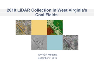
  • 1. 2010 LiDAR Collection in West Virginia’s Coal Fields WVAGP Meeting December 7, 2010
  • 2.
  • 3. Initially Contracted LiDAR AoI Slide AoI polygons are watershed rather than county-based. Initial AoI encompassed about 5,000,000 acres or about 33% of the State
  • 4. Project Status as of Nov. 29, 2010 Slide 1,322,454 acres 1,162,728 acres 1,162,728 acres Highest priority area of the state was about 3,000,00 acres. 2,485,182 acres have been completed collected. A B
  • 5.
  • 6.
  • 7.
  • 8. LiDAR Intensity Image Slide Produced from spring 2009 flight contracted by the Cabell County Assessor’s Office  two whole LiDAR tiles
  • 9. LiDAR Intensity Image Slide Produced from spring 2009 flight contracted by the Cabell County Assessor’s Office  two whole LiDAR tiles Zoom in from here
  • 10.
  • 11. The end Slide If we don’t take a shot at partnering more effectively … … future opportunities may be lost