SlideShare una empresa de Scribd logo
1 de 18
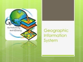
Geographic
Information
System
Group Members:
Saad Bare
Hrishikesh Bhise
Mohak Kirtane
Mukul Kulkarni
(T.Y.I.F.) second shift
Dr. D. Y. PATIL PRATISHTHAN’S
Y. B. PATIL
POLYTECHNIC,
AKURDI, PUNE
Sponsored by:
NELSOFT TECHNOLOGIES INC.
Project Guide:
R. N. Jagtap
Introduction
Geographic Information System
 A GIS is a particular form of Information System
applied to geographical data.
 An Information System is a set of processes, executed
on raw data( Longitude, Latitude) to produce
information which will be useful when making
decisions.
 A system is a group of connected entities and
activities which interact for a common purpose.
Geographic
Information System (GIS)?
 A GIS is an organized collection of computer
hardware, software, geographic data, and
personnel to efficiently
capture, store, update, manipulate, analyze, and
display all forms of geographically referenced
information.
 A GIS integrates spatial and other kinds of
information within a single system to provide a
consistent framework for analyzing
geographic (spatial) data.
 A GIS makes connections between activities
based on geographic proximity.
What is a Geographic
Information System (GIS)?
 The digital data structure can be conceptualized as
a set of “floating electronic maps” with a common
registration allowing the used to “look” down (drill
down) and across the stack of maps.
 The spatial relationships can be summarized (data
base inquiries)
What is a Geographic
Information System (GIS)?
Problem Definition
 Unavailability of Geological information.
 Improper information guidance.
Existing Systems
 There are various existing systems such as
Google maps, MapQuest, etc.
 This systems provide inadequate information
about user needs.
Proposed System
 This is the website which is to be designed in such a
manner that even a new person in the given area
will find it easy to spot the needful mapping system.
 The user could find the shortest path for his
destination.
 User could be able to find contacts and
appointments for needful places.
And much more . . .
 With help of GIS, we can easily analyze and identify the
Expected Location.
 Easy to Use
 General Purpose Solving Application.
 Allocates the map(How to reach).
 Estimate the Availability of end user(visiting office).
Advantages
Scope Of GIS
 An information system has a full range of
functions to find:
 Hospitals & Health care Centers
 Schools, Colleges & Edu. Campus
 Hotels, Restaurants
 Banks , ATMs
 Govt. Offices, Police Stations
 Railway Stations, Bus Stations, etc.
Server
 Software Requirements:
 Operating System: Windows Server 2003 or
higher
 Front End: ASP.NET using C# 3.5
 Back End: SQL Server 2005 or higher
 Hardware Requirements:
 Processor: Dual Core or higher
 RAM: 4 GB DDR2
Requirement Specification
Client
 Software Requirements:
 Operating System: Windows XP or higher
 Web browser: Internet Explorer 6.0 or higher
 Hardware Requirements:
 Processor: P IV or higher
 RAM: 512MB
Requirement Specification
Capture
Data
GIS – Program Flow
Register
Map Base
Interpret
Data
Convert Data
to Digital
Format
Store Data
in Computer
Process
Data
Display
Results
Modules
The overall system divided into 3 modules:
 Module 1: Geographical Survey
 This module consists of overall geographical
survey of our area.
 The survey of parameters and related
information is to be done in this module
 Module 2: Programming and Developing
 In this module we will perform the related
programming using SQL, ASP.net develop the
website
 In this we will store the related data in the
server for the website
 Module 3: Designing
 Here we will concentrate on designing of the
website and the related pages
 Overall structure of website will be discussed
Conclusion
•User can print and save the image of the required map.
•User can view different parameters of particular area.
•User can get path from source to destination.
•GIS will also provide working hours.
Gis (geographic information system)

Más contenido relacionado

La actualidad más candente

La actualidad más candente (20)

Introduction and Application of GIS
Introduction and Application of GISIntroduction and Application of GIS
Introduction and Application of GIS
 
GEOGRAPHICAL INFORMATION SYSTEM (GIS)
GEOGRAPHICAL INFORMATION SYSTEM (GIS)GEOGRAPHICAL INFORMATION SYSTEM (GIS)
GEOGRAPHICAL INFORMATION SYSTEM (GIS)
 
Geographic information system
Geographic information systemGeographic information system
Geographic information system
 
raster data model
raster data modelraster data model
raster data model
 
GIS Geographical Information System
GIS Geographical Information SystemGIS Geographical Information System
GIS Geographical Information System
 
Introduction to GIS
Introduction to GISIntroduction to GIS
Introduction to GIS
 
georeference
georeferencegeoreference
georeference
 
GIS presentation
GIS presentationGIS presentation
GIS presentation
 
Web Mapping
Web MappingWeb Mapping
Web Mapping
 
Introduction to GIS
Introduction to GISIntroduction to GIS
Introduction to GIS
 
My ppt on gis
My ppt on gisMy ppt on gis
My ppt on gis
 
Introduction to gis and arc gis
Introduction to gis and arc gis Introduction to gis and arc gis
Introduction to gis and arc gis
 
GIS Data Types
GIS Data TypesGIS Data Types
GIS Data Types
 
ppt spatial data
ppt spatial datappt spatial data
ppt spatial data
 
GIS MAPPING
GIS MAPPINGGIS MAPPING
GIS MAPPING
 
Introduction to arc gis
Introduction to arc gisIntroduction to arc gis
Introduction to arc gis
 
Functions of GIS
Functions of GISFunctions of GIS
Functions of GIS
 
Geo-spatial Analysis and Modelling
Geo-spatial Analysis and ModellingGeo-spatial Analysis and Modelling
Geo-spatial Analysis and Modelling
 
GIS - lecture-1.ppt
GIS - lecture-1.pptGIS - lecture-1.ppt
GIS - lecture-1.ppt
 
Geographic information system (gis)
Geographic information system (gis)Geographic information system (gis)
Geographic information system (gis)
 

Destacado

What is GIS
What is GISWhat is GIS
What is GISEsri
 
Intro to GIS and Remote Sensing
Intro to GIS and Remote SensingIntro to GIS and Remote Sensing
Intro to GIS and Remote SensingJohn Reiser
 
Basic of Remote Sensing
Basic of Remote SensingBasic of Remote Sensing
Basic of Remote Sensinggueste5cfed
 
Applications of gis
Applications of gisApplications of gis
Applications of gisPramoda Raj
 
Remote Sensing PPT
Remote Sensing PPTRemote Sensing PPT
Remote Sensing PPTAmal Murali
 
Knowledge Discovery and Data Mining
Knowledge Discovery and Data MiningKnowledge Discovery and Data Mining
Knowledge Discovery and Data MiningAmritanshu Mehra
 
Introduction to MAPS,Coordinate System and Projection System
Introduction to MAPS,Coordinate System and Projection SystemIntroduction to MAPS,Coordinate System and Projection System
Introduction to MAPS,Coordinate System and Projection SystemNAXA-Developers
 
Geographic coordinate system & map projection
Geographic coordinate system & map projectionGeographic coordinate system & map projection
Geographic coordinate system & map projectionvishalkedia119
 
map projections
map projectionsmap projections
map projectionsom290979
 
Projections and coordinate system
Projections and coordinate systemProjections and coordinate system
Projections and coordinate systemMohsin Siddique
 
Understanding Coordinate Systems and Projections for ArcGIS
Understanding Coordinate Systems and Projections for ArcGISUnderstanding Coordinate Systems and Projections for ArcGIS
Understanding Coordinate Systems and Projections for ArcGISJohn Schaeffer
 
Components of Remote Sensing
Components of Remote SensingComponents of Remote Sensing
Components of Remote SensingAbby Varghese
 
Ppt on remote sensing system
Ppt on remote sensing systemPpt on remote sensing system
Ppt on remote sensing systemAlisha Korpal
 
Advantages and disadvantages of Remote Sensing
Advantages and disadvantages of Remote SensingAdvantages and disadvantages of Remote Sensing
Advantages and disadvantages of Remote SensingEr Abhi Vashi
 

Destacado (20)

What Is GIS?
What Is GIS?What Is GIS?
What Is GIS?
 
What is GIS
What is GISWhat is GIS
What is GIS
 
Intro to GIS and Remote Sensing
Intro to GIS and Remote SensingIntro to GIS and Remote Sensing
Intro to GIS and Remote Sensing
 
Basic of Remote Sensing
Basic of Remote SensingBasic of Remote Sensing
Basic of Remote Sensing
 
Applications of gis
Applications of gisApplications of gis
Applications of gis
 
Remote Sensing PPT
Remote Sensing PPTRemote Sensing PPT
Remote Sensing PPT
 
Mobile gis
Mobile gisMobile gis
Mobile gis
 
Knowledge Discovery and Data Mining
Knowledge Discovery and Data MiningKnowledge Discovery and Data Mining
Knowledge Discovery and Data Mining
 
Lower indus basin-Pakistan
Lower indus basin-PakistanLower indus basin-Pakistan
Lower indus basin-Pakistan
 
Introduction to MAPS,Coordinate System and Projection System
Introduction to MAPS,Coordinate System and Projection SystemIntroduction to MAPS,Coordinate System and Projection System
Introduction to MAPS,Coordinate System and Projection System
 
GIS Map Projection
GIS Map ProjectionGIS Map Projection
GIS Map Projection
 
Geographic coordinate system & map projection
Geographic coordinate system & map projectionGeographic coordinate system & map projection
Geographic coordinate system & map projection
 
map projections
map projectionsmap projections
map projections
 
Map projection
Map projection Map projection
Map projection
 
Projections and coordinate system
Projections and coordinate systemProjections and coordinate system
Projections and coordinate system
 
Understanding Coordinate Systems and Projections for ArcGIS
Understanding Coordinate Systems and Projections for ArcGISUnderstanding Coordinate Systems and Projections for ArcGIS
Understanding Coordinate Systems and Projections for ArcGIS
 
Map Projections
Map ProjectionsMap Projections
Map Projections
 
Components of Remote Sensing
Components of Remote SensingComponents of Remote Sensing
Components of Remote Sensing
 
Ppt on remote sensing system
Ppt on remote sensing systemPpt on remote sensing system
Ppt on remote sensing system
 
Advantages and disadvantages of Remote Sensing
Advantages and disadvantages of Remote SensingAdvantages and disadvantages of Remote Sensing
Advantages and disadvantages of Remote Sensing
 

Similar a Gis (geographic information system)

Introduction To Geographical Information System (GIS)
Introduction To Geographical Information System (GIS) Introduction To Geographical Information System (GIS)
Introduction To Geographical Information System (GIS) Ajay Singh Lodhi
 
Principles of GIS unit 2
Principles of GIS unit 2Principles of GIS unit 2
Principles of GIS unit 2SanjanaKhemka1
 
TYBSC IT PGIS Unit I Chapter I- Introduction to Geographic Information Systems
TYBSC IT PGIS Unit I  Chapter I- Introduction to Geographic Information SystemsTYBSC IT PGIS Unit I  Chapter I- Introduction to Geographic Information Systems
TYBSC IT PGIS Unit I Chapter I- Introduction to Geographic Information SystemsArti Parab Academics
 
GIS Training in Hyderabad | GIS Coaching insistue in Hyderabad,Ameerpet | GIS...
GIS Training in Hyderabad | GIS Coaching insistue in Hyderabad,Ameerpet | GIS...GIS Training in Hyderabad | GIS Coaching insistue in Hyderabad,Ameerpet | GIS...
GIS Training in Hyderabad | GIS Coaching insistue in Hyderabad,Ameerpet | GIS...GEOSYS ENTERPRISE PVT. LTD.
 
EVS G.I.S CONCEPTS OF SCIENCE PPT.pptx
EVS  G.I.S CONCEPTS  OF SCIENCE PPT.pptxEVS  G.I.S CONCEPTS  OF SCIENCE PPT.pptx
EVS G.I.S CONCEPTS OF SCIENCE PPT.pptxUMANJUNATH
 
Principles of GIS unit 1
Principles of GIS unit 1Principles of GIS unit 1
Principles of GIS unit 1SanjanaKhemka1
 
Intro of geographic info system
Intro of geographic info systemIntro of geographic info system
Intro of geographic info systemJanak Parmar
 
Geographic information system
Geographic information system Geographic information system
Geographic information system Bhavik A Shah
 
Getting started with GIS
Getting started with GISGetting started with GIS
Getting started with GISEsri India
 
Learning assignment on geographic information system
Learning assignment on geographic information systemLearning assignment on geographic information system
Learning assignment on geographic information systemMuhammad Tahir Mehmood
 
How to empower community by using GIS lecture 1
How to empower community by using GIS lecture 1How to empower community by using GIS lecture 1
How to empower community by using GIS lecture 1wang yaohui
 
GEOSPATIAL TECHNOLOGY, CONCEPT, TECHNIQUES AND ITS COMPONENTS. pptx
GEOSPATIAL TECHNOLOGY, CONCEPT, TECHNIQUES AND ITS COMPONENTS. pptxGEOSPATIAL TECHNOLOGY, CONCEPT, TECHNIQUES AND ITS COMPONENTS. pptx
GEOSPATIAL TECHNOLOGY, CONCEPT, TECHNIQUES AND ITS COMPONENTS. pptxMalothSuresh2
 
INTRODUCTION GEOGRAPHIC INFORMATION SYSTEM
INTRODUCTION GEOGRAPHIC INFORMATION SYSTEMINTRODUCTION GEOGRAPHIC INFORMATION SYSTEM
INTRODUCTION GEOGRAPHIC INFORMATION SYSTEMmusadoto
 

Similar a Gis (geographic information system) (20)

Introduction To Geographical Information System (GIS)
Introduction To Geographical Information System (GIS) Introduction To Geographical Information System (GIS)
Introduction To Geographical Information System (GIS)
 
Principles of GIS unit 2
Principles of GIS unit 2Principles of GIS unit 2
Principles of GIS unit 2
 
Gis
GisGis
Gis
 
TYBSC IT PGIS Unit I Chapter I- Introduction to Geographic Information Systems
TYBSC IT PGIS Unit I  Chapter I- Introduction to Geographic Information SystemsTYBSC IT PGIS Unit I  Chapter I- Introduction to Geographic Information Systems
TYBSC IT PGIS Unit I Chapter I- Introduction to Geographic Information Systems
 
GIS
GISGIS
GIS
 
GIS Training in Hyderabad | GIS Coaching insistue in Hyderabad,Ameerpet | GIS...
GIS Training in Hyderabad | GIS Coaching insistue in Hyderabad,Ameerpet | GIS...GIS Training in Hyderabad | GIS Coaching insistue in Hyderabad,Ameerpet | GIS...
GIS Training in Hyderabad | GIS Coaching insistue in Hyderabad,Ameerpet | GIS...
 
gis.pdf
gis.pdfgis.pdf
gis.pdf
 
introduction to GIS
introduction to GIS introduction to GIS
introduction to GIS
 
EVS G.I.S CONCEPTS OF SCIENCE PPT.pptx
EVS  G.I.S CONCEPTS  OF SCIENCE PPT.pptxEVS  G.I.S CONCEPTS  OF SCIENCE PPT.pptx
EVS G.I.S CONCEPTS OF SCIENCE PPT.pptx
 
Principles of GIS unit 1
Principles of GIS unit 1Principles of GIS unit 1
Principles of GIS unit 1
 
Intro of geographic info system
Intro of geographic info systemIntro of geographic info system
Intro of geographic info system
 
Geographic information system
Geographic information system Geographic information system
Geographic information system
 
Getting started with GIS
Getting started with GISGetting started with GIS
Getting started with GIS
 
Learning assignment on geographic information system
Learning assignment on geographic information systemLearning assignment on geographic information system
Learning assignment on geographic information system
 
How to empower community by using GIS lecture 1
How to empower community by using GIS lecture 1How to empower community by using GIS lecture 1
How to empower community by using GIS lecture 1
 
GEOSPATIAL TECHNOLOGY, CONCEPT, TECHNIQUES AND ITS COMPONENTS. pptx
GEOSPATIAL TECHNOLOGY, CONCEPT, TECHNIQUES AND ITS COMPONENTS. pptxGEOSPATIAL TECHNOLOGY, CONCEPT, TECHNIQUES AND ITS COMPONENTS. pptx
GEOSPATIAL TECHNOLOGY, CONCEPT, TECHNIQUES AND ITS COMPONENTS. pptx
 
INTRODUCTION GEOGRAPHIC INFORMATION SYSTEM
INTRODUCTION GEOGRAPHIC INFORMATION SYSTEMINTRODUCTION GEOGRAPHIC INFORMATION SYSTEM
INTRODUCTION GEOGRAPHIC INFORMATION SYSTEM
 
Introduction to gis
Introduction to gisIntroduction to gis
Introduction to gis
 
Introduction to GIS
Introduction to GISIntroduction to GIS
Introduction to GIS
 
Mrp Intrim
Mrp IntrimMrp Intrim
Mrp Intrim
 

Último

Kotlin Multiplatform & Compose Multiplatform - Starter kit for pragmatics
Kotlin Multiplatform & Compose Multiplatform - Starter kit for pragmaticsKotlin Multiplatform & Compose Multiplatform - Starter kit for pragmatics
Kotlin Multiplatform & Compose Multiplatform - Starter kit for pragmaticscarlostorres15106
 
Search Engine Optimization SEO PDF for 2024.pdf
Search Engine Optimization SEO PDF for 2024.pdfSearch Engine Optimization SEO PDF for 2024.pdf
Search Engine Optimization SEO PDF for 2024.pdfRankYa
 
Tampa BSides - Chef's Tour of Microsoft Security Adoption Framework (SAF)
Tampa BSides - Chef's Tour of Microsoft Security Adoption Framework (SAF)Tampa BSides - Chef's Tour of Microsoft Security Adoption Framework (SAF)
Tampa BSides - Chef's Tour of Microsoft Security Adoption Framework (SAF)Mark Simos
 
Scanning the Internet for External Cloud Exposures via SSL Certs
Scanning the Internet for External Cloud Exposures via SSL CertsScanning the Internet for External Cloud Exposures via SSL Certs
Scanning the Internet for External Cloud Exposures via SSL CertsRizwan Syed
 
DevEX - reference for building teams, processes, and platforms
DevEX - reference for building teams, processes, and platformsDevEX - reference for building teams, processes, and platforms
DevEX - reference for building teams, processes, and platformsSergiu Bodiu
 
Training state-of-the-art general text embedding
Training state-of-the-art general text embeddingTraining state-of-the-art general text embedding
Training state-of-the-art general text embeddingZilliz
 
Ensuring Technical Readiness For Copilot in Microsoft 365
Ensuring Technical Readiness For Copilot in Microsoft 365Ensuring Technical Readiness For Copilot in Microsoft 365
Ensuring Technical Readiness For Copilot in Microsoft 3652toLead Limited
 
Story boards and shot lists for my a level piece
Story boards and shot lists for my a level pieceStory boards and shot lists for my a level piece
Story boards and shot lists for my a level piececharlottematthew16
 
SIP trunking in Janus @ Kamailio World 2024
SIP trunking in Janus @ Kamailio World 2024SIP trunking in Janus @ Kamailio World 2024
SIP trunking in Janus @ Kamailio World 2024Lorenzo Miniero
 
Are Multi-Cloud and Serverless Good or Bad?
Are Multi-Cloud and Serverless Good or Bad?Are Multi-Cloud and Serverless Good or Bad?
Are Multi-Cloud and Serverless Good or Bad?Mattias Andersson
 
Gen AI in Business - Global Trends Report 2024.pdf
Gen AI in Business - Global Trends Report 2024.pdfGen AI in Business - Global Trends Report 2024.pdf
Gen AI in Business - Global Trends Report 2024.pdfAddepto
 
Install Stable Diffusion in windows machine
Install Stable Diffusion in windows machineInstall Stable Diffusion in windows machine
Install Stable Diffusion in windows machinePadma Pradeep
 
SAP Build Work Zone - Overview L2-L3.pptx
SAP Build Work Zone - Overview L2-L3.pptxSAP Build Work Zone - Overview L2-L3.pptx
SAP Build Work Zone - Overview L2-L3.pptxNavinnSomaal
 
"Debugging python applications inside k8s environment", Andrii Soldatenko
"Debugging python applications inside k8s environment", Andrii Soldatenko"Debugging python applications inside k8s environment", Andrii Soldatenko
"Debugging python applications inside k8s environment", Andrii SoldatenkoFwdays
 
Beyond Boundaries: Leveraging No-Code Solutions for Industry Innovation
Beyond Boundaries: Leveraging No-Code Solutions for Industry InnovationBeyond Boundaries: Leveraging No-Code Solutions for Industry Innovation
Beyond Boundaries: Leveraging No-Code Solutions for Industry InnovationSafe Software
 
"LLMs for Python Engineers: Advanced Data Analysis and Semantic Kernel",Oleks...
"LLMs for Python Engineers: Advanced Data Analysis and Semantic Kernel",Oleks..."LLMs for Python Engineers: Advanced Data Analysis and Semantic Kernel",Oleks...
"LLMs for Python Engineers: Advanced Data Analysis and Semantic Kernel",Oleks...Fwdays
 
Dev Dives: Streamline document processing with UiPath Studio Web
Dev Dives: Streamline document processing with UiPath Studio WebDev Dives: Streamline document processing with UiPath Studio Web
Dev Dives: Streamline document processing with UiPath Studio WebUiPathCommunity
 
Bun (KitWorks Team Study 노별마루 발표 2024.4.22)
Bun (KitWorks Team Study 노별마루 발표 2024.4.22)Bun (KitWorks Team Study 노별마루 발표 2024.4.22)
Bun (KitWorks Team Study 노별마루 발표 2024.4.22)Wonjun Hwang
 

Último (20)

Kotlin Multiplatform & Compose Multiplatform - Starter kit for pragmatics
Kotlin Multiplatform & Compose Multiplatform - Starter kit for pragmaticsKotlin Multiplatform & Compose Multiplatform - Starter kit for pragmatics
Kotlin Multiplatform & Compose Multiplatform - Starter kit for pragmatics
 
DMCC Future of Trade Web3 - Special Edition
DMCC Future of Trade Web3 - Special EditionDMCC Future of Trade Web3 - Special Edition
DMCC Future of Trade Web3 - Special Edition
 
Search Engine Optimization SEO PDF for 2024.pdf
Search Engine Optimization SEO PDF for 2024.pdfSearch Engine Optimization SEO PDF for 2024.pdf
Search Engine Optimization SEO PDF for 2024.pdf
 
Tampa BSides - Chef's Tour of Microsoft Security Adoption Framework (SAF)
Tampa BSides - Chef's Tour of Microsoft Security Adoption Framework (SAF)Tampa BSides - Chef's Tour of Microsoft Security Adoption Framework (SAF)
Tampa BSides - Chef's Tour of Microsoft Security Adoption Framework (SAF)
 
Scanning the Internet for External Cloud Exposures via SSL Certs
Scanning the Internet for External Cloud Exposures via SSL CertsScanning the Internet for External Cloud Exposures via SSL Certs
Scanning the Internet for External Cloud Exposures via SSL Certs
 
DevEX - reference for building teams, processes, and platforms
DevEX - reference for building teams, processes, and platformsDevEX - reference for building teams, processes, and platforms
DevEX - reference for building teams, processes, and platforms
 
E-Vehicle_Hacking_by_Parul Sharma_null_owasp.pptx
E-Vehicle_Hacking_by_Parul Sharma_null_owasp.pptxE-Vehicle_Hacking_by_Parul Sharma_null_owasp.pptx
E-Vehicle_Hacking_by_Parul Sharma_null_owasp.pptx
 
Training state-of-the-art general text embedding
Training state-of-the-art general text embeddingTraining state-of-the-art general text embedding
Training state-of-the-art general text embedding
 
Ensuring Technical Readiness For Copilot in Microsoft 365
Ensuring Technical Readiness For Copilot in Microsoft 365Ensuring Technical Readiness For Copilot in Microsoft 365
Ensuring Technical Readiness For Copilot in Microsoft 365
 
Story boards and shot lists for my a level piece
Story boards and shot lists for my a level pieceStory boards and shot lists for my a level piece
Story boards and shot lists for my a level piece
 
SIP trunking in Janus @ Kamailio World 2024
SIP trunking in Janus @ Kamailio World 2024SIP trunking in Janus @ Kamailio World 2024
SIP trunking in Janus @ Kamailio World 2024
 
Are Multi-Cloud and Serverless Good or Bad?
Are Multi-Cloud and Serverless Good or Bad?Are Multi-Cloud and Serverless Good or Bad?
Are Multi-Cloud and Serverless Good or Bad?
 
Gen AI in Business - Global Trends Report 2024.pdf
Gen AI in Business - Global Trends Report 2024.pdfGen AI in Business - Global Trends Report 2024.pdf
Gen AI in Business - Global Trends Report 2024.pdf
 
Install Stable Diffusion in windows machine
Install Stable Diffusion in windows machineInstall Stable Diffusion in windows machine
Install Stable Diffusion in windows machine
 
SAP Build Work Zone - Overview L2-L3.pptx
SAP Build Work Zone - Overview L2-L3.pptxSAP Build Work Zone - Overview L2-L3.pptx
SAP Build Work Zone - Overview L2-L3.pptx
 
"Debugging python applications inside k8s environment", Andrii Soldatenko
"Debugging python applications inside k8s environment", Andrii Soldatenko"Debugging python applications inside k8s environment", Andrii Soldatenko
"Debugging python applications inside k8s environment", Andrii Soldatenko
 
Beyond Boundaries: Leveraging No-Code Solutions for Industry Innovation
Beyond Boundaries: Leveraging No-Code Solutions for Industry InnovationBeyond Boundaries: Leveraging No-Code Solutions for Industry Innovation
Beyond Boundaries: Leveraging No-Code Solutions for Industry Innovation
 
"LLMs for Python Engineers: Advanced Data Analysis and Semantic Kernel",Oleks...
"LLMs for Python Engineers: Advanced Data Analysis and Semantic Kernel",Oleks..."LLMs for Python Engineers: Advanced Data Analysis and Semantic Kernel",Oleks...
"LLMs for Python Engineers: Advanced Data Analysis and Semantic Kernel",Oleks...
 
Dev Dives: Streamline document processing with UiPath Studio Web
Dev Dives: Streamline document processing with UiPath Studio WebDev Dives: Streamline document processing with UiPath Studio Web
Dev Dives: Streamline document processing with UiPath Studio Web
 
Bun (KitWorks Team Study 노별마루 발표 2024.4.22)
Bun (KitWorks Team Study 노별마루 발표 2024.4.22)Bun (KitWorks Team Study 노별마루 발표 2024.4.22)
Bun (KitWorks Team Study 노별마루 발표 2024.4.22)
 

Gis (geographic information system)

  • 2. Group Members: Saad Bare Hrishikesh Bhise Mohak Kirtane Mukul Kulkarni (T.Y.I.F.) second shift Dr. D. Y. PATIL PRATISHTHAN’S Y. B. PATIL POLYTECHNIC, AKURDI, PUNE Sponsored by: NELSOFT TECHNOLOGIES INC. Project Guide: R. N. Jagtap
  • 3. Introduction Geographic Information System  A GIS is a particular form of Information System applied to geographical data.  An Information System is a set of processes, executed on raw data( Longitude, Latitude) to produce information which will be useful when making decisions.  A system is a group of connected entities and activities which interact for a common purpose.
  • 4. Geographic Information System (GIS)?  A GIS is an organized collection of computer hardware, software, geographic data, and personnel to efficiently capture, store, update, manipulate, analyze, and display all forms of geographically referenced information.
  • 5.  A GIS integrates spatial and other kinds of information within a single system to provide a consistent framework for analyzing geographic (spatial) data.  A GIS makes connections between activities based on geographic proximity. What is a Geographic Information System (GIS)?
  • 6.  The digital data structure can be conceptualized as a set of “floating electronic maps” with a common registration allowing the used to “look” down (drill down) and across the stack of maps.  The spatial relationships can be summarized (data base inquiries) What is a Geographic Information System (GIS)?
  • 7. Problem Definition  Unavailability of Geological information.  Improper information guidance.
  • 8. Existing Systems  There are various existing systems such as Google maps, MapQuest, etc.  This systems provide inadequate information about user needs.
  • 9. Proposed System  This is the website which is to be designed in such a manner that even a new person in the given area will find it easy to spot the needful mapping system.  The user could find the shortest path for his destination.  User could be able to find contacts and appointments for needful places. And much more . . .
  • 10.  With help of GIS, we can easily analyze and identify the Expected Location.  Easy to Use  General Purpose Solving Application.  Allocates the map(How to reach).  Estimate the Availability of end user(visiting office). Advantages
  • 11. Scope Of GIS  An information system has a full range of functions to find:  Hospitals & Health care Centers  Schools, Colleges & Edu. Campus  Hotels, Restaurants  Banks , ATMs  Govt. Offices, Police Stations  Railway Stations, Bus Stations, etc.
  • 12. Server  Software Requirements:  Operating System: Windows Server 2003 or higher  Front End: ASP.NET using C# 3.5  Back End: SQL Server 2005 or higher  Hardware Requirements:  Processor: Dual Core or higher  RAM: 4 GB DDR2 Requirement Specification
  • 13. Client  Software Requirements:  Operating System: Windows XP or higher  Web browser: Internet Explorer 6.0 or higher  Hardware Requirements:  Processor: P IV or higher  RAM: 512MB Requirement Specification
  • 14. Capture Data GIS – Program Flow Register Map Base Interpret Data Convert Data to Digital Format Store Data in Computer Process Data Display Results
  • 15. Modules The overall system divided into 3 modules:  Module 1: Geographical Survey  This module consists of overall geographical survey of our area.  The survey of parameters and related information is to be done in this module
  • 16.  Module 2: Programming and Developing  In this module we will perform the related programming using SQL, ASP.net develop the website  In this we will store the related data in the server for the website  Module 3: Designing  Here we will concentrate on designing of the website and the related pages  Overall structure of website will be discussed
  • 17. Conclusion •User can print and save the image of the required map. •User can view different parameters of particular area. •User can get path from source to destination. •GIS will also provide working hours.