121224 railyards summary_memo_reduced
•
1 recomendación•1,224 vistas

This document provides a summary of a study evaluating the potential for transit-oriented development at the 4th and King Street Railyards in San Francisco. It describes the existing conditions, including surrounding land uses and height limits. Two development scenarios were analyzed: one assuming development above the existing railyards, and a "blank slate" scenario. Key findings from the study will inform future planning and design efforts for the site once the rail configuration is finalized. The study aims to evaluate development capacity and potential revenue generation to support rail investments.

Recomendados
Recomendados
Más contenido relacionado
La actualidad más candente
La actualidad más candente (20)
Destacado
Similar a 121224 railyards summary_memo_reduced
Similar a 121224 railyards summary_memo_reduced (20)
Más de Adina Levin
Más de Adina Levin (20)
121224 railyards summary_memo_reduced
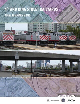
- 1. 4TH AND KING STREET RAILYARDS FINAL SUMMARY MEMO DECEMBER 2012
- 3. Table of Contents 1. Introduction ........................................................................................................................ 1 2. Existing Conditions Overview ............................................................................................. 4 3. Urban Design and Planning Principles ............................................................................. 12 4. Development Scenario 1 .................................................................................................. 13 5. Development Scenario 2 .................................................................................................. 19 6. Key Findings and Next Steps ........................................................................................... 33
- 5. 1. Introduction This memo provides a summation of the findings of a study for transit-oriented development at the 4th and King Street Railyards, the scope of which was to document the conditions, opportunities, and development capacity, feasibility and economic value of the site and to serve as a reference for future planning, design, and implementation efforts that can take place once the ultimate configuration of the railyards is more certain. The findings of this study may also inform decisions made about rail investments and alignments themselves that would affect layout and development of the site. The overarching purposes of the study are to evaluate the potential for transit-oriented development on the site and related potential for both one-time and ongoing revenue to support both the Downtown Rail Extension and High Speed Rail investments as well as to improve physical conditions in the neighborhood. Future development of this site can take advantage of a major transit-oriented development opportunity, promote a major mixed-use development center, help forge new connections in the fabric of the city, provide much-needed open space amenities and public realm improvements, and fund rail infrastructure improvements and facilities. The purpose of this study for was not to create a specific land use proposal for adoption or endorsement by any decision-making body, but should be regarded as an informational study intended as an important step in determining the potential for, feasibility of, and likely parameters for future development of the site and to inform future decision-making regarding this site. This memo is organized into the following sections: 1. Introduction 1.1 Background 1.2 Site Ownership and Jurisdiction 1.3 Planning Process Overview 2. Existing Conditions Overview 2.1 Setting and Site Importance 2.2 Existing Land Use 2.3 Height Regulations and Urban Form Context 3. Urban Design and Planning Principles 4. Development Scenario 1 4.1 Opportunities and Constraints 5. Development Scenario 2 5.1 Land Use and Urban Design Overview 5.2 Concept 1 – Highway 5.3 Concept 2 – Boulevard 4th and King Railyards Study – Final Summary Memo Page 1
- 6. 5.4 Valuation Estimates – Development Scenario 2 6. Key Findings and Next Steps 6.1 Key Findings 6.2 Recommended Next Steps 1.1 Background In 1999, San Francisco voters adopted Proposition H, calling for Caltrain to be extended into a new intermodal transit center on the site of the former Transbay Terminal that connects regional bus and rail service (including Muni, AC Transit, BART, and Caltrain) and eventually High Speed Rail. An important element of this program is the extension of Caltrain 1.3 miles via a downtown extension subway tunnel (“DTX”) to the new Transbay Transit Center from its current terminus at 4th and King Streets. The DTX alignment from 4th and King to the Transbay Center will be designed to facilitate a critical element of the California High Speed Rail (CHSR) system, which will be an electrified train network that will connect California’s major metropolitan areas. The site evaluated in this study is comprised of three blocks between 4th Street to 7th Street bounded by King Street and Townsend Street in the City of San Francisco. The 19.1-acre site includes existing station and railyards, which serve Caltrain. Currently, the railyards form a ½-mile long physical and visual barrier between the South of Market (SOMA) neighborhood north of the site and the Mission Bay neighborhood to the south. 1.2 Site Ownership and Jurisdiction The purpose of this study is to evaluate issues, opportunities, and potential value generated by more intensive use of the railyards site, and not to adjudicate legal rights to direct the development on the site or assert parties’ specific rights to share in the revenues derived therefrom. Preliminary research by the Planning Department1 has indicated the following: (1) The underlying railyards parcels are owned by ProLogis/Cattellus, the entity that is the master developer/owner of Mission Bay; and (2) The Joint Powers Board (i.e. Caltrain) owns a railroad operating easement to the property that allows them to construct and operate a railroad and make any investments and improvements thereto, and that this easement extends to 30 feet above the level of the railroad tracks. The proceeds of any development on the site will certainly and necessarily be the subject of future negotiation, due to the site’s complicated ownership and easement structure. The property owner, ProLogis, will not derive economic value from the property without the ability to change the current conditions. Caltrain does not own the underlying property, and therefore may not have a claim on economic benefits resulting from future development of the site, if the rail footprint was reduced or 1 Subject to verification. Planning Department makes no claims of correctness. These findings are based on informal conversations with and review of documentation in the possession of representatives of Caltrain JPB, ProLogis/Cattellus, and the former San Francisco Redevelopment Agency. 4th and King Railyards Study – Final Summary Memo Page 2
- 7. vacated. The incentive for Caltrain to entertain development on the site is for the possibility of development to yield major financial benefit to Caltrain for capital investment and ongoing operating revenue purposes. A major motivation for this study is to assess what value might be generated by development on the site in order to fund investment in rail infrastructure. Any outcome that does not achieve this would unlikely be worth pursuing. The westernmost block of the site between 6th Street/I-280 overpass and 7th Street is located within the Mission Bay Redevelopment Area. This block is designated as Public Facility on the Mission Bay North Land Use Plan in the Redevelopment Plan and in the Mission Bay North Design for Development. The remainder of the site is subject to the Planning Code requirements and Planning Department review and oversight. 1.3 Planning Process Overview The planning process studied the potential development capacity of the railyards based on two different conditions and sets of assumptions. The purpose of evaluating two scenarios is to bracket the study and identify high-level constraints and opportunities under both conditions: 1. Railyards Scenario 1– Initiated and completed in 2010, evaluated the potential for development to occur within air-rights above the railyards as currently envisioned according to documentation from the California High Speed Rail Authority and Caltrain. 2. Railyards Scenario 2– Initiated and completed in 2012, evaluated the development potential for the site assuming that the site is essentially a “blank slate” for development. This analysis did not explore how rail operations or facilities would be adjusted to enable this scenario, however the presumption is that the mid-line subway station under Townsend Street between 4th and 5th Street planned as part of the DTX is the only Caltrain/HSR rail facility at or adjacent to the site. Rail storage and other functions of the current railyards are presumed to be handled off-site. Two different roadway concepts were analyzed as part of this scenario (discussed in detail in this memo). 4th and King Railyards Study – Final Summary Memo Page 3
- 8. 2. Existing Conditions Overview 2.1 Setting and Site Importance As illustrated on Figure 1 and Figure 2, the 4th and King Railyards site is composed of three city blocks located between 4th Street and 7th Street east to west, and between Townsend Street and King Street north to south. The site enjoys an excellent regional location due to its proximity to the transportation network, including transit opportunities and immediate access to Highway 280. The Caltrain station is located at the of 4th Street edge of the property between Townsend and King Streets. This station serves as the northern terminus of the Caltrain commuter rail line that serves the San Francisco Peninsula and Santa Clara Valley, and is a major regional transit hub. The Caltrain station is also a major hub for local Muni rail lines - the N-Judah and the T-Third converge here. The T-Third will soon be extended as the Central Subway, which will run on the surface of 4th Street before heading underground at Bryant Street en route to Yerba Buena, Union Square and Chinatown. There are plans for additional Muni rail service along the waterfront (the “E” line) which will further reinforce this location as a rail hub. In addition, several Muni bus lines also connect to the Caltrain station. The light rail and bus lines provide direct connections to downtown San Francisco and Bay Area Rapid Transit (BART). In addition to the extensive transportation network, the mix and intensity of surrounding land uses contribute to the site’s future development potential. Mission Bay, to the south, includes existing and planned high density residential and employment uses, as well as continued expansion of the UCSF campus and medical uses. AT&T Park, home of the San Francisco Giants, is located one block east of the 4th and King Railyards. On days with baseball games or entertainment events, the ballpark draws heavy pedestrian and transit traffic, contributing to the future development potential of the area, particularly supporting entertainment, visitor and retail uses. The SOMA district to the north of the site and the Showplace Square area to the west are a mix of moderate density office, retail, light industrial, and residential uses. These areas are currently hotbeds of economic activity, mostly related to the high tech industries that are key drivers of the City’s economy. Just to the south of Mission Creek, opposite AT&T Park, the Giants have secured exclusive negotiating rights with the Port of San Francisco to redevelop Seawall Lot 337, which currently is a large surface parking lot serving the ballpark. This potential development, currently in planning stages, would contain substantial amounts of offices, housing, structured replacement parking, and new public open space. Additionally, the Warriors basketball team is in planning stages for a new 17,000-seat basketball and entertainment arena on Piers 30-32, northeast of the railyards. Future development of the site should capitalize on the existing and planned transportation infrastructure and the activity and interest in the surrounding neighborhoods to create and support a major transit- oriented hub with a mix of uses and opportunities, while creating connections between the SOMA and Mission Bay neighborhoods. A transit-oriented development hub would generate additional riders for the 4th and King Railyards Study – Final Summary Memo Page 4
- 9. Caltrain/HSR rail system, but could also potentially generate revenue for investment and sustenance of the rail system. 4th and King Railyards Study – Final Summary Memo Page 5
- 10. 4th and King Railyards Study – Final Summary Memo Page 6
- 11. 4th and King Railyards Study – Final Summary Memo Page 7
- 12. 2.2 Existing Land Use Currently, the use of the entire 4th and King site is dedicated to the Caltrain station and the rail facilities, including storage of vehicles. The Caltrain station, which opened in 1975, is a stub-end terminal with six platforms – each providing access to two tracks – offering a total of 12 active tracks. The small station building and platforms are located at the eastern end of the site, and the remainder of the site contains at- grade rail alignments. Current weekday Caltrain service includes 46 arrivals and 46 departures daily, for a total of 92 scheduled train movements. Weekend service includes 16 arrivals and 16 departures on Saturdays, and 14 arrivals and 14 departures on Sundays. As described in the previous section, the site is surrounded by heavily trafficked land uses (illustrated in Figure 3). AT&T Park is located to the east of the site, with the SOMA district to the north. The SOMA district is currently the fastest growing office market in the city, and the epicenter of the San Francisco high-tech industry. It includes a mix of uses, including office, residential, service and light industrial uses, as well as retail and entertainment uses located throughout the district. The Western SOMA Community Plan was approved by the Planning Commission in December 2012 and awaits review and action by the Board of Supervisors in early 2013. The plan contains zoning and height proposals for the parcels directly north of the study area. Currently, these parcels are zoned Service/Light Industry (SLI), but the proposed zoning as part of the draft Western SOMA plan effort is for a Mixed-Use Office district along Townsend with preservation of the industrial district (renamed “SALI”) to the north of Brannan. There is also a planning effort underway for the southern portion of the Central Subway rail corridor, bounded by 2nd and 6th Streets between Market Street and Townsend Street. This ongoing planning effort, initiated in 2011, overlaps with portions of the Western SOMA Plan area. Current draft concept proposed zoning recommendations as part of this effort include rezoning of most of the SALI and SLI parcels in this area (south of Bryant Street) for high density commercial uses, while allowing some housing and other uses. Mixed-use office and multi-family residential uses predominantly surround the site on the remaining borders of the railyards. Residential and retail uses are concentrated in the northern part of Mission Bay, just south and east of the site. Biotechnology, medical and office-based employment uses are located in the southern portion of Mission Bay, including a new UCSF campus and medical center. To the immediate southwest of the railyards is the Showplace Square district, which includes a mix of large office uses (including high-tech uses such as Adobe and Zynga), as well as the San Francisco Design Center, California College of Arts, industrial uses, and small amounts of residential development. 4th and King Railyards Study – Final Summary Memo Page 8
- 13. 4th and King Railyards Study – Final Summary Memo Page 9
- 14. 2.3 Height Regulations and Urban Form Context The current height limit regulations for the 4th and King site allow for building heights up to 110’. Surrounding the site, the height limits in the SOMA district to the north allow for a maximum building height of 65’, and in the Showplace/Potrero district maximum allowable building heights are 68’. The parcels directly north of the study area on Townsend Street are proposed to be rezoned to an 85’ height district, as part of the Western SOMA Community Plan process. The Central Corridor planning effort includes proposed changes to height regulations as well, including 65’ and 85’ base heights along major street frontages, large-floorplate mid-rise buildings up to 130’ in key growth areas, and taller building heights (180’-320’) at Central Subway rail stations along 4th Street, particularly at Townsend and Brannan Streets. Mission Bay contains varying height districts of 50’, 65’, 90’, including several mixed-use residential/office towers rising up to 160’. As previously mentioned, the Port is reviewing a development proposal for Seawall Lot 337, south of AT&T Park; proposed building heights range from midrise buildings (90’) to towers in key locations (320’-450’). Height limit regulations are illustrated in Figure 4. 4th and King Railyards Study – Final Summary Memo Page 10
- 15. 4th and King Railyards Study – Final Summary Memo Page 11
- 16. 3. Urban Design and Planning Principles In order to assess future development potential at the site, there was a need to establish some fundamental principles and objectives to guide any changes to the site. Following are guiding urban design and planning principles, which should serve as the design benchmarks for any future development of the 4th and King site. These principles were developed during the initial phase of analysis, and revisited as part of the analysis of the “blank slate” scenario. As described in the following sections, there are significant challenges to realizing these principles when considering development in the air-rights over a working railyard. Ensure that the project site is woven into the surrounding neighborhoods, blending the office and employment uses to the north in SOMA with the residential uses to directly south of the site in Mission Bay. Ensure active ground floor uses along all frontages and a vibrant and welcoming neighborhood environment. Continue to support the transit operations on or adjacent to the site, to meet existing and future ridership demands. Improve access to and across the site, as well as internal connectivity. Provide new connections through the site that extend or enhance the existing street grid in order to reduce or break down the barrier presented by the existing facility, improve local circulation, and knit neighborhoods together on either side of the site. Enhance the street environment to improve the pedestrian experience in the area. Improve the public realm and public amenities surrounding and within the site, including provision of new open space and gathering areas throughout the site and enhanced connections to nearby open space. Provide a mix of varying building heights across the site responding to the surrounding context of existing development as well as nearby development controls planned or under consideration, ranging from 85’ mid-rise buildings as the predominant podium height to a cluster of one or more high-rise buildings (ranging from 160’ up to 450’ in height) toward the far eastern side of the site near 4th Street, to create a landmark element. 4th and King Railyards Study – Final Summary Memo Page 12
- 17. DEVELOPMENT SCENARIO 1 4. Development Scenario 1 The initial portion of the 4th and King planning process, which began in 2010, included the preparation of a comprehensive existing conditions review and opportunities and constraints summary of the site and the surrounding area, as well as a general study of potential development options for the site. All of the tasks completed during the initial phase of work assumed that the railyards would remain operational. The layout of the railyards was consistent with published plans by the California High Speed Rail Authority and Caltrain, and it was assumed that future development would occur in the air-rights above the railyards. 4.1 Opportunities and Constraints The Opportunities & Constraints Report (Appendix A), produced in December 2010, summarizes the results of the analysis of development potential of the 4th and King Railyards, assuming the site is to be rebuilt as a major station for both Caltrain and the CHSR system, with significant expansion of the railyards footprint, such that it would occupy the full width of the site to the property lines along Townsend and King Streets. The current CHSR/Caltrain plans for the station include the following characteristics: Serve both high speed rail intercity trains and Caltrain regional trains Contain two 30’ wide platforms of 1,370’ in length for high speed trains, serving four tracks Provide five Caltrain tracks overall, including two 30’-wide platforms 800’ in length for Caltrain, serving two tracks each, and one 20’-wide platform, serving one Caltrain track. Contain a mezzanine, which would run the length of the station between King and Townsend and 4th and 5th Streets. The mezzanine would add a pedestrian layer above the railyard, with the purpose of facilitating pedestrian movement, and accommodating the needs of both transit riders and non-riders. A new mid-line Caltrain subway station under Townsend Street between 4th and 5th Street, constructed as part of DTX. Figure 5 on the following page illustrates the expanded railyard layout, consistent with published plans. In this scenario, there would be limited opportunities for at-grade level development, and it is envisioned that the majority of development would occur in air-rights, on a podium above the station, with the exception of the portion of the site above the station mezzanine/platforms. This portion is assumed to be covered with a roof that allows significant natural lighting of the mezzanine and platforms; additionally the combined clearance needed for the platform level plus the mezzanine level would reduce the ability for any podium development above this portion of the site. On the remainder of the site, Caltrain would retain the use the area up to 30’ above ground, and air-rights above this point would be available for development. Figure 6 illustrates the potential development envelope, both for ground-floor development and development within the air-rights. 4th and King Railyards Study – Final Summary Memo Page 13
- 18. DEVELOPMENT SCENARIO 1 4th and King Railyards Study – Final Summary Memo Page 14
- 19. DEVELOPMENT SCENARIO 1 4th and King Railyards Study – Final Summary Memo Page 15
- 21. DEVELOPMENT SCENARIO 1 Following is a discussion of the key constraints and challenges that emerged regarding development based on the expanded railyards / air-rights assumptions, also illustrated in Figure 7 (with additional detail provided in Appendix A): 1. Site Access – The primary concerns as they relate to site access include ground level interface and vertical circulation to the podium and/or below grade levels. At the ground level, the main pedestrian access to the station would have to occur on the 4th Street side. The rest of the perimeters would have limited access due to train operations and facilities right up against the property lines, with an exception at the corner of Townsend Street and 7th Street. Additionally, site access from Mission Bay is particularly constrained due to the Highway 280 on-ramp, and the residential development on Berry Street. The land that would be available for vertical circulation to access upper levels from the street level is limited with the platform layout taking up the entire width of the property (right up to the property lines on Townsend and King Streets) for railyards use. Furthermore, support services such as shipping, delivery, waste removal, and main utility distribution would have a difficult time obtaining access due to the at-grade property setbacks and track configuration/clearance constraints. Additionally, since the site functions as a multi-modal hub, ensuring access while minimizing potential conflicts between pedestrians, buses, trains, bicycles, and automobiles would be a significant challenge, particularly due to limited access to and across the site. 2. Development Area – Continued rail operations would significantly limit the possibility of ground floor development. Under current and planned conditions, ground floor development would be th th restricted to the current station area on 4 Street, and the corner of Townsend and 7 Street. Creating liner buildings along the Townsend and King Street edges would not be feasible, as the building depth needed (minimum of 25’) would not be available due to space reserved for rail operations. As primary goals of any development at this site are to provide for improved pedestrian environment around the perimeter of the site and to have the expansive rail property integrate with the surrounding neighborhoods, the inability to “ground” development along the lengthy edges of the property and provide active ground floor uses or accessible and usable building lobbies presents a fundamental challenge to the physical feasibility and desirability of development above the railyard, even if it is structurally feasible to support several floors of new buildings on a podium above the railyard. Additionally, development should not or could not encroach on the public rights-of-way (i.e. Townsend and King Streets) in order to provide for vertical connections (i.e. lobbies, elevators, stairwells, escalators), because the transportation demands on these limited public ways are 2 significant, increasing, and already pressed spatially to meet needed transportation functions . As previously mentioned, air-rights development would require complicated vertical circulation from 2 There are significant urban design issues associated with extending buildings in any considerable way into the public ROW, and this is explicitly discouraged and/or prohibited by San Francisco’s General Plan. 4th and King Railyards Study – Final Summary Memo Page 16
- 22. DEVELOPMENT SCENARIO 1 the street level. Due to Caltrain and high speed rail operations, development within air-rights would be available at a minimum of 30’ above grade level, further reducing total site capacity. Because of these factors and the complexity of developing over the railyards, the design of potential development within the air-rights would be a large, monolithic structure that would further separate Mission Bay and SOMA, which would be in opposition to the objective of creating additional connections in this vicinity. As part of the opportunities and constraints analysis for Development Scenario 1, Economics and Planning Systems (EPS) prepared an overview of market conditions and a theoretical feasibility analysis of varying building/use typologies over a 35’ podium. No analysis was prepared for the overall value of the site under this development scenario, because the major constraints to development on the site (discussed previously in this section) make development physically challenging or undesirable across large portions of the site. This study, prepared in September 2010, is included within of Appendix A to this memo. 4th and King Railyards Study – Final Summary Memo Page 17
- 23. DEVELOPMENT SCENARIO 1 4th and King Railyards Study – Final Summary Memo Page 18
- 25. DEVELOPMENT SCENARIO 2 5. Development Scenario 2 Following the opportunities and constraints analysis completed in 2010 as part of Development Scenario 1, the focus of this study shifted to consideration of a “blank slate” scenario, which assumed that the railyards would no longer be present on the site. This analysis did not explore how rail operations or facilities would be adjusted to enable this scenario, however the presumption is that the mid-line subway station under Townsend Street between 4th and 5th Street planned as part of the DTX and associated station entries along the ground floor of the Townsend Street edge of the site are the only Caltrain/HSR rail facility at or adjacent to the site, except as noted for the “boulevard” concept below. Rail storage and other functions of the current railyards are presumed to be handled off-site. Under these assumptions, the entire site is considered as a future development opportunity. A variety of factors contributed to the shift in focus to the blank slate scenario, including the complexity and constraints of developing in the air-rights over the railyard and the fact that the plans for high speed rail implementation and extension of Caltrain are not certain at this point in time. Regardless of the ultimate configuration of the rail facilities, this scenario provides a useful benchmark to “bracket” the potential value, and development capacity of the site, in comparison with the design issues and challenges associated with Scenario 1. The analysis completed for the blank slate scenario focused on understanding the site’s development, while reflecting current market conditions, a realistic land use mix, and desired land use and urban design principles. The primary work task for blank slate scenario was to develop two land use and urban design concepts for the site based on the following roadway configurations: 1. A “highway” concept that assumes that the current elevated freeway configuration will remain unchanged from its current state, with one leg touching down on King Street between th th 5 and 6 Street, and a second running through the site in a north-south direction, elevated above what would otherwise be 6th Street. 2. A “boulevard” concept that assumes the existing Highway 280 configuration is significantly changed. This concept envisions Highway 280 touching down on the south side of 16th Street, continuing north along the 7th Street alignment as an urban surface boulevard similar to a wider Octavia Boulevard, and curving east along the southern edge of the railyard site to connect to King Street3. The 6th Street overpass and ramps would not be replaced, with northbound traffic from the Boulevard continuing north along 7th Street. Under these conditions, the site would no longer be bisected by the elevated freeway or bordered on its southern edge by an elevated freeway ramp, which would allow for a more accessible site 3 The boulevard concept is presented for exploratory and discussion purposes. It has not been endorsed by any government agency, commission, board or entity and would require further study. 4th and King Railyards Study – Final Summary Memo Page 19
- 26. DEVELOPMENT SCENARIO 2 and cohesive project, in terms of design and connectivity. While the boulevard would be designed to accommodate significant levels of traffic, it could also include pedestrian amenities and encourage a walkable, welcoming street frontage along King Street with active ground floor uses. Note that this scenario does provide an opportunity for the DTX underground alignment to curve under the site between 5th and 6th Street to connect to the new subway station between 4th and 5th Streets, substantially easing the sharp 90-degree curve of the current planned alignment at 7th and Townsend Streets. Because this development concept assumes no more than one level of below grade parking across the site, and assumes that the underground rail alignment would be approximately 30’ below ground, there was not assumed to be any major impact on the development capacity or envelope for the site. EPS prepared a revised market study reflecting the updated site assumptions and development conditions as of 2012, as well as valuation estimates for both boulevard and highway scenarios (included as Appendices B and C to this memo). 4th and King Railyards Study – Final Summary Memo Page 20
- 27. DEVELOPMENT SCENARIO 2 5.1 Land Use and Urban Design Overview While the concepts analyzed in Development Scenario 2 consider two dramatically different roadway configurations, the following land use and urban design elements are consistent across both the highway and boulevard concepts: The land use mix includes retail, entertainment, office, residential, and hotel. A Caltrain station is located below-ground underneath Townsend Street between 4th and 5th Streets, with pedestrian access to the station provided at the corners of 4th and Townsend and 5th and Townsend Streets.4 Development on the easternmost portion of the site is set back from 4th Street to allow for a pedestrian plaza and ample public circulation and access to the train station. Uses and individual buildings on the site would share parking across the site, with one level of below-ground parking located within each of the blocks. Pathways are included within the development pattern to create mid-block connections within the large blocks of the SOMA street grid, and to provide open space and gathering areas for residents, employees, and visitors. Pathways and non-developed areas are distributed evenly throughout the blocks within the study area. 5th and 6th Streets are extended through the site, to connect to the surrounding street grid. (Note: the total developable area shown in the graphics and tables for each concept excludes existing and new streets within the site, but includes non-vehicular pathways and open space areas). Uses transition across the site from predominantly office/visitor-serving uses at the eastern portion of the 4th and King site, to predominantly residential uses at the western end of the site. (Note that the mix of uses was adjusted based on the particulars of each concept, as described further in the following sections.) Building heights are varied across the site, with generally taller buildings at the eastern end, and decreasing building heights moving in a westward direction. Due to the varying roadway configurations, the highway concept has a slightly larger developable area, and a corresponding higher overall development yield. However, the boulevard concept provides for a notably higher residual land value on a per square foot basis and in aggregate, since a substantial premium or value enhancement would derive from removal of the elevated freeway and replacement with the boulevard. The resulting change to the infrastructure in the boulevard concept would support more residential development, which provides the highest land value. As part of this planning process, EPS estimated the site’s value for both the highway and boulevard concepts using both comparable land sales and residual land value analysis. The key finding from this study, detailed further in this report, is that the 4 This station concept has been planned by the TJPA as part of the DTX project. It is a mid-line station that allows high speed rail trains to pass stopped Caltrain trains. 4th and King Railyards Study – Final Summary Memo Page 21
- 28. DEVELOPMENT SCENARIO 2 estimated land value is significantly higher for the boulevard scenario ($228 million) than for the highway scenario ($148 million). 4th and King Railyards Study – Final Summary Memo Page 22
- 29. DEVELOPMENT SCENARIO 2 5.2 Concept 1 – Highway Due to the roadway configuration, the highway concept includes a slightly larger total gross area than the boulevard concept, with a total developable area of 15.6 acres. The total development GFA for this concept is just over 3.6 million square feet. The land use mix and urban design concept is illustrated in Figure 8, and Figure 9 illustrates general building massing for this concept. The development program is summarized in Table 1 below. Table 1: Highway Concept Development Program Block A Block B Block C Total 259,167 sf 208,582 sf 213,165 sf 680,914 sf Gross Site Area (5.9 ac) (4.8 ac) (4.9 ac) (15.6 ac) Office GFA 247,000 sf 1,005,000 sf 933,500 sf 2,185,500 sf Retail GFA 38,000 sf 22,000 sf 144,000 sf 204,000 sf Entertainment GFA 0 sf 0 sf 191,500 sf 191,500 sf Residential GFA 745,000 sf 0 sf 0 sf 745,000 sf Total Dwelling Units ¹ 745 du 0 du 0 du 745 du Hotel GFA 0 sf 0 sf 300,000 sf 300,000 sf Hotel Rooms ² 0 rm 0 rm 325 rm 325 rm 1,030,000 Total GFA sf 1,027,000 sf 1,569,000 sf 3,626,000 sf FAR 4.0 4.9 7.4 5.3 Max. Parking per Code ³ 616 205 275 1,096 Parking Estimate Across the Study Area 4 1,000-1,100 126,000 sf 72,500 sf 69,000 sf 267,500 sf Pathways and Plaza5 (2.9 ac) (1.7 ac) (1.6 ac) (6.1) Notes: 1 Residential efficiency 85%, average gross unit size = 1000 sf, net unit size = 850 sf 2 Hotel efficiency 65%, average room size = 600 sf ³ Max residential parking ratio: .75 spaces/du, max commercial/entertainment parking ratio: 7% of total GFA, max hotel parking ratio: 1 space/16 rooms + 1 space for manager 4 Assume 1 level below-ground parking 5 Does not include the existing or proposed streets through the site While the block configuration of the highway concept provides for a slightly larger gross development area and overall development yield, the elevated highway running through the site north-south along 6th Street limits the potential land use mix for Blocks A and B. Given the single-land use configuration of these mid-rise buildings and proximity to the highway, residential land uses would not be particularly desirable adjacent to the highway overpass along 6th Street. The total dwelling unit count for this concept is approximately 750 units, compared to over 1,200 in the boulevard concept. Correspondingly, the 4th and King Railyards Study – Final Summary Memo Page 23
- 30. DEVELOPMENT SCENARIO 2 amount of office development contained in the highway concept is much larger, since it is more reasonable to locate office uses adjacent to Highway 280. This concept incorporates approximately 6.1 acres of open space in the form of pathways and plazas (excluding existing and new streets). It is envisioned that this open space would be a mix of private and public open space, intended to serve residents, employees, and visitors to the area. It is important to note that the open space areas included in these development concepts do not represent a specific design, but illustrate a reasonable average amount and dispersal of unbuilt and pedestrian circulation area in proportion to the built area. When considering the land use mix for the site, it is necessary to balance the provision of neighborhood open space and amenities with the need to maximize revenue from development to support future rail improvements. Open space areas above and beyond what is included in this study would reduce the value of the site, and reduce the amount of revenue available to fund infrastructure improvements. 4th and King Railyards Study – Final Summary Memo Page 24
- 31. DEVELOPMENT SCENARIO 2 4th and King Railyards Study – Final Summary Memo Page 25
- 32. DEVELOPMENT SCENARIO 2 4th and King Railyards Study – Final Summary Memo Page 26
- 33. DEVELOPMENT SCENARIO 2 5.3 Concept 2 – Boulevard As previously described, implementation of the boulevard concept would allow for a more accessible site and cohesive project, in terms of design and connectivity (Figure 10 illustrates the boulevard roadway conceptual design). This concept includes a developable area of 14.9 acres, with a total development gross floor area (GFA) of over 3.5 million square feet. The land use mix and urban design concept is illustrated in Figure 11, and Figure 12 illustrates general building massing for this concept. The development program is contained in Table 2, below. Table 2: Boulevard Concept Development Program Block A Block B Block C Total 216,025 218,016 sf 213,165 sf 647,206 sf Gross Site Area sf (5.0 ac) (5.0 ac) (4.9 ac) (14.9 ac) Office GFA 0 sf 712,000 sf 934,500 sf 1,646,500 sf Retail GFA 44,500 sf 55,000 sf 104,000 sf 203,500 sf Entertainment GFA 0 sf 0 sf 191,500 sf 191,500 sf 934,000 Residential GFA sf 283,500 sf 0 sf 1,217,500 sf Total Dwelling Units ¹ 934 du 283 du 0 du 1,217 du Hotel GFA 0 sf 0 sf 300,000 sf 300,000 sf Hotel Rooms ² 0 rm 0 rm 325 rm 325 rm 978,500 Total GFA sf 1,050,500 sf 1,523,000 sf 3,552,000 sf Floor Area Ratio (FAR) 4.5 4.8 7.2 5.5 Max. Parking per Code ³ 709 366 267 1,342 Parking Estimate Across the Study Area 4 1,200-1,350 92,500 sf 84,500 sf 69,000 sf 246,000 sf Pathways and Plazas 5 (2.1 ac) (1.9 ac) (1.6 ac) (5.7 ac) Notes: 1 Residential efficiency 85%, average gross unit size = 1000 sf, net unit size = 850 sf 2 Hotel efficiency 65%, average room size = 600 sf ³ Max residential parking ratio: .75 spaces/du, max commercial/entertainment parking ratio: 7% of total GFA, max hotel parking ratio: 1 space/16 rooms + 1 space for manager 4 Assume 1 level below-ground parking 5 Does not include the existing or proposed streets through the site. As illustrated in Figure 11, Block C (between 4th and 5th Streets) contains the most intense development, with a mix of hotel, entertainment, office, and commercial uses. The building containing the hotel is the tallest building included in the study area (450’), serving as a landmark and gateway to the site. The hotel is envisioned as a large, full-service hotel containing approximately 325 rooms. Block B serves as a transition block, containing a mix of commercial, office, and residential land uses, and Block C is a primarily residential block, with ground-floor retail uses located on the corners. The program for this 4th and King Railyards Study – Final Summary Memo Page 27
- 34. DEVELOPMENT SCENARIO 2 concept includes approximately 5.7 acres of open space, including pathways and plazas incorporated within the development blocks (excluding existing or new streets). The boulevard roadway configuration creates more street frontage on King Street on Blocks A and B, encouraging activation of the ground floor and an improved pedestrian environment. The boulevard also creates a wider range of development opportunities along 6th Street, since there will no longer be an elevated freeway crossing the site. 4th and King Railyards Study – Final Summary Memo Page 28
- 35. DEVELOPMENT SCENARIO 2 4th and King Railyards Study – Final Summary Memo Page 29
- 36. DEVELOPMENT SCENARIO 2 4th and King Railyards Study – Final Summary Memo Page 30
- 37. DEVELOPMENT SCENARIO 2 5.4 Valuation Estimates – Development Scenario 2 EPS conducted an analysis to assess the potential market support and value of both the highway and boulevard concepts for 4th and King site assuming the blank slate scenario, reviewed case study literature regarding the value impacts associated with development adjacent to urban highways (particularly elevated highways) compared with examples where highways have been removed or replaced with attractive surface roadways, and estimated the site’s value using comparable land use sales and residual land value analysis. As previously mentioned, the boulevard concept generates nearly 50 percent more value than the highway concept, due to two key differences: 1. Residential and office uses configured around a boulevard are assumed to generate significantly higher values than those situated near the existing highway, consistent with case study research indicating value premiums for adjacent properties after freeways are removed5; and 2. The residential uses for the prototypes tested generate higher land values than the office uses tested, and the boulevard concept contains approximately 60 percent more residential units than the highway concept (1,217 vs. 745), due to the land use configuration enabled by the removal of the freeway. The following table provides an overview of the residual land value summary for each of the scenarios, organized by land use. Table 3: 4th and King Railyards Valuation Land Use Concept 1: Highway Concept 2: Boulevard Land Value Estimate per GSF ($s) Residential $64 $115 Office $36 $46 Hotel $20 $20 Retail $15 $15 TOTAL for Program ($s millions) Residential $77 $140 Office $59 $76 Hotel $6 $6 Retail /Entertainment $6 $6 Total $148 $228 Value Metrics by Program ($s) Total Land Value per Acre $7,750,000 $11,930,000 Total Land Value per Land Sq.Ft. $178 $274 Total Land Value per Building GSF $41 $64 5 For example, “From Elevated Freeways to Surface Boulevards: Neighborhood, Traffic, and Housing Price Impacts in San Francisco”(Cervero, Kang and Shively; UC Berkeley, 2007) 4th and King Railyards Study – Final Summary Memo Page 31
- 38. DEVELOPMENT SCENARIO 2 Please note that these land values reflect a clean and entitled site with required infrastructure in place; no analysis has been completed to evaluate the costs required to prepare and entitle the site. The full findings are included in Appendix C, “4th and King Preliminary Draft Feasibility Analysis Findings”, prepared by EPS in September 2012. 4th and King Railyards Study – Final Summary Memo Page 32
- 39. 6. Key Findings and Next Steps 6.1 Key Findings This study for the 4th and King site, which including analysis of two development scenarios, highlighted several key findings that will help inform and direct future development opportunities for the railyards site: Development over the existing/expanded railyards consistent with published plans would be extremely constrained and challenging, due to a variety of factors: o Complex and limited ground floor and vertical site access. o Limited development areas. Ground floor development would be exceedingly limited, and development in air-rights would be constructed starting at a height of 30’, further limiting total developable capacity. o Limited potential for improving the overall physical environment of the site and in the surrounding area. This development scenario provides few opportunities for creating connections across and within the site, and does not allow for significant public realm improvements or provision of open space on-site. Development Scenario 2, the blank-slate scenario which assumes that rail facilities are limited to the planned DTX tunnel and new mid-line subway station below Townsend Street, is a more desirable and physically feasible scenario. o This scenario allows for substantially greater development capacity, more flexibility in terms of land use mix, and for site design features that will improve the pedestrian environment, improve circulation and connectivity within and across the site, and provide supporting open space amenities. o Reconfiguration of Highway 280 to create a boulevard would increase the value of the land, both from a financial standpoint and also from the perspective of improving the physical environment. o The residual land value of the site conservatively ranges from $148m to $228m. This is a substantial revenue opportunity for rail agencies with a stake in the site (i.e. Caltrain, CHSRA, TJPA) to support investment in planned rail infrastructure and ongoing service, as well as generate substantial additional ridership from transit-oriented development on the site. 4th and King Railyards Study – Final Summary Memo Page 33
- 40. 6.2 Recommended Next Steps This study provided a high-level overview of the opportunities and constraints associated with developing the railyards under both the existing/planned conditions (existing or expanded railyard footprint), and the blank slate scenario. It also provided an idea of the site capacity and potential land use mix and circulation/access opportunities under the blank slate scenario. There are several important next steps to be taken in order to further explore the full revenue, operational, and physical improvement opportunities for the site and to advance the dialogue, including: Actively engage Caltrain, CHSRA, and the land owner to discuss development opportunities, and the option of finding other alternatives/locations to serve railyard functions elsewhere along the corridor, in order to allow for a future scenario that resembles the “blank slate” development scenario. It is important to note that recent discussions between Caltrain and CHSRA regarding a “blended” system could result in a rail footprint on the site that is less extensive than both published plans and the existing facility; this evolution should be supported and further evaluated. Complete a more extensive and comprehensive financial assessment of the broader economic benefits of intensification and development of the site, including exploring an infrastructure financing district (IFD), property value and real estate tax benefits of such changes to the broader area, including nearby areas in SOMA, Showplace Square, and Mission Bay. Initiate and advance discussions with Caltrans, the San Francisco Municipal Transportation Agency (SFMTA), and the San Francisco County Transportation Authority (SFCTA) regarding the reconfiguration of Highway 280. Establish a public process to review and gain input on the land use and urban design concepts for the site. Create more specific and detailed land use plans and recommended policy direction for the site, based on stakeholder and community input. Assess ridership generated by future site development. Evaluate and pursue memoranda of understanding (MOUs) or other financial or legal agreements to ensure that all relevant parties and stakeholders (Caltrain, CHSRA, and ProLogis) receive a financial benefit from mutual agreement to pursue changes to the site that include vertical development. These conversations should address what specific rail infrastructure projects and/or operational uses toward which such proceeds would be directed. 4th and King Railyards Study – Final Summary Memo Page 34
- 41. Appendices Appendix A: Opportunities and Constraints Report Appendix B: Revised Market Assessment Appendix C: Draft Feasibility Analysis Findings
- 43. APPENDIX A
- 45. APPENDIX A FOURTH AND KING STREET RAILYARDS OPPORTUNITIES AND CONSTRAINTS REPORT FINAL | DECEMBER 2010
- 47. APPENDIX A FOURTH AND KING STREET RAILYARDS OPPORTUNITIES AND CONSTRAINTS REPORT FINAL | DECEMBER 2010
- 49. TABLE OF CONTENTS 1. Introduction A. Purpose of this Report. . . . . . . . . . . . . . . . . . . . . . . . . . . . . . . . . . . . . . . . . . . . . 2 2. Project Area Existing Conditions Analysis A. Importance of the Site . . . . . . . . . . . . . . . . . . . . . . . . . . . . . . . . . . . . . . . . . . . . 4 B. Historical Background of the site and railyard configuration. . . . . . . . . . . . . 6 C. Land Use . . . . . . . . . . . . . . . . . . . . . . . . . . . . . . . . . . . . . . . . . . . . . . . . . . . . . . . . 8 D. Zoning / Height / Bulk. . . . . . . . . . . . . . . . . . . . . . . . . . . . . . . . . . . . . . . . . . . . . 10 E. Context Development / Surrounding Land Use . . . . . . . . . . . . . . . . . . . . . . . . 12 3. Planning Analysis : Opportunities And Constraints A. Current Use of Railroad Yard. . . . . . . . . . . . . . . . . . . . . . . . . . . . . . . . . . . . . . . . 17 B. Current Plans . . . . . . . . . . . . . . . . . . . . . . . . . . . . . . . . . . . . . . . . . . . . . . . . . . . . 18 C. Planning Principles . . . . . . . . . . . . . . . . . . . . . . . . . . . . . . . . . . . . . . . . . . . . . . . 21 D. Key Opportunities . . . . . . . . . . . . . . . . . . . . . . . . . . . . . . . . . . . . . . . . . . . . . . . . 22 E. Key Constraints and Challenges. . . . . . . . . . . . . . . . . . . . . . . . . . . . . . . . . . . . . 32 F. Conceptual Block Organization . . . . . . . . . . . . . . . . . . . . . . . . . . . . . . . . . . . . . 36 4. Circulation Analysis A. Existing Conditions, Plans, and Policies. . . . . . . . . . . . . . . . . . . . . . . . . . . . . . . 42 B. Proposed Connectivity Goals and Principles. . . . . . . . . . . . . . . . . . . . . . . . . . . 56 C. Key Issues and Opportunities . . . . . . . . . . . . . . . . . . . . . . . . . . . . . . . . . . . . . . . 58 5. Next Steps . . . . . . . . . . . . . . . . . . . . . . . . . . . . . . . . . . . . . . . . . . . . . . . . . . . . . . . . . . . . . 66 Appendices Appendix A. EPS Economic Feasibility Analysis . . . . . . . . . . . . . . . . . . . . . . . . . . 68 Appendix B. LTK Engineering Services Railyard Analysis. . . . . . . . . . . . . . . . . . . 106 Appendix C. Draft Townsend Street and Station Design Guidelines and Recommendations. . . . . . . . . . . . . . . . . . . . . . . . . . . . 112 LIST OF FIGURES Figure 1: Site Context Figure 2: Land Use District Map Figure 3: Height And Bulk District Map Figure 4: District Map Figure 5: Current Railroad Yard Figure 6: Proposed Rail Alignment Figure 7: Proposed Railroad Yard Figure 8: Opportunities Map- Connectivity Figure 9: Opportunities Map- Development Areas Figure 10: Photo Simulations Figure 11: Opportunities Map- Urban Design Consideration Figure 12: Constraints Map Figure 13: Westward Shift of Platforms Figure 14: Conceptual Block Organization Figure 15: Muni Metro Platform Figure 16: Pedestrian Path along South Side of Townsend West of Fourth Figure 17: Fourth & King Caltrain Station Access Mode Splits (2006) Figure 18: Average Numbers of Weekday Boardings at Major Muni Stops Adjacent to Fourth & King Station Figure 19: Average Numbers Of Weekday Boardings at Major Muni Stops Adjacent to Fourth & King Station Figure 20: Existing Access & Circulation OPPORTUNITIES AND CONSTRAINTS REPORT 1
- 51. 1. INTRODUCTION A. PURPOSE OF THIS REPORT This Opportunities & Constraints report summarizes the results of an analysis of development potential of the 4th and King Railyards, now that this site is scheduled to be rebuilt as a major station for both Caltrain and the California High Speed Rail system. The objective of this initial work is to outline the physical considerations in developing a mix of uses on land that includes active railroad service. This report will be followed by a one that builds on the findings of this report to explore more detailed development concepts and economic feasibility of such concepts for the site. The report addresses an important question at 4th and King: What is the potential for development of air rights above the station? If air rights development were feasible, it would enable several positive city building outcomes, including a better physical connection to the surrounding neighborhood, the possibility of an enhanced mixed-use 24-hour neighborhood that celebrates transit, and, through good design, a chance to create a landmark entrance to downtown from at its southern entrance. Development on this 19-acre site could present a major opportunity to mesh together the surrounding neighborhoods, which represent a significant share of the City’s recent and future growth. The transit service provided by the railyard currently and into the future is critical for supporting this very growth. However if it were possible to build over the facility, it may mitigate some of the existing physical challenges to the life and circulation of the vicinity presented by this long facility, as well as provide additional opportunity for transit-oriented growth to add to the vitality of the area and the City. This overall study effort will not result in a specific plan proposal for adoption or endorsement by any authoritative body, but should be regarded as an informational feasibility study intended as a first step in determining the potential for, advisability of, and likely parameters for development of this critical location in Mission Bay. Subsequent planning work will almost certainly be necessary, especially considering that this study is being conducted amidst some amount of uncertainty, in that the California High Speed Rail Authority and Caltrain Joint Powers Board are currently engaged in planning for rail improvements on Peninsula corridor. As such, information regarding the future of the railyards is preliminary and subject to change. The analysis starts by examining existing plans, policies and regulations, the existing site and surrounding context, as well as regional and state activities that affect the site. As a consequence, this analysis stresses how the development of the site can be integrated with surrounding neighborhood uses. Opportunities and limitations are identified along with the site’s long term development potential and recommendations for next steps in the process of reaching a plan the terminal and yards. This report was developed by AECOM, a consulting firm, in association with the San Francisco Planning Department. Contributors included the Transbay Joint Powers Authority, San Francisco Redevelopment Agency and the Pennisula Joint Powers Board. The AECOM team included architects, urban designers and planners. Nelson Nygaard and LTK Engineering reviewed various technical background documents and participated in group discussions, charettes and field visits. View to the northeast, current Caltrain station 2 FOURTH AND KING STREET RAILYARDS
- 52. California High-Speed Train Route Map, Statewide Overview (Source : California High-Speed Rail Authority http://www.cahighspeedrail.ca.gov/library.asp?topic=maps) OPPORTUNITIES AND CONSTRAINTS REPORT 3
- 53. 2. PROJECT AREA EXISTING CONDITIONS ANALYSIS A. IMPORTANCE OF THE SITE The Fourth and King Street Railyards comprise approximately three blocks of the city between Fourth Street to Seventh Street and King Street to Townsend Street. The railyards currently occupies approximately 19.1 acres of land forming a barrier between South of Market (SoMa) to the north and Mission Bay to the south. The site represents an enormous opportunity for San Francisco to connect the SoMa and Mission Bay neighborhoods and provide a land use and development response to an important transit rich area in the city. A portion of the site is in the Mission Bay North (MBN) Redevelopment Area. The railyard enjoys an excellent regional location due to its proximity to the transit network, regional freeway and the Mission Bay Redevelopment Plan area which includes high density residential and employment uses. The site is also well located for future development particularly as a future site for California High-Speed Rail Service combined with a Caltrain station. In addition, the AT&T Ballpark draws heavy pedestrian and transit traffic contributing to the development potential of the area. The existing Caltrain station at Fourth and King streets is the node that links San Francisco to Silicon Valley and the Peninsula. Today, passengers make about 15,000 trips to and from Caltrain, a number that is projected to grow dramatically over the coming years, making Fourth and King an important regional destination. This station is also the hub of an extraordinary network of Muni rail lines - the N-Judah, the T-Third, and soon the Central Subway, which will run down Fourth Street before heading under Market Street to Chinatown and North Beach. In addition, the area is also served by numerous Muni bus lines 1. With the continued expansion of the UCSF campus and biotech offices in Mission Bay as well as the new housing development, the Fourth and King Transit Center can serve as a major transit-oriented employment center. View to the east and south, new residential development along King Street 1 http://www.spur.org/publications/library/report/anewtransitfirstneighborhood_070107 4 FOURTH AND KING STREET RAILYARDS
- 54. FIGURE 1: SITE CONTEXT OPPORTUNITIES AND CONSTRAINTS REPORT 5
- 55. B. HISTORICAL BACKGROUND OF THE SITE AND RAILYARD CONFIGURATION The Caltrain Terminal in San Francisco occupies the blocks bounded by Fourth Street on the east, Seventh Street on the west, Townsend Street on the north and King Street on the south. Mainline trackage approaching the terminal throat from the south also occupies a significant part of the block bounded by Seventh, King, Sixth and Berry Streets. These blocks are half-blocks in the 100 vara section of the O’Farrell survey, which is the explanation for their dimensions, 100 varas being 275 feet, the width of the Caltrain terminal blocks, and 300 varas, or 825 feet, corresponding to their length. Emerging from a series of tunnels, the Caltrain mainline approaches the terminal parallel to Seventh Street on its east side from 16th Street north to what would be Channel or Berry Streets if they went through to Seventh Street. It then swings 90° to the east, on what to the railroad is a fairly tight curve, to parallel King and Townsend Streets into the stub end terminal at Fourth Street. The railroad alignment therefore is in conflict with both east-west surface traffic circulation across Seventh between Townsend and 16th, and also with north-south surface traffic circulation across Townsend between Seventh and Fourth Streets. The Sixth Street I-280 ramp passes over the terminal trackage. The explanation for this L-shaped alignment is essentially historical. These blocks have never been used for anything other than railroad operating purposes. Constructed during the Civil War, and opened in 1863, Caltrain’s ancestor, the San Francisco and San Jose Railroad, did not follow the current alignment east of Potrero Hill, but rather followed one similar to the current BART routing west of San Bruno Mountain and through the Mission District, running up Harrison Street at grade north from 22nd. At that time, although the lots for the terminal had been purchased by the railroad company, the terminal area was still under the waters of Mission Bay. There were several interim terminal sites, including a short-lived operation down Market Street, but eventually the land that had been purchased was filled, and a station fronting on Townsend between Third and Fourth was opened in 1875. The railroad approached this terminal using Division Street, curving into the northwest corner of the property through the area now occupied by the unused storage tracks. By this time the line was part of the Southern Pacific Company, which built its headquarters building across the street on the northeast corner of Fourth and Townsend. Later, early in the 20th Century, the fast, direct and gradeless Bayshore cutoff between San Bruno and San Francisco was built, connecting into the original mainline at Seventh and Townsend Streets using the present sharp curve and generally establishing the pattern seen today. A large railroad yard for freight car classification and switching, as well as servicing and maintenance of cars and locomotives, was built at that time at “Bayshore”, the railroad name for Visitacion Valley. The density of passenger and freight service also required car storage and servicing 1915 1946 6 FOURTH AND KING STREET RAILYARDS
- 56. facilities adjacent to the Third Street Station, and also a locomotive roundhouse and engine terminal to support commuter and intercity passenger trains at “Mission Bay”, near Third and 16th Streets. After the Southern Pacific’s Townsend Street headquarters building was destroyed in 1906, the company built a major new office building near the Ferry Building on Market Street between Spear and Steuart, today known as One Market Plaza. As the closest thing San Francisco ever has had to a true Union Station, the Ferry Building was the focus of San Francisco’s regional connections, the key to Downtown’s centrality in an era of water transportation. Southern Pacific made plans for extension of the Peninsula service to the foot of Market Street so that all rail passenger service would be in one place, but these plans were never carried out. Instead, a new 15-track terminal with a brick-and- stucco headhouse fronting on Third Street at Townsend was opened in 1915. With other railroads considering serving San Francisco from the south, there were also other proposals for electrification and for multiple tracks on the Peninsula and into the city, some coeval with the Grand Central and Penn Station electrification projects in New York, and some remarkably similar to current plans. The Burnham Plan of 1906 envisioned a large union station at the foot of a wide Eleventh Street boulevard, terminating a vista from Civic Center. The Bion Arnold transit plan of 1911-12, which laid out the original MUNI system for the city, contemplated a continuation of the SP tracks up Seventh Street to a terminal at Mission. Like the Southern Pacific’s own ideas, these never came to fruition. After the opening of the Bay Bridge and its railway terminal, Downtown San Francisco’s regional transportation connections lost their focus in a proliferation of terminals and stations. Long distance rail passenger traffic declined, and with the creation of Amtrak in 1971, disappeared entirely from San Francisco, leaving only the Southern Pacific Peninsula commute service in the deteriorating Third Street station. With the extension of Interstate 280 into the South of Market area, new connections from the city street grid to the freeway were at odds with the railroad’s at-grade crossing, and frequent closure of Fourth Street for train movements in and out of the Third Street station. The Southern Pacific itself was unenthusiastic about its passenger operation. The solution was to cut back the commute service from Third to Fourth, producing the present configuration in 1975. The Third/Fourth block was sold off. With the loss of intercity trains, the drastic decline in freight train operation in and out of the city, and no corporate commitment to continued commuter rail service, both the Bayshore Yards and Mission Bay complex were also abandoned and removed during this period, leaving the Fourth Street terminal without any off-site storage or servicing facilities. 1987 2010 (Source : Google Earth) OPPORTUNITIES AND CONSTRAINTS REPORT 7
- 57. C. LAND USE In addition to the railyards, the Project Site includes a transit station – the Caltrain Depot - and is the northern terminus of the Caltrain commuter rail line that serves San Francisco Peninsula and Santa Clara Valley, and is a major regional transit hub. It is also served by the adjacent Muni Metro light rail stations with direct connections to downtown San Francisco and Bay Area Rapid Transit. It is served by all 96 weekday trains and all 32 (Saturday) and 28 (Sunday) weekend trains. The station is located adjacent to the Mission Bay Redevelopment Area bordered on the north by Townsend Street, east by Fourth Street and south by King Street. It opened on June 21, 1975, replacing a structure built in 1914 at Third and Townsend, one block away. Fourth and King is located one block from AT&T Park, the home of the San Francisco Giants. Caltrain usually operates special trains to transport fans to and from baseball games. Special trains usually depart about fifteen minutes after the last out. Giants fans can either walk or take the Muni to the ballpark. Muni operates special trains from Caltrain to the ballpark on game days. The northeastern portion of the Project Site is currently classified as Mission Bay-Office (MB-O) office use (per the City and County of San Francisco Municipal Code - Planning Code) while the southwestern portion of the site is regulated by the Mission Bay North Redevelopment Plan. To the north in the SoMa district, land uses are comprised mainly of Service and Light Industrial uses. On the remaining sides, mixed- use office and residential apartments predominantly border the site. Further southwest in the Showplace/Potrero district, Production/ Distribution/Repair uses line Seventh Street where the railyard continues to the South Bay Area. 8 FOURTH AND KING STREET RAILYARDS
- 58. . St 4t nd h e St ns w To . St ng Ki t. yS 5t rr h Be St 6t PROJECT SITE h St 7t h St FIGURE 2: LAND USE DISTRICT MAP Source: City and County of San Francisco Municipal Code - Planning Code and AECOM OPPORTUNITIES AND CONSTRAINTS REPORT 9
- 59. D. ZONING / HEIGHT / BULK The Fourth and King Railyards current height zoning allows for construction up to 110’. Surrounding the site, the height limits in the SoMa district dictate a height of 65’ and in the Showplace/Potrero district zoning heights are 58’. The Mission Bay Redevelopment Area contains varying heights of 50’, 65’, 90’, including several mixed-use residential/office towers rising up to 160’. The Mission Bay North redevelopment area allows for 65’-80’ for base height, 90’-120’ for mid-rise and 160’ for towers. In Mission Bay South, the permitted heights are 65’-90’ for base, 90’ for mid-rise and 160’ for towers. 10 FOURTH AND KING STREET RAILYARDS
- 60. . St 4t nd h e St ns w To . St ng Ki t. yS 5t rr h Be St 6t h St 7t h St 68’ FIGURE 3: HEIGHT AND BULK DISTRICT MAP Source: City and County of San Francisco Municipal Code - Zoning Code and San Francisco Redevelopment Agency OPPORTUNITIES AND CONSTRAINTS REPORT 11
- 61. E. CONTEXT DEVELOPMENT/ SURROUNDING LAND USE East South of Market (East SoMa) Considered as part of the Eastern Neighborhood Planning Areas as defined in the San Francisco General Plan, East SoMa is located north of the Transit Center and within convenient access to the downtown area. East SoMa, as defined in the Eastern Neighborhoods analysis, is irregularly shaped, with most of the area generally bounded by Folsom Street, Essex Street and the Bay Bridge, the Bay, and Fourth Street. East SoMa also encompasses the South of Market Redevelopment Area, bounded generally by Fifth and Seventh Streets and Mission and Harrison Streets. A small corridor between Fourth and Fifth Streets south of Folsom Street links these two separate areas. No single use predominates in East SoMa, though Production, Distribution and Repair (PDR) uses occupy more land than any other single category (approximately 23 percent), followed by residential and residential mixed uses, which together occupy 19 percent of the area, then by office and retail and entertainment uses, with 15 and 14 percent, respectively1. East SoMa has experienced many transitions throughout the years and offers a rich cultural history. Many new immigrants in search for employment found a niche in this area, renowned for its industries and low-rent housing. Then as the Multimedia Gulch (bounded by Market Street to the north, the Embarcadero to the east, Townsend Street to the south and Division Street to the west) and later the dot com era emerged, technology-savvy entrepreneurs and venture capitalists began investing in East SoMa, developing new office space and creating live/work units, both of which greatly influenced the built form of this community. East SoMa now boasts a diverse mix of commerce, entertainment and living space with a majority of the Plan Area zoned as Service Light Industrial, Downtown Residential and Mixed Use Residential. South Beach is a recent residential neighborhood that occupies the entirety of several blocks along the Embarcadero between Bryant and King Streets, formerly a warehouse district. This is one of the few areas of East SoMa that has a concentration of primarily residential use. The Rincon Point-South Beach Redevelopment plan was originally adopted in 1981 by the SFRA with the intent to rehabilitate this area as it was, at the time, generally characterized by conditions of blight. Today, several important improvements have been made including the creation of The Giants ballpark, a variety of mixed-income housing and ground level neighborhood serving retail. AT&T Park, a baseball stadium constructed in 2000, occupies 13 acres at the southeast corner of the neighborhood and represents a major entertainment use. New housing and retail uses have been developed in the blocks adjacent to the ballpark, particularly in the Mission Bay North Redevelopment Area. Other retail and entertainment uses, such as restaurants, bars and nighttime entertainment uses are scattered throughout East SoMa. Pedestrian and traffic calming improvements efforts are underway, which will enhance safety as well as provide better access for people commuting north and south, and specifically, between the Transit Center and downtown. 1 Eastern Neighborhoods Rezoning and Area Plans Final EIR, 2009 East SoMa 12 FOURTH AND KING STREET RAILYARDS
- 62. West South of Market (West SoMa) This Plan Area is currently undergoing a separate planning effort through the West SoMa Citizens Planning Task Force and is located directly northwest of the Transit Center. Similar to East SoMa, West SoMa assumes an odd shaped area, generally bounded by Mission and Harrison Streets to the north, 13th and Townsend Streets to the south, and intersected by Interstate-80. Comprised of two sections, the eastern portion of West SoMa is predominantly zoned as Service Light Industrial while Service Light Residential dictates the western portion where historic and cultural arts and entertainment have a high presence. Overall the Plan Area is a residential and small business community, consisting of low and moderate-income rental housing units and affordable commercial and industrial spaces. West SoMa features an eclectic mix of buildings and land uses; a majority of the building stock in West SoMa is older than 65 years old. This historic and vibrant area supports a mix of uses, warehouse, commercial and retail uses. Western SoMa is characterized by different zones that vary in scale and use due to regional/citywide element such as freeway arterials, the Hall of Justice and big box retail stores including a Costco store. West SoMa OPPORTUNITIES AND CONSTRAINTS REPORT 13
- 63. Showplace Square / Potrero Hill Situated just northeast of and adjacent to the Transit Center is the Showplace Square/ Potrero Area. This neighborhood is bounded by Bryant and Seventh Streets on the north, the I-280 freeway on the east, 26th and César Chávez Streets to the south and Potrero Street to the west. A number of subareas with distinct land use character can be identified. Immediately adjacent to the Project Site is Recology, San Francisco Recycling Service and Garbage Collection and Removal, which has a large facility located at 900 Seventh Street, just across the street from the railyards. The Concourse Exhibit Center and the San Francisco Design Center are also nearby as are other large offices and retailers. Showplace Square can be characterized by predominately large spaces for furniture and design sales and exhibitions. Production/distribution/ repair occupies about 21 percent of the land area in this neighborhood, largely concentrated in the north (Showplace Square) near the Project Site.. Retail, entertainment, and office uses represent a relatively small proportion of the land area in this neighborhood, and 5 percent of the land area is devoted to parks and open space1. Recently, Supervisor Sophie Maxwell and the San Francisco Planning Department have established the Showplace Square Open Space Planning Process which is intended to identify, design, and prioritize the community’s open space needs. At one time this area prevailed as a warehouse and industrial district, primarily serving nearby port facilities. However after World War II and as these facilities changed worldwide, the Port of San Francisco became less competitive and thus triggered the decline of maritime activity2. Building reuse became a natural transition as furniture and interior design centers and other related uses in need of open floor plans started utilizing these vacant warehouse spaces. Showrooms, re-upholstery shops and retail stores now occupy Showplace Square. In the upper part of Showplace Square, or lower part of Potrero Hill, between approximately 16th and Mariposa Streets (but in some blocks extending as far south as 18th Street), there is an eclectic mix of land uses. Light PDR uses such as auto repair and graphic design and medium PDR warehouses are prevalent in the eastern part of this area, mixed with a few dining and entertainment establishments on 17th Street and a limited number of new residential buildings. The western part of this area includes the Anchor Steam Brewery at Mariposa and De Haro. Along 16th are light PDR uses, dining establishments, retail stores, and the new 100,000 square foot campus of the California Culinary Institute. This area also has a great deal of new multi-story infill residential construction 3. Showplace / Potrero Showplace / Potrero 1 Eastern Neighborhoods Rezoning and Area Plans Final EIR, 2009 2 http://www.sf-planning.org/ftp/General_Plan/Showplace_Square_Potrero.htm 3 Eastern Neighborhoods Rezoning and Area Plans Final EIR, 2009 14 FOURTH AND KING STREET RAILYARDS
- 64. Mission Bay In October and November of 1998, Mission Bay was designated by the Board of Supervisors as two Redevelopment Project Areas – Mission Bay North and South. Under the purview of San Francisco Redevelopment Agency, the area is 303 acres and is bounded by Townsend Street to the north, San Francisco Bay to the east, Mariposa Street to the south, and Interstate-280 to the west. A portion of the transit center site falls within the Redevelopment Area. Historically, railyards serving the Port once dominated the Mission Bay landscape and land uses were focused around rail and Port activity. However, with the change to cargo containers and trucking beginning in the 1950’s, the demand for railyards in Mission Bay ended, leaving acres of vacant and underutilized land. The adopted plan for Mission Bay calls for a new mixed-use, transit-oriented neighborhood that includes market rate and affordable housing, new parks, roads and infrastructure, and employment opportunities. Residential and retail uses are focused in the northern portion of Mission Bay, adjacent to the transit center, and along 4th Street in the south. Biotechnology and office-based employment opportunities are focused in the southern area, centering around a new University of California, San Francisco (UCSF) campus and medical center. At build-out, Mission Bay will include 6,000 new residential units (30% affordable); 4.4 million sf of office/biotechnology space; 43-acre UCSF research campus and hospital; 500,000 sf of retail and 500-bed hotel; 43 acres of public open space; and new library, school, and police and fire stations. To date, more than 3,000 housing units have been built, most in Mission Bay North adjacent to the transit center. 4th Street, the retail core of Mission Bay is starting to take shape with the connection of the roadway all the way south to 16th Street and with the completion of the first mixed use building that will ultimately line both sides of 4th Street. The biotech and high tech cluster is growing, with over 1.7 million square feet of development completed and 14 acres were just purchased by salesforce.com for the construction of a new San Francisco headquarters. UCSF has started construction on its new medical center and the campus now has over 1.2 million square feet of development completed. Mission Bay OPPORTUNITIES AND CONSTRAINTS REPORT 15
- 65. FIGURE 4: DISTRICT MAP 16 FOURTH AND KING STREET RAILYARDS
- 66. 3. PLANNING ANALYSIS : OPPORTUNITIES AND CONSTRAINTS A. CURRENT USE OF RAILROAD YARD Fourth Street Station, opened in 1975, is a stub-end terminal with six platforms, each providing access to two tracks, and therefore offering a total of 12 active tracks. There is also one pocket track without platform which ends west of the station concourse on the north side of the complex; according to a Caltrain representative, it is not regularly used. Current scheduled Caltrain service calls for 45 arrivals and 45 departures, 90 scheduled train movements per weekday. This is following recent service reductions, the previous maximum, about 100 scheduled train movements per weekday, having been reached about three years ago. In very general terms, this level of service for a 12-track station would not be considered intensive by world standards. As a gross rule of thumb, the maximum reasonable limit of a stub terminal configured like Fourth Street might typically, given American operating practices and common peaking characteristics, reach 30-35 scheduled train movements (arrivals plus departures) per day (or 45+45 train movements with 12 tracks translating to 7.5 train movements per day per 1 platform). However, Fourth Street is significantly handicapped by the absence of nearby, readily accessible train servicing and storage facilities, so that terminal tracks have to be used for storage. This reduces the track time available for train movements, and thus also reduces terminal capacity. Offsetting this limitation somewhat has been Caltrain’s use in recent years of push-pull trainsets, whose servicing needs are limited to engineers changing ends, cleaners working through the interiors of the coaches, and only the most minor servicing of the train’s mechanical and electrical components. Despite the service reduction, and fare increases, both brought about by the recession, ridership has not fallen off too badly. In comparison with Southern Pacific days, the station seems quite busy, and in fact Caltrain recently announced that June 2010 ridership actually increased slightly in comparison with June 2009. The current station’s platforms are 16 feet wide, and fill up with a crowd of people in a few seconds on the arrival of peak trains. Caltrain staff correctly notes that the platforms are not of sufficient width to handle a surge of arrivals and simultaneously provide reasonable capacity for outbound passengers. This is an important consideration because, in common with other major commuter rail systems in the U.S., the most significant growth factor in ridership has been in non-traditional markets – local travel and, importantly in San Francisco, reverse commute traffic on a fast service to Silicon Valley. These markets do not conform to traditional concepts of “commute” travel, i.e. morning peak trips into the central city and evening peak trips out of it. Instead, they often offer counter-flow business, desirable from the point of view of operational efficiency and high market penetration for transit, but requiring adequate pedestrian space to accommodate inbound and outbound crowds at the same time. With fewer platforms, frequent arrivals and departures from both sides of the platform, and quick turnaround times for electrified EMU service, pedestrian handling capability will be an important consideration for Caltrain. FIGURE 5: CURRENT RAILROAD YARD OPPORTUNITIES AND CONSTRAINTS REPORT 17