
Recomendados
Más contenido relacionado
Destacado
Destacado (12)
Similar a Dublin Crossing Specific Plan Draft June 2013
Similar a Dublin Crossing Specific Plan Draft June 2013 (20)
Más de arounddublin
Más de arounddublin (7)
Último
Último (20)
Dublin Crossing Specific Plan Draft June 2013
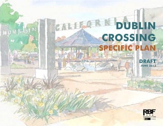
- 5. DUBLIN CROSSING SPECIFIC PLAN | i DUBLIN CROSSING SPECIFIC PLAN VISION Located in the heart of the City of Dublin, Dublin Crossing will be a vibrant urban village where people can work, live, and play. The community will serve as a gathering place for the entire city, with a large central park, direct access to the Iron Horse Regional Trail, and links to the Dublin/Pleasanton BART station.
- 6. i | T A B L E O F C O N T E N T S ii | CITY OF DUBLIN CITY OF DUBLIN City Council Tim Sbranti, Mayor Kevin Hart, Vice Mayor Don Biddle Abe Gupta David Haubert Planning Commission Sean O'Keefe, Chair Tara Bhuthimethee, Vice Chair Lynna Do Arun Goel Rameet Kohli City Staff Joni Pattillo, City Manager Chris Foss, Assistant City Manager Luke Sims, Community Development Director Linda Smith, Economic Development Director Bonnie Terra, Fire Marshal Paul McCreary, Parks and Community Services Director Tom McCarthy, Police Commander Gary Huisingh, Public Works Director Jeff Baker, Assistant Community Development Director Andrew Russell, City Engineer Herma Lichtenstein, Parks and Facilities Development Manager Jayson Imai, Senior Civil Engineer (Development) Obaid Khan, Senior Civil Engineer (Traffic) Kristi Bascom, Principal Planner Consultants RBF Consulting, a Company of Michael Baker Corporation
- 7. T A B L E O F C O N T E N T S | i DUBLIN CROSSING SPECIFIC PLAN | iii 1 INTRODUCTION ...................................... 1 1.1. Specific Plan Organization................................................1-2 1.2. Specific Plan Principles and Objectives ..............................1-2 1.3. Background.....................................................................1-4 1.4. Planning Process and Entitlements .....................................1-6 1.5. Specific Plan Setting .........................................................1-6 1.6. Existing Constraints ........................................................1-12 1.7. Relationship to Existing Plans and Policies ........................1-14 1.8. Statutory Requirements of a Specific Plan .........................1-15 2 LAND USE & DEVELOPMENT STANDARDS... 1 2.1. Land Use Concept ...........................................................2-2 2.2. Planning Areas ................................................................2-9 2.3. Phasing Plan .................................................................2-11 2.4. Land Use Policies...........................................................2-13 2.5. Infrastructure and Services ..............................................2-13 2.6. Development Standards .................................................2-15 2.7. Permitted Uses...............................................................2-41 3 DESIGN GUIDELINES .............................3-1 3.1. General Design Guidelines...............................................3-3 3.2. Residential Design Guidelines.........................................3-21 3.3. Residential Architectural Styles.........................................3-30 3.4. Commercial and Mixed-Use Design Guidelines................3-45 3.5. Crime Prevention Through Environmental Design..............3-52 3.6. Mobility and Parking ......................................................3-55 3.7. Signage ....................................................................... 3-65 3.8. Public Facilities ............................................................. 3-74 4 CIRCULATION & STREETSCAPE DESIGN .. 4-1 4.1. Circulation and Streetscape Design Policies....................... 4-2 4.2. Pedestrian and Bicycle Circulation, Transit Facilities ........... 4-4 4.3. Street Network and Hierarchy........................................... 4-8 4.4. Gateways and Entries .................................................... 4-51 4.5. Streetscape Design........................................................ 4-57 5 INFRASTRUCTURE & PUBLIC SERVICES..... 5-1 5.1. Sanitary Sewer ................................................................ 5-2 5.2. Potable Water................................................................. 5-3 5.3. Recycled Water............................................................... 5-6 5.4. Stormwater and Water Quality ......................................... 5-6 5.5. Dry Utilities..................................................................... 5-9 5.6. Public Services .............................................................. 5-10 6 PUBLIC REALM (PARKS, OPEN SPACE, PUBLIC FACILITIES) ........................................... 6-1 6.1. Public Realm Policies....................................................... 6-2 6.2. Connecting to Existing Parks, Recreation Facilities and Trails.............................................................................. 6-3 6.3. Concepts for Dublin Crossing Central Park........................ 6-4 6.4. Chabot Creek Habitat Corridor...................................... 6-15 6.5. Neighborhood Park(s) ................................................... 6-18 6.6. School ......................................................................... 6-21
- 8. i | T A B L E O F C O N T E N T S iv | CITY OF DUBLIN 7 ADMINISTRATION, IMPLEMENTATION, & FINANCING.......................................... 7-1 7.1. Specific Plan Administration and Project Entitlements...........7-2 7.2. Affordable Housing..........................................................7-6 7.3. Phasing and Financing Project Improvements .....................7-7 List of Figures Figure 1-1: Specific Plan Location................................................... 1-7 Figure 1-2: Specific Plan Aerial....................................................... 1-9 Figure 1-3: Proximity to BART Station ............................................ 1-11 Figure 1-4: Existing Constraints .................................................... 1-13 Figure 2-1: Conceptual Land Use Plan............................................ 2-3 Figure 2-2: Illustrative Site Plan....................................................... 2-5 Figure 2-3: Planning Areas........................................................... 2-10 Figure 2-4: Conceptual Phasing Plan............................................ 2-12 Figure 4-1: Pedestrian and Bicycle Circulation Network .................... 4-5 Figure 4-2: Existing Street Network ................................................. 4-9 Figure 4-3: Proposed Backbone Street Network ............................. 4-11 Figure 4-4: Illustrative B Street Section .......................................... 4-12 Figure 4-5: Illustrative Central Parkway (Arnold Road to F Street) Street Section..................................................................... 4-14 Figure 4-6: Illustrative Central Parkway (F Street to D Street) Street Section..................................................................... 4-18 Figure 4-7: Illustrative Central Parkway (D Street to B Street) Street Section..................................................................... 4-20 Figure 4-8: Illustrative G Street (Arnold Road to F Street and D Street to B Street) Street Section.................................................. 4-22 Figure 4-9: Illustrative G Street (F Street to D Street) Street Section... 4-24 Figure 4-10: Illustrative G Street (B Street to Scarlett Drive) Street Section 4-26 Figure 4-11: Illustrative A, C, E, H, and I Streets Street Section ........ 4-28 Figure 4-12: Illustrative D Street South Street Section ...................... 4-30 Figure 4-13: Illustrative D Street North Street Section...................... 4-32 Figure 4-14: Illustrative F Street Section......................................... 4-34 Figure 4-15: Private Streets – Street Sections.................................. 4-37 Figure 4-16: Illustrative Dublin Boulevard Street Section.................. 4-39 Figure 4-17: Illustrative Scarlett Drive Street Section........................ 4-41 Figure 4-18: Illustrative Arnold Road Street Section......................... 4-43 Figure 4-19: Illustrative Dublin Boulevard/B Street Intersection ........ 4-48 Figure 4-20: Illustrative Scarlett Drive/G Street Intersection ............. 4-49 Figure 4-21: Illustrative Arnold Road/G Street Intersection .............. 4-50 Figure 4-22: Illustrative Central Park Gateway Plaza....................... 4-52 Figure 4-23: Illustrative East Gateway Plaza................................... 4-54 Figure 5-1: Dublin San Ramon Service District Service Area .............. 5-2 Figure 5-2: Conceptual Sanitary Sewer System................................. 5-4 Figure 5-3: Conceptual Potable Water System ................................. 5-5 Figure 5-4: Conceptual Recycled Water System................................ 5-7 Figure 5-5: Conceptual Stormwater Drainage and Detention System.. 5-8
- 9. T A B L E O F C O N T E N T S | i DUBLIN CROSSING SPECIFIC PLAN | v List of Tables Table 2-1: Land Use Summary ....................................................... 2-4 Table 2-2: Planning Area Development Summary ......................... 2-11 Table 2-3: Phasing Plan.............................................................. 2-11 Table 2-4: Conventional Single Family Home (Detached) Development Standards................................................................. 2-26 Table 2-5: Alley Loaded Home (Detached) Development Standards 2-28 Table 2-6: Duet Home (Attached) Development Standards............. 2-30 Table 2-7: Rowhouse (Attached) Development Standards............... 2-32 Table 2-8: Green Court Home (Detached) Development Standards 2-34 Table 2-9: Motorcourt Home (Detached or Attached) Development Standards................................................................. 2-36 Table 2-10: Townhome (Attached) Development Standards ........... 2-38 Table 2-11: Multi-Family (Attached) Development Standards ......... 2-40 Table 2-12: Permitted Uses .......................................................... 2-43 Table 3-1: Contemporary Style Criteria ......................................... 3-32 Table 3-2: Craftsman Style Criteria ............................................... 3-34 Table 3-3: European Cottage Style Criteria ................................... 3-36 Table 3-4: Mediterranean Style Criteria......................................... 3-38 Table 3-5: Monterey Style Criteria................................................. 3-40 Table 3-6: Spanish Eclectic Style Criteria ....................................... 3-42 Table 3-7: Tuscan Style Criteria.................................................... 3-44 Table 4-1: Parkway Bioretention Palette......................................... 4-58 Table 4-2: Street Tree Palette ....................................................... 4-59 Table 4-3: Recommended Plant Palette......................................... 4-60
- 11. DUBLIN CROSSING SPECIFIC PLAN | 1-1 1INTRODUCTION This chapter explains the purpose of the Specific Plan; background; planning process and entitlements; guiding principles; organization of the Specific Plan; authority to prepare; relationship to existing plans and policies; local and regional context and setting.
- 12. 1 | I N T R O D U C T I O N 1-2 | CITY OF DUBLIN The Dublin Crossing Specific Plan (Specific Plan) is a plan for the orderly development of approximately 189 acres in the City of Dublin (the City). As shown in Figure 1-1: Specific Plan Location, the project site is located in the center of Dublin, north of Interstate 580 and Dublin Boulevard. The project site is located on a portion of the 2,485-acre Camp Park Reserve Forces Training Area (Camp Parks), which currently sits in the middle of the City of Dublin, leaving geographically large portions of the City to the east and to the west of the project site. The Specific Plan address the development of the proposed Dublin Crossing Project (the Project) which is comprised of residential units, commercial uses, parks and open space, and an elementary school. Specifically, the Project includes a maximum of up to 1,995 residential units, between 75,000 and 200,000 square feet (sf.) of commercial uses, a 30 net acre Community Park, five (5) acres of Neighborhood Park land, and an elementary school site. 1.1. Specific Plan Organization The Specific Plan is organized with the following chapters and content. Chapter 1 – Introduction This chapter explains the purpose of the Specific Plan; background; planning process and entitlements; guiding principles; organization of the Specific Plan; authority to prepare; relationship to existing plans and policies; local and regional context and setting. Chapter 2 – Land Use and Development Standards This chapter explains the conceptual land use plan for the Specific Plan area; identifies land use policies, and defines the land use designations unique to the Specific Plan. Development standards for each land use designation are also described. Chapter 3 – Design Guidelines This chapter explains design concepts and establishes design policies and design guidelines for development in the Specific Plan area. Chapter 4 – Circulation and Streetscape Design This chapter explains the circulation and streetscape design including the roadway hierarchy and proposed mobility plans for pedestrians and bicycles. Chapter 5 – Infrastructure and Public Services This chapter describes the plan for infrastructure and utility needs (e.g., water, sewer, recycled water, etc.) and public services for the Specific Plan area. Chapter 6 – Public Realm (Parks, Open Space, Public Facilities) This chapter identifies the goals and design concepts for the community and neighborhood parks, trails and bikeways; and locates and characterizes public facilities anticipated for the Specific Plan area. Chapter 7 – Administration, Implementation, and Financing This chapter discusses the development review procedures by the City of Dublin, and other relevant permitting agencies, applicable to the Specific Plan area. Implementation of the proposed land uses shall be through a tiered process as outlined in this chapter. A process for amendments to the Specific Plan is also discussed. Additionally, financing sources, maintenance responsibilities, and costs are identified for major infrastructure improvements. 1.2. Specific Plan Principles and Objectives The Specific Plan establishes a vision for a vibrant, compact, walkable, bicycle-friendly, transit-oriented community that provides active public gathering spaces and is designed to promote accessibility, connectivity, and a high quality of life. This Specific Plan ensures the creation of unique neighborhoods that blend diverse residences, shops, offices, parks, open space, and entertainment within easy access to public transportation and an interconnected network of sidewalks and bike routes, all providing easier access to daily needs.
- 13. I N T R O D U C T I O N | 1 DUBLIN CROSSING SPECIFIC PLAN | 1-3 1.2.1. Specific Plan Guiding Principles The following guiding principles provide the framework for the Specific Plan policies, regulations and development standards: Create a strong connection between the eastern and western parts of the City, while also maintaining a distinct identity. Provide a unique community gathering space in the Specific Plan area which will strengthen the image of the City, create a “sense of place,” and further increase the quality of life for the residents of Dublin. Establish residential land use principles that encourage diverse housing options to meet the needs of Dublin’s current and future population, and the creation of neighborhoods with a sense of place. Maximize the use of pedestrian and bicycle friendly connections through the strategic placement and variation of land uses and densities, and the creation of safe multi-modal transportation networks both through the site and into the larger community. Accommodate community needs by providing public spaces such as public parks, open space, trails, community facilities, other public places, and potential school facilities. Establish new communities that will not negatively impact the City infrastructure, facilities, or services. 1.2.2. Specific Plan Objectives The following objectives form the basis for anticipated outcomes for the project. They will also be used as the basis for evaluating future development applications and analyzing alternatives in the environmental review process. Ensure a long-term financially viable infill project that provides for the creation of new jobs, recreational opportunities, and expanded housing opportunities. Create a community that is compatible in scale and design with surrounding land uses. Create a project that has a fiscally-neutral impact on the City’s financial and services resources1 . Create a community with a strong sense of place and a range of recreation and mobility amenities by designing a unique streetscape that will serve to tie the neighborhoods together with an integrated design theme. Establish a cohesive community feel in the project area through the development and implementation of design guidelines that ensure consistency between individual neighborhoods while allowing unique architectural expression. Provide sufficient land for the Dublin Unified School District (DUSD) to construct an elementary school within the project site. Provide a new Community Park that will be the centerpiece of Dublin Crossing and serve as the focus for major social, cultural, and recreational events for the project, residents of Dublin, and the Tri-Valley region. If the City of Dublin, the Dublin Crossing project developer and the County of Alameda come to an agreement on the transfer of the Alameda County Surplus Property Authority (ACSPA) property to either the City of Dublin or the Dublin Crossing project developer, include the 8.7-acre ACSPA parcel in the project area and plan for its full integration into the project design while maintaining the park acreage within the 30-acre Community Park in the project area. 1 Fiscal neutrality occurs when taxation and government spending are neutral, with neither having an effect on demand (i.e. where tax revenue is equal to government spending).
- 14. 1 | I N T R O D U C T I O N 1-4 | CITY OF DUBLIN Create a distinctive Dublin Boulevard with amenities and facilities that are consistent with the City of Dublin Streetscape Master Plan, Bikeways Master Plan, and the City of Dublin General Plan. Provide a range of transportation choices; including walking, bicycling, and access to transit (BART and bus service), ridesharing, and vanpooling to reduce traffic congestion and greenhouse gas emissions. Provide enhanced transportation and circulation amenities that encourage non-vehicular access to and on the Iron Horse Regional Trail, the Dublin/Pleasanton BART station, and to both on-site and adjacent commercial services. Provide an east-west roadway through the project site to enhance circulation between the points east and points west of the area. Construct one or more neighborhood parks that are conveniently located and serve as a focal point of recreation and neighborhood events. Provide flexibility in land use regulations to allow for site constraints, variations in housing styles, and changing market conditions. Provide a mixture of residential unit types appropriate to the projected housing needs as identified in the City of Dublin General Plan Housing Element. Ensure that each phase (or combination of phases) can stand alone as a well-designed neighborhood, with an adequate circulation network and an attractive transition between the project and the remaining Camp Parks base. Promote environmental stewardship through the inclusion of progressive energy programs and standards in construction and ongoing operation of residential and commercial buildings. 1.3. Background This Specific Plan is the result of a multi-year effort by the US Army, City of Dublin, community members, and Dublin Crossing Ventures (“Developer”) to create a plan for development of the 189-acre Dublin Crossing Specific Plan area (“Specific Plan area”). In 2002, the US Army formally requested an amendment to the General Plan to change the land use designation on the project site from “Public Lands” to a combination of commercial retail, office space, residential, and open space uses. On April 15, 2003, the Dublin City Council authorized the commencement of a General Plan Amendment study to initiate a comprehensive General Plan Amendment and Specific Plan program over a 172-acre portion of the 2,485-acre Camp Parks area, a 8.5-acre NASA parcel, and (at a later date) an 8.7-acre Alameda County Surplus Property Authority parcel (see Figure 1-3: Specific Plan Ownership).
- 15. I N T R O D U C T I O N | 1 DUBLIN CROSSING SPECIFIC PLAN | 1-5 The General Plan Amendment study did not authorize a change in the land use designation on the property but permitted City Staff, in partnership with the Army, to engage the involvement of the community in several strategic visioning meetings. These meetings were used to create a cohesive vision for future development of the site. Based on the information provided from several community meetings, five conceptual land use plans, each illustrating different land use scenarios, were formulated. The City Council held a series of meetings in 2005 to review the five conceptual land use alternatives. Input from these meetings served as the basis for selecting a preferred land use plan for future development of the Project. In December 2007 the Army prepared a “Notice of Availability” to solicit a master developer for the Camp Parks Real Property Exchange Area. The Exchange Agreement provides the Army with an opportunity to construct new and modernize existing facilities through the provision of 172-acres of Army owned property (but excluding the NASA parcel and the 8.7-acre Alameda County Surplus Property Authority parcel), to a developer in exchange for Camp Parks facilities improvements. The Exchange Agreement is not a part of the Specific Plan but was necessary to facilitate acquisition of the property by the project developer. In October 2008, the Army announced the selection of the master developer for the Project. In April 2011, the developer and the US Army officially finalized the Exchange Agreement, authorizing the developer to commence the General Plan Amendment and Specific Plan process.
- 16. 1 | I N T R O D U C T I O N 1-6 | CITY OF DUBLIN 1.4. Planning Process and Entitlements 1.4.1. Planning Process When subsequent site-specific development proposals for the Specific Plan area are presented to the City, planning staff will use this Specific Plan as a policy and regulatory guide for subsequent project review. Projects will be evaluated for consistency with Specific Plan policies and for conformance with development standards and design guidelines. Policies and standards in the Specific Plan will take precedence over more general policies and standards applied throughout the rest of the City. In situations where policies or standards relating to a particular subject have not been provided in the Specific Plan, the existing policies and standards of the City's General Plan and Zoning Ordinance will continue to apply. In the event any provision in this Specific Plan conflicts with General Plan, Zoning Ordinance, or other City regulation, the provision set forth within this Specific Plan shall prevail. 1.4.2. Project Entitlements The project entitlements are expected to include: A certified Project-level Environmental Impact Report (EIR); Specific Plan; General Plan Amendment Zoning Ordinance and Zoning Map amendments; Large lot Tentative Map to facilitate the US Army/developer property exchange; Multiple small lot Tentative Maps for the various project development phases; City/Developer Development Agreement; Site Development Review approval for individual development projects; Grading and Improvement Plans for infrastructure and utilities; and Other related entitlements and local, state, and federal permits as may be needed to build out the project(s) as envisioned by the Specific Plan. See Chapter 7: Administration, Implementation and Financing for detailed provisions of the project approvals and implementation process. 1.5. Specific Plan Setting 1.5.1. Regional Setting The Specific Plan area is located in northern Alameda County, near the center of the Tri-Valley region. As a part of the Eastern San Francisco Bay Area, the City of Dublin plays an important regional role due to its close proximity to major metropolitan centers, including San Francisco (35 miles northwest), Oakland (30 miles northwest) and Silicon Valley (25 miles southwest). The City of Dublin offers the Dublin/Pleasanton and West Dublin/Pleasanton Bay Area Rapid Transit (BART) stations, Interstates 580 and 680, and the Iron Horse Regional Trail, a multi- modal trail that links numerous cities within Alameda and Contra Costa counties(see Figure 1-1: Specific Plan Location). 1.5.2. Local Setting The 189-acre Specific Plan area is centrally located in the City of Dublin and is bound by a network of streets; 5th and 6th street to the north on the active Camp Parks installation, Arnold Road to the east, Dublin Boulevard to the south and Scarlett Drive (with future extension) to the west. The Specific Plan area is located adjacent to the Iron Horse Regional Trail, and close to the Dublin/Pleasanton BART station, with the station entrance approximately one-third mile to the south of the project area boundary.
- 17. I N T R O D U C T I O N | 1 DUBLIN CROSSING SPECIFIC PLAN | 1-7 Figure 1-1: Specific Plan Location
- 18. 1 | I N T R O D U C T I O N 1-8 | CITY OF DUBLIN The Specific Plan area is generally flat and a significant portion is undeveloped. Two seasonal drainage channels traverse the site, one north to south generally through the middle of the project site, and another along the eastern border, parallel to Arnold Street. Figure 1-2: Specific Plan Aerial shows an aerial photograph of the Specific Plan area. Existing and Surrounding Land Uses Of the 189 acres, approximately 62 acres consists of developed land which is generally located in the western part of the Specific Plan area and includes approximately 20 structures and buildings which are currently used for U.S. Army operations, academic activities, administration, equipment storage, and maintenance. Most facilities are currently in use by the U.S. Army, with the exception of a NASA warehouse building that is deteriorated and has not been used for several years. The Specific Plan area is located adjacent to existing urban development. Camp Parks base housing and administrative buildings are located to the north. A complex of office buildings is located east of Arnold Road, along with a vacant parcel at the northeast corner of Dublin Boulevard and Arnold Road. South of Dublin Boulevard is a broad mix of land uses including multi-family residential and commercial. The entrance to the Dublin-Pleasanton BART station is located approximately one-third mile south of the Specific Plan boundary edge. adjacent to Interstate 580. Medium-high density single-family residential, retail and industrial uses are located to the west. West of Interstate 680 is Downtown Dublin. Figure 1-2: Specific Plan Aerial identifies existing and surrounding land uses within the vicinity of the Specific Plan area. 1.5.3. Existing Mobility Facilities and Services Roadways Interstate Highways – Interstate Highway access to the Specific Plan area is provided by I-580 and I-680. I-580 runs south of the Specific Plan area and connects to I-680 and I-880 to the west and I-5 to the east. I- 680 runs west of the Specific Plan area and connects to the northerly cities of San Ramon, Danville, Walnut Creek and Concord and the southerly cities of Fremont, Milpitas, San Jose, and Silicon Valley. Dublin Boulevard – Dublin Boulevard is the main east-west arterial that runs through the City and is the southern boundary of the Specific Plan area. Dublin Boulevard provides access to the Dublin/Pleasanton and West Dublin/Pleasanton BART stations and commercial, office, and residential areas throughout Dublin. Dublin Boulevard has an existing bikeway network consisting of Class I bike paths and Class II bike lanes. Livermore-Amador Valley Transit Authority (LAVTA, or “Wheels”) bus transit service and a bus rapid transit (BRT) line run along Dublin Boulevard. Arnold Road – Arnold Road is a Class I Collector roadway extending north from Interstate 580onto Camp Parks. Existing office buildings are located on the east side of the roadway. Arnold Road has Class II bike lanes on both sides of the street that connect to a Class I bike path along the north side of Dublin Boulevard.
- 19. I N T R O D U C T I O N | 1 DUBLIN CROSSING SPECIFIC PLAN | 1-9 Figure 1-2: Specific Plan Aerial
- 20. 1 | I N T R O D U C T I O N 1-10 | CITY OF DUBLIN Scarlett Drive – Scarlett Drive is a Class II Residential Collector roadway located along the west side of the Specific Plan area. The current alignment terminates at Houston Place and picks up again at Dublin Boulevard. It is anticipated that the Specific Plan will provide for the extension of Scarlett Drive from Houston Place to Dublin Boulevard, adjacent to the Iron Horse Regional Trail. Transit Service Bay Area Rapid Transit (BART) – BART is the regional rail service in the San Francisco Bay Area, with stations and stops throughout the greater Bay Area, including the Dublin/Pleasanton and West Dublin/Pleasanton stations. The entrance to the Dublin-Pleasanton BART station is located approximately one-third mile south of the Specific Plan boundary edge. Figure 1-3: Proximity to BART Station identifies quarter-, third-, and half- mile distances from the Dublin/Pleasanton BART station. Livermore-Amador Valley Transit Authority (LAVTA, or “Wheels”) – Wheels provides services in Dublin and the Tri-Valley area, with nearby stops along Dublin Boulevard, along Dougherty Road, and at the Dublin/Pleasanton BART station.
- 21. I N T R O D U C T I O N | 1 DUBLIN CROSSING SPECIFIC PLAN | 1-11 Figure 1-3: Proximity to BART Station
- 22. 1 | I N T R O D U C T I O N 1-12 | CITY OF DUBLIN Trails Iron Horse Regional Trail – Iron Horse Regional Trail is a regional multi- use trail that, at full completion, will span approximately 33 miles from Livermore to Suisun Bay, connecting 12 cities within Alameda and Contra Costa counties. This trail provides an important recreational and commuting component for the communities it serves by connecting residential neighborhoods, commercial and business centers, schools, public transportation, open space, parks, and community facilities. 1.6. Existing Constraints The following are existing physical constraints to development in the Specific Plan area: The Department of the Army Exchange Agreement is an agreement between the U.S. Army and the Developer to which the City is not a party. The Exchange Agreement requires that the project be developed in specific land allocation phases associated with capital improvements to be completed by the Developer on the remaining active Camp Parks installation. Conveyance of the 8.7-acre parcel located at the northwest corner of Dublin Boulevard and Arnold Road which is owned by the Alameda County Surplus Property Authority. Conveyance of the 8.5-acre parcel located adjacent to Scarlett, which is owned by the NASA. Stormwater capacity issues associated with the Chabot storm drainage channel. Existence of a 100-year flood plain within and around the project site. Existing right-of-way and easements, including Dublin Boulevard, Arnold Road, 5th and 6th Streets, and Scarlett Drive. Building window height restrictions along the north side of the project site. Due to sensitivities over potential visual intrusion into a particular building on the military base, within the buffer area, there shall not be any windows on north-facing elevations that are higher than 25 feet from adjacent grade. Existing and future project traffic levels of service on existing roadways and intersections. Safe connectivity of the project to the local and regional transit system, especially at Dublin Boulevard. Maintaining Iron Horse Trail connectivity south across Dublin Boulevard to the Dublin/Pleasanton BART station. Existing underground infrastructure including a 10” gasoline pipeline (owned by Kinder Morgan) and a fiber optic line that extends on the west side of the project site, adjacent to the Iron Horse Regional Trail. Figure 1-4: Existing Constraints identifies the above on-site physical constraints.
- 23. I N T R O D U C T I O N | 1 DUBLIN CROSSING SPECIFIC PLAN | 1-13 Figure 1-4: Existing Constraints
- 24. 1 | I N T R O D U C T I O N 1-14 | CITY OF DUBLIN 1.7. Relationship to Existing Plans and Policies 1.7.1. Dublin General Plan The City of Dublin General Plan (the General Plan) (1985) provides a broader city-wide framework to support future land use and development decisions in the Specific Plan area. California state law requires this Specific Plan to be consistent with the policies and standards contained in the General Plan. Together with the Specific Plan, the City of Dublin will approve any necessary General Plan amendments to provide for the land uses, goals and policies in this Specific Plan. Chapter 2: Land Use and Development Standards outlines goals and policies which support the goals and policies of the General Plan. In situations where policies or standards relating to a particular subject have not been provided in this Specific Plan, the existing policies and standards in the General Plan will continue to apply. In the event any provision in this Specific Plan conflicts with the General Plan, the provisions set forth within the Specific Plan shall prevail. 1.7.2. City of Dublin Zoning Ordinance The City of Dublin Zoning Code (the Zoning Ordinance) provides a citywide framework of regulations that address topics such as permitted uses, development standards, parking and landscaping regulations, permit procedures, and sign regulations. This Specific Plan includes the zoning standards for development within the Specific Plan area. In situations where policies or standards relating to a particular subject are silent in this Specific Plan, the existing regulations of the Zoning Ordinance will continue to apply. In the event that any provision in this Specific Plan conflicts with Zoning Ordinance, the provisions set forth within the Specific Plan shall prevail. 1.7.3. Park and Recreation Master Plan The City of Dublin Park and Recreation Master Plan (2006) provides goals, policies, and standards for “park facilities, combined with the active recreation-oriented lifestyle of the population [with] a significant emphasis on the provision of high quality and sufficient recreation opportunities for the community.” This Specific Plan provides park and open space system that integrates a continuous network of multi-modal trails and bikeways (see Chapter 6: Public Realm). 1.7.4. City of Dublin Bikeways Master Plan The City of Dublin’s Bikeways Master Plan (2007), provides goals, policies and standards for developing and implementing a city-wide bikeway system. This Specific Plan promotes viable transportation alternatives to the automobile and supports walking and bicycling throughout the Specific Plan area, with safe and convenient access to transit, open space, trails, parks, and other recreational amenities (see Chapter 4: Circulation and Streetscape Design). 1.7.5. City of Dublin Streetscape Master Plan The City of Dublin Streetscape Master Plan (2005) provides goals, policies, and standards for streetscape continuity, aesthetics and connectivity. This Specific Plan implements design standards and guidelines that strengthen and unify the City’s streetscape (see Chapter 4: Circulation and Streetscape Design). 1.7.6. City of Dublin Public Art Master Plan The City of Dublin Public Art Master Plan provides goals, policies, and standards for public art to create a unique sense of place and a strong identity for public spaces in neighborhoods and business districts, and to provide opportunities for people to experience visual art. This Specific Plan includes design guidelines and standards which promote public art that will create a unique sense of place and a strong identity for the Specific Plan area (see Chapter 3: Design Guidelines).
- 25. I N T R O D U C T I O N | 1 DUBLIN CROSSING SPECIFIC PLAN | 1-15 1.7.7. Dublin Transit Center The Dublin Transit Center area covers 91 acres of land on the south side of Dublin Boulevard surrounding the Dublin/Pleasanton BART station. The Master Plan includes policies and design guidelines intended to create a high-density mixed-use project by encouraging transit as a primary means of transportation. The land uses proposed within this Specific Plan are compatible with those of the Transit Center. The Transit Center Master Plan designates an 8.7-acre parcel, owned by the Alameda County Surplus Property Authority, as “Neighborhood Park.” Located at the northwestern most portion of the Transit Center Area, this parcel is intended to be included in the Specific Plan area and designated for commercial and mixed-use opportunities. 8.7 additional acres will be added to Central Park in Dublin Crossing to compensate. The Dublin Transit Center is a recognized Priority Development Area (PDA) in the Metropolitan Transportation Commission (MTC) and Association of Bay Area Governments (ABAG) “Plan Bay Area”. PDAs are areas within communities that have been identified and approved by city or county governments to take on larger shares of future growth. These areas typically are easily accessible to transit, jobs, shopping and other services, such as the Dublin Crossing Specific Plan area. 1.8. Statutory Requirements of a Specific Plan This Specific Plan implements the goals and policies of the General Plan, serves as an extension of the General Plan, and can be used as both a policy and a regulatory document. The purpose of this Specific Plan is to implement the vision by providing goals, policies, programs, development standards and design guidelines to direct future development within the Specific Plan area. 1.8.1. Authority to Prepare A “specific plan” is a planning and regulatory tool made available to local governments by the State of California. Specific plans implement a city’s General Plan through the development of policies, programs and regulations that provide an intermediate level of detail between General Plan and individual development projects. State law stipulates that specific plans can only be adopted or amended if they are consistent with a city’s adopted General Plan. The authority to prepare and adopt a Specific Plan and the requirements for its contents are set forth in California Government Code Sections 65450 through 65457. Section 65451 states, “A Specific Plan shall include a text and a diagram or diagrams which specify all the following in detail: The distribution, location, and intent of the uses, including open space, within the area covered by the plan. The proposed distribution, location, and extent and intensity of major components of public and private transportation, sewage, water, drainage, solid waste disposal, energy, and other essential faculties proposed to be located within the area covered by the plan and needed to support the land uses described in the plan. Standards and criteria by which the development will proceed, and standards for the conservation, development, and utilization of natural resources, where applicable. A program of implementation measure including regulation, programs, public works projects, and financing measures to carry out the paragraphs 1, 2, and 3. The Specific Plan shall include a statement of the relationship of the specific plan to the General Plan." 1.8.2. Environmental Review The California Environmental Quality Act (CEQA) classifies a specific plan as a “Project” which is subject to an Environmental Impact Report (EIR). The Dublin Crossing Specific Plan EIR (State Clearinghouse # 2012062009) evaluates this Specific Plan as a single project consisting of parcels that are anticipated to be further subdivided and developed over an extended period of time. The EIR analyzes environmental impacts of the potential developments within the Specific Plan area and
- 26. 1 | I N T R O D U C T I O N 1-16 | CITY OF DUBLIN proposes mitigation measures to reduce significant environmental impacts to a less than significant level as defined by CEQA. The intent of preparing a project-level EIR is to expedite the processing for future projects that are consistent with this Specific Plan, if it is determined that the proposed development would not result in new environmental impact nor require additional mitigation. Through a project-level EIR, the City can approve future applications within the Specific Plan area without an additional environmental document or, if there are changes to this Specific Plan, additional environmental review need only focus on areas of change.
- 27. DUBLIN CROSSING SPECIFIC PLAN | 2-1 2LAND USE & DEVELOPMENT STANDARDS This chapter explains the conceptual land use plan for the Specific Plan area; identifies land use policies, and defines the land use designations unique to the Specific Plan. Development standards for each land use designation are also described.
- 28. 2 | L A N D U S E A N D D E V E L O P M E N T S T A N D A R D S 2-2 | CITY OF DUBLIN 2.1. Land Use Concept The Dublin Crossing Specific Plan creates land use designations that will implement the Specific Plan guiding principles and objectives outlined in Chapter 1: Introduction. The land uses, intensities, sizes and locations are designed to focus the vision of Dublin Crossing as a vibrant urban village where people can work, live, and play. Furthermore, the land uses are designed to support the Specific Plan land use concept and will act as the regulatory “zoning districts” for each use. As shown in Figure 2-1: Conceptual Land Use Plan, Dublin Crossing is envisioned as an infill, mixed-use development located in the center of Dublin. It will include a 30 acre Community Park, up to 1,995 residential units, up to 200,000 sf. of commercial space, five acres of neighborhood parks, and an elementary school site. A summary of the land use by type is shown in Table 2-1: Land Use Summary. See Table 2-12: Permitted Uses for more detail on the permitted uses in each land use district. The community will be connected by a hierarchy of streets, trails, linked open spaces, and interconnected neighborhoods. Land uses are also visually and physically connected to other uses by safe circulation infrastructure, continuity of streetscapes, complementary design features, and by the nature of their compatibility. Land uses in the Specific Plan area reflect the optimal type and mix necessary to achieve the vision of a livable urban village. Each of the land uses and the circulation network are described further in this section. Figure 2-2: Illustrative Site Plan illustrates how development within Dublin Crossing may occur.
- 29. L A N D U S E A N D D E V E L O P M E N T S T A N D A R D S | 2 DUBLIN CROSSING SPECIFIC PLAN | 2-3 Figure 2-1: Conceptual Land Use Plan
- 30. DUBLIN CROSSING SPECIFIC PLAN | 2-4 Table 2-1: Land Use Summary Land Use District Total Acreage 1 Permitted Density Total Development Potential Dublin Crossing Lower Density Residential (DC LDR) 41.9 6.0-14.0 units/net acre Up to 1,995 dwelling units 5 Dublin Crossing Medium Density Residential (DC MDR) 46.5 14.1-20 units/net acre Mixed Use (MU) 2 13.2 20.1-60 units/net acre 0.25 to 1.0 FAR 75,000 to 200,000 gross square feet General Commercial/DC Medium Density Residential (GC/DC MDR) 3 9.1 14.1-20 units/net acre 0.25 to 1.0 FAR General Commercial/DC High Density Residential (GC/DC HDR) 3 9.9 20.1-60 units/net acre 0.25 to 1.0 FAR Park (P) 30 n/a n/a Open Space (OS) 4 2.6 n/a n/a School (S) 5 12 n/a n/a Roadways, Utilities, and other Infrastructure 23.8 n/a n/a Total Project Area 189 Notes: (1) Acreages are rounded to the nearest whole number. Net acreage is defined as the gross acreage less backbone street, public street, and right-of-way area. (2) The Mixed Use land use district shall contain a minimum of 75,000 gross square feet of commercial uses (with a maximum floor area ratio (FAR) of 1.0) and a 5 acre neighborhood park. In conjunction with an application that meets the commercial and park requirements above, residential uses are permitted with a density of up to 60 units/net acre. FAR applies only to commercial uses. (3) Can have commercial only, mixed-use, or residential-only uses. FAR applies only to commercial uses. (4) Park acreage is net usable acres. In the case of the 30 net-acre Community Park, the park is exclusive of Chabot Creek. (5) The school site can be developed at the Dublin Crossing Lower Density Residential (DC LDR) use and density and if the site is not utilized by the Dublin Unified School District and if the Specific Plan maximum of 1,995 residential units is not exceeded.
- 31. L A N D U S E A N D D E V E L O P M E N T S T A N D A R D S | 2 DUBLIN CROSSING SPECIFIC PLAN | 2-5 Figure 2-2: Illustrative Site Plan
- 32. 2 | L A N D U S E A N D D E V E L O P M E N T S T A N D A R D S 2-6 | CITY OF DUBLIN 2.1.1. Parks, Open Space, and Public Facilities The Specific Plan area contains a total of 73.4 acres of land designed for public use which includes parks/open space, an elementary school site, and public roadways. Central Park and Iron Horse Regional Trail Realignment Located at the crossroads of Dublin Boulevard, Scarlett Drive and the Iron Horse Regional Trail is the proposed 30 net usable acre Dublin Crossing Central Park (Central Park). The Central Park is envisioned as an innovative and uniquely designed community gathering place for the residents of Dublin Crossing and the broader community of Dublin. The Central Park will provide high-quality recreational amenities for both passive and active recreation and civic events (e.g., festivals, farmer’s market, art shows, etc.). Amenities could include an amphitheater, organized and informal sports fields, sport courts, restrooms, walking paths, parking, a community garden, demonstration vineyards, play areas, picnic grounds, a carousel, a rose garden, and possibly a building pad for a children’s museum (to be built by others). An existing drainage channel extends north to south along the eastern side of the proposed land area for Central Park. This channel provides regional drainage from Camp Parks (to the north) and eventually flows under I-580 and into the Chabot Canal. This channel will be relocated and grade-contoured as a natural riparian corridor. The channel could include a multi-use trail with staggered observation lookouts and interpretive signage. The new channel will be located adjacent to the eastern border of the Central Park. A gateway plaza at the southeast corner of Central Park at the visually prominent corner of Dublin Boulevard and the future extended Scarlett Drive will serve as the primary entrance into the park. The Dublin Boulevard frontage will create an opportunity for a strong visual civic statement at a key central location within the City. The gateway plaza should include significant landscaping, seating, street furniture, and other element(s). The Iron Horse Regional Trail will be reconfigured with the new project frontage and Scarlett Drive, and a secondary trail pathway could be integrated along the southwestern edge of the Central Park. Associated uses along the secondary trail pathway through the park could include a café/concession, bicycle racks, wayfinding signage, lighting, restrooms, and landscaped gardens. Neighborhood Parks A five-acre Neighborhood Park will be located within the Mixed Use (MU) land use district with frontage facing at least one adjacent public street. The Neighborhood Park will be designed to be integrated with the commercial and/or residential development located in the Mixed Use District, and could contain unique amenities that are appropriate to a park in this context. School The Specific Plan provides an opportunity for the Dublin Unified School District (DUSD) to acquire land for a public elementary school site which is designated as School (S) on Figure 2-1: Conceptual Land Use Plan. This elementary school site will be designed to accommodate up to 900 children and will include classrooms, a gymnasium, administrative offices, a multi-use sports field, sport courts, a playground, and parking. The school site will have an overlay designation of Dublin Crossing Lower Density Residential (DC LDR). In the event that DUSD does not acquire the site, residential uses will be allowed in accordance with the DC LDR land use district, development standards, and design guidelines contained in this Specific Plan.
- 33. L A N D U S E A N D D E V E L O P M E N T S T A N D A R D S | 2 DUBLIN CROSSING SPECIFIC PLAN | 2-7 2.1.2. Residential Neighborhoods The proposed project will contain 88.4 acres of residential neighborhoods accommodating up to 1,995 residential units with densities ranging from 6 to 60 dwelling units per net acre. There are two land use districts that accommodate residential development: Dublin Crossing Lower Density Residential (DC LDR) has a density of 6 to 14 units per net acre; and Dublin Crossing Medium Density Residential (DC MDR) has a density of 14.1 to 20 units per net acre. There will be a variety of housing types throughout the project area including single-family detached, single-family attached and multi-family units which will be located in order to provide a logical transition from the existing high density residential development adjacent to the BART station and from the existing Medium-Density Residential neighborhood across Scarlett Drive Residential density ranges within each residential neighborhood are allowed to provide flexibility of subdivision design and to adapt to changing future housing market conditions. 2.1.3. Commercial and Mixed Use Mixed Use (MU) The Mixed Use (MU) land use district is proposed for 13.2 acres at the northwest corner of Arnold Road and Dublin Boulevard. The Mixed Use land use district shall contain a minimum of 75,000 (maximum of 200,000) gross square feet of commercial uses (with a maximum floor area ratio (FAR) of 1.0) and a 5 acre neighborhood park. In conjunction with an application that meets the commercial and park requirements above, residential uses are permitted with a density of up to 60 units/net acre. Residential-only uses are not permitted. Mixed-use can take the form of vertical mixed-use, horizontal mixed-use, or a combination of both. Vertical mixed-use is characterized by residential use above and adjacent to the base commercial. Horizontal mixed-use is characterized by residential use adjacent to the base commercial, as either attached or detached units, but the project is designed so that the residential and commercial uses are integrated and built simultaneously to function as a single project. Typical permitted commercial uses include a variety of eating and drinking establishments, hotel, entertainment, retail stores, bank branches, bookstores, markets, personal and professional services, and office uses. Residential uses (within a mixed-use project) are permitted in addition to the commercial with a density of up to 60 units/net acre. FAR applies only to commercial uses. A five acre Neighborhood Park will be located within the 13.2 acre MU district, which will be designed in concert with the surrounding development. A gateway plaza located at the northwest corner of Dublin Boulevard and Arnold Road will create another public focal point along Dublin Boulevard. It will be located within the Mixed Use land use district. This gateway plaza will include generous landscape and hardscape treatment around a water feature with trellises and seating areas to encourage activation of the space.
- 34. 2 | L A N D U S E A N D D E V E L O P M E N T S T A N D A R D S 2-8 | CITY OF DUBLIN A second plaza is envisioned in an internal courtyard between the commercial and/or mixed-use buildings. This plaza would feature a smaller water feature, and possibly an outdoor eating area for restaurants. Accent planting in pots and planters will be located throughout the interior plaza to provide color. These plazas will be constructed concurrent with the commercial and/or mixed-use development and will not be counted as Neighborhood Park acreage. General Commercial/Dublin Crossing Medium Density Residential (GC/DC MDR) To provide flexibility to accommodate future market conditions and City housing needs, a combination land use district is proposed for areas along Arnold Road – north of the General Commercial land use district. General Commercial/Dublin Crossing Medium Density Residential (GC/DC MDR) is proposed for 9.1 acres on the periphery of the project area along Arnold Road, as shown in Figure 2-1: Conceptual Land Use Plan. Uses allowed in this district are commercial, mixed use (as described in the MU land use district above), and residential. In combination with the Mixed Use land use district (which will contain a minimum of 75,000 square feet of commercial uses), the GC/DC MDR land use district can contain an additional 125,000 of commercial uses, up to a Specific Plan area total of 200,000 square feet. The maximum floor area ratio (FAR) of commercial uses in the district is 1.0 and the maximum density for residential development in the land use district is 20 units/net acre. Residential uses do not count toward the commercial FAR limits. General Commercial/Dublin Crossing High Density Residential (GC/DC HDR) To provide flexibility to accommodate future market conditions and City housing needs, a combination land use district is proposed for areas along Dublin Boulevard – west of the Mixed Use land use district. General Commercial/Dublin Crossing High Density Residential (GC/DC HDR) is proposed for 9.9 acres on the periphery of the project area along Dublin Boulevard, as shown in Figure 2-1: Conceptual Land Use Plan. Uses allowed in this district are commercial, mixed use (as described in the MU land use district above), and residential. In combination with the Mixed Use land use district (which will contain a minimum of 75,000 square feet of commercial uses), the GC/DC HDR land use district can contain an additional 125,000 of commercial uses, up to a Specific Plan area total of 200,000 square feet. The maximum floor area ratio (FAR) of commercial uses in the district is 1.0 and the maximum density for residential development in the land use district is 60 units/net acre. Residential uses do not count toward the commercial FAR limits.
- 35. L A N D U S E A N D D E V E L O P M E N T S T A N D A R D S | 2 DUBLIN CROSSING SPECIFIC PLAN | 2-9 2.1.4. Roadway Network As public spaces, streets will have significant importance within Dublin Crossing. They will facilitate access to the residential, commercial, mixed use, and public uses within the community and provide the opportunity for physical exercise and social interaction. This Specific Plan includes a thoughtfully designed streetscape that is conducive to creating an urban community, facilitating multiple modes of travel in an inviting, safe, aesthetically-pleasing circulation network. A grid pattern of different street types, each with a defined character and function, will serve the transportation needs of the project. The internal “backbone” street system is designed to establish connections to the existing exterior roadway network as well as internally between residential neighborhoods, parks, open spaces, an optional elementary school site, and business /commercial areas. With sidewalks on nearly all streets, and bikeways on many, the streets will become the framework for the pedestrian and bicycle network as they connect to uses both internally and beyond Dublin Crossing. Internal roadway classifications include Residential, Class I, and Class II Collector Streets, Residential Streets, and Private Streets. Chapter 4: Circulation and Streetscape Design provides greater detail on the roadway network. Residential, Class I, and Class II Collector Streets Collector Streets will serve as the primary conduits for interior neighborhood vehicular, bicycles, and pedestrian traffic and to provide access to and from neighborhood residential streets and perimeter streets outside of the Specific Plan area. These streets are not intended to support regional traffic, but they may provide direct access to schools and parks. Collector Streets include B Street, Central Parkway, and G Street. Residential Streets Residential Streets will provide direct multi-modal access to neighborhoods by residents and visitors while discouraging through traffic and high speeds. Residential Streets are intended to provide low-speed access between and within neighborhoods, promoting a multi-modal network with an emphasis on comfort, safety, and amenities for pedestrians and bicyclists. Private Streets Private Streets will be privately owned and maintained streets that provide access within common interest subdivisions and commercial and mixed- use developments. Private Streets will be designed for a low volume of traffic with limited vehicular access. Private Streets will be narrower than public Residential Streets and may or may not include sidewalks, on- street parking, or other street features. 2.2. Planning Areas Figure 2-3: Planning Areas organizes the project site into distinct Planning Areas for purposes of the overall site development.
- 36. 2 | L A N D U S E A N D D E V E L O P M E N T S T A N D A R D S 2-10 | CITY OF DUBLIN Figure 2-3: Planning Areas
- 37. L A N D U S E A N D D E V E L O P M E N T S T A N D A R D S | 2 DUBLIN CROSSING SPECIFIC PLAN | 2-11 Table 2-2: Planning Area Development Summary Planning Area Project Phase Net Area (Acres) Land Use District 1 5 16.64 DC MDR (14.1-20 u/a) 2 4 / 5 17.67 DC LDR (6-14 u/a) 3 2 / 3 / 4 31.50 P-OS 4 1A 3.72 DC MDR (14.1-20 u/a) 5 1A / 2 8.49 DC LDR (6-14 u/a) 6 1B / 2 4.60 DC LDR (6-14 u/a) 7 1A / 1B 5.33 DC MDR (14.1-20 u/a) 8 1A 6.13 GC/DC HDR 9 1B 3.10 DC MDR (14.1-20 u/a) 10 2 / 3 11.00 DC LDR (6-14 u/a) 11 2 / 3 14.42 DC MDR (14.1-20 u/a) 12 4 2.03 GC/DC MDR 13 3 / 4 6.18 GC/DC MDR 14 2 / 3 12.00 S 15 3 3.15 DC MDR (14.1-20 u/a) 16 2 / 3 3.77 GC/DC HDR 17 2 / 3 13.00 MU Roadway, Utilities, other Infrastructure -- 26.27 n/a TOTAL 189 2.3. Phasing Plan Development of the Specific Plan area shall include 5 (five) development phases, with anticipated build-out occurring over a period of approximately 10 years in response to market demands, the acquisition of the property from the U.S. Army, and according to an orderly extension of roadways, infrastructure, public services, and utilities. Over the course of the five phases, parks sites, private recreational facilities, school, and other amenities will be provided commensurate with the residential and commercial development pursuant to terms in the Development Agreement. Figure 2-4: Conceptual Phasing Plan and Table 2-3: Phasing Plan identify proposed development phasing within the Specific Plan area. As the Phasing Plan exhibits, the development phases shall occur sequentially, although portions of phases may occur concurrently. Development of each phase shall include all infrastructure, services, facilities and amenities, both public and private, needed to serve the uses and structures within that phase, which shall be completed in accordance with the provisions in this Specific Plan and the Development Agreement. Development of each phase will result in a project that could “stand alone” with suitable roadway, utility, and public facility infrastructure if future phases were not constructed. It is anticipated that each of the phases may include sub-phases which may result in multiple Final Maps. Table 2-3: Phasing Plan Phase Gross Area Maximum Number of Residential Units Maximum Amount of Commercial Square Footage 1 33 570 - 2 54 421 75,000 3 48 435 50,000 4 26 156 75,000 5 28 413 - TOTAL 189 acres Up to 1,995 Up to 200,000
- 38. 2 | L A N D U S E A N D D E V E L O P M E N T S T A N D A R D S 2-12 | CITY OF DUBLIN Figure 2-4: Conceptual Phasing Plan
- 39. L A N D U S E A N D D E V E L O P M E N T S T A N D A R D S | 2 DUBLIN CROSSING SPECIFIC PLAN | 2-13 2.4. Land Use Policies The following land use policies shall apply to all development within the project area unless otherwise noted in this Specific Plan. Special implementation measures are described in Chapter 7: Administration, Implementation and Financing. LU Policy 2.1 – Concentrate commercial uses near the intersection of Dublin Boulevard and Arnold Road to act as the Specific Plan’s “Easterly Commercial Focus”. Commercial development should be focused in the General Commercial (GC) land use district and a minimum of 75,000 square feet of commercial uses should be located in this land district prior to allowing commercial in the General Commercial/Dublin Crossing Medium Density Residential (GC/DC MDR) and General Commercial/Dublin Crossing High Density Residential (GC/DC HDR) land use districts. LU Policy 2.2 – Locate higher density residential uses along Dublin Boulevard and within walking or biking distance to transit facilities. LU Policy 2.3 – Provide pedestrian and bicycle facilities to meet the goals and objectives of the Specific Plan and to promote alternatives to automobile use and reduce parking demand. Pedestrian and bicycle trails/ multi-use trails shall safely connect residential, commercial, and recreational uses and with transit facilities. LU Policy 2.4 – Develop a comprehensive Park Master Plan for the Community Park (Central Park), Neighborhood Park(s), and the Specific Plan area pedestrian/bicycle trail network that is consistent with the City of Dublin Bicycle Master Plan and Parks and Recreation Master Plan. LU Policy 2.5 – Locate the Central Park near the intersection of Dublin Boulevard, Scarlett Drive and the Iron Horse Regional Trail to provide physical and visual access to the Dublin Community and to enable a strong connection between the parks in the Specific Plan area and the Iron Horse Regional Trail. LU Policy 2.6 –Promote development of a wide variety of housing types and housing alternatives for Dublin residents. LU Policy 2.7 –Allow the development of residential units consistent with the Dublin Crossing Lower Density Residential (DC LDR) land use district, development standards, and design guidelines should DUSD choose to not construct a school facility on the site designated for school uses. LU Policy 2.9 – Each development phase shown in Figure 2-3 shall include all infrastructure, services, facilities and amenities, both public and private, needed to serve the uses and structures within that phase, which shall be completed in accordance with the provisions in this Specific Plan and Development Agreement. Development of each phase shall result in a project that could “stand alone” both functionally and aesthetically if future phases were not constructed. LU Policy 2.10 – Development of Phase 2 shall include the provision of a wide, landscaped connection along D Street North to connect the residential development of Phase 1 and Phase 2 into a cohesive neighborhood with comfortable, multi-modal connections between the two. The construction of D Street North shall include a minimum of 10 feet of additional landscaping on the east side of D Street. 2.5. Infrastructure and Services Figure 2-1: Conceptual Land Use Plan provides for a variety of land uses within the Specific Plan area. Each of these land uses will be served by existing and future utilities infrastructure planned for future development in and around the Specific Plan area. Project development will require removal relocation of exiting, and construction of new public utilities within the Specific Plan area. This section briefly describes onsite infrastructure and services. Chapter 5: Infrastructure and Public Services provides greater detail on infrastructure and public services improvements as part of development of the Specific Plan area. 2.5.1. Storm Drainage Camp Parks watershed drains through the Specific Plan area. The majority of the runoff from this watershed is conveyed through Camp Parks in natural and man-made swales. These swales cross the Specific Plan area, are intercepted along the north side of Dublin Boulevard and
- 40. 2 | L A N D U S E A N D D E V E L O P M E N T S T A N D A R D S 2-14 | CITY OF DUBLIN conveyed to various existing Zone 7 drainage facilities. The main drainage channel for runoff from Camp Parks crosses the Specific Plan area and is currently a mapped FEMA 100 year floodplain. To the northeast and east of Camp Parks, runoff is collected in an existing channel and conveyed south along Arnold Road. Near Arnold Road and Central Parkway, a flow “splitter” divides flow between two existing Zone 7 drainage facilities. A portion of this flow continues down Arnold Road, while the remainder is conveyed in an existing trapezoidal channel across the southeastern portion of the Project. Refer to Figure 5-5: Conceptual Stormwater Drainage and Detention System. 2.5.2. Wastewater The wastewater collection, treatment, and disposal services for the Specific Plan area will be provided by the Dublin San Ramon Services District (DSRSD). DSRSD provides wastewater collection and treatment at the Regional Wastewater Treatment Facility located in the City of Pleasanton. DRSD owns and operates the existing sanitary sewer mains through the Specific Plan area, which currently convey wastewater from areas adjacent to, and north of, the Specific Plan area. The existing wastewater facilities are active and currently provide service to existing buildings in and around the Specific Plan area. These sewer mains will be rerouted through the Specific Plan area as required to accommodate phased development (see Figure 5-2: Conceptual Sanitary Sewer System). Wastewater generated from the Specific Plan uses will be collected and conveyed through a conventional gravity system of pipes located within the new backbone rights-of-way. The onsite wastewater system will connect to the existing DSRSD sewer conveyance facilities surrounding the site. According to DSRSD the existing adjacent sewer infrastructure is adequately sized to serve this development. 2.5.3. Potable Water The Dublin San Ramon Services District (DSRSD) owns and operates the potable water system within the boundaries of Camp Parks including the Specific Plan area. DSRSD also maintains potable water facilities in the streets adjacent to Camp Parks, including Dougherty Road, Scarlett Drive, Dublin Blvd. and Arnold Road. The existing water facilities are active and currently provide service to existing buildings in and around the Specific Plan area. Several existing water mains currently traverse the Specific Plan area providing service to existing buildings within the Specific Plan area and providing a looped water system for Camp Parks. As shown in Figure 5- 3: Conceptual Potable Water System, these water mains will be rerouted through the Specific Plan area as required to accommodate phased development. 2.5.4. Recycled Water The Dublin San Ramon Services District (DSRSD) produces and distributes recycled water for landscape irrigation in Dublin as part of its Potable Water Conservation and Water Recycling Program. Except for certain isolated locations, all new irrigation systems serving parks, schools, streetscapes, and common area landscaping for multi-family or commercial complexes within the potable water service area of DSRSD are required to use recycled water for irrigation. DSRSD maintains several domestic recycled water facilities near the Specific Plan area including recycled water mains in Dougherty Road and Dublin Blvd. All recycled water mains originate at DSRSD’s Regional Wastewater Treatment Plant located in Pleasanton. This plant includes a recycled water treatment facility and a pump station that conveys recycled water from the plant. Per DSRSD Ordinance 301, the Specific Plan area is required to connect to recycled water for landscaping, except for single family residential uses that do not have landscaping maintained in common. The Specific Plan area will be served by recycled water facilities for public roadways, schools, parks, commercial, and multi- family residential landscape irrigation. See Figure 5-4: Conceptual
- 41. L A N D U S E A N D D E V E L O P M E N T S T A N D A R D S | 2 DUBLIN CROSSING SPECIFIC PLAN | 2-15 Recycled Water System for the anticipated recycled water system onsite layout and points of connection. 2.5.5. Joint Trench (Gas, Electricity, and Telecommunications) Gas and electric service for the Specific Plan area will be provided by Pacific Gas and Electric Company (PG&E). There are existing gas distribution lines in the following streets; portions of Dublin Boulevard (6- inch line) and Arnold Road (6-inch line and 8-inch lines). All new transit stops will have new shelters and bicycle and pedestrian amenities for access to transit and will have electrical service for the provision of lighting and real time arrival/departure signs. All new signals shall be interconnected with fiber optic cable. Development in the Specific Plan area will connect with electric and telecommunication services in the joint trench facilities along Dublin Boulevard. There are also existing petroleum gas and fiber optic lines traversing a portion of the Specific Plan area. 2.6. Development Standards The purpose of this section is to provide land use development standards that apply throughout the Specific Plan area. These include standards regarding permitted uses, building height limits, parking requirements, and setbacks. These development standards should be used in conjunction with Chapter 3: Design Guidelines, which describe and illustrate building designs, concepts, and features that will ensure the high-quality development that is envisioned for the Specific Plan area. Development standards apply for each of the respective land use designations described below. These are: Dublin Crossing Lower Density Residential (DC LDR) Dublin Crossing Medium Density Residential (DC MDR) Mixed Use (MU) General Commercial/ Dublin Crossing Medium Density Residential (GC/DC HDR) General Commercial/ Dublin Crossing High Density Residential (GC/DC HDR) Parks (P) Open Space (OS) School (S) Additionally, development standards are provided for specific residential product types. These development standards apply to residential developments within the above land use districts.
- 42. 2 | L A N D U S E A N D D E V E L O P M E N T S T A N D A R D S 2-16 | CITY OF DUBLIN 2.6.1. Development Standards for DC Lower Density Residential (DC LDR) land use district The DC Lower Density Residential (DC LDR) land use district allows a mix of residential lot configurations from conventional single-family small-lots including “two-pack” or “zipper” lots, to attached multi-family lots at a density of 6-14 units per net acre. Residential product types may include a variety of attached and detached housing types, including: Single-Family Conventional Home (Detached) Alley Loaded Home (Detached) Duet Home (Attached) Rowhouse (Attached) Green Court Home (Detached) Motorcourt Home (Detached or Attached) Townhome (Attached) Refer to Section 2.6.11: Residential Product Type Development Standards (all Land Use Districts) for product type development standards. Secondary dwelling units, accessory structures, and home occupations are permitted in the DC LDR land use district in accordance with the Zoning Ordinance Chapter 8.64: Home Occupations Regulations. Development of residential units in this land use district shall be regulated by the standards established for each product type noted below and in accordance with these additional notes: No building shall be taller than 40 feet, except for architectural projections such as chimneys or architectural features of a roof. Due to sensitivities over potential visual intrusion into a particular building on the military base, within the visual intrusion buffer area as identified on Figure 1-4: Existing Constraints, there shall not be any windows on north-facing elevations that are higher than 25 feet from adjacent grade. All setbacks at corner lots shall meet the intersection sight distance design criteria of the Highway Design Manual. All setbacks for front area shall ensure safe sight distances for pedestrians and vehicles at commercial driveways as approved by the City Engineer. Architectural projections such as porches and patios, landings, steps, bay windows, media nooks, fireplaces and other similar features are allowed to project into setback. Setbacks shall be measured to back of sidewalk. If not sidewalk, setback shall be measured to right-of-way. Interior lot setbacks may be reduced to zero (0) feet depending on building type; however, any setbacks less than three (3) feet shall meet fire code requirements. Allowed encroachments include: patios, utility boxes, cantilevers, roof eaves, and other similar features. Common Usable Outdoor Space for attached housing units of any type shall be a minimum of 25% of net site area. Parking shall be provided in accordance with the Zoning Ordinance based on residential use type
- 43. L A N D U S E A N D D E V E L O P M E N T S T A N D A R D S | 2 DUBLIN CROSSING SPECIFIC PLAN | 2-17 2.6.2. Development Standards for DC Medium Density Residential (DC MDR) Land Use District DC Medium Density Residential (DC MDR) allows for a mix of attached and detached single-family and multi-family housing lot configurations at a density of 14.1 to 20 units/net acre. Residential product types may include a variety of attached and detached housing types, including: Single-Family Conventional Home (Detached) Alley Loaded Home (Detached) Duet Home (Attached) Rowhouse (Attached) Green Court Home (Detached) Motorcourt Home (Detached or Attached) Townhome (Attached) Multi-Family (Attached) Refer to Section 2.6.11: Residential Product Type Development Standards (all Land Use Districts) for product type development standards. Medium-High Density Residential development provides a transition from the higher density apartments and condominiums along the project periphery to the DC Low Density Residential land use district in the core of the Specific Plan area. Home occupations are permitted in the DC MDR land use district in accordance with the Zoning Ordinance Chapter 8.64: Home Occupations Regulations. Development of residential units in this land use district shall be regulated by the standards noted for each product type and in accordance with these additional notes: No building height shall be taller than 45 feet, except for architectural projections such as chimneys or architectural features of a roof. Due to sensitivities over potential visual intrusion into a particular building on the military base, within the visual intrusion buffer area as identified on Figure 1-4: Existing Constraints, there shall not be any windows on north-facing elevations that are higher than 25 feet from adjacent grade. All setbacks at corner lots shall meet the intersection sight distance design criteria of the Zoning Ordinance. All setbacks for front area shall ensure safe sight distances for pedestrians and vehicles at commercial driveways as approved by the City Engineer. Architectural projections such as porches and patios, landings, steps, bay windows, media nooks, fireplaces and other similar features are allowed to project into setback. Setbacks shall be measured to back of sidewalk. Interior lot setbacks may be reduced to zero (0) feet depending on building type; however, any setbacks less than three (3) feet shall meet fire code requirements. Allowed encroachments include: patios, utility boxes, cantilevers, roof eaves, and other similar features. Common Usable Outdoor Space for attached housing units of any type shall be a minimum of 25% of net site area. Parking shall be provided in accordance with the Zoning Ordinance based on residential use type. The City Engineer may allow variations from the standards noted above based on a parking study that shows a reduction is warranted and if (1) connectivity to the BART station can be demonstrated via safe, convenient pedestrian connections and (2) the reduction can verified through studies at similar locations with similar characteristics.
- 44. 2 | L A N D U S E A N D D E V E L O P M E N T S T A N D A R D S 2-18 | CITY OF DUBLIN 2.6.3. Development Standards for Mixed Use (MU) Land Use District Mixed Use (MU) is proposed for approximately 13.2 acres at the northwest corner of Arnold Road and Dublin Boulevard, as shown in Figure 2-1: Conceptual Land Use Plan. Uses allowed in this district are commercial and mixed use (commercial and residential combined in a single project). Residential-only uses are not permitted. Mixed-use can take the form of vertical mixed-use, horizontal mixed-use, or a combination of both. Vertical mixed-use is characterized by residential use adjacent to the base commercial. Horizontal mixed-use is characterized by residential use adjacent to the base commercial, as either attached or detached units, but the project is designed so that the residential and commercial uses are integrated and built simultaneously to function as a single project. The Mixed Use land use district shall contain a minimum of 75,000 (maximum of 200,000) gross square feet of commercial uses (with a maximum floor area ratio (FAR) of 1.0) and a 5 acre neighborhood park. Typical permitted commercial uses include a variety of eating and drinking establishments, hotel, entertainment, retail stores, bank branches, bookstores, markets, personal and professional services, and office uses. Residential uses (within a mixed-use project) are permitted in addition to commercial with a density of up to 60 units/net acre. In multi-story buildings in the MU land use district, ground floor commercial uses should include uses that serve daily needs, such as retail and grocery stores and eating and drinking establishments. All other uses are permitted on all floors. A gateway plaza shall be located in the northwest corner of Dublin Boulevard and Arnold Road to create a focal point along Dublin Boulevard. A second plaza in an internal courtyard may be located between commercial and/or mixed-use buildings. Residential product types may include a variety of attached housing types, including: Alley Loaded Home (Detached) Duet Home (Attached) Rowhouse (Attached) Green Court Home (Detached) Motorcourt Home (Detached or Attached) Townhome (Attached) Multi-Family (Attached) Refer to Section 2.6.11: Residential Product Type Development Standards (all Land Use Districts) for product type development standards. Home occupations are permitted in the MU land use district in accordance with the Zoning Ordinance Chapter 8.64: Home Occupations Regulations. The following apply to all development within this land use district: No building height shall be taller than 75 feet and 6 stories, except for architectural projections such as chimneys or architectural features of a roof. All setbacks at corner lots shall meet the intersection sight distance design criteria of the Zoning Ordinance. All setbacks for front area shall ensure safe sight distances for pedestrians and vehicles at commercial driveways as approved by the City Engineer. Architectural projections such as porches and patios, landings, steps, bay windows, media nooks, fireplaces and other similar features are allowed to project into setback. Setbacks shall be measured to back of sidewalk.
- 45. L A N D U S E A N D D E V E L O P M E N T S T A N D A R D S | 2 DUBLIN CROSSING SPECIFIC PLAN | 2-19 Interior lot setbacks may be reduced to zero (0) feet depending on building type; however, any setbacks less than three (3) feet shall meet fire code requirements. Allowed encroachments include: patios, utility boxes, cantilevers, roof eaves, and other similar features. Common Usable Outdoor Space for attached housing units of any type shall be a minimum of 25% of net site area. Parking: For commercial uses, parking shall conform to the City of Dublin Zoning Ordinance Chapter 8.76: Off-Street Parking and Loading Regulations. For residential development in this district, the parking requirement is 1.5 spaces (covered or uncovered) per residential unit plus guest parking provided as an additional 15% of the number of required spaces. The City Engineer may allow variations from the standards noted above based on a parking study that shows a reduction is warranted and if (1) connectivity to the BART station can be demonstrated via safe, convenient pedestrian connections and (2) the reduction can verified through studies at similar locations with similar characteristics.
- 46. 2 | L A N D U S E A N D D E V E L O P M E N T S T A N D A R D S 2-20 | CITY OF DUBLIN 2.6.4. Development Standards for General Commercial/DC Medium Density Residential (GC/DC MDR) Land Use District To provide flexibility to accommodate future market conditions and City housing needs, a combination land use district is proposed for areas along Arnold Road both north of the Mixed Use land use district. General Commercial/Dublin Crossing Medium Density Residential (GC/DC MDR) is proposed for approximately 9.1 acres on the periphery of the project area along Arnold Road, as shown in Figure 2-1: Conceptual Land Use Plan. Uses allowed in this district are commercial, mixed use (as described in Section 2.6.4: Development Standards for the Mixed Use (MU) Land Use District), and residential at a density of 14.1 - 20 units per net acre. In combination with the General Commercial land use district (which will contain a minimum of 75,000 square feet of commercial uses), the GC/DC MDR land use district can contain additional commercial square footage, up to a Specific Plan area total of 200,000 square feet. The maximum floor area ratio (FAR) of commercial uses in the GC/DC MDR land use district is 1.0. Residential product types may include a variety of attached and detached housing types, including: Single-Family Conventional Home (Detached) Alley Loaded Home (Detached) Duet Home (Attached) Rowhouse (Attached) Green Court Home (Detached) Motorcourt Home (Detached or Attached) Townhome (Attached) Multi-Family (Attached) Refer to Section 2.6.11: Residential Product Type Development Standards (all Land Use Districts) for product type development standards. Home occupations are permitted in the GC/DC MDR land use district in accordance with the Zoning Ordinance Chapter 8.64: Home Occupations Regulations. The following apply to all development within this land use district: No building height shall be taller than 45 feet and four stories, except for architectural projections such as chimneys or architectural features of a roof. All setbacks at corner lots shall meet the intersection sight distance design criteria of the Zoning Ordinance. All setbacks for front area shall ensure safe sight distances for pedestrians and vehicles at commercial driveways as approved by the City Engineer. Architectural projections such as porches and patios, landings, steps, bay windows, media nooks, fireplaces and other similar features are allowed to project into setback. Setbacks shall be measured to back of sidewalk. Interior lot setbacks may be reduced to zero (0) feet depending on building type; however, any setbacks less than three (3) feet shall meet fire code requirements. Allowed encroachments include: patios, utility boxes, cantilevers, roof eaves, and other similar features. Common Usable Outdoor Space for attached housing units of any type shall be a minimum of 25% of net site area. Parking: For commercial uses, parking shall conform to the City of Dublin Zoning Ordinance Chapter 8.76: Off-Street Parking and Loading Regulations. See also Chapter 3 Design Guidelines.
- 47. L A N D U S E A N D D E V E L O P M E N T S T A N D A R D S | 2 DUBLIN CROSSING SPECIFIC PLAN | 2-21 2.6.5. Development Standards for General Commercial/DC High Density Residential (GC/DC HDR) Land Use District To provide flexibility to accommodate future market conditions and City housing needs, a combination land use district is proposed for areas along Dublin Boulevard, west of the General Commercial land use district. General Commercial/Dublin Crossing High Density Residential (GC/DC HDR) is proposed for approximately 9.9 acres on the periphery of the project area along Dublin Boulevard, as shown in Figure 2-1: Conceptual Land Use Plan. Uses allowed in this district are commercial, mixed use (as described in the GC land use district above), and residential at a density of 20.1-60 units per net acre. In combination with the General Commercial land use district (which will contain a minimum of 75,000 square feet of commercial uses), the GC/DC HDR land use district can contain additional commercial square footage, up to a Specific Plan area total of 200,000 square feet. The maximum floor area ratio (FAR) of commercial uses in the district is 1.0 and the maximum density for residential development in the land use district is 20.1 to 60 units/net acre. DC High Density Residential (DC HDR) allows for a mix of both single- family attached and multi-family housing lot configurations at a density of 20.1-60 units/net acre. Residential product types may include a variety of attached and detached housing types, including: Alley Loaded Home (Detached) Duet Home (Attached) Rowhouse (Attached) Green Court Home (Detached) Motorcourt Home (Detached or Attached) Townhome (Attached) Multi-Family (Attached) Refer to Section 2.6.11: Residential Product Type Development Standards (all Land Use Districts) for product type development standards. Home occupations are permitted in the DC HDR land use district in accordance with the Zoning Ordinance Chapter 8.64: Home Occupations Regulations. The following apply to all development within this land use district: No building height shall be taller than 75 feet and 6 stories, except for architectural projections such as chimneys or architectural features of a roof. All setbacks at corner lots shall meet the intersection sight distance design criteria of the Zoning Ordinance. All setbacks for front area shall ensure safe sight distances for pedestrians and vehicles at commercial driveways as approved by the City Engineer. Architectural projections such as porches and patios, landings, steps, bay windows, media nooks, fireplaces and other similar features are allowed to project into setback. Setbacks shall be measured to back of sidewalk. Interior lot setbacks may be reduced to zero (0) feet depending on building type; however, any setbacks less than three (3) feet shall meet fire code requirements. Allowed encroachments include: patios, utility boxes, cantilevers, roof eaves, and other similar features. Common Usable Outdoor Space for attached housing units of any type shall be a minimum of 25% of net site area.
- 48. 2 | L A N D U S E A N D D E V E L O P M E N T S T A N D A R D S 2-22 | CITY OF DUBLIN Parking: For commercial uses, parking shall conform to the City of Dublin Zoning Ordinance Chapter 8.76: Off-Street Parking and Loading Regulations. For residential development in this district, the parking requirement is 1.5 spaces (covered or uncovered) per residential unit plus guest parking provided as an additional 15% of the number of required spaces. The City Engineer may allow variations from the standards noted above based on a parking study that shows a reduction is warranted and if (1) connectivity to the BART station can be demonstrated via safe, convenient pedestrian connections and (2) the reduction can verified through studies at similar locations with similar characteristics.
- 49. L A N D U S E A N D D E V E L O P M E N T S T A N D A R D S | 2 DUBLIN CROSSING SPECIFIC PLAN | 2-23 2.6.6. Parks (P) Land Use District The Parks land use designation shall apply to the 30 acres of Community Park (Central Park) in the project area, as identified in Figure 2-1: Conceptual Land Use Plan. The five-acre Neighborhood Park is located within the Mixed Use district. Typical uses within the P district include public park facilities that include formal and informal recreation activities including walking, biking, organized sporting events, and informal play. Chapter 6: Public Realm (Parks, Open Space, Public Facilities) provides policies, standards and design concepts for all parks within the Specific Plan area. 2.6.7. Open Space (OS) Land Use District The Open Space land use designation shall apply to approximately 2.6 acres of land that has been set aside for non-development uses, such as creek corridors, private recreation, flood control, or habitat area. There are no development standards or design guidelines for land within this district. 2.6.8. School (S) Land Use District The Specific Plan provides an opportunity for the DUSD to acquire up to 12 acres of land within the project area for a public elementary school. The School (S) land use designation includes a residential overlay. In the event the DUSD does not acquire the designated property for a use as an elementary school or other District purposes, the school site can be developed in accordance with the DC Lower Density Residential (DC LDR) land use district development standards and design guidelines. Development of the school site as an elementary school is under the jurisdiction of the DUSD and the Department of the State Architect (DSA). Therefore, no regulations or development standards are provided in the Specific Plan. However, Chapter 3: Design Guidelines contains recommendations for the school facilities design should DUSD wish to consider them. Additionally, the Community Design and Sustainability Element of the General Plan contains guidelines on the pedestrian and bicycle facilities that should be found at the periphery of the school site. 2.6.9. Adjustment to Boundaries of Land Use Districts Minor adjustments to the boundaries of each land use district resulting is a different acreage number than is noted in Table 2-1: Land Use Summary may occur as more detailed plans are developed during the Tentative and Final Subdivision Map review and approval process. The Community Development Director has the discretion to approve any minor boundary and/or acreage adjustment requested provided the Developer demonstrates the following: The requested adjustment will not exceed the maximum number of residential units permitted to be developed in the Specific Plan area (1,995) or the maximum amount of commercial square footage (200,000 square feet); The requested adjustment will not result in new significant, unmitigated environmental impacts or a significant increase in previously identified impacts; The requested adjustment will not result in reduction in public facilities such as the width of bike lanes, sidewalks, landscaping, travel lanes, access to transit, etc. as required under the Specific Plan unless such a reduction is approved by the Public Works Director; The Developer will provide all needed infrastructure, facilities, services and amenities and will otherwise satisfy all obligations in connection with development, as required under the Specific Plan; The adjustment will not adversely affect the provision of needed infrastructure, facilities, services and amenities to serve other portions of the Specific Plan area; The requested adjustment will not exceed the projected amount of trip generation for the uses studied in the Project EIR. Alternatively, if any requested adjustments would result in trip generation rates above those projected in the Project EIR, then
- 50. 2 | L A N D U S E A N D D E V E L O P M E N T S T A N D A R D S 2-24 | CITY OF DUBLIN additional traffic analysis shall be conducted to identify any new significant impacts or any significant increase in previously identified impacts, and to recommend feasible mitigation measures, which the Developer shall commit to fulfill to the satisfaction of the Community Development Director and Public Works Director in accordance with CEQA; and The requested adjustment will not result in a reduction of total acreage designated Parks (P) below 30 net acres. 2.6.10. Residential Product Type Development Standards (all Land Use Districts) The following development standards apply to residential product types allowed within the Specific Plan area. These are: Single-Family Conventional Home (Detached) Alley Loaded Home (Detached) Duet Home (Attached) Rowhouse (Attached) Green Court Home (Detached) Motorcourt Home (Detached or Attached) Townhome (Attached) Multi-Family (Attached) To provide flexibility and to accommodate new and innovative residential product types, additional product types may be provided in the Specific Plan area following the procedures in Section 7.1.6: Minor Modifications.
- 51. L A N D U S E A N D D E V E L O P M E N T S T A N D A R D S | 2 DUBLIN CROSSING SPECIFIC PLAN | 2-25 Single-Family Conventional Home (Detached) A Single-Family Conventional Home is defined as a dwelling that is occupied by one family, does not share a common wall, is not attached to another home, and provides both front door and garage access from a residential street or common driveway. Single-family homes are typically built on larger lots between 3,000 and 6,000 square feet with private rear yard space. This type of product in general faces a residential street or common driveway. Principal Dwelling Individual lots, typically with residential street or common driveway frontage One dwelling per lot Private rear yards Garages may be attached or detached Resident parking on individual lots. 2 covered side-by-side parking spaces shall be provided. Guest parking 1 guest space per dwelling (driveway, on-street or designated parking areas) Secondary Unit or Accessory Guesthouse Detached or attached secondary unit or accessory guesthouse allowed Secondary Units shall conform to the Zoning Ordinance Chapter 8.40: Accessory Structures and Uses Regulations and Chapter 8.80: Second Units Regulations.
- 52. 2 | L A N D U S E A N D D E V E L O P M E N T S T A N D A R D S 2-26 | CITY OF DUBLIN Table 2-4: Conventional Single Family Home (Detached) Development Standards Feature Criteria Lot Size (minimum) 3,000 square feet Lot Width (minimum) (1) 35 feet Setbacks (minimum) (2)(3) Front (4) Living 10 feet Garage (5) 18 feet Porch 5 feet Side (6) Interior (7) 4 feet Corner (4) Living 8 feet Porch 5 feet Rear (7)(8) 10 feet Building Height (maximum) (9) 40 feet Number of Stories (maximum) 3 stories Notes: (1) Flag lots are allowed within the Specific Plan area in cases where conventional rectangular lot layouts are not feasible or practical. Cul-de-sac lots shall not have a frontage of less than 30 feet. Flag lots shall not have a frontage of less than 25 feet for each lot (lot frontage is measured at right-of-way or property line which ever applies). In cases where more than one flag lot is necessary, shared common driveways may be utilized to reduce pavement and driveway repetition. Landscaping along both sides of the flag lot driveway should be used to avoid an alley appearance. (2) Building setbacks are measured from edge of building foundation. (3) Architectural projections such as roof eaves, covered patios, landings, steps, bay windows, media nooks, fireplaces, and other similar features are allowed to project into the setback. (4) Front and side corner setbacks are measured from back of sidewalk. If sidewalks do not exist along lot frontage or side corner, front setbacks are measured from back of curb. (5) Minimum garage setback for a driveway is 18 feet. Maximum garage setback for no parking driveway is 5 feet. (6) Zero lot line configurations are permitted provided a minimum building separation of 8 feet is provided. Articulated lot lines and Reciprocal Use Easements (RUE) are allowed. (7) Side interior and rear setbacks are measured from property line. (8) Rear setbacks may be a minimum of 10 feet with an average setback of 15 feet. (9) No building height shall be taller than 40 feet, except for chimneys, vents, and other architectural or mechanical appurtenances.
- 53. L A N D U S E A N D D E V E L O P M E N T S T A N D A R D S | 2 DUBLIN CROSSING SPECIFIC PLAN | 2-27 Alley Loaded Home (Detached) Alley Loaded Homes are single-family detached dwelling units that provide garage access from a common rear alley and front door access along a residential street. Alleys should be carefully designed as an attractive common space with landscaping, building articulation, and architectural details. Principal Dwelling Individual lots, typically with front door access along a residential street and common private rear alleys for garage access Garages may be attached or detached Resident parking on individual lots. 2 covered side-by-side parking spaces shall be provided. Guest parking 1 guest space per dwelling (driveway, on-street or designated parking areas) One dwelling per lot Private side yards utilizing Reciprocal Use Easements (RUE) Secondary Unit or Accessory Guesthouse Detached or attached secondary unit or accessory guesthouse allowed Secondary Unit shall conform to the Zoning Ordinance Chapter 8.40: Accessory Structures and Uses Regulations and Chapter 8.80: Second Units Regulations. Building Separation Provisions The minimum separation between primary building interior side yards shall be a minimum aggregate of 8 feet.
- 54. 2 | L A N D U S E A N D D E V E L O P M E N T S T A N D A R D S 2-28 | CITY OF DUBLIN Table 2-5: Alley Loaded Home (Detached) Development Standards Feature Criteria Lot Size (minimum) 2,200 square feet Lot Width (minimum) 30 feet Setbacks (minimum) (1)(2) Front (3) Living 10 feet Porch 5 feet Side (4) Interior (5) 4 feet Corner (3) Living 8 feet Porch 5 feet Rear (5) Living 3 feet Garage (6) 3 feet Building Height (maximum) (7) 40 feet Number of Stories (maximum) 3 stories Notes: (1) Architectural projections such as roof eaves, covered patios, landings, steps, bay windows, media nooks, fireplaces, and other similar features are allowed to project into the setback. (2) Building setbacks are measured from edge of building foundation. (3) Front and side corner setbacks are measured from back of sidewalk. If no sidewalks exist along lot frontage or side corner, front setbacks are measured from back of curb. (4) Zero lot line configurations are permitted provided a minimum building separation of 8 feet aggregate is provided. Articulated lot lines and Reciprocal Use Easements (RUE) are allowed. (5) Side interior and rear setbacks are measured from property line. (6) Minimum garage setback for a driveway is 18 feet. Maximum garage setback for no parking driveway is 5 feet. (7) No building height shall be taller than 40 feet, except for chimneys, vents, and other architectural or mechanical appurtenances.