
Recomendados
Recomendados
Más contenido relacionado
Similar a AusPlots Rangelands Field Data Collection and Publication Infrastructure
Similar a AusPlots Rangelands Field Data Collection and Publication Infrastructure (20)
Más de bensparrowau
Más de bensparrowau (15)
Último
Último (20)
AusPlots Rangelands Field Data Collection and Publication Infrastructure
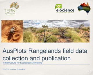
- 1. 1 22/10/14, Andrew Tokmakoff AusPlots Rangelands field data collection and publication Infrastructure for Ecological Monitoring
- 2. 2 Objectives ✤ To cover: ✤ what AusPlots is, and why it exists ✤ how AusPlots data is collected, handled and published ✤ the AusPlots system architecture, its key functions and the technical path we’ve have taken ✤ For you to consider what our work might mean for you
- 3. What is AusPlots Rangelands? ✤ AusPlots is based at Adelaide University and is one of 12 Terrestrial Ecosystem Research Network (TERN) facilities ✤ AusPlots identifies, prioritises, and fills data gaps in environmental monitoring of Australian rangelands bioregions (81% of the continent) ✤ AusPlots has defined a standardised survey methodology and undertakes surveys over a national network of permanent 1 hectare plots, collecting baseline vegetation and soils ecological data. ✤ This work facilitates ongoing evidence-based decision making at local, regional, national and international levels. 3
- 4. So, what do Australian Rangelands look like? 4
- 5. 5
- 6. Collecting field data in a prescribed methodology ✤ Prescribes a survey methodology for collecting plot-based vegetation and soils data ✤ consistency of both data and collection method ✤ allows analysis of consistent data over time, by future researchers 6
- 7. What is collected? General ✤ High accuracy (DGPS) location data for the plot’s corners, centre and transect start/end points ✤ Site observations in regard to condition, erosion, drainage, micro-relief, lithologies and landform pattern/element. 7
- 8. What is collected? Vegetation ✤ Vouchering ✤ Vouchered vegetation species (barcoded) over the plot; later sent for Herbarium Determinations. ✤ Genetic vouchering (barcoded) of species and extra sampling of dominant species (up to 4 samples). 8
- 9. What is collected? Vegetation ✤ Point Intercept ✤ consists of 1010 points, where each point records: ✤ the substrate; ✤ any vegetation intercept(s), indicating the species and intercept height 9
- 10. ✤ Basal Area ✤ recordings in each of the 9 segments of the plot, each consisting of: ✤ a set of vegetation species under observation, the associated wedge factor and the number of ‘hits’ What is collected? Vegetation 10
- 11. What is collected? Vegetation ✤ PhotoPoints ✤ stitched from 3 sets of 360 degree high resolution images taken from 3 points at the plot centre ✤ used to automatically calculate basal area using computer vision (experimental) 11
- 12. Trunk Identification and Basal Area Calculation 12 Ben Sparrow and Ben Ward
- 13. What is collected? Vegetation ✤ Leaf Area Index (LAI) ✤ Site Structural Summary ✤ recording the three most dominant species in the Upper, Middle and Lower strata, (with floristics comments). 13
- 14. What is collected? Soils ✤ Characterisation of soils (barcoded) ✤ 1 metre deep pit, in 10cm increments (ec, ph, texture and colour) ✤ 9 subsite samples: ✤ barcoded meta-genomics surface soil samples and soil samples in 10cm increments to 30cm depth 14
- 15. What is collected? Soils ✤ 3 bulk density measurements, which quantify soil fine earth and gravel. 15
- 16. Where are the plots? 16
- 18. 2 The AusPlots Approach: tooling 18
- 19. Some requirements.. ✤ Core function: support data collection according to the protocol ✤ Minimise data double-handling ✤ Maximise integrity of data (e.g. transcription errors) ✤ Use ‘off-the-shelf’ where appropriate (rapid development) ✤ Be able to function without a network (remote locations) ✤ Offer efficiency gains vs. traditional data collection methods 19
- 20. System Architecture 20 cron Internet Data Upload Apach e/PHP Field App Web-based Admin Interface (Cloud) SWARM Server
- 21. 2 AusPlots Rangelands Field Data Collection App 21
- 22. Field App: Plot Creation 22
- 23. Field App: Site Description 23
- 24. Field App: Veg. Vouchering 24
- 25. Field App: Point Intercept 25
- 26. Field App: Basal Wedge 26
- 27. Field App: Structural Summary 27
- 28. Field App: Plot Upload 28
- 30. Data Management 30 ingestion ✤ Two databases that are synchronised through regular and automated ingestion of newly uploaded plot data (from Field App). (Cloud) SWARM Server
- 31. Data Management: CouchDB ✤ CouchDB acts as a ‘landing-spot’ for Field App Data. ✤ 24/7 availability of upload service ✤ Data uploaded via internet (WiFi or 3G) 31 ingestion (Cloud) SWARM Server
- 32. Data Management: PostgreSQL ✤ PostgreSQL acts as the ‘permanent’ AusPlots data repository (Vault). ✤ Data uploaded by the Field App into CouchDB is periodically “ingested” ✤ Relational DB ✤ 24/7 availability, scheduled backups. 32 ingestion (Cloud) SWARM Server
- 33. Data Management: Curation 33 Field App Web-based Admin Interface cron REST/ JSON Apach e/PHP (Cloud) SWARM Server ✤ Apache/PHP web “site” provides a User Interface for data curation. ✤ Allows “cleaning” of data and entry of new items such as herbarium determinations.
- 35. ✤ Soils 2 Satellites offers visualisation ✤ (e.g. for land managers, consultants) ✤ Aekos offers raw data access, data enrichment and search ✤ (e.g. for ecological scientists) Publishing to external services 35 Field App cron REST/ JSON (Cloud) SWARM Server
- 36. ÆKOS data warehouse and portal 36
- 38. Motivation: overcoming barriers to ecological data re- use Identify problem Draft approac h Search for data Acquire data Assess suitability Modify approach Prepare data Conduct analysis Interpret results Dispersed: Data is stored in many storage locations and formats Source:Forestcheck: www.dec.wa.gov.au Complex: Data usually needs explanation and context before it can be accurately used www.nswrail.net Diverse and fragmented: Ecological data covers a wide range of topics and there are many different ways of measuring, observing and expressing different concepts * Rapidly evolving with few measurement standards 38
- 39. 39
- 40. 40
- 42. 42 image of 2s2 map page
- 43. 43
- 44. 44
- 45. 45
- 46. 2 Reflecting.. ✤Benefits: ✤ Integrity of data ✤ Speed of data availability ✤Challenges: ✤ getting the UI right; resistance when it is slower than “recording audio” (with subsequent data entry later on). ✤ dealing with legacy data at the same time as introducing new tools. 46
- 47. 2 Looking ahead… ✤ New Woodlands module w/ protocols (Forests not) ✤ Veg Condition, Fauna and Soils are likely to be first ✤ iOS support 47
- 48. Summary ✤ The AusPlots field data collection App generates clean data that is readily curated and easy to publish. ✤ The solution was developed iteratively, based upon experience from field use and adopted a component-based design for fast results. ✤ Complexity of the data collected led to a custom solution. ✤ ÆKOS provides a publishing platform for AusPlots. ✤ Together, we have a field-to-web solution that makes data accessible for use in long-term studies and facilitates informed ecological decision-making. 48
Notas del editor
- This is a problem for the initial observer also
- Key Points: Data is dispersed meaning that discovery involves having to in search multiple places Because there are multiple custodians, multiple approaches to owners are needed and there is often ambiguity around licensing and conditions of use Data is complex meaning that it needs explanation and context to be understood. Nevertheless, data is often poorly described making it hard to interpret – leading to the possibility of inappropriate use Ecological data is diverse and fragmented meaning it covers a broad range of topics. Things can be observed and measured in different ways using different models There are however a lack of standards for methods around the way data is stored and represented