

Recomendados
Recomendados
Más contenido relacionado
La actualidad más candente
La actualidad más candente (20)
Similar a Pentair - Coastal Capability
Similar a Pentair - Coastal Capability (20)
Pentair - Coastal Capability
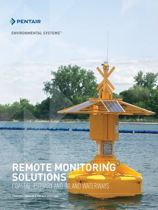
- 1. REMOTE MONITORING SOLUTIONS COASTAL, ESTUARY AND INLAND WATERWAYS PRODUCTS, SERVICES & PROJECT SOLUTIONS
- 2. BETTER MONITORING BETTER RESULTS ONE COMPANY. GLOBAL RESOURCES. 30,000 EMPLOYEES SIX CONTINENTS 100+ MANUFACTURING FACILITIES 90+ SERVICE CENTERS Whatever your application, understanding and managing water conditions is vital to your success, whether it’s for aquaculture, drinking water, port operations or public safety. PENTAIR, YOUR PARTNER IN A CHANGING WORLD Pentair Environmental Systems offers solutions and expertise to monitor and understand your operating conditions. Our resources and experience enable us to better understand risks that may threaten your operations. OUR EXPERTISE RUNS DEEP Pentair Environmental Systems is the monitoring expert in challenging environments—our experience runs deep! We have access to a network of complimentary resources within the Pentair family of companies, to provide you with the best solution to your monitoring challenges. • Expertise and resources from a multitude of technology sectors including pumping, valve and control, filtration, water treatment and aquatic ecosystems • Extensive product line and supplier access • Complete solutions for easier project planning • Technicians and engineers available for all levels of technical support MARINE ELECTRONIC HIGHWAY Indonesia The Strait of Malacca is the shortest route between the Indian Ocean and the South China Sea, and one of the busiest thoroughfares in the world. In an effort to reduce collisions and groundings in the area, Pentair’s monitoring solutions supply real-time wave, tide, current and meteorological information that’s broadcast to all passing traffic and vessel-tracking systems. PROJECT NEPTUNE Singapore A nationwide network of buoy-mounted monitoring laboratories provides early warning of water, oil and nutrient pollution problems for coastal protection, and harmful water-quality conditions for fisheries production. Coupled with hydrodynamic models, the system forecasts what may eventually occur, aiding in event response operations planning. CSG POND MONITORNG Australia A large network of floating buoys were fitted with varied depth profile sampling, water quality, level and temperature instruments for a number of settlement ponds in the coal seam gas industry. This monitoring solution fulfilled the client’s compliance monitoring requirements and eliminated the safety risks associated with physical sampling. COASTAL FISHERIES China Hundreds of thousands of acres of China’s northeastern coastline are used for fisheries production, with the sea cucumber being one of the most valuable industries. Pentair’s buoy and floating platform systems are providing real-time data via a secure Web login to the Fisheries Agency, assisting in fisheries management and event response in the coastal region, especially through winter conditions when the sea freezes. DESALINATION PLANT MONITORING Australia To ensure the concentrated brine from a desalination plant does not adversely affect coastal waters, Pentair has a network of buoy-mounted monitoring systems throughout the bay to measure salinity and oxygen-profile conditions, particularly near the ocean floor, where high-density brine may concentrate. The system can be used to shut down the plant or divert intakes should dangerous conditions occur. CUSTOMER CHALLENGES. PENTAIR SOLUTIONS.
- 3. WHY MONITOR? Marine ecosystems are one of the most fragile on the planet and the first to suffer when poorly managed. The ocean can be an early indicator of what can potentially happen to the wider environment. Real-time, on-site monitoring enables you to detect and remediate problems before damage occurs. • Gain a better understanding of natural seasonal, daily and event variations • Detect potential problems early on • Model and forecast the movement and magnitude of the problem PROBLEMS THAT CAN BE IDENTIFIED: • Potential fish losses from lack of oxygen • Excessive nutrients driving algal blooms • Oil spills or other toxic chemicals • Weather and ocean currents that transport problems • Sea conditions that increase accident risks or navigation hazards MEASURE TO PROTECT Almost any water condition can be monitored in real time with the right combination of Pentair solutions. CONTINUOUS MONITORING VS. SPOT SAMPLING CONTINUOUS MONITORING CAN REVEAL TRENDS AND EVENTS THAT SPOT SAMPLING FAILS TO CAPTURE. Same event, continuous samples Daily spot sampling Ecosystems are dynamic and continually changing. Sampling plans that use spot-check methods run the risk of missing long-term trends and short-term events that can be detected only by continuous monitoring. CRUDE AND REFINED OILS CHLOROPHYLL A MOVEMENT SALINITY TEMPERATURE WAVE HEIGHT AND DIRECTION WEATHER CONDITIONS WIND SPEED AND DIRECTION TIDE LEVEL TURBIDITY VISIBILITY SAMPLE COLLECTION NUTRIENTS (NITRATE, AMMONIA, PHOSPHATE) BLUE-GREEN ALGAE pH LOCATION RAINFALL CURRENT PROFILE ORGANIC MATTER SUNSHINE LIGHTNING DISSOLVED OXYGEN
- 4. Instruments deployed in open water quickly get covered in ocean growth. With Pentair, instruments are securely housed in the buoy. GREATER ACCURACY LESS MAINTENANCE LONGER DEPLOYMENT With abundant nutrients and light, coastal waters provide a rich environment for growth. Instruments deployed in the open water rapidly foul from algae, barnacles and corals, regardless of the protection used. MULTI-DEPTH SAMPLING SYSTEM At Pentair, we have developed an innovative multi-depth sampling system that eliminates moisture and light, resulting in significantly longer periods between maintenance. A sample is rapidly analyzed and returned, with the instrument drained between measurements and housed inside the buoy. OPEN WATER VS. MULTI-DEPTH SAMPLING The same instrument for chlorophyll a installed inside a Pentair sampling system provides better measurements for a longer time period. Side-by-side comparison data shows the improvement in the sampling system over instruments directly deployed in open water. Along with the benefit of better measurements for a longer period of time, the multi- depth sampling system offers: • A more secure location – All valuable assets are housed inside the buoy. • Simpler maintenance – No need for divers; equipment can be serviced and maintained from the surface. • Greater precision – Use the same instrument to gather more precise comparisons between various depths. • Easy updates – Replace with new instruments with minimal changes. FLEXIBLE DEPLOYMENT We can tailor a solution for your specific needs. For full system design and specifications, consult Pentair Environmental Systems engineering services. MOUNTING OPTIONS Choose from four standard designs: • Cabinets for integration into any fixed-position system (hut, jetty, pier, channel marker) • Lake and pond square platform • Lake and pond buoy • Coastal buoy COMMUNICATION OPTIONS Depending on signal coverage and integration requirements, the following communication methods are available: • Cellular (for near shore) • Radio (for near shore) • Automatic Identification System (AIS) transceiver utilizing the AtoN (Aids to Navigation) subset for broadcasting to Vessel Traffic Services (VTS) and passing vessels • Satellite Good initial agreement Open-water instrument problems arise after 30 days Open-water instrument completely fails at 55 days Pentair sampling system still accurately recording after 90 days Instrument in sampling system Instrument in open water Validation measurement
- 5. SECURE, REAL-TIME DATA ACCESS Access data via dedicated control centers, or via the secure ENVAULT hosted solution. Software tools include: • Automatic QA/QC processing • Alarm notification (email/SMS) • Integration with VTS (Vessel Traffic Services) • Real-time hydrodynamic modeling systems Consult Pentair for system design. Having data available via the password- protected ENVAULT enabled us to view the data in a real- time format from any PC with an Internet connection, any time of the day. This greatly improved our assessment of the impacts from the dredging. – PAUL BOYD, MANAGER, Environmental monitoring channel dredging project, Port of Melbourne Corporation “ ”
- 6. WATER-MONITORING SOLUTIONS FROM THE SOURCE TO THE SEA COASTAL-WQ The COASTAL-WQ (water quality) is the most flexible platform with a multi-depth pump sampling system providing laboratory-quality water measurements in real time. • Flexible sampling and profiling (multi-depth intakes) configurations • Biofouling-resistant – suitable for long-term fresh water or marine water applications • Instruments mounted inside the buoy for protection and easy maintenance • Optional systems for sample collections, warning systems, navigational aids COASTAL-HM The COASTAL-HM (hydromet) is the standard for hydrological or meteorological applications such as ports and harbors (for assisted navigation) or hazardous coastal conditions. • Broadcasts all data on the AIS AtoN network fitted on every passenger vessel and cargo ship • Can measure the complete set of AtoN parameters, including tide, current, real-time waves, swell, sea state, visibility, wind gust and other meteorological conditions COASTAL-OS The COASTAL-OS (oil slick) provides the highest-reliability early-warning system for oil-slick hazards or illegal ship water ballast discharges. Monitor and protect intakes for desalination or other water supply systems or as an early-warning system to assist port security and response activities. • Redundant measurement system using independent detection techniques to ensure early detection in all fresh water and marine water applications • Wide range of hydrocarbons and options for other critical contaminants LAKE Series Designed for Inland lakes and waterways extending into the estuary zone. A compact and stable monitoring platform provides a wide range of water quality and hydrometric data monitoring. Suitable for long-term environmental monitoring and resource management as well as short-term event monitoring such as river, port or harbor extensions or upgrades, ship-loading activities, water sporting events and seasonal climatic impacts. POND Series A range of purpose-designed compact floating monitoring systems for protected ponds, lakes and rivers. A wide range of sensors can be incorporated to provide specific monitoring of local water and weather conditions to assist waterway management, dredging, fisheries, environmental compliance and other impacts on the aquatic environment. HARBOR Series Flexible and innovative water quality and hydrometric monitoring systems for ports and harbors. Equipment can be remote-mounted on existing jetties or piers or other fixed platforms such as rigs or navigation beacons. From support vessels to calibration services, Pentair has the expertise, staff and resources to perform the following complete deployment services: • Site surveys for final system design • Navigational aids to suit local regulations • Naval architect design of mooring system to suit local conditions • Mooring system design and deployment • Support vessels and dive crews • Bathymetric surveys • Global access to remote sites via radio, satellite and cellular • Web-based real-time data management, reporting and alarming • Maintenance and calibration services FLEXIBLE SOLUTIONS COMPLETE DEPLOYMENT SERVICES
- 7. ASIA 45 Tuas Avenue 9 Singapore 639189 SINGAPORE Phone: +65 6869 8978 Fax: +65 6861 8310 AUSTRALIA New South Wales 268-292 Milperra Rd. Milperra, NSW 2214 Phone: +61 2 9792 0201 Fax: +61 2 9772 2960 Queensland 240 Lavarack Ave Eagle Farm, QLD 4009 Phone: +61 7 3866 7850 Fax: +61 7 3260 1916 Western Australia 70 Cleaver Tce Belmont, WA 6104 Phone: +61 8 9477 1188 Fax: +61 8 9479 6727 NORTH AMERICA 2395 Apopka Blvd. Apopka, FL 32703 United States Office: 1.407.992.5592 Fax: 1.866.260.0753 PRODUCTS, SERVICES PROJECT SOLUTIONS ASIA / PACIFIC: pes.apac@pentair.com + 61 1300 797 246 USA / REST OF WORLD: pes.us@pentair.com + 1 407 886 3939 All Pentair trademarks and logos are owned by Pentair or one of its global affiliates. Pentair Aquatic Eco-Systems™ is a trademark or registered trademark of Pentair Aquatic Eco-Systems, Inc. and/or its affiliated companies in the United States and/or other countries. Unless expressly noted, names and brands of third parties that may be used in this document are not used to indicate an affiliation or endorsement between the owners of these names and brands and Pentair Aquatic Eco-Systems, Inc. Those names and brands may be the trademarks or registered trademarks of those third parties. Because we are continuously improving our products and services, Pentair reserves the right to change specifications without prior notice. Pentair is an equal opportunity employer. ©2015 Pentair Aquatic Eco-Systems, Inc. All rights reserved.