16 oceans coasts_forstudents
•Descargar como PPT, PDF•
2 recomendaciones•465 vistas

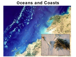
This document provides an overview of oceans and coasts. It discusses ocean exploration and oceanography, the structure and composition of the ocean basins and seafloor, ocean currents driven by factors like the Coriolis effect and global thermohaline circulation, coastal landforms shaped by waves and tides like beaches and barrier islands, and how plate tectonics and sea level changes influence coastal environments globally.

Recomendados
Más contenido relacionado
La actualidad más candente
La actualidad más candente (17)
Similar a 16 oceans coasts_forstudents
Similar a 16 oceans coasts_forstudents (20)
16 oceans coasts_forstudents
- 1. O ceans and Coasts Chapter 18
- 2. Outline • Ocean exploration & oceanography • The globes’ oceans -Lithosphere density and ocean basins -Global ocean landscape • Submarine landscape -Major zones (shelf to Abyssal plains) – reflection of tectonics -Continental margins, submarine canyons -Ocean water composition, temperature • Ocean dynamics -Currents, Coriolis effect, tides, waves • Coastal landforms -beaches, barrier islands, rocky coasts, tidal flats, reefs etc.. Chapter 18 Chapter 18
- 3. Oceans • Humans have explored the ocean for centuries. • Before 1800s, • Dredged • Measured • Analyzed • Collected Chapter 18
- 4. Oceans • Our knowledge of oceans has expanded greatly: • Oceanography – • Marine geology – • Marine biology – Chapter 18
- 5. Oceanography • Instruments have greatly expanded our knowledge. • Submarine exploration – • Bathymetric mapping – • Ocean drilling • Major Chapter 18
- 6. Oceanography • Seismic reflection profiling. • Sound waves • Some waves • Travel time of • Used to make images of Chapter 18
- 7. Outline • Ocean exploration & oceanography • The globes’ oceans -Lithosphere density and ocean basins -Global ocean landscape • Submarine landscape -Major zones (shelf to Abyssal plains) – reflection of tectonics -Continental margins, submarine canyons -Ocean water composition, temperature • Ocean dynamics -Currents, Coriolis effect, tides, waves • Coastal landforms -beaches, barrier islands, rocky coasts, tidal flats, reefs etc.. Chapter 18 Chapter 18
- 8. The Global Oceans • Ocean covers • Largest reservoir • Oceans… • Serve as • Regulate • Cycle • Linked to Chapter 18
- 9. Global Landscape • Oceans exist because of lithosphere differences. • Continental lithosphere floats higher • Oceanic lithosphere • Ocean basins collect Chapter 18
- 10. Global Ocean Landscape • The world ocean is divided into smaller oceans • Tectonic processes constantly change the map • Biotic activity: oceans (chlorophyll content) and land (vegetation) Chapter 18
- 11. Global Ocean Landscape • Present configuration of tectonic plates… • Most continental crust in northern hemisphere • Most oceanic crust in southern hemisphere Chapter 18
- 12. Outline • Ocean exploration & oceanography • The globes’ oceans -Lithosphere density and ocean basins -Global ocean landscape • Submarine landscape -Major zones (shelf to Abyssal plains) – reflection of tectonics -Continental margins, submarine canyons -Ocean water composition, temperature • Ocean dynamics -Currents, Coriolis effect, tides, waves • Coastal landforms -beaches, barrier islands, rocky coasts, tidal flats, reefs etc.. Chapter 18 Chapter 18
- 13. Undersea Landscapes • Sea floor bathymetry (topo) is highly variable • Continental shelf – shallow (0-500m), gentle slope (.3 degrees) • Continental slope – descends -500m to 4km at slope of 2degrees • Abyssal plain – flat, low-relief bottom below 4.5km Chapter 18
- 14. Undersea Landscapes • Sea floor reflects tectonics • Continental shelf – underlain by thinning siliceous crust • Continental slope – transition between crust types • Abyssal plain – underlain by mafic oceanic crust Chapter 18
- 15. Undersea Landscapes Continental margins: • Passive (broad shelf, no plate boundary) • Active (narrow shelf, trench, accr. prism, plate boundary) Western SA: active Eastern NA: passive Chapter 18
- 16. Undersea Landscapes • Submarine canyons cut continental shelves. • Associated with large rivers • Carved during sea level lowstands • Funnel sediments to deeper water • Submarine fans grow where canyons empty onto the Ab plain Chapter 18
- 17. Ocean Water Composition • Normal marine salinity, reflecting dissolved ions, is 3.5% • (35g/L; 35000 parts/million) • Dissolved ions derive from rock chemical weathering • Ions mostly Cl(neg.), Na(pos.), SO42-, Ca2+, Chapter 18
- 18. Ocean Water Composition • Surface salinity can vary. • Higher salinity evaporation and sea-ice form • Lower salinity rainfall, glacial melt, river input • Salinity becomes more uniform with depth. Chapter 18
- 19. Ocean Water Temperature • Ocean surface T varies inversely with latitude. • Water buffers wide T shifts (moderates climate) • Water T approaches a uniform value with depth • Ocean bottom water is near freezing <4 degrees C (39F) Chapter 18
- 20. Outline • Ocean exploration & oceanography • The globes’ oceans -Lithosphere density and ocean basins -Global ocean landscape • Submarine landscape -Major zones (shelf to Abyssal plains) – reflection of tectonics -Continental margins, submarine canyons -Ocean water composition, temperature • Ocean dynamics -Currents, Coriolis effect, tides, waves • Coastal landforms -beaches, barrier islands, rocky coasts, tidal flats, reefs etc.. Chapter 18 Chapter 18
- 21. Oceanic Currents • Currents continuously move ocean water in 3D • Surface currents (upper 100 m) - due to wind shear • Current motion creates large spirals (notice a pattern?) Chapter 18
- 22. The Coriolis Effect • Earth rotation deflects prevailing winds and currents. • Acts as an “apparent” force on winds/currents • Coriolis deflection sense depends upon… • Direction of motion • Position relative to equation Merry-go-round analogy: Chapter 18
- 23. The Coriolis Effect • Surface winds & currents are both influenced • North hemisphere: • S-moving winds/currents deflected W • N-moving winds/currents deflected E • South hemisphere. • N-moving winds/currents deflected W • S-moving winds/currents deflected E Chapter 18
- 24. Vertical Oceanic Currents • Currents also transport ocean water vertically • Downwelling – surface waters drawn downward • Upwelling – deep waters pushed upward • Wind perpendicular to shore drives vertical flow • Onshore – water piling up along coast drives downwelling • Offshore – upwelling replaces water moved away Downwelling Upwelling Chapter 18
- 25. Vertical Oceanic Currents • Thermohaline contrast also drives vertical currents • Temp – cold water is dense -> sinks • Salinity – More saline water is dense -> sinks • Polar water is both colder and saltier • Deep ocean waters are replenished from poles Chapter 18
- 26. Oceanic Currents • Sinking polar water is replaced by surface flow • This process carries warm water up from tropics • These surface currents warm northern oceans • System forms a a global “conveyor belt” Chapter 18
- 27. Tides • Sea level rises and falls twice daily • High tide – maximum tidal flooding • Low tide – maximum tidal withdrawal • Tidal reach – range between high and low tides • Intertidal zone lies between tides Chapter 18
- 28. Tides • Caused by: • Gravitational pull of moon and sun • Centrifugal forces from Earth, Moon, and Sun rotations • Orbiting moon creates strongest tidal effects. • Sublunar bulge follows Moons orbit • Smaller bulge occurs on opposite side of Earth • Bulges = high tides ; low tides = between bulges Chapter 18
- 29. Tides • Lunar & solar tidal effects interact. • Positive alignment yields enhanced “spring” tides • Negative alignment results in dampened “neap” tides Chapter 18
- 30. Waves • Ocean waves develop via friction from wind on water. • Gentle wind small waves ; gales giant waves • Waves move upper part of the water • Wave height, length, and period depend on wind speed, wind duration, and travel distance (fetch). Chapter 18
- 31. Waves • Wave anatomy: • Crest – wave top • Trough – low between crusts • Wavelength – distance b/w adjacent wave crests • Depth of influence (wave base) is ½ the wavelength. • Above wave base, water moves in circular motion • Below wave base, water is not affected Chapter 18
- 32. Waves • As waves approach shore, wave base hits bottom • Friction slows wave motion near sea floor • Near surface, waves continue moving fast • Wave over-steepens and crests • This zone features diverse environments. Chapter 18
- 33. Waves • Waves that crash onto beach breakers • Wave energy dissipated by turbulence • Creates white water in surf zone • Water surge (swash) rushes up beach face • Gravity pulls backwash back down beach slope. Chapter 18
- 34. Wave Refraction • Irregular shoreline water depth varies • As waves drag on bottom, they are forced to bend. • This process, wave refraction, has consequences: • Wave attack concentrated on headlands • Wave attack is dissipated in embayments • Tend to straighten irregular shores. Chapter 18
- 35. Longshore Currents • Sediment is transported along shore. • Oblique waves push sediment sideways up the beach • Gravity then pulls this sediment straight downslope. • Zig-zag pattern moves sediment in one direction Chapter 18
- 36. Rip Currents • Develop when wave flow is perpendicular to shoreline • Water piles up on beach, must return seaward • Rip current develops perpendicular to beach • Rip currents are often strong; people can get pulled under. • Rip currents dissipate away from the surf zone Chapter 18
- 37. Outline • Ocean exploration & oceanography • The globes’ oceans -Lithosphere density and ocean basins -Global ocean landscape • Submarine landscape -Major zones (shelf to Abyssal plains) – reflection of tectonics -Continental margins, submarine canyons -Ocean water composition, temperature • Ocean dynamics -Currents, Coriolis effect, tides, waves • Coastal landforms -beaches, barrier islands, rocky coasts, tidal flats, reefs etc.. Chapter 18 Chapter 18
- 38. Coastal Landforms • A variety of landforms Chapter 18
- 39. Beaches • Dominated by sand. • Gravel beaches reflect energetic surf and a rock supply • Muds absent. • Turbulent surf suspends and removes finer sediments • Muds transported to lower energy environments Chapter 18
- 40. Beaches • Beach sediment composition reflects the geology. • Quartz common • Carbonates in tropics • Resistant minerals Chapter 18
- 41. Beaches • Beaches develop distinctive cross-sectional profiles • Profiles change seasonally with energy regime. • Summer – broad sandy beach • Winter – narrow gravel beach Chapter 18
- 42. Beaches • Distinct zones exist along a beach profile. • Foreshore or intertidal – region between high and low tide • Beach face – steep, concave zone formed by wave smash • Backshore – upper part of beach • Beyond reach of normal high tides • Often exhibit berms (stepped terraces of storm sediment) Chapter 18
- 43. Beaches • Longshore currents move sediments along beaches • This process, beach drift, moves tons of sand daily • Beach drift builds bars and spits Chapter 18
- 44. Beach Drift Beach Drift This animation illustrates the sawtooth motion that causes sand to gradually migrate along beaches in a process called beach drift, and shows how this can create sand spits in places where the coastline indents landward. For more information, see Section 18.6 Where Land Meets Sea: Coastal Landforms starting on p. 638 and Figure 18.20 in your textbook. Chapter 18
- 45. Barrier Islands • Barrier islands are elongate, linear sand bars. • Form where sand is plentiful • Protected backwater area called a lagoon • Common places for development • They are ephemeral (temporary!) Chapter 18
- 46. Tidal Flats • Form in intertidal zones lacking strong waves • Common behind barrier islands or in estuaries • Thinly laminated sand and muds • Ancient tidal flat sediments well-studied – past sea level Chapter 18
- 47. Rocky Coasts • Bedrock intersects the sea • Wave action • Wave energy acts • Develop unique Chapter 18
- 48. Rocky Coasts • Wave-cut notches – waves erode an oberhang • Cliff collapses and process resumes • Over time, cliff retreat is marked by a wave-cut bench • An erosional remnant of of former cliffs • Often exposed at low tide Chapter 18
- 49. Rocky Coasts • Rocky headlands are preferentially eroded. • Refracted waves focus energy to headland sides. • Erosion from both sides creates a sea arch. • Collapse of the sea arch leaves remnant sea stacks. Chapter 18
- 50. Wetlands • Wetlands cover large coastal regions. • Develop in places protected from waves and currents. • Fuel high biological productivities • Vegetation governed by climate • Temperate – vegetated by trees, grasses, or mosses • Tropical – mangroves dominate Chapter 18
- 51. Estuaries • River valleys flooded by marine water • Mixed fresh and salt water • Modern estuaries are relation to glaciation • Rivers carved canyons during sea-level lows • Sea-level rise flooded the canyons Chapter 18
- 52. Fjords • Flooded U-shaped valleys carved by glaciers • Form spectacular • Notable examples found in… • Norway. • British Columbia. • New Zealand. Chapter 18
- 53. Reefs • Coral reefs grow in tropical marine settings • Large structures of cemented skeletons. • Most biologically productive ecosystems. Chapter 18
- 54. Reefs • Coral reefs modify sediment accumulations • Reefs alter wave and current energy • Protect leeward environments. • Abundant debris is shed to adjacent environments. Chapter 18
- 55. Reefs • Coral atolls reefs formed on subsiding volcano • Reef is established when volcano is active • After extinction, volcano erodes and subsides • Reef can easily keep pace with subsidence • Reef continues long after volcano is below sea level Chapter 18
- 56. Coastal Variability • Plate tectonic setting governs coastline style • Passive margin – broad low-lying coastal plains typical • Active margin – uplifted rocky coastlines Chapter 18
- 57. Coastal Variability • Global sea-level changes effect coasts worldwide. • Inflation/deflation of mid-ocean ridges • Glaciation/deglaciation traps or releases water • Pleistocene glaciations exposed all continental shelfs Chapter 18
- 58. Coastal Variability • Emergent coasts experience relative sea-level fall. • Via uplift due to tectonic processes. • Via sea-level drop (due to global climate change) • Emergent coasts characterized by… • River incision, cliffs, wave-cut notches • Terraces representing former sea-level positions Chapter 18
- 59. Coastal Variability • Submergent coasts experience relative sea-level rise • Subsidence of passive margin (i.e., deltaic sediments) • Global sea-level rise • characterized by river or glacial valleys that create estuaries and fjords. Chapter 18
- 60. Coastal Variability • Shoreline character is linked to • Balance between • Accretionary coasts – • Erosional coasts – Chapter 18
- 61. Coastal Variability • Climate is a strong influence on • Harsh weather enhances • Calm weather favors • Tropics – • Temperate – • Arctic – Chapter 18
- 62. Coastal Problems • Sea-level change. • Sea level is • Rate of • People living in Chapter 18
- 63. Coastal Problems • Beach • Storms (e.g. hurricanes) • Human development in coastal settings • Construction in coastal settings is Chapter 18
- 64. Mitigating Coastal Problems • Artificial barriers built to • Groins, jetties, breakwaters • Usually produces • Deposition is enhanced • BUT, erosion is accelerated Chapter 18
- 65. Mitigating Coastal Problems • Approach to combat erosion • Seawalls may hasten erosion. • Wave energy is • Erosion enhanced • Seawalls can Chapter 18