
Recomendados
Más contenido relacionado
La actualidad más candente
La actualidad más candente (20)
Similar a Part 1 Catfincut
Similar a Part 1 Catfincut (20)
Part 1 Catfincut
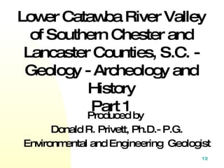
- 1. Produced by Donald R. Privett, Ph.D.- P.G. Environmental and Engineering Geologist Lower Catawba River Valley of Southern Chester and Lancaster Counties, S.C. - Geology - Archeology and History Part 1
- 3. Disrupted mafic dike (dark rock) OR mafic schlerien cutting the metagranite .
- 5. PURPOSE OF THIS PRODUCTION: 1. Provide an introduction to the general geology and geomorphology of the lower Catawba River Valley. 2. Show the areas natural history. 3. Summarize the understanding of the area geologic and human history. 4. Introduce the recreational opportunities of the area.
- 6. The Catawba River heads in the Blue Ridge Mountains as brook cascading high off the eastern slope of Chestnut Ridge in the Swannanoa Mountains near Old Fort, North Carolina. Collecting tributaries and picking up power on steep slopes it tumbles over falls and rapids and onto a broad valley flowing east for 120 km. It then makes two angular turns to flow south into South Carolina and into the Atlantic Ocean.
- 10. South Carolina consists of three distinct geologic regions, from northwest to southeast, they are 1. Blue Ridge 2. Piedmont and 3. Coastal Plain. Great Falls is located in the Piedmont more specifically in the Carolina terrane and at the boundary between the Carolina Slate belt and The Charlotte belt. The area is underlain by massive crystalline rocks, both metamorphic and igneous.
- 11. Among the igneous are granites, diorites, and diabase. The metamorphic rocks consist of gneiss, schists, phyllites, meta-sediments, and meta-volcanics. The Piedmont Province is the non-mountainous portion of the older Appalachians. Its surface is the result of eons of weathering.
- 19. Part of the Great Falls 7.5 °Quadrangle Long channel Short or steep Great Falls channel
- 20. Gradient of the Catawba River, note steep slope at Great Falls .
- 21. Topographic profile. Duke Energy Drawing 1. Nitrolee 2. Great Falls Projections looking north
- 22. The Great Falls
- 25. Topographic map at the Great Falls.
- 26. Aerial photograph 2004 contour interval is 2 feet. Duke Energy Photo.
- 27. The Great Falls Spillway dams were built atop the Great Falls of the Catawba .
- 28. East (Lancaster Co.) Side, Granite Is Stained by Iron Oxide and Lichens.
- 29. After Heavy Rains, Water Overflows the Spillway Dam, Forming a Waterfall for a Short While. To Hear It From an Open Window Is a Delight.
- 30. Looking across lake toward the Great Falls of the Catawba. The spillway dam is located near the base of the falls, most of the falls is under water.
- 33. Drawing of the Great Falls made in 1847.
- 34. How the Great Falls looks from north end of Dearborn Island after heavy rains .
- 35. The Great Falls
- 36. 1879 map showing the correct location of the Great Falls of the Catwba. the Great Falls
- 37. Looking South Catawba River Valley Below the Great Falls.
- 38. Looking south -Catawba River Valley below the Great Falls.
- 40. Pothole in Granite. Potholes form over thousands of years by the scouring action of pebbles and cobbles caught in a depression and swirled by water.
- 41. Potholes and polished metagranite.
- 42. Small cascade looking north.
- 45. Large vertical mafic dike.
- 46. Large vertical mafic dike.
- 47. Metagranite covered by water eroded flutes.
- 48. Small flutes and polish.
- 49. Large mafic xenoliths (dark) assimilated (by heat) at edges.
- 50. Pothole and polished metagranite.
- 51. Large pothole.
- 52. Fluting and polishing of granite.
- 53. Metagranite polished smooth by sediment. and water
- 55. The Great Falls of the Potomac, how the Catawba may have looked before damming.
- 56. Maybe we will be able to do this trick soon.
- 57. Continued in Part 2