Finding HMAS Sydney Chapter 8 - Performance Review
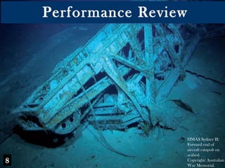
1. Performance Review HMAS Sydney II: Forward end of aircraft catapult on seabed Copyright: Australian War Memorial. 8
2. Road to expertise The road from novice to expert is obvious in virtually all forms of human enterprise. Learning curves follow a classical and almost universal function first observed for hand made cigar production in the 1930s (Snoddy, 1932). The same general pattern is observed for a huge range of tasks, from chess to surgery to the probability of death in aerial combat. The following figure includes a rough approximation of a skill acquisition curve for Kirsner and his colleagues. Interpretation is complicated by the fact that the project involved several strategic changes. See Speelman and Kirsner (2005) for a review of Learning Curves (1) Road to expertise
3. Legend: KK = Kim Kirsner; SH = Sam Hughes; JD = John Dunn Phase 1: Based on Search and Rescue model Phase 2: Based on Cognitive Reconstruction without Mathematical Decision Model Phase 3: Based on Based on Cognitive Reconstruction with Mathematical Decision Model Performance on the Learning Curve
4. Performance on the Map Area for next map Position of Kormoran Phase 2 (1997-1998): In collaboration with the HMAS Sydney Foundation Trust : Based on Cognitive Reconstruction without a Mathematical Decision Model Phase 1 (1991-1993): With the guidance of or in collaboration with Search and Rescue expert Sam Hughes Phase 3 (2004): In collaboration with the Finding Sydney Foundation: Based on Cognitive Science with Mathematical Decision Model
5. (2) Comparative Review of Search Definition performance by FSF Directors/Consultants and David Mearns The presentation involves one chart for the FSF, followed by explanations of the coded publications on that chart, and one chart for Mearns, followed by explanations of the coded publications on that chart
6. D/FSF 1: Kirsner (1991); Kirsner (1992); Kirsner & Hughes (1993) * Distance from wreck ranged from 20 – 25 nm * Procedure based on Search and Rescue (SAR) model used by Sam Hughes D/FSF 2: Kirsner & Dunn (1998) * Position given as ‘a few miles north of 26° 15 South 111° East’ ([i.e., 5 - 10 nm from the wreck of Kormoran] * Procedure based on reports from Kormoran survivors collected 7-21 days after the battle and used in conjunction with SAR model and Geraldton signal. D/D/FSF 3: Kirsner & Dunn (2004); Finding Sydney Foundation (2005, 2007) Position given as 26° 04’ South 111° 02’ East’ [i.e., 2.7 nm from the wreck of Kormoran] Procedure involved mathematical integration of reports from the Kormoran survivors, the Geraldton signal, a circle of equal distance for the movements of the two life-rafts
7. DM 1, 2, 3 and 4: Mearns (2004a, b) * Distance from wreck ranged from 17-45 nm * Procedure based on reports by Detmers created 40-400 days after the battle DM 5-6: Correspondence with FSF; Finding Sydney Foundation (2005) * Distance from wreck ranged from 17-27 nm from wreck of Kormoran * Procedure based on reports by Detmers created 40-400 days after the battle DM 7-8: Correspondence with FSF; Finding Sydney Foundation (2005, 2007); Correspondence with Warren Whittaker; Correspondence between Minister Bilson and PM Howard * Distance from wreck ranged from 25-27 nm * Procedure based on interview with von Malapert coupled with reports from Detmers
8. Mearns (2008) “ Previous attempts by Sydney researchers to estimate the ocean current effect on the drift of the life rafts and other objects relied on a simplistic decades-old understanding that the currents in this area were uniformly northward flowing.” The pro bono articles published by oceanographers and Search and Rescue experts Steedman and McCormack (1991), Hughes (1991; 2001) and Penrose and Klaka (1991) included explicit provision for variation in the current, and they provided efficient and accurate solutions. Pearce (1991) went one step further and provided detailed descriptions of the variability in the movement of objects in the water. The early oceanographic work was professional and provided an accurate fit on the location of the wrecks. (3) Oceanography
9. Griffin (2008) Green ellipse Area ≈ 13,000 sqnm Steedman & McCormack (1991) Pale green circle Area ≈ 3,000 sqnm Hughes (1991) Maroon circle Area ≈ 7,000 sqnm Hughes (2001 Green square Area ≈ 3,000 sqnm Oceanography and Search and Rescue 111° East 26° South Position of Kormoran
10. The final figure indicates the approximate sizes of the search boxes recommended or used in the search for Kormoran together with the comparable areas associated with the searches for Titanic , Bismarck and Yorktown . The needlework precision associated with Ballard’s navigational solutions is clear. The imprecision associated with the Search and Rescue and Oceanographic solutions is equally clear. (4) Bob Ballard as a benchmark
11. The areas shown in the figure are square nautical miles (≈) Analysis of Search Boxes