Brownfield Sites as Catalysts for Sustainable Urban Regeneration and the Dema...
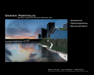
Geoff Taylor Design Portfolio
1. Design Portfolio
Design, Modeling, Remote Sensing, Gis
| Academic
| Professional
| Development
Geoff Taylor | Exit Project | Portfolio
Clemson Planning & Landscape Architecture
2. Contents
Professional
Projects at HewittNassar Studio
Sonoma Garden Show
Luxor Master Plan
Azbakeya Park Cairo
Projects for Clemson University
Clemson University Land Assets Online GIS
Clemson University PDPLA Social Network Marketing Framework
Academic
Projects
Rosetta Egypt Master Plan
Ten at the Top Regional Plan
Norristown Riverfront Master Plan Undergraduate Exit Project
3. Sonoma CA Garden Show
This garden exhibit, located at a winery in So-
noma, California was designed for an autumn
festival titled “The Late Show Gardens.” The de-
sign was based on three contemporary issues:
climate change, renewable, resources, and sus-
tainable practices. The garden offered opportu-
nities to address global and local connections
between Climate Change, Sonoma, California
and important locations in Egypt, based on So-
noma’s relationship to its sister city of Aswan,
Egypt. The garden offered a unique opportu-
nity to effect public perception of landscape
architecture concerning climate change, espe-
cially given ASLA’s growing interest in climate
change. The design concepts were derived from
global climate information, specifically showing
changes in the earth’s climate zones, and data
indicating increased carbon dioxide concentra-
tions throughut the planet. The design gestures
included local native plants and groundcovers.
Designed at HewittNassar Studio
AWARDS:
2011 SCASLA Award
Job: Imagery Creation, 3d Modeling, Site Design
4. Project Description Project Background
During the last decade, a winery in the Carneros Wine District in Sonoma ,California has created a garden exhibition venue mod- The client suggested that exhibition garden themes
eled after international garden festivals like those at Chateau de Chaumont in the Loire Valley, France, and the Chelsea Garden address one of three contemporary issues: Climate
Show in London, England. In 2009, the winery invited international designers, including the project landscape architects, to create Change, Renewable Resources, or Sustainable
individual exhibition gardens for an Autumn Festival titled “The Late Show Gardens.” Practices.
The project landscape architects developed a
garden design concept to express the global/local
contexts of climate change based on three ideas:
The garden offered opportunities to address global
and local connections between Climate Change,
Sonoma, California and important locations in
Egypt, based on Sonoma’s relationship to its sister
city of Aswan, Egypt; and to the landscape archi-
tect’s past experience related to planning for cli-
mate change in the Nile Delta
The garden offered opportunities to address cli-
mate change in vulnerable landscapes throughout
the world, given Sonoma’s location bordering one
of the largest estuaries and population centers in
the world (San Francisco Bay and Sonoma Marsh-
es), and given its similarities with other large estu-
aries and population centers vulnerable to climate
change, including London, New York, Shanghai
and Los Angeles.
The garden offered a unique opportunity to ef-
fect public perception of landscape architecture
concerning climate change, especially given the
ASLA’s growing interest in climate change.
5. Regional Site
Description
The winery is located among
many wineries in the Carne-
ros District between the
Coast Range Mountains,
the Sonoma Marches, and
the Sonoma Wetlands on
the northern periphery
of the San Francisco Bay.
While the wineries are now
above the 100 hundred year
floodplain, projected changes
in sea level as a result of cli-
mate change could bring the
North Bay, its marsh lands and
wetlands closer to the winery,
prompting drastic changes
to surrounding natural habi-
tat and local economies.
Project Site Description
The winery’s exhibition venue contains more than 20 garden plots clustered in display
areas connected by walkways and interspersed among wine tasting tents, entertainment
venues and stages, art galleries, festival greens, water features and courtyards. Past
exhibitions include gardens by well known landscape architects, such as: Ken Smith,
SWA, Walter Hood, Pam Burton, and James Van Sweden.
The Climate Change Garden was exhibited in Plot 6, an area surrounded on three sides
by privet hedges, with access to the front of the garden through a pathway connecting
the primary festival circulation path to a garden display courtyard. The plot is broadly
open to the sky and the changing effects of sunlight throughout the day.
6. Project Description Design Concepts: Garden Murals
The garden design concepts were derived from global climate change information, specifically data showing changes in the earth’s Garden exhibition design concepts were also derived from garden mural traditions intended to illustrate the underlying meanings of
climate zones, and data indicating increased carbon dioxide concentrations throughout the planet. Because climate information is often our relationship to the world and nature. The images below illustrate historic examples of murals representing maps, gardens, hu-
represented in the form of maps, the garden ground plane was organized to represent the idea of well-recognized map projections. man symbolic values, and the relationship between animals and the cosmos. Modeling for the exhibition’s murals by the landscape
The images below illustrate the process of deriving design gestures from climate maps and cartographic projections. Global climate architects addressed the creation of meaning in the murals, the development of spatial transparency, privacy within a small space,
design gestures were implemented with native plant ground covers and local redwood barks. Global carbon dioxide design gestures and the relationship of the murals to the garden design concepts.
were implemented with native and agricultural plants Map projection design gestures were implemented with locally mined gravels.
The murals were constructed from recycled polyester mounted on recycled wood frames, and were chosen for their transparent
and reflective qualities to take advantage of the natural light conditions of the site. Grids of recycled steel rods representing vertical
data points used to measure water and ice depth were used to increase symbolic meaning and improve wall transparency.
7. Design Concepts: Art and Meaning
The artwork for the murals was selected from a German artist and from the landscape architects. The German artist contributed two prints: one
titled “Two Mantis in Nature,” and the other titled “Mantis and Global Economies.” The prints were selected to symbolically represent global and
local ecological balance, and the relationship between ecology and economic life.
The landscape architect’s five prints illustrate Sonoma’s global connections to the Nile River and Delta, a collage of estuaries threatened by climate
change, two images of green infrastructure that resolve climate related flooding in the Nile Delta, and a print of diagrams indicating incremental
sea level rise at the mouth of the Nile River.
8. Luxor Egypt Avenue of the Sphinxes
Prompted by the recent discovery and imminent
excavation of a 2.72 km-long, ancient ceremonial,
boulevard buried beneath the City of Luxor, Egypt
and connecting two UNESCO World Heritage Tem-
ples, a new specific master plan was developed by
a team of landscape architects, international plan-
ners and architects at the request of the Governor
of Luxor. The specific plan proposes a framework
for historic preservation, heritage development,
sustainable tourism, and ecological restoration for
the city’s future urban growth and for development
along the Nile River and between the two UNESCO
Temples. This specific master plan and process of-
fers a model for the preservation of important ar-
chaeological, cultural and natural treasures, the
restoration of urban fabric, and the advocacy of
participatory planning in the resettlement of rap-
idly expanding urban populations living in informal
settlements. It serves as an example of planning
for the integration of cultural heritage with new de-
velopment, ecological restorations a component
of sustainable tourism, and the encouragement of
meaningful connections between tourists and local
citizens with greater understanding of local issues
that reflect regional approaches to sustainability
for one of the world’s most important historic sites.
Designed at HewittNassar Studio
AWARDS:
2011 Tri State ASLA Merit Award
2011 SCASLA Award
Job: Graphics, Design, and Layout
9.
10. Azbakeya Urban Park Restoration
A conceptual restoration plan for Azbakeya park
located in Cairo, Egypt. This design takes into
consideration the history of this site, one of North
Africa’s first urban parks changes over time for
grounding. The final design includes locations
for islamic prayer, water elements, vegitation, Is-
lamic pattern hardscapes, and placement of spe-
cial events structures, amongst other things...
The entire project was developed via BIM based
applications in order to work in an interop-
erable workflow with architects in Egypt as
they updated the site’s structures. in real-time.
Designed at HewittNassar Studio
Job: Design, Modeling, Research, Concept
13. Clemson University Land Assets GIS
Clemson university is one of the largest land grant
institutions in the United States and until the devel-
opment of a custom gis system lacked a database of
all their records. In 2011 I began developing a cus-
tom solution for the Clemson University Land Assets
group using ESRI’s Flex Viewer and ArcGis Server.
The final product consisted of a simple search
widget to search for property information in a
simplified manner, file storage and retrieval, par-
cel commenting system, advanced query wid-
get that allows for comparitive analysis between
multiple layers, euclidean distance tools, drag-
and-drop google streetview capabilities for loca-
tion analysis, and advanced print function. Many
of these functions were hard-coded with custom
requests to meet Clemson’s needs and requests.
Other GIS information required for real-estate analysis
such as census information, infrastructure, soils, and
hydrological features were added to the application
The custom ESRI Flex Viewer application is fully
operational and is currently being used by Clem-
son University for all their real-estate needs.
14. Content Types Dissemination Mode Social Networks Crowdsource Marketing
Clemson PDPLA Social Marketing
Clemson University’s department of Planning, Devel- Facebook Page Wall
Wordpress Blogging Platform (Time and Release News)
opment, Preservation, and Landscape Architecture
was not properly maximizing their marketing potential B
L Automated Posting
and communication with students via social networks. O Twitter Feed
G
I was approached to develop a blueprint for the de- / RSS FEED
partment to utilize that would place the departments N
on the social map. The workflow stream-lines the com- E Linkedin Group
W
plex process of having to post the same information S
to several networks to a more automated approach.
Google+ “API Not Yet Released”
The data collected from my CELA research paper
was utilized as a foundation for how to successfully V
implement a successful social network campaign. I
D
E
O
S
P Hootsuite Timed Automation
O
D
C Facebook Page Wall
A
S
T Twitter Feed
S
Google+ “API Not Yet Released”
U
S
E
R
P
O
S
T SOCIAL NETWORK MARKETING WORKFLOW
Aug 2011: Developed by: Geo Taylor geo rt@g.clemson.edu
15. Rosetta Egypt Master Plan
Rosetta is one of the oldest cities in Egypt founded
in AD 800. The city is known by the Rosetta stone
discovery in 1799. Located about 65 Km east of
the much larger city of Alexandria, Rosetta is at
the junction of the Nile and the Mediterranean Sea.
In the 16th century Rosetta was a booming port
city and in the 19th century it became famous as
a tourists destination. Today the city of Rosetta is
renowned for its large number of historic Islamic
houses, mansions and mosques, archaeological
sites, thousands of acres of date palm groves and
related craft industries, its boat building, brick and
fishing industries, and its natural scenic beauty.
Rosetta and similar cities long situated on water, en-
vironmental vulnerabilities are increasingly related
to changes in water levels from climate change, and
to their historic and contemporary positions along
water resources that are especially linear. While
their specific problems are geographically more
complex, their particular linearity suggests change
and development strategies that are in turn linear.
Change and development strategies are e bodied
within a corridor joining water and city. The corridor
integrates processes and land use to mediate vul-
nerability and change between river and city. Resis-
tant, resilient, robust, and responsive are aspects
within the corridor that prompt collateral develop-
ment, change further inland and within the river.
Intelligent sensor systems monitor the corridors
vulnerability. The combined corridor processes and
uses form Rosetta’s identity as an ecological icon.
16. lack of civic infrastructure no formal circulation
waste as erosion control unplanned settlements
stormwater flooding unplanned settlements
sewage drainage lack of mooring facilities
polluting industry polluting aqua farms
absent recreation areas
Water
on water is tremendous.
destroy most of Rosetta.
Dependency of city’s livelihood
Only the Nile River. The Aswan
Dam on Nile has caused erosion
of the delta. Potential sea rise will
2m 1.5m 1m .5m present conditions
19. Ten At The Top Regional Analysis
A GIS analysis commissioned by non-profit group
“Ten At The Top” in order to update the existing
Strom Thurmond model for upstate SC.
Utilizing Carl Steinitz’s model for alternative futures
as a basis the analysis developed suitability mod-
els using Erdas and Arc-Gis Modelbuilder for high
suburban, suburban housing , rural housing, mixed
use, commercial, industrial, recreation, agriculture,
surface water quality, groundwater, visual quality,
and land cover change. Other models were then
developed such as competition for growth, and Gap
Analysis from the original models outputs.
The produced models were used as a means for
discussion concerning the future of Upstate South
Carolina.
20.
21.
22.
23. Norristown Riverfront Master Plan
Norristown is situated along the Skuylkill River
near Philadelphia Pennsylvania. Aligning the river-
front edge are dilapidated structures, low income
communities, and flood-prone undeveloped areas.
Pennsylvania’s Septa terminates along the river-
front making it a prime location for future commer-
cial, and mixed-use development. This masterplan
takes into consideration all of the issues plaguing
the Norristown Riverfront and attempts to develop
a concept to help engineer the riverfront for future
development.
The proposal of parks, greenways, trail-systems,
approaches to flood-tolerant structures, hard-scape,
and soft-scape are used in this project to spur public
discussions on sustainable design and the future.
24. The 128 mile Schyulkull River trail runs from Philadelphia through Norristown and
up to Pottsville Pennsylvania on an abandoned railroad line. The trail is a great way to enjoy
the outdoors, exercise or commute. Norristown has failed to capitalize on this opportunity
for economic gains due to downtrodden streetscapes, lack of hotels, bike shops, and signage.
The impacts of riverfront industry conflicts with beauty of the riverfront. The industrial
wasteland and abandonment of landscape creates an eyesore for tourists. It spurs people to
move quickly through the landscape without pause for exploration.
Norristown's relationship to rapid and mass-transit commuter lines is one of the most impor-
tant of the borough features. South Eastern Pennsylvania Transportation Authority (SEPTA)
maintains all transportation in this region. The Norristown Transportation Center is located
less than 200 feet away from the transportation center and runs into Pennsylvania’s City
Norristown Riverfront Pennsylvania Center. Recently the R6, a high speed transit route was installed. Public bus service is main-
tained through downtown and connecting to the Montgomery Mall Shopping District. Abun-
Flowing through Pennsylvania, the Schuylkill River has been the regional influence over the growth of towns and boroughs. The river dant and available transportation, limited housing and office space within Philadelphia, the
spreads along through Philadelphia's northwestern along the Ridge and Valley region. Norristown's historic rise is charted by the river Norristown riverfront becomes an excellent opportunity for future large scale development.
and transportation, mill, and manufacturing industry. The city’s growth is informed by the natural feature with an echoing relative to
the borough reaching out to the Montgomery County agricultural land. Norristown has many amenities with parks and public spaces scattered throughout the entire
borough. Linkages and opportunities for open spaces via safe walkability and greenways
External to Norristown is the suburban sprawl of Montgomery County. Towards the end of the last century people relocated to the will enhance the community. A large farm park exists northwest of the riverfront at the
outskirts of the Borough. The resulting collapse in economic growth and prosperity for Norristown may be traced to the adjacent decommissioned Pennsylvania State Mental Institution. This is a historic landscape punctu-
communities embracing more contemporary retail-commercial business practices. The decline of the downtown district and residen- ated by the vast views and beauty. The farm park is not linked to the Schuylkill River Trail.
tial functional obsolescence promotes the opportunistic to profit from the working class citizen. Many people living within the down- However, Stony Creek follows the contour of the farm park through downtown and into the
town areas are renting housing in poor conditions while a thriving opportunistic community can still be found. Currently Norristowns Schuylkill River . This creek provides the perfect scenario to develop a greenway between
diverse population consists of a healthy mix of caucasion, african-american, and hispanic citizens that utilize the neighborhood hous- existing park systems, reduce the requirement for vehicular transportation, possibly provid-
ing within the blighted downtown area. Norristown has a need for more economic opportunity and in some way would greatly benefit ing walkable connections, economic growth, and beautifying the downtown area in the pro-
from the results of redevelopment throughout the downtown area. cess. A large scale beautification technique for Norristown will create a synergistic develop-
ment rippling through the rest of the town. Revitalization projects inspire creativ! e capital
Potentially, the Norristown riverfront serves as the most attractive and developable real estate for Norristown and Montgomery Coun- through entrepreneurial projects, artists, do-it-yourselfers and first time homeowners opening
ty. Realization of this opportunity to showcase the natural amenities and increasing the tax base of the the county seat. Norristown is up the doors for the overall revitalization of the entire borough. The unfathomable positive
poised to renew the planning and leadership for the rest of Montgomery County. The riverfront revitalization project well help this community health and psychological benefit of green designing.
process to begin. The river is the "Gateway" leading into the downtown area.
25. While the river informed Norristown's growth, as with all riverfronts flooding has been problematic. Agriculture, development and Conshohocken Pennsylvania is located 3.5 miles from Norristown downstream on the Schuylkill river in suburban Penn-
the current climatic conditions have ensured the need for planning for rapid change. Along the riverfront the 100 and 500 year flood sylvania. The borough is historically a large mill town and industrial manufacturing center. Since the decline of industry in recent
marks could easily be reached with the right conditions. Flooding devastation has been frequent and becoming increasingly more years Conshohocken has developed into a center of riverfront commercial and residential development. The borough faced the exact
frequent. Norristown has seen 100 year floods and anticipates the reality of 500 year flooding. The 100 year floodmark has been met same problem Norristown faces dealing with brownfields and dilapidated sites. The riverfront was completely capped with concrete
on multiple occassions within the past 10 years. The cities anticipation, preparedness and forward thought will mitigate the situation to prevent runoff from toxins and developed into a series of high-tech office buildings with multi-level parking below. Some of the
prior to catastrophy. Smart growth, green infrastructure plans, land use, climate preparedness plan, and zoning are the tools the mu- structures are a part of Philadelphia’s “Silicon Valley Forge” coined Forbes in 2000. Such redevelopment of the borough did however
nicipality will use to address and inform the public to advert unpredicted events. create issues with gentrification. The per capita income rose drastically post implementation for people living within the borough.
Presently, the Norristown Riverfront consist of industrial brownfields, warehouses, and other decaying structures. Service relocation As for transportation the same R6 line entering into norristown has a station in Conshohocken
expense, expensive remediation techniques or extensive phytoremediation are necessary to bring this site up to code. City water treat- directly behind the remediated riverfront district.
ment service is also located along the riverfront. Frequent flooding of the facility allows waste to enter the river every few years.The
city wants to move the facility but the cost are millions in the dollars and beyond their municipal budget.
The unique conditions of the site and the cities interest in renewal suggest that the most effective strategy for remediation would be
capping of the dangerous site. An expedient method and perhaps the best solution is to utilize a concrete cap on the most toxic site.
Effective funding strategy for removal would be available through the replacement of brownfield and waste through civic and multi-
use zoning, high end construction featuring multilevel towers and views to downtown Philadelphia. Investment for high end struc-
tures will address the needs of new economic development and job generation for the future growth.
26. Source: Google Satellite Imagery
Data Source: PASDA
Data Source: PASDA
Source: USGS
Data Source: PASDA
I
N
L F
O R
C A
A S
T T
I R
O U
N C
T
U
R Pikes
E Crossroads Roads
Highways Railroads
Pennsylvania Philadelphia Area Major Roads Roads Railroads
Data Source: PASDA
Source: USGS
T
O
P E
O X
G P
R A
A N
P S
H I
I O
C N
A
L Loss
Growth
Terrain Population Growth
Data Source: FEMA
Data Source: FEMA
Data Source: PASDA
Data Source: PASDA
Data Source: PASDA
Data Source: PASDA
S
O
E C
C I
O A
L L
O
G E
I C
C O
A N
L O
M
Greenscape I
Wooded Parks C
Rivers Flooding Green Data Source: PASDA
Parks Historic Areas Town Centers
27. Data Source: PASDA
Data Source: SEPTA
Data Source: PASDA
Source: Google Satellite Imagery
I
N
L F
O R
C A
A S
T T
I R
O U
N C
T
U Primary
R Secondary
E Tertiary Bus Routes Railroads
Alleys Train Routes Rail Trail
Norristown Aerial Roads Public Transportation Railroads
Data Source: Norristown Hist. Society
Data Source: Norristown Hist. Society
Data Source: Norristown Hist. Society
Data Source: Norristown Hist. Society
Data Source: USGS
T
O
P E
O X
G P
R A
A N
P S
H I
I O
C N
A
L
Terrain Growth 1750-1875 Growth 1875-1925 Growth 1925-1975 Growth 1975-Current
Data Source: FEMA
Data Source: PASDA
Data Source: PASDA
Data Source: Census
Data Source: Census
S
O
E C
C I
O A
L L
O
G E
I C
C O
A N $1600-$2800
L O $2800-$3900
Green Space M $3900-$4600 Black
Park Space I $4600-$5700 White
Streetscape C $5700+ Hispanic
Rivers Flooding Green Income Demographics
28. Normal Flood Level, 100 Year Flood, 500Data Source: PASDA, FEMA
Year Flood Canopy Cover, Buildings, Topography
Data Source: PASDA, Google Imagery, FEMA
29. Parking Garage Downtown Norristown
Parking Train Station
Park
Parking field
Green Roof Green Streets
Tower Green Streets
Green Streets Piazza
Green Streets Piazza
Buildings Piazza
Piazza
Wooded Area
Green Roof Tower
River Trail Convention/Civic Center
Green Roof
Wooded Area
Wooded Area
Wooded Area
River Trail
Brige
Skulylkill River
Skulylkill River
Barbadoes Island
Canopy Cover, Buildings, Topography, Roads, Railroads,Rail-Trail Building, Green Roof, Road, Green Street, Wooded Area, Trails, Piazza
Data Source: PASDA, Google Imagery, FEMA
31. Septa Station
Septa Station
Railroad Park
Trail Parking
Grocery Tower
Transit
Center
Towers
Tower Civic Center
Riverfront Trail
Bridge Riverfront Trail
Existing & Proposed Parks, Greenway, Existing Trail, Proposed Trail
32. Septa Station
Septa Station
Green Streets
Wave
Piazza
Field Tower
Greenroof Park Grocery
B Waterfall Wall B
r B r
i r i
d i d
g d g
e g e Convention Center
e
Tower Grass Tower
Tower Dunes Green
Roof
Pedestrian Bridge
33.
34. Tower Case Studies Rooftop Park
High-Rise Crops Towers P
Aeroponics
Plants held in place so that roots hang in the air
Tower L
Convention Center
and are infused with water vapor and nutrients. A
Used for potatoes, carrots, and other similar crops. N
Hydroponics
Plants held in place so that roots sit in open
troughs; dissolved nutrients in matter are continu-
ously rotated over the crops.
Convention Center
Source: 2009 Scientific American, inc. Emilio Ambasz: Greenroof
Used for tomatoes, spinach, and berries. Greenroof system minimizes runoff
The Grand Embrace
Drip Irrigation and recycles water
Plants grow in low-weight inert material.
Used for grass, wheat, and corn. Conference Rooms
Condominiums Will help to bring large events and
Office and residential condominiums utilized by commerce to Norristown
people looking for a short commute into Phila-
delphia and surrounding area.
Business Offices Indoor Green Wall
Brings nature indoors, improving air quality, and
Business space for companies and entrepreneurs provided a positive natural environment for visitors.
easily accessible by current rail, vehicular, and Convention Center
public transportation.
Shopping Area Interior Garden
Small Shops and restaurants help to Located in the main hall, this interior garden
create destination points and economic brings nature indoors and provides seating for
opportunity. visitors.
Rooftop Park Rooftop Park
Greenroof park system for connectivity Greenroof park system for connectivity
and enjoyment between buildings. and enjoyment between buildings.
Parking David L. Lawrence Convention Center Renzo Piano: Kansai International Airport
2 story parking garage to elevate buildings Pittsburgh Pennsylvania Parking
Terminal. 2 story parking garage to elevate buildings
above flood levels and provide parking.
above flood levels and provide parking.
35. Riverfront Trail Underpass
Riverfront Trail
Schuylkill River
Pedestrian Schuylkill River
Bridge
Schuylkill River
36.
37.
38.
39.
40. Railroad Park Flood Simulation Transportation Center Flood Simulation
Normal Conditions Normal Conditions
100 Year Flood 100 Year Flood
200 Year Flood 200 Year Flood