SlideShare una empresa de Scribd logo
1 de 37
Descargar para leer sin conexión
let's map our planet!


                    Sajjad Anwar
                    http://geohackers.in
You're here!


and...I'm from here!


Why do we care about maps?!
                 
All of us have
    used a map to
      figure out
     where “it” is
          And
 
    how to get there.
             
Ownership


Copyright 
                                            
http://www.omninerd.com/images/content/1/4_article_33_full_figure1.jpg
What if the
Greenland Ice
Sheet melts?

                 
Maps tells us a story!
               Do you believe?
             Where is ____?
             How many ____?
             Density of ____?
             What’s inside ____?
             What’s near ____?
             How has ____ changed?
             How do ____ relate?
             What  if ____?
What is ?


"OpenStreetMap is a project
    aimed squarely at creating and
    providing free geographic data
     such as street maps to anyone
             who wants them."

                            -- www.openstreetmap.org


"The project was started because
     most maps you think of as free
    actually have legal or technical
        restrictions on their use,
     holding back people from using
     them in creative, productive or
              unexpected ways."

            -- www.openstreetmap.org

                   
The Four Freedoms; Granted!


+
    ODbL
       
We make beautiful maps.
    And we give them away.


London


New Delhi


        Bengaluru
. . . and the whole planet!


But does'nt ___ .com do that already?!


                 Google maps
                 Yahoo maps
                 Mapquest
                 Mapblast


                               Well, Yes!
but...


The Google Maps “ Terms of Service” says:

    "Geocoding data for map content in Google Local is provided
    under license by Navteq... and/or Tele Atlas... and subject to
    copyright protection and other intellectual property rights owned
    by or licensed to NAVTEQ, TANA and/or such other third
    parties."
        "Also, you may not use Google Local in a manner which
    gives you or any other person access to mass downloads or bulk
    feeds of numerical latitude and longitude coordinates."
                                     
Why
     OpenStreetMap?
      Because that data is copyrighted and
    owned by people like the Ordnance Survey.
    Google / whoever just license it. If we used
           it, we'd have to pay for it.


But who owns
          OpenStreetMap?
                        You do!
          The data and software is owned by you,
                      the contributors.
           There is an organisation called the
    OpenStreetMap Foundation which exists to protect,
    promote, and support the project, but does not own the
 
                           data.
                                
....Ah! Still more?!
     Create your own maps!
     Render them!
     Setup your own server!


Get Involved!


    Register for the API and wiki
    http://OpenStreetMap.org
                           
You!
    know your nieghbourhood more than anyone!
    I bet!
     So why do you want someone else to map it?!
                            
Mapping Parties!
    Mapping parties are events where anyone
    can come and participate in the
    OpenStreetMap project.


Potlatch: Online editor


    Potlatch is a Flash-based OpenStreetMap editor, found on the 'Edit' tab of the main site.
                                         
     
JOSM: Offline editor
    Java OpenStreetMap Editor


Dont want to use both of them?
    Well, you should try Merkaartor!


Setup your own server,and deploy your projects!


..and possibilties
    endless!

             
Get Connected!           24x7
    Join maling lists and IRC's
    Talk
    Geocoding
    Accessibilty
    And much more..

    #osm
    irc://irc.oftc.net/osm
                              
Thanks!

        
let's map our planet!
          Presentation cc-by Sajjad Anwar
          Fonts by Hfactor; http://hiran.in
          Few slides by Richard (Thanks!)
    OSM Map Data cc­by­sa http://OpenStreetMap.org/
           http://wiki.openstreetmap.org/
               irc://irc.oftc.net #osm
                      Mailing lists
                            
                                       http://geohackers.in

Más contenido relacionado

La actualidad más candente

An introduction to OpenStreetMap for bushwalkers
An introduction to OpenStreetMap for bushwalkersAn introduction to OpenStreetMap for bushwalkers
An introduction to OpenStreetMap for bushwalkersdbdean
 
“Webmapping Solutions: Technology & Tips” -- November 13, 2013
“Webmapping Solutions: Technology & Tips” -- November 13, 2013“Webmapping Solutions: Technology & Tips” -- November 13, 2013
“Webmapping Solutions: Technology & Tips” -- November 13, 2013Aerial Services
 
Geography Apps
Geography AppsGeography Apps
Geography Appsegill11
 
Introduction to OpenStreetMap
Introduction to OpenStreetMapIntroduction to OpenStreetMap
Introduction to OpenStreetMapdbdean
 
An Introduction to OpenStreetMap (UQ GIS Students)
An Introduction to OpenStreetMap (UQ GIS Students)An Introduction to OpenStreetMap (UQ GIS Students)
An Introduction to OpenStreetMap (UQ GIS Students)dbdean
 
Geo-ing Global TeachMeet BETT 2011
Geo-ing Global TeachMeet BETT 2011Geo-ing Global TeachMeet BETT 2011
Geo-ing Global TeachMeet BETT 2011Dom Breadmore
 
Augmented Reality: A Primer for Libraries
Augmented Reality: A Primer for LibrariesAugmented Reality: A Primer for Libraries
Augmented Reality: A Primer for LibrariesSarah Houghton
 
Augmented Reality - Possibilities for Libraries
Augmented Reality - Possibilities for LibrariesAugmented Reality - Possibilities for Libraries
Augmented Reality - Possibilities for LibrariesTor Loney
 
Augmented Reality in the Library
Augmented Reality in the LibraryAugmented Reality in the Library
Augmented Reality in the LibraryEliot Boden
 

La actualidad más candente (13)

An introduction to OpenStreetMap for bushwalkers
An introduction to OpenStreetMap for bushwalkersAn introduction to OpenStreetMap for bushwalkers
An introduction to OpenStreetMap for bushwalkers
 
“Webmapping Solutions: Technology & Tips” -- November 13, 2013
“Webmapping Solutions: Technology & Tips” -- November 13, 2013“Webmapping Solutions: Technology & Tips” -- November 13, 2013
“Webmapping Solutions: Technology & Tips” -- November 13, 2013
 
Geography Apps
Geography AppsGeography Apps
Geography Apps
 
Introduction to OpenStreetMap
Introduction to OpenStreetMapIntroduction to OpenStreetMap
Introduction to OpenStreetMap
 
An Introduction to OpenStreetMap (UQ GIS Students)
An Introduction to OpenStreetMap (UQ GIS Students)An Introduction to OpenStreetMap (UQ GIS Students)
An Introduction to OpenStreetMap (UQ GIS Students)
 
Google earth fa
Google earth faGoogle earth fa
Google earth fa
 
Google
GoogleGoogle
Google
 
Google earth fa1
Google earth fa1Google earth fa1
Google earth fa1
 
Geo-ing Global TeachMeet BETT 2011
Geo-ing Global TeachMeet BETT 2011Geo-ing Global TeachMeet BETT 2011
Geo-ing Global TeachMeet BETT 2011
 
Google earth fa
Google earth faGoogle earth fa
Google earth fa
 
Augmented Reality: A Primer for Libraries
Augmented Reality: A Primer for LibrariesAugmented Reality: A Primer for Libraries
Augmented Reality: A Primer for Libraries
 
Augmented Reality - Possibilities for Libraries
Augmented Reality - Possibilities for LibrariesAugmented Reality - Possibilities for Libraries
Augmented Reality - Possibilities for Libraries
 
Augmented Reality in the Library
Augmented Reality in the LibraryAugmented Reality in the Library
Augmented Reality in the Library
 

Similar a Introduction to Open Street Map

OpenStreetMap Mapping Party - Boston
OpenStreetMap Mapping Party - BostonOpenStreetMap Mapping Party - Boston
OpenStreetMap Mapping Party - BostonDavid Zwarg
 
OSM SFD2012
OSM SFD2012OSM SFD2012
OSM SFD2012esambale
 
Stanford Presentation to GISSIG
Stanford Presentation to GISSIGStanford Presentation to GISSIG
Stanford Presentation to GISSIGSarah_Manley
 
Intro to OpenStreetMap- UC Merced 4.22.09
Intro to OpenStreetMap- UC Merced 4.22.09Intro to OpenStreetMap- UC Merced 4.22.09
Intro to OpenStreetMap- UC Merced 4.22.09Sarah_Manley
 
Philippine Geospatial Forum Presentation 20130311
Philippine Geospatial Forum Presentation 20130311Philippine Geospatial Forum Presentation 20130311
Philippine Geospatial Forum Presentation 20130311esambale
 
OpenStreetMap OpenTech 2011
OpenStreetMap OpenTech 2011OpenStreetMap OpenTech 2011
OpenStreetMap OpenTech 2011Harry Wood
 
NIJC presentation
NIJC presentationNIJC presentation
NIJC presentationSarahManley
 
CartoHeritage 2011: Georeferencer & MapRank Search
CartoHeritage 2011: Georeferencer & MapRank SearchCartoHeritage 2011: Georeferencer & MapRank Search
CartoHeritage 2011: Georeferencer & MapRank SearchPetr Pridal
 
Open streetmapによる鳥取ガイドの試み3
Open streetmapによる鳥取ガイドの試み3Open streetmapによる鳥取ガイドの試み3
Open streetmapによる鳥取ガイドの試み3Hiroyuki Nakaji
 
Spatial Data processing with Hadoop
Spatial Data processing with HadoopSpatial Data processing with Hadoop
Spatial Data processing with HadoopVisionGEOMATIQUE2014
 
Building Maps with Leaflet
Building Maps with LeafletBuilding Maps with Leaflet
Building Maps with LeafletAndrew Howard
 
Public Sphere: Gov 2.0 - Shoaib Burq
Public Sphere: Gov 2.0 - Shoaib BurqPublic Sphere: Gov 2.0 - Shoaib Burq
Public Sphere: Gov 2.0 - Shoaib BurqPia Waugh
 
Opening of Geographic Data
Opening of Geographic DataOpening of Geographic Data
Opening of Geographic DataShoaib Burq
 
Open Data on the Open Platform
Open Data on the Open PlatformOpen Data on the Open Platform
Open Data on the Open PlatformMasaki Ito
 
「Power of NeoGeographer」Lecture
「Power of NeoGeographer」Lecture「Power of NeoGeographer」Lecture
「Power of NeoGeographer」LectureTaichi Furuhashi
 
OldMapsOnline.org: Open Source & Online Tools for Old Maps
OldMapsOnline.org: Open Source & Online Tools for Old MapsOldMapsOnline.org: Open Source & Online Tools for Old Maps
OldMapsOnline.org: Open Source & Online Tools for Old MapsPetr Pridal
 
Osgis 10 arnulf-christl
Osgis 10 arnulf-christlOsgis 10 arnulf-christl
Osgis 10 arnulf-christlArnulf Christl
 
Open streetmap
Open streetmapOpen streetmap
Open streetmapBGTT_SYD
 

Similar a Introduction to Open Street Map (20)

OpenStreetMap Mapping Party - Boston
OpenStreetMap Mapping Party - BostonOpenStreetMap Mapping Party - Boston
OpenStreetMap Mapping Party - Boston
 
OSM SFD2012
OSM SFD2012OSM SFD2012
OSM SFD2012
 
Stanford Presentation to GISSIG
Stanford Presentation to GISSIGStanford Presentation to GISSIG
Stanford Presentation to GISSIG
 
Intro to OpenStreetMap- UC Merced 4.22.09
Intro to OpenStreetMap- UC Merced 4.22.09Intro to OpenStreetMap- UC Merced 4.22.09
Intro to OpenStreetMap- UC Merced 4.22.09
 
Philippine Geospatial Forum Presentation 20130311
Philippine Geospatial Forum Presentation 20130311Philippine Geospatial Forum Presentation 20130311
Philippine Geospatial Forum Presentation 20130311
 
OpenStreetMap OpenTech 2011
OpenStreetMap OpenTech 2011OpenStreetMap OpenTech 2011
OpenStreetMap OpenTech 2011
 
NIJC presentation
NIJC presentationNIJC presentation
NIJC presentation
 
OpenStreetMap
OpenStreetMapOpenStreetMap
OpenStreetMap
 
CartoHeritage 2011: Georeferencer & MapRank Search
CartoHeritage 2011: Georeferencer & MapRank SearchCartoHeritage 2011: Georeferencer & MapRank Search
CartoHeritage 2011: Georeferencer & MapRank Search
 
Open streetmapによる鳥取ガイドの試み3
Open streetmapによる鳥取ガイドの試み3Open streetmapによる鳥取ガイドの試み3
Open streetmapによる鳥取ガイドの試み3
 
Spatial Data processing with Hadoop
Spatial Data processing with HadoopSpatial Data processing with Hadoop
Spatial Data processing with Hadoop
 
Building Maps with Leaflet
Building Maps with LeafletBuilding Maps with Leaflet
Building Maps with Leaflet
 
OpenStreetMap Workshop, Accra
OpenStreetMap Workshop, AccraOpenStreetMap Workshop, Accra
OpenStreetMap Workshop, Accra
 
Public Sphere: Gov 2.0 - Shoaib Burq
Public Sphere: Gov 2.0 - Shoaib BurqPublic Sphere: Gov 2.0 - Shoaib Burq
Public Sphere: Gov 2.0 - Shoaib Burq
 
Opening of Geographic Data
Opening of Geographic DataOpening of Geographic Data
Opening of Geographic Data
 
Open Data on the Open Platform
Open Data on the Open PlatformOpen Data on the Open Platform
Open Data on the Open Platform
 
「Power of NeoGeographer」Lecture
「Power of NeoGeographer」Lecture「Power of NeoGeographer」Lecture
「Power of NeoGeographer」Lecture
 
OldMapsOnline.org: Open Source & Online Tools for Old Maps
OldMapsOnline.org: Open Source & Online Tools for Old MapsOldMapsOnline.org: Open Source & Online Tools for Old Maps
OldMapsOnline.org: Open Source & Online Tools for Old Maps
 
Osgis 10 arnulf-christl
Osgis 10 arnulf-christlOsgis 10 arnulf-christl
Osgis 10 arnulf-christl
 
Open streetmap
Open streetmapOpen streetmap
Open streetmap
 

Último

2024: Domino Containers - The Next Step. News from the Domino Container commu...
2024: Domino Containers - The Next Step. News from the Domino Container commu...2024: Domino Containers - The Next Step. News from the Domino Container commu...
2024: Domino Containers - The Next Step. News from the Domino Container commu...Martijn de Jong
 
Finding Java's Hidden Performance Traps @ DevoxxUK 2024
Finding Java's Hidden Performance Traps @ DevoxxUK 2024Finding Java's Hidden Performance Traps @ DevoxxUK 2024
Finding Java's Hidden Performance Traps @ DevoxxUK 2024Victor Rentea
 
How to Troubleshoot Apps for the Modern Connected Worker
How to Troubleshoot Apps for the Modern Connected WorkerHow to Troubleshoot Apps for the Modern Connected Worker
How to Troubleshoot Apps for the Modern Connected WorkerThousandEyes
 
ICT role in 21st century education and its challenges
ICT role in 21st century education and its challengesICT role in 21st century education and its challenges
ICT role in 21st century education and its challengesrafiqahmad00786416
 
Why Teams call analytics are critical to your entire business
Why Teams call analytics are critical to your entire businessWhy Teams call analytics are critical to your entire business
Why Teams call analytics are critical to your entire businesspanagenda
 
ProductAnonymous-April2024-WinProductDiscovery-MelissaKlemke
ProductAnonymous-April2024-WinProductDiscovery-MelissaKlemkeProductAnonymous-April2024-WinProductDiscovery-MelissaKlemke
ProductAnonymous-April2024-WinProductDiscovery-MelissaKlemkeProduct Anonymous
 
Corporate and higher education May webinar.pptx
Corporate and higher education May webinar.pptxCorporate and higher education May webinar.pptx
Corporate and higher education May webinar.pptxRustici Software
 
Repurposing LNG terminals for Hydrogen Ammonia: Feasibility and Cost Saving
Repurposing LNG terminals for Hydrogen Ammonia: Feasibility and Cost SavingRepurposing LNG terminals for Hydrogen Ammonia: Feasibility and Cost Saving
Repurposing LNG terminals for Hydrogen Ammonia: Feasibility and Cost SavingEdi Saputra
 
Apidays New York 2024 - The value of a flexible API Management solution for O...
Apidays New York 2024 - The value of a flexible API Management solution for O...Apidays New York 2024 - The value of a flexible API Management solution for O...
Apidays New York 2024 - The value of a flexible API Management solution for O...apidays
 
Cyberprint. Dark Pink Apt Group [EN].pdf
Cyberprint. Dark Pink Apt Group [EN].pdfCyberprint. Dark Pink Apt Group [EN].pdf
Cyberprint. Dark Pink Apt Group [EN].pdfOverkill Security
 
Exploring the Future Potential of AI-Enabled Smartphone Processors
Exploring the Future Potential of AI-Enabled Smartphone ProcessorsExploring the Future Potential of AI-Enabled Smartphone Processors
Exploring the Future Potential of AI-Enabled Smartphone Processorsdebabhi2
 
AXA XL - Insurer Innovation Award Americas 2024
AXA XL - Insurer Innovation Award Americas 2024AXA XL - Insurer Innovation Award Americas 2024
AXA XL - Insurer Innovation Award Americas 2024The Digital Insurer
 
Spring Boot vs Quarkus the ultimate battle - DevoxxUK
Spring Boot vs Quarkus the ultimate battle - DevoxxUKSpring Boot vs Quarkus the ultimate battle - DevoxxUK
Spring Boot vs Quarkus the ultimate battle - DevoxxUKJago de Vreede
 
FWD Group - Insurer Innovation Award 2024
FWD Group - Insurer Innovation Award 2024FWD Group - Insurer Innovation Award 2024
FWD Group - Insurer Innovation Award 2024The Digital Insurer
 
MS Copilot expands with MS Graph connectors
MS Copilot expands with MS Graph connectorsMS Copilot expands with MS Graph connectors
MS Copilot expands with MS Graph connectorsNanddeep Nachan
 
Cloud Frontiers: A Deep Dive into Serverless Spatial Data and FME
Cloud Frontiers:  A Deep Dive into Serverless Spatial Data and FMECloud Frontiers:  A Deep Dive into Serverless Spatial Data and FME
Cloud Frontiers: A Deep Dive into Serverless Spatial Data and FMESafe Software
 
Architecting Cloud Native Applications
Architecting Cloud Native ApplicationsArchitecting Cloud Native Applications
Architecting Cloud Native ApplicationsWSO2
 
Apidays New York 2024 - APIs in 2030: The Risk of Technological Sleepwalk by ...
Apidays New York 2024 - APIs in 2030: The Risk of Technological Sleepwalk by ...Apidays New York 2024 - APIs in 2030: The Risk of Technological Sleepwalk by ...
Apidays New York 2024 - APIs in 2030: The Risk of Technological Sleepwalk by ...apidays
 
Rising Above_ Dubai Floods and the Fortitude of Dubai International Airport.pdf
Rising Above_ Dubai Floods and the Fortitude of Dubai International Airport.pdfRising Above_ Dubai Floods and the Fortitude of Dubai International Airport.pdf
Rising Above_ Dubai Floods and the Fortitude of Dubai International Airport.pdfOrbitshub
 

Último (20)

2024: Domino Containers - The Next Step. News from the Domino Container commu...
2024: Domino Containers - The Next Step. News from the Domino Container commu...2024: Domino Containers - The Next Step. News from the Domino Container commu...
2024: Domino Containers - The Next Step. News from the Domino Container commu...
 
Finding Java's Hidden Performance Traps @ DevoxxUK 2024
Finding Java's Hidden Performance Traps @ DevoxxUK 2024Finding Java's Hidden Performance Traps @ DevoxxUK 2024
Finding Java's Hidden Performance Traps @ DevoxxUK 2024
 
How to Troubleshoot Apps for the Modern Connected Worker
How to Troubleshoot Apps for the Modern Connected WorkerHow to Troubleshoot Apps for the Modern Connected Worker
How to Troubleshoot Apps for the Modern Connected Worker
 
ICT role in 21st century education and its challenges
ICT role in 21st century education and its challengesICT role in 21st century education and its challenges
ICT role in 21st century education and its challenges
 
Why Teams call analytics are critical to your entire business
Why Teams call analytics are critical to your entire businessWhy Teams call analytics are critical to your entire business
Why Teams call analytics are critical to your entire business
 
ProductAnonymous-April2024-WinProductDiscovery-MelissaKlemke
ProductAnonymous-April2024-WinProductDiscovery-MelissaKlemkeProductAnonymous-April2024-WinProductDiscovery-MelissaKlemke
ProductAnonymous-April2024-WinProductDiscovery-MelissaKlemke
 
Corporate and higher education May webinar.pptx
Corporate and higher education May webinar.pptxCorporate and higher education May webinar.pptx
Corporate and higher education May webinar.pptx
 
Repurposing LNG terminals for Hydrogen Ammonia: Feasibility and Cost Saving
Repurposing LNG terminals for Hydrogen Ammonia: Feasibility and Cost SavingRepurposing LNG terminals for Hydrogen Ammonia: Feasibility and Cost Saving
Repurposing LNG terminals for Hydrogen Ammonia: Feasibility and Cost Saving
 
Apidays New York 2024 - The value of a flexible API Management solution for O...
Apidays New York 2024 - The value of a flexible API Management solution for O...Apidays New York 2024 - The value of a flexible API Management solution for O...
Apidays New York 2024 - The value of a flexible API Management solution for O...
 
Cyberprint. Dark Pink Apt Group [EN].pdf
Cyberprint. Dark Pink Apt Group [EN].pdfCyberprint. Dark Pink Apt Group [EN].pdf
Cyberprint. Dark Pink Apt Group [EN].pdf
 
Exploring the Future Potential of AI-Enabled Smartphone Processors
Exploring the Future Potential of AI-Enabled Smartphone ProcessorsExploring the Future Potential of AI-Enabled Smartphone Processors
Exploring the Future Potential of AI-Enabled Smartphone Processors
 
AXA XL - Insurer Innovation Award Americas 2024
AXA XL - Insurer Innovation Award Americas 2024AXA XL - Insurer Innovation Award Americas 2024
AXA XL - Insurer Innovation Award Americas 2024
 
+971581248768>> SAFE AND ORIGINAL ABORTION PILLS FOR SALE IN DUBAI AND ABUDHA...
+971581248768>> SAFE AND ORIGINAL ABORTION PILLS FOR SALE IN DUBAI AND ABUDHA...+971581248768>> SAFE AND ORIGINAL ABORTION PILLS FOR SALE IN DUBAI AND ABUDHA...
+971581248768>> SAFE AND ORIGINAL ABORTION PILLS FOR SALE IN DUBAI AND ABUDHA...
 
Spring Boot vs Quarkus the ultimate battle - DevoxxUK
Spring Boot vs Quarkus the ultimate battle - DevoxxUKSpring Boot vs Quarkus the ultimate battle - DevoxxUK
Spring Boot vs Quarkus the ultimate battle - DevoxxUK
 
FWD Group - Insurer Innovation Award 2024
FWD Group - Insurer Innovation Award 2024FWD Group - Insurer Innovation Award 2024
FWD Group - Insurer Innovation Award 2024
 
MS Copilot expands with MS Graph connectors
MS Copilot expands with MS Graph connectorsMS Copilot expands with MS Graph connectors
MS Copilot expands with MS Graph connectors
 
Cloud Frontiers: A Deep Dive into Serverless Spatial Data and FME
Cloud Frontiers:  A Deep Dive into Serverless Spatial Data and FMECloud Frontiers:  A Deep Dive into Serverless Spatial Data and FME
Cloud Frontiers: A Deep Dive into Serverless Spatial Data and FME
 
Architecting Cloud Native Applications
Architecting Cloud Native ApplicationsArchitecting Cloud Native Applications
Architecting Cloud Native Applications
 
Apidays New York 2024 - APIs in 2030: The Risk of Technological Sleepwalk by ...
Apidays New York 2024 - APIs in 2030: The Risk of Technological Sleepwalk by ...Apidays New York 2024 - APIs in 2030: The Risk of Technological Sleepwalk by ...
Apidays New York 2024 - APIs in 2030: The Risk of Technological Sleepwalk by ...
 
Rising Above_ Dubai Floods and the Fortitude of Dubai International Airport.pdf
Rising Above_ Dubai Floods and the Fortitude of Dubai International Airport.pdfRising Above_ Dubai Floods and the Fortitude of Dubai International Airport.pdf
Rising Above_ Dubai Floods and the Fortitude of Dubai International Airport.pdf
 

Introduction to Open Street Map

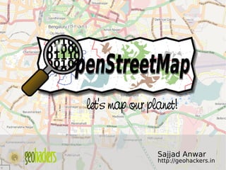
  • 1. let's map our planet!     Sajjad Anwar http://geohackers.in
  • 4. Why do we care about maps?!    
  • 5. All of us have used a map to figure out where “it” is And   how to get there.  
  • 6. Ownership Copyright      http://www.omninerd.com/images/content/1/4_article_33_full_figure1.jpg
  • 7. What if the Greenland Ice Sheet melts?    
  • 8. Maps tells us a story! Do you believe? Where is ____? How many ____? Density of ____? What’s inside ____? What’s near ____? How has ____ changed? How do ____ relate?   What  if ____?
  • 10. "OpenStreetMap is a project aimed squarely at creating and providing free geographic data such as street maps to anyone who wants them." -- www.openstreetmap.org    
  • 11. "The project was started because most maps you think of as free actually have legal or technical restrictions on their use, holding back people from using them in creative, productive or unexpected ways." -- www.openstreetmap.org    
  • 12. The Four Freedoms; Granted!    
  • 13. + ODbL    
  • 14. We make beautiful maps. And we give them away.    
  • 15.    
  • 16. London    
  • 18.     Bengaluru
  • 19. . . . and the whole planet!    
  • 20. But does'nt ___ .com do that already?! Google maps Yahoo maps Mapquest Mapblast     Well, Yes!
  • 21. but...    
  • 22. The Google Maps “ Terms of Service” says: "Geocoding data for map content in Google Local is provided under license by Navteq... and/or Tele Atlas... and subject to copyright protection and other intellectual property rights owned by or licensed to NAVTEQ, TANA and/or such other third parties." "Also, you may not use Google Local in a manner which gives you or any other person access to mass downloads or bulk feeds of numerical latitude and longitude coordinates."    
  • 23. Why OpenStreetMap? Because that data is copyrighted and owned by people like the Ordnance Survey. Google / whoever just license it. If we used it, we'd have to pay for it.    
  • 24. But who owns OpenStreetMap? You do! The data and software is owned by you, the contributors. There is an organisation called the OpenStreetMap Foundation which exists to protect, promote, and support the project, but does not own the   data.  
  • 25. ....Ah! Still more?! Create your own maps! Render them! Setup your own server!    
  • 26. Get Involved! Register for the API and wiki http://OpenStreetMap.org    
  • 27. You! know your nieghbourhood more than anyone! I bet! So why do you want someone else to map it?!    
  • 28. Mapping Parties! Mapping parties are events where anyone can come and participate in the OpenStreetMap project.    
  • 29. Potlatch: Online editor   Potlatch is a Flash-based OpenStreetMap editor, found on the 'Edit' tab of the main site.  
  • 30.    
  • 31. JOSM: Offline editor Java OpenStreetMap Editor    
  • 32. Dont want to use both of them? Well, you should try Merkaartor!    
  • 33. Setup your own server,and deploy your projects!    
  • 34. ..and possibilties endless!    
  • 35. Get Connected! 24x7 Join maling lists and IRC's Talk Geocoding Accessibilty And much more.. #osm irc://irc.oftc.net/osm    
  • 37. let's map our planet! Presentation cc-by Sajjad Anwar Fonts by Hfactor; http://hiran.in Few slides by Richard (Thanks!) OSM Map Data cc­by­sa http://OpenStreetMap.org/ http://wiki.openstreetmap.org/ irc://irc.oftc.net #osm Mailing lists     http://geohackers.in