2. LOCATION
Country – INDIA
State- Uttar Pradesh
Varanasi town lies between the
25D15’ to 25D22’ North latitude
and 82057’ to 83001’ East longitude.
The River Ganga only here flows
South to North having the world
famous Ghats on the left bank of
the river..
3. The highest flood level of river
Ganga was 73.90m (1978) and
the lowest river water level is
approximately 58m. It is at an
elevation of 80.71 metres above
mean sea level.
The city of Varanasi is located in
the middle Ganga valley of North
India, in the Eastern part of the
state of Uttar Pradesh, along the
left crescent-shaped bank of the
Ganga river.
4. CONNECTIVITY
Varanasi is well connected by road, rail and air with other parts of the country.
The distance from the major cities are
Delhi-750 km,
Lucknow-286 km
Allahabad-125 km.
There are three national highways i.e.
NH-2, NH-56 and NH-29 and four state
highways i.e. SH-87, SH-73, SH-74 and
SH-98 passing through the heart of the
city. The linkages provided by the
National highways are:
i. NH 2- G.T. Road from Mughal Sarai to
ii. Allahabad;
iii. ii. NH 29- Varanasi to Gorakhpur, Kushinagar; and
iii. NH 56- Varanasi to Jaunpur Lucknow,.
5.
6. GEOGRAPHY
Ganges covering a course of about 2525km, only in Varanasi .Ganga river flow in
a crescent shape meander from south to north (length 6.5km).
clay with coarse
grained sand,
limestone concretion
(kankar) and gravel
bed..
7. This sharp-bend meander is only observed in Varanasi throughout its course .
This unique geological formation has provided the base for the growth of the
city in a crescent shape, symbolically described as crescent moon on the
forehead of Lord Shiva.
In terms of river ecology, this characteristic is also considered as the unique
aspect of energy quantum and direction of the energy flow.
This peculiar shape is the result of fluvial process through which the coarser
sediments get deposited on its western bank between Raj Ghat in the north and
Samne Ghat in the south. The portion between these two points a hillock-like
geologic feature, called natural levee, consists of nearly 60m bed of clay with
coarse grained sand, limestone concretion (kankar) and gravel.
Another similar ridge like formation exits other side at Ramanagar where exists
the fort. This peculiar geological formation changes the flow of the Ganga in a half-
circular shape.
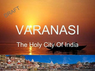
8. INTRODUCTION
The renowned American novelist Mark Twain once wrote,
"Banaras is older than history, older than tradition,
older even than legend and looks twice as old as all
of them put together.“
Dashawamegh Ghat: A view in 1820s,by James Prinsep, 1830
9. The city has two remnants of a holy past: the first being Rajghat plateau, where
the archaeological findings of wares date back to the period of very existence of
urban settlement and the second being Sarnath, where Buddha gave his first
sermon, “Turning the wheel of law” in 528 BC.
10. Later during 3rd century King Ashoka built a monastery township there, which
continued its existence till 12th century and was later destroyed.
11. Ancient Buddhist monasteries near
Dhamekh Stupa Monument Site,
3rd century BC Buddhist ruins
Hindu legend has it that Varanasi is the centre of
the universe, the first city created by the gods on
Earth, and it is certainly true that it was already an
old city when Rome was created.
12. ETYMOLOGY
• The name Varanasi has its origin
possibly from the names of the two
rivers Varuna and Assi for it lies with
the confluence of Varuna with the
Ganges being to its north and that of
Assi and the Ganges to its south.
• Through the ages, Varanasi was
variously known
as Avimuktaka, Anandakanana, Mahas
masana, Surandhana, Brahma
Vardha, Sudarsana, Ramya, and Kasi.
13. The city of Varanasi is located in the middle Ganga valley of North India, in
the Eastern part of the state of Uttar Pradesh, along the left crescent-
shaped bank of the Ganga river.
It has the headquarters of Varanasi district.
It covers an area of 112.26 km²
It is stretched between 82° 56’E - 83° 03’E and 25° 14’N - 25° 23.5’N.
Being located in the Indo-Gangetic Plains of North India, the land is very
fertile because low level floods in the Ganges continually replenish the soil
Sangam of varuna
river into Ganga
Sangam of Assi river
into Ganga
14. • Banaras: where “always ready” (Bana) is the “juice of life” (ras)! It is the
blending or “complex mixing” of these, which makes up the mosaic of culture
known as Banaras, the City of Lord Shiva.
• The natural setting, the spirit of place, and the continuity of cultural traditions
have all blended together to create and preserve a unique lifestyle known as
Banarasi.
The life style of Banaras is
distinct in nature, and
referred to as Banarasipana.
It is an art of living, both
passionate and carefree,both
relaxed and concentrated,
both intense and free, both
traditional and Modern.
15. HISTORY/ Time Line/Structure of Varanasi
According to legend, the city as founded by the Hindu deity, Lord
Shiva, around 5,000 years ago.
It is one of the seven sacred cities of Hindus.
Many Hindu scriptures, including the Rigveda, Skanda
Purana, Ramayana, and the Mahabharata, mention the city.
16.
17. Ashoka (272-242 BCE), the great Mauryan king, had declared
Buddhism a state religion and visited Sarnath. Under his patronage
there developed a Buddhist township with many monasteries, stupas
and shrines. The inscriptions of Kushana king Kanishka, dated 3rd
century CE, refer to the persistence of Buddhism together with animistic
religion of Yaksha.
Ancient Buddhist monasteries near
Dhamekh Stupa Monument Site,
3rd century BC Buddhist ruins
18. The archaeological findings at Rajghat (northern part of Banaras city)
confirm the existence of urban settlements during 800-500 BCE.
Archaeological remains of the Buddhist Monastery built by the
King Ashoka
19. The Pali and Buddhist literature mention the structure, condition
and some plans of the city of Varanasi, especially narrating the six
beautiful gates surrounding the city and moats along the main
protecting rampart walls. Perhaps these gates were linked to the
market areas in the city.
2nd century BCE burnt bricks became common in making
buildings.
Gupta period, 4th to 6th century CE
By the Gupta period the city expanded, following a rough
rectangular plan.The main roads were running parallel to the Ganga
river, north-south. Evidences support that the city was divided by many
wide roads and lanes, however there was no well-planned design.
During the period of Harsha (606-648 CE), a great Chinese pilgrim
Hsüan- tsang paid visit to Varanasi and described the city as
conglomerate of congested houses separated by narrow lanes,
garden and groves, andwater pools with lotus flowers.
20. The major expansion and transformation of landscape took place
between 8th and 12th centuries.
The first settlements were in the north to the confluence of the Varana to
the Ganga and later by the mid 10th century city expanded in the southern
side.
At the turn of 11th century the city came under the Gahadvalas that
continued till 1197. In the Gahadavala period the city reached to its
zenith. Three zones surrounding Omkareshvara, Vishveshvara and
Kedareshvara temples came out in full bloom associated with sacredness
and settlements, inhabited by traders and migrants belonging to various
linguo-cultural groups from different parts of India.
Temples were destroyed in 1300s under Firoz Shah Tughlaq (1351-1388).
In the 1400s, again under the rule of Sharqi kings of Jaunpur temples were
destroyed. During the moments of calm, the Hindus rebuilt temples and
lingas but they were again destroyed by the next wave of invaders.
21. Under the rule of Lodis (1451-1526) a major part of the city was
destroyed by Sikander Lodi.
AKBAR PERIOD
A great sigh of relief was surely heaved when Mughal Emperor Akbar
(1556-1605).
More religious freedom was granted.
The Rajputs Man Singh and Todarmal, the two senior ministers in the court
of Akbar, participated actively in repairing, rebuilding and in new
construction of temples and Banaras ghats during his period.
22. AURANGZEB PERIOD ( 1658 – 1707)
By the order of Aurangzeb around thousand temples, including city’s greatest
temples like Vishveshvara, Krittivasa,and Vindu Madhava, were razed.
Painting
depicting the
construction of
mosques during
the Aurangzeb
period or the
view of Ghats
during
Aurangzeb’s
Rule.
23. AURANGZEB PERIOD ( 1658 – 1707)
In 1665 the French traveller Jean Baptiste Tavernier, paid a visit to Banaras
and described the architectural
beauty of Vindu Madhava
temple at the riverside.
There is no major religious
sanctuary in the city of Banaras
that pre-dates the time
of Aurangzeb in the
17th century.
The sacred city could not be
destroyed, but it could certainly
be defaced.
AURENGZEB MOSQUE
24. 18th Century Rule of MARATHAS ( 1734 – 1785)
Substantial part of the city had been rebuilt.
The city became the recipient of the gratitude, the wealth, the skill
and energy of the Marathas.
It is said that ‘Modern Banaras is largely a creation of the
Marathas’. Bajirao Peshva I(1720-40) had patronised construction of
several ghats and nearby residential quarters, a number water pools and
noted temples of Vishvanatha, Trilochana, Annapurna, Sakshi Vinayaka and
Kala Bhairava.
Queen Ahilyabai of Indore built the present Vishvanatha temple
in 1775-76. As one after another ghat was added, the temples rose, the
city regained its gaiety, and its educational system was revitalised.
Varanasi became an independent Kingdom of Kashi in the
eighteenth century.
25. 18th Century Rule of MARATHAS ( 1734 – 1785)
The Ram nagar Fort was built by Kashi Naresh Raja Balwant Singh with
creamy chunar sandstone in the eighteenth century.
The Ramnagar Fort of the Kashi Naresh is situated to the east of
Varanasi, across the Ganges.
Kashi Naresh is the religious head and the people of Benares consider
him the incarnation of Lord Shiva.
30. BRITISH RULE
The urban area of the city continued to develop
along the river under the British rule.
By the approval of the British Governor-General
Warren Hastings in 1791, JonathanDuncan, a
British resident in Banaras, founded a Sanskrit
College.
1853 the present buildings of the college were
built in Gothic style.
In 1916, the Viceroy of India, Lord Hardinge, laid
the foundation stone of what would become
one of the largest and most beautiful universities
in Asia, i.e. Banaras Hindu University.
During the early decades of the 19th century
Banaras was typical of an oriental city. Streets
were not wide enough for wheeled carriage
particularly in the densely settled
residential areas.
31. The streets generally were at a lower level
than the entrance of the houses and
shops that lined them.
The Grand Trunk road passed from the
northern outskirts of the city and the river
Ganga was not bridged near Rajghat.
The riverside and the inner zone of the
city were approached by numerous
narrow lanes as one can see even today.
32. Under British rule, it remained a commercial and religious center.
The Municipal Board was instituted in 1867 under the Municipal Act XXVI of
1850, with a view to introducing a general improvement in the existing condition
of the city.
In 1910, the British made Varanasi a new Indian state, with Ramanagar as its
headquarters.Kashi Naresh still resides in the fort of Ramanagar.
In continuation of such improvements, the site of the Maidagin tank gradually
came to be replaced by a park known as the Company Garden, north of the
present Maidagin-Kashi station road.
Opposite the garden, to the south of the road, the Town Hall was built, as a result
of the efforts of the Maharaja of Vijayanagar (cf. Singh, 2007).
The introduction of various branches of railways along with the construction of
the railway bridge near Rajghat, installation of water works and provision of
improved sewerage and drainage works in the last quarter of the 19th century, all
these widely modified the urban fabric of Banaras.
33. AFTER INDEPENDENCE
India received independence from the British rule on the 15th of August
1947.
Since then no substantive change in the urban fabric and city morphology is
recorded.
On 15th October 1949 the district of Banaras assumed its present form and
area by the merger of the erstwhile Banaras State (Kashiraj), and the city of
Varanasi became the district headquarters.
In 1948 The Banaras Improvement Trust was constituted for making
‘Master Plan of Banaras’, and in 1951 the first such plan was prepared.
The latest plan, that also demarcates heritage areas, was approved by
the State Government on 10th of July 2001.
34. First Map of Varanasi Prepared by
James Prinsep in year 1822.
35.
36.
37.
38.
39. The area to which Kashi refers includes all that is within the circular route
around the city called PANCHAKROSHI Road
40. The Inner sanctum
of Vishveshvara is
part of another
divisions of the city
into three sectors
OMKARA KHANDA
IN NORTH
VISHVESHVARA
KHANDA IN
MIDDLE
KEDARA KHANDA
IN SOUTH
41.
42. Urban Profile
Present Day analysis of Urban character
The existing urban setting and growth trends of Varanasi can be classified
into
three main categories.
1. The Old City consisting of the Ghat area including Chauk, Kotwali,
Adamura,etc.,
2. The Central City comprising of the area beyond the old city and bound by
NH-2 along the western and northern edge
3. Peripheral area comprising of the trans Varuna area.
43.
44. The Old City
The urban character of Varanasi is very complex. The traditional typical old city of
Varanasi has undergone transformations over time, still retaining its original
character and ethos. Areas djacent to Ghats and the old city exhibit dense
development due to its proximity to Ghats and their longevity of existence, which
have become the cultural fabric of the city. Predominant characteristics of the old city
include:
45. Dependence on River Ganga as the sacred lifeline of the entire city
Proximity to Ghats which are the nodes of religious and tourist activity in the
city
Rich built heritage representative of various traditional building styles.
Pollution of River Ganga due to intense load of tourist and religious activities
Dotted with temples of high religious significance all along the ghats
Bazaar street pattern catering mainly to religious and tourist population
High density core area with narrow and inorganic street patterns
Encroachment by commercial and informal sector on the roads
Slow moving traffic and lack of parking spaces leading to congestions and
chaos
Major concentration of retail and wholesale trade of Handlooms (including
Banarasi sarees) and brassware
Haphazard cabling including electric and telephone wires.
Open drains with grey water and solid waste dumps along internal streets
Need for improvement in infrastructure, traffic facilities and utilities.
Need for provision of infrastructure to cater to the tourist load, conservation
and adaptive reuse of heritage buildings.
46.
47. The Central City
Areas adjacent to the city core are constantly under great development pressure
due to close proximity to the core areas. This is because of availability of all
services,cultural attractions and Varanasi is no exception to this. These areas
have been categorized as “proximal areas” in developing the growth analysis.
Predominant characteristics of the newer city include:
Focus on religious character reduces considerably.
Lower density development as compared to the old city
Relatively wider roads with lesser encroachments
Vulnerable to high potential for growth.
Relatively less disorganized compared to the old city area and the built form is
less congested. The development pressure on these areas remains high
and is likely to impose additional burden on existing limited infrastructural
facilities available.
Institutional areas like Kashi Vidyapeeth, BHU and Sanskrit University
Railway station and Cantonment area form a considerable part of this zone
The plantation levels and green areas are higher than those in old city but
roadside plantation needs to be provided.
48. Major traffic congestion points like railway station, Chaukaghat and Andhrapul fall
in this one. The GT road itself carries significant amount of traffic and needs to be
decongested
The marked reduction in the number of cycle rickshaws plying on the roads in
this zone leads to an increase in the average flow of traffic.
Lack of public transport facilities
Diesel Locomotives Factory lies in this zone and forms a major industrial zone
on the western side
Newer constructions coming up in the areas near Madhadhi and BHU
49. Peripheral areas
The peripheral areas encompassed by the municipal wards have a strikingly
different development pattern than the rest of the city.
These areas are becoming more popular among the citizens as they provide more
organized development pattern with infrastructure being relatively in better
conditions.
The State Housing Board, through the Varanasi Development Authority,
undertakes these developments.
The demand for such development is increasing and with the participation of
governmental and private development groups, the growth of peripheral areas is
likely to be much higher in comparison to other parts of the city.
The proposal for the construction of ring road in this zone has further accelerated
the development process. The development in this zone is the most planned and
organized in the whole city but there is a relative lack of recreational/green spaces
in this zone.
50. Major catalyst for urban growth will be development of new ring road to the north
of the city, which will over the next decade comes into developed form.
Greater urban development will take place along this in the northern part of
Varanasi.
Along with this development of major road systems connecting to the National
Highways on the southern extent of the city is already causing a spurt in
development in this area.
Combined with plans for a transport nagar in the western extremity of Varanasi
and the connectivity across the Ganga to the eastern bank (to Ram Nagar and
Mughal Sarai) the growth of urban areas and the population of Varanasi outside
the municipal wards are likely to continue to accelerate.
51. IMPORTANT ASPECTS OF THE CITY
CITY IS FAMOUS FOR:
1. Holy City for Hindus.
2. Tourism
3. Trade
4. Ganga river front consists of
Ghats, Temples, Mosques etc.
5. Heritage value of city
6. Sarnath
7. Ramgarh Fort
8. Pilgrimage Route
9. Education
52.
53. GHATS
Varanasi is famous for its Ghats.
Ghats are steps that lead down to
River GangaThe 84 ghats along
the arc-shaped Ganga symbolise
the integration of the 12 signs of
the zodiac (division of time) and
the 7 sheaths of the body or the 7
layers of the
atmosphere (division of space),
thus 12 x 7 = 84.
Several rituals and religious
ceremonies are associated with
these ghats and pilgrims travel
from all over the country for
prayers, holy dip in the river
Ganga, cremation, religious
offerings, etc.
54. The most important Ghats are Dasaswamedh, Harish Chandra, Manikarnika,
Panchaganga, and Assi ghat.
55. GHATS
Varanasi is famous for its Ghats.
Ghats are steps that lead down to
River Ganga. The crescent shaped
bank of river Ganges houses 84
Ghats on the western bank spread
over a distance of 6.5 km to 6.8 km.
Several rituals and religious
ceremonies are associated with
these ghats and pilgrims travel from
all over the country for prayers, holy
dip in the river Ganga, cremation,
religious offerings, etc.
The most important ghats are
Dasaswamedh, Harish
Chandra, Manikarnika,
Panchaganga, and Assi ghat.
56. Dasaswamedh Ghat: It is one
of the
most important ghats of Varanasi. It is
located near ‘Kashi vishwanath
Temple’.
It is belived that on this very Ghat ten
horses were sacrificed by Lord Brahma
to allow Lord Shiva to return from a
period of banishment. In spite of the
fact that dasaswamedh is one of the
oldest Ghats of Varanasi, dating back
to many thousand years, the ghat has
remained unspoilt and clean.
57. Harish Chandra Ghat: Harish
Chandra Ghat is name after a
mythological King
Harish Chandra, who once worked at
the cremation ground here for the
perseverance of truth and charity. It is
believed that the Gods rewarded him
for his resolve, charity and truthfulness
and restored his lost throne and his
dead son to him.
Harish Chandra Ghat is one of the two
cremation Ghats (the other being
Manikarnika Ghat) and is some times
referred as Adi Manikarnika (the
original creation ground). Hindus from
distant places bring the dead bodies
of their near and dear ones to the
Harish Chandra Ghat for cremation.
In Hindu mythology it is believed
that if a person is cremated at the
Harish Chandra Ghat, that person
gets salvation or "moksha".
58. Manikarnika Ghat:
It is one of the oldest and most
sacred Ghats of Varanasi.
liberalisation from the cycle of births
and rebirths.
It is also believed that fire does not
extinguish at this Ghat.
There is a sacred well at the
Manikarnika Ghat, called the
Manikarnika Kund. Manikarnika
Kund is said to be dug by Lord
Vishnu at the time of creation while
the hot ashes of the burnt bodies
makes one remember the inevitable
destruction of everything in the
world. ".
59. Panchaganga Ghat: As the
name
suggests, it is belived that five
rivers Kirana, Ganga, Yamuna,
Saraswati and Dhuta-papa
converge here.
Dominating the Ghat is
Auangazeb's smaller
mosque, also known as the
Alamgir Mosque, which he built
on the site of large Vishnu
temple erected by the Maratha
chieftain Beni Madhav Rao
Scindia.
60. Assi Ghat:
This Ghat marks the
confluence of the Assi canal
with the River Ganga. It is
believed that when Lord
Durga killed the demons
Shunga and Nishunga, her
sword fell in Varanasi creating
a depression in the form of
Assi canal.
61. TEMPLES
Apart from the Ghats, there are around 2000
temples, small, medium and big in size
throughout the city.
Many important temples are located along the
ghats of
Ganga River, adding to the religious value to the
holey river. Some of the important temples are
Kashi Vishwanath,
Sankat Mochan temple,
Tulsi Manas temple,
Durga temple,
Kal Bhairav temple
Mritunjaya temple.
KASHI VISHWANATH TEMPLE
63. • Varanasi has several small cottage industries,
including Banarasi Silk sari making, the production of textiles such as hand-
woven carpets, and handicrafts.
• Banarasi paan (betel leaf) and khoa (a milk product) are popular, and the
related small-scale industries employ many people.
• Banarasi Silk is known all over the world for its finery and softness.
Banarasi Sarees are adorned with intricate designs and zari embellishments
making it popular during traditional functions and weddings. Earlier, the
embroidery on sarees were often done with threads of pure gold.
• Varanasi is also popular for Langda aam(Mango). City is biggest producer
of world famous langda mango(Malda Mango).
64. • Indian Railways runs a major diesel locomotive factory in Varanasi, Diesel
Locomotive Works (DLW).
• BHEL (India's largest heavy engineering and manufacturing enterprise) also
runs a plant here.
• The first Indian business house of Varanasi and Kanpur was the firm
NihalChand KishoriLal established in the year 1857 which set up the fourth
Oxygen plant in the country here by the name of Indian Air Gases Ltd.
65. EDUCATION
• Banaras Hindu University was founded in 1916
by Madan Mohan Malaviya with the cooperation
of Annie Besant. Its 1350 acre (5.5 km²) campus was
built on land donated by the Kashi Naresh.
• Sampurnanand Sanskrit University: Governor
General Lord Cornwallis established the Sanskrit
College (1791), which was the first college in Varanasi.
• Mahatma Gandhi Kashi Vidyapeeth is a deemed and
chartered university that is named for Gandhi and
follows the principles of Gandhism.
Banaras Hindu
University is a major
university in
Varanasi
66. EDUCATION contd…
The Central Institute of Higher Tibetan Studies (Central University
of Tibetan Studies) at Sarnath is a deemed university with a preference for
the traditional Tibetan method of teaching within a framework of modern
universities.
• Udai Pratap College, autonomous college, is the center of sports and
science study for the suburban students of modern Benares.
• Agrasen Mahila Mahavidyala is another autonomous college in the
city.
• Nav Sadhana Kala Kendra is a college of Dance and Music in the city that
trains the students professionally in Bharatnatyam and Hindustani Vocal.
67. THREATS TO CITY
• In March 2006, bomb blasts from terrorists resulted in 28 people being killed and
many injured. One of the bombs was planted in the Sankat Mochan Hanuman
Temple, a shrine dedicated to Lord Hanuman, while another was planted on a
platform of the Varanasi Cantonment Railway Station, the main railway station in
the city. A militant group, Lashkar-e-Kahab, claimed responsibility for the terror
attacks.
• In November 2007 Varanasi endured another bomb blast. The bomb was placed
in the civil court of Varanasi. More than 20 people died and over 100 were
injured.
• 7th December 2010 A baby girl was killed and at least 25 people were injured in
the blast at Sheetla Ghat in Varanasi on Tuesday. A railing collapsed in a
stampede that followed the blast, contributing to the injuries. The explosion at
Sheetla Ghat, near the main ghat where daily aarti or prayers are offered, took
place at about 6:25 pm in the evening just as the aarti ended. Thousands of
devotees and tourists had assembled at the ghat for the Ganga aarti
Read more at: http://www.ndtv.com/article/india/varanasi-bomb-blast-terror-mail-
traced-to-mumbai-dj-71247?cp
Pollution of GANGA;, Communal Riots & Terrorism