Hawaii Pacific GIS Conference 2012: National Data Sets - An Overview of the National Hydrography Dataset
•
2 recomendaciones•576 vistas


Recomendados
Recomendados
Más contenido relacionado
Similar a Hawaii Pacific GIS Conference 2012: National Data Sets - An Overview of the National Hydrography Dataset
Similar a Hawaii Pacific GIS Conference 2012: National Data Sets - An Overview of the National Hydrography Dataset (20)
Más de Hawaii Geographic Information Coordinating Council
Más de Hawaii Geographic Information Coordinating Council (20)
Último
Último (20)
Hawaii Pacific GIS Conference 2012: National Data Sets - An Overview of the National Hydrography Dataset
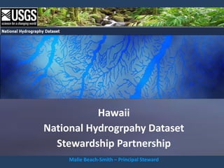
- 1. Hawaii National Hydrogrpahy Dataset Stewardship Partnership Malie Beach-Smith – Principal Steward
- 2. Overview of the National Hydrography Dataset What it looks like? How it work?
- 4. collection of points, lines, and polygons in a digital vector database. Hanapepe Bay Kauai
- 5. Oceans, lakes, ponds, reservoirs, rivers, wider streams, swamps and marshes are represented by POLYGONS. lake/pond river reservoir sea/ocean
- 6. Coastlines, streams, irrigation ditches, pipelines and artificial paths are represented by LINES. artificial path pipeline stream canal/ditch coastline
- 7. Dams, gaging stations, wells, and springs are represented by POINTS. gaging stations dams springs
- 8. Note: There are many more feature types represented in the NHD. Those were just a few of the more prominent ones.
- 9. seamless dataset covering: contiguous United States, Alaska, Hawaii, the Virgin Islands, Puerto Rico, American Samoa, and Guam Includes: bordering watersheds in Canada and Mexico
- 10. Data Organized into Hydrologic Units HYDROLOGIC UNITS Defined by headwaters, bordered by a ridge system, converging to a “pour point” or “belt flow” “Subregions”
- 11. Hydrologic Units – Subregions of the Contiguous United States 22,056 Subregions in the countiguous U.S.
- 12. Region 20 Ni'ihau Kaua'i 2008 2007 Oahu 2006 Moloka'i 2005 Maui 2004 2002 Lana'i 2003 Kaho'olawe Hawai'i 2001 8 subregions in Hawaii. Hawaii’s SUBREGIONS are defined by ISLAND. Each ISLAND subregion is further divided into drainage units by the WBD.
- 13. Hydrologic Units – Watershed Boundary Dataset Six level hierarchy of nested watersheds Hydrologic Unit Code (HUC) Each level is referred to by the Hydrologic Unit Code or “HUC”
- 14. Hydrologic Units – Watershed Boundary Dataset Hawai'i (subregion 2001) HUC_8 This is the HUC 8 for the island of Hawaii (subregion 2001)
- 15. Hydrologic Units – Watershed Boundary Dataset HUC_10 These are the HUC 10s
- 16. Hydrologic Units – Watershed Boundary Dataset HUC_12 These are the HUC 12s
- 17. Hydrologic Units – Watershed Boundary Dataset HUC_12 And these are the HUC 12s uniquely color coded
- 18. Watershed Boundary Dataset and the National Hydrography Dataset Streams (hydrography dataset) Sub-watersheds (WBD) HUC_12 This slide shows the integration of the WBD with the hydrography feature class.
- 19. Streams - the fundamental core of the NHD Halawa Bay Moloka'i NHD carries a lot of information about streams. Stream classification is one piece of information within the data structure. Here, the perennial streams are displayed as dark blue and the intermittent streams as light blue.
- 20. Streams - the fundamental core of the NHD Halawa Bay Moloka'i Flowlines also carry names. These names are collected directly from the Geographic Names Information System, where all names have been approved by the Board of Geographic Names.
- 21. Flow Direction – giving intelligence to the data Flow direction: Flowlines in the NHD contain information about where the water is flowing. With directional information we can navigate upstream and downstream. This allows us to ask questions, and get answers, such as…
- 22. Navigation – Creating fundamental knowledge Kaiaka Bay Oahu What is upstream of a given point?
- 23. Navigation – Creating fundamental knowledge Kaiaka Bay Oahu Because we know which way the water flows, we can navigate upstream…
- 24. Navigation – Creating fundamental knowledge …and capture all the flowlines in the network upstream of a given point.
- 25. Navigation – Creating fundamental knowledge Or you may say…show me everything downstream of a given point…
- 26. Navigation – Creating fundamental knowledge …and the database can navigated downstream through the network. This ability to navigate upstream or downstream through the network is useful for a variety of modeling and analysis exercises.
- 27. Navigation – Creating fundamental knowledge Transport downstream Toxic spill Sewage spill For example, you may want to model the downstream transport of a toxic spill. Or, you may want to know what waters will be affected by a sewage spill.
- 28. Navigation – Creating fundamental knowledge You may want to model fish migration upstream.
- 29. Navigation – Creating fundamental knowledge trace upstream with barriers Northern East Maui Coast And here, you may want to model possible barriers to fish migration upstream. In this example, the irrigation ditch layer was used as a barrier to fish migration.
- 30. Linear Referencing – Stream “Reaches” Another very important part of the NHD is its ability to address information to the dataset.
- 31. Linear Referencing – Stream “Reaches” referencing system Linking information to the dataset gives the data it’s intelligence The flowlines are more than just blue lines on a map, they are also a referencing system for
- 32. Linear Referencing – Stream “Reaches” 20060000001050 Reach Malie Street Street NHD Road Map In the NHD, the linear referencing system can be analogous to street addresses on a road map. The NHD uses “reaches” the way road maps use street names.
- 33. Linear Referencing – Stream “Reaches” Each reach has a Similar to the way 20060000001050 unique 14 digit reachcode a zip code describes Malie Street that holds information the region of a country, about the subregion, county, and the hydrologic unit or town that flowlines reside in Reach Street
- 34. Linear Referencing – Stream “Reaches” Each reach uniquely color coded unique numerical code Each reach in this slide is uniquely color coded, and each reach has a unique numerical code.
- 35. Linear Referencing – Stream “Reaches” region The first two digits, “2, 0”, tell us what region we are in. “20” indicates Hawaii.
- 36. Linear Referencing – Stream “Reaches” subregion The next two digits, “0,6” identify the subregion . “2006” is the island of Oahu.
- 37. Linear Referencing – Stream “Reaches” sub-watershed The next six digits describe finer divisions of watersheds and sub-watersheds.
- 38. Linear Referencing – Stream “Reaches” unique reach (basis for the address referencing system) The last 4 digits describe a unique reach that is the basis for the address referencing system. This is reach number 2164 of subregion 2006 (Oahu).
- 39. Linear Referencing – “Measures” 80.00543 2468 20060000001050 Reach StreetMalie Street Like a house number on a street. A point on a reach has a measure.
- 40. Linear Referencing – Stream Addresses Reachcode 20060000000848 100 75 0 25 50 A reach is divided into address ranges called “measures”. A measure works like this…
- 41. Linear Referencing – Stream Addresses Reachcode 20060000000848 100 0 The downstream end of a reach is designated as “0”, and the upstream end is designated “100”.
- 42. Linear Referencing – Stream Addresses Reachcode 20060000000848 100 75 0 25 50 Every location along the reach has a measure (like a percentage of the total length). It doesn’t matter how long, or sinuous a reach is, a particular address is anywhere between 0 and 100.
- 43. Linear Referencing – Data “Events” Reachcode 20060000000848 data point = “event” So having an address referencing system, allows us to attach information to the dataset. Data related to the NHD is referred to as “events”.
- 44. Linear Referencing – Data “Events” Reachcode 20060000000848 Water quality sampling site Biological survey site Stream gage etc. An “event” may be a water quality sampling site, a biological survey site, or a stream gage or dam.
- 45. Linear Referencing – Data “Events” Reachcode 20060000000848 37.52676 (measure) “Events”have an address within the network using a reachcode and “measure”. This site is at measure 37.52676 on reach 848 in subregion 2006 (Oahu)
- 46. Linear Referencing – Data “Events” Reachcode 20060000000848 data segment = “event” “Events” can also describe stretches or segments of a flowline.
- 47. Linear Referencing – Data “Events” Reachcode 20060000000848 Biological survey segment Segment of impaired water Waters with special uses A “line event” may be a biological survey segment, a segment of impaired water, or waters with special uses.
- 48. Linear Referencing – Data “Events” Reachcode 20060000000848 82.37655 T0_measure 31.49238 FROM_measure Line “events” are addressed using a “from” measure and a “to” measure.
- 49. Linear Referencing – Data “Events” Hanalei Bay USGS stream gage ID: 16103000 “Events” can be layers within the NHD that contain additional information or links to additional data. This is a USGS gage on the Hanalei River. It is gage number 1610300.
- 50. Linear Referencing – Data “Events” Hanalei Bay USGS stream gage ID: 16103000 Latitude 22°10'46.5“ Longitude 159°27'59.0" We know the stream gage’s position in space. We know its X Y position in latitude and longitude…
- 51. Linear Referencing – Data “Events” Hanalei Bay USGS stream gage ID: 16103000 Latitude 22°10'46.5“ Reachcode: 20070000001000 Longitude 159°27'59.0" Measure: 98.66498 … but even more importantly, as an event in the NHD, we know where this stream gage is within the network. We know it’s address. ..
- 52. Linear Referencing – Data “Events” Hanalei Bay USGS stream gage ID: 16103000 Latitude 22°10'46.5“ Reachcode: 20070000001000 Longitude 159°27'59.0" Measure: 98.66498 And having an address on the network allows use to analyze relationships between features.
- 53. Events – Intelligence about the data Through the “Events” table, we have a link from this particular stream gage record to the National Water Information System. (Clicking on this point will take us there.)
- 54. Events – Intelligence about the data This is the record of that Hanalei stream gage from March 4th. You can see that the water flowing though that stream was well above the median daily statistic.
- 55. Events – Intelligence about the data By linking an event to the dataset, (in this case we linked a stream gage to a river), we add to our knowledge about that dataset. We went from knowing we had a river to knowing something about that river.
- 56. Events – Intelligence about the data biological communities fish habitat water quality fish migration barriers etc. Events can be added to provide information about all kinds of things. You can add events about biological communities, fish habitat, water quality, stream flow, and fish barriers, for example.
- 57. Events – More than just dots on a map Data that is truly integrated The building blocks for knowledge ● Diversions in the headwaters of the Colorado River (12,500 diversions in this particular dataset) So events are more than just dots on a map. Events are data that is truly integrated into the Jeff Simley, USGS framework of the dataset.
- 58. Events – More than just dots on a map Data that is truly integrated The building blocks for knowledge ● Diversions in the headwaters of the Colorado River (12,500 diversions in this particular dataset) The black dots in this slide are diversions in the headwaters of the Colorado Simley,There are Jeff River. USGS over 12,500 diversions in this particular dataset.
- 59. Events – More than just dots on a map Data that is truly integrated The building blocks for knowledge There is so much data, here, it can be a bit overwhelming. But by indexing these diversions to Jeff Simley, USGS the dataset, we can use the power of the computer to sort all this information out.
- 60. Analyzing Information to create knowledge Jeff Simley, USGS We can sort out which diversions affect the flow of water through a particular stream gage. Taking advantage of the upstream - downstream directionality of the dataset we can do these kinds of calculations.
- 61. National Water Information System Linear Events The NHD integrates information from many resources. In DFIRM Floodplains the future, the USGS plans to include National Wetlands DFIRM floodplain Inventory data, the National Watershed Wetlands Inventory, Boundary Dataset and the National Elevation Dataset. National Hydrography Dataset National Elevation Dataset
- 62. Traditional GIS National Water Information System NHD overlays themes of Data is linked information, one on Linear Events together within the top of other data structure. Relationships between features are DFIRM Floodplains Analysis is much determined by their more powerful. National spatial proximity. Wetlands Inventory Works well for some Watershed analysis. Boundary A highly effective Dataset solution to Works for making National geospatial analysis. maps. Hydrography Dataset The power of the GIS to sort this information National Elevation and understand the Dataset relationships becomes Well integrated data strained when you makes this possible. have a lot of data to analyze.
- 63. So, how do we make all this happen? There are a lot of things we need to do to keep the NHD current: add data to it, add intelligence to it, add new features, new content, things like that. Jeff Simley The capabilities of the USGS are rather limited. So what the USGS has done is to leverage those capabilities with a partnership of people.
- 64. In building the NHD for the country, the USGS partnered with a lot of different people, States, and other Federal Agencies…A huge partnership made all this possible. And the USGS needs to continue these partnerships to help maintain and improve this data. To do this, The USGS established the Stewardship capability. The partners of the Stewardship join in to help maintain and improve the National Dataset.
- 65. Building the National Hydrography Dataset The National Hydrography Dataset was designed and substantially built by three Federal partners…⌂The USGS remains the lead agency for: maintaining the NHD framework; developing NHD software; quality-control of edits; and housing and disseminating the data.
- 66. Maintaining the National Hydrography Dataset Hawaii NHD Stewardship Partnership … State Stewardship programs (like Hawaii’s Partnership) take the lead in UPDATING and MAINTAIING the datasets. Hawaii’s NHD Stewardship Program began in August 2009 as a partnership between the USGS and three primary State agencies… ⌂ These state agencies took the lead to establish the Stewardship Program and provide direction and oversight of changes to the NHD. Since it’s formation, over 10,000 edits have been made to Hawaii’s datasets.
- 67. GOAL Provide the State and the Nation with the most up-to-date and reliable surface water dataset
- 68. NHD’s is notable for these Achievements:
- 69. NHD’s is notable for these Achievements: 1. Developing a standardized data model almost everyone can agree to.
- 70. NHD’s is notable for these Achievements: 1. Developing a standardized data model almost everyone can agree to. 2. Creating a fundamental framework to serve as an application foundation.
- 71. NHD’s is notable for these Achievements: 1. Developing a standardized data model almost everyone can agree to. 2. Creating a fundamental framework to serve as an application foundation. 3. Developing a robust solution that will advance the science.
- 72. NHD’s is notable for these Achievements: 1. Developing a standardized data model almost everyone can agree to. 2. Creating a fundamental framework to serve as an application foundation. 3. Developing a robust solution that will advance the science. 4. Making the solution simple enough to be implementable.
- 73. NHD’s is notable for these Achievements: 1. Developing a standardized data model almost everyone can agree to. 2. Creating a fundamental framework to serve as an application foundation. 3. Developing a robust solution that will advance the science. 4. Making the solution simple enough to be implementable. 5. Creating a national partnership to pool resources.
- 74. NHD’s is notable for these Achievements: 1. Developing a standardized data model almost everyone can agree to. 2. Creating a fundamental framework to serve as an application foundation. 3. Developing a robust solution that will advance the science. 4. Making the solution simple enough to be implementable. 5. Creating a national partnership to pool resources. 6. Actually building the national dataset.
- 75. NHD’s is notable for these Achievements: 1. Developing a standardized data model almost everyone can agree to. 2. Creating a fundamental framework to serve as an application foundation. 3. Developing a robust solution that will advance the science. 4. Making the solution simple enough to be implementable. 5. Creating a national partnership to pool resources. 6. Actually building the national dataset. 7. Creating a stewardship community and process to enhance and maintain the data.
- 76. How to get it. Where to learn more. Who to call to contribute.
- 80. END
- 81. The NHD is a collection of points, lines, and polygons in a vector dataset. Polygons represent lakes, ponds, reservoirs, and oceans, MakaoKaha'i Point, Kauai Worldview2 imagery
- 82. polygons Lake/pond Nomilo Fishpond reservoir Sea/Ocean MakaoKaha'i Point, Kauai
- 83. as well as rivers, wider streams, swamps and marshes. ' Anahulu River, Oahu Worldview 2 imagery
- 84. polygons swamp/marsh swamp/ marsh swamp/ marsh
- 85. canals and ditches Kohala Ditch Hawaii
- 86. Kohala Ditch, Hawaii Kohala Ditch, Hawaii DOQQ natural color imagery DOQQ Natural Color imagery
- 90. springs Honolulunui Bay Hanawī Springs Pali Spring Big Spring Hawaii Island Worldview 2 imagery
- 91. Honolulunui Bay Hanawī Springs Pali Spring Big Spring Hawaii Island
- 92. wells
- 93. Lanai Lanai
- 94. gaging stations Olowalu stream gage Maui
- 95. gaging stations Maui Gaging station
- 97. waterfalls Kahiwa Falls East Molokai
- 98. dams Wahiawa Dam
- 99. dam Wahiawā Reservoir Oahu
- 102. including larger offshore islets Ford Island Sand Island Oahu
- 103. Lehua State Seabird Sanctuary and smaller offshore islets Ni'ihau
- 104. Watershed Boundary Dataset integrated into the NHD HUC_8 Hawaii Island
- 105. HUC_10 Hawaii Island
- 106. HUC_12 Hawaii Island
- 107. Put it all together…
- 108. coastline, Hanapepe Bay Kauai
- 109. watershed boundaries, Hanapepe Bay Kauai
- 110. rivers, Hanapepe Bay Kauai
- 111. streams, Hanapepe Bay Kauai
- 112. irrigation ditches, Hanapepe Bay Kauai
- 113. lakes, ponds, and reservoirs, Hanapepe Bay Kauai
- 114. gaging stations, Hanapepe Bay Kauai
- 115. dams, Hanapepe Bay Kauai
- 116. and wells. Hanapepe Bay Kauai
- 118. More than just a collection of shapefiles… More than just a collection of shapefiles… Hanalei Bay TOPOLOGY Kauai TOPOLOGY
- 119. With topology, the flowlines carry information about the relationship between the . Hanalei Bay