SlideShare una empresa de Scribd logo
1 de 16
Descargar para leer sin conexión
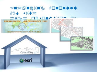
Enhancing Honolulu
GIS with
high resolution 3D
Buildings


       Free Powerpoint Templates
                                   Page 1
Genesis of the
•
       Honolulu 3D Inc. (featured on
    Originally created for Google,
                                   City
                    Model
    Earth and Mobile Maps)
• Created from Photogrammetry
• High resolution aerial images
• Re-processed to become the first “True” 3D GIS
  City Model of Honolulu for Esri applications
• 14 Feature GIS Classes
• Now available “off-the-shelf” for public and
  private use


                Free Powerpoint Templates
                                            Page 2
Photogrammetric Modeling Work Flow
    Stereo Pairs           Capturing Point Clouds              Raw Data

1                      2                                   3


                   4                         Post-edited
                                              buildings


                       Free Powerpoint Templates
                                                                      Page 3
Processing the Measurements into GIS
             Data Fields


            Free Powerpoint Templates
                                        Page 4
City of Honolulu 3D City Model
• Created from 4-inch stereo
  images
• 6,333 Buildings
• 11 square kilometers
• Includes roof detail and
  superstructures


           Free Powerpoint Templates
                                       Page 5
Area Coverage (CyberCity 3D web page)


         Free Powerpoint Templates
                                     Page 6
Honolulu 3D City Model Feature
           Classes


         Free Powerpoint Templates
                                     Page 7
GIS Products
Product           Deliverable                 Data Type

Solar Azimuth     6,500 measurements          Geo Data


Roof              Thousands of roof           Geo Data
Measurements      polygons measured

Roof Styles       6,800 Roof Styles           Geo Data

Superstructures   Thousands of                Geo Data
                  superstructures


                  Free Powerpoint Templates
                                                          Page 8
Data Fields (the geodatabase)


         Free Powerpoint Templates
                                     Page 9
Potentially Multiple Agency Benefits
 • Department of Planning
   – Honolulu Rail Transit Project
 • Mayor’s Energy and Sustainability Task
   Force
 • Engineering and Property Management
 • GIS / Mapping
 • Police & Fire


                  Free Powerpoint Templates
                                              Page 10
Free Powerpoint Templates
                            Page 11
Facilities Analysis and Maps


         Free Powerpoint Templates
                                     Page 12
Arc GIS 3D Analyst


    Free Powerpoint Templates
                                Page 13
Potential Use: Solar Maps


       Free Powerpoint Templates
                                   Page 14
Deliverables

Feature Class     Description                 Data Type

Solar Azimuth     6,333 measurements with     Geo Data
                  color codes

Roof              Thousands of roof           Geo Data
Measurements      polygons

Roof Styles       6,333 Roof Styles           Geo Data

Superstructures   Thousands of                Geo Data
Layer             superstructures

3D Buildings      6,333 3D Buildings          Shape File /
                                              Multipatch


                  Free Powerpoint Templates
                                                             Page 15
Mahalo
  !    CyberCity 3D, Inc.
300 Continental Blvd. Suite 420
     El Segundo CA 90245
        310-760-2556 d
  kdevito@cybercity3D.com
    www.cybercity3D.com


   Free Powerpoint Templates
                                  Page 16

Más contenido relacionado

La actualidad más candente

6 Stories of Maps and FOSS4G Korea
6 Stories of Maps and FOSS4G Korea6 Stories of Maps and FOSS4G Korea
6 Stories of Maps and FOSS4G KoreaSANGHEE SHIN
 
3D Digital Cities: The Convergence of CAD, GIS and BIM
3D Digital Cities: The Convergence of CAD, GIS and BIM3D Digital Cities: The Convergence of CAD, GIS and BIM
3D Digital Cities: The Convergence of CAD, GIS and BIMACSG Section Montréal
 
How to Create GIS and BIM Interoperability
How to Create GIS and BIM InteroperabilityHow to Create GIS and BIM Interoperability
How to Create GIS and BIM InteroperabilitySafe Software
 
Crowdsourcing and storytelling by gamification
Crowdsourcing and storytelling by gamificationCrowdsourcing and storytelling by gamification
Crowdsourcing and storytelling by gamificationDany Laksono
 
Overview of 3D GIS Capabilties
Overview of 3D GIS CapabiltiesOverview of 3D GIS Capabilties
Overview of 3D GIS CapabiltiesErik Van Der Zee
 
The future of GIS as we know it
The future of GIS as we know itThe future of GIS as we know it
The future of GIS as we know itJan Willem van Eck
 
DRCOG Keynote on GIS, BIM, CAD Convergence and 3D Cities
DRCOG Keynote on GIS, BIM, CAD Convergence and 3D CitiesDRCOG Keynote on GIS, BIM, CAD Convergence and 3D Cities
DRCOG Keynote on GIS, BIM, CAD Convergence and 3D CitiesMatt Ball
 
Geo spatial analytics using Microsoft BI
Geo spatial analytics using Microsoft BIGeo spatial analytics using Microsoft BI
Geo spatial analytics using Microsoft BIJason Thomas
 
StevesDWESlide_exported
StevesDWESlide_exportedStevesDWESlide_exported
StevesDWESlide_exportedSteve Snow
 
스마트시티 공간정보 서비스 지원을 위한 BIM-GIS 객체 맵핑 표준
스마트시티 공간정보 서비스 지원을 위한 BIM-GIS 객체 맵핑 표준스마트시티 공간정보 서비스 지원을 위한 BIM-GIS 객체 맵핑 표준
스마트시티 공간정보 서비스 지원을 위한 BIM-GIS 객체 맵핑 표준Tae wook kang
 
Infrastruktur Informasi Geospasial untuk Big Data dan 3D Geoinformasi
Infrastruktur Informasi Geospasial untuk Big Data dan 3D GeoinformasiInfrastruktur Informasi Geospasial untuk Big Data dan 3D Geoinformasi
Infrastruktur Informasi Geospasial untuk Big Data dan 3D GeoinformasiDany Laksono
 
Integrating BIM & GIS - Closing the Data Loop, September 2019
Integrating BIM & GIS - Closing the Data Loop, September 2019Integrating BIM & GIS - Closing the Data Loop, September 2019
Integrating BIM & GIS - Closing the Data Loop, September 2019Esri Ireland
 
Future of GIS, Moving to the Enterprise Platform
Future of GIS, Moving to the Enterprise PlatformFuture of GIS, Moving to the Enterprise Platform
Future of GIS, Moving to the Enterprise PlatformSSP Innovations
 
A Research on EIA(Environmental Impact Assessment) Data Visualization Technol...
A Research on EIA(Environmental Impact Assessment) Data Visualization Technol...A Research on EIA(Environmental Impact Assessment) Data Visualization Technol...
A Research on EIA(Environmental Impact Assessment) Data Visualization Technol...SANGHEE SHIN
 
Esri CityEngine
Esri CityEngineEsri CityEngine
Esri CityEngineEsri
 

La actualidad más candente (20)

6 Stories of Maps and FOSS4G Korea
6 Stories of Maps and FOSS4G Korea6 Stories of Maps and FOSS4G Korea
6 Stories of Maps and FOSS4G Korea
 
3D Digital Cities: The Convergence of CAD, GIS and BIM
3D Digital Cities: The Convergence of CAD, GIS and BIM3D Digital Cities: The Convergence of CAD, GIS and BIM
3D Digital Cities: The Convergence of CAD, GIS and BIM
 
3D Modeling by GIS
3D Modeling by GIS3D Modeling by GIS
3D Modeling by GIS
 
How to Create GIS and BIM Interoperability
How to Create GIS and BIM InteroperabilityHow to Create GIS and BIM Interoperability
How to Create GIS and BIM Interoperability
 
Smart city and gis
Smart city and gisSmart city and gis
Smart city and gis
 
Crowdsourcing and storytelling by gamification
Crowdsourcing and storytelling by gamificationCrowdsourcing and storytelling by gamification
Crowdsourcing and storytelling by gamification
 
Overview of 3D GIS Capabilties
Overview of 3D GIS CapabiltiesOverview of 3D GIS Capabilties
Overview of 3D GIS Capabilties
 
The future of GIS as we know it
The future of GIS as we know itThe future of GIS as we know it
The future of GIS as we know it
 
Hardik_Final_CV
Hardik_Final_CVHardik_Final_CV
Hardik_Final_CV
 
DRCOG Keynote on GIS, BIM, CAD Convergence and 3D Cities
DRCOG Keynote on GIS, BIM, CAD Convergence and 3D CitiesDRCOG Keynote on GIS, BIM, CAD Convergence and 3D Cities
DRCOG Keynote on GIS, BIM, CAD Convergence and 3D Cities
 
Geo spatial analytics using Microsoft BI
Geo spatial analytics using Microsoft BIGeo spatial analytics using Microsoft BI
Geo spatial analytics using Microsoft BI
 
StevesDWESlide_exported
StevesDWESlide_exportedStevesDWESlide_exported
StevesDWESlide_exported
 
3D CITY MODELS
3D CITY MODELS3D CITY MODELS
3D CITY MODELS
 
스마트시티 공간정보 서비스 지원을 위한 BIM-GIS 객체 맵핑 표준
스마트시티 공간정보 서비스 지원을 위한 BIM-GIS 객체 맵핑 표준스마트시티 공간정보 서비스 지원을 위한 BIM-GIS 객체 맵핑 표준
스마트시티 공간정보 서비스 지원을 위한 BIM-GIS 객체 맵핑 표준
 
Infrastruktur Informasi Geospasial untuk Big Data dan 3D Geoinformasi
Infrastruktur Informasi Geospasial untuk Big Data dan 3D GeoinformasiInfrastruktur Informasi Geospasial untuk Big Data dan 3D Geoinformasi
Infrastruktur Informasi Geospasial untuk Big Data dan 3D Geoinformasi
 
Integrating BIM & GIS - Closing the Data Loop, September 2019
Integrating BIM & GIS - Closing the Data Loop, September 2019Integrating BIM & GIS - Closing the Data Loop, September 2019
Integrating BIM & GIS - Closing the Data Loop, September 2019
 
Future of GIS, Moving to the Enterprise Platform
Future of GIS, Moving to the Enterprise PlatformFuture of GIS, Moving to the Enterprise Platform
Future of GIS, Moving to the Enterprise Platform
 
Smart City with GIS
Smart City with GISSmart City with GIS
Smart City with GIS
 
A Research on EIA(Environmental Impact Assessment) Data Visualization Technol...
A Research on EIA(Environmental Impact Assessment) Data Visualization Technol...A Research on EIA(Environmental Impact Assessment) Data Visualization Technol...
A Research on EIA(Environmental Impact Assessment) Data Visualization Technol...
 
Esri CityEngine
Esri CityEngineEsri CityEngine
Esri CityEngine
 

Similar a Hawaii Pacific GIS Conference 2012: 3D GIS - True 3D GIS Buildings: Honolulu Area 3D Buildings Created with 4-inch Accuracy and Roof Details including Superstructures for 3D Analysis, Visualation, 3D Editing and Planning

Introduction to mago3D, an Open Source Based Digital Twin Platform
Introduction to mago3D, an Open Source Based Digital Twin PlatformIntroduction to mago3D, an Open Source Based Digital Twin Platform
Introduction to mago3D, an Open Source Based Digital Twin PlatformSANGHEE SHIN
 
Design and Development of BIM on GIS Interoperability Open Platform
Design and Development of BIM on GIS Interoperability Open PlatformDesign and Development of BIM on GIS Interoperability Open Platform
Design and Development of BIM on GIS Interoperability Open Platformslhead1
 
Case Study about BIM on GIS platform development project with the standard model
Case Study about BIM on GIS platform development project with the standard modelCase Study about BIM on GIS platform development project with the standard model
Case Study about BIM on GIS platform development project with the standard modelTae wook kang
 
Mago3D - An innovative AEC/GIS integration platform that can service millions...
Mago3D - An innovative AEC/GIS integration platform that can service millions...Mago3D - An innovative AEC/GIS integration platform that can service millions...
Mago3D - An innovative AEC/GIS integration platform that can service millions...SANGHEE SHIN
 
Current State of mago3D, an Open Source Based Digital Twin Platform
Current State of mago3D, an Open Source Based Digital Twin PlatformCurrent State of mago3D, an Open Source Based Digital Twin Platform
Current State of mago3D, an Open Source Based Digital Twin PlatformSANGHEE SHIN
 
Unleashing the Power of Data Interoperability - UMass Amherst
Unleashing the Power of Data Interoperability - UMass AmherstUnleashing the Power of Data Interoperability - UMass Amherst
Unleashing the Power of Data Interoperability - UMass AmherstSafe Software
 
도시건축설계와 오픈소스 기반 GIS
도시건축설계와 오픈소스 기반 GIS도시건축설계와 오픈소스 기반 GIS
도시건축설계와 오픈소스 기반 GISmac999
 
도시 설계와 GIS 기술의 관계
도시 설계와 GIS 기술의 관계도시 설계와 GIS 기술의 관계
도시 설계와 GIS 기술의 관계Tae wook kang
 
BIM Conversion & Analysis Workshop: Story of the I-35W Bridge Collapse
BIM Conversion & Analysis Workshop: Story of the I-35W Bridge CollapseBIM Conversion & Analysis Workshop: Story of the I-35W Bridge Collapse
BIM Conversion & Analysis Workshop: Story of the I-35W Bridge CollapseSafe Software
 
Introduction of super map gis 10i bitcc technology jayson
Introduction of super map gis 10i bitcc technology jaysonIntroduction of super map gis 10i bitcc technology jayson
Introduction of super map gis 10i bitcc technology jaysonGeoMedeelel
 
UrbanIT Partner Presentation
UrbanIT Partner PresentationUrbanIT Partner Presentation
UrbanIT Partner Presentationatmm69
 
What we've done so far with mago3D, an open source based 'Digital Twin' platf...
What we've done so far with mago3D, an open source based 'Digital Twin' platf...What we've done so far with mago3D, an open source based 'Digital Twin' platf...
What we've done so far with mago3D, an open source based 'Digital Twin' platf...SANGHEE SHIN
 
A Bumpy Road to Digital Twin
A Bumpy Road to Digital TwinA Bumpy Road to Digital Twin
A Bumpy Road to Digital TwinSANGHEE SHIN
 
Digital Twin and Smart Spaces
Digital Twin and Smart Spaces Digital Twin and Smart Spaces
Digital Twin and Smart Spaces SANGHEE SHIN
 
Introduction of super map gis 10i(2020) (1)
Introduction of super map gis 10i(2020) (1)Introduction of super map gis 10i(2020) (1)
Introduction of super map gis 10i(2020) (1)GeoMedeelel
 
Presentation dr abeermoh_bahrain_gbforum2012kuwait
Presentation dr abeermoh_bahrain_gbforum2012kuwaitPresentation dr abeermoh_bahrain_gbforum2012kuwait
Presentation dr abeermoh_bahrain_gbforum2012kuwaitgreenbuilding
 
09165566d individual
09165566d individual09165566d individual
09165566d individuallsgi4321
 
Super map solution for mobile surveying and 3d cadastre vella
Super map solution for mobile surveying and 3d cadastre vellaSuper map solution for mobile surveying and 3d cadastre vella
Super map solution for mobile surveying and 3d cadastre vellaGeoMedeelel
 

Similar a Hawaii Pacific GIS Conference 2012: 3D GIS - True 3D GIS Buildings: Honolulu Area 3D Buildings Created with 4-inch Accuracy and Roof Details including Superstructures for 3D Analysis, Visualation, 3D Editing and Planning (20)

Introduction to mago3D, an Open Source Based Digital Twin Platform
Introduction to mago3D, an Open Source Based Digital Twin PlatformIntroduction to mago3D, an Open Source Based Digital Twin Platform
Introduction to mago3D, an Open Source Based Digital Twin Platform
 
Design and Development of BIM on GIS Interoperability Open Platform
Design and Development of BIM on GIS Interoperability Open PlatformDesign and Development of BIM on GIS Interoperability Open Platform
Design and Development of BIM on GIS Interoperability Open Platform
 
Case Study about BIM on GIS platform development project with the standard model
Case Study about BIM on GIS platform development project with the standard modelCase Study about BIM on GIS platform development project with the standard model
Case Study about BIM on GIS platform development project with the standard model
 
Mago3D - An innovative AEC/GIS integration platform that can service millions...
Mago3D - An innovative AEC/GIS integration platform that can service millions...Mago3D - An innovative AEC/GIS integration platform that can service millions...
Mago3D - An innovative AEC/GIS integration platform that can service millions...
 
Current State of mago3D, an Open Source Based Digital Twin Platform
Current State of mago3D, an Open Source Based Digital Twin PlatformCurrent State of mago3D, an Open Source Based Digital Twin Platform
Current State of mago3D, an Open Source Based Digital Twin Platform
 
Unleashing the Power of Data Interoperability - UMass Amherst
Unleashing the Power of Data Interoperability - UMass AmherstUnleashing the Power of Data Interoperability - UMass Amherst
Unleashing the Power of Data Interoperability - UMass Amherst
 
도시건축설계와 오픈소스 기반 GIS
도시건축설계와 오픈소스 기반 GIS도시건축설계와 오픈소스 기반 GIS
도시건축설계와 오픈소스 기반 GIS
 
도시 설계와 GIS 기술의 관계
도시 설계와 GIS 기술의 관계도시 설계와 GIS 기술의 관계
도시 설계와 GIS 기술의 관계
 
BIM Conversion & Analysis Workshop: Story of the I-35W Bridge Collapse
BIM Conversion & Analysis Workshop: Story of the I-35W Bridge CollapseBIM Conversion & Analysis Workshop: Story of the I-35W Bridge Collapse
BIM Conversion & Analysis Workshop: Story of the I-35W Bridge Collapse
 
Introduction of super map gis 10i bitcc technology jayson
Introduction of super map gis 10i bitcc technology jaysonIntroduction of super map gis 10i bitcc technology jayson
Introduction of super map gis 10i bitcc technology jayson
 
UrbanIT Partner Presentation
UrbanIT Partner PresentationUrbanIT Partner Presentation
UrbanIT Partner Presentation
 
What we've done so far with mago3D, an open source based 'Digital Twin' platf...
What we've done so far with mago3D, an open source based 'Digital Twin' platf...What we've done so far with mago3D, an open source based 'Digital Twin' platf...
What we've done so far with mago3D, an open source based 'Digital Twin' platf...
 
A Bumpy Road to Digital Twin
A Bumpy Road to Digital TwinA Bumpy Road to Digital Twin
A Bumpy Road to Digital Twin
 
Hawaii Pacific GIS Conference 2012: 3D GIS - Has GIS Become 3D Yet?
Hawaii Pacific GIS Conference 2012: 3D GIS - Has GIS Become 3D Yet?Hawaii Pacific GIS Conference 2012: 3D GIS - Has GIS Become 3D Yet?
Hawaii Pacific GIS Conference 2012: 3D GIS - Has GIS Become 3D Yet?
 
Esri cityengine
Esri cityengineEsri cityengine
Esri cityengine
 
Digital Twin and Smart Spaces
Digital Twin and Smart Spaces Digital Twin and Smart Spaces
Digital Twin and Smart Spaces
 
Introduction of super map gis 10i(2020) (1)
Introduction of super map gis 10i(2020) (1)Introduction of super map gis 10i(2020) (1)
Introduction of super map gis 10i(2020) (1)
 
Presentation dr abeermoh_bahrain_gbforum2012kuwait
Presentation dr abeermoh_bahrain_gbforum2012kuwaitPresentation dr abeermoh_bahrain_gbforum2012kuwait
Presentation dr abeermoh_bahrain_gbforum2012kuwait
 
09165566d individual
09165566d individual09165566d individual
09165566d individual
 
Super map solution for mobile surveying and 3d cadastre vella
Super map solution for mobile surveying and 3d cadastre vellaSuper map solution for mobile surveying and 3d cadastre vella
Super map solution for mobile surveying and 3d cadastre vella
 

Más de Hawaii Geographic Information Coordinating Council

Más de Hawaii Geographic Information Coordinating Council (20)

Taking 3D to the next Level with 3D Streaming Maps
Taking 3D to the next Level with 3D Streaming MapsTaking 3D to the next Level with 3D Streaming Maps
Taking 3D to the next Level with 3D Streaming Maps
 
US Army Real Estate Holdings in Hawaii
US Army Real Estate Holdings in HawaiiUS Army Real Estate Holdings in Hawaii
US Army Real Estate Holdings in Hawaii
 
NOAA's Coastal Change Analysis Program
NOAA's Coastal Change Analysis ProgramNOAA's Coastal Change Analysis Program
NOAA's Coastal Change Analysis Program
 
Hawaii and US Pacific Basin Orthoimagery Update
Hawaii and US Pacific Basin Orthoimagery UpdateHawaii and US Pacific Basin Orthoimagery Update
Hawaii and US Pacific Basin Orthoimagery Update
 
The ArcGIS Platform: Appyling Geography Everywhere
The ArcGIS Platform: Appyling Geography EverywhereThe ArcGIS Platform: Appyling Geography Everywhere
The ArcGIS Platform: Appyling Geography Everywhere
 
Web based Data and Tools for Coastal Management
Web based Data and Tools for Coastal ManagementWeb based Data and Tools for Coastal Management
Web based Data and Tools for Coastal Management
 
Ecosystem Vulnerability and Cumulative Impacts on th eOceans of hawaii
Ecosystem Vulnerability and Cumulative Impacts on th eOceans of hawaiiEcosystem Vulnerability and Cumulative Impacts on th eOceans of hawaii
Ecosystem Vulnerability and Cumulative Impacts on th eOceans of hawaii
 
Using GIS to Connect Communities
Using GIS to Connect CommunitiesUsing GIS to Connect Communities
Using GIS to Connect Communities
 
Assessing Reef Health Using a Low Altitude Sensing Platform
Assessing Reef Health Using a Low Altitude Sensing PlatformAssessing Reef Health Using a Low Altitude Sensing Platform
Assessing Reef Health Using a Low Altitude Sensing Platform
 
Hawaii DOT Monitoring Stations Versus National Performance Measurement Resear...
Hawaii DOT Monitoring Stations Versus National Performance Measurement Resear...Hawaii DOT Monitoring Stations Versus National Performance Measurement Resear...
Hawaii DOT Monitoring Stations Versus National Performance Measurement Resear...
 
Use of GIS Technology to Inform Planning Efforts Through Visualization of Com...
Use of GIS Technology to Inform Planning Efforts Through Visualization of Com...Use of GIS Technology to Inform Planning Efforts Through Visualization of Com...
Use of GIS Technology to Inform Planning Efforts Through Visualization of Com...
 
Expanding GIS Access to Technical and Non-Technical Users to Enhance Project ...
Expanding GIS Access to Technical and Non-Technical Users to Enhance Project ...Expanding GIS Access to Technical and Non-Technical Users to Enhance Project ...
Expanding GIS Access to Technical and Non-Technical Users to Enhance Project ...
 
STEMworks: K12 Education in Hawaii in Science Technology Engineering and Math
STEMworks: K12 Education in Hawaii in Science Technology Engineering and MathSTEMworks: K12 Education in Hawaii in Science Technology Engineering and Math
STEMworks: K12 Education in Hawaii in Science Technology Engineering and Math
 
Planning for Technological Change
Planning for Technological ChangePlanning for Technological Change
Planning for Technological Change
 
Now & the Future of geodesy in Hawaii for the GIS Users
Now & the Future of geodesy in Hawaii for the GIS UsersNow & the Future of geodesy in Hawaii for the GIS Users
Now & the Future of geodesy in Hawaii for the GIS Users
 
314 woods- uav mapping history
314   woods- uav mapping history314   woods- uav mapping history
314 woods- uav mapping history
 
314 smith 2015 higicc-final
314  smith 2015 higicc-final314  smith 2015 higicc-final
314 smith 2015 higicc-final
 
Real Time Corrections for GNSS Receivers
Real Time Corrections for GNSS ReceiversReal Time Corrections for GNSS Receivers
Real Time Corrections for GNSS Receivers
 
Honolulu Board of Water Supply: Enterprise GIS
Honolulu Board of Water Supply: Enterprise GISHonolulu Board of Water Supply: Enterprise GIS
Honolulu Board of Water Supply: Enterprise GIS
 
State of Hawaii Digital Leveling Project
State of Hawaii Digital Leveling ProjectState of Hawaii Digital Leveling Project
State of Hawaii Digital Leveling Project
 

Último

Neo4j - How KGs are shaping the future of Generative AI at AWS Summit London ...
Neo4j - How KGs are shaping the future of Generative AI at AWS Summit London ...Neo4j - How KGs are shaping the future of Generative AI at AWS Summit London ...
Neo4j - How KGs are shaping the future of Generative AI at AWS Summit London ...Neo4j
 
Unblocking The Main Thread Solving ANRs and Frozen Frames
Unblocking The Main Thread Solving ANRs and Frozen FramesUnblocking The Main Thread Solving ANRs and Frozen Frames
Unblocking The Main Thread Solving ANRs and Frozen FramesSinan KOZAK
 
Injustice - Developers Among Us (SciFiDevCon 2024)
Injustice - Developers Among Us (SciFiDevCon 2024)Injustice - Developers Among Us (SciFiDevCon 2024)
Injustice - Developers Among Us (SciFiDevCon 2024)Allon Mureinik
 
Strategies for Unlocking Knowledge Management in Microsoft 365 in the Copilot...
Strategies for Unlocking Knowledge Management in Microsoft 365 in the Copilot...Strategies for Unlocking Knowledge Management in Microsoft 365 in the Copilot...
Strategies for Unlocking Knowledge Management in Microsoft 365 in the Copilot...Drew Madelung
 
IAC 2024 - IA Fast Track to Search Focused AI Solutions
IAC 2024 - IA Fast Track to Search Focused AI SolutionsIAC 2024 - IA Fast Track to Search Focused AI Solutions
IAC 2024 - IA Fast Track to Search Focused AI SolutionsEnterprise Knowledge
 
GenCyber Cyber Security Day Presentation
GenCyber Cyber Security Day PresentationGenCyber Cyber Security Day Presentation
GenCyber Cyber Security Day PresentationMichael W. Hawkins
 
Salesforce Community Group Quito, Salesforce 101
Salesforce Community Group Quito, Salesforce 101Salesforce Community Group Quito, Salesforce 101
Salesforce Community Group Quito, Salesforce 101Paola De la Torre
 
Developing An App To Navigate The Roads of Brazil
Developing An App To Navigate The Roads of BrazilDeveloping An App To Navigate The Roads of Brazil
Developing An App To Navigate The Roads of BrazilV3cube
 
How to convert PDF to text with Nanonets
How to convert PDF to text with NanonetsHow to convert PDF to text with Nanonets
How to convert PDF to text with Nanonetsnaman860154
 
EIS-Webinar-Prompt-Knowledge-Eng-2024-04-08.pptx
EIS-Webinar-Prompt-Knowledge-Eng-2024-04-08.pptxEIS-Webinar-Prompt-Knowledge-Eng-2024-04-08.pptx
EIS-Webinar-Prompt-Knowledge-Eng-2024-04-08.pptxEarley Information Science
 
Data Cloud, More than a CDP by Matt Robison
Data Cloud, More than a CDP by Matt RobisonData Cloud, More than a CDP by Matt Robison
Data Cloud, More than a CDP by Matt RobisonAnna Loughnan Colquhoun
 
Finology Group – Insurtech Innovation Award 2024
Finology Group – Insurtech Innovation Award 2024Finology Group – Insurtech Innovation Award 2024
Finology Group – Insurtech Innovation Award 2024The Digital Insurer
 
Raspberry Pi 5: Challenges and Solutions in Bringing up an OpenGL/Vulkan Driv...
Raspberry Pi 5: Challenges and Solutions in Bringing up an OpenGL/Vulkan Driv...Raspberry Pi 5: Challenges and Solutions in Bringing up an OpenGL/Vulkan Driv...
Raspberry Pi 5: Challenges and Solutions in Bringing up an OpenGL/Vulkan Driv...Igalia
 
Exploring the Future Potential of AI-Enabled Smartphone Processors
Exploring the Future Potential of AI-Enabled Smartphone ProcessorsExploring the Future Potential of AI-Enabled Smartphone Processors
Exploring the Future Potential of AI-Enabled Smartphone Processorsdebabhi2
 
[2024]Digital Global Overview Report 2024 Meltwater.pdf
[2024]Digital Global Overview Report 2024 Meltwater.pdf[2024]Digital Global Overview Report 2024 Meltwater.pdf
[2024]Digital Global Overview Report 2024 Meltwater.pdfhans926745
 
Boost PC performance: How more available memory can improve productivity
Boost PC performance: How more available memory can improve productivityBoost PC performance: How more available memory can improve productivity
Boost PC performance: How more available memory can improve productivityPrincipled Technologies
 
08448380779 Call Girls In Civil Lines Women Seeking Men
08448380779 Call Girls In Civil Lines Women Seeking Men08448380779 Call Girls In Civil Lines Women Seeking Men
08448380779 Call Girls In Civil Lines Women Seeking MenDelhi Call girls
 
Axa Assurance Maroc - Insurer Innovation Award 2024
Axa Assurance Maroc - Insurer Innovation Award 2024Axa Assurance Maroc - Insurer Innovation Award 2024
Axa Assurance Maroc - Insurer Innovation Award 2024The Digital Insurer
 
08448380779 Call Girls In Friends Colony Women Seeking Men
08448380779 Call Girls In Friends Colony Women Seeking Men08448380779 Call Girls In Friends Colony Women Seeking Men
08448380779 Call Girls In Friends Colony Women Seeking MenDelhi Call girls
 
How to Troubleshoot Apps for the Modern Connected Worker
How to Troubleshoot Apps for the Modern Connected WorkerHow to Troubleshoot Apps for the Modern Connected Worker
How to Troubleshoot Apps for the Modern Connected WorkerThousandEyes
 

Último (20)

Neo4j - How KGs are shaping the future of Generative AI at AWS Summit London ...
Neo4j - How KGs are shaping the future of Generative AI at AWS Summit London ...Neo4j - How KGs are shaping the future of Generative AI at AWS Summit London ...
Neo4j - How KGs are shaping the future of Generative AI at AWS Summit London ...
 
Unblocking The Main Thread Solving ANRs and Frozen Frames
Unblocking The Main Thread Solving ANRs and Frozen FramesUnblocking The Main Thread Solving ANRs and Frozen Frames
Unblocking The Main Thread Solving ANRs and Frozen Frames
 
Injustice - Developers Among Us (SciFiDevCon 2024)
Injustice - Developers Among Us (SciFiDevCon 2024)Injustice - Developers Among Us (SciFiDevCon 2024)
Injustice - Developers Among Us (SciFiDevCon 2024)
 
Strategies for Unlocking Knowledge Management in Microsoft 365 in the Copilot...
Strategies for Unlocking Knowledge Management in Microsoft 365 in the Copilot...Strategies for Unlocking Knowledge Management in Microsoft 365 in the Copilot...
Strategies for Unlocking Knowledge Management in Microsoft 365 in the Copilot...
 
IAC 2024 - IA Fast Track to Search Focused AI Solutions
IAC 2024 - IA Fast Track to Search Focused AI SolutionsIAC 2024 - IA Fast Track to Search Focused AI Solutions
IAC 2024 - IA Fast Track to Search Focused AI Solutions
 
GenCyber Cyber Security Day Presentation
GenCyber Cyber Security Day PresentationGenCyber Cyber Security Day Presentation
GenCyber Cyber Security Day Presentation
 
Salesforce Community Group Quito, Salesforce 101
Salesforce Community Group Quito, Salesforce 101Salesforce Community Group Quito, Salesforce 101
Salesforce Community Group Quito, Salesforce 101
 
Developing An App To Navigate The Roads of Brazil
Developing An App To Navigate The Roads of BrazilDeveloping An App To Navigate The Roads of Brazil
Developing An App To Navigate The Roads of Brazil
 
How to convert PDF to text with Nanonets
How to convert PDF to text with NanonetsHow to convert PDF to text with Nanonets
How to convert PDF to text with Nanonets
 
EIS-Webinar-Prompt-Knowledge-Eng-2024-04-08.pptx
EIS-Webinar-Prompt-Knowledge-Eng-2024-04-08.pptxEIS-Webinar-Prompt-Knowledge-Eng-2024-04-08.pptx
EIS-Webinar-Prompt-Knowledge-Eng-2024-04-08.pptx
 
Data Cloud, More than a CDP by Matt Robison
Data Cloud, More than a CDP by Matt RobisonData Cloud, More than a CDP by Matt Robison
Data Cloud, More than a CDP by Matt Robison
 
Finology Group – Insurtech Innovation Award 2024
Finology Group – Insurtech Innovation Award 2024Finology Group – Insurtech Innovation Award 2024
Finology Group – Insurtech Innovation Award 2024
 
Raspberry Pi 5: Challenges and Solutions in Bringing up an OpenGL/Vulkan Driv...
Raspberry Pi 5: Challenges and Solutions in Bringing up an OpenGL/Vulkan Driv...Raspberry Pi 5: Challenges and Solutions in Bringing up an OpenGL/Vulkan Driv...
Raspberry Pi 5: Challenges and Solutions in Bringing up an OpenGL/Vulkan Driv...
 
Exploring the Future Potential of AI-Enabled Smartphone Processors
Exploring the Future Potential of AI-Enabled Smartphone ProcessorsExploring the Future Potential of AI-Enabled Smartphone Processors
Exploring the Future Potential of AI-Enabled Smartphone Processors
 
[2024]Digital Global Overview Report 2024 Meltwater.pdf
[2024]Digital Global Overview Report 2024 Meltwater.pdf[2024]Digital Global Overview Report 2024 Meltwater.pdf
[2024]Digital Global Overview Report 2024 Meltwater.pdf
 
Boost PC performance: How more available memory can improve productivity
Boost PC performance: How more available memory can improve productivityBoost PC performance: How more available memory can improve productivity
Boost PC performance: How more available memory can improve productivity
 
08448380779 Call Girls In Civil Lines Women Seeking Men
08448380779 Call Girls In Civil Lines Women Seeking Men08448380779 Call Girls In Civil Lines Women Seeking Men
08448380779 Call Girls In Civil Lines Women Seeking Men
 
Axa Assurance Maroc - Insurer Innovation Award 2024
Axa Assurance Maroc - Insurer Innovation Award 2024Axa Assurance Maroc - Insurer Innovation Award 2024
Axa Assurance Maroc - Insurer Innovation Award 2024
 
08448380779 Call Girls In Friends Colony Women Seeking Men
08448380779 Call Girls In Friends Colony Women Seeking Men08448380779 Call Girls In Friends Colony Women Seeking Men
08448380779 Call Girls In Friends Colony Women Seeking Men
 
How to Troubleshoot Apps for the Modern Connected Worker
How to Troubleshoot Apps for the Modern Connected WorkerHow to Troubleshoot Apps for the Modern Connected Worker
How to Troubleshoot Apps for the Modern Connected Worker
 

Hawaii Pacific GIS Conference 2012: 3D GIS - True 3D GIS Buildings: Honolulu Area 3D Buildings Created with 4-inch Accuracy and Roof Details including Superstructures for 3D Analysis, Visualation, 3D Editing and Planning

  • 1. Enhancing Honolulu GIS with high resolution 3D Buildings Free Powerpoint Templates Page 1
  • 2. Genesis of the • Honolulu 3D Inc. (featured on Originally created for Google, City Model Earth and Mobile Maps) • Created from Photogrammetry • High resolution aerial images • Re-processed to become the first “True” 3D GIS City Model of Honolulu for Esri applications • 14 Feature GIS Classes • Now available “off-the-shelf” for public and private use Free Powerpoint Templates Page 2
  • 3. Photogrammetric Modeling Work Flow Stereo Pairs Capturing Point Clouds Raw Data 1 2 3 4 Post-edited buildings Free Powerpoint Templates Page 3
  • 4. Processing the Measurements into GIS Data Fields Free Powerpoint Templates Page 4
  • 5. City of Honolulu 3D City Model • Created from 4-inch stereo images • 6,333 Buildings • 11 square kilometers • Includes roof detail and superstructures Free Powerpoint Templates Page 5
  • 6. Area Coverage (CyberCity 3D web page) Free Powerpoint Templates Page 6
  • 7. Honolulu 3D City Model Feature Classes Free Powerpoint Templates Page 7
  • 8. GIS Products Product Deliverable Data Type Solar Azimuth 6,500 measurements Geo Data Roof Thousands of roof Geo Data Measurements polygons measured Roof Styles 6,800 Roof Styles Geo Data Superstructures Thousands of Geo Data superstructures Free Powerpoint Templates Page 8
  • 9. Data Fields (the geodatabase) Free Powerpoint Templates Page 9
  • 10. Potentially Multiple Agency Benefits • Department of Planning – Honolulu Rail Transit Project • Mayor’s Energy and Sustainability Task Force • Engineering and Property Management • GIS / Mapping • Police & Fire Free Powerpoint Templates Page 10
  • 12. Facilities Analysis and Maps Free Powerpoint Templates Page 12
  • 13. Arc GIS 3D Analyst Free Powerpoint Templates Page 13
  • 14. Potential Use: Solar Maps Free Powerpoint Templates Page 14
  • 15. Deliverables Feature Class Description Data Type Solar Azimuth 6,333 measurements with Geo Data color codes Roof Thousands of roof Geo Data Measurements polygons Roof Styles 6,333 Roof Styles Geo Data Superstructures Thousands of Geo Data Layer superstructures 3D Buildings 6,333 3D Buildings Shape File / Multipatch Free Powerpoint Templates Page 15
  • 16. Mahalo ! CyberCity 3D, Inc. 300 Continental Blvd. Suite 420 El Segundo CA 90245 310-760-2556 d kdevito@cybercity3D.com www.cybercity3D.com Free Powerpoint Templates Page 16