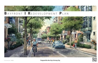
2. BAY F R O N T I RE D E V E L O P M E N T P L A N Table of Contents
SECTION 1 Description of the Plan 3 SECTION 6 Landscape Plan 177
INTRODUCTION 4 INTRODUCTION 178
STATUTORY BASIS OF THE PLAN 9 GENERAL REQUIREMENTS 179
PURPOSE OF THE PLAN 10 ILLUSTRATIVE LANDSCAPE PLAN 180
OVERVIEW OF THE PLAN 11 SUGGESTED PLANT LIST 193
GOALS OF THE PLAN 12
DEFINITIONS 13
SECTION 2 Illustrations 20 SECTION 7 Parking and Utilities 195
GENERAL PARKING 196
SHARED PARKING REQUIREMENTS 197
SECTION 3 Land Use 27 ADDITIONAL PARKING REQUIREMENTS 198
GENERAL UTILITIES REQUIREMENTS 207
LAND USE REGULATIONS 28 207
STORMWATER MANAGEMENT REQUIREMENTS
FRONTAGE REGULATIONS 31 207
WIRELESS SYSTEM REQUIREMENTS
SECTION 4 Mobility 35
SECTION 8 Legal Provisions 208
MOBILITY INTRODUCTION 35
LEGAL REQUIREMENTS 209
MOBILITY REGULATIONS 36
PLANS CONSISTENCY REVIEW 210
THOROUGHFARE OVERVIEW 37
REDEVELOPMENT PLAN IMPLEMENTATION 211
SCHEDULE AND DURATION OF THE PLAN 213
OTHER PROVISIONS 214
SECTION 5 Building Regulations 35
INTRODUCTION 67
68 SECTION 9 Acknowledgements 215
BUILDING REGULATIONS
ARCHITECTURAL REGULATIONS 138 ACKNOWLEDGEMENTS 216
13 FE B R U A R Y 2008 2
3. BAY F R O N T I RE D E V E L O P M E N T P L A N
SECTION 1 Description of the Plan
INTRODUCTION
EXHIBIT 1 BAYFRONT I REDEVELOPMENT AREA
EXHIBIT 2 BLOCK AND LOT MAP
EXHIBIT 3 CONSTRAINTS MAP
EXHIBIT 4 FAA FLIGHT PATHS MAP
STATUTORY BASIS OF THE PLAN
PURPOSE OF THE PLAN
OVERVIEW OF THE PLAN
EXHIBIT 5 LOW AXONOMETRIC
EXHIBIT 6 HIGH AXONOMETRIC
EXHIBIT 7 DEVELOPMENT PLAN
EXHIBIT 8 BLOCK IDENTIFICATION
EXHIBIT 9 SUPERIMPOSED PLAN
GOALS OF THE PLAN
DEFINITIONS
13 FE B R U A R Y 2008 3
4. BAY F R O N T I RE D E V E L O P M E N T P L A N Description of the Plan Section 1
I nt ro d u c t i o n
The Bayfront I Redevelopment Plan sets in motion the of the Redevelopment Area. These industrial and commercial citizens, residents, business owners, faculty, staff, real estate and
transformation of a key section of Jersey City’s west side. When uses are old and now represent a deleterious land use given the transit professionals, as well as the Mayor of Jersey City at the
completed the project will boast new housing, retail, office ongoing redevelopment activity in adjoining areas. Although time and the City’s planning and redevelopment staff, partici-
space, parkland and many other amenities. the Redevelopment Area is almost 100 acres, there are no streets pated in the creation of the Bayside Plan. There were also inter-
or public rights-of-way within it. As a result, the public has no views with stakeholders and a series of public meetings using a
Bayfront 1 presents a unique opportunity for Jersey City. It access to the water’s edge along the Hackensack River. Visual Preference Survey and Demographic, Market and Policy
transforms old industrial, commercial, and municipal sites into Questionnaires. Participants identified their ideas for develop-
a new pedestrian friendly urban neighborhood that will be a The Jersey City Master Plan dated May 2000 designated the ment using a charrette process called the Vision Translation
model of environmentally conscious design. Redevelopment Area for Waterfront Planned Development. Workshop. All data and input were synthesized by professionals,
The purpose of the Waterfront Planned Development District tested through multiple feedback sessions, transformed into a
The Plan emphasizes one of Jersey City’s most underused natural is to promote water-oriented commercial, residential and PowerPoint presentation and report, and presented at a well-at-
assets, the Hackensack River, with new and expanded parks, recreational uses. The intent of the District is to accommodate tended public meeting.
recreation space and a waterfront park walkway. It adopts basic new uses, while also promoting the creative reuse of large tracts
components of urban Smart Growth with a circulator bus, a light of land and providing public access to an enhanced waterfront. The Bayfront I Redevelopment Area utilizes the information pro-
rail stop, green buffers and paths for pedestrians and cyclists. The City of Jersey City later adopted a new Land Development duced by the Bayside Plan visioning process and applies plan-
New offices and residences will be built with the environment Ordinance in April of 2001. The Land Development Ordinance ning and urban design principles to realize the vision. The result
in mind, and will incorporate sustainable design standards that is in conformance with the Master Plan and also placed was recommended street and block layouts, location of linear
address renewable energy, the use of renewable materials, a the Redevelopment Area within the Waterfront Planned parks, location of a waterfront walkway, extension of the Hud-
sustainable stormwater management plan, and green roofs and Development District. son-Bergen Light rail line, land use and intensity, location of bus
terraces. The Plan incorporates two parks extending from Route and pedestrian networks, community facilities and visual and
440 to the Hackensack River as well as the continuation of the Industrial development is no longer appropriate for the spatial character, scale and form.
Riverwalk in Society Hill. The Plan shall provide affordable housing Redevelopment Area. Furthermore, the large expanses of vacant
as detailed below in Section 8 Legal Provisions, Subsection e land and antiquated municipal facilities are an underutilization The introduction, purpose of the plan, overview of the plan,
(Other Provisions). of the Hackensack River waterfront, a valuable resource. As the axonometric descriptions, and illustration descriptions provide
Jersey City Master Plan has recommended, the Area is better background information and a general synopsis but are not
Bayfront I will join west side development projects that have suited for development as a modern integrated mixed-use regulatory.
been completed, are under construction, or are expected community that provides access to an enhanced waterfront to
to be completed including recent construction at Droyers the benefit of the entire Jersey City community.
Point, residences adjacent to the west side transit stop and
the expansion of the New Jersey City University (NJCU) urban The Bayfront I Redevelopment Area is part of a larger vision called
campus located directly across Route 440 from Bayfront I. the Jersey City Bayside Development Plan. The Bayside Plan was
a collective effort by a successful partnership among state and
The Bayfront I Redevelopment Plan will regulate development city officials, academic institutions and the public. The Bayside
within the Bayfront I Redevelopment Area, which is adjacent to Plan was completed in 2003 and set the stage for redevelop-
the Hackensack River, as it meets and becomes part of Newark ment of the west side of Jersey City.
Bay. (See Exhibit 1 – Regional Context Map)
The Bayside Plan comprised 2.1 square miles or 1,344 acres. The
The Redevelopment Area has developed over time with a mixture Bayfront I Redevelopment Plan is approximately 100 acres of
of industrial, commercial and governmental uses that have since these 1,344 acres, and is fully consistent with the direction and
gone through transition and decline. Approximately 38% of vision of this broader Plan.
the area is vacant land. Another 42% is tax-exempt property
owned by various municipal agencies. The property still houses The Bayside Plan was generated through an extensive public
the remnants of an incinerator, an obsolete sewage treatment participation process sponsored by NJCU, the City of Jersey City,
facility and a public works garage and office building that are the Board of Education of the City of Jersey City and New Jer-
over 40 years old. The remaining 20% of the Area contains sey Transit, with support from faculty at NJCU, New Jersey Insti-
mostly industrial uses along Kellogg Street at the southern edge tute of Technology (NJIT), and Rutgers University. Hundreds of
13 FE B R U A R Y 2008 4
5. BAY F R O N T I RE D E V E L O P M E N T P L A N Description of the Plan Section 1
Exhibit 1
REGIONAL CONTEXT MAP
The Bayfront I Redevelopment Area is bounded by the
Hackensack River to the West, Route 440 to the East, Kellogg
Street to the South and the edge of the railroad right-of-way to
the North. The Redevelopment Area is also in close proximity to
the New Jersey City University (NJCU) Redevelopment Area and
the Route 440 South Study Area.
Hackensack River
BAYFRONT 1 REDEVELOPMENT AREA
440
NJCU
ute
Ro
Droyers Point & Society Hill
N
13 FE B R U A R Y 2008 5
6. BAY F R O N T I RE D E V E L O P M E N T P L A N Description of the Plan Section 1
Exhibit 2
BLOCK AND LOT MAP
The Bayfront I Redevelopment Area can generally be described
as consisting of all lands and water lying within the area bound
REDEVELOPMENT AREA
by Kellogg Street and the southernmost lot lines of lot 9.H on
the south, the Hackensack River to the west, the northernmost
lot lines of lots 1.E, 2.E, and portions of 2.D to the north and
New Jersey State Highway Route 440 to the east. The Bayfront
I Redevelopment Area is comprised of approximately 100 acres.
2E The Study Area consists of the following tax blocks and lots: Block
BLOCK 1290.1 1290.1 (aka Block 1290.A) Lots 1.E, 2E, 2.A, 2.D, 9.H, 9.L, 10.E, 10.H,
11.H, 11.W, 11.Y, 14.D, 14.H, 14.J, 17, 18, 19, 16A.99, and 20.
1E
The boundary of the Study Area is depicted on the adjacent map
and any land area within the boundary that is not listed in the tax
2D lot enumeration in the first paragraph of this section is intended
to be included within the Study Area. Due to potential errors in
tax lot enumeration, the map takes precedence to determine
which properties are in the Area that is the subject of this Plan.
2A
14J
11W
11Y 16.A99
9L
11H
9H KE 17
LL
OG 14D
G 14H
ST
440
18
UTE
RO
19
20
10E
N 10H
100’ 400’ 800’
0’ 200’
13 FE B R U A R Y 2008 6
7. BAY F R O N T I RE D E V E L O P M E N T P L A N Description of the Plan Section 1
Exhibit 3
CONSTRAINTS MAP
This Map shows the multiple constraints on the Study Area.
Included are:
• The four underground barrier walls surrounding SA7.
These walls encompass an area of approximately 34
acres.
• The Flood Zone AE created primarily by high tidal
overflow.
• The major sewer lines and force mains, the JCMUA pump
station, and the grit chamber.
• The JCMUA 96” Combined Sewer Overflow (CSO) pipe.
SA 6N
Pump Station
Grit Chamber
SA 7
SA 6S LEGEND
440
UTE
Major Sewage and/or
CSO Pipes
RO
Slurry Walls
Flood Zone AE
Flood Zone AH
N
100’ 400’ 800’ Proposed Buildings
0’ 200’
13 FE B R U A R Y 2008 7
8. BAY F R O N T I RE D E V E L O P M E N T P L A N Description of the Plan Section 1
Exhibit 4
FAA FLIGHT PLAN MAP
This map illustrates the Newark International Airport FAR Part 77
airspace surface, the primary flight path to the eastern approach
to the airport. The highlighted area indicates the least used
approach for landings and take-offs for the airport. The Area is
BAYFRONT I located north of the limits. As such, structures in the Area will not
penetrate the Part 77 airspace. Nevertheless, a general airspace
REDEVELOPMENT review is required: structures within the Area would have to
AREA exceed 300’ to be at issue. Any structure over 150 feet in height
would benefit from obstruction lighting.
NEWARK EWR FAR
LIBERTY PART 77
INTERNATIONAL AIRSPACE
AIRPORT
(EWR)
N
Miles
0 0.25 0.5 1
13 FE B R U A R Y 2008 8
9. BAY F R O N T I RE D E V E L O P M E N T P L A N Description of the Plan Section 1
Statutor y Basis of the Plan
The Municipal Council of the City of Jersey City, by way of
Resolution 06-319, adopted on April 26, 2006, authorized the
Jersey City Planning Board to:
1. Conduct a preliminary investigation of the
physical and economic conditions of an area
known as the Bayfront I Study Area, (hereinafter
the Study Area) to determine whether or not
this Study Area meets the statutory criteria
necessary to be declared an “Area in Need of
Redevelopment” as outlined in NJSA 40A:12A-5
and NJSA 40A:12A-6; and
2. Propose a Redevelopment Plan for this
Study Area if it is found to be in Need of
Redevelopment.
13 FE B R U A R Y 2008 9
10. BAY F R O N T I RE D E V E L O P M E N T P L A N Description of the Plan Section 1
Pur p o s e o f t h e P l a n
The purpose of this Plan is to set forth the terms and conditions
under which the Bayfront I Redevelopment Area may be
redeveloped by a designated Redeveloper(s). The Plan describes,
among other regulations, the basic cityscape requirements
and recommendations. The Mobility Regulating Plan includes
the design of the streets and circulation network; the Land
Use Regulating Plan includes the layout of mandatory and
recommended uses, including retail, residential, and office;
the Building Regulating Plan includes the general massing,
build-to-lines, and height limitation of buildings and illustrates
the suggested building style, character, and streetscapes. The
Architectural Standards describe the character of the buildings.
The Landscape Plan includes the landscape and streetscape
requirements and open space programming and design.
The physical components of the Plan are both written and
illustrated using a form-based code. This type of code is the most
appropriate to assure the highest visual and spatial quality of city
design. It assures that the Redevelopment Entity can expect a
redevelopment of superior quality that will complement the
existing character of the City and have a long term positive
fiscal and aesthetic impact on residents and businesses in the
area and Jersey City. It further assures a high level of market
flexibility to assure that the Redeveloper(s) can build and market
a superior product that is financially feasible, while maintaining
architectural design flexibility within an urban context.
The Bayfront I Redevelopment Plan can fulfill the role of
capitalizing on these under utilized brownfield sites while
promoting green urban design that provides the pedestrian
friendly environment necessary for high quality mixed-use
residential/commercial buildings and parking while bringing a
new street life to this area. When developed, the Plan will add
market-rate housing and affordable housing, expand the range
of retail, office, and live-work, and provide a catalyst for future
redevelopment in adjacent areas.
13 FE B R U A R Y 2008 10
11. BAY F R O N T I RE D E V E L O P M E N T P L A N Description of the Plan Section 1
O ver view o f the Plan
The proposed Bayfront I redevelopment is mixed-use in nature. will discourage typical “big box” retailers from the project; how- environment surrounding the pedestrian with an understanding
There are three main components of the Plan: residential, retail, ever it will encourage anchor stores incorporated into the major of the human scale and respect for varied building, street, and
and commercial. Because the Plan will be market driven, the fo- pedestrian streets at key major intersections. open space design, as well as architecture. The Plan employs
cus is on maximum flexibility without compromising the identity these concepts to create a network of pedestrian friendly streets.
of the Plan. Therefore the Plan has a capacity range for all types The Plan also contains several recreational uses. The project will By orienting the retail buildings with minimal, if any, setbacks from
of development. However, it is important to note that the street contain two linear parks running the depth of the site from Route the sidewalk edge and requiring a semi-public edge with wide
network, parks/open space, and development block configura- 440 on the east to the Hackensack River on the west. Along the sidewalks along the residential edges, the proper relationship of
tion plans will not change except as provided in the Mobility Hackensack River a proposed Riverfront Park for would provide the building edge to the sidewalk will be created. The pedestrian
Section and Legal Provision Section in this plan. What is dynamic views and recreational access to the river. In addition, the river- realm will be enhanced with crosswalks and tree-lined sidewalks.
about the Plan is the flexibility in density and the options of uses front walkway will be continued from the Droyers Point project The envisioned transit plaza will be within walking distance of all
at various locations. The capacity of the Plan is dynamic with a along the Hackensack Riverfront to the adjacent property to the residents. Depending upon the development scheme, parking
development program given in terms of minimums and maxi- north. is planned to be embedded within the blocks, enhancing
mums. walking experience. Local retail will be strategically located for
The development will also include a pedestrian street beginning convenience.
Residential: at the proposed light rail stop at the north of the site and con-
Min. 4,200 units* Max. 8,100 units* tinuing down to Droyers Point at the south. The Pedestrian Way The Plan intends to create well proportioned and human scaled
Office: will be the retail focus of the Plan using the model of the tradi- buildings and streetscapes through the use of build-to-lines,
Min. 700,000 s.f* Max. 1,000,000 s.f* tional European market street. step-backs, building heights, identifiable building modules,
Retail: bay spacing, cornice treatment, architectural land marking of
Min. 250,000 s.f* Max 600,000 s.f * Transit and personal mobility is a major focus of the Plan. This corners, aesthetic street proportions, and a dynamic palette of
Parking: will be a highly walkable neighborhood that is served by the materials and complementary urban landscaping.
Min. 7,000 spaces Max. 12,000 spaces* envisioned Hudson Bergen Light Rail, with a proposed station
*These numbers are estimates for the expected range of devel- at the northern plaza. Extending the Hudson Bergen Light Rail This Plan focuses on transforming old industrial, commercial,
opment to the site is a significant opportunity, providing a station for an and municipal sites into a new mixed-use urban neighborhood
easy commute to the business centers of Jersey City and New that will be a model of environmentally conscious design.
Residential units are recommended to be a mix of flats, 2-story York City. In fact, the residential, commercial and retail densities The Plan focuses on building a community appropriate to the
duplexes, and live-work units ranging from studios, 1, 2, and 3 contemplated in this plan are contingent on achieving the light location while adopting the principles of Smart Growth, Transit-
bedrooms of various ownerships and tenures including, condo- rail extension noted above. Furthermore, another key enabler to Orientation, Green Design and Buildings, LEED® Certification,
miniums, co-ops, and rental units. The result is the creation of the densities in this plan, as well as to support general growth walkability, and sustainability.
flexibility that will respond to future market demand. contemplated on the Jersey City west side area is a significant
upgrade of the local roads and Route 440 infrastructure.
The commercial office component of the project is integrated
into the concept of sustainability in that jobs will be provided The site will also have a secondary transit system by way of a
within the project boundary to promote a jobs-to-housing bal- circulator bus that may ultimately connect Droyers Point, NJCU,
ance, if desired. The end type commercial user will include, but and multiple locations throughout the site to the Light Rail stop.
not be limited to, general offices (e.g., law firms, accountants, Finally, a bicycle network along the streets is included as a part
architects, artist studios, and other small businesses), financial of this plan.
groups, and service businesses and professionals such as doc-
tors and health practitioners. Unless the market can support Although the Area has several design constraints, the site
large space tenants, most, if not all, of the commercial space will affords an opportunity for innovative thinking and design.
be for smaller end users. Mitigating existing brownfields affords the opportunity not only
to remediate the sites but to create one or more completely
The Plan suggests commercial retail end uses will include, but sustainable “green” urban neighborhoods on the growing west
not be limited to, coffee shops, restaurants, bars, clothing stores, side of Jersey City.
bookstores, newsstands, boutique retail, banks, grocery stores,
and other common uses exhibited in downtowns. The project The focus of the Bayfront I Redevelopment Plan is to regulate the
13 FE B R U A R Y 2008 11
12. BAY F R O N T I RE D E V E L O P M E N T P L A N Description of the Plan Section 1
G o a l s a n d O b j e c t i ve s o f t h e P l a n
Redevelopment Goals fabric and streetscape. Redevelopment Objectives
By adoption of this Bayfront I Redevelopment Plan, the City of K. Provide market-value housing and commercial and The Bayfront I Redevelopment Plan addresses the need for
Jersey City seeks to accomplish the following goals: retail development through new construction of redevelopment in the Bayfront I Redevelopment Area through
mixed-use buildings. the following objectives focused on the goal of transforming
A. Eliminate underutilization of the designated Area L. Encourage more people to take up permanent the Redevelopment Area into a vital part of the Jersey City
and its blighting influences. residence within Jersey City while minimizing community, full of activity both day and night:
B. Maximize the advantages provided by the Hudson- negative effects on the surrounding environment
Bergen Light Rail and other mass transportation through both the construction of green buildings 1. Replace vacant, contaminated industrial uses in the
resources thereby becoming a transit-oriented and reduction of resident dependence on the southern portion of the Area and city owned land to
development. automobile for daily travel. the north with newly redeveloped sustainable mixed-
C. Allow for more efficient use of land and to expand M. Design buildings for modern, sustainable, mixed- use residential and commercial projects, offices, and
the City’s tax base by encouraging high quality uses. a variety of other uses that will be new to the City.
mixed-use development. N. Create mixed-use buildings, parks, plazas, This redevelopment will create a fully sustainable,
D. Create a new sustainable community utilizing streetscapes, and pedestrian realms that will act as a environmentally friendly community on the west side
modern green technology and adopting LEED focus area for the west side of Jersey City. of Jersey City. This will address criteria (a) and (d) of the
principles for neighborhoods and buildings O. Provide for additional urban green spaces through Local Redevelopment and Housing Law (LRHL).
throughout the Area. linear parks, plantings, tree-lined streets, and other 2. Assemble City owned properties with privately
E. Expand the level of residential and commercial open space amenities. owned lots in the Redevelopment Area into larger
activity in the Area, thereby increasing the potential P. Utilize and improve the existing water edge as an redevelopment parcels to enable the construction of a
for economic activity and job creation. amenity in the Plan. densely populated mixed-use urban neighborhood that
F. Maximize the participation of private investment. Q. Create opportunities for shared parking to reduce will benefit from Jersey City’s extensive transportation
G. Create a well planned and designed development overall parking needs. network, concentration of employment, and growing
area which will provide opportunities for mixed- R. Maximize energy savings through the use of cultural and entertainment venues. Such redevelopment
use, retail, multi-family residential, entertainment, green building methods, compact design, and activities will address the conditions found under criteria
recreation, permanent employment, and commercial walkability. (e) of the LRHL.
facilities within an area that is currently underutilized S. Promote a city with activity day and night, every day 3. Contain parking within structured parking decks or
but has the potential for sound development that of the week. underground parking integrated into mixed-use and
will improve quality-of-life and the visual and spatial T. Provide a clearly articulated and rationally designed residential uses. Structured parking will not consume
character of Jersey City. open space system consisting of green parks and large tracts of land zoned for intensive development
H. Provide a system of sidewalks, crosswalks activity-driven plazas. while creating a more pedestrian-friendly, walkable
streetscapes, landscapes and building wall area.
treatments at the ground level that encourage a The goals set forth are intended to be broad, general policy 4. Implementation of the Redevelopment Plan will address
safe, engaging, and pedestrian-friendly experience statements. While it is possible that specific aspects of the Plan conditions found under criteria (e) of the LRHL.
that will enhance walkability while increasing the may result in some variation or deviations from these goals, it
amount of accessible green space in Jersey City. is intended that the overall result of the implementation of this
I. Provide for the creation of places and pedestrian Plan will be consistent with the goals as set forth above.
realms which promote pedestrian activities, social
interaction, and citizen security.
J. Implement developments where the physical,
spatial, and visual characteristics are established
and reinforced through the consistent use of streets,
architectural design, and urban components. Such
components should relate the design elements
of individual structures or development to other
planned or existing structures or development in a
seamless manner, resulting in a coherent overall city
13 FE B R U A R Y 2008 12
13. BAY F R O N T I RE D E V E L O P M E N T P L A N Description of the Plan Section 1
D ef in itio n s
Definitions contained herein shall prevail within the street where public access to the building(s) is available. is determined by desired design speed. Interim Uses - A temporary use before the final Redevelopment
Redevelopment Area. For definitions not contained herein, the Plan implementation.
definitions contained in the City of Jersey City Zoning Ordinance Building Height – The vertical extent of a building measured in Developable Area – The allowable building footprint of the
shall prevail. stories, not including a raised basement or a habitable attic. Height ground floor of the building. It is within this designated area on LEED-NC (Leadership in Energy Efficient Design-New
limits do not apply to masts, belfries, clock towers, chimney flues, the specific parcel that the building can be located. Construction) – Green building standards developed by the U.S.
The following definitions are provided as examples. Additional water tanks, elevator bulkheads and similar structures. Building Green Building Council (USGBC)
definitions may be added. Terms that are already defined within heights shall be measured from the average finished grade of Development – The division of a parcel of land into two or more
the Municipal Land Use Law, the Jersey City Redevelopment the fronting thoroughfares. parcels, the construction, reconstruction, conversion, structural Live-Work – A dwelling unit that contains a commercial
Agency, or the Jersey City Land Development Ordinance need alteration, relocation, or enlargement of any building or other component. The commercial component can be located
not be redefined here. Capacity – The maximum and minimum projected residential structure, or of any excavation or landfill, and any use or change anywhere within the unit but is typically located on the ground
units, retail, and office square footage. in the use of any building or other structure, or land or extension floor connected internally with a stair to a residential unit.
Area – Shall mean the Bayfront I Redevelopment Area. of use of land, for which permission may be required pursuant
Cartway – The paved area of a street between the curbs, including to the “Municipal Land Use Law,” P.L. 1975, c.291 (C.40:55D-1 et Mandatory Standards – Phrases or sentences that contain the
Bay – The distance between structural elements of a building travel lanes and parking areas but not including shoulders, curbs, seq.). following words: require, must, and shall.
that is reflected on the facade of a building. A division of a façade sidewalks, or swales.
of a building into distinctive vertical compositions. Typically bays Duplex – A unit within a multifamily building that has two or Manufacturing Operations – Any business that engages in the
are based on the structure of a building, but can also be created City – The City of Jersey City, New Jersey. more floors stacked one above the other, accessed with a private making of goods or wares by manual labor or by machinery.
through design treatment of the façade. internal stairway.
Cityscape – The urban equivalent of “landscape,” referring to the Mixed-Use Building – A building with a variety of complementary
Block – The aggregate of one or more private lots in total or configuration of built forms and interstitial space. Elevation (drawing) – The exterior walls of a building. An and integrated uses, such as, but not limited to, residential, office,
segmented, passages, real lanes or alleys, circumscribed by elevation drawing includes material, rendered window and door retail, public, or entertainment, in a compact urban form.
thoroughfares. Context – The particular combination of elements that create openings, height and facade details. See Facade.
specific habitat. Context includes building use, density, height Non-Mandatory Provisions – Provisions expressed by the words,
Block Area – The block area is measure from the edge of the and setback, and other elements of the intended habitat, Encroachment – An area beyond the build-to-line that certain including but not limited to, may, should, recommended,
sidewalk or lot line. including those of the private lot and building as well as those of building elements can protrude. The encroachment distance is encouraged, proposed, typical, allowed, approximately, or the
the public streetscape. typically expressed in feet. like.
Block Face – The aggregate of all the building facades on one side
of a block. The Block face provides the context for establishing Corridor (Urban) – A linear geographic area incorporating Façade – any vertical, exterior face or wall of a building. Open Space – Any sidewalk, park, public plaza, water feature,
architectural harmony buildings typically on both sides of the street including the courtyard, or similar area that is open and unobstructed from its
pedestrian realm all in proper proportions to create a sense of Flat – A unit on one level in a multifamily building. lowest level to the sky.
Brownfield – any former or current commercial or industrial site street space.
that is currently vacant or underutilized and on which there Floor Area – The sum of the gross area of all floors of a building Parking Space – An area not to exceed nine (9) feet in width
has been, or there is suspected to have been, a discharge of a Curb – The edge of the vehicular pavement detailed as a raised or buildings, measured from the exterior face of exterior walls or by eighteen (18) feet in depth (except handicapped spaces),
contaminant (NJSA: 58: 10B-23.d) masonry step. The Curb usually incorporates the street drainage from the centerlines of common walls separating two buildings, either within a parking structure or a surface lot, for the parking
inlets. but excluding mechanical rooms and areas, parking areas, and of motor vehicles, exclusive of driveways, access drives, fire lanes
Build-to-line – A build-to line is a line to which the primary vertical access and movement areas such as elevators, escalators and public rights-of-way. Parking spaces and lots must meet
facades of a building must be located. The build-to-line allows Deed Notice - shall mean any Deed Notice (formerly known as and stairways. ADA requirements.
flexibility to the articulation of the façade allowing the façade to Declaration of Environmental Restrictions) given by Redeveloper
deviate in limited increments from this line. in favor of NJDEP in connection with the environmental Green Roof – a roof of a building that is partially or completely Parkway, Residential – The area between the curb and the
remediation of any portion of the Bayfront I Redevelopment covered with plants that can be used to retain stormwater, as sidewalk into which street trees are planted and which typically
Buildable Area – The total area of the block minus the area of the Area and recorded in the Office of the Hudson County Register. well as for recreation (both passive and active). See Section 5 for has a planted ground cover.
public right-of-way (sidewalk). The buildable area includes the further detail and specifications.
semi-public edge, as porticos, stoops, and fences may extend Design Speed – The velocity at which a thoroughfare tends to be Parkway, Mixed-Use/Commercial – The area between the curb
into this area. driven without the constraints of signage or enforcement. There Identifiable Building Widths – A subdivision of a linear facade to and building into which street trees, decorative lighting, and
are four ranges of speed: Very Low (below 20 MPH); Low: (20-25 look like a series of adjoined buildings. street furniture are located. The sidewalk extends from the curb
Building Frontage – Building elevation that fronts on a public MPH); Moderate: (25-35 MPH); High (above 35 MPH). Lane width to the building. Typically, trees are planted in the first four (4) to
13 FE B R U A R Y 2008 13
14. BAY F R O N T I RE D E V E L O P M E N T P L A N Description of the Plan Section 1
D ef in itio n s
six (6) feet. Traditional Neighborhood Development (TND) - A community
Semi-Public Edge – The yard area in front of a residential unit type consisting of one or more pedestrian sheds plus a mixed-
Pedestrian Shed, Primary – An area defined as a five minute walk defined by a low fence and/or gate through which a person use center
or approximately ¼ mile from a center or transit station. must pass in order to gain access to the front primary entrance.
Semi-public edges are also typically located in front of smaller Transit Oriented Development (TOD) - A Regional Center
offices. Development with more intensive office, retail, service and
Pedestrian Shed, Secondary – A distance defined as a 10 minute residential uses within one primary and one secondary pedestrian
walk or approximately ½ mile from a center or transit station. Setback – The required horizontal distance, measured in number shed that focuses on a transit or train station.
of feet, that the build-to-line is stepped inward beyond the
Plan – Shall mean the Bayfront I Redevelopment Area Plan. property line. Setbacks are used in order to create the proper Utility - Water, sewage, telecommunication, gas or electric service
space and scale for the pedestrian realm. from a private or public utility company or service provider.
Planting Strip – The area between the curb and the edge of the
sidewalk that allows for vegetation to grow (soil can not be com- Sidewalk – The paved layer of the public frontage dedicated Urban Village - A TND type within an urbanized area consisting
pacted in this area). exclusively to pedestrian activity. of one or more pedestrian sheds plus a mixed-use center, or
pedestrian street and plaza.
Portico – A smaller porch often leading to the entrance of a Stepback – The horizontal distance, at a given building story
building with a roof supported by columns; extends no more above the first floor, that the building façade is stepped inward Zone (or District) - A specifically delineated area or district in a
than 2 feet from the building façade. beyond the vertical plane of the first floor façade. Stepbacks municipality within which uniform regulations and requirements
are used in order to allow buildings to have appropriate height govern the use, placement, spacing, and size of land and
Property Line – Edge of the right-of-way and/or edge of a lot on while reducing the bulk and obstruction of natural light in the buildings. These terms may be used interchangeably.
a block. pedestrian realm.
Public Realm – Shall mean the areas that are both used and seen Story – The height of the space between floors of a building
by a person walking. measured from the floor on one level to the floor on the above
or below level. Story heights vary from 8 to 20 feet.
Redeveloper – Any person, firm, corporation or public body
that shall enter into or propose to enter into a contract with a Street – A throughway that has emphasis on both vehicular and
municipality or other redevelopment entity for the redevelopment pedestrian movements.
or rehabilitation of an area in need of redevelopment, or an area
in need of rehabilitation, or any part thereof, under the provisions Streetscape - The streetscape is comprised of thoroughfares (
of the LRHL, or for any construction or other work forming part travel lanes for vehicles, and bicycles, parking lanes for cars and
of a redevelopment or a rehabilitation project. sidewalks or paths for pedestrians) as well as the visible private
frontages( building facades and elevations, porches, stoops, yards,
Redevelopment Area – Shall mean the Area detailed in the fences awnings etc.) and the amenities for the public frontages (
description of the Redevelopment Area in Exhibits 1 and 2. street trees and plantings, benches, streetlights, etc.).
Redevelopment Entity – Shall mean the Jersey City Streetwall – The elevations of buildings that when seen from the
Redevelopment Agency (JCRA) or designated entity. street or sidewalks seem to enclose the space.
Redevelopment Plan – The Bayfront I Redevelopment Plan. Terrace – A space extending out from the ground floor of a build-
ing to the edge of the sidewalk over the semi-public edge that
Right-of-Way (ROW) - The area on, below, or above a public can be used for a continuous walkway or exterior retail.
roadway, highway, street, cartway, bicycle lane, and sidewalk
in which a governmental unit has an interest, including other Tower – A building above 12 stories in a square or more
rights-of-way dedicated for travel purposes and utility easements rectangular shape with a central core for vertical circulation.
of governmental units.
13 FE B R U A R Y 2008 14
15. BAY F R O N T I RE D E V E L O P M E N T P L A N Description of the Plan Section 1
Exhibit 5
MINIMUM DEVELOPMENT AXONOMETRIC
Two axonometric site plans (see Exhibits 5 and 6) illustrate the
building massing with the various floors expressed with a horizontal
line. They illustrate an interconnected network of streets, efficient
development blocks, varied open space and parks, and a Pedestrian
Way connecting the transit plaza to Droyers Point. The “low” and
“high” axonometric plans illustrate the variation of the maximum
and minimum development programs, translated into building
heights.
The Site Axonometrics are a valuable tool to visualize the location
of buildings, the streetscape, and the pedestrian realm and open
space at the various intensities of development. Actual building
forms may vary in their design, but the key elements of the Site
Axonometrics, such as building locations, new street network,
enhanced pedestrian realms, land devoted to open spaces and
plazas, and the careful massing of structures to provide both
architectural interest and appropriate levels of light and air should
substantially conform to these site plans. Deviations are expected
and allowed provided that the primary features of the Plan remain,
including the grid of streets and the linear parks and plazas.
It is the desire of the Plan that flat roofs and terraces be “green”, i.e.
covered with vegetation and accessible, thereby enhancing the
ecological appeal, decreasing impervious surface and therefore
stormwater runoff, lowering heat and energy costs, and reducing
urban heat island effect. In addition, a nominal 20% of the site will
be used for vegetated open space utilizing native and adaptive
vegetation to create a harmonious natural environment.
The Bayfront I Redevelopment Plan can fulfill the role of capitalizing
on underutilized brownfields while promoting green urban design
that provides the pedestrian friendly environment necessary for high
quality mixed-use residential/commercial buildings and parking
while bringing a new street life to this area. When developed, the
Plan will add market-rate housing and affordable housing, expand
the range of retail, office, and live-work, and provide a catalyst for
future redevelopment in adjacent areas.
Depending on market conditions, the Plan can accommodate
a range of densities and square footage of uses. The intention of
the Plan is to create a balanced, mixed and multiple use urban
neighborhoods where people can live, work, shop, and recreate.
The following is an estimated range of uses expressed in minimums
and maximums:
Retail
The plan ranges from a minimum of 250,000* square feet to a
maximum of 600,000* square feet.
13 FE B R U A R Y 2008 15
16. BAY F R O N T I RE D E V E L O P M E N T P L A N Description of the Plan Section 1
Exhibit 6
HIGH DENSITY AXONOMETRIC
Office
The plan proposes dedicated office buildings along with mixed-use
buildings and live-work space. Office space ranges from 700,000*
square feet to 1,000,000* square feet. Larger offices greater than
15,000 square feet are permitted and encouraged along Route
440 frontage and in the signature Transit Plaza building. Along the
Pedestrian Way second through fourth floor offices of the same
type are allowed up to 5,000 square feet.
Housing
The plan proposes a minimum of 4,200* to a maximum of 8,100*
units, calculated with an average unit size of 1,200 square feet,
including interior circulation. This provides a range of housing
square footage from a low of approximately 5,000,000 square feet
to a high of 10,000,000 square feet.
Parking
The Plan proposes on-street parking, partial below ground parking,
above ground embedded parking structures, and stand alone
parking structures. The plan proposes a minimum of approximately
6,000* spaces for the lower density plan with a maximum of
approximately 10,500* with embedded parking for the higher
density plan. On-street parking remains similar for both plans with
approximately 600 spaces.
Special Use Buildings
There are several special use buildings proposed in the Plan. The
Plan sets aside approximately five (5) acres of land for the Municipal
Utilities Authority (MUA). The MUA site will contain several buildings
to house facilities necessary for the operation of the MUA, but may
also provide space for a police substation, a fire station, and a public
library. The second special use is proposed to hold a K-3 elementary
school, possibly housed within a mixed-use commercial and
residential building.
*These numbers are estimates for the expected range of
development.
The minimum development plan represents most of the buildings
at four-over-one (four-stories of wood construction over one
concrete bay level) with parking located under the building. The
taller buildings surround the transit plaza.
The maximum development plan buildings range from eight to
twelve stories with embedded parking. The taller buildings are lo-
cated along the riverfront with a signature mixed-use building at
the transit plaza.
13 FE B R U A R Y 2008 16