Neil Coyne and Anthony Jones - Data collection and presentation tools in real life situations - now and in the future
•
1 recomendación•191 vistas

RSK - a live demo was included as part of this presentation

Recomendados
Recomendados
Más contenido relacionado
La actualidad más candente
La actualidad más candente (20)
Similar a Neil Coyne and Anthony Jones - Data collection and presentation tools in real life situations - now and in the future
Similar a Neil Coyne and Anthony Jones - Data collection and presentation tools in real life situations - now and in the future (20)
Más de IES / IAQM
Más de IES / IAQM (20)
Último
Último (20)
Neil Coyne and Anthony Jones - Data collection and presentation tools in real life situations - now and in the future
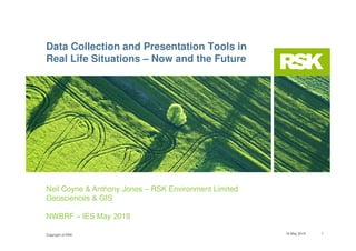
- 1. Copyright of RSK 16 May 2019 1 Neil Coyne & Anthony Jones – RSK Environment Limited Geosciences & GIS NWBRF – IES May 2019 Data Collection and Presentation Tools in Real Life Situations – Now and the Future
- 2. Copyright of RSK Outline of presentation • Overview of project • Site works • Timeline and data gathering • Data collection – tablet based data collection – Why? • Data analysis – what to do with the data? • Presentation of information • Deliverables 16 May 2019 2
- 3. Copyright of RSK Background to project • A former oil blending and grease manufacturing plant at Birkenhead docks had been active for over a 100 years and mothballed in early 2000 with all structures remaining • Client required redevelopment of the former oil manufacturing and distribution facility for future commercial opportunity however significant challenges present including oil, asbestos, drainage, structures, concrete, weak soils • RSK assisted in verification and validation of programme of removal and treatment of hydrocarbon impacted soil, treatment of residual oil and removal of hard points (such as existing foundations and pipes) within top 1m of surface • Staged approach to site works due to funding, timescale and commercial pressures. The works originally started in Summer 2014 and completing in Spring 2017. 16 May 2019 3
- 4. Copyright of RSK 16 May 2019 4 Site Photograph 1925
- 5. Copyright of RSK Site works and timescale 2014- 2017 • Site works commenced in 2014 – demolition and site investigations • Environmental risk assessment by RSK in agreement with key stakeholders such as landowner, regulators, client team, council • Slab removal and oil / water treatment during earthworks • Approximately 1 year hiatus due to commercial decisions • Recommenced works in 2016 with selective area assigned to be ‘remediated’ due to future commercial interest • RSK assessed site area and provided contamination contour plans for most heavily impacted areas to be remediated • Decision to use data capture and reporting via web based applications to record and verify the site works – bio remediation of soils and treatment of impacted water over five month window during winter of 2016/2017 • On site supervision and provision of verification data - how did we do it? 16 May 2019 5
- 6. Copyright of RSK How to collect and record the data Remediation project of a former oil depot with contaminated groundwater and soil – so what’s different? Nothing – so why a different approach? RSK reviewed the options and considered that given the complexity of the site that a more holistic and integrated approach was required: • What information do we want? • Why do we want it? • How to get it? • What is the best way of recording the data? • What have we always done previously? • Are there any new ways to do this? Yes • What does the client want? – Answers / remediated site! In essence we needed to attend site, take notes, record all information / activity, take validation samples where necessary and then provide the client and client team with a report detailing the activity undertaken. 16 May 2019 6
- 7. Copyright of RSK Changing the way we access data 16 May 2019 7 • ArcGIS Online - Cloud environment for hosting and sharing GIS data • Data shared to web portal and added to project group • Group hosts web maps specific to project and made available to selected users • Data accessible via web browser or variety of apps (IOS, Android and Windows) • Live data shared between apps • Multiuser access and editing • Collaborative working and improved communication
- 8. Copyright of RSK Collector for ArcGIS – Map based data collection 16 May 2019 8 • Free on app store. Paid username required • View, edit and collect data at your location • Customised data entry • Drop down lists and default entries • View intangibles – protected areas, proposals etc. • Access to variety of base maps in the field • Attach images/photos to data • Track surveyors location – 4G for live tracking • Go offline • Live field data synced can be accessed in the office and in other apps Highlights can be in colour.
- 9. Copyright of RSK Collector App 16 May 2019 9
- 10. Copyright of RSK Works recommenced 2016 Following commercial uncertainty in 2015, things stated to look better in 2016, so with: • Financial and time pressure • Funding requirements • Commercial requirements • Political constraints • Client/ consultant/contractor relationship After all this, button was pushed to move forward 16 May 2019 10
- 11. Copyright of RSK Derivation of most impacted areas An intensive program of trial pitting was undertaken prior to remediation, soil samples were collected from the trial pits and these combined with visual and olfactory reports were input into surfer and used to plot contamination as shown opposite. The site was then split into 25m by 25m grid cells and the locations (cells) with the highest concentration of hydrocarbons were designated for ex-situ soil bio-remediation. 16 May 2019 11
- 12. Copyright of RSK Harsh realities of data collection in Winter! “I feel it must be said that the RSK ladies we have on site are doing a sterling job. Considering the fact that over the last few days particularly the weather has been bitterly cold here at Mobil with a wind chill of -40 C at some points and they have not complained once and just got on with the task in hand. I have men working on the site who complain more about the cold!!” Email from Demolition and Earthworks Contractor “Wow in 30 years of working with contractors I have never received such a complimentary note. Definitely an email to frame!” Comments from RSK Director 16 May 2019 12
- 13. Copyright of RSK Upload of additional surveys – Sonar Survey of Dock Wall (showing features) 16 May 2019 13
- 14. Copyright of RSK Drone survey of final site conditions (2017) 16 May 2019 14
- 15. Copyright of RSK Deliverables... • The large volume of data was presented to the client as a ‘Story Map’ – a new type of interactive presentation showing the work undertaken and how to query it online • The ‘Story Map’ includes all chemical data, plus other data gathered such as the Geophysical survey, Sonar survey, Drone survey • The ‘Story Map’ can be accessed around the world through designated login details 15
- 16. Copyright of RSK To conclude site works Throughout the project innovative technological techniques were used to demonstrate the progression of the works and to display effectively in GIS the large volume of data collected. In total 100 m3 of LNAPL was removed, over 1000 m3 groundwater treated and 5000 m3 of soil bio- remediated. Data Points collected on the collector app 16
- 17. Copyright of RSK The Future • Complex survey forms using Survey123 • 4G tablets for H&S; • Track surveyor location for lone working • Digital H&S forms • Dashboards and story maps for data visualisation • 3D scenes; • Below ground modelling • Sub-metre accuracy using external GNSS receiver • Make greater use of tablets; • Word and excel apps available, Free CAD viewers 17
- 18. Copyright of RSK 16 May 2019 18 Thank you for listening!
- 19. Copyright of RSK 16 May 2019 19 Q & A