
Recomendados
Recomendados
Más contenido relacionado
Destacado
Similar a Most Recent Downtown Flushing Powerpoint
Similar a Most Recent Downtown Flushing Powerpoint (20)
Most Recent Downtown Flushing Powerpoint
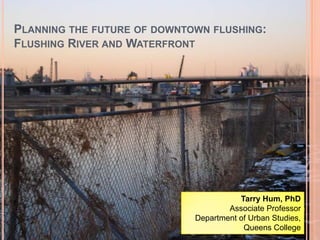
- 1. Planning the future of downtown flushing: Flushing River and Waterfront Tarry Hum, PhD Associate Professor Department of Urban Studies, Queens College
- 2. Who we are Alex Doulaveris Audra de Falco Jean Kapanoff Sean M. Dalpiaz Regina Fojas SooJi Lim MuneebaTalukder Nataly Rojas In association with: The MinKwon Center for Community Action
- 4. Met with the stakeholders
- 5. Worked side by side with the Min Kwon Center Community Organizers
- 6. Conducted land-use, small business, and residential surveys
- 7. Researched in and out of the classroom, personally and in a group setting
- 8. Studied Research MethodsA diverse student body invested in the future of Downtown Flushing, studying what new development will mean for the entire community. Our goal is to promote awareness of redevelopment to community members, organizations, and others involved in or affected by the redevelopment process to ensure that all community members’ voices are heard.
- 10. In a valley that was a large riverbed before the last Ice Age divided Queens into an Eastern and Western half. The Flushing River in 1891. The landscape appears almost identical since the last Ice Age. Source: http://www.mazeartist.com/flushingriver.htm
- 11. The source of the Flushing River was located in Kew Gardens Hills, once called the Head of the Vleigh by the Dutch. The Queens Valley Exchange: where the Grand Central Expressway, the Van Wyck Expressway, Union Turnpike and the Jackie Robinson Parkway meet. The (now defunct) source of the Flushing River Source: http://www.mazeartist.com/flushingriver.htm The Flushing River predates the Pleistocene Ice Age, a period from between 2. 6 million to 12,000 years ago. At that time, the Hudson River flowed into the Atlantic Ocean via the Harlem River and Flushing River streambeds.
- 13. No sidewalks, public lighting, and garbage removal along Willets Point Blvd.
- 14. Before 1930, one could cross the Flushing River from Flushing to Willets Point in two ways: Drawbridges and …?
- 15. Today, the Roosevelt Avenue Bridge and the Northern Boulevard Bridge. Serve this function.
- 16. However, walking over these bridges is not pedestrian friendly. Lack of Roads and Infrastructure in Willets Point Source: forgotten-ny.com
- 18. To ease travel between the Western and Eastern part of Queens, the Flushing River was cut off from connecting bodies of water.
- 19. The river was drained into the Flushing Meadows-Corona park.Post 1939 map of Queens. Source: http://macaulay.cuny.edu/eportfolios Plans for the Flushing Meadows Park cut off a section of unused land. It is now known as Willets Point and seriously neglected by the city.
- 20. Industry Along the Flushing River When Flushing was mainly a residential area, the river was used for recreation and transportation. Flushing’s accessibility by rail and road, as well as the construction of the World’s Fair, drew manufacturers to the area in the mid 20th century. Flushing River around 1890, south of Northern Boulevard. To the right is Wahnetah Boat Club. Credit: http://www.forgotten-ny.com/STREET%20SCENES/flushing/oldflushingriver.jpg
- 21. Industry Along the Flushing River The area around the Flushing River was re-zoned in 1998 to accommodate mixed and commercial land use. Today, the Flushing River waterfront is still home to some manufacturers. Concrete barges account for most of the traffic on the river. The Flushing River at present. Just north of Northern Blvd., one can see concrete plants and their barges along the river. Credit: http://www.forgotten-ny.com/STREET%20SCENES/flushing.river/42.flushriver3.jpg
- 22. Current Conditions of the Flushing Waterfront Flushing River is polluted and gives off a foul smell. Few pedestrians seen on severely weathered sidewalks. The view of the River itself is obstructed. Traffic generally appears to be light or absent. Overall, the area is in a state of disrepair.
- 24. The Waterfront: 39-08 Janet Place Deserted lot used as a dumping ground Currently owned by LED Development Group Adjacent to various auto repair shops and construction sites
- 25. Key Stakeholders Community Board 7 Asian Americans for Equality, Inc. MinKwon Center for Community Action New York City EDC Department of City Planning Flushing Willets Point LDC Councilman Peter Koo
- 26. DOWNTOWN FLUSHING FRAMEWORK1. Flushing Commons Municipal Lot 1 will become Flushing Commons, a mixed retail, residential, and commercial development. Parking for 1,600 cars will also be provided. It will accommodate the new location of the YMCA, and feature a town square with water fountains and greenery.
- 28. a hotel
- 30. open space
- 32. The Flushing-Willets Point-Corona LDC FWCLDC is an organization, comprised of both public and private stakeholders Aims for the planned development of areas including, Flushing, Willets Point and Corona The recipient of a New York State Brownfield Opportunity Areas Grant (BOA).
- 33. FWCLDC’s Vision Goals for waterfront: Create link to Downtown Flushing, Willets Point, and Corona Environmental remediation and clean up of the waterfront Access to the waterfront + preserving industrial uses of waterfront Long term development that is conducive to affordable housingand senior housing units Transportation Improvements Renovation of LIRR station
- 34. Goals for Consultant Development of the BOA/Nomination Master Plan Comprehensive study of the BOA and the following: Existing info and land ownership Indexing of buildings and historically significant sites Current transportation, traffic, parking, infrastructure, Sites on waterfront for potential development Outreach to community Shared vision of redevelopment
- 35. An artist's rendering of the Riverfront Flushing development as seen from Willets Point.
- 36. Vision 2020 A comprehensive plan of New York City to develop the waterfronts in all five boroughs. Released by the Department of City Planning It will be put into effect in the following three years and expected to conclude in the next ten years. Different agencies and patrons will be responsible for the funding and the design of the development.
- 37. Goals of Vision 2020 Expand public access to the waterfront Develop attractions and support public recreation on and near waterfront Encourage economic activity that pertains to the waterfront Improve water quality Restore degraded natural waterfront areas Enforce governmental regulation of the waterfront Pursue strategies to defend against climate change and sea level rise
- 38. Vision 2020: Reach 11 Flushing River will become a great attraction for its enhanced Blue Network and vitality. There will be publicly accessible spaces along the shoreline. Recreational boating may be a possibility. The City’s goal for the waterfront is to construct mixed-use development and add affordable housing.
- 39. Downtown Flushing Resident Survey Findings
- 41. Reasons Surveyed Resident Respondents Moved to Flushing
- 47. Small Business Survey Findings
- 52. Conclusion
Notas del editor
- Professor Hum will present slides 1-3
- Professor Hum
- Photo credit: http://www.mazeartist.com/flushingriver.htmAudra presentsRemove Ice Age data, mention during ppt
- Audra
- north along Willets Point Boulevard.Remove Willets Point dataAlex
- and for specific attractions during the World’s FairAlex
- Flushing was established in the 1600s as a mainly residential area, and it remained so for much of its early history. The creek was designated as belonging to Flushing. Before the first bridge was built over the Flushing River in 1800, people crossed it in ferries and rowboats on their way to other parts of Queens. It was also a site for recreation for a considerable amount of time, as you can see in the picture, which shows a boat club just south of Northern Blvd. in 1890. However, by this time, Flushing had become home to several manufacturing establishments, most of which were in the building supply industry. This trend continued to build in Flushing well into the 20th century, as the boroughs were increasingly connected by railways and roads. The construction efforts required by the Worlds Fair drew further construction companies and manufacturers to the area. JeanWaller, H. D. (1899). History of the Town of Flushing, Long Island, New York. Flushing: J.H. Ridenour.(need citation for 3)Buglione, N. (2000). Forging a New Flushing: First Steps in Transforming a Town. Queens Tribune. Retrieved from http://www.queenstribune.com/archives/featurearchive /feature2001 /0111/ feature_story.htmlKadinsky, S. (2008). Across the Mighty Flushing River. Forgotten-NY. Retrieved from http://www.forgotten-ny.com/STREET%20SCENES/flushing.river/flushing.river.html
- JeanThus, the waterfront came to be known as an area dominated by industrial and manufacturing establishments, and it is still home to a number of such establishments, and the most common traffic on the river is now concrete barges – it’s not considered a recreational area. However, the area around the Flushing River was re-zoned in 1998, from the M3 category for manufacturing, to the C4-2 and C4-3 categories for mixed commercial and residential activities. This creates the opportunity to build more housing and buisnesses, and create a more public-friendly and accessible waterfront. (see previous slide’s notes for citations)
- Jean--addpicturecan be seen beyond Sky View Parc.in most places by buildings and fenced lots. on this stretch of the Flushing River Area is at a crossroads, both figuratively and literally. New Muss development adjacent to Bland Houses, owned by NYCHA, and varying levels of industry and construction.As we conducted a land use survey of the waterfront, along College Point Boulevard between Roosevelt and Northern Boulevard, we made a number of observations about the area. For one thing, it’s very hard to get up close to the river – it is blocked from view and from access all along this stretch of College Point Boulevard, and the closest one can get is in the back of the Assi Plaza Parking lot. ONce you get close enough to the River, you can see that there’s garbage floating in it and that it’s often giving off a foul smell. Along College Point Boulevard, there’s usually very few pedestrians between Roosevelt and Northern, sometimes none at all. There’s a lot of foot traffic in and out of the Sky View Center, but almost none of that traffic crosses north over Roosevelt. Also, there seems to be little to no boat or barge traffic on the river. The area is populated mostly by building supply manufacturers and a number of vacant lots. Some areas, especially Roosevelt Ave. between College Point Blvd. and the River, have severely weathered sidewalks.
- SoojiTop Left: 39-08 Janet Pl, facing waterfrontTop Center: 35-32 College Point Blvd.Top Right: Corner of Roosevelt and Janet Pl. Bottom left: UHAUL center, from south sideBottom Center: 35-32 College Point Blvd. – North side of lot, vacant building.Bottom Left: F&T Parking Co, looking towards River.
- SoojiLot size: 160,825 sq. ft.LED: a global real estate company that plans to develop luxury condominiums and retail and commercial buildingsCan be considered an eyesore: visible graffiti, grease stains on the ground, ripped up signageLimited Liability Corporations have popped up in Flushing by the dozens Rise of TDC Developers, which owns many plots of land in Downtown Flushing
- Sean--These are the key stakeholders. The ones in bold are groups we met with.--Verbally describe each stakeholder quickly
- SoojiIn 2004, the Economic Development Corporation (EDC) and Department of City Planning (DCP) of New York City launched the Downtown Flushing Framework to enact large scale improvements in the area.Developers are TDC Development LLC, which was the force behind Queens Crossing Development, and Rockefeller Group.
- SoojiThe city is using eminent domain to seize auto body and industrial use shops in the “Iron Triangle.”
- Sooji
- Muneeba: The Flushing Willets Point Corona LDC is an organization, comprised of both public and private stakeholders, that aims for the planned development of areas including, Flushing, Willets Point and Corona. The organization has been around for four years and since 2009 the LDC has shifted their focus to Downtown Flushing and the Flushing Waterfront. It has been awarded a New York State Brownfield Opportunity Areas Grant. The grant will be used to develop a BOA Nomination/Master Plan and Draft Generic Environmental Impact Study.
- Muneeba: FWCLDC envisions the Flushing Waterfront as becoming a vital part of the city—it sees the Flushing Waterfront as a vital link to Downtown Flushing, Willets Point, and Corona. The LDC, thus, stresses revitalization of the waterfront. The LDC’s broad goals for the waterfront include: environmental remediation and clean up of the waterfront, access to the waterfront (actively being on the water, getting to the water, being alongside the water), and preserving industrial uses of the waterfront. Public access to the waterfront would bring about development west of Main Street—consequently relieving some of the congestion on Main Street as well as reconnecting Downtown Flushing (and even Willets Point) to the water. The LDC also hopes to see long-term development that is conducive to affordable and senior housing units. Currently, there is a deficiency in the availability of these units in the Flushing area. The LDC prioritizes affordable and senior housing units as a critical need and predicts that the redevelopment will address this issue. It has also advocated specific sites for these units, one of them being Municipal Lot # 1. The LDC identifies transportation as one of the key issues that needs to be focused on. The organization has considered an additional entrance/exit to be made on Prince Street, however, because of a high water table, drilling would be made difficult. According to Project Manager, Nicholas Roberts, of FWCLDC, this development would be unlikely. Instead, the LDC’s vision of improving mass transportation involves renovation of the Long Island Rail Road (LIRR).
- Muneeba: Task 17 (outreach to community) is a key goal that highlights the FWCLDC’s desire to work with community organizations to produce development plans that are in tune with the needs of the community. The LDC’s inclusion of this task stresses the possibility of community issues being addressed in development plans. The LDC’s key requirement for the planning consultant would involve outreach and active efforts to engage with and involve the community into the process and developing a plan that would be greatly informed by the communities that comprise Flushing. There is a great deal of potential for the Minkwon Center for Community Action to advocate and push for the development they would like to see.
- Muneeba
- Nataly
- Nataly
- Downtown Flushing is part of the Reach 11 development of the waterfront. Reach 11 includes the areas from “North Shore of Queens from 20th Ave. in Astoria to the Flushing River, including Riker’s Island”. (p.140)-Explain the Blue Network (Nataly)