SlideShare una empresa de Scribd logo
1 de 36
12 Week Subsurface Mapping and Interpretation Technique Building Laying The Theoretical Foundations And Introducing Techniques To Explore For And Develop Oil And Gas Fields. Joe Dumesnil
Special thanks to: Dr. Stewart Chuber of Fayette Exploration Company AAPG Foundation The friends I have made while here including the entire SCA Company staff and its Partner-Instructors
First 6 Weeks Devoted to Classes ,[object Object],[object Object],[object Object],[object Object],[object Object],[object Object],[object Object],[object Object],[object Object]
Second 6 Weeks Devoted to Application of Tools Learned on a Hypothetical Lease ,[object Object],[object Object],[object Object],[object Object],[object Object],[object Object],[object Object],[object Object],[object Object]
Dip Line - 5
Lead Map – Depth Structure of Frio A Top Note:  1.  Line 5  2.  Well Tops from previous dry holes
Refined Prospect Depth Structure & Volumetrics 950 Acres 12,350 Ac-Ft 13.561 BCF  and 624 MBO Note:  Engineering Parameters from Analogous Fields were used for Calculations 13’ Ft Pay, 50% Sw, 24.9 Porosity, 2% Attic,  46B/MM, P-intial 4700 psi, P-abandonment 1000psi, Recovery: 1098 MCF/Ac-Ft
Data Provided after drilling SR #1 ,[object Object],[object Object],[object Object],[object Object],[object Object]
Time Structure Top Frio A
Depth Structure Top Frio A
Fault Surface Map after finding  a Bifurcator to the Main Fault
Velocity Gradient Map  Integrated with times of a seismic event to get a better approximation of depth structure.
Well Data Stencil Time Conversion from Depth (Frio A, J, U) Depth of Surface (Frio A, J, U) Fault Cuts in Time and Depth
Net Sand Map
Isochore Mapping of Western Frio A Prospect ,[object Object],[object Object],1055 Acres 13,715 Ac-Ft 20.089 BCF 904 MBO Note: 13’ Ft of Pay, 40% Sw, 26.5%, 2% Attic, 45 B/MM, P-intial 4650 psi, P-abandonment 1000 psi, Recovery: 1,465 MCF/Ac-Ft
Structural X-Section across Main Fault
[object Object],[object Object]
Stacks of Data Are there more Prospects on our Lease? Remaining 5 of 15 Lines of Seismic in the Area Integrate all Logs to Structural Interpretation
Fault Cuts taken from Seismic lines with Naming Convention Frio A
Updated Fault Surface Map After Receiving All Available Seismic Note that only faults pertinent to the fault blocks that we are prospecting in are included.
1. Shot Points at which certain faults occur on specified lines.  2.  Grid to loop tie Frio A Seismic Event across entire Seismic Grid
Time Structure Top of Frio J
Time Structure of Top Frio U
Eastern Frio A Prospect Depth Structure ,[object Object],[object Object]
East of Bifurcator – 1  Time Structure for Top of Frio J
East of Bifurcator – 1 Frio J Prospect ,[object Object],[object Object],[object Object]
East of Bifurcator – 1 Time Structure for Top of Frio U
Eastern side of Bifurcator – 1 with a Frio U Prospect ,[object Object],[object Object],[object Object]
Proposed Deviated / Directional Well  Multiple Payzones In The Frio Frio A: ~10,000 Ac-Ft Frio J: ~11,000Ac-Ft Frio U: ~8500 Ac-Ft
Geologic Risk Factors  for the Deviated Step Out Exploration Well ,[object Object],[object Object],[object Object],[object Object],[object Object],[object Object],[object Object],[object Object],[object Object]
Geologic Risk Factor cont. ,[object Object],[object Object],[object Object],[object Object],[object Object],[object Object],[object Object],[object Object],[object Object]
Stratigraphic Framework
3 rd  and 4 th  Order Sequence Stratigraphy
Beach Barrier / Strandplain Complex Zone of Frio Growth Fault Expansion -7000 GENERAL AREA OF PROJECT -7000
Thank You All Again, Especially,  Dr. Stewart Chuber  and  The AAPG Foundation Questions?
Final Base Map (with all wells that were drilled into the block)

Más contenido relacionado

La actualidad más candente

Bp sesmic interpretation
Bp sesmic interpretationBp sesmic interpretation
Bp sesmic interpretationMarwan Mahmoud
 
Seismic Attributes
Seismic AttributesSeismic Attributes
Seismic AttributesDalia Hassan
 
Simple seismic processing workflow
Simple seismic processing workflowSimple seismic processing workflow
Simple seismic processing workflowAli M. Abdelsamad
 
Petrel F 4 fault interpretation 2018 v1.0
Petrel F 4 fault interpretation 2018 v1.0Petrel F 4 fault interpretation 2018 v1.0
Petrel F 4 fault interpretation 2018 v1.0Sigve Hamilton Aspelund
 
What do you means by seismic resolution
What do you means by seismic resolutionWhat do you means by seismic resolution
What do you means by seismic resolutionHaseeb Ahmed
 
Introduction to Seismic Method
Introduction to Seismic MethodIntroduction to Seismic Method
Introduction to Seismic MethodŞarlatan Avcısı
 
Multicomponent Seismic Data API
Multicomponent Seismic Data APIMulticomponent Seismic Data API
Multicomponent Seismic Data APIBablu Nonia
 
Seismic data processing
Seismic data processingSeismic data processing
Seismic data processingShah Naseer
 
Reservoir characterization
Reservoir characterizationReservoir characterization
Reservoir characterizationSirius 100
 
Introduction to seismic interpretation
Introduction to seismic interpretationIntroduction to seismic interpretation
Introduction to seismic interpretationAmir I. Abdelaziz
 
Well log (The Bore Hole Image)
Well log (The Bore Hole Image)Well log (The Bore Hole Image)
Well log (The Bore Hole Image)Shayan Ahmad Yar
 
Petrel introduction course guide
Petrel introduction course guidePetrel introduction course guide
Petrel introduction course guideMarc Diviu Franco
 
Petrophysic interpretation
Petrophysic interpretationPetrophysic interpretation
Petrophysic interpretationAndi Anriansyah
 
Reservoir modeling work flow chart
Reservoir modeling work flow chartReservoir modeling work flow chart
Reservoir modeling work flow chartDr. Arzu Javadova
 

La actualidad más candente (20)

3D Facies Modeling
3D Facies Modeling3D Facies Modeling
3D Facies Modeling
 
Bp sesmic interpretation
Bp sesmic interpretationBp sesmic interpretation
Bp sesmic interpretation
 
Quick look log analyses
Quick look log analysesQuick look log analyses
Quick look log analyses
 
Seismic Attributes
Seismic AttributesSeismic Attributes
Seismic Attributes
 
Simple seismic processing workflow
Simple seismic processing workflowSimple seismic processing workflow
Simple seismic processing workflow
 
Petrel F 4 fault interpretation 2018 v1.0
Petrel F 4 fault interpretation 2018 v1.0Petrel F 4 fault interpretation 2018 v1.0
Petrel F 4 fault interpretation 2018 v1.0
 
What do you means by seismic resolution
What do you means by seismic resolutionWhat do you means by seismic resolution
What do you means by seismic resolution
 
Introduction to Seismic Method
Introduction to Seismic MethodIntroduction to Seismic Method
Introduction to Seismic Method
 
seismic inversion
seismic inversionseismic inversion
seismic inversion
 
Multicomponent Seismic Data API
Multicomponent Seismic Data APIMulticomponent Seismic Data API
Multicomponent Seismic Data API
 
Seismic data processing
Seismic data processingSeismic data processing
Seismic data processing
 
Reservoir characterization
Reservoir characterizationReservoir characterization
Reservoir characterization
 
Reservoir modeling and characterization
Reservoir modeling and characterizationReservoir modeling and characterization
Reservoir modeling and characterization
 
Introduction to seismic interpretation
Introduction to seismic interpretationIntroduction to seismic interpretation
Introduction to seismic interpretation
 
Well log (The Bore Hole Image)
Well log (The Bore Hole Image)Well log (The Bore Hole Image)
Well log (The Bore Hole Image)
 
Petrel introduction course guide
Petrel introduction course guidePetrel introduction course guide
Petrel introduction course guide
 
SP Log
SP Log SP Log
SP Log
 
Petrophysic interpretation
Petrophysic interpretationPetrophysic interpretation
Petrophysic interpretation
 
New introduction to seismic method
New introduction to seismic method New introduction to seismic method
New introduction to seismic method
 
Reservoir modeling work flow chart
Reservoir modeling work flow chartReservoir modeling work flow chart
Reservoir modeling work flow chart
 

Destacado

Interpretation 23.12.13
Interpretation 23.12.13Interpretation 23.12.13
Interpretation 23.12.13Shashwat Sinha
 
The conversion of organic matter to petroleum
The conversion of organic matter to petroleumThe conversion of organic matter to petroleum
The conversion of organic matter to petroleumBelal El Nagar
 
PETROLEUM SYSTEM FINAL
PETROLEUM SYSTEM FINALPETROLEUM SYSTEM FINAL
PETROLEUM SYSTEM FINALFarhan Aslam
 
Geology & geophysics in oil exploration
Geology & geophysics in oil explorationGeology & geophysics in oil exploration
Geology & geophysics in oil explorationFelipe Andrés
 
Hydrocarbon Traps & Seals
Hydrocarbon Traps & SealsHydrocarbon Traps & Seals
Hydrocarbon Traps & SealsM.T.H Group
 
Element of Petroleum System
Element of Petroleum SystemElement of Petroleum System
Element of Petroleum SystemEric HAGENIMANA
 
Petroleum Geology - Origin of Petroleum
Petroleum Geology - Origin of PetroleumPetroleum Geology - Origin of Petroleum
Petroleum Geology - Origin of PetroleumJames Craig
 
Hydrocarbon Generation & Migration
Hydrocarbon Generation & MigrationHydrocarbon Generation & Migration
Hydrocarbon Generation & MigrationM.T.H Group
 
Foraminifera
ForaminiferaForaminifera
ForaminiferaMonik Pc
 
Oasis montaj workshop session 1
Oasis montaj workshop session 1Oasis montaj workshop session 1
Oasis montaj workshop session 1Amin khalil
 
ECHOES & DELPH Seismic - Advances in geophysical sensor data acquisition
ECHOES & DELPH Seismic - Advances in geophysical sensor data acquisitionECHOES & DELPH Seismic - Advances in geophysical sensor data acquisition
ECHOES & DELPH Seismic - Advances in geophysical sensor data acquisitionIXSEA-DELPH
 
Importing data in Oasis Montaj
Importing data in Oasis MontajImporting data in Oasis Montaj
Importing data in Oasis MontajAmin khalil
 
Foraminifera in coastal studies
Foraminifera in coastal studiesForaminifera in coastal studies
Foraminifera in coastal studiesProf Simon Haslett
 
Morphological feature of foraminifera
Morphological feature of foraminiferaMorphological feature of foraminifera
Morphological feature of foraminiferaSaad Raja
 
Science reading the earth sediment layers
Science   reading the earth sediment layersScience   reading the earth sediment layers
Science reading the earth sediment layersKirstin Kelleher
 

Destacado (20)

Interpretation 23.12.13
Interpretation 23.12.13Interpretation 23.12.13
Interpretation 23.12.13
 
The conversion of organic matter to petroleum
The conversion of organic matter to petroleumThe conversion of organic matter to petroleum
The conversion of organic matter to petroleum
 
PETROLEUM SYSTEM FINAL
PETROLEUM SYSTEM FINALPETROLEUM SYSTEM FINAL
PETROLEUM SYSTEM FINAL
 
Geology & geophysics in oil exploration
Geology & geophysics in oil explorationGeology & geophysics in oil exploration
Geology & geophysics in oil exploration
 
Basics of petroleum geology
Basics of petroleum geologyBasics of petroleum geology
Basics of petroleum geology
 
Hydrocarbon Traps & Seals
Hydrocarbon Traps & SealsHydrocarbon Traps & Seals
Hydrocarbon Traps & Seals
 
Element of Petroleum System
Element of Petroleum SystemElement of Petroleum System
Element of Petroleum System
 
Petroleum Geology - Origin of Petroleum
Petroleum Geology - Origin of PetroleumPetroleum Geology - Origin of Petroleum
Petroleum Geology - Origin of Petroleum
 
Hydrocarbon Generation & Migration
Hydrocarbon Generation & MigrationHydrocarbon Generation & Migration
Hydrocarbon Generation & Migration
 
Foraminifera
ForaminiferaForaminifera
Foraminifera
 
Oasis montaj workshop session 1
Oasis montaj workshop session 1Oasis montaj workshop session 1
Oasis montaj workshop session 1
 
SOM-VIS
SOM-VISSOM-VIS
SOM-VIS
 
Geosoft Systems Ltd.
Geosoft Systems Ltd.Geosoft Systems Ltd.
Geosoft Systems Ltd.
 
ECHOES & DELPH Seismic - Advances in geophysical sensor data acquisition
ECHOES & DELPH Seismic - Advances in geophysical sensor data acquisitionECHOES & DELPH Seismic - Advances in geophysical sensor data acquisition
ECHOES & DELPH Seismic - Advances in geophysical sensor data acquisition
 
Importing data in Oasis Montaj
Importing data in Oasis MontajImporting data in Oasis Montaj
Importing data in Oasis Montaj
 
Foraminifera in coastal studies
Foraminifera in coastal studiesForaminifera in coastal studies
Foraminifera in coastal studies
 
Foraminiferos
ForaminiferosForaminiferos
Foraminiferos
 
Morphological feature of foraminifera
Morphological feature of foraminiferaMorphological feature of foraminifera
Morphological feature of foraminifera
 
Science reading the earth sediment layers
Science   reading the earth sediment layersScience   reading the earth sediment layers
Science reading the earth sediment layers
 
Nstp crime rate
Nstp crime rateNstp crime rate
Nstp crime rate
 

Similar a 12 Week Subsurface Mapping Technique Building

Assessment of subsurface shallow gas expressions
Assessment of subsurface shallow gas expressionsAssessment of subsurface shallow gas expressions
Assessment of subsurface shallow gas expressionsMahmoud Hossam
 
Site Surveys_Rig Safety-Link
Site Surveys_Rig Safety-LinkSite Surveys_Rig Safety-Link
Site Surveys_Rig Safety-LinkAbdul Rahim
 
1_Buck - Wavemil Steps IGARSS-11.ppt
1_Buck - Wavemil Steps IGARSS-11.ppt1_Buck - Wavemil Steps IGARSS-11.ppt
1_Buck - Wavemil Steps IGARSS-11.pptgrssieee
 
1_Buck - Wavemil Steps IGARSS-11.ppt
1_Buck - Wavemil Steps IGARSS-11.ppt1_Buck - Wavemil Steps IGARSS-11.ppt
1_Buck - Wavemil Steps IGARSS-11.pptgrssieee
 
Modeling CO2 injection into saline aquifers, Gonzalo Zambrano, University of ...
Modeling CO2 injection into saline aquifers, Gonzalo Zambrano, University of ...Modeling CO2 injection into saline aquifers, Gonzalo Zambrano, University of ...
Modeling CO2 injection into saline aquifers, Gonzalo Zambrano, University of ...Global CCS Institute
 
TGS GPS- Eastern Canada Interpretation- Labrador
TGS GPS- Eastern Canada Interpretation- LabradorTGS GPS- Eastern Canada Interpretation- Labrador
TGS GPS- Eastern Canada Interpretation- LabradorTGS
 
Oil and Gas Imaging, pumpsandpipesmdhc
Oil and Gas Imaging, pumpsandpipesmdhcOil and Gas Imaging, pumpsandpipesmdhc
Oil and Gas Imaging, pumpsandpipesmdhctmhsweb
 
Lecture 23 april29 static correction
Lecture 23 april29 static correctionLecture 23 april29 static correction
Lecture 23 april29 static correctionAmin khalil
 
Construction and calibration of a fractured tight reservoir model
Construction and calibration of a fractured tight reservoir modelConstruction and calibration of a fractured tight reservoir model
Construction and calibration of a fractured tight reservoir modelPortal de Ingeniería /SlideShare
 
TH3.L10.1: THE NASA SOIL MOISTURE ACTIVE PASSIVE (SMAP) MISSION: OVERVIEW
TH3.L10.1: THE NASA SOIL MOISTURE ACTIVE PASSIVE (SMAP) MISSION: OVERVIEWTH3.L10.1: THE NASA SOIL MOISTURE ACTIVE PASSIVE (SMAP) MISSION: OVERVIEW
TH3.L10.1: THE NASA SOIL MOISTURE ACTIVE PASSIVE (SMAP) MISSION: OVERVIEWgrssieee
 
3 d land seismic surveys definition of geophysical parameter
3 d land seismic surveys definition of geophysical parameter3 d land seismic surveys definition of geophysical parameter
3 d land seismic surveys definition of geophysical parameterFands-llc
 
REAL-TIME INTELLIGENT FRACTURING: OPTIMIZING FRACTURE SURFACE AREA
REAL-TIME INTELLIGENT FRACTURING: OPTIMIZING FRACTURE SURFACE AREAREAL-TIME INTELLIGENT FRACTURING: OPTIMIZING FRACTURE SURFACE AREA
REAL-TIME INTELLIGENT FRACTURING: OPTIMIZING FRACTURE SURFACE AREAiQHub
 
PetroTeach Free Webinar by Dr. Andrew Ross on Seismic Reservoir Characterization
PetroTeach Free Webinar by Dr. Andrew Ross on Seismic Reservoir CharacterizationPetroTeach Free Webinar by Dr. Andrew Ross on Seismic Reservoir Characterization
PetroTeach Free Webinar by Dr. Andrew Ross on Seismic Reservoir CharacterizationPetro Teach
 
PetroTeach Free Webinar on Seismic Reservoir Characterization
PetroTeach Free Webinar on Seismic Reservoir CharacterizationPetroTeach Free Webinar on Seismic Reservoir Characterization
PetroTeach Free Webinar on Seismic Reservoir CharacterizationPetroTeach1
 
9oct 1 esposito-landslide risk reduction
9oct 1 esposito-landslide risk reduction9oct 1 esposito-landslide risk reduction
9oct 1 esposito-landslide risk reductionceriuniroma
 
Expo Presentation Poster FINAL
Expo Presentation Poster FINALExpo Presentation Poster FINAL
Expo Presentation Poster FINALBenjamin Kramka
 
TGS GPS- Newfoundland and Flemish Pass Interp
TGS GPS- Newfoundland and Flemish Pass Interp TGS GPS- Newfoundland and Flemish Pass Interp
TGS GPS- Newfoundland and Flemish Pass Interp TGS
 
Extra_Li_XF_2011_IGARSS_OilSpill.pptx
Extra_Li_XF_2011_IGARSS_OilSpill.pptxExtra_Li_XF_2011_IGARSS_OilSpill.pptx
Extra_Li_XF_2011_IGARSS_OilSpill.pptxgrssieee
 

Similar a 12 Week Subsurface Mapping Technique Building (20)

Assessment of subsurface shallow gas expressions
Assessment of subsurface shallow gas expressionsAssessment of subsurface shallow gas expressions
Assessment of subsurface shallow gas expressions
 
Site Surveys_Rig Safety-Link
Site Surveys_Rig Safety-LinkSite Surveys_Rig Safety-Link
Site Surveys_Rig Safety-Link
 
1_Buck - Wavemil Steps IGARSS-11.ppt
1_Buck - Wavemil Steps IGARSS-11.ppt1_Buck - Wavemil Steps IGARSS-11.ppt
1_Buck - Wavemil Steps IGARSS-11.ppt
 
1_Buck - Wavemil Steps IGARSS-11.ppt
1_Buck - Wavemil Steps IGARSS-11.ppt1_Buck - Wavemil Steps IGARSS-11.ppt
1_Buck - Wavemil Steps IGARSS-11.ppt
 
Modeling CO2 injection into saline aquifers, Gonzalo Zambrano, University of ...
Modeling CO2 injection into saline aquifers, Gonzalo Zambrano, University of ...Modeling CO2 injection into saline aquifers, Gonzalo Zambrano, University of ...
Modeling CO2 injection into saline aquifers, Gonzalo Zambrano, University of ...
 
TGS GPS- Eastern Canada Interpretation- Labrador
TGS GPS- Eastern Canada Interpretation- LabradorTGS GPS- Eastern Canada Interpretation- Labrador
TGS GPS- Eastern Canada Interpretation- Labrador
 
Oil and Gas Imaging, pumpsandpipesmdhc
Oil and Gas Imaging, pumpsandpipesmdhcOil and Gas Imaging, pumpsandpipesmdhc
Oil and Gas Imaging, pumpsandpipesmdhc
 
Lecture 23 april29 static correction
Lecture 23 april29 static correctionLecture 23 april29 static correction
Lecture 23 april29 static correction
 
Construction and calibration of a fractured tight reservoir model
Construction and calibration of a fractured tight reservoir modelConstruction and calibration of a fractured tight reservoir model
Construction and calibration of a fractured tight reservoir model
 
TH3.L10.1: THE NASA SOIL MOISTURE ACTIVE PASSIVE (SMAP) MISSION: OVERVIEW
TH3.L10.1: THE NASA SOIL MOISTURE ACTIVE PASSIVE (SMAP) MISSION: OVERVIEWTH3.L10.1: THE NASA SOIL MOISTURE ACTIVE PASSIVE (SMAP) MISSION: OVERVIEW
TH3.L10.1: THE NASA SOIL MOISTURE ACTIVE PASSIVE (SMAP) MISSION: OVERVIEW
 
3 d land seismic surveys definition of geophysical parameter
3 d land seismic surveys definition of geophysical parameter3 d land seismic surveys definition of geophysical parameter
3 d land seismic surveys definition of geophysical parameter
 
REAL-TIME INTELLIGENT FRACTURING: OPTIMIZING FRACTURE SURFACE AREA
REAL-TIME INTELLIGENT FRACTURING: OPTIMIZING FRACTURE SURFACE AREAREAL-TIME INTELLIGENT FRACTURING: OPTIMIZING FRACTURE SURFACE AREA
REAL-TIME INTELLIGENT FRACTURING: OPTIMIZING FRACTURE SURFACE AREA
 
PetroTeach Free Webinar by Dr. Andrew Ross on Seismic Reservoir Characterization
PetroTeach Free Webinar by Dr. Andrew Ross on Seismic Reservoir CharacterizationPetroTeach Free Webinar by Dr. Andrew Ross on Seismic Reservoir Characterization
PetroTeach Free Webinar by Dr. Andrew Ross on Seismic Reservoir Characterization
 
PetroTeach Free Webinar on Seismic Reservoir Characterization
PetroTeach Free Webinar on Seismic Reservoir CharacterizationPetroTeach Free Webinar on Seismic Reservoir Characterization
PetroTeach Free Webinar on Seismic Reservoir Characterization
 
9oct 1 esposito-landslide risk reduction
9oct 1 esposito-landslide risk reduction9oct 1 esposito-landslide risk reduction
9oct 1 esposito-landslide risk reduction
 
Presentation
PresentationPresentation
Presentation
 
shaikh2012
shaikh2012shaikh2012
shaikh2012
 
Expo Presentation Poster FINAL
Expo Presentation Poster FINALExpo Presentation Poster FINAL
Expo Presentation Poster FINAL
 
TGS GPS- Newfoundland and Flemish Pass Interp
TGS GPS- Newfoundland and Flemish Pass Interp TGS GPS- Newfoundland and Flemish Pass Interp
TGS GPS- Newfoundland and Flemish Pass Interp
 
Extra_Li_XF_2011_IGARSS_OilSpill.pptx
Extra_Li_XF_2011_IGARSS_OilSpill.pptxExtra_Li_XF_2011_IGARSS_OilSpill.pptx
Extra_Li_XF_2011_IGARSS_OilSpill.pptx
 

12 Week Subsurface Mapping Technique Building

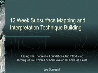
  • 1. 12 Week Subsurface Mapping and Interpretation Technique Building Laying The Theoretical Foundations And Introducing Techniques To Explore For And Develop Oil And Gas Fields. Joe Dumesnil
  • 2. Special thanks to: Dr. Stewart Chuber of Fayette Exploration Company AAPG Foundation The friends I have made while here including the entire SCA Company staff and its Partner-Instructors
  • 3.
  • 4.
  • 6. Lead Map – Depth Structure of Frio A Top Note: 1. Line 5 2. Well Tops from previous dry holes
  • 7. Refined Prospect Depth Structure & Volumetrics 950 Acres 12,350 Ac-Ft 13.561 BCF and 624 MBO Note: Engineering Parameters from Analogous Fields were used for Calculations 13’ Ft Pay, 50% Sw, 24.9 Porosity, 2% Attic, 46B/MM, P-intial 4700 psi, P-abandonment 1000psi, Recovery: 1098 MCF/Ac-Ft
  • 8.
  • 11. Fault Surface Map after finding a Bifurcator to the Main Fault
  • 12. Velocity Gradient Map Integrated with times of a seismic event to get a better approximation of depth structure.
  • 13. Well Data Stencil Time Conversion from Depth (Frio A, J, U) Depth of Surface (Frio A, J, U) Fault Cuts in Time and Depth
  • 15.
  • 17.
  • 18. Stacks of Data Are there more Prospects on our Lease? Remaining 5 of 15 Lines of Seismic in the Area Integrate all Logs to Structural Interpretation
  • 19. Fault Cuts taken from Seismic lines with Naming Convention Frio A
  • 20. Updated Fault Surface Map After Receiving All Available Seismic Note that only faults pertinent to the fault blocks that we are prospecting in are included.
  • 21. 1. Shot Points at which certain faults occur on specified lines. 2. Grid to loop tie Frio A Seismic Event across entire Seismic Grid
  • 22. Time Structure Top of Frio J
  • 23. Time Structure of Top Frio U
  • 24.
  • 25. East of Bifurcator – 1 Time Structure for Top of Frio J
  • 26.
  • 27. East of Bifurcator – 1 Time Structure for Top of Frio U
  • 28.
  • 29. Proposed Deviated / Directional Well Multiple Payzones In The Frio Frio A: ~10,000 Ac-Ft Frio J: ~11,000Ac-Ft Frio U: ~8500 Ac-Ft
  • 30.
  • 31.
  • 33. 3 rd and 4 th Order Sequence Stratigraphy
  • 34. Beach Barrier / Strandplain Complex Zone of Frio Growth Fault Expansion -7000 GENERAL AREA OF PROJECT -7000
  • 35. Thank You All Again, Especially, Dr. Stewart Chuber and The AAPG Foundation Questions?
  • 36. Final Base Map (with all wells that were drilled into the block)