SlideShare una empresa de Scribd logo
1 de 36
Descargar para leer sin conexión
L-15
Wind Rose, Plume Behaviour and
MMD
Air Pollution and Control
(Elective -I)
Wind Rose Diagram
•The wind rose is the time honored method of
graphically presenting the wind conditions,
direction and speed, over a period of time at a
specific location.
•Accurate estimation of the dispersion of
pollutants in the atmosphere require a
knowledge of the frequency distribution of wind
directions as well as wind speed.
• To create a wind rose, average wind
direction and wind speed values are
collected at a site, at short intervals, over
a period of time, e.g. 1 week, 1 month, 1
year or longer.
• The collected wind data is then sorted by
wind direction so that the percentage of
time that the wind was blowing from each
direction can be determined.
• Presented in a circular format, the wind rose
shows the frequency of winds blowing from
particular directions over a particular
period.
• The length of each "spoke or segment" around
the circle is related to the frequency that the
wind blows from a particular direction per unit
time.
• Each concentric circle represents a different
frequency, starting from zero at the center to
increasing frequencies at the outer circles.
• A wind rose plot may contain additional
information, in that each spoke/segment is
broken down into color-coded bands that show
wind speed ranges.
• Wind roses typically use 16 cardinal
directions, such as north (N), NNE, NE, etc.,
although they may be subdivided into as many
as 32 directions.
• In terms of angle measurement in degrees,
North corresponds to 0°/360°, East to 90°,
South to 180° and West to 270°.
Uses of wind rose
1.Sailors use wind rose.
2.Architects do, or should, use wind rose information
for the siting of buildings and stadiums.
3. Wind-power "farms" (wind mills) do extensive
wind rose type studies prior to erecting their wind
turbines.
4. Also used for siting of industries in order to
minimize impact of air pollution on neighboring
cities
Why are these plumes so different?
Plume Behaviour
1. Looping Plume
• High degree of convective
turbulence
• Super adiabatic lapse rate -strong instabilities
• Associated with clear daytime
conditions accompanied by
strong solar heating & light
winds
• High probability of high
concentrations at ground level
close to stack.
• Occurs in unstable
atmospheric conditions.
2. Coning Plume
• Stable with small-scale
turbulence
• Associated with
overcast moderate to
strong winds
• Roughly 10° cone
• Pollutants travel fairly
long distances before
reaching ground level
in significant amounts
• Occurs in neutral
atmospheric conditions
3. Fanning Plume
• Occurs under large negative
lapse rate
• Strong inversion at a
considerable distance above
the stack
• Extremely stable atmosphere
• Little turbulence
• If plume density is similar to
air, travels downwind at
approximately same elevation
4. Lofting Plume
• Favorable in the sense
that fewer impacts at
ground level.
• Pollutants go up into
environment.
• They are created when
atmospheric
conditions are
unstable above the
plume and stable
below.
5. Fumigation
• Most dangerous plume:
contaminants are all coming
down to ground level.
• They are created when
atmospheric conditions are
stable above the plume and
unstable below.
• This happens most often
after the daylight sun has
warmed the atmosphere,
which turns a night time
fanning plume into
fumigation for about a half
an hour.
6. Trapping plume
• When inversion exists both below and
above stack height, trapping results.
• The diffusion of pollutant is severely
restricted to the layer between the two
stable regions as shown in the figure.
7. Neutral Plume
• It tend to rise vertically until it reaches
air density similar to that of plume
itself. It is often converted to coning if
wind velocity is grater than 10 m/sec
and when cloud cover blocks solar
radiation.
Captured near Pandharpur
(Satara –Pandharpur road)
L-16
Maximum Mixing Depth (MMD)
• The dispersion of pollutants in the lower
atmosphere is greatly aided by the convective and
turbulent mixing that takes place.
• The vertical extent to which this mixing takes
place depends on the environmental lapse rate
which varies diurnally, from season to season and
is also affected by topographical features.
• The depth of the convective mixing layer in which
vertical movement of pollutants is possible, is
called the maximum mixing depth (MMD).
• The maximum mixing depth (sometimes called the
mixing height) is obtained by projecting the dry
adiabatic lapse rate line to the point of intersection
with the atmospheric temperature profile
• These profiles are usually measured at night or early
in the morning.
• An air parcel at a temperature warmer than the
existing ground level temperature rises and cools
according to adiabatic lapse rate.
• The level where its temperature becomes equal to
the surrounding air gives the MMD value.
• Urban air pollution episodes are known to occur
when MMD is 1500 m or less.
MMDs for different lapse rate profiles
Summary….of MMD
• Parcel heated by solar radiation at
earth’s surface
• Rises until temperature T’ = T
• T’ = particle’s temp
• T = atmospheric temp
• Achieves neutral equilibrium, no
tendency for further upward motion
DETERMINATION OF
MAXIMUM MIXING HEIGHT
• The following steps can be used to determine the
maximum mixing height for a day from a temperature
profile:
1. Plot the temperature profile (ELR), if needed.
2. Plot the maximum surface temperature for the day on
the graph for morning temperature profile.
3. Draw a dry adiabatic line (-1oC/100m) from the point of
maximum surface temperature to the point where it
interests the morning temperature profile.
4. Read the corresponding height above ground at the
point of intersection obtained in step 2. This is the
31
maximum mixing height for the day.
Practice problem (MMD)
Calculate the maximum mixing height from the
following early morning temperature data given
below:
The maximum surface temperature for the day was
15oC.
(Hint:- Follow steps given in previous slide. From
tabular values plot ELR and 150 C is air parcel temp in
contact with surface apply DALR to it)

Height (m)
Temperature (oC)

0 250 350 450 550 650
9.5 12.2 15.1 15.6 16.2 16.5
32
• A radiosonde (Sonde is French for probe) is a
unit for use in weather balloons that measures
various atmospheric parameters and
transmits them to a fixed receiver.
Radiosondes may operate at a radio frequency
of 403 MHz or 1680 MHz and both types
may be adjusted slightly higher or lower as
required.
• A rawinsonde is a radiosonde that is designed
to only measure wind speed and direction.
Rawinsondes are usually referred to as
Radiosondes.
MMD problems
Objective Questions
Q1. Accurate estimation of the dispersion of pollutants
in the atmosphere require a knowledge of the
___________________________of wind directions
as well as _________________.
Q2. __________________ are important for fixing
location of new industries.
Q3. Most dangerous type of plume is ____________.
Q4. When inversion exists both below and above stack
height, _________________ results.
Q5. ___________________ is, at which temperature
of air parcel and ambient air becomes equal at
particular height.
Theory Questions
Q1. Write detailed note on Plume
Behaviour with neat sketches.
Q2. What is Maximum mixing depth?
Explain how do you determine the same?
Q3. Explain in detail wind rose
construction and its use.

Más contenido relacionado

La actualidad más candente

11 air pollution dispersion
11 air pollution dispersion11 air pollution dispersion
11 air pollution dispersion
Gaurav Pahuja
 
Control of Gaseous Pollutants
Control of Gaseous PollutantsControl of Gaseous Pollutants
Control of Gaseous Pollutants
Sourabh Kulkarni
 

La actualidad más candente (20)

Study of plume behaviour
Study of plume behaviourStudy of plume behaviour
Study of plume behaviour
 
Air pollution and meteorology
Air pollution and meteorologyAir pollution and meteorology
Air pollution and meteorology
 
Gravity settling chambers for controlling air pollution
Gravity settling chambers for controlling air pollutionGravity settling chambers for controlling air pollution
Gravity settling chambers for controlling air pollution
 
Meteorology and air pollution
Meteorology and air pollutionMeteorology and air pollution
Meteorology and air pollution
 
Gaussian model (kabani & sumeet)
Gaussian model (kabani & sumeet)Gaussian model (kabani & sumeet)
Gaussian model (kabani & sumeet)
 
Transport of pollution in atmosphere. m2 pptx
Transport of pollution in atmosphere. m2 pptxTransport of pollution in atmosphere. m2 pptx
Transport of pollution in atmosphere. m2 pptx
 
11 air pollution dispersion
11 air pollution dispersion11 air pollution dispersion
11 air pollution dispersion
 
L 8 equalization and proportioning
L  8 equalization and proportioningL  8 equalization and proportioning
L 8 equalization and proportioning
 
Fabric filters
Fabric filtersFabric filters
Fabric filters
 
Air Pollution - control methods
Air Pollution - control methodsAir Pollution - control methods
Air Pollution - control methods
 
SAMPLING IN AIR POLLUTION
SAMPLING IN AIR POLLUTIONSAMPLING IN AIR POLLUTION
SAMPLING IN AIR POLLUTION
 
Air pollution control m4
Air pollution control m4Air pollution control m4
Air pollution control m4
 
L 27 final
L 27 finalL 27 final
L 27 final
 
Meteorological Factors Influencing Air Pollution And Atmospheric Stability ...
Meteorological Factors Influencing Air Pollution  And  Atmospheric Stability ...Meteorological Factors Influencing Air Pollution  And  Atmospheric Stability ...
Meteorological Factors Influencing Air Pollution And Atmospheric Stability ...
 
Gaussian Plume Dispersion Model
Gaussian Plume Dispersion ModelGaussian Plume Dispersion Model
Gaussian Plume Dispersion Model
 
Control of Gaseous Pollutants
Control of Gaseous PollutantsControl of Gaseous Pollutants
Control of Gaseous Pollutants
 
Centrifugal collectors (2)
Centrifugal collectors (2)Centrifugal collectors (2)
Centrifugal collectors (2)
 
particulate air pollution measurement
particulate air pollution measurement particulate air pollution measurement
particulate air pollution measurement
 
Plume characteristics
Plume characteristicsPlume characteristics
Plume characteristics
 
air Pollution sampling
air Pollution samplingair Pollution sampling
air Pollution sampling
 

Similar a AIR POLLUTION CONTROL L 15

Atmospheric Dispersion in Nuclear Power Plant Siting
Atmospheric Dispersion in Nuclear Power Plant SitingAtmospheric Dispersion in Nuclear Power Plant Siting
Atmospheric Dispersion in Nuclear Power Plant Siting
Hussain Majid
 
Making the invisible visible
Making the invisible visibleMaking the invisible visible
Making the invisible visible
Wania Pereira
 
Mesosphere stratosphere and troposphere (mst) radars
Mesosphere    stratosphere and troposphere (mst) radarsMesosphere    stratosphere and troposphere (mst) radars
Mesosphere stratosphere and troposphere (mst) radars
mayuresh gotarne
 
Capter 5 Climate of Ethiopia and the Horn GeES 1011.pdf
Capter 5 Climate of Ethiopia and the Horn GeES 1011.pdfCapter 5 Climate of Ethiopia and the Horn GeES 1011.pdf
Capter 5 Climate of Ethiopia and the Horn GeES 1011.pdf
Behailu Getu, Wolkite University, Ethiopia
 

Similar a AIR POLLUTION CONTROL L 15 (20)

CE8005 Air Pollution and Control
CE8005 Air Pollution and ControlCE8005 Air Pollution and Control
CE8005 Air Pollution and Control
 
Atmospheric Dispersion in Nuclear Power Plant Siting
Atmospheric Dispersion in Nuclear Power Plant SitingAtmospheric Dispersion in Nuclear Power Plant Siting
Atmospheric Dispersion in Nuclear Power Plant Siting
 
UNIT 2.pptx
UNIT 2.pptxUNIT 2.pptx
UNIT 2.pptx
 
Natural Science: Weather and Storms
Natural Science: Weather and StormsNatural Science: Weather and Storms
Natural Science: Weather and Storms
 
Dbn163 # 02. elements, factors planning & designing
Dbn163 # 02. elements, factors planning & designingDbn163 # 02. elements, factors planning & designing
Dbn163 # 02. elements, factors planning & designing
 
S4 oman wind energy lidar sodar 2016
S4 oman wind energy lidar sodar 2016S4 oman wind energy lidar sodar 2016
S4 oman wind energy lidar sodar 2016
 
Air Pollution and Meteorology
Air Pollution and MeteorologyAir Pollution and Meteorology
Air Pollution and Meteorology
 
Chapter 3
Chapter 3Chapter 3
Chapter 3
 
Wind resource assessment.
Wind resource assessment.Wind resource assessment.
Wind resource assessment.
 
Elements of climate
Elements of climateElements of climate
Elements of climate
 
Aviation weather.pdf
Aviation weather.pdfAviation weather.pdf
Aviation weather.pdf
 
Weather and Climate
Weather and Climate Weather and Climate
Weather and Climate
 
Making the invisible visible
Making the invisible visibleMaking the invisible visible
Making the invisible visible
 
Synoptic Charts
Synoptic ChartsSynoptic Charts
Synoptic Charts
 
Elements of climate and weather
Elements of climate and weatherElements of climate and weather
Elements of climate and weather
 
Climate vs Weather
Climate vs WeatherClimate vs Weather
Climate vs Weather
 
Ducting cause and impact on radio performance
Ducting cause and impact on radio performanceDucting cause and impact on radio performance
Ducting cause and impact on radio performance
 
UNIt 2.pptx
UNIt 2.pptxUNIt 2.pptx
UNIt 2.pptx
 
Mesosphere stratosphere and troposphere (mst) radars
Mesosphere    stratosphere and troposphere (mst) radarsMesosphere    stratosphere and troposphere (mst) radars
Mesosphere stratosphere and troposphere (mst) radars
 
Capter 5 Climate of Ethiopia and the Horn GeES 1011.pdf
Capter 5 Climate of Ethiopia and the Horn GeES 1011.pdfCapter 5 Climate of Ethiopia and the Horn GeES 1011.pdf
Capter 5 Climate of Ethiopia and the Horn GeES 1011.pdf
 

Más de Dr. shrikant jahagirdar

Más de Dr. shrikant jahagirdar (20)

Indoor Air Pollution .......................
Indoor Air Pollution .......................Indoor Air Pollution .......................
Indoor Air Pollution .......................
 
06 Filtration.ppt
06 Filtration.ppt06 Filtration.ppt
06 Filtration.ppt
 
Oxidation pond problem
Oxidation pond problemOxidation pond problem
Oxidation pond problem
 
Module v Environmental Sanitation
Module v Environmental SanitationModule v Environmental Sanitation
Module v Environmental Sanitation
 
Module VI Rural Sanitation
Module VI Rural SanitationModule VI Rural Sanitation
Module VI Rural Sanitation
 
Module IV Wastewater treatment methods
Module IV Wastewater treatment methodsModule IV Wastewater treatment methods
Module IV Wastewater treatment methods
 
Hw2 do sag curve
Hw2 do sag curveHw2 do sag curve
Hw2 do sag curve
 
Do sag problems
Do sag problemsDo sag problems
Do sag problems
 
Do sag curve
Do sag curveDo sag curve
Do sag curve
 
Module iii
Module iiiModule iii
Module iii
 
Septic tank
Septic tankSeptic tank
Septic tank
 
Unit viii
Unit viiiUnit viii
Unit viii
 
Unit vii
Unit viiUnit vii
Unit vii
 
L tannery industry
L tannery industryL tannery industry
L tannery industry
 
L sugar industry
L sugar industryL sugar industry
L sugar industry
 
L distillery industry
L distillery industryL distillery industry
L distillery industry
 
L dairy industry
L dairy industryL dairy industry
L dairy industry
 
L 31 Water Pollution act and other topics
L 31 Water Pollution act and other topicsL 31 Water Pollution act and other topics
L 31 Water Pollution act and other topics
 
L 30 fertilizer industry
L 30 fertilizer industryL 30 fertilizer industry
L 30 fertilizer industry
 
L 29 steel industry
L 29 steel industryL 29 steel industry
L 29 steel industry
 

Último

Cloud Frontiers: A Deep Dive into Serverless Spatial Data and FME
Cloud Frontiers:  A Deep Dive into Serverless Spatial Data and FMECloud Frontiers:  A Deep Dive into Serverless Spatial Data and FME
Cloud Frontiers: A Deep Dive into Serverless Spatial Data and FME
Safe Software
 
Artificial Intelligence: Facts and Myths
Artificial Intelligence: Facts and MythsArtificial Intelligence: Facts and Myths
Artificial Intelligence: Facts and Myths
Joaquim Jorge
 

Último (20)

Mastering MySQL Database Architecture: Deep Dive into MySQL Shell and MySQL R...
Mastering MySQL Database Architecture: Deep Dive into MySQL Shell and MySQL R...Mastering MySQL Database Architecture: Deep Dive into MySQL Shell and MySQL R...
Mastering MySQL Database Architecture: Deep Dive into MySQL Shell and MySQL R...
 
Apidays New York 2024 - The Good, the Bad and the Governed by David O'Neill, ...
Apidays New York 2024 - The Good, the Bad and the Governed by David O'Neill, ...Apidays New York 2024 - The Good, the Bad and the Governed by David O'Neill, ...
Apidays New York 2024 - The Good, the Bad and the Governed by David O'Neill, ...
 
Understanding Discord NSFW Servers A Guide for Responsible Users.pdf
Understanding Discord NSFW Servers A Guide for Responsible Users.pdfUnderstanding Discord NSFW Servers A Guide for Responsible Users.pdf
Understanding Discord NSFW Servers A Guide for Responsible Users.pdf
 
Boost Fertility New Invention Ups Success Rates.pdf
Boost Fertility New Invention Ups Success Rates.pdfBoost Fertility New Invention Ups Success Rates.pdf
Boost Fertility New Invention Ups Success Rates.pdf
 
Cloud Frontiers: A Deep Dive into Serverless Spatial Data and FME
Cloud Frontiers:  A Deep Dive into Serverless Spatial Data and FMECloud Frontiers:  A Deep Dive into Serverless Spatial Data and FME
Cloud Frontiers: A Deep Dive into Serverless Spatial Data and FME
 
Powerful Google developer tools for immediate impact! (2023-24 C)
Powerful Google developer tools for immediate impact! (2023-24 C)Powerful Google developer tools for immediate impact! (2023-24 C)
Powerful Google developer tools for immediate impact! (2023-24 C)
 
🐬 The future of MySQL is Postgres 🐘
🐬  The future of MySQL is Postgres   🐘🐬  The future of MySQL is Postgres   🐘
🐬 The future of MySQL is Postgres 🐘
 
GenAI Risks & Security Meetup 01052024.pdf
GenAI Risks & Security Meetup 01052024.pdfGenAI Risks & Security Meetup 01052024.pdf
GenAI Risks & Security Meetup 01052024.pdf
 
Manulife - Insurer Innovation Award 2024
Manulife - Insurer Innovation Award 2024Manulife - Insurer Innovation Award 2024
Manulife - Insurer Innovation Award 2024
 
How to Troubleshoot Apps for the Modern Connected Worker
How to Troubleshoot Apps for the Modern Connected WorkerHow to Troubleshoot Apps for the Modern Connected Worker
How to Troubleshoot Apps for the Modern Connected Worker
 
MINDCTI Revenue Release Quarter One 2024
MINDCTI Revenue Release Quarter One 2024MINDCTI Revenue Release Quarter One 2024
MINDCTI Revenue Release Quarter One 2024
 
Workshop - Best of Both Worlds_ Combine KG and Vector search for enhanced R...
Workshop - Best of Both Worlds_ Combine  KG and Vector search for  enhanced R...Workshop - Best of Both Worlds_ Combine  KG and Vector search for  enhanced R...
Workshop - Best of Both Worlds_ Combine KG and Vector search for enhanced R...
 
Exploring the Future Potential of AI-Enabled Smartphone Processors
Exploring the Future Potential of AI-Enabled Smartphone ProcessorsExploring the Future Potential of AI-Enabled Smartphone Processors
Exploring the Future Potential of AI-Enabled Smartphone Processors
 
Apidays New York 2024 - The value of a flexible API Management solution for O...
Apidays New York 2024 - The value of a flexible API Management solution for O...Apidays New York 2024 - The value of a flexible API Management solution for O...
Apidays New York 2024 - The value of a flexible API Management solution for O...
 
presentation ICT roal in 21st century education
presentation ICT roal in 21st century educationpresentation ICT roal in 21st century education
presentation ICT roal in 21st century education
 
Artificial Intelligence: Facts and Myths
Artificial Intelligence: Facts and MythsArtificial Intelligence: Facts and Myths
Artificial Intelligence: Facts and Myths
 
Top 10 Most Downloaded Games on Play Store in 2024
Top 10 Most Downloaded Games on Play Store in 2024Top 10 Most Downloaded Games on Play Store in 2024
Top 10 Most Downloaded Games on Play Store in 2024
 
A Domino Admins Adventures (Engage 2024)
A Domino Admins Adventures (Engage 2024)A Domino Admins Adventures (Engage 2024)
A Domino Admins Adventures (Engage 2024)
 
Strategies for Unlocking Knowledge Management in Microsoft 365 in the Copilot...
Strategies for Unlocking Knowledge Management in Microsoft 365 in the Copilot...Strategies for Unlocking Knowledge Management in Microsoft 365 in the Copilot...
Strategies for Unlocking Knowledge Management in Microsoft 365 in the Copilot...
 
Artificial Intelligence Chap.5 : Uncertainty
Artificial Intelligence Chap.5 : UncertaintyArtificial Intelligence Chap.5 : Uncertainty
Artificial Intelligence Chap.5 : Uncertainty
 

AIR POLLUTION CONTROL L 15

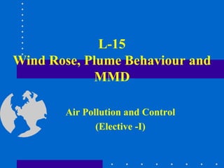
  • 1. L-15 Wind Rose, Plume Behaviour and MMD Air Pollution and Control (Elective -I)
  • 2. Wind Rose Diagram •The wind rose is the time honored method of graphically presenting the wind conditions, direction and speed, over a period of time at a specific location. •Accurate estimation of the dispersion of pollutants in the atmosphere require a knowledge of the frequency distribution of wind directions as well as wind speed.
  • 3. • To create a wind rose, average wind direction and wind speed values are collected at a site, at short intervals, over a period of time, e.g. 1 week, 1 month, 1 year or longer. • The collected wind data is then sorted by wind direction so that the percentage of time that the wind was blowing from each direction can be determined.
  • 4. • Presented in a circular format, the wind rose shows the frequency of winds blowing from particular directions over a particular period. • The length of each "spoke or segment" around the circle is related to the frequency that the wind blows from a particular direction per unit time. • Each concentric circle represents a different frequency, starting from zero at the center to increasing frequencies at the outer circles.
  • 5. • A wind rose plot may contain additional information, in that each spoke/segment is broken down into color-coded bands that show wind speed ranges. • Wind roses typically use 16 cardinal directions, such as north (N), NNE, NE, etc., although they may be subdivided into as many as 32 directions. • In terms of angle measurement in degrees, North corresponds to 0°/360°, East to 90°, South to 180° and West to 270°.
  • 6.
  • 7.
  • 8. Uses of wind rose 1.Sailors use wind rose. 2.Architects do, or should, use wind rose information for the siting of buildings and stadiums. 3. Wind-power "farms" (wind mills) do extensive wind rose type studies prior to erecting their wind turbines. 4. Also used for siting of industries in order to minimize impact of air pollution on neighboring cities
  • 9. Why are these plumes so different?
  • 10. Plume Behaviour 1. Looping Plume • High degree of convective turbulence • Super adiabatic lapse rate -strong instabilities • Associated with clear daytime conditions accompanied by strong solar heating & light winds • High probability of high concentrations at ground level close to stack. • Occurs in unstable atmospheric conditions.
  • 11.
  • 12. 2. Coning Plume • Stable with small-scale turbulence • Associated with overcast moderate to strong winds • Roughly 10° cone • Pollutants travel fairly long distances before reaching ground level in significant amounts • Occurs in neutral atmospheric conditions
  • 13.
  • 14. 3. Fanning Plume • Occurs under large negative lapse rate • Strong inversion at a considerable distance above the stack • Extremely stable atmosphere • Little turbulence • If plume density is similar to air, travels downwind at approximately same elevation
  • 15.
  • 16. 4. Lofting Plume • Favorable in the sense that fewer impacts at ground level. • Pollutants go up into environment. • They are created when atmospheric conditions are unstable above the plume and stable below.
  • 17.
  • 18. 5. Fumigation • Most dangerous plume: contaminants are all coming down to ground level. • They are created when atmospheric conditions are stable above the plume and unstable below. • This happens most often after the daylight sun has warmed the atmosphere, which turns a night time fanning plume into fumigation for about a half an hour.
  • 19.
  • 20. 6. Trapping plume • When inversion exists both below and above stack height, trapping results. • The diffusion of pollutant is severely restricted to the layer between the two stable regions as shown in the figure.
  • 21.
  • 22. 7. Neutral Plume • It tend to rise vertically until it reaches air density similar to that of plume itself. It is often converted to coning if wind velocity is grater than 10 m/sec and when cloud cover blocks solar radiation.
  • 23.
  • 24. Captured near Pandharpur (Satara –Pandharpur road)
  • 25. L-16
  • 26. Maximum Mixing Depth (MMD) • The dispersion of pollutants in the lower atmosphere is greatly aided by the convective and turbulent mixing that takes place. • The vertical extent to which this mixing takes place depends on the environmental lapse rate which varies diurnally, from season to season and is also affected by topographical features. • The depth of the convective mixing layer in which vertical movement of pollutants is possible, is called the maximum mixing depth (MMD).
  • 27. • The maximum mixing depth (sometimes called the mixing height) is obtained by projecting the dry adiabatic lapse rate line to the point of intersection with the atmospheric temperature profile • These profiles are usually measured at night or early in the morning. • An air parcel at a temperature warmer than the existing ground level temperature rises and cools according to adiabatic lapse rate. • The level where its temperature becomes equal to the surrounding air gives the MMD value. • Urban air pollution episodes are known to occur when MMD is 1500 m or less.
  • 28.
  • 29. MMDs for different lapse rate profiles
  • 30. Summary….of MMD • Parcel heated by solar radiation at earth’s surface • Rises until temperature T’ = T • T’ = particle’s temp • T = atmospheric temp • Achieves neutral equilibrium, no tendency for further upward motion
  • 31. DETERMINATION OF MAXIMUM MIXING HEIGHT • The following steps can be used to determine the maximum mixing height for a day from a temperature profile: 1. Plot the temperature profile (ELR), if needed. 2. Plot the maximum surface temperature for the day on the graph for morning temperature profile. 3. Draw a dry adiabatic line (-1oC/100m) from the point of maximum surface temperature to the point where it interests the morning temperature profile. 4. Read the corresponding height above ground at the point of intersection obtained in step 2. This is the 31 maximum mixing height for the day.
  • 32. Practice problem (MMD) Calculate the maximum mixing height from the following early morning temperature data given below: The maximum surface temperature for the day was 15oC. (Hint:- Follow steps given in previous slide. From tabular values plot ELR and 150 C is air parcel temp in contact with surface apply DALR to it) Height (m) Temperature (oC) 0 250 350 450 550 650 9.5 12.2 15.1 15.6 16.2 16.5 32
  • 33. • A radiosonde (Sonde is French for probe) is a unit for use in weather balloons that measures various atmospheric parameters and transmits them to a fixed receiver. Radiosondes may operate at a radio frequency of 403 MHz or 1680 MHz and both types may be adjusted slightly higher or lower as required. • A rawinsonde is a radiosonde that is designed to only measure wind speed and direction. Rawinsondes are usually referred to as Radiosondes.
  • 35. Objective Questions Q1. Accurate estimation of the dispersion of pollutants in the atmosphere require a knowledge of the ___________________________of wind directions as well as _________________. Q2. __________________ are important for fixing location of new industries. Q3. Most dangerous type of plume is ____________. Q4. When inversion exists both below and above stack height, _________________ results. Q5. ___________________ is, at which temperature of air parcel and ambient air becomes equal at particular height.
  • 36. Theory Questions Q1. Write detailed note on Plume Behaviour with neat sketches. Q2. What is Maximum mixing depth? Explain how do you determine the same? Q3. Explain in detail wind rose construction and its use.