6. Asset Tracking & Management 30 million bags lost by airlines globally in 2005 (240,000 never returned to owners) $2.5 billion that airlines spent returning lost luggage (up from $1.6 billion in 2004)
16. GPS Telecom Rosum AeroScout AetherWire Deployment Range Global Wide area Metro area Building Building Position Calculation Mobile device Network Mobile device or Network Network Network Position Method TOF lateration Triangulation, Cell-ID Multi- lateration TDOA or RSSI Multi- lateration RF Signal Used GPS Cellular Terrestrial broadcast TV 802.11 UWB Transmitter 28 satellites Cell phone TV towers Active RFID tags or WiFi devices “ Localizer” Receiver Commodity Receivers Cell tower Rosum RTMM chipset AeroScout Location Receiver (TDOA) “ Localizer” Accuracy 3-65ft /1- 20m (outdoors: 10ft / 3m) Triangulation: 65-656 ft / 20- 200m; Cell-ID: 165ft- 0.6mile / 50 m- 1Km 98-164ft / 30- 50m (outdoors: 16ft / 5m) 3.3-16 ft / 1-5 m 1-5 cm
RTLS market = $1.25-$1.6 billion by 2010 (IDTechEx Ltd & Yankee Group)
How Does Ultrasound IPS work? Nature gave bats ultrasound to navigate safely in close quarters in the dark... A small wireless transmission Tag is securely attached to the object to be tracked. The motion-activated Tag transmits its unique identification signal using ultrasound waves. A Detector dedicated to the room where the Tag is located receives the transmitted ultrasound signals from the Tag. The Detector uses Sonitor's patented Digital Signal Processing (DSP) algorithms and Transmits the received signals in a digital format via either the existing LAN, or through a wireless network, to a central computer unit that stores information about the Tag's room-location and the time of the receipt of the Tag signal. The IPS software enables users to retrieve a Tag's position and/or movement information from any computer on the network. So with Sonitor IPS you will know where a tagged object is at all times.
(TIME April 2006) 30 million bags lost by airlines globally in 2005 (240,000 never returned to owners) $2.5 billion that airlines spent returning lost luggage (up from $1.6 billion in 2004)
This image illustrates the invisible geography of wireless "wifi" Internet signal blanketing downtown Salt Lake City, UT. The research has been undertaken by Assistant Professor, Dr. Paul M. Torrens at the University of Utah's Department of Geography. It is part of ongoing work to map "urban data clouds" in an effort to study the geography of new emerging technologies and their impact on dense urban environments
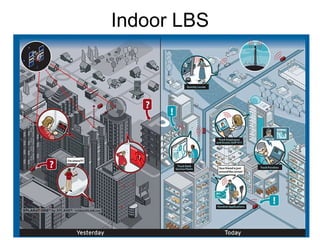
A-GPS can achieve high accuracy, but deploying pseudolites is expensives…? What are the pros and cons of deploying A-GPS vs the other indoor technologies? The WiFi accuracy is different here from Rosum’s figure
Handset same as mobile device in later slide, and server same as network
![[email_address] 646.244.2731 San Francisco, CA](data:image/gif;base64,R0lGODlhAQABAIAAAAAAAP///yH5BAEAAAAALAAAAAABAAEAAAIBRAA7)