SlideShare una empresa de Scribd logo
1 de 28
Descargar para leer sin conexión
Monumental
mapping
GIS and
Hadrian’s Wall
Stuart Dunn
King’s College London
stuart.dunn@kcl.ac.uk
• Vector – points, lines and polygons
• Ratser – pixels with attributes
• GIS allows us to query and overlay data with
geographic coordinates
• “A map on top of a database”
• Everything happens somewhere
• Historical sources refer to place in many different
ways
• Associating exact location with these is complex
• Georeferencing
• Accuracy versus precision
• Relative versus absolute
e.g. roads, rivers
e.g. places
e.g. countries,
territories etc
Vector GIS
Source: http://www-eio.upc.edu/~pau/?q=node/18
• ArcView x.x – ESRI; proprietary
• GRASS – www.grass.osgeo.org
• Quantum GIS -
http://hub.qgis.org/projects/quantum-
gis/wiki/Download
• Google Earth – www.earth.google.com
• Open Street Map - http://www.openstreetmap.org
Volunteered Geographical Information (VGI) is considered
a special case of an intermediary discourse: information is
not fixed, it can be extended, altered, or even deleted at
any time. This multi-stage, reflective character has to taken
into consideration in a discourse- analytical approach.
C. Fink, 2011 - Mapping Together : On collaborative implicit cartographies,
their discourses and space construction.
AD 1250 – Matthew Paris (Image source - British Library)
Antonine Wall, c. 1906
E.g. search for Chollerford
GeoNames
Introduction: What is GIS? Vector & unique identifiers, APIs and openstreetmap
Monumental mapping: GIS and Hadrian’s Wall

Más contenido relacionado

La actualidad más candente

Education colleen beard_good2015
Education colleen beard_good2015Education colleen beard_good2015
Education colleen beard_good2015
GO Open Data (GOOD)
 
Intro to GIS
Intro  to GISIntro  to GIS
Intro to GIS
pvhead123
 
Spring 2016 - Career Fair
Spring 2016 - Career FairSpring 2016 - Career Fair
Spring 2016 - Career Fair
Vannesa Kello
 
Europeana Network Association Members Council Meeting, Copenhagen by Aubery E...
Europeana Network Association Members Council Meeting, Copenhagen by Aubery E...Europeana Network Association Members Council Meeting, Copenhagen by Aubery E...
Europeana Network Association Members Council Meeting, Copenhagen by Aubery E...
Europeana
 
Application of gis and remote sensing in modern transport system
Application of gis and remote sensing in modern transport systemApplication of gis and remote sensing in modern transport system
Application of gis and remote sensing in modern transport system
Sabhapathy Civil
 

La actualidad más candente (20)

France: ARIADNE - Success stories from partners and the research community
France: ARIADNE - Success stories from partners and the research communityFrance: ARIADNE - Success stories from partners and the research community
France: ARIADNE - Success stories from partners and the research community
 
Understanding Gis
Understanding GisUnderstanding Gis
Understanding Gis
 
Hydrological reconnaissance for rural water projects using free online inform...
Hydrological reconnaissance for rural water projects using free online inform...Hydrological reconnaissance for rural water projects using free online inform...
Hydrological reconnaissance for rural water projects using free online inform...
 
TransportCamp AU Presentation: Designing a multimodal, high-frequency network...
TransportCamp AU Presentation: Designing a multimodal, high-frequency network...TransportCamp AU Presentation: Designing a multimodal, high-frequency network...
TransportCamp AU Presentation: Designing a multimodal, high-frequency network...
 
Houston_P_Workshop_Australian Peri-Urban Observatory
Houston_P_Workshop_Australian Peri-Urban ObservatoryHouston_P_Workshop_Australian Peri-Urban Observatory
Houston_P_Workshop_Australian Peri-Urban Observatory
 
21 3 2007 Edinburgh
21 3 2007  Edinburgh21 3 2007  Edinburgh
21 3 2007 Edinburgh
 
Education colleen beard_good2015
Education colleen beard_good2015Education colleen beard_good2015
Education colleen beard_good2015
 
Intro to GIS
Intro  to GISIntro  to GIS
Intro to GIS
 
Spring 2016 - Career Fair
Spring 2016 - Career FairSpring 2016 - Career Fair
Spring 2016 - Career Fair
 
OpenStreetMap in the public sector - case HSL
OpenStreetMap in the public sector - case HSLOpenStreetMap in the public sector - case HSL
OpenStreetMap in the public sector - case HSL
 
Earth observation for oil and gas
Earth observation for oil and gasEarth observation for oil and gas
Earth observation for oil and gas
 
AddressingHistory - Crowdsourcing the Past - Stuart Macdonald
AddressingHistory - Crowdsourcing the Past - Stuart MacdonaldAddressingHistory - Crowdsourcing the Past - Stuart Macdonald
AddressingHistory - Crowdsourcing the Past - Stuart Macdonald
 
Corridor Selection in USA and UAE with GIS
Corridor Selection in USA and UAE with GISCorridor Selection in USA and UAE with GIS
Corridor Selection in USA and UAE with GIS
 
Christopher j. busic_engineering_resume_2020-2021
Christopher j. busic_engineering_resume_2020-2021Christopher j. busic_engineering_resume_2020-2021
Christopher j. busic_engineering_resume_2020-2021
 
Semantically Mapping Science (SMS) Platform
Semantically Mapping Science (SMS) PlatformSemantically Mapping Science (SMS) Platform
Semantically Mapping Science (SMS) Platform
 
Europeana Network Association Members Council Meeting, Copenhagen by Aubery E...
Europeana Network Association Members Council Meeting, Copenhagen by Aubery E...Europeana Network Association Members Council Meeting, Copenhagen by Aubery E...
Europeana Network Association Members Council Meeting, Copenhagen by Aubery E...
 
OSM HOT SBTF 2013_03_16
OSM HOT SBTF 2013_03_16OSM HOT SBTF 2013_03_16
OSM HOT SBTF 2013_03_16
 
Italy: ARIADNE - Success stories from partners and the research community
Italy: ARIADNE - Success stories from partners and the research communityItaly: ARIADNE - Success stories from partners and the research community
Italy: ARIADNE - Success stories from partners and the research community
 
Application of gis and remote sensing in modern transport system
Application of gis and remote sensing in modern transport systemApplication of gis and remote sensing in modern transport system
Application of gis and remote sensing in modern transport system
 
RobertFohrenbach Resume
RobertFohrenbach ResumeRobertFohrenbach Resume
RobertFohrenbach Resume
 

Similar a Monumental mapping: GIS and Hadrian’s Wall

Wikimaps Wikimania 2013
Wikimaps Wikimania 2013Wikimaps Wikimania 2013
Wikimaps Wikimania 2013
Susanna Ånäs
 
CensusGIV - Geographic Information Visualisation of Census Data
CensusGIV - Geographic Information Visualisation of Census DataCensusGIV - Geographic Information Visualisation of Census Data
CensusGIV - Geographic Information Visualisation of Census Data
CASA, UCL
 
00 charlton map_projections
00 charlton map_projections00 charlton map_projections
00 charlton map_projections
Dublinked .
 
GeoSemantic Technologies for Archaeological Resources
GeoSemantic Technologies for Archaeological ResourcesGeoSemantic Technologies for Archaeological Resources
GeoSemantic Technologies for Archaeological Resources
Paul Cripps
 

Similar a Monumental mapping: GIS and Hadrian’s Wall (16)

Archaeological Applications Of Gis
Archaeological Applications Of GisArchaeological Applications Of Gis
Archaeological Applications Of Gis
 
Wikimaps Wikimania 2013
Wikimaps Wikimania 2013Wikimaps Wikimania 2013
Wikimaps Wikimania 2013
 
CensusGIV - Geographic Information Visualisation of Census Data
CensusGIV - Geographic Information Visualisation of Census DataCensusGIV - Geographic Information Visualisation of Census Data
CensusGIV - Geographic Information Visualisation of Census Data
 
2013 gis, gil and libraries… mapping in the digital age
2013 gis, gil and libraries… mapping in the digital age2013 gis, gil and libraries… mapping in the digital age
2013 gis, gil and libraries… mapping in the digital age
 
PIAS 2013-GIS.pptxfskjczjsbchdbfscnnND dHSA
PIAS 2013-GIS.pptxfskjczjsbchdbfscnnND  dHSAPIAS 2013-GIS.pptxfskjczjsbchdbfscnnND  dHSA
PIAS 2013-GIS.pptxfskjczjsbchdbfscnnND dHSA
 
Qualitative GIS by Rob Berry @rural_gis
Qualitative GIS by Rob Berry @rural_gisQualitative GIS by Rob Berry @rural_gis
Qualitative GIS by Rob Berry @rural_gis
 
Maps: a "Must Have" for Genealogists
Maps: a "Must Have" for GenealogistsMaps: a "Must Have" for Genealogists
Maps: a "Must Have" for Genealogists
 
Public Access through technology; Using archaeological computing to interact ...
Public Access through technology; Using archaeological computing to interact ...Public Access through technology; Using archaeological computing to interact ...
Public Access through technology; Using archaeological computing to interact ...
 
ArchaeoSTOR Map: Publishing archaeological geodata on the web
ArchaeoSTOR Map: Publishing archaeological geodata on the webArchaeoSTOR Map: Publishing archaeological geodata on the web
ArchaeoSTOR Map: Publishing archaeological geodata on the web
 
GIS data analysis
GIS data analysisGIS data analysis
GIS data analysis
 
Real-time Visualisation of Cultural Heritage and Environmental Archaeology Da...
Real-time Visualisation of Cultural Heritage and Environmental Archaeology Da...Real-time Visualisation of Cultural Heritage and Environmental Archaeology Da...
Real-time Visualisation of Cultural Heritage and Environmental Archaeology Da...
 
Kansa SAA 2014 Archaeological Data on Vastly Different Scales
Kansa SAA 2014 Archaeological Data on Vastly Different ScalesKansa SAA 2014 Archaeological Data on Vastly Different Scales
Kansa SAA 2014 Archaeological Data on Vastly Different Scales
 
00 charlton map_projections
00 charlton map_projections00 charlton map_projections
00 charlton map_projections
 
GeoSemantic Technologies for Archaeological Resources
GeoSemantic Technologies for Archaeological ResourcesGeoSemantic Technologies for Archaeological Resources
GeoSemantic Technologies for Archaeological Resources
 
Linking Spaces with Places: Examples from the PastPlace Project
Linking Spaces with Places: Examples from thePastPlace ProjectLinking Spaces with Places: Examples from thePastPlace Project
Linking Spaces with Places: Examples from the PastPlace Project
 
GIS Services at Michigan State University Libraries: Interactions with the Wi...
GIS Services at Michigan State University Libraries: Interactions with the Wi...GIS Services at Michigan State University Libraries: Interactions with the Wi...
GIS Services at Michigan State University Libraries: Interactions with the Wi...
 

Más de London School of Hygiene and Tropical Medicine

Más de London School of Hygiene and Tropical Medicine (20)

Preparing to submit your thesis at LSHTM
Preparing to submit your thesis at LSHTMPreparing to submit your thesis at LSHTM
Preparing to submit your thesis at LSHTM
 
Your research is more than a thesis: Make the most of research data and other...
Your research is more than a thesis: Make the most of research data and other...Your research is more than a thesis: Make the most of research data and other...
Your research is more than a thesis: Make the most of research data and other...
 
Enhance your rese​arch impact through open science
Enhance your rese​arch impact through open scienceEnhance your rese​arch impact through open science
Enhance your rese​arch impact through open science
 
Information Security and GDPR
Information Security and GDPRInformation Security and GDPR
Information Security and GDPR
 
GDPR and Research Data Management
GDPR and Research Data ManagementGDPR and Research Data Management
GDPR and Research Data Management
 
Towards Open Research: practices, experiences, barriers and opportunities
Towards Open Research: practices, experiences, barriers and opportunitiesTowards Open Research: practices, experiences, barriers and opportunities
Towards Open Research: practices, experiences, barriers and opportunities
 
Data Journals and repositories: Getting academic credit for data sharing
Data Journals and repositories: Getting academic credit for data sharingData Journals and repositories: Getting academic credit for data sharing
Data Journals and repositories: Getting academic credit for data sharing
 
Crowd sourcing and high resolution satellite imagery in public health
Crowd sourcing and high resolution satellite imagery in public healthCrowd sourcing and high resolution satellite imagery in public health
Crowd sourcing and high resolution satellite imagery in public health
 
Determining the relationship between physical environment and weight status u...
Determining the relationship between physical environment and weight status u...Determining the relationship between physical environment and weight status u...
Determining the relationship between physical environment and weight status u...
 
i-Sense: an early-warning sensing systems for infectious diseases
i-Sense: an early-warning sensing systems for infectious diseasesi-Sense: an early-warning sensing systems for infectious diseases
i-Sense: an early-warning sensing systems for infectious diseases
 
Internet-based surveillance of illness: the FluSurvey platform
Internet-based surveillance of illness: the FluSurvey platformInternet-based surveillance of illness: the FluSurvey platform
Internet-based surveillance of illness: the FluSurvey platform
 
An overview of the MyHeart Counts app
An overview of the MyHeart Counts appAn overview of the MyHeart Counts app
An overview of the MyHeart Counts app
 
Electronic data collection for a modular household survey in Ethiopia
Electronic data collection for a modular household survey in EthiopiaElectronic data collection for a modular household survey in Ethiopia
Electronic data collection for a modular household survey in Ethiopia
 
Mobile-Based Experience Sampling for Behaviour Research
Mobile-Based Experience Sampling for Behaviour ResearchMobile-Based Experience Sampling for Behaviour Research
Mobile-Based Experience Sampling for Behaviour Research
 
Preparing Data for Sharing: The FAIR Principles
Preparing Data for Sharing: The FAIR PrinciplesPreparing Data for Sharing: The FAIR Principles
Preparing Data for Sharing: The FAIR Principles
 
RDM Training for health researchers: An institutional perspective
RDM Training for health researchers: An institutional perspectiveRDM Training for health researchers: An institutional perspective
RDM Training for health researchers: An institutional perspective
 
Research Data Readiness in UK Institutions: Digital Curation Centre’s 2015 Su...
Research Data Readiness in UK Institutions: Digital Curation Centre’s 2015 Su...Research Data Readiness in UK Institutions: Digital Curation Centre’s 2015 Su...
Research Data Readiness in UK Institutions: Digital Curation Centre’s 2015 Su...
 
Research data services at the University of Oxford
Research data services at the University of OxfordResearch data services at the University of Oxford
Research data services at the University of Oxford
 
Research Data Management at The University of Edinburgh
Research Data Management at The University of EdinburghResearch Data Management at The University of Edinburgh
Research Data Management at The University of Edinburgh
 
Research data management at UAL
Research data management at UALResearch data management at UAL
Research data management at UAL
 

Último

Architecting Cloud Native Applications
Architecting Cloud Native ApplicationsArchitecting Cloud Native Applications
Architecting Cloud Native Applications
WSO2
 
Modular Monolith - a Practical Alternative to Microservices @ Devoxx UK 2024
Modular Monolith - a Practical Alternative to Microservices @ Devoxx UK 2024Modular Monolith - a Practical Alternative to Microservices @ Devoxx UK 2024
Modular Monolith - a Practical Alternative to Microservices @ Devoxx UK 2024
Victor Rentea
 
Cloud Frontiers: A Deep Dive into Serverless Spatial Data and FME
Cloud Frontiers:  A Deep Dive into Serverless Spatial Data and FMECloud Frontiers:  A Deep Dive into Serverless Spatial Data and FME
Cloud Frontiers: A Deep Dive into Serverless Spatial Data and FME
Safe Software
 

Último (20)

DEV meet-up UiPath Document Understanding May 7 2024 Amsterdam
DEV meet-up UiPath Document Understanding May 7 2024 AmsterdamDEV meet-up UiPath Document Understanding May 7 2024 Amsterdam
DEV meet-up UiPath Document Understanding May 7 2024 Amsterdam
 
Manulife - Insurer Transformation Award 2024
Manulife - Insurer Transformation Award 2024Manulife - Insurer Transformation Award 2024
Manulife - Insurer Transformation Award 2024
 
Architecting Cloud Native Applications
Architecting Cloud Native ApplicationsArchitecting Cloud Native Applications
Architecting Cloud Native Applications
 
Modular Monolith - a Practical Alternative to Microservices @ Devoxx UK 2024
Modular Monolith - a Practical Alternative to Microservices @ Devoxx UK 2024Modular Monolith - a Practical Alternative to Microservices @ Devoxx UK 2024
Modular Monolith - a Practical Alternative to Microservices @ Devoxx UK 2024
 
FWD Group - Insurer Innovation Award 2024
FWD Group - Insurer Innovation Award 2024FWD Group - Insurer Innovation Award 2024
FWD Group - Insurer Innovation Award 2024
 
Cyberprint. Dark Pink Apt Group [EN].pdf
Cyberprint. Dark Pink Apt Group [EN].pdfCyberprint. Dark Pink Apt Group [EN].pdf
Cyberprint. Dark Pink Apt Group [EN].pdf
 
Apidays New York 2024 - The Good, the Bad and the Governed by David O'Neill, ...
Apidays New York 2024 - The Good, the Bad and the Governed by David O'Neill, ...Apidays New York 2024 - The Good, the Bad and the Governed by David O'Neill, ...
Apidays New York 2024 - The Good, the Bad and the Governed by David O'Neill, ...
 
Exploring the Future Potential of AI-Enabled Smartphone Processors
Exploring the Future Potential of AI-Enabled Smartphone ProcessorsExploring the Future Potential of AI-Enabled Smartphone Processors
Exploring the Future Potential of AI-Enabled Smartphone Processors
 
DBX First Quarter 2024 Investor Presentation
DBX First Quarter 2024 Investor PresentationDBX First Quarter 2024 Investor Presentation
DBX First Quarter 2024 Investor Presentation
 
Axa Assurance Maroc - Insurer Innovation Award 2024
Axa Assurance Maroc - Insurer Innovation Award 2024Axa Assurance Maroc - Insurer Innovation Award 2024
Axa Assurance Maroc - Insurer Innovation Award 2024
 
MS Copilot expands with MS Graph connectors
MS Copilot expands with MS Graph connectorsMS Copilot expands with MS Graph connectors
MS Copilot expands with MS Graph connectors
 
Strategies for Landing an Oracle DBA Job as a Fresher
Strategies for Landing an Oracle DBA Job as a FresherStrategies for Landing an Oracle DBA Job as a Fresher
Strategies for Landing an Oracle DBA Job as a Fresher
 
Ransomware_Q4_2023. The report. [EN].pdf
Ransomware_Q4_2023. The report. [EN].pdfRansomware_Q4_2023. The report. [EN].pdf
Ransomware_Q4_2023. The report. [EN].pdf
 
Emergent Methods: Multi-lingual narrative tracking in the news - real-time ex...
Emergent Methods: Multi-lingual narrative tracking in the news - real-time ex...Emergent Methods: Multi-lingual narrative tracking in the news - real-time ex...
Emergent Methods: Multi-lingual narrative tracking in the news - real-time ex...
 
AWS Community Day CPH - Three problems of Terraform
AWS Community Day CPH - Three problems of TerraformAWS Community Day CPH - Three problems of Terraform
AWS Community Day CPH - Three problems of Terraform
 
Corporate and higher education May webinar.pptx
Corporate and higher education May webinar.pptxCorporate and higher education May webinar.pptx
Corporate and higher education May webinar.pptx
 
Spring Boot vs Quarkus the ultimate battle - DevoxxUK
Spring Boot vs Quarkus the ultimate battle - DevoxxUKSpring Boot vs Quarkus the ultimate battle - DevoxxUK
Spring Boot vs Quarkus the ultimate battle - DevoxxUK
 
Rising Above_ Dubai Floods and the Fortitude of Dubai International Airport.pdf
Rising Above_ Dubai Floods and the Fortitude of Dubai International Airport.pdfRising Above_ Dubai Floods and the Fortitude of Dubai International Airport.pdf
Rising Above_ Dubai Floods and the Fortitude of Dubai International Airport.pdf
 
Cloud Frontiers: A Deep Dive into Serverless Spatial Data and FME
Cloud Frontiers:  A Deep Dive into Serverless Spatial Data and FMECloud Frontiers:  A Deep Dive into Serverless Spatial Data and FME
Cloud Frontiers: A Deep Dive into Serverless Spatial Data and FME
 
Artificial Intelligence Chap.5 : Uncertainty
Artificial Intelligence Chap.5 : UncertaintyArtificial Intelligence Chap.5 : Uncertainty
Artificial Intelligence Chap.5 : Uncertainty
 

Monumental mapping: GIS and Hadrian’s Wall

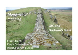
  • 1. Monumental mapping GIS and Hadrian’s Wall Stuart Dunn King’s College London stuart.dunn@kcl.ac.uk
  • 2. • Vector – points, lines and polygons • Ratser – pixels with attributes • GIS allows us to query and overlay data with geographic coordinates • “A map on top of a database”
  • 3. • Everything happens somewhere • Historical sources refer to place in many different ways • Associating exact location with these is complex • Georeferencing • Accuracy versus precision • Relative versus absolute
  • 4. e.g. roads, rivers e.g. places e.g. countries, territories etc Vector GIS
  • 6.
  • 7. • ArcView x.x – ESRI; proprietary • GRASS – www.grass.osgeo.org • Quantum GIS - http://hub.qgis.org/projects/quantum- gis/wiki/Download • Google Earth – www.earth.google.com • Open Street Map - http://www.openstreetmap.org
  • 8. Volunteered Geographical Information (VGI) is considered a special case of an intermediary discourse: information is not fixed, it can be extended, altered, or even deleted at any time. This multi-stage, reflective character has to taken into consideration in a discourse- analytical approach. C. Fink, 2011 - Mapping Together : On collaborative implicit cartographies, their discourses and space construction.
  • 9.
  • 10.
  • 11.
  • 12.
  • 13. AD 1250 – Matthew Paris (Image source - British Library)
  • 15.
  • 16. E.g. search for Chollerford GeoNames
  • 17.
  • 18.
  • 19. Introduction: What is GIS? Vector & unique identifiers, APIs and openstreetmap
  • 20.
  • 21. Introduction: What is GIS? Vector & unique identifiers, APIs and openstreetmap
  • 22. Introduction: What is GIS? Vector & unique identifiers, APIs and openstreetmap
  • 23. Introduction: What is GIS? Vector & unique identifiers, APIs and openstreetmap
  • 24. Introduction: What is GIS? Vector & unique identifiers, APIs and openstreetmap