SMART Implementation Plan Charrette - North Corridor Presentation
•Descargar como PPTX, PDF•
1 recomendación•353 vistas

Presentation provided to participants at the North Corridor Charrettes on November 4 and 8, 2017.

Recomendados
Recomendados
Más contenido relacionado
Similar a SMART Implementation Plan Charrette - North Corridor Presentation
Similar a SMART Implementation Plan Charrette - North Corridor Presentation (20)
Más de Miami-Dade Transportation Planning Organization
Más de Miami-Dade Transportation Planning Organization (20)
Último
Último (20)
SMART Implementation Plan Charrette - North Corridor Presentation
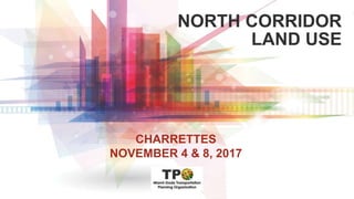
- 1. NORTH CORRIDOR LAND USE CHARRETTES NOVEMBER 4 & 8, 2017
- 2. WHY ARE WE DOING THIS This Study Is Parallel To The Transit Study This Study Is About Land Use… Not Transit Because Land Use and Transit are Linked
- 3. WHAT IS LAND USE The Rules That Tell Us: How Much of What Can Go Where Local Governments in Control Transit: National Land Use: Local
- 4. TIMES and LOCATIONS – PHASE I Charrette Time and Locations November 4, 2017 Historic Hampton House 9 am – Noon November 8, 2017 Stadium Hotel 6 pm – 9 pm
- 5. CHARRETTE PROCESS Ample opportunity to provide input/feedback Two phases 1: November,2017 2: March,2018 Two meetings in each phase North South Phase 1: Lifestyle What do you want the corridor to look like? Phase 2: Location and urban design What should the station areas look like? Station Area Massing/Scale Parcel Accessibility
- 6. QUESTIONS TO CONSIDER Think about where you live What does your neighborhood look like? What do you want it to look like? What Would Make It Better? Jobs? What Kind? Where? Schools?
- 7. TRANSPORTATION AND LAND USE Both Very Connected How Much Of Each Do We Need Why Naturally Happens Federal Transit Administration Scores it That Way
- 8. WHAT IS LAND USE The Difference Between
- 9. WHAT IS LAND USE Each Use Served By A Different Level of Transit Our Existing Level of Uses Hasn’t Attained the Level Of Transit That Many Desire
- 10. HOW ARE WE GOING TO DO THIS You tell us what the community should look like in the future, Housing Jobs Shopping Parks
- 11. WHAT WE WILL ACHIEVE Determine the level of transit that can be supported today and tomorrow under the existing codes Analyze alternative development scenarios and the degree of support for various transit modes. Begin with the community’s vision gained through charrettes Define the steps and processes achieve the final vision Comprehensive Plan Policies Zoning Code Changes
- 12. LAND USE COMPARISONS Land use scenarios (Density) Low Medium High
- 13. TRANSPORTATION AND LAND USE ARE LINKED Historically, cities formed around natural and man-made grids Rivers Railroads/Street Cars Expressways
- 14. IT’S ABOUT THE MONEY FTA Funding Transit funding is highly competitive Federal Transit Administration evaluates based on (each rated on 5 point scale) Land use Mobility Environment Congestion relief Economic development Affordable housing Cost Effectiveness
- 15. WANTS vs NEEDS Federal Transit Administration (FTA) Perspectives……. What is wanted must be needed or the project fails to attain financial assistance Totally locally-funded projects are not constrained by FTA rules
- 16. FTA FUNDING Transit funding is highly competitive Federal Transit Administration evaluation is based on (rated on “5 point” scale) Land use Mobility Environment Congestion relief Economic development Affordable housing Cost Effectiveness
- 17. FTA SCORING Each category rated on “5-point” scale (Must meet an average of “3-points” minimum) (Need “4- or 5-points” to be highly competitive) Compared against projection of existing conditions Key measurements Ridership and Vehicle-Miles Traveled (STOPS) (a new model)
- 18. FTA Land Use Breakpoints: 70K 140K 220K EMPLOYMENT 5,760 9,600 15,000 POPULATION/SQM $8 $12 $16 PARKING COST / DAY 0.03 0.02 0.01 PARKING SPACES / EMP
- 20. THE DETAILS 13-mile corridor Anchors North: Hard Rock Stadium and planned Unity Station South: Miami Intermodal Center Key destinations: Miami-Dade College, North Campus; Miami International Airport; Hard Rock Stadium; Calder Casino; and Miami Jai Alai. Character: Low-density urban/suburban
- 21. DEMOGRAPHICS 120,000 residents (9,000 people per square mile) 36,000 households. 24,000 jobs (primarily filled by employees living outside the corridor) Fewer than 1,000 workers who live in the corridor also work in the corridor Generates approximately 100,000 employment trips regionally. Workers within the corridor primarily originate from Hialeah, City of Miami, Sweetwater, or the Fontainebleau area Resident workers primarily work in Downtown Miami, Aventura, Miami Beach, and Doral’s industrial/warehouse districts. Linked Jobs (+/- 49,000)
- 22. WHO WORKS HERE Employment Who is coming, going, or staying? +/- 20% in and out
- 23. WHERE ARE PEOPLE GOING Where Residents Work Where Workers Live
- 24. HOW ARE WE ALLOCATED 53%32% 8% 5% 2% 1% Land Area Miami-Dade County Miami Gardens Opa-Locka Miami Hialeah Miami Springs
- 25. EXISTING LAND USE Miami-Dade 53% (low-density residential, institutional, industrial commercial) Miami Gardens 32% (low-density residential, commercial, institutional) Opa-Locka 8% (low-density residential, industrial, commercial) Miami 5% (low-density residential, commercial, preserved lands) Hialeah 2% (industrial) Miami Springs 1% (transient residential)
- 26. VACANT LAND Vacant land 8.2% (Approximately 575 acres) All vacant land within the Corridor is unprotected, allowing for future development. No other category of land use composes more than 5% of the overall corridor; notably, Parks and Open Space falls within this category.
- 27. PROJECTING THE FUTURE (existing plans) Employment projected to increase approximately 200% by 2040 (30,815 to 89,976) (Medium Ranking) Population is projected to increase 43% by 2040 (111,908 to 159,878) (12,000 / SqM) (Medium High Ranking) Moving in the right direction to achieve balance, but…..
- 28. WHAT DO YOU LIKE So, before we begin - Everyone have a clicker? When asked--Press any button. When answering, point to computer at the front of the room. Look at the following slides. Each represents a level of intensity. Tell us: How much do you like what you see?
- 29. WHAT DO YOU LIKE Look at these pictures Use the Key Pad to vote on how much you like each
- 30. How did you hear about this meeting? A. Flyer B. Postcard C. Radio D. Newspaper E. Email F. Facebook G. Word of Mouth H. Other
- 31. What does it look like where you currently live? A. A B. B C. C D. D E. E F. F G. G H. H I. I A B DC E F HG I
- 32. Rate on a scale of 1 (low) - 9 (high) 1 2 3 4 5 6 7 8 9 0% 0% 0% 0% 0%0%0%0%0%
- 33. Rate on a scale of 1 (low) - 9 (high) 1 2 3 4 5 6 7 8 9 0% 0% 0% 0% 0%0%0%0%0%
- 34. Rate on a scale of 1 (low) - 9 (high) 1 2 3 4 5 6 7 8 9 0% 0% 0% 0% 0%0%0%0%0%
- 35. Rate on a scale of 1 (low) - 9 (high) 1 2 3 4 5 6 7 8 9 0% 0% 0% 0% 0%0%0%0%0%
- 36. Rate on a scale of 1 (low) - 9 (high) 1 2 3 4 5 6 7 8 9 0% 0% 0% 0% 0%0%0%0%0%
- 37. Rate on a scale of 1 (low) - 9 (high) 1 2 3 4 5 6 7 8 9 0% 0% 0% 0% 0%0%0%0%0%
- 38. Rate on a scale of 1 (low) - 9 (high) 1 2 3 4 5 6 7 8 9 0% 0% 0% 0% 0%0%0%0%0%
- 39. Rate on a scale of 1 (low) - 9 (high) 1 2 3 4 5 6 7 8 9 0% 0% 0% 0% 0%0%0%0%0%
- 40. Rate on a scale of 1 (low) - 9 (high) 1 2 3 4 5 6 7 8 9 0% 0% 0% 0% 0%0%0%0%0%
- 41. Rate on a scale of 1 (low) - 9 (high) 1 2 3 4 5 6 7 8 9 0% 0% 0% 0% 0%0%0%0%0%
- 42. Rate on a scale of 1 (low) - 9 (high) 1 2 3 4 5 6 7 8 9 0% 0% 0% 0% 0%0%0%0%0%
- 43. Rate on a scale of 1 (low) - 9 (high) 1 2 3 4 5 6 7 8 9 0% 0% 0% 0% 0%0%0%0%0%
- 44. Rate on a scale of 1 (low) - 9 (high) 1 2 3 4 5 6 7 8 9 0% 0% 0% 0% 0%0%0%0%0%
- 45. Rate on a scale of 1 (low) - 9 (high) 1 2 3 4 5 6 7 8 9 0% 0% 0% 0% 0%0%0%0%0%
- 46. Rate on a scale of 1 (low) - 9 (high) 1 2 3 4 5 6 7 8 9 0% 0% 0% 0% 0%0%0%0%0%
- 47. BREAK OUT SESSION Discuss Questions Report Back
- 48. 15-Minute BREAK
- 49. QUESTIONS TO CONSIDER Think about where you live What does your neighborhood look like? What do you want it to look like? What Would Make It Better? Jobs? What Kind? Where? Schools?
- 50. 15-Minute BREAK
- 52. NEXT STEPS We Refine The Information Use the ESRI Tool Next Charrettes – March or April Conversation about Station Areas
- 53. ESRI 3D Model
- 54. ESRI 3D MODEL Input Concentrated areas of future growth Identification of suitable/potential (re)development locations Underutilized parcels Vacant parcels
- 55. ESRI 3D MODEL Output: Conceptual massing along corridor New land use and implications: Population Employment Land Use Typology Including mixed-use
- 56. Thank you !!! We’ll keep in touch.