SlideShare una empresa de Scribd logo
1 de 18
1
Ukraine
Institute of Geophysics and Problems of the Earth
Innovative Technology
for remote sounding of
fresh and thermal waters
2
Innovative Technology for remote sounding
of fresh water
Contents
1. About company "Institute of Geophysics and Problems of the Earth "
2. General Provisions
3. Scientific approach to the formation of artesian groundwater
4. The most powerful natural sources of fresh water on the globe
5. Some of the work performed
6. Experience of the work performed
7. Innovative Geophysical Exploration Technology
8. Service Ideology using RSS-NMR technology
9. General Idea of the Technology
3
1. About company "Institute of Geophysics and Problems
of the Earth "
Institute of Geophysics and Problems of the Earth is an innovative scientific and
technological production company that provides a wide range of services for identification and
research of water resources, hydrocarbon deposits and various minerals.
The main goals of the company are the creation and implementation of innovative technologies
that increase the efficiency of exploration of fresh water. hydrocarbon and other natural
resources of the Earth.
The Company's strategy for the provision of geophysical services is always the same -
achieving the result with the greatest efficiency and with the lowest cost for the Customer,
that is:
- high performance,
- speed of task performance,
- inspection of territories without
restrictions,
- absolute environmental friendliness,
- relatively low cost of work.
2. General Provisions
Water supply problems in the world is getting more acute. This problem is especially
relevant for countries with arid climate and deserts who occupy large areas.
Relevant is the development and application of accurate, rapid and inexpensive
methods to search for underground fresh water in large areas and depths
The scientists of our company developed and successfully applied the technology of
direct search for underground water resources, based on the effect of resonance.
Search depths - up to a few kilometers!
Confidence in the success is based on three main principles:
1. The development of a scientific approach to the genesis of groundwater.
2. Successfully completed freshwater research projects in various countries.
3. The presence of highly effective technology groundwater exploration.
The use of technology in your country lets you quickly inspect large and hardly
accessible areas, identify underground fresh water and to determine the
optimal drilling point.
3. Scientific approach to the formation of artesian groundwater
Mechanism of formation of underground waters is that sea water along tectonic fractures
comes to the magma chamber (2000 ÷ 3000 m depth), where the water boils.
The resulting vapor flows under pressure into the upper water permeable rocks by tectonic
fractures (at a depth of 400 ÷ 1000m) condenses and forms an underground fresh water lakes.
Of these lakes along the faults expire streams of fresh water
From boiling zone by tectonic fractures expires geothermal salt water (at a depth of 2000 ÷ 2500 m).
4. The most powerful natural sources of fresh water on the globe
In all cases, groundwater flow is discharged into the seas and oceans (wedge out in the lake)
through hundreds of kilometers at certain depths and distances from the shoreline.
Along the way, the flow of fresh water is branching into smaller streams, which cover large areas.
We have identified a number of major sources of groundwater in different countries:
A few more examples of powerful natural sources of fresh water
Publications by our scientists on this subject
1. G.A. Bielawski, NI Kovalev. New technologies in remote environmental monitoring of underground and underwater
objects // "Environment and Resources", vol. Number 9, Kiev, 2004., P.7.
2. N.I.Kovalev, etc. Investigation of the mechanism of formation of underground fresh water near the magma chambers
extinguished volcanoes. International Conference «Space technologies in geophysics» //C.P. Russia, 2013.
3. N.I. Kovalev, etc. On the mechanism of formation of underground fresh water near magma chambers. - The book
Scientific works of СНУЯЭиП, vol. 2(46), 2013.
We can not only find natural "boilers", but also determine their structure:
Parameters Рoint number 6
Mauritania
Point number 8
Egypt
Point number 9
Mozambique
Рoint number 13
Iran
Receipt of salt
water.
Atlantic Ocean.
3 km width
Mediterranean
Sea. 8 km width
Indian Ocean.
10 km width
Caspian Sea.
10 km width
Geothermal
water
Geothermal
salty streams.
The depth of
~ 2000 m
Geothermal
salty streams.
The depth of
~ 2500 m
Geothermal
salty streams.
The depth of
~ 2300 m
Geothermal
salty streams.
The depth of
~ 2000 m
Freshwaters 3 flow. Depth
70m -128m
Multipe streams
of fresh water.
Depth ≥ 200m
Multipe streams
of fresh water.
Depth ≥ 150m
3 flow of fresh
water. Depth =
180 - 240m
5. Some of the work performed (point 14 - UAE)
Fresh water
For example: In the magma chamber number 14 in the south of Iran sea water comes from the
Arabian Gulf. As a result forming two flow of geothermal water at depths of 2 and 3 km.
Is also formed a large flow of fresh water that crosses Arabian Peninsula and Saudi Arabia.
A powerful stream of fresh water crosses the UAE at a depth of 280m - 350m.
Further underground streams wedge into in the Red Sea near the city of Jeddah.
Presalted water
The formation of large water flows in southern Africa
9 M
7 N
South Africa is powered by two powerful natural boilers 7N and 9M, which create a network of
subterranean streams of fresh water. In this territory may be present smaller power sources.
In sum, they give high prospects of providing the Southern African fresh water.
The problem of existing methods is that they only work at small depths and territories. We will
provide rapid remote detection of underground streams and reservoirs of fresh water on small
and large depths.
6. Experience of the work performed (groundwater in the deserts)
2008
MAURITANIA
(Sahara)
Detected and then opened the flow of
fresh water in the desert. Results:
The depth of 75m - 150m
Spouting water with the debit of 90
tons per hour (25 liters per second).
The work was commissioned by the
Department of Geology of the Ministry
of Energy of Mauritania (Chief
Geologist Lamine Ibrahim).
Initially remote search facilities were
surveyed 2,500 km square. Then, the
mobile equipment on the terrain were
refined parameters of occurrence of
water and drilling points.
Experience of work performed (groundwater)
2011
MONGOLIA
(Gobi)
Detected and then opened the flow of
fresh water in the Gobi Desert.
Results: 6 wells were drilled with a
diameter 67 mm, all successful.
Depth of 290m - 320m.
For all wells debit of water from 20 to
25 tons per hour (5 - 7 liters per
second).
The work was commissioned by the
Mongolian-Ukrainian company "Mon-
Zim-International".
Remote search tools have been
surveyed more than 1,600 sq km.
Then, with the help of mobile devices,
on the terrain were refined data
streams of water, and drilling points.
Comparison of our data with drilling
Europe's Best Water Search
Technology 2019
Honorary "Crystal
Prize Water
2019 drop"
Ethiopia, Danakil Desert
AfterBefore
Country Area remote The depth, m Water Тype
Our data / drilling results Our data / drilling results
Mauritania,
city of Atar
2500 sq. km. 80 ÷ 130
75 ÷ 150
Fresh / fresh
Mongolia,
Gobi Desert
1600 sq. km. 270 ÷ 320
290 ÷ 320
Fresh / fresh
Cyprus,
cityof Limassol
400 sq. km. 180 ÷ 200
195 ÷ 205
Fresh / fresh
Ukraine,
Sevastopol,
Simferopol
1600 sq. km. From 50 to 950 Fresh / fresh
The technology is based on the principle of resonance, which allows
directly identify and record the required substances
RSS-NMR technology classification
13
The “direct” method of prospecting and exploration of mineral deposits
Resonance Spectral Sounding
(RSS)
Remote surveying of territories
based on resonance processing
analog IR space images
Work on the ground with
using point-to-point NMR
sounding of deposits
Thus, RSS-NMR technology consists of methods:
RSS - for remote surveying of territories, sites, points.
NMR - for work on the ground / fieldwork .
At the same time, operational research of hydrocarbons, minerals, underground fresh
and thermal waters both on large and small territories of land and shelf is provided.
Nuclear magnetic resonance
(NMR)
7. Innovative Geophysical Exploration Technology
14
Technology Features
Territory of use - without restrictions (on land or on the shelf)
Survey area - virtually no limits
Depths of research - from 0 to 5 km
Searched minerals - oil, gas, water and other minerals
Efficiency - for hydrocarbons and water > 90%
The duration of the stages - up to 1 month.
Environmental safety - the method is absolutely safe for
people and the environment
8. Service Ideology using RSS-NMR technology
The presence of a highly effective remote research phase in combined with
a ground survey of deposits allows implement a unique geophysical service
covering almost all possible tasks of the customer.
These tasks include:
1.Rapid identification of hydrocarbon deposits on the Customer’s territory
and their contouring (“diagnostics” of the territory in 2D format);
2. Detailed remote exploration of identified deposits (3D),
3. Testing of drilling points obtained by classical methods;
4. Conducting an expedition for a detailed survey of deposits (3D), etc.
A standard approach for exploring the territory of the Customer is first to “diagnose” the site and
then, if there is a deposit (s) of groundwater, conduct a detailed inspection of them.
This approach can significantly reduce time and costs in the event of the identification of
"empty" areas.
9. General Idea of the Technology
С
В
A
D
Water
Oil
Test
wafer
Reprinter
Preliminary the spectrum of the sought-for mineral is recorded on special test wafers
Isotropic
broad-band
radio
emission
Photograph Тest X-ray film
Aerospace photographs
Test wafers are used as a resonator during resonant l
processing of analogue aerospace photographs of the
territory obtained in the infrared range.
Result is direct detection of underground streams and
reservoirs of fresh water, determine their depths and
drilling points.
Ground expedition
Point-to-point NMR resonance sounding of an area:
improvement of deposit contours and depths, selection
of optimal drilling points.
Test wafers are used for spectral modulation of
transmitter’s radiation
Innovative methods are patented and tested
Testing in the USA at 5 wells
showed 100% effectiveness and
95% accuracy for depths of horizons
17
We believe that application
of the Technology will have a significant economic impact
which can be achieved within very short time!
Thank you for your attention
Landline +591-33257175
Mobile +591-716-96657 (WhatsApp)
VoIP: + 1-786-352-8843
Skype mlf10357
Home Bolivia: +591-3-3330971
Michel.friedman@fands-llc.biz

Más contenido relacionado

Más de Fands-llc

Uso de la RSS y de la RMN para programas de exploracion de yacimientos de ole...
Uso de la RSS y de la RMN para programas de exploracion de yacimientos de ole...Uso de la RSS y de la RMN para programas de exploracion de yacimientos de ole...
Uso de la RSS y de la RMN para programas de exploracion de yacimientos de ole...
Fands-llc
 
Use of RSS and NMR for exploration in oil and gas industry but also for refur...
Use of RSS and NMR for exploration in oil and gas industry but also for refur...Use of RSS and NMR for exploration in oil and gas industry but also for refur...
Use of RSS and NMR for exploration in oil and gas industry but also for refur...
Fands-llc
 
Methode d'exploration rapide pour decouvrir de nouveaux gisement petroliers ...
Methode d'exploration rapide pour decouvrir de nouveaux  gisement petroliers ...Methode d'exploration rapide pour decouvrir de nouveaux  gisement petroliers ...
Methode d'exploration rapide pour decouvrir de nouveaux gisement petroliers ...
Fands-llc
 
Recherche des rivieres souterraines et des reservoirs d'eaux potable avec afl...
Recherche des rivieres souterraines et des reservoirs d'eaux potable avec afl...Recherche des rivieres souterraines et des reservoirs d'eaux potable avec afl...
Recherche des rivieres souterraines et des reservoirs d'eaux potable avec afl...
Fands-llc
 

Más de Fands-llc (20)

Mcmahon best practice in 3d seismic 1999
Mcmahon best practice in 3d seismic 1999Mcmahon best practice in 3d seismic 1999
Mcmahon best practice in 3d seismic 1999
 
Geophysical methods
Geophysical methodsGeophysical methods
Geophysical methods
 
3 d land seismic surveys definition of geophysical parameter
3 d land seismic surveys definition of geophysical parameter3 d land seismic surveys definition of geophysical parameter
3 d land seismic surveys definition of geophysical parameter
 
Brief information for use nmr in geophysics1
Brief information for use nmr in geophysics1Brief information for use nmr in geophysics1
Brief information for use nmr in geophysics1
 
Ngi, references, 2020
Ngi, references, 2020Ngi, references, 2020
Ngi, references, 2020
 
Infos y pricing studies brownfields for refurbish
Infos y pricing studies brownfields for refurbish Infos y pricing studies brownfields for refurbish
Infos y pricing studies brownfields for refurbish
 
Capture co2 100 % french
Capture co2 100 % frenchCapture co2 100 % french
Capture co2 100 % french
 
Fands specific security training module weapons hostage and local security ...
Fands specific security training module weapons hostage and local security   ...Fands specific security training module weapons hostage and local security   ...
Fands specific security training module weapons hostage and local security ...
 
Fands-llc general security training module 1
Fands-llc  general security training   module 1 Fands-llc  general security training   module 1
Fands-llc general security training module 1
 
strategie petroliere quand le cours est bas - strategy for oil and gas
strategie petroliere quand le cours est bas - strategy for oil and gas strategie petroliere quand le cours est bas - strategy for oil and gas
strategie petroliere quand le cours est bas - strategy for oil and gas
 
FANDS-LLC /IGPE form and content of reports to clients
FANDS-LLC /IGPE  form and content of reports to clientsFANDS-LLC /IGPE  form and content of reports to clients
FANDS-LLC /IGPE form and content of reports to clients
 
nuclear magnetic resonance Oilfi Review Winter 2008/2009: 20, no. 4. Copyri...
 nuclear magnetic resonance Oilfi  Review Winter 2008/2009: 20, no. 4. Copyri... nuclear magnetic resonance Oilfi  Review Winter 2008/2009: 20, no. 4. Copyri...
nuclear magnetic resonance Oilfi Review Winter 2008/2009: 20, no. 4. Copyri...
 
NMR & logging principles-and-applications by halliburton
NMR & logging principles-and-applications by halliburtonNMR & logging principles-and-applications by halliburton
NMR & logging principles-and-applications by halliburton
 
NMR water exploration & presentation of water project technology
NMR water exploration & presentation of water project technology NMR water exploration & presentation of water project technology
NMR water exploration & presentation of water project technology
 
General ideas About NMR technology
General ideas About NMR technologyGeneral ideas About NMR technology
General ideas About NMR technology
 
Uso de la RSS y de la RMN para programas de exploracion de zona arides para b...
Uso de la RSS y de la RMN para programas de exploracion de zona arides para b...Uso de la RSS y de la RMN para programas de exploracion de zona arides para b...
Uso de la RSS y de la RMN para programas de exploracion de zona arides para b...
 
Uso de la RSS y de la RMN para programas de exploracion de yacimientos de ole...
Uso de la RSS y de la RMN para programas de exploracion de yacimientos de ole...Uso de la RSS y de la RMN para programas de exploracion de yacimientos de ole...
Uso de la RSS y de la RMN para programas de exploracion de yacimientos de ole...
 
Use of RSS and NMR for exploration in oil and gas industry but also for refur...
Use of RSS and NMR for exploration in oil and gas industry but also for refur...Use of RSS and NMR for exploration in oil and gas industry but also for refur...
Use of RSS and NMR for exploration in oil and gas industry but also for refur...
 
Methode d'exploration rapide pour decouvrir de nouveaux gisement petroliers ...
Methode d'exploration rapide pour decouvrir de nouveaux  gisement petroliers ...Methode d'exploration rapide pour decouvrir de nouveaux  gisement petroliers ...
Methode d'exploration rapide pour decouvrir de nouveaux gisement petroliers ...
 
Recherche des rivieres souterraines et des reservoirs d'eaux potable avec afl...
Recherche des rivieres souterraines et des reservoirs d'eaux potable avec afl...Recherche des rivieres souterraines et des reservoirs d'eaux potable avec afl...
Recherche des rivieres souterraines et des reservoirs d'eaux potable avec afl...
 

Último

Verification of thevenin's theorem for BEEE Lab (1).pptx
Verification of thevenin's theorem for BEEE Lab (1).pptxVerification of thevenin's theorem for BEEE Lab (1).pptx
Verification of thevenin's theorem for BEEE Lab (1).pptx
chumtiyababu
 
Cara Menggugurkan Sperma Yang Masuk Rahim Biyar Tidak Hamil
Cara Menggugurkan Sperma Yang Masuk Rahim Biyar Tidak HamilCara Menggugurkan Sperma Yang Masuk Rahim Biyar Tidak Hamil
Cara Menggugurkan Sperma Yang Masuk Rahim Biyar Tidak Hamil
Cara Menggugurkan Kandungan 087776558899
 
Kuwait City MTP kit ((+919101817206)) Buy Abortion Pills Kuwait
Kuwait City MTP kit ((+919101817206)) Buy Abortion Pills KuwaitKuwait City MTP kit ((+919101817206)) Buy Abortion Pills Kuwait
Kuwait City MTP kit ((+919101817206)) Buy Abortion Pills Kuwait
jaanualu31
 
1_Introduction + EAM Vocabulary + how to navigate in EAM.pdf
1_Introduction + EAM Vocabulary + how to navigate in EAM.pdf1_Introduction + EAM Vocabulary + how to navigate in EAM.pdf
1_Introduction + EAM Vocabulary + how to navigate in EAM.pdf
AldoGarca30
 

Último (20)

HAND TOOLS USED AT ELECTRONICS WORK PRESENTED BY KOUSTAV SARKAR
HAND TOOLS USED AT ELECTRONICS WORK PRESENTED BY KOUSTAV SARKARHAND TOOLS USED AT ELECTRONICS WORK PRESENTED BY KOUSTAV SARKAR
HAND TOOLS USED AT ELECTRONICS WORK PRESENTED BY KOUSTAV SARKAR
 
Verification of thevenin's theorem for BEEE Lab (1).pptx
Verification of thevenin's theorem for BEEE Lab (1).pptxVerification of thevenin's theorem for BEEE Lab (1).pptx
Verification of thevenin's theorem for BEEE Lab (1).pptx
 
Computer Networks Basics of Network Devices
Computer Networks  Basics of Network DevicesComputer Networks  Basics of Network Devices
Computer Networks Basics of Network Devices
 
AIRCANVAS[1].pdf mini project for btech students
AIRCANVAS[1].pdf mini project for btech studentsAIRCANVAS[1].pdf mini project for btech students
AIRCANVAS[1].pdf mini project for btech students
 
COST-EFFETIVE and Energy Efficient BUILDINGS ptx
COST-EFFETIVE  and Energy Efficient BUILDINGS ptxCOST-EFFETIVE  and Energy Efficient BUILDINGS ptx
COST-EFFETIVE and Energy Efficient BUILDINGS ptx
 
Double Revolving field theory-how the rotor develops torque
Double Revolving field theory-how the rotor develops torqueDouble Revolving field theory-how the rotor develops torque
Double Revolving field theory-how the rotor develops torque
 
Thermal Engineering Unit - I & II . ppt
Thermal Engineering  Unit - I & II . pptThermal Engineering  Unit - I & II . ppt
Thermal Engineering Unit - I & II . ppt
 
Cara Menggugurkan Sperma Yang Masuk Rahim Biyar Tidak Hamil
Cara Menggugurkan Sperma Yang Masuk Rahim Biyar Tidak HamilCara Menggugurkan Sperma Yang Masuk Rahim Biyar Tidak Hamil
Cara Menggugurkan Sperma Yang Masuk Rahim Biyar Tidak Hamil
 
Unit 4_Part 1 CSE2001 Exception Handling and Function Template and Class Temp...
Unit 4_Part 1 CSE2001 Exception Handling and Function Template and Class Temp...Unit 4_Part 1 CSE2001 Exception Handling and Function Template and Class Temp...
Unit 4_Part 1 CSE2001 Exception Handling and Function Template and Class Temp...
 
HOA1&2 - Module 3 - PREHISTORCI ARCHITECTURE OF KERALA.pptx
HOA1&2 - Module 3 - PREHISTORCI ARCHITECTURE OF KERALA.pptxHOA1&2 - Module 3 - PREHISTORCI ARCHITECTURE OF KERALA.pptx
HOA1&2 - Module 3 - PREHISTORCI ARCHITECTURE OF KERALA.pptx
 
FEA Based Level 3 Assessment of Deformed Tanks with Fluid Induced Loads
FEA Based Level 3 Assessment of Deformed Tanks with Fluid Induced LoadsFEA Based Level 3 Assessment of Deformed Tanks with Fluid Induced Loads
FEA Based Level 3 Assessment of Deformed Tanks with Fluid Induced Loads
 
Navigating Complexity: The Role of Trusted Partners and VIAS3D in Dassault Sy...
Navigating Complexity: The Role of Trusted Partners and VIAS3D in Dassault Sy...Navigating Complexity: The Role of Trusted Partners and VIAS3D in Dassault Sy...
Navigating Complexity: The Role of Trusted Partners and VIAS3D in Dassault Sy...
 
Kuwait City MTP kit ((+919101817206)) Buy Abortion Pills Kuwait
Kuwait City MTP kit ((+919101817206)) Buy Abortion Pills KuwaitKuwait City MTP kit ((+919101817206)) Buy Abortion Pills Kuwait
Kuwait City MTP kit ((+919101817206)) Buy Abortion Pills Kuwait
 
1_Introduction + EAM Vocabulary + how to navigate in EAM.pdf
1_Introduction + EAM Vocabulary + how to navigate in EAM.pdf1_Introduction + EAM Vocabulary + how to navigate in EAM.pdf
1_Introduction + EAM Vocabulary + how to navigate in EAM.pdf
 
data_management_and _data_science_cheat_sheet.pdf
data_management_and _data_science_cheat_sheet.pdfdata_management_and _data_science_cheat_sheet.pdf
data_management_and _data_science_cheat_sheet.pdf
 
PE 459 LECTURE 2- natural gas basic concepts and properties
PE 459 LECTURE 2- natural gas basic concepts and propertiesPE 459 LECTURE 2- natural gas basic concepts and properties
PE 459 LECTURE 2- natural gas basic concepts and properties
 
A CASE STUDY ON CERAMIC INDUSTRY OF BANGLADESH.pptx
A CASE STUDY ON CERAMIC INDUSTRY OF BANGLADESH.pptxA CASE STUDY ON CERAMIC INDUSTRY OF BANGLADESH.pptx
A CASE STUDY ON CERAMIC INDUSTRY OF BANGLADESH.pptx
 
School management system project Report.pdf
School management system project Report.pdfSchool management system project Report.pdf
School management system project Report.pdf
 
A Study of Urban Area Plan for Pabna Municipality
A Study of Urban Area Plan for Pabna MunicipalityA Study of Urban Area Plan for Pabna Municipality
A Study of Urban Area Plan for Pabna Municipality
 
Block diagram reduction techniques in control systems.ppt
Block diagram reduction techniques in control systems.pptBlock diagram reduction techniques in control systems.ppt
Block diagram reduction techniques in control systems.ppt
 

Use of innovante technology for support underground water discovery by exploration using of RSS & NMR

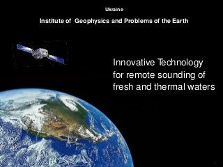
  • 1. 1 Ukraine Institute of Geophysics and Problems of the Earth Innovative Technology for remote sounding of fresh and thermal waters
  • 2. 2 Innovative Technology for remote sounding of fresh water Contents 1. About company "Institute of Geophysics and Problems of the Earth " 2. General Provisions 3. Scientific approach to the formation of artesian groundwater 4. The most powerful natural sources of fresh water on the globe 5. Some of the work performed 6. Experience of the work performed 7. Innovative Geophysical Exploration Technology 8. Service Ideology using RSS-NMR technology 9. General Idea of the Technology
  • 3. 3 1. About company "Institute of Geophysics and Problems of the Earth " Institute of Geophysics and Problems of the Earth is an innovative scientific and technological production company that provides a wide range of services for identification and research of water resources, hydrocarbon deposits and various minerals. The main goals of the company are the creation and implementation of innovative technologies that increase the efficiency of exploration of fresh water. hydrocarbon and other natural resources of the Earth. The Company's strategy for the provision of geophysical services is always the same - achieving the result with the greatest efficiency and with the lowest cost for the Customer, that is: - high performance, - speed of task performance, - inspection of territories without restrictions, - absolute environmental friendliness, - relatively low cost of work.
  • 4. 2. General Provisions Water supply problems in the world is getting more acute. This problem is especially relevant for countries with arid climate and deserts who occupy large areas. Relevant is the development and application of accurate, rapid and inexpensive methods to search for underground fresh water in large areas and depths The scientists of our company developed and successfully applied the technology of direct search for underground water resources, based on the effect of resonance. Search depths - up to a few kilometers! Confidence in the success is based on three main principles: 1. The development of a scientific approach to the genesis of groundwater. 2. Successfully completed freshwater research projects in various countries. 3. The presence of highly effective technology groundwater exploration. The use of technology in your country lets you quickly inspect large and hardly accessible areas, identify underground fresh water and to determine the optimal drilling point.
  • 5. 3. Scientific approach to the formation of artesian groundwater Mechanism of formation of underground waters is that sea water along tectonic fractures comes to the magma chamber (2000 ÷ 3000 m depth), where the water boils. The resulting vapor flows under pressure into the upper water permeable rocks by tectonic fractures (at a depth of 400 ÷ 1000m) condenses and forms an underground fresh water lakes. Of these lakes along the faults expire streams of fresh water From boiling zone by tectonic fractures expires geothermal salt water (at a depth of 2000 ÷ 2500 m).
  • 6. 4. The most powerful natural sources of fresh water on the globe In all cases, groundwater flow is discharged into the seas and oceans (wedge out in the lake) through hundreds of kilometers at certain depths and distances from the shoreline. Along the way, the flow of fresh water is branching into smaller streams, which cover large areas. We have identified a number of major sources of groundwater in different countries:
  • 7. A few more examples of powerful natural sources of fresh water Publications by our scientists on this subject 1. G.A. Bielawski, NI Kovalev. New technologies in remote environmental monitoring of underground and underwater objects // "Environment and Resources", vol. Number 9, Kiev, 2004., P.7. 2. N.I.Kovalev, etc. Investigation of the mechanism of formation of underground fresh water near the magma chambers extinguished volcanoes. International Conference «Space technologies in geophysics» //C.P. Russia, 2013. 3. N.I. Kovalev, etc. On the mechanism of formation of underground fresh water near magma chambers. - The book Scientific works of СНУЯЭиП, vol. 2(46), 2013. We can not only find natural "boilers", but also determine their structure: Parameters Рoint number 6 Mauritania Point number 8 Egypt Point number 9 Mozambique Рoint number 13 Iran Receipt of salt water. Atlantic Ocean. 3 km width Mediterranean Sea. 8 km width Indian Ocean. 10 km width Caspian Sea. 10 km width Geothermal water Geothermal salty streams. The depth of ~ 2000 m Geothermal salty streams. The depth of ~ 2500 m Geothermal salty streams. The depth of ~ 2300 m Geothermal salty streams. The depth of ~ 2000 m Freshwaters 3 flow. Depth 70m -128m Multipe streams of fresh water. Depth ≥ 200m Multipe streams of fresh water. Depth ≥ 150m 3 flow of fresh water. Depth = 180 - 240m
  • 8. 5. Some of the work performed (point 14 - UAE) Fresh water For example: In the magma chamber number 14 in the south of Iran sea water comes from the Arabian Gulf. As a result forming two flow of geothermal water at depths of 2 and 3 km. Is also formed a large flow of fresh water that crosses Arabian Peninsula and Saudi Arabia. A powerful stream of fresh water crosses the UAE at a depth of 280m - 350m. Further underground streams wedge into in the Red Sea near the city of Jeddah. Presalted water
  • 9. The formation of large water flows in southern Africa 9 M 7 N South Africa is powered by two powerful natural boilers 7N and 9M, which create a network of subterranean streams of fresh water. In this territory may be present smaller power sources. In sum, they give high prospects of providing the Southern African fresh water. The problem of existing methods is that they only work at small depths and territories. We will provide rapid remote detection of underground streams and reservoirs of fresh water on small and large depths.
  • 10. 6. Experience of the work performed (groundwater in the deserts) 2008 MAURITANIA (Sahara) Detected and then opened the flow of fresh water in the desert. Results: The depth of 75m - 150m Spouting water with the debit of 90 tons per hour (25 liters per second). The work was commissioned by the Department of Geology of the Ministry of Energy of Mauritania (Chief Geologist Lamine Ibrahim). Initially remote search facilities were surveyed 2,500 km square. Then, the mobile equipment on the terrain were refined parameters of occurrence of water and drilling points.
  • 11. Experience of work performed (groundwater) 2011 MONGOLIA (Gobi) Detected and then opened the flow of fresh water in the Gobi Desert. Results: 6 wells were drilled with a diameter 67 mm, all successful. Depth of 290m - 320m. For all wells debit of water from 20 to 25 tons per hour (5 - 7 liters per second). The work was commissioned by the Mongolian-Ukrainian company "Mon- Zim-International". Remote search tools have been surveyed more than 1,600 sq km. Then, with the help of mobile devices, on the terrain were refined data streams of water, and drilling points.
  • 12. Comparison of our data with drilling Europe's Best Water Search Technology 2019 Honorary "Crystal Prize Water 2019 drop" Ethiopia, Danakil Desert AfterBefore Country Area remote The depth, m Water Тype Our data / drilling results Our data / drilling results Mauritania, city of Atar 2500 sq. km. 80 ÷ 130 75 ÷ 150 Fresh / fresh Mongolia, Gobi Desert 1600 sq. km. 270 ÷ 320 290 ÷ 320 Fresh / fresh Cyprus, cityof Limassol 400 sq. km. 180 ÷ 200 195 ÷ 205 Fresh / fresh Ukraine, Sevastopol, Simferopol 1600 sq. km. From 50 to 950 Fresh / fresh
  • 13. The technology is based on the principle of resonance, which allows directly identify and record the required substances RSS-NMR technology classification 13 The “direct” method of prospecting and exploration of mineral deposits Resonance Spectral Sounding (RSS) Remote surveying of territories based on resonance processing analog IR space images Work on the ground with using point-to-point NMR sounding of deposits Thus, RSS-NMR technology consists of methods: RSS - for remote surveying of territories, sites, points. NMR - for work on the ground / fieldwork . At the same time, operational research of hydrocarbons, minerals, underground fresh and thermal waters both on large and small territories of land and shelf is provided. Nuclear magnetic resonance (NMR) 7. Innovative Geophysical Exploration Technology
  • 14. 14 Technology Features Territory of use - without restrictions (on land or on the shelf) Survey area - virtually no limits Depths of research - from 0 to 5 km Searched minerals - oil, gas, water and other minerals Efficiency - for hydrocarbons and water > 90% The duration of the stages - up to 1 month. Environmental safety - the method is absolutely safe for people and the environment
  • 15. 8. Service Ideology using RSS-NMR technology The presence of a highly effective remote research phase in combined with a ground survey of deposits allows implement a unique geophysical service covering almost all possible tasks of the customer. These tasks include: 1.Rapid identification of hydrocarbon deposits on the Customer’s territory and their contouring (“diagnostics” of the territory in 2D format); 2. Detailed remote exploration of identified deposits (3D), 3. Testing of drilling points obtained by classical methods; 4. Conducting an expedition for a detailed survey of deposits (3D), etc. A standard approach for exploring the territory of the Customer is first to “diagnose” the site and then, if there is a deposit (s) of groundwater, conduct a detailed inspection of them. This approach can significantly reduce time and costs in the event of the identification of "empty" areas.
  • 16. 9. General Idea of the Technology С В A D Water Oil Test wafer Reprinter Preliminary the spectrum of the sought-for mineral is recorded on special test wafers Isotropic broad-band radio emission Photograph Тest X-ray film Aerospace photographs Test wafers are used as a resonator during resonant l processing of analogue aerospace photographs of the territory obtained in the infrared range. Result is direct detection of underground streams and reservoirs of fresh water, determine their depths and drilling points. Ground expedition Point-to-point NMR resonance sounding of an area: improvement of deposit contours and depths, selection of optimal drilling points. Test wafers are used for spectral modulation of transmitter’s radiation
  • 17. Innovative methods are patented and tested Testing in the USA at 5 wells showed 100% effectiveness and 95% accuracy for depths of horizons 17
  • 18. We believe that application of the Technology will have a significant economic impact which can be achieved within very short time! Thank you for your attention Landline +591-33257175 Mobile +591-716-96657 (WhatsApp) VoIP: + 1-786-352-8843 Skype mlf10357 Home Bolivia: +591-3-3330971 Michel.friedman@fands-llc.biz