Ei map mongolia_rmipresentation_hires_ jim
•Descargar como PPTX, PDF•
0 recomendaciones•276 vistas


Recomendados
Más contenido relacionado
Similar a Ei map mongolia_rmipresentation_hires_ jim
Similar a Ei map mongolia_rmipresentation_hires_ jim (20)
Más de Enku Enkhtsetseg
Más de Enku Enkhtsetseg (11)
Ei map mongolia_rmipresentation_hires_ jim
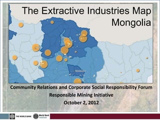
- 1. The Extractive Industries Map Mongolia Community Relations and Corporate Social Responsibility Forum Responsible Mining Initiative October 2, 2012
- 2. WHY AN ONLINE MINING MAP? Growing interest in open government data and how to use it for transparency Mining sector is of high interest, but it’s technical, and data can be hard to come by Policy makers and Civil society groups need a place to access and explore data
- 3. GOALS OF MONGOLIA’S MINING MAP See how government data can be made more open and usable Provide a tool for journalists, CSOs, decision- makers to understand sector Visualize complex sector for greater understanding
- 4. MAP OVERVEIW
- 5. CHOOSING AND GETTING THE DATA Exploration and production licenses Active mines, oil and gas wells Government revenue from mining Socioeconomic indicators Civil Society Activities
- 10. NEXT STEPS • Get feedback and refine: – What’s missing? How can we get it? – How can this tool be used? What needs to be improved to make it useful? – How can we add more detail at local level? • Transfer hosting and update responsibilities to Mongolian counterpart • Continue improving and upgrading data
- 11. Thank you The Extractive Industries Map Mongolia For more information: Jim Duncan (jduncan@worldbank.org) Michael Jarvis (mjarvis@worldbank.org)
Notas del editor
- Happy to be here today, and excited as this represents our official launch of the EI Map of Ghana!The EI Map of Mongolia gives users the ability to interactively map data and information on mineral and oil resources in the country, including government revenues, license data and socioeconomic conditions.We’ve learned a lot since releasing the beta version 6 months ago, so I am going demonstrate what you can do with the map, and share some of the insights in the process of creating such a platformWhy the map?Who asked for? Why Ghana? What was theory behind why it would work?What does it doOverview slide from how-to GuideWalk people through major functions of map: Customization – choosing minerals and only gold mines, adding projects, zooming inVisualization – payments, district revenues, employmentAccess to information – oil Main uses: Customization, visualization and access to informationuse slides from demo stages to highlightHow we got thereWhy does it help governance of EI?Citizens – access and comprehensionGovernment/Policy makers – survey of the state of the sectorPrivate sector – ability to show what they’re doingDonors – coordinationChallenges aheadGetting better and more timely dataCitizen feedback/mappingSustainability/hosting
- Data is often locked up in reports, books, paper charts, different ministries – and so we asked…And not only can we put this info in one place but can we make it understandable and give citizens the ability to create their own representations.Experience in Ghana mapping mining and oil activitiesInitially, civil society was our audience. But as we gathered data and showed our progress, we saw a broader interest among government officials and private industry. because this information had not been compiled like this before.
- Compiled data through desk research, contact with government agencies and others. Not about gathering new data -- consolidating data that was already out there.Going beyond report data required knocking on doors and pursuing underlying tablesUsing mineral license data from MRAM, we could analyze how much area they cover in soums, and visualize that. The Extractive Industries Transparency Initiative or EITI provided much of the financial data down to the soum-level, such as company payments to government for royalties, taxes and other fees. They also gave information about how much money went back from the national level to mining-affected districts.We used socioeconomic indicators from the National Statistics Office, which are regularly updated but only available at Aimag level
- Customization of what is displayed and where the map is focusedVisualization of consolidated data previously locked up in scattered reportsAccess to additional information about contracts, environmental performance or stakeholders
- Customization of what is displayed and where the map is focusedVisualization of consolidated data previously locked up in scattered reportsAccess to additional information about contracts, environmental performance or stakeholders
- Customization of what is displayed and where the map is focusedVisualization of consolidated data previously locked up in scattered reportsAccess to additional information about contracts, environmental performance or stakeholders
- Customization of what is displayed and where the map is focusedVisualization of consolidated data previously locked up in scattered reportsAccess to additional information about contracts, environmental performance or stakeholders
- Focus on data that can be mappedInterested in exposing and making available government data
- There is obviously a wealth of options and initiatives out there of which the EI map of Mongolia is just one. This map is just a first step, but it take information from dispersed sources and gives users the power to access it, visualize it and customize it. This tool has the potential to improve governance in the sector by giving citizens, advocates and policy makers the ability to visualize, understand and track the impacts of extractive activities, with the ultimate hope of creating better outcomes for the communities most affected.