SlideShare una empresa de Scribd logo
1 de 59
Page 1 of 59
An investigation into how physical channel characteristics
change throughout the course of the River Holford
Name: Nishay Patel
Candidate Number: 8331
Centre Number: 12760
Page 2 of 59
Contents
Introduction P.3
Location P.4
Exmoor National Park P.5
Land use map P.6
Land uses and Employment P.7
Facts about the River Holford P.7
OS map of River Holford P.8
The Geology of Somerset P.9
Geology and site map P.10
Aim and Hypotheses P.11
Sequence of work P.12
Methodology P.13
Risk Assessment P.14
Justification of Methods P.15
Techniques to measure data P.16-18
Equipment P.19
Secondary data and Formulae P.20
Site Descriptions P.21-25
Problems and Limitations P.26
Data Presentation P.27
Depth graphs P.28-33
Cross section graphs P.34-37
Cross section base map P.38
Width graph P.39
Gradient graph P.39
Formulae Sheet P.41
Data Analysis P.42
Spearman’s Rank P.43
Hypothesis 1 P.44-47
Hypothesis 2 P.48-51
Hypothesis 3 P.52-53
Conclusions and Evaluation P.54
Summary table and explanations P.55-56
Limitations P.57
Improvements P.58
Acknowledgements P.58
Bibliography P.58
Appendix-Raw Data P.59
Page 3 of 59
Introduction
Page 4 of 59
Introduction
In my introduction I will be talking about where in the UK the River Holford is
situated and the describing the relief around it.
I chose to investigate this river study over our four day field trip to Somerset in order
to find out the different factors that affect the physical characteristics of the River
Holford such as its depth and the channel’s width.
Location
Somerset is a county in the South West of England and borders five other counties
including Bristol, Gloucestershire, Wiltshire, Dorset and Devon. The Bristol Channel
and the estuary of the River Severn are to the north and west of Somerset. Somerset is
a rural county and is where many tourists come to visit the rolling hills including the
Quantock Hills. It is also home to Exmoor National park which is known for its
scenery and rare wildlife such as the red deer.
Local Map of Somerset
Thisis a national mapof
where Somersetisinrelation
to the rest of England.
The Bristol Channel islocated
inthisarea here.
Thisis a local map of
Holford,whichisa
settlementinSomerset
where the riverHolford
runs throughandis
namedafter.
Thisis a confluence
RiverHolford.
Page 5 of 59
Woodland
12.2%
Moorland
12.2%
Farmland
55.9%
Other
19.7%
Land uses in Somerset
During our four day field trip we stayed in a mansion called Nettlecombe Court which
is located in Nettleton Park. It was originally built with the intentions of it being a
manor house until it became a boy’s school in 1963. The house itself is in Exmoor
National Park and is set in a valley just north of the Brendon Hills.
A photograph of Nettlecombe Court.
Exmoor NationalPark
Somerset is home to Exmoor National Park which is 693 km2 and is only one of
twelve National parks in the United Kingdom. Within Exmoor National Park there is a
site of special scientific interest which is 194 km2 large and a 4 km2 national nature
reserve. There is a population of 10,873 people in Somerset and a census taken in
2001 showed that it had increased by 2.1% between 1991 and 2001. 25% of
Somerset’s population is over sixty-five and this shows that it is a popular retirement
resort. There are 1,011 enlisted buildings in Exmoor National Park and 11.5% of the
houses are second homes, which mean that they are old and cheaper to buy. With
regards to tourism, over 1.4 million visitors go to Somerset each year and this brings
in over £35.5 million.
Land uses
The main land uses in Somerset are,
farmland, which is mainly pastoral
sheep farming. Woodland, where
Deciduous and Coniferous trees grow
which would have been ideal for fuel
and as building materials when early
settlers arrived. Settlements, such as
Holford and Kilve, and moor land
where vegetation such as heather and
bracken grows.
Page 6 of 59
Land Use map
Page 7 of 59
Land use along the course of the River Holford is important to look at because it could
affect the characteristics if the channel. As you can see on the land use map there is a
high amount deciduous forest near the source meaning that the trees will intercept rain
water and prevent it from reaching the river. This tells us that the sites near the forest
will have a shallower depth.
As you can see on the land use map on page 6 the River Holford flows through urban
areas such as Kilve. You would expect the river’s width and depth to increase because
the concrete surfaces in these areas would increase surface runoff and decrease
infiltration. Water from people’s drains run into the river and this causes the depth of
the river to increase. In Kilve the channel has been altered by man making them more
efficient. This tells us that the wetted perimeter of the river will decrease, meaning
that river’s velocity will increase. This is due to the fact that there will be less friction
between the water and the banks and bed of the river.
Employment in Somerset
Employment figures show that 15% of the people living in Somerset work in the hotel
and catering business because of the huge amounts of tourists who go there each year.
Farming plays a major role in Somerset because it does not only take up most of the
land space but, 13.9% of the population works in agriculture.
Facts about the River Holford
The River Holford’s source is at Lady's Fountain Spring, Frog Combe which is 250 m
above sea level, ands mouth is at Kilve. All together it is 7.4 km long. The upper
course of the River Holford is very steep and the lower course has hardly any gradient.
The middle course is less steep when compared to the upper course. This tells us that
there is a decline in gradient from source to mouth.
This is the source of the River
Holford at Lady's Fountain
Spring, Frog Combe.
This is the mouth of the River
Kilve.
Page 8 of 59
OS map
Page 9 of 59
The GeologyofSomerset
The River Holford is 7.4 km long and has three main types of geology throughout its
course which are Devonian Quartzite, Permo-Triassic Marl and Jurassic Limestone.
1. Devonian Quartzite is found in the upper course of the River Holford where the
gradient is steep. It is a hard, impermeable red metamorphic rock and means
that the depth will be shallow here as water cannot percolate through it. The
width will be narrow here seeing as the river requires more energy to erode the
rock. Quartzite was once sandstone and this conversion took place after heat
and pressure. Its appearance is red because of the amount of iron oxide and
other chemical impurities inside it.
2. Permo-Triassic Marl is also found in the upper course of the river and is a soft,
impermeable sedimentary rock which is composed mainly of calcium
carbonate. This means that the width will be larger here seeing as more erosion
takes place in this part of the river. However, the depth here is deep as less
water is lost via percolation.
3. Jurassic Limestone is found in the lower course of the River Holford and is a
permeable sedimentary rock which is resistant to erosion. Limestone is mainly
made from calcium carbonate. Because Jurassic Limestone is a permeable rock
more water is lost via percolation meaning that there is less water in the
channel. This tells us that the depth of the river will decrease at the sites where
the geology is Limestone.
This is an example of Quartzite. This is a sample of Jurrasic Limestone.
This is an example of
Permo- Triassic Marl.
Page 10 of 59
Geology and site
map
Page 11 of 59
Hypotheses
Aim: An investigation into the changing physical characteristics form source to mouth
of the River Holford.
Objectives: We will be looking at a number of different factors that change throughout
the course of the river. These will be the width of the river channel, the average depth,
velocity, volume and the gradient. When these readings are taken there should be
correlations between them.
Hypothesis 1- The width of the river will increase as you move from the source to
mouth.
The width of a river channel increases as it goes downstream because tributaries and
confluences join into it, thus making it wider because it holds more water. In the upper
profile of the river you would find mainly vertical erosionwhich cuts downwards. In
the lower course of the river more lateral erosiontakes place which means the river
cuts sideways into the valley. The river gets more powerful as you go down its course
which means that it has more erosioncapability. There is also less energy waste on
frictionas there is less substrate is on the bed. This is why you would expect a wider
channel in the lower profile of the river.
Hypothesis 2- The depth of the river will increase as you go from source to mouth.
Depth is how deep the river is. As the River Holford flows along its course, tributaries
and confluences join it which means there is more water in the river than at its source.
In the higher profile of the river mainly vertical erosiontakes place. This is the rapid
down cutting of the bed. In the lower course of the river there is lateral erosionwhich
means that the river erodes the valley sideways. However, as the river continues
downstream there is less substrate on the bed which
means that there less energy waste on friction. This
means that there is more energy to erode the bed.
Hypothesis 3- Gradient will decrease as you move
from source to mouth.
Gradient is the elevation of the river along its course.
This hypothesis has been made because the contour
lines of an OS map are closer together at the source
than any other point along the rivers course. The map
tells us that the source is 250m high and the mouth is
not elevated at all. Rivers cannot flow upwards and
always flow at a negative gradient due to gravity.
Thisis Bradshaw’smodel andtellsushow differentcharacteristics change
as yougo from upstreamtodownstream.
Page 12 of 59
Sequence of work Start
Firstly we established our aims and hypotheses
before embarking on this trip.
Preparation
Suitable equipment was selectedin order to
measure the factors along the river accurately
Practice
We left school on the 16th October. Shortly after
reaching our destination, we went to a nearby
river and practised measuring using the
different equipment.
Fieldwork
Many measurements such as the width, depth
and gradient, were taken at eight different
points along the River Holford.
Data Collection
The data which was collectedduring the
fieldwork was analysed using graphs.
Write up
The introduction and the methodology were then written about the background of
the area and the different sites at which the different measurements were taken.
This is a somatic diagram
of how I prepared for and
undertook my river
study.
Page 13 of 59
Methodology
Page 14 of 59
Methodology
In this section I shall be describing the different sites at which we collectedour
primary data and methods that were used to collect this data. I will also be looking at
how the risks were minimized.
Risk Assessment
Risk How it was minimized
There could have been rat faeces in the
river which could have caused diseases if
it got into the skin.
Marigold gloves were worn at all times
when in contact with the river.
We could have slipped on river substrate
while taking the different measurements.
Wellington boots were worn while in the
river in order to give us more grip and
this would minimize the risk of slipping.
Ticks Long sleeve clothing was worn to cover
the whole body and therefore decreasing
the chances of getting ticks on the body.
Getting diseases from the river Hands were washed thoroughly with soap
after returning from the river study.
Uneven terrain Hiking boots were worn in order to
minimize any injuries taking place.
Hypothermia Suitable warm clothing such as, woolly
hats and gloves were worn when we were
outside on the field trip.
Falling into the river and breaking bones. We were working in groups of 6 so that if
someone fell in the river, then a teacher
could be called by the remaining people.
Getting wet in the river. Waterproof clothing was worn when we
were in the river.
Page 15 of 59
Justificationof Methods
There are three types of sampling methods which could have been used on this river
study and are a random method, a systematic method and a stratified method. We
chose a stratified sampling method for the sites because we had prior knowledge of
the area and so knew where the different parts of geology, the confluences and the
urban areas were. This sampling method allowed us to find out the impacts after
confluences and if there was a difference in other factors such as depth in areas of
different geology along the river’s course. If we used a systematic sampling method,
then you might overlook key points along the river and go into private land without
knowing. A stratified approach was practical method to adopt because we could
measure all along the river’s course in such a limited amount of time, even if it was
biased because you chose specific areas in which you wanted to sample. A random
sampling method was used to measure the clast size at each site so that we were not
biased when collectingthe data.
We chose to sample eight sites along the River Holford’s course because this would
give us a broader range of results. When all the data was collectedand put into graphs,
this would tell us the change from the source to the mouth of the different factors that
we were measuring. If we only sampled at two sites, then we would not find a trend in
the data and find it very hard to interpret it.
These are the different factors that we sampled and how many we chose to sample at
each site:
1) Gradient- We chose to sample one gradient at every site because the reading
would always be the same.
2) Width- We chose to sample one width reading at every site because the reading
would always stay the same.
3) Depth- We chose to take five depth readings at each site as one would not be
enough to give an average reading.
4) Velocity- 5 readings were taken at each site to see where the fastest flow was
along the width of the river.
5) Clast angularity and size- 15 clasts were picked at random at every site in order
to get a broader set of results.
6) Wetted perimeter- One reading was taken at each site as the wetted perimeter
would always be the same.
Page 16 of 59
Width
The width was calculated at each of the eight sites along the course of the river
Holford. It took the least amount of time to measure so was therefore taken first. We
used a measuring tape in meters to measure the width because it is flexible and very
easy to use. In order to measure the width, we had to face upstream and measure from
left to right. We put the measuring tape right to the edge of the banks and then read
out the reading. It only required two people to measure the width and so the other
members of the group were writing down the readings in meters.
Measuring the width of the
river.
Depth
After the width was measured we
found the depth. The depth of the
river was calculated using a ridged
meter ruler and it was predicted
that as we continued downstream,
the river would get deeper. We
divided the river’s width by 5 and
then used this to take 5 separate
readings along the width. While
measuring the depth we used the
narrow edge of the metre ruler to
prevent a build up of water and stood after the metre ruler in order not to affect the
results.
Direction of
flow
Direction of
flow
Page 17 of 59
Wetted Perimeter
The third reading we took was the wetted perimeter. The wetted perimeter was
measured using a measuring tape because it is flexible. Firstly, the measuring tape was
spread along the width of the river and left slacking. Then, someone in the group
walked in a straight line along the measuring tape and read the measurement out to be
recorded. While we were measuring the wetted perimeter we were careful to work
upstream and from the left bank to right bank so not to alter our readings.
Measuring the wetted
perimeter of the River
Holford.
Velocity
The velocity was measured using a hydroprop and an impeller. At each site, we
measured 5 velocity readings by dividing the channel’s width by 5. The impeller was
placed onto the hydroprop, and then put two thirds of the depth into the river in order
to prevent the impeller from touching the bed. A stopwatch was started immediately
as the impeller was placed into the water and stopped when the impeller stopped.
Some readings were defaulted at 100 seconds because at some sites, the water was too
shallow for the impeller to go in.
Measuring the velocity
Direction of
flow
Direction of
flow
Page 18 of 59
Angularity and Size of Bed load
First, 15 clasts were picked up from the river bed at random, with our eyes closed so
that we were not biased in the selection of the clasts. Then the angularity of the clasts
were measured by using the cailleux roundness index chart. Next, the longest axis of
the clasts were measured using a rigid meter ruler and then recorded.
Measuring the longest Axis of the clasts. Measuring the angularity of the clasts.
Gradient
The last reading that we had to take at each site was the Gradient. The equipment
which was used to find the gradient was an E-ruler and a surveyor’s level. First, one
group member went into the river and held the E-ruler straight just above the tip of
their boot. Then, another person on land five meters away, downstream looked
through the surveyor’s level and read the height on the E-ruler. The readings were
then noted for each site.
Page 19 of 59
Equipment
1) The hydroprop and the impeller were used to measure the
velocity of the River Holford. The impeller was attached to
the hydroprop and were placed two thirds of the depth of the
river in order to stop there being frictionbetween the
impeller and the bed. The impeller turned and a stop watch
was started, and stopped when the impeller stopped rotating.
2) A 1 meter ruler was used to measure the clast
size and the depth. It was ideal for these two
measurements because it was rigid and very easy
to read.
3) A tape measure was used to measure the wetted
perimeter and the width of the river. It was also
used to split the river up into 5 parts when we
were finding out the gradient.
4) A surveyor’s level was used to measure the gradient.
You had to look through the surveyor’s level at an E-
ruler and measure the reading on it.
1
2
3
1. Impellor and hydroprop
2. 1 meter ruler
3. Tape measure
4. Surveyor’s level
5. E-ruler
Page 20 of 59
Secondary Data
Secondary data is data that we have to rely on. I used a number of different sources
such as, the internet and maps in order to support the primary data collected. An
ordnance survey map of the area around the River Holford was used to predict if the
gradient was decreasing in order to strengthen the readings.
Our gradient data was mostly secondary data because we did not physically take all of
the eight measurements ourselves. We only measured one out of the eight sites.
Weather information of Somerset was looked up on the internet to see if there was
rain prior to our study. If there was a lot of rain or no rain at all, then this factor would
be taken into consideration when our data was analysed.
Formulae
Gradient (m/m) = Downstream reading (m) – Upstream reading (m) ÷ 10m
Channel Size (m2) = Average depth (cm) ÷ 100 x width (m)
Channel Shape (form ratio) = Average depth (cm) ÷ 100 x width (m)
Bank full CSA (m2) = bank full width (m) x Bank full average depth (cm) ÷ 100
Spearman’s Rank Correlation
Spearman’s rank technique is a statistical test which will be used for each hypothesis
to see whether there is a correlation between two variables, and to test the actual
strength and the reliability of the relationship.
This is the equation to work out Spearman’s Rank Correlation:
After finding the results from the Spearman’s rank, a significance test will be used to
test the significance of the relationship. This will show us whether my results occurred
by chance and if we should accept or reject my hypotheses.
Page 21 of 59
Site Descriptions
Site1- This site was very close to the
source of the River Holford. It is in a
wooded area with steep sides and
there is a very obvious drop in
gradient as you continue from the
source to site 1. Site 1 is a small
stream which had very little depth
and width because it had not rained
prior to our trip. The clasts were all
angular here and the geology was
Devonian Quartzite.
Site 2- The river at site 2 was very
narrow but was getting deeper as
predicted. The geology in this area
was Quartzite and the gradient was
decreasing. There were still steep
“v” shaped sides here just like at
source 1.
Direction of
flow
Direction of
flow
Angular clasts
Page 22 of 59
Site 3- At this site, the river widened
considerably when compared to site 2 but
still stayed relatively the same depth. The
rock type was still Quartzite and there
was non-coniferous woodland around the
river.
Site 4- At this site we were near to a
settlement called Holford. The river’s
width had increased considerably and
there was a change in geology from the
previous sites and now there was Permo-
Triassic Marl.
Direction of
flow
Direction of
flow
Page 23 of 59
Site 5- At this site the river’s width,
depth and velocity increased slightly.
The geology at this site was Marl. The
cross sectional area also increased
because we were in the middle course of
the river.
Site 6- At this site, there was a rapid
increase in the velocity of the river. The
environment here was very similar to
that of site 1 because there were steep
sides which were covered with dense
trees and vegetation. The geology here
was still Marl.
Direction of
flow
Direction of
flow
Page 24 of 59
Site 7- This site was in the lower course
of the river and was on Jurassic
Limestone. The river had calmed down
and its velocity decreased. The cross
sectional area increased because we
were in the lower course of the river.
There was very little gradient here and
the clasts were decreasing in size and
were mostly rounded.
Site 8- This site was located in the
lower course of the river and was the
closest site to the river’s mouth at
Kilve. This part of the river was on
Jurassic Limestone and there were vast
amounts of vegetation that had grown
on the river banks here. The river had
become calmer and there was very
little change in the gradient.
Direction of
flow
on of
w
Direction of
flow
Vegetation on the banks of
the river.
Page 25 of 59
Mouth- This is the river Holford’s
mouth at Kilve beach. Although
this was not a site and we did not
sample here, we can tell that the
clasts are smooth and that there is
a downward gradient as the water
goes into the Bristol Channel.
The water percolates through the
limestone and came back up on the
beach into the Bristol Channel.
Water emerging from
underground
Page 26 of 59
Problems and Limitations encountered in Data Collection
There were many problems that we encountered on our river study. Some we could
not change but others we could.
Physical Factors
One physical problem was that there was debris in the river such as tree branches and
clasts. This affected measurements such as depth and velocity, because there was a
build up of water due to this river substrate. This meant that many readings were
difficult to measure accurately.
There was a lack of rain before we went on this field trip which meant that the river in
some parts was very shallow and could have limited the reliability of the data.
At some points, the impeller could not turn due to the fact that the river was too
shallow and this could have also been because there was a lack of rain. This meant
that, especially in the upper course sites that the readings had to be defaulted at 100
seconds.
Human factors
One human problem was that the angularity of the clasts had to be decided by eye.
This meant that it was the group member’s opinion on whether the clast was rounder
or angular. Instead of measuring the clasts size, we could have measured its volume in
order to make it more accurate.
Another human limitation was that we could have taken ten measurements for every
factor per site. This would have meant a wider range of results to interpret. The reason
that this was not undertaken was because of the limited amount of time we had to
sample the river.
Accessibility of land was a human limitation because part of the river was blocked
because it was in private land. This meant that we could not sample in this area and
therefore we could not tell if the trends of the previous sites would continue.
Debris such as leaves, rocks
and tree branches blocking
the flow of the river.
Page 27 of 59
Data Presentation
Page 28 of 59
In this section I shall be presenting my data as graphs and describing the basic trends
that are seen in them. I will also be justifying why I used a particular type of graph as
oppose to another one.
Graphs to show the depth of the river along all eight sites
I have chosen to represent the depth of the river as a bar chart because it is very easy
to visualize the depth of the river in this way. You can also tell where the deepest part
of the river was along each of the eight sites. Bar charts are used when the change is
large.
Overall, all the depth readings at this site were what was expected to be seen at this
stage along the river’s course because the river at this stage was very shallow.
Measurements 1 and 2 are the same at 0.015m and this was correct because the
channel was very narrow here. However, measurement 4’s depth was only 0.001m
and this is incredibly low when compared to the other depth readings taken at this site.
-0.51
-0.41
-0.31
-0.21
-0.11
-0.01
1 2 3 4 5
Depth(m)
Number of Readings taken
Site 1 Depth
Depth
Page 29 of 59
The readings at site 2 tell us that the river was increasing in depth from an average of
0.0122m at site 1 to 0.1246m. Reading 5’s depth was 0.51m which was very far away
from the trends that the other readings taken at this site showed. This reading could be
seen as an outlier. An explanation of why this outlier occurred may have been because
there were many objects such as tree branches in the river which could have caused a
build up of water where we were measuring the depth. Reading 3 was quite low when
compared to the other readings at 0.005m.
Reading 1 was the shallowest depth and was 0.037m. The depth then increased by
0.03m at reading 2 and continued to increase at reading 3 where it was 0.074m. The
depth then steadily increased by 0.009m until reading 5.
-0.51
-0.41
-0.31
-0.21
-0.11
-0.01
1 2 3 4 5
Depth(m)
Number ofReadingstaken
Site 2 Depth
Depth
-0.51
-0.41
-0.31
-0.21
-0.11
-0.01
1 2 3 4 5
Depth(m)
Number of Readings taken
Site 3 Depth
Depth
Page 30 of 59
At Site 4 the average depth was 0.093m which was larger then at the previous site.
The depth stayed the same at readings 1 and 2 and was 0.105m. It then increased
slightly by 0.005m at reading 4 until the depth decreased by 0.065m at reading 5.
At site 5 the five readings taken across the width of the channel were quite varied.
Reading 2 was the lowest measurment that was taken and was 0.0102m. This may
lead us to believe that this was an outlier seeing as none of the other results are this
low. The depth then increased after reading 2 until 4 where it was at its highest of
0.17m. The depth then decreased until reading 5 where it was 0.07m.
-0.51
-0.41
-0.31
-0.21
-0.11
-0.01
1 2 3 4 5
Depth(m)
Number of Readings taken
Site 4 Depth
Depth
-0.51
-0.41
-0.31
-0.21
-0.11
-0.01
1 2 3 4 5
Depth(m)
Number of Readings taken
Site 5 Depth
Depth
Page 31 of 59
The depth at site 6 generally decreased from 0.099m at site 5 to 0.0812m which came
as a surprise because the depth of the river is supposed to increase as you get closer to
its mouth. Reading 1 had a depth of 0.055m which was expected because it was the
nearest to the bank of the river. The depth then deepened at reading 2 where it was
0.107m until reading 3 where it was 0.064m. At readings 4 and 5 the readings
increased to 0.091m.
At reading 1 the depth was 0.043m and was the lowest measurement because it was
the closest reading taken to the bank. The depth then increased at reading 2 where it
was 0.096m and then deepened further by 0.008m until reading 3. The river’s deepest
point in the channel was at reading 4 where the depth was 0.127m. The depth then
decreased at reading 5 by 0.074m.
-0.51
-0.41
-0.31
-0.21
-0.11
-0.01
1 2 3 4 5
Depth(m)
Number of Readings taken
Site 6 Depth
Depth
-0.51
-0.41
-0.31
-0.21
-0.11
-0.01
1 2 3 4 5
Depth(m)
Number of Readings taken
Site 7 Depth
Depth
Page 32 of 59
At site 8 our readings showed us that this was overall the deepest part of the river. The
depth at reading 1 was 0.092m which was the shallowest reading because it was the
closest one taken to the bank. The river increased in depth at site 2 where it was 0.14m
and continued to increase until reading 3 which was 0.195m and was the deepest point
in the channel. The river’s depth then decreased at sites 4 and 5 by 0.045m.
-0.51
-0.41
-0.31
-0.21
-0.11
-0.01
1 2 3 4 5
Depth(m)
Number of Readings taken
Site 8 Depth
Depth
Page 33 of 59
Overall, there is an increase in depth as you go along the river’s course. This can be
seen at site 1 where the average depth was 0.0122m, and then at site 8 where the depth
was 0.152m. There is a 0.1398 m difference between the two and shows that the depth
of the river increases as you go from its source to its mouth.
-0.16
-0.14
-0.12
-0.1
-0.08
-0.06
-0.04
-0.02
0
1 2 3 4 5 6 7 8
Depth(m)
Site number
Average Depth vs Distance downstream
Depth
Site Number Average Depth (m)
1 0.0122
2 0.1246
3 0.0686
4 0.093
5 0.099
6 0.0812
7 0.0876
8 0.152
Page 34 of 59
Graphs showing the Cross sectional of each site
A x-y plot was chosen to represent the cross sectionof the river because it is easy to
see how the river changed as we progressed through the sites. It was used to determine
relationships between the width and depth.We did not use a bar graph to represent this
data because they are used to track changes over time.
At site 1 the cross sectional area was 0.008418 m2, which is the lowest result out of all
the sites and was what we expected. The channel’s width and depth were very small
here. There was an unexpected drop in the depth of the river at the 5th plot where it
was 0.001m, and means that this reading was unexpected.
At site 2 the cross sectional area was 0.28035 m2 which was higher than at the
previous site. Plot 6 was an unexpected rapid increase in the depth which was an
outlier because it was outside the range of the other results.
Page 35 of 59
At site 3 the cross sectional area was 0.155036 m2 which shows that there was an
unexpected drop from this reading to the one at site 2. The depth of river increased
until plot 6 where it started to decrease until it reached the river’s bank. The width of
the river stayed the same as the previous site which was unexpected because the width
was supposed to increase as you travel from source to mouth.
At site 4 the cross sectional area was 0.33852 m2 which was an increase from the
previous site. The depth at plots 2-5 were very close to each other, until there was a
decrease in the depth at plot 6 until the river bank. The width of the river increased by
1.38m from the previous site which showed that the river was increasing in size.
Page 36 of 59
At site 5 the cross sectional area was 0.18216 m2 which was lower than the previous
site. The depth increased and then decreased at plot 3, where the result was an outlier.
The depth then increased until plot 5, (where the water was at its deepest), and then
decreased until the river bank. The width of the river decreased by 1.8m from the
previous site and this was an unexpected reading.
Site’s 6 cross sectional area was 0.23142 m2 which was an increase from the last site.
The depth increases until plot 3, until plot 4 where there is a decrease. The width
increased by 1.01m from the previous site, and this was expected.
Page 37 of 59
At site 7 the cross sectional area was 0.219 m2 which was a decrease from site 6.The
depth increased until plot 5 and then it decreased. The depth was at its highest near the
middle of the river at plot 5 which was 0.127 m. The width of the river had
unexpectedly decreased by 0.35m from the previous site.
Site’s 8 cross sectional area was 0.42256 m2 which was the highest reading of all the
eight sites and this was expected. The depth increases until plot 4 where it is 0.2 and
then starts to decrease until the bank. The width of the river increased from 2.50m at
site 7 to 2.78m at this site which was expected in the hypotheses.
Page 38 of 59
CSA base
map
Page 39 of 59
Width along the eight sites of the river Holford
I have chosen to represent my data for width as a lateral bar chart because it is very
easy to see the trends and where the river was at its narrowest and widest. Bar graphs
are used to track changes over each site.
The width of the river starts to increase as we go from site1to site 4 by 2.95m. At site
4 the river was very wide which was unexpected because the widest part of the river
was supposed to be the nearest to the mouth. There was an unexpected drop of 1.8m in
the width at site 5. The width then increased until site 7 where there was a slight
decrease, and then there was a final increase at site 8. Overall, we can see that the
river increased in width from 0.69m – 2.78m as you went from its source to its mouth.
0 0.5 1 1.5 2 2.5 3 3.5 4
1
2
3
4
5
6
7
8
Width (m)
SiteNumber
Width vs Distance downstream
Width
Site Number Width of River (m)
1 0.69
2 2.25
3 2.26
4 3.64
5 1.84
6 2.85
7 2.50
8 2.78
Page 40 of 59
Gradient along the eight sites of the river Holford
I have chosen a line graph to show the gradient of the river Holford because it is very
easy to see if the gradient was increasing or decreasing. You can also see the rate at
which the river is decreasing in gradient with this type of graph. A line graph was
used instead of a bar chart because when smaller changes exist, line graphs are better
to use than bar graphs.
The gradient of the river starts to decrease rapidly as you go from site1 to site 2. Then
the river starts to decline at a slower rate until site 4 where it is 0.008 m/m. After this,
there was an unexpected increase in the gradient of the river until site 5. The river then
decreased from site 5 to site 8. Overall, there is a 0.08 m/m downward trend in the
data which means that gradient decreases as you go from the source to the mouth.
0
0.01
0.02
0.03
0.04
0.05
0.06
0.07
0.08
0.09
0.1
1 2 3 4 5 6 7 8
Gradient(m/m)
Site number
Gradient of the river
Gradient
Site Number Gradient of River (m/m)
1 0.086
2 0.034
3 0.021
4 0.008
5 0.029
6 0.021
7 0.021
8 0.006
All raw data that was collectedis in the appendix on page 59.
Page 41 of 59
Formulae Sheet
Page 42 of 59
Data Analysis
Page 43 of 59
In this section I will be analysing my results to see if my hypothesis were correct and
using Spearman’s Rank correlation to show the reliability of my results. Scatter
graphs will be used to show the possibility of a positive correlationbetween two
variables, such as width and the distance from the source. Simply looking at the line
of best fit will tell us if there is a strong positive relationship, no relationship, or a
negative relationship between the two variables.
Spearman’s rank
Spearman’s Rank is a statistical technique which is used to see if there is a correlation
between the results and to see the reliability of this relationship between them. This
technique tells us whether the correlation is really mathematically significant or if it
could have been the result of chance alone.
Method of finding R2
1) State if there is a relationship between your two sets of readings.
2) Make a table and rank both sets of measurements, for example distance from
source and depth, with the biggest number having a ranking of 1, and the
smallest having a ranking of 8.
3) Take away the two sets of rankings away from each other in order to get the
difference between the two ranks (d).
4) Then square the difference between the two values to remove the negative
values and get Sigma difference2 (∑d2).
5) Next, calculate the coefficient (r2) by using the formula below. The answer will
always be between 1.0 (a perfect positive correlation) and -0.1 (a perfect
negative correlation).
This is the Spearman’s Rank formula written in mathematical notation:
Page 44 of 59
My hypotheses were:
1. Width will increase as you go from source to mouth.
2. Depth will increase as you go from source to mouth.
3. Gradient will decrease as you go from source to mouth
Hypothesis 1: Width
Scatter graph to show the change in width of the
River Holford from source to mouth.
It can be easily seen from this scatter graph that the width increased as you went form
sites 1-8. This supports my hypothesis because the graph indicates that there is a
correlationwhich is that, as the distance from the source increases, the width also
increases. Nearly all the widths, except sites 1 and 4, are near to the line of best fit and
this shows us that the correlationis quite good. Now a statistical test called
Spearman’s Rank correlation must be undertaken to see the strength of this
correlation.
0
0.5
1
1.5
2
2.5
3
3.5
4
0 1000 2000 3000 4000 5000 6000 7000 8000 9000
width(m)
distance from source (m)
Width from source to mouth along the River Holford (m)
Page 45 of 59
Spearman’s rank correlation
Below is how we found r2 using the Spearman’s rank equation:
6 x 36 = 1 - 216
83-8 504
= 1- 0.428 r2 = 0.572
The closer r2 is to +1 or -1, the stronger the likely correlation. A perfect positive
correlationis +1, while a perfect negative correlationis -1. My r2 value is 0.572 which
is quite close to +1, and therefore suggests to us that there is a fairly strong positive
relationship.
Site
Number
Distance
from
Source
(m)
Rank Width
(m)
Rank Difference
Between
Ranks
(d)
Difference2
d²
1 20 8 0.69 8 0 0
2 230 7 2.25 6 1 1
3 480 6 2.26 5 1 1
4 560 5 3.64 1 4 16
5 1104 4 1.84 7 -3 9
6 2987 3 2.85 2 1 1
7 4200 2 2.50 4 -2 4
8 7727 1 2.78 3 -2 4
Total: 36
Page 46 of 59
Significance Testing
A further technique is now required to test the significance of the relationship. The
r2value of 0.572 must be looked up on the Spearman Rank significance table which is
below. First you have to work out the “degrees of freedom”, which is the number of
pairs in your sample minus 2. For our test this was 6 (8-2). The result was then plotted
on the significance table below in order to be assessed. If the reading is below 5%,
then you must reject your hypothesis because your reading was a product of chance. If
your reading is above 0.1, then we can be 99.9% confident that the correlation did not
occur by chance.
The plot of 0.572 above gives a significance level of under 5% which tells us that it is
possible that my result my have been the product of chance and that the hypothesis
must be rejected. This means that the probability of the relationship that has been
found being a chance event is nearly 99%. However, we did only take 8 samples along
the river’s course, so if more measurements were taken, then the results would be
more reliable. From the significance test above my hypothesis is very likely to be
wrong.
Page 47 of 59
Possible Explanations for width results
There are many possible explanations for why the width of the river followed the
trend which can be seen in the graph.
One explanation of why the width decreased at some sites but then unexpectedly
increased at others was that there were three types of geology along the river’s course,
(which can be seen in the geology base map on page 10).The geology at the first three
sites was Quartzite which is a hard, impermeable red metamorphic rock which means
that water cannot percolate through it. This meant that we would not expect a large
channel because the rock is resistant so is hard to be eroded and weathered away. The
next three sites widths could have been affected because the geology was Marl, which
is a soft, impermeable sedimentary rock. This meant that the channel was expected to
be wider because more erosiontakes place in this part of the river, and this is why
there was an increase in the channel’s width at sites 4-6. The geology at the last two
sites was limestone which is a permeable sedimentary rock and is resistant to erosion.
Limestone’s permeability meant that water in the channel was going to percolate
through it, and would mean that there would be less energy in the river so the river
may narrow again.
Another explanation of why the width readings were not as the hypothesis had
predicted was because of the gradient (which is seen by the contour lines on the OS
map on page 8). In the upper course of the river, we expected the river to have more
potential energy which meant that the river was deeper rather than wider. As we
progressed to the lower course of the river, we found that the river was wider because
there was more lateral erosiontaking place, which meant the widening of the channel.
Where we were along the drainage basin could have changed the width of the river.
An example of this is at site 3 where we were near a confluence. The river would have
had more energy to erode the banks and therefore widen the river.
At the first three sites there was dense forest to both sides of the river, (which can be
seen on the land use map on page 6). This meant that interception by this canopy layer
could stop rain water from reaching the ground and therefore decreasing surface
runoff. Surface runoff is very quick and is the movement of water in any form from
the atmosphere to the ground. This meant that the width of the river was expected to
be very small in the forestedareas. On the other hand, the sites which were in open
farm land were expected to have a wider channel because there would be little or no
interception from trees and vegetation.
Page 48 of 59
Hypothesis 2: Depth
It can be easily seen from this scatter graph that the depth increases as you go further
out from the source and therefore supports my hypothesis. There is an overall positive
correlationwhich can be seen in the graph which is that, as the distance from the
source increases, the depth also increases. However, some of the depths, such as at
sites 1 and 2 were not near the line of best fit which could weaken the correlation.
Now a statistical test called Spearman’s Rank correlation must be undertaken to see
the strength of this correlation.
0
0.02
0.04
0.06
0.08
0.1
0.12
0.14
0.16
0 1000 2000 3000 4000 5000 6000 7000 8000 9000
depth(m)
distance from source (m)
Depth from source to mouth along the River Holford (m)
Page 49 of 59
Spearman’s rank correlation
Below is how we found r2 using the Spearman’s rank equation:
6 x 46 = 1 - 276
83-8 504
= 1- 0.547 r2 = 0.453
My r2 value is 0.453 which is relatively close to +1, and therefore suggests to us that
there is a fairly good positive correlation between the depth and the distance from the
source.
Site
Number
Distance
from
Source
(m)
Rank Average
Depth
(m)
Rank Difference
Between
Ranks
(d)
Difference2
(d²)
1 20 8 0.0122 8 0 0
2 230 7 0.1246 2 5 25
3 480 6 0.0686 7 -1 1
4 560 5 0.093 4 1 1
5 1104 4 0.099 3 1 1
6 2987 3 0.0812 6 -3 9
7 4200 2 0.0876 5 -3 9
8 7727 1 0.152 1 0 0
Total: 46
Page 50 of 59
Significance of Relationship Testing
This Spearman’s rank correlationgraph test tells us that 0.453 is under a significance
level of 5% and means that it was possible that my results was the product of chance
and therefore must be rejected. However, we could have compared our data with the
other groups completing the same study to see if they got mainly the same results as
us, and this would improve the reliability of the sample.
Page 51 of 59
Possible Explanations for depth results
One reason why the depth increased at some sites and then decreased at others was
because of gradient, (which can be seen on page 8). In the upper course of the river we
expected the river to be deep because the gradient was steep and this meant that there
would be vertical erosionwith more potential energy. At the later sources we expected
more lateral erosion, so the river would not have been as deep.
At some sites we were very near to confluences and this could have affected our
results. This is because at a confluence the river has more energy and power to erode,
resulting in a larger, deeper channel.
We were undertaking this study in the autumn and so there were many rotting leaves
around and inside the river. A result of this was that Humic acid was formed and
dissolved the river bed and thus created deeper channels. This is an example of
solution. Solution is an erosional process where acids in the river dissolve the banks
and the bed which results in a deeper channel. Sites 4, 5 and 6 would have been the
most affected by this because the geology there was marl which is a soft rock
composed of Calcium carbonate.
Near the mouth of the River Holford, (the Bristol Channel), we expected the river to
be slightly shallower than at the previous sites because it was losing its energy and
was depositing its load, (sediment).
The geology, (which is seen on page 8), at the first 3 sites was Quartzite which is a
hard impermeable rock. This meant that we expected the river to be shallow at these
first sites because the rock was too resistant. The geology at sites 4-6 was Marl which
is an impermeable, soft rock which meant that there would be more erosion taking
place here. This is why we expected the river’s depth to increase at these sites. The
geology at the last two sites was Limestone which is a hard, permeable rock.
Limestone is well jointed which means that the rock has vertical and horizontal
bedding planes. This meant that groundwater flow would occur here, where the water
moved underground through these pores and joints. This particular type of limestone
was resistant to erosion so we expected the river to get narrower here.
Site 4 was near an urban area, (Holford), which meant that there was concrete and
tarmac which formed impermeable surfaces. This meant that there would be more
overland flow here which is the movement of water in any form from the atmosphere
to the ground.
There had been little rain in Somerset before we went on our river study. This meant
that the river would not have been as deep as it normally should have been and this
could have affected our results.
Page 52 of 59
Hypothesis 3
The gradient decreased from source to mouth and this can be seen in this scatter
graph. There is a negative correlationand this can be seen, as the distance from the
source increases, the gradient decreases. Nearly all the gradient readings are near the
line of best fit which means that the correlation is strong. However, some of the
gradient readings, such as at sites 1 and 4 are not near the line of best fit, and this may
weaken the strength of the correlation.
River’s can only flow in a downward gradient due to gravity and this is why we got
these set of results. At site 5, the gradient was seen to increase and this could be an
incorrect measurement.
Gradient form source to mouth along the River Holford (m/m)
0
0.01
0.02
0.03
0.04
0.05
0.06
0.07
0.08
0.09
0.1
0 1000 2000 3000 4000 5000 6000 7000 8000 9000
distance from source (m)
Gradient(m/m)
Page 53 of 59
Spearman’s rank correlation
Below is how we found r2 using the Spearman’s rank equation:
6 x 139 = 1 - 834
83-8 504
= 1- 1.654 r2 = -0.654
My r2 value is -0.654 which is relatively close to -1, and therefore suggests to us that
there is a fairly good negative correlationbetween the gradient and the distance from
the source.
Site
Number
Distance
from
Source
(m)
Rank Gradient
(m/m)
Rank Difference
Between
Ranks
(d)
Difference2
(d²)
1 20 8 0.086 1 7 49
2 230 7 0.034 2 5 25
3 480 6 0.021 5 1 1
4 560 5 0.008 7 -2 4
5 1104 4 0.029 3 1 1
6 2987 3 0.021 5 -2 4
7 4200 2 0.021 5 -3 9
8 7727 1 0.006 8 -7 49
Total: 139
Page 54 of 59
Conclusions and
Evaluation
Page 55 of 59
In this section I will be seeing if my hypotheses were correct overall using data from
my graphs. The limitations of the data collectionwill be explored and the changes that
I would make if I were going to undertake this river study again.
Summary table
Visually Statistically
Hypotheses 1 Accepted Rejected
Hypotheses 2 Accepted Rejected
Hypotheses 3 Accepted Rejected
This is a summary table showing if my hypotheses were accepted visually, by looking
at my data graphs, and statistically, by using Spearman’s Rank correlation.
My aim was to investigate the physical channel characteristics along the course of the
River Holford which were the width, the depth and the gradient.
My first hypothesis was that the width of the channel would increase as you went
from the source to the mouth. As you can see from the table above, this hypothesis
was visually accepted by looking at width graphs. This can be seen in the width graph
on page 39 which supported my hypothesis by showing a general increase from the
source to the mouth. This can be seen at site 1 where the width was 0.69 m and then at
site 8 where the width was 2.78 m. The width increased by 2.09 m and this shows us
that there was an increase in width from the source to the mouth of the river.
However, at site 4, the width decreased by 1.38m from the previous site. This decrease
however can be explained because there was a geology change from Quartzite to
Marl. Overall, visually, my hypothesis, that the width will increase as you go from
source to mouth, is accepted.
Hypothesis 1 was rejectedwhen it came to assessing the data using Spearman’s rank
correlationtechnique and significance testing. My significance test for width can be
seen on page 46 and shows that my significance level, which was 0.572 was below the
line marked 5%. This tells us that my results were a product of chance and that I must
reject my hypothesis.
My second hypothesis was that the depth of the river would increase as you went from
the source to the mouth. As you can see from the table above, this hypothesis was
visually accepted by looking at depth graphs. An average depth graph can be seen on
page 33 which supported my hypothesis by showing an increase as you got close to
the mouth. An example of this can be seen at site 1 where my depth was 0.0122m and
Page 56 of 59
then at site 8 where my depth was 0.152m. The depth increased by 0.1398m and this
tells us that there was an increase in depth as you go from the source to the mouth.
Overall, visually, my hypothesis, that the depth will increase as you go from source to
mouth, is accepted.
Hypothesis 2 was rejectedwhen it came to analysing the data using Spearman’s rank
correlationtechnique and significance testing. My significance test for depth can be
seen on page 50 and shows that my significance level, which was 0.453was below the
line marked 5%. This tells us that my results were a product of chance and that I must
therefore reject my hypothesis.
My third hypothesis was that gradient would decrease as you went from source to
mouth. As you can see from the table above, my hypothesis was accepted visually by
looking at the gradient graph which can be found on page 40. The graph shows that
the gradient decreased as you went from source to mouth and can be seen when a site
1 the gradient was 0.086 m/m and then at site 8 where the gradient was 0.006 m/m.
There is a 0.08 m/m difference between the two readings and this tells us that my
hypothesis is supported by the graph.
Hypothesis 3 was rejectedwhen it came to the data being analysed using Spearman’s
Rank correlationand significance testing. My Spearman’s rank table for gradient can
be seen on page 53 and shows that my significance level, which was -0.654 was below
the line marked 5%. This tells us that my results were a product of chance and that I
must therefore reject my hypothesis.
Bradshaw’s model is generalised in the way that it tells you what is expected to
happen along a river with the same factors throughout its course. Some of the model’s
predictions did not work for our particular river that we were studying because there
were a lot of changes throughout its course that affected our readings, such as the
geology and confluences along its course.
Page 57 of 59
Evaluation
Overall, our river study on the River Holford was very successful because we took a
lot of measurements which were taken very accurately.
Limitations
There were some limitations when we were measuring our data and the methods we
used to find the sites.
One limitation was that a stratified sampling strategy had been used for the sites
because of the little time we had to carry out this study. This meant that our results
were biased because we chose specific areas in which we wanted to sample, such as
near confluences and on different geology types.
It was hard to get an exact depth reading because the water was always moving. This
meant that we were not measuring the depth of the river accurately and weakens our
results and conclusion.
At the first 3 sites when we were measuring the velocity, using a hydroprop and an
impeller, the water was just too shallow. This meant that the impeller could not turn
due to the fact that it was coming into contact with the river bed. As a result of this
limitation some of the velocity readings were defaulted to 100 seconds. At all the sites
throughout the course of the river, all the groups were trying to collect data at the
same time which resulted in them pushing water downstream at a faster rate than
normal. This meant that the impeller turned faster then normal and therefore altered
our results.
There were lots of objects such as tree branches in the river. These could have affected
our depth results because there would have been a water build up in these areas. This
would have also affected the velocity data because the flow of the river would have
been altered.
Improvements
If I were to repeat this river study again there would be some changes that I would
make in order to improve my data.
One of these changes is that I would have taken ten depth readings at each site rather
than five. This is because it would broaden our results and make then more accurate.
You would also be able to see if the new depth readings followed the same trends as
the data before it.
Page 58 of 59
Ten sites could have been looked rather than eight along the river’s course. This
would have given us more results to analyse, and to see if my data trends continued at
these extra sites.
We could have compared data with other groups taking part in this study to see if we
all got similar results and trends. This would strengthen our conclusion and make it
more reliable.
A systematic sampling method could have been used rather than a stratified one if we
had a larger period of time in which to carry out this study. This would have meant
that our data would not have been biased because we would not take readings near
confluences, but all through the river’s course.
We used the cailleux roundness index chart and a ruler when measuring the clast size.
To improve this method I feel that we could have just worked out the volume of the
clasts. This would mean that there would not be someone’s own opinion on if the
clasts were rounded or angular.
Overall this study along the River Holford was highly successful in that we collected
good data to be analysed, and taught me more about factors that affect a river’s
physical characteristics. These all led me into producing a good piece of coursework.
Acknowledgements
I would like to thank Mr Matthews, Mr Orme, and Mr Parker for coming with us on
this trip and offering us guidance along the way. I would also like to thank the staff at
Nettlecombe Court for accommodating us and helping us with our river study along
the River Holford.
Bibliography
Picture of Quartzite on page 9:http://maurice.strahlen.org/minerals/pics/quartzite-
shoksha.jpg
Picture of Limestone on page 9: www.m.godden.btinternet.co.uk/oolite.jpg
Picture of Marl on page 9: en.wikipedia.org/wiki/River_Holford
Page 59 of 59
Appendix
Raw data: Primary and Secondary:
Site 1 Site 2 Site 3 Site 4 Site 5 Site 6 Site 7 Site 8
Width (m) 0.69 2.25 2.26 3.64 1.84 2.85 2.5 2.78
Wetted Perimeter (m) 0.74 2.4 2.48 2.08 2 3.13 2.84 2.92
Depth (m) 1 0.015 0.045 0.037 0.105 0.105 0.055 0.043 0.092
Depth (m) 2 0.015 0.027 0.067 0.105 0.0102 0.107 0.096 0.14
Depth (m) 3 0.014 0.005 0.074 0.11 0.14 0.064 0.119 0.195
Depth (m) 4 0.001 0.036 0.082 0.105 0.17 0.091 0.127 0.183
Depth (m) 5 0.016 0.51 0.083 0.04 0.07 0.089 0.053 0.15
Average Depth 0.0122 0.1246 0.0686 0.093 0.09904 0.0812 0.0876 0.152
Flow Rate (s) 1 100 54.44 100 12.52 7.6 7.33 100 100
Flow Rate (s) 2 100 43.06 58.46 18.62 10.4 23.35 100 61.49
Flow Rate (s) 3 100 45.7 17.06 15.9 22.69 18.97 43.99 100
Average Flow Rate (s) 100 47.733 58.507 15.68 13.565 16.55 81.33 87.163
Velocity (m/s) 0.0605 0.0964 0.0838 0.2369 0.2696 0.2259 0.068 0.0653
Gradient 0.086 0.034 0.021 0.008 0.029 0.021 0.021 0.006
Clast Analysis
Clast Shape - Enter the number of each shape found at each site
Very Angular 3 4 0 0 0 0 0 0
Angular 7 9 2 1 2 1 0 0
Sub Angular 4 2 8 4 7 5 1 1
Sub Rounded 1 0 5 7 6 5 8 7
Rounded 0 0 0 2 0 4 3 6
Very Rounded 0 0 0 1 0 0 3 1
Clast Size (cm) 1 9 11.5 7.9 15.5 16 2.2 6.9 7
Clast Size (cm) 2 12.5 11.2 10.7 5.4 11.2 8.4 8.2 8.1
Clast Size (cm) 3 8 7.2 7 7.1 13.3 0.5 11.5 7.6
Clast Size (cm) 4 5 9.7 7.3 13.5 9.6 8 12.4 4.8
Clast Size (cm) 5 14.7 8.4 10.3 9.9 13.1 7.8 16.7 9.2
Average Clast Size (cm) 9.84 9.6 8.64 10.28 12.64 5.38 11.14 7.34
Key
Black data: Primary Data
Red data: Secondary Data

Más contenido relacionado

La actualidad más candente

GEOGRAPHY IGCSE: ALTERNATIVE PAPER 4 - INVESTIGATING
GEOGRAPHY IGCSE: ALTERNATIVE PAPER 4 - INVESTIGATINGGEOGRAPHY IGCSE: ALTERNATIVE PAPER 4 - INVESTIGATING
GEOGRAPHY IGCSE: ALTERNATIVE PAPER 4 - INVESTIGATINGGeorge Dumitrache
 
CAMBRIDGE AS GEOGRAPHY - CASE STUDY: YEMEN AND ITS FOOD
CAMBRIDGE AS GEOGRAPHY - CASE STUDY: YEMEN AND ITS FOODCAMBRIDGE AS GEOGRAPHY - CASE STUDY: YEMEN AND ITS FOOD
CAMBRIDGE AS GEOGRAPHY - CASE STUDY: YEMEN AND ITS FOODGeorge Dumitrache
 
CAMBRIDGE AS GEOGRAPHY REVISION: SETTLEMENTS - 6.1 CHANGES IN RURAL SETTLEMENTS
CAMBRIDGE AS GEOGRAPHY REVISION: SETTLEMENTS - 6.1 CHANGES IN RURAL SETTLEMENTSCAMBRIDGE AS GEOGRAPHY REVISION: SETTLEMENTS - 6.1 CHANGES IN RURAL SETTLEMENTS
CAMBRIDGE AS GEOGRAPHY REVISION: SETTLEMENTS - 6.1 CHANGES IN RURAL SETTLEMENTSGeorge Dumitrache
 
Channel efficiency - Rivers
Channel efficiency - RiversChannel efficiency - Rivers
Channel efficiency - RiversSteven Heath
 
CAMBRIDGE AS GEOGRAPHY REVISION: HYDROLOGY AND FLUVIAL GEOMORPHOLOGY - 1.3 RI...
CAMBRIDGE AS GEOGRAPHY REVISION: HYDROLOGY AND FLUVIAL GEOMORPHOLOGY - 1.3 RI...CAMBRIDGE AS GEOGRAPHY REVISION: HYDROLOGY AND FLUVIAL GEOMORPHOLOGY - 1.3 RI...
CAMBRIDGE AS GEOGRAPHY REVISION: HYDROLOGY AND FLUVIAL GEOMORPHOLOGY - 1.3 RI...George Dumitrache
 
Geography-Subsistence rice farming in the lower ganges valley
Geography-Subsistence rice farming in the lower ganges valleyGeography-Subsistence rice farming in the lower ganges valley
Geography-Subsistence rice farming in the lower ganges valleyEbin Robinson
 
CAMBRIDGE AS GEOGRAPHY - CASE STUDY: RIVER HARBOURNE
CAMBRIDGE AS GEOGRAPHY - CASE STUDY: RIVER HARBOURNECAMBRIDGE AS GEOGRAPHY - CASE STUDY: RIVER HARBOURNE
CAMBRIDGE AS GEOGRAPHY - CASE STUDY: RIVER HARBOURNEGeorge Dumitrache
 
AS Level Physical Geography - Hydrology and Fluvial Geomorphology
AS Level Physical Geography - Hydrology and Fluvial GeomorphologyAS Level Physical Geography - Hydrology and Fluvial Geomorphology
AS Level Physical Geography - Hydrology and Fluvial GeomorphologyArm Punyathorn
 
CAMBRIDGE AS GEOGRAPHY - CASE STUDY: CHINA'S ONE CHILD POLICY
CAMBRIDGE AS GEOGRAPHY - CASE STUDY: CHINA'S ONE CHILD POLICYCAMBRIDGE AS GEOGRAPHY - CASE STUDY: CHINA'S ONE CHILD POLICY
CAMBRIDGE AS GEOGRAPHY - CASE STUDY: CHINA'S ONE CHILD POLICYGeorge Dumitrache
 
CAMBRIDGE AS GEOGRAPHY REVISION: SETTLEMENTS - 6.2 URBAN TRENDS
CAMBRIDGE AS GEOGRAPHY REVISION: SETTLEMENTS - 6.2 URBAN TRENDSCAMBRIDGE AS GEOGRAPHY REVISION: SETTLEMENTS - 6.2 URBAN TRENDS
CAMBRIDGE AS GEOGRAPHY REVISION: SETTLEMENTS - 6.2 URBAN TRENDSGeorge Dumitrache
 
A2 CAMBRIDGE GEOGRAPHY: GLOBAL INTERDEPENDENCE - DEBT AND AID AND THEIR MANAG...
A2 CAMBRIDGE GEOGRAPHY: GLOBAL INTERDEPENDENCE - DEBT AND AID AND THEIR MANAG...A2 CAMBRIDGE GEOGRAPHY: GLOBAL INTERDEPENDENCE - DEBT AND AID AND THEIR MANAG...
A2 CAMBRIDGE GEOGRAPHY: GLOBAL INTERDEPENDENCE - DEBT AND AID AND THEIR MANAG...George Dumitrache
 
CAMBRIDGE AS GEOGRAPHY REVISION: HYDROLOGY AND FLUVIAL GEOMORPHOLOGY - 1.2 RA...
CAMBRIDGE AS GEOGRAPHY REVISION: HYDROLOGY AND FLUVIAL GEOMORPHOLOGY - 1.2 RA...CAMBRIDGE AS GEOGRAPHY REVISION: HYDROLOGY AND FLUVIAL GEOMORPHOLOGY - 1.2 RA...
CAMBRIDGE AS GEOGRAPHY REVISION: HYDROLOGY AND FLUVIAL GEOMORPHOLOGY - 1.2 RA...George Dumitrache
 
IB Geography: Systems Approach
IB Geography: Systems ApproachIB Geography: Systems Approach
IB Geography: Systems ApproachRichard Allaway
 
Hydrograph explanation and animation
Hydrograph explanation and animationHydrograph explanation and animation
Hydrograph explanation and animationDuncanAshton
 
CAMBRIDGE AS GEOGRAPHY REVISION: HYDROLOGY AND FLUVIAL GEOMORPHOLOGY - 1.4 HU...
CAMBRIDGE AS GEOGRAPHY REVISION: HYDROLOGY AND FLUVIAL GEOMORPHOLOGY - 1.4 HU...CAMBRIDGE AS GEOGRAPHY REVISION: HYDROLOGY AND FLUVIAL GEOMORPHOLOGY - 1.4 HU...
CAMBRIDGE AS GEOGRAPHY REVISION: HYDROLOGY AND FLUVIAL GEOMORPHOLOGY - 1.4 HU...George Dumitrache
 
AS Level Physical Geography - Atmosphere and Weather
AS Level Physical Geography - Atmosphere and WeatherAS Level Physical Geography - Atmosphere and Weather
AS Level Physical Geography - Atmosphere and WeatherArm Punyathorn
 
Depositional coastal landforms
Depositional coastal landformsDepositional coastal landforms
Depositional coastal landformsWill Williams
 
Revision checklist for igcse geography
Revision checklist for igcse geographyRevision checklist for igcse geography
Revision checklist for igcse geographyMoses Lutta
 
Geography case studies
Geography case studiesGeography case studies
Geography case studiesThomas Earl
 

La actualidad más candente (20)

GEOGRAPHY IGCSE: ALTERNATIVE PAPER 4 - INVESTIGATING
GEOGRAPHY IGCSE: ALTERNATIVE PAPER 4 - INVESTIGATINGGEOGRAPHY IGCSE: ALTERNATIVE PAPER 4 - INVESTIGATING
GEOGRAPHY IGCSE: ALTERNATIVE PAPER 4 - INVESTIGATING
 
CAMBRIDGE AS GEOGRAPHY - CASE STUDY: YEMEN AND ITS FOOD
CAMBRIDGE AS GEOGRAPHY - CASE STUDY: YEMEN AND ITS FOODCAMBRIDGE AS GEOGRAPHY - CASE STUDY: YEMEN AND ITS FOOD
CAMBRIDGE AS GEOGRAPHY - CASE STUDY: YEMEN AND ITS FOOD
 
CAMBRIDGE AS GEOGRAPHY REVISION: SETTLEMENTS - 6.1 CHANGES IN RURAL SETTLEMENTS
CAMBRIDGE AS GEOGRAPHY REVISION: SETTLEMENTS - 6.1 CHANGES IN RURAL SETTLEMENTSCAMBRIDGE AS GEOGRAPHY REVISION: SETTLEMENTS - 6.1 CHANGES IN RURAL SETTLEMENTS
CAMBRIDGE AS GEOGRAPHY REVISION: SETTLEMENTS - 6.1 CHANGES IN RURAL SETTLEMENTS
 
Channel efficiency - Rivers
Channel efficiency - RiversChannel efficiency - Rivers
Channel efficiency - Rivers
 
CAMBRIDGE AS GEOGRAPHY REVISION: HYDROLOGY AND FLUVIAL GEOMORPHOLOGY - 1.3 RI...
CAMBRIDGE AS GEOGRAPHY REVISION: HYDROLOGY AND FLUVIAL GEOMORPHOLOGY - 1.3 RI...CAMBRIDGE AS GEOGRAPHY REVISION: HYDROLOGY AND FLUVIAL GEOMORPHOLOGY - 1.3 RI...
CAMBRIDGE AS GEOGRAPHY REVISION: HYDROLOGY AND FLUVIAL GEOMORPHOLOGY - 1.3 RI...
 
Geography-Subsistence rice farming in the lower ganges valley
Geography-Subsistence rice farming in the lower ganges valleyGeography-Subsistence rice farming in the lower ganges valley
Geography-Subsistence rice farming in the lower ganges valley
 
CAMBRIDGE AS GEOGRAPHY - CASE STUDY: RIVER HARBOURNE
CAMBRIDGE AS GEOGRAPHY - CASE STUDY: RIVER HARBOURNECAMBRIDGE AS GEOGRAPHY - CASE STUDY: RIVER HARBOURNE
CAMBRIDGE AS GEOGRAPHY - CASE STUDY: RIVER HARBOURNE
 
AS Level Physical Geography - Hydrology and Fluvial Geomorphology
AS Level Physical Geography - Hydrology and Fluvial GeomorphologyAS Level Physical Geography - Hydrology and Fluvial Geomorphology
AS Level Physical Geography - Hydrology and Fluvial Geomorphology
 
CAMBRIDGE AS GEOGRAPHY - CASE STUDY: CHINA'S ONE CHILD POLICY
CAMBRIDGE AS GEOGRAPHY - CASE STUDY: CHINA'S ONE CHILD POLICYCAMBRIDGE AS GEOGRAPHY - CASE STUDY: CHINA'S ONE CHILD POLICY
CAMBRIDGE AS GEOGRAPHY - CASE STUDY: CHINA'S ONE CHILD POLICY
 
CAMBRIDGE AS GEOGRAPHY REVISION: SETTLEMENTS - 6.2 URBAN TRENDS
CAMBRIDGE AS GEOGRAPHY REVISION: SETTLEMENTS - 6.2 URBAN TRENDSCAMBRIDGE AS GEOGRAPHY REVISION: SETTLEMENTS - 6.2 URBAN TRENDS
CAMBRIDGE AS GEOGRAPHY REVISION: SETTLEMENTS - 6.2 URBAN TRENDS
 
A2 CAMBRIDGE GEOGRAPHY: GLOBAL INTERDEPENDENCE - DEBT AND AID AND THEIR MANAG...
A2 CAMBRIDGE GEOGRAPHY: GLOBAL INTERDEPENDENCE - DEBT AND AID AND THEIR MANAG...A2 CAMBRIDGE GEOGRAPHY: GLOBAL INTERDEPENDENCE - DEBT AND AID AND THEIR MANAG...
A2 CAMBRIDGE GEOGRAPHY: GLOBAL INTERDEPENDENCE - DEBT AND AID AND THEIR MANAG...
 
CAMBRIDGE AS GEOGRAPHY REVISION: HYDROLOGY AND FLUVIAL GEOMORPHOLOGY - 1.2 RA...
CAMBRIDGE AS GEOGRAPHY REVISION: HYDROLOGY AND FLUVIAL GEOMORPHOLOGY - 1.2 RA...CAMBRIDGE AS GEOGRAPHY REVISION: HYDROLOGY AND FLUVIAL GEOMORPHOLOGY - 1.2 RA...
CAMBRIDGE AS GEOGRAPHY REVISION: HYDROLOGY AND FLUVIAL GEOMORPHOLOGY - 1.2 RA...
 
IB Geography: Systems Approach
IB Geography: Systems ApproachIB Geography: Systems Approach
IB Geography: Systems Approach
 
Hydrograph explanation and animation
Hydrograph explanation and animationHydrograph explanation and animation
Hydrograph explanation and animation
 
CAMBRIDGE AS GEOGRAPHY REVISION: HYDROLOGY AND FLUVIAL GEOMORPHOLOGY - 1.4 HU...
CAMBRIDGE AS GEOGRAPHY REVISION: HYDROLOGY AND FLUVIAL GEOMORPHOLOGY - 1.4 HU...CAMBRIDGE AS GEOGRAPHY REVISION: HYDROLOGY AND FLUVIAL GEOMORPHOLOGY - 1.4 HU...
CAMBRIDGE AS GEOGRAPHY REVISION: HYDROLOGY AND FLUVIAL GEOMORPHOLOGY - 1.4 HU...
 
River profile
River profileRiver profile
River profile
 
AS Level Physical Geography - Atmosphere and Weather
AS Level Physical Geography - Atmosphere and WeatherAS Level Physical Geography - Atmosphere and Weather
AS Level Physical Geography - Atmosphere and Weather
 
Depositional coastal landforms
Depositional coastal landformsDepositional coastal landforms
Depositional coastal landforms
 
Revision checklist for igcse geography
Revision checklist for igcse geographyRevision checklist for igcse geography
Revision checklist for igcse geography
 
Geography case studies
Geography case studiesGeography case studies
Geography case studies
 

Destacado

Geography Controlled assessment
Geography Controlled assessmentGeography Controlled assessment
Geography Controlled assessmentMr Hunt
 
4a.1 corporate objectives and strategy
4a.1 corporate objectives and strategy4a.1 corporate objectives and strategy
4a.1 corporate objectives and strategyRawVix
 
Methodology Checklist Guide
Methodology Checklist GuideMethodology Checklist Guide
Methodology Checklist GuideMark Cowan
 
Conclusion and Evaluation
Conclusion and EvaluationConclusion and Evaluation
Conclusion and Evaluationguest583a0f
 
Coursework Evaluation
Coursework   EvaluationCoursework   Evaluation
Coursework EvaluationAndy Knill
 
The Formation Of A Waterfall
The Formation Of A WaterfallThe Formation Of A Waterfall
The Formation Of A WaterfallRose Crees
 
Strengths and weakness of data presentation
Strengths and weakness of data presentationStrengths and weakness of data presentation
Strengths and weakness of data presentationWill Williams
 
Data Presentation
Data PresentationData Presentation
Data Presentationcheergalsal
 
IGCSE Geography - Fieldwork Data Presentation
IGCSE Geography - Fieldwork Data PresentationIGCSE Geography - Fieldwork Data Presentation
IGCSE Geography - Fieldwork Data PresentationRichard Allaway
 
River regime of the colorado river
River regime of the colorado riverRiver regime of the colorado river
River regime of the colorado riverNishay Patel
 
Glacial landforms with mapped examples
Glacial landforms with mapped examplesGlacial landforms with mapped examples
Glacial landforms with mapped examplesNishay Patel
 
Periglacial Landforms: an in-depth study
Periglacial Landforms: an in-depth studyPeriglacial Landforms: an in-depth study
Periglacial Landforms: an in-depth studyNishay Patel
 
The formation of features in the upper course
The formation of features in the upper courseThe formation of features in the upper course
The formation of features in the upper courseNishay Patel
 
Soft engineering case study:River quaggy
Soft engineering case study:River quaggySoft engineering case study:River quaggy
Soft engineering case study:River quaggyNishay Patel
 
Types of coastal protection
Types of coastal protectionTypes of coastal protection
Types of coastal protectionNishay Patel
 
The control of bone growth and repair
The control of bone growth and repairThe control of bone growth and repair
The control of bone growth and repairNishay Patel
 
Bangladesh vs carlisle flooding facts
Bangladesh vs carlisle flooding facts Bangladesh vs carlisle flooding facts
Bangladesh vs carlisle flooding facts Nishay Patel
 

Destacado (20)

Geography Controlled assessment
Geography Controlled assessmentGeography Controlled assessment
Geography Controlled assessment
 
4a.1 corporate objectives and strategy
4a.1 corporate objectives and strategy4a.1 corporate objectives and strategy
4a.1 corporate objectives and strategy
 
Methodology Checklist Guide
Methodology Checklist GuideMethodology Checklist Guide
Methodology Checklist Guide
 
Conclusion and Evaluation
Conclusion and EvaluationConclusion and Evaluation
Conclusion and Evaluation
 
Coursework Evaluation
Coursework   EvaluationCoursework   Evaluation
Coursework Evaluation
 
The Formation Of A Waterfall
The Formation Of A WaterfallThe Formation Of A Waterfall
The Formation Of A Waterfall
 
Strengths and weakness of data presentation
Strengths and weakness of data presentationStrengths and weakness of data presentation
Strengths and weakness of data presentation
 
Data Presentation
Data PresentationData Presentation
Data Presentation
 
IGCSE Geography - Fieldwork Data Presentation
IGCSE Geography - Fieldwork Data PresentationIGCSE Geography - Fieldwork Data Presentation
IGCSE Geography - Fieldwork Data Presentation
 
Lynmouth flooding
Lynmouth floodingLynmouth flooding
Lynmouth flooding
 
River regime of the colorado river
River regime of the colorado riverRiver regime of the colorado river
River regime of the colorado river
 
Glacial landforms with mapped examples
Glacial landforms with mapped examplesGlacial landforms with mapped examples
Glacial landforms with mapped examples
 
Periglacial Landforms: an in-depth study
Periglacial Landforms: an in-depth studyPeriglacial Landforms: an in-depth study
Periglacial Landforms: an in-depth study
 
The formation of features in the upper course
The formation of features in the upper courseThe formation of features in the upper course
The formation of features in the upper course
 
Soft engineering case study:River quaggy
Soft engineering case study:River quaggySoft engineering case study:River quaggy
Soft engineering case study:River quaggy
 
Hard engineering
Hard engineeringHard engineering
Hard engineering
 
Types of coastal protection
Types of coastal protectionTypes of coastal protection
Types of coastal protection
 
Annates-1532
Annates-1532Annates-1532
Annates-1532
 
The control of bone growth and repair
The control of bone growth and repairThe control of bone growth and repair
The control of bone growth and repair
 
Bangladesh vs carlisle flooding facts
Bangladesh vs carlisle flooding facts Bangladesh vs carlisle flooding facts
Bangladesh vs carlisle flooding facts
 

Similar a A* full marks GCSE geography coursework (rivers)

Importance of River by Jabir
Importance of River by JabirImportance of River by Jabir
Importance of River by JabirJabir Jammy
 
Geomorphology - irrigation on riverine plains
Geomorphology - irrigation on riverine plainsGeomorphology - irrigation on riverine plains
Geomorphology - irrigation on riverine plainsPramoda Raj
 
Revision booklet 2015 OCR B Geography
Revision booklet 2015 OCR B GeographyRevision booklet 2015 OCR B Geography
Revision booklet 2015 OCR B GeographyMrs Coles
 
Revision pack OCR B Geography
Revision pack OCR B GeographyRevision pack OCR B Geography
Revision pack OCR B GeographyMrs Coles
 
Rivers - George Mather, Chris Hancox, Alex Owen and Michael Soley
Rivers - George Mather, Chris Hancox, Alex Owen and Michael SoleyRivers - George Mather, Chris Hancox, Alex Owen and Michael Soley
Rivers - George Mather, Chris Hancox, Alex Owen and Michael SoleyKeith Phipps
 
Holford combe (landscape) case study
Holford combe (landscape) case studyHolford combe (landscape) case study
Holford combe (landscape) case studytonybattista
 
Kliffi Blackstone_ENVS601_Report_Final_12.16.16
Kliffi Blackstone_ENVS601_Report_Final_12.16.16Kliffi Blackstone_ENVS601_Report_Final_12.16.16
Kliffi Blackstone_ENVS601_Report_Final_12.16.16Kliffi Blackstone
 
Sediment flow changes induced by dams in pamba river
Sediment flow changes induced by dams in pamba riverSediment flow changes induced by dams in pamba river
Sediment flow changes induced by dams in pamba riverIAEME Publication
 
WATERSHED NOTES IN BOTH HYDROLOGY AND GEOMORPHOLOGY COURSES.pptx
WATERSHED NOTES IN BOTH HYDROLOGY AND GEOMORPHOLOGY COURSES.pptxWATERSHED NOTES IN BOTH HYDROLOGY AND GEOMORPHOLOGY COURSES.pptx
WATERSHED NOTES IN BOTH HYDROLOGY AND GEOMORPHOLOGY COURSES.pptxFormulaMw
 
GCSE OCR B Revision pack 2013
GCSE OCR B Revision pack 2013GCSE OCR B Revision pack 2013
GCSE OCR B Revision pack 2013Mrs Coles
 
UNIT. 4. Rivers.pptx, river system, tribuary
UNIT. 4. Rivers.pptx, river system, tribuaryUNIT. 4. Rivers.pptx, river system, tribuary
UNIT. 4. Rivers.pptx, river system, tribuaryAbdinasirAhmedMohame2
 
Stream MorphologyInvestigation ManualENVIRONMENTAL SCI.docx
Stream MorphologyInvestigation ManualENVIRONMENTAL SCI.docxStream MorphologyInvestigation ManualENVIRONMENTAL SCI.docx
Stream MorphologyInvestigation ManualENVIRONMENTAL SCI.docxcpatriciarpatricia
 

Similar a A* full marks GCSE geography coursework (rivers) (20)

Uses of Rivers
Uses of Rivers Uses of Rivers
Uses of Rivers
 
Importance of River by Jabir
Importance of River by JabirImportance of River by Jabir
Importance of River by Jabir
 
Watershed
WatershedWatershed
Watershed
 
Geomorphology - irrigation on riverine plains
Geomorphology - irrigation on riverine plainsGeomorphology - irrigation on riverine plains
Geomorphology - irrigation on riverine plains
 
Hydrology.ppt
Hydrology.pptHydrology.ppt
Hydrology.ppt
 
Rivers Year 11
Rivers Year 11Rivers Year 11
Rivers Year 11
 
Revision booklet 2015 OCR B Geography
Revision booklet 2015 OCR B GeographyRevision booklet 2015 OCR B Geography
Revision booklet 2015 OCR B Geography
 
Group Rivers
Group RiversGroup Rivers
Group Rivers
 
Fluvial morphology
Fluvial morphologyFluvial morphology
Fluvial morphology
 
Revision pack OCR B Geography
Revision pack OCR B GeographyRevision pack OCR B Geography
Revision pack OCR B Geography
 
Rivers - George Mather, Chris Hancox, Alex Owen and Michael Soley
Rivers - George Mather, Chris Hancox, Alex Owen and Michael SoleyRivers - George Mather, Chris Hancox, Alex Owen and Michael Soley
Rivers - George Mather, Chris Hancox, Alex Owen and Michael Soley
 
Holford combe (landscape) case study
Holford combe (landscape) case studyHolford combe (landscape) case study
Holford combe (landscape) case study
 
G3 ppt
G3 pptG3 ppt
G3 ppt
 
Kliffi Blackstone_ENVS601_Report_Final_12.16.16
Kliffi Blackstone_ENVS601_Report_Final_12.16.16Kliffi Blackstone_ENVS601_Report_Final_12.16.16
Kliffi Blackstone_ENVS601_Report_Final_12.16.16
 
Sediment flow changes induced by dams in pamba river
Sediment flow changes induced by dams in pamba riverSediment flow changes induced by dams in pamba river
Sediment flow changes induced by dams in pamba river
 
Geology
GeologyGeology
Geology
 
WATERSHED NOTES IN BOTH HYDROLOGY AND GEOMORPHOLOGY COURSES.pptx
WATERSHED NOTES IN BOTH HYDROLOGY AND GEOMORPHOLOGY COURSES.pptxWATERSHED NOTES IN BOTH HYDROLOGY AND GEOMORPHOLOGY COURSES.pptx
WATERSHED NOTES IN BOTH HYDROLOGY AND GEOMORPHOLOGY COURSES.pptx
 
GCSE OCR B Revision pack 2013
GCSE OCR B Revision pack 2013GCSE OCR B Revision pack 2013
GCSE OCR B Revision pack 2013
 
UNIT. 4. Rivers.pptx, river system, tribuary
UNIT. 4. Rivers.pptx, river system, tribuaryUNIT. 4. Rivers.pptx, river system, tribuary
UNIT. 4. Rivers.pptx, river system, tribuary
 
Stream MorphologyInvestigation ManualENVIRONMENTAL SCI.docx
Stream MorphologyInvestigation ManualENVIRONMENTAL SCI.docxStream MorphologyInvestigation ManualENVIRONMENTAL SCI.docx
Stream MorphologyInvestigation ManualENVIRONMENTAL SCI.docx
 

Más de Nishay Patel

Drug Shortages and their alternatives
Drug Shortages and their alternativesDrug Shortages and their alternatives
Drug Shortages and their alternativesNishay Patel
 
The Crohn's chronicles- basic guide to diet
The Crohn's chronicles- basic guide to dietThe Crohn's chronicles- basic guide to diet
The Crohn's chronicles- basic guide to dietNishay Patel
 
The alyeska pipeline and the exxon valdez disaster
The alyeska pipeline and the exxon valdez disasterThe alyeska pipeline and the exxon valdez disaster
The alyeska pipeline and the exxon valdez disasterNishay Patel
 
Deltas- types, formation, case studies
Deltas- types, formation, case studiesDeltas- types, formation, case studies
Deltas- types, formation, case studiesNishay Patel
 
Borneo- case study
Borneo- case studyBorneo- case study
Borneo- case studyNishay Patel
 
The subsidy- Wolsey's plan
The subsidy- Wolsey's plan The subsidy- Wolsey's plan
The subsidy- Wolsey's plan Nishay Patel
 
The arms race-cold war
The arms race-cold warThe arms race-cold war
The arms race-cold warNishay Patel
 
Periglacial landforms-processes, formation
Periglacial landforms-processes, formationPeriglacial landforms-processes, formation
Periglacial landforms-processes, formationNishay Patel
 

Más de Nishay Patel (9)

Drug Shortages and their alternatives
Drug Shortages and their alternativesDrug Shortages and their alternatives
Drug Shortages and their alternatives
 
The Crohn's chronicles- basic guide to diet
The Crohn's chronicles- basic guide to dietThe Crohn's chronicles- basic guide to diet
The Crohn's chronicles- basic guide to diet
 
The alyeska pipeline and the exxon valdez disaster
The alyeska pipeline and the exxon valdez disasterThe alyeska pipeline and the exxon valdez disaster
The alyeska pipeline and the exxon valdez disaster
 
Deltas- types, formation, case studies
Deltas- types, formation, case studiesDeltas- types, formation, case studies
Deltas- types, formation, case studies
 
Borneo- case study
Borneo- case studyBorneo- case study
Borneo- case study
 
The subsidy- Wolsey's plan
The subsidy- Wolsey's plan The subsidy- Wolsey's plan
The subsidy- Wolsey's plan
 
The arms race-cold war
The arms race-cold warThe arms race-cold war
The arms race-cold war
 
Periglacial landforms-processes, formation
Periglacial landforms-processes, formationPeriglacial landforms-processes, formation
Periglacial landforms-processes, formation
 
Glitazones
GlitazonesGlitazones
Glitazones
 

Último

COMMUNICATING NEGATIVE NEWS - APPROACHES .pptx
COMMUNICATING NEGATIVE NEWS - APPROACHES .pptxCOMMUNICATING NEGATIVE NEWS - APPROACHES .pptx
COMMUNICATING NEGATIVE NEWS - APPROACHES .pptxannathomasp01
 
Beyond_Borders_Understanding_Anime_and_Manga_Fandom_A_Comprehensive_Audience_...
Beyond_Borders_Understanding_Anime_and_Manga_Fandom_A_Comprehensive_Audience_...Beyond_Borders_Understanding_Anime_and_Manga_Fandom_A_Comprehensive_Audience_...
Beyond_Borders_Understanding_Anime_and_Manga_Fandom_A_Comprehensive_Audience_...Pooja Bhuva
 
NO1 Top Black Magic Specialist In Lahore Black magic In Pakistan Kala Ilam Ex...
NO1 Top Black Magic Specialist In Lahore Black magic In Pakistan Kala Ilam Ex...NO1 Top Black Magic Specialist In Lahore Black magic In Pakistan Kala Ilam Ex...
NO1 Top Black Magic Specialist In Lahore Black magic In Pakistan Kala Ilam Ex...Amil baba
 
ICT role in 21st century education and it's challenges.
ICT role in 21st century education and it's challenges.ICT role in 21st century education and it's challenges.
ICT role in 21st century education and it's challenges.MaryamAhmad92
 
Holdier Curriculum Vitae (April 2024).pdf
Holdier Curriculum Vitae (April 2024).pdfHoldier Curriculum Vitae (April 2024).pdf
Holdier Curriculum Vitae (April 2024).pdfagholdier
 
Wellbeing inclusion and digital dystopias.pptx
Wellbeing inclusion and digital dystopias.pptxWellbeing inclusion and digital dystopias.pptx
Wellbeing inclusion and digital dystopias.pptxJisc
 
ICT Role in 21st Century Education & its Challenges.pptx
ICT Role in 21st Century Education & its Challenges.pptxICT Role in 21st Century Education & its Challenges.pptx
ICT Role in 21st Century Education & its Challenges.pptxAreebaZafar22
 
UGC NET Paper 1 Mathematical Reasoning & Aptitude.pdf
UGC NET Paper 1 Mathematical Reasoning & Aptitude.pdfUGC NET Paper 1 Mathematical Reasoning & Aptitude.pdf
UGC NET Paper 1 Mathematical Reasoning & Aptitude.pdfNirmal Dwivedi
 
How to Add New Custom Addons Path in Odoo 17
How to Add New Custom Addons Path in Odoo 17How to Add New Custom Addons Path in Odoo 17
How to Add New Custom Addons Path in Odoo 17Celine George
 
Unit 3 Emotional Intelligence and Spiritual Intelligence.pdf
Unit 3 Emotional Intelligence and Spiritual Intelligence.pdfUnit 3 Emotional Intelligence and Spiritual Intelligence.pdf
Unit 3 Emotional Intelligence and Spiritual Intelligence.pdfDr Vijay Vishwakarma
 
On_Translating_a_Tamil_Poem_by_A_K_Ramanujan.pptx
On_Translating_a_Tamil_Poem_by_A_K_Ramanujan.pptxOn_Translating_a_Tamil_Poem_by_A_K_Ramanujan.pptx
On_Translating_a_Tamil_Poem_by_A_K_Ramanujan.pptxPooja Bhuva
 
Micro-Scholarship, What it is, How can it help me.pdf
Micro-Scholarship, What it is, How can it help me.pdfMicro-Scholarship, What it is, How can it help me.pdf
Micro-Scholarship, What it is, How can it help me.pdfPoh-Sun Goh
 
Exploring_the_Narrative_Style_of_Amitav_Ghoshs_Gun_Island.pptx
Exploring_the_Narrative_Style_of_Amitav_Ghoshs_Gun_Island.pptxExploring_the_Narrative_Style_of_Amitav_Ghoshs_Gun_Island.pptx
Exploring_the_Narrative_Style_of_Amitav_Ghoshs_Gun_Island.pptxPooja Bhuva
 
Jual Obat Aborsi Hongkong ( Asli No.1 ) 085657271886 Obat Penggugur Kandungan...
Jual Obat Aborsi Hongkong ( Asli No.1 ) 085657271886 Obat Penggugur Kandungan...Jual Obat Aborsi Hongkong ( Asli No.1 ) 085657271886 Obat Penggugur Kandungan...
Jual Obat Aborsi Hongkong ( Asli No.1 ) 085657271886 Obat Penggugur Kandungan...ZurliaSoop
 
80 ĐỀ THI THỬ TUYỂN SINH TIẾNG ANH VÀO 10 SỞ GD – ĐT THÀNH PHỐ HỒ CHÍ MINH NĂ...
80 ĐỀ THI THỬ TUYỂN SINH TIẾNG ANH VÀO 10 SỞ GD – ĐT THÀNH PHỐ HỒ CHÍ MINH NĂ...80 ĐỀ THI THỬ TUYỂN SINH TIẾNG ANH VÀO 10 SỞ GD – ĐT THÀNH PHỐ HỒ CHÍ MINH NĂ...
80 ĐỀ THI THỬ TUYỂN SINH TIẾNG ANH VÀO 10 SỞ GD – ĐT THÀNH PHỐ HỒ CHÍ MINH NĂ...Nguyen Thanh Tu Collection
 
How to setup Pycharm environment for Odoo 17.pptx
How to setup Pycharm environment for Odoo 17.pptxHow to setup Pycharm environment for Odoo 17.pptx
How to setup Pycharm environment for Odoo 17.pptxCeline George
 
Python Notes for mca i year students osmania university.docx
Python Notes for mca i year students osmania university.docxPython Notes for mca i year students osmania university.docx
Python Notes for mca i year students osmania university.docxRamakrishna Reddy Bijjam
 
Google Gemini An AI Revolution in Education.pptx
Google Gemini An AI Revolution in Education.pptxGoogle Gemini An AI Revolution in Education.pptx
Google Gemini An AI Revolution in Education.pptxDr. Sarita Anand
 
SOC 101 Demonstration of Learning Presentation
SOC 101 Demonstration of Learning PresentationSOC 101 Demonstration of Learning Presentation
SOC 101 Demonstration of Learning Presentationcamerronhm
 
2024-NATIONAL-LEARNING-CAMP-AND-OTHER.pptx
2024-NATIONAL-LEARNING-CAMP-AND-OTHER.pptx2024-NATIONAL-LEARNING-CAMP-AND-OTHER.pptx
2024-NATIONAL-LEARNING-CAMP-AND-OTHER.pptxMaritesTamaniVerdade
 

Último (20)

COMMUNICATING NEGATIVE NEWS - APPROACHES .pptx
COMMUNICATING NEGATIVE NEWS - APPROACHES .pptxCOMMUNICATING NEGATIVE NEWS - APPROACHES .pptx
COMMUNICATING NEGATIVE NEWS - APPROACHES .pptx
 
Beyond_Borders_Understanding_Anime_and_Manga_Fandom_A_Comprehensive_Audience_...
Beyond_Borders_Understanding_Anime_and_Manga_Fandom_A_Comprehensive_Audience_...Beyond_Borders_Understanding_Anime_and_Manga_Fandom_A_Comprehensive_Audience_...
Beyond_Borders_Understanding_Anime_and_Manga_Fandom_A_Comprehensive_Audience_...
 
NO1 Top Black Magic Specialist In Lahore Black magic In Pakistan Kala Ilam Ex...
NO1 Top Black Magic Specialist In Lahore Black magic In Pakistan Kala Ilam Ex...NO1 Top Black Magic Specialist In Lahore Black magic In Pakistan Kala Ilam Ex...
NO1 Top Black Magic Specialist In Lahore Black magic In Pakistan Kala Ilam Ex...
 
ICT role in 21st century education and it's challenges.
ICT role in 21st century education and it's challenges.ICT role in 21st century education and it's challenges.
ICT role in 21st century education and it's challenges.
 
Holdier Curriculum Vitae (April 2024).pdf
Holdier Curriculum Vitae (April 2024).pdfHoldier Curriculum Vitae (April 2024).pdf
Holdier Curriculum Vitae (April 2024).pdf
 
Wellbeing inclusion and digital dystopias.pptx
Wellbeing inclusion and digital dystopias.pptxWellbeing inclusion and digital dystopias.pptx
Wellbeing inclusion and digital dystopias.pptx
 
ICT Role in 21st Century Education & its Challenges.pptx
ICT Role in 21st Century Education & its Challenges.pptxICT Role in 21st Century Education & its Challenges.pptx
ICT Role in 21st Century Education & its Challenges.pptx
 
UGC NET Paper 1 Mathematical Reasoning & Aptitude.pdf
UGC NET Paper 1 Mathematical Reasoning & Aptitude.pdfUGC NET Paper 1 Mathematical Reasoning & Aptitude.pdf
UGC NET Paper 1 Mathematical Reasoning & Aptitude.pdf
 
How to Add New Custom Addons Path in Odoo 17
How to Add New Custom Addons Path in Odoo 17How to Add New Custom Addons Path in Odoo 17
How to Add New Custom Addons Path in Odoo 17
 
Unit 3 Emotional Intelligence and Spiritual Intelligence.pdf
Unit 3 Emotional Intelligence and Spiritual Intelligence.pdfUnit 3 Emotional Intelligence and Spiritual Intelligence.pdf
Unit 3 Emotional Intelligence and Spiritual Intelligence.pdf
 
On_Translating_a_Tamil_Poem_by_A_K_Ramanujan.pptx
On_Translating_a_Tamil_Poem_by_A_K_Ramanujan.pptxOn_Translating_a_Tamil_Poem_by_A_K_Ramanujan.pptx
On_Translating_a_Tamil_Poem_by_A_K_Ramanujan.pptx
 
Micro-Scholarship, What it is, How can it help me.pdf
Micro-Scholarship, What it is, How can it help me.pdfMicro-Scholarship, What it is, How can it help me.pdf
Micro-Scholarship, What it is, How can it help me.pdf
 
Exploring_the_Narrative_Style_of_Amitav_Ghoshs_Gun_Island.pptx
Exploring_the_Narrative_Style_of_Amitav_Ghoshs_Gun_Island.pptxExploring_the_Narrative_Style_of_Amitav_Ghoshs_Gun_Island.pptx
Exploring_the_Narrative_Style_of_Amitav_Ghoshs_Gun_Island.pptx
 
Jual Obat Aborsi Hongkong ( Asli No.1 ) 085657271886 Obat Penggugur Kandungan...
Jual Obat Aborsi Hongkong ( Asli No.1 ) 085657271886 Obat Penggugur Kandungan...Jual Obat Aborsi Hongkong ( Asli No.1 ) 085657271886 Obat Penggugur Kandungan...
Jual Obat Aborsi Hongkong ( Asli No.1 ) 085657271886 Obat Penggugur Kandungan...
 
80 ĐỀ THI THỬ TUYỂN SINH TIẾNG ANH VÀO 10 SỞ GD – ĐT THÀNH PHỐ HỒ CHÍ MINH NĂ...
80 ĐỀ THI THỬ TUYỂN SINH TIẾNG ANH VÀO 10 SỞ GD – ĐT THÀNH PHỐ HỒ CHÍ MINH NĂ...80 ĐỀ THI THỬ TUYỂN SINH TIẾNG ANH VÀO 10 SỞ GD – ĐT THÀNH PHỐ HỒ CHÍ MINH NĂ...
80 ĐỀ THI THỬ TUYỂN SINH TIẾNG ANH VÀO 10 SỞ GD – ĐT THÀNH PHỐ HỒ CHÍ MINH NĂ...
 
How to setup Pycharm environment for Odoo 17.pptx
How to setup Pycharm environment for Odoo 17.pptxHow to setup Pycharm environment for Odoo 17.pptx
How to setup Pycharm environment for Odoo 17.pptx
 
Python Notes for mca i year students osmania university.docx
Python Notes for mca i year students osmania university.docxPython Notes for mca i year students osmania university.docx
Python Notes for mca i year students osmania university.docx
 
Google Gemini An AI Revolution in Education.pptx
Google Gemini An AI Revolution in Education.pptxGoogle Gemini An AI Revolution in Education.pptx
Google Gemini An AI Revolution in Education.pptx
 
SOC 101 Demonstration of Learning Presentation
SOC 101 Demonstration of Learning PresentationSOC 101 Demonstration of Learning Presentation
SOC 101 Demonstration of Learning Presentation
 
2024-NATIONAL-LEARNING-CAMP-AND-OTHER.pptx
2024-NATIONAL-LEARNING-CAMP-AND-OTHER.pptx2024-NATIONAL-LEARNING-CAMP-AND-OTHER.pptx
2024-NATIONAL-LEARNING-CAMP-AND-OTHER.pptx
 

A* full marks GCSE geography coursework (rivers)

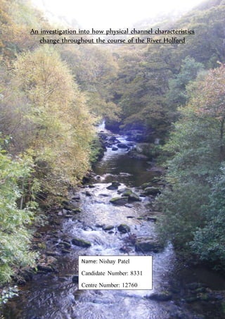
  • 1. Page 1 of 59 An investigation into how physical channel characteristics change throughout the course of the River Holford Name: Nishay Patel Candidate Number: 8331 Centre Number: 12760
  • 2. Page 2 of 59 Contents Introduction P.3 Location P.4 Exmoor National Park P.5 Land use map P.6 Land uses and Employment P.7 Facts about the River Holford P.7 OS map of River Holford P.8 The Geology of Somerset P.9 Geology and site map P.10 Aim and Hypotheses P.11 Sequence of work P.12 Methodology P.13 Risk Assessment P.14 Justification of Methods P.15 Techniques to measure data P.16-18 Equipment P.19 Secondary data and Formulae P.20 Site Descriptions P.21-25 Problems and Limitations P.26 Data Presentation P.27 Depth graphs P.28-33 Cross section graphs P.34-37 Cross section base map P.38 Width graph P.39 Gradient graph P.39 Formulae Sheet P.41 Data Analysis P.42 Spearman’s Rank P.43 Hypothesis 1 P.44-47 Hypothesis 2 P.48-51 Hypothesis 3 P.52-53 Conclusions and Evaluation P.54 Summary table and explanations P.55-56 Limitations P.57 Improvements P.58 Acknowledgements P.58 Bibliography P.58 Appendix-Raw Data P.59
  • 3. Page 3 of 59 Introduction
  • 4. Page 4 of 59 Introduction In my introduction I will be talking about where in the UK the River Holford is situated and the describing the relief around it. I chose to investigate this river study over our four day field trip to Somerset in order to find out the different factors that affect the physical characteristics of the River Holford such as its depth and the channel’s width. Location Somerset is a county in the South West of England and borders five other counties including Bristol, Gloucestershire, Wiltshire, Dorset and Devon. The Bristol Channel and the estuary of the River Severn are to the north and west of Somerset. Somerset is a rural county and is where many tourists come to visit the rolling hills including the Quantock Hills. It is also home to Exmoor National park which is known for its scenery and rare wildlife such as the red deer. Local Map of Somerset Thisis a national mapof where Somersetisinrelation to the rest of England. The Bristol Channel islocated inthisarea here. Thisis a local map of Holford,whichisa settlementinSomerset where the riverHolford runs throughandis namedafter. Thisis a confluence RiverHolford.
  • 5. Page 5 of 59 Woodland 12.2% Moorland 12.2% Farmland 55.9% Other 19.7% Land uses in Somerset During our four day field trip we stayed in a mansion called Nettlecombe Court which is located in Nettleton Park. It was originally built with the intentions of it being a manor house until it became a boy’s school in 1963. The house itself is in Exmoor National Park and is set in a valley just north of the Brendon Hills. A photograph of Nettlecombe Court. Exmoor NationalPark Somerset is home to Exmoor National Park which is 693 km2 and is only one of twelve National parks in the United Kingdom. Within Exmoor National Park there is a site of special scientific interest which is 194 km2 large and a 4 km2 national nature reserve. There is a population of 10,873 people in Somerset and a census taken in 2001 showed that it had increased by 2.1% between 1991 and 2001. 25% of Somerset’s population is over sixty-five and this shows that it is a popular retirement resort. There are 1,011 enlisted buildings in Exmoor National Park and 11.5% of the houses are second homes, which mean that they are old and cheaper to buy. With regards to tourism, over 1.4 million visitors go to Somerset each year and this brings in over £35.5 million. Land uses The main land uses in Somerset are, farmland, which is mainly pastoral sheep farming. Woodland, where Deciduous and Coniferous trees grow which would have been ideal for fuel and as building materials when early settlers arrived. Settlements, such as Holford and Kilve, and moor land where vegetation such as heather and bracken grows.
  • 6. Page 6 of 59 Land Use map
  • 7. Page 7 of 59 Land use along the course of the River Holford is important to look at because it could affect the characteristics if the channel. As you can see on the land use map there is a high amount deciduous forest near the source meaning that the trees will intercept rain water and prevent it from reaching the river. This tells us that the sites near the forest will have a shallower depth. As you can see on the land use map on page 6 the River Holford flows through urban areas such as Kilve. You would expect the river’s width and depth to increase because the concrete surfaces in these areas would increase surface runoff and decrease infiltration. Water from people’s drains run into the river and this causes the depth of the river to increase. In Kilve the channel has been altered by man making them more efficient. This tells us that the wetted perimeter of the river will decrease, meaning that river’s velocity will increase. This is due to the fact that there will be less friction between the water and the banks and bed of the river. Employment in Somerset Employment figures show that 15% of the people living in Somerset work in the hotel and catering business because of the huge amounts of tourists who go there each year. Farming plays a major role in Somerset because it does not only take up most of the land space but, 13.9% of the population works in agriculture. Facts about the River Holford The River Holford’s source is at Lady's Fountain Spring, Frog Combe which is 250 m above sea level, ands mouth is at Kilve. All together it is 7.4 km long. The upper course of the River Holford is very steep and the lower course has hardly any gradient. The middle course is less steep when compared to the upper course. This tells us that there is a decline in gradient from source to mouth. This is the source of the River Holford at Lady's Fountain Spring, Frog Combe. This is the mouth of the River Kilve.
  • 8. Page 8 of 59 OS map
  • 9. Page 9 of 59 The GeologyofSomerset The River Holford is 7.4 km long and has three main types of geology throughout its course which are Devonian Quartzite, Permo-Triassic Marl and Jurassic Limestone. 1. Devonian Quartzite is found in the upper course of the River Holford where the gradient is steep. It is a hard, impermeable red metamorphic rock and means that the depth will be shallow here as water cannot percolate through it. The width will be narrow here seeing as the river requires more energy to erode the rock. Quartzite was once sandstone and this conversion took place after heat and pressure. Its appearance is red because of the amount of iron oxide and other chemical impurities inside it. 2. Permo-Triassic Marl is also found in the upper course of the river and is a soft, impermeable sedimentary rock which is composed mainly of calcium carbonate. This means that the width will be larger here seeing as more erosion takes place in this part of the river. However, the depth here is deep as less water is lost via percolation. 3. Jurassic Limestone is found in the lower course of the River Holford and is a permeable sedimentary rock which is resistant to erosion. Limestone is mainly made from calcium carbonate. Because Jurassic Limestone is a permeable rock more water is lost via percolation meaning that there is less water in the channel. This tells us that the depth of the river will decrease at the sites where the geology is Limestone. This is an example of Quartzite. This is a sample of Jurrasic Limestone. This is an example of Permo- Triassic Marl.
  • 10. Page 10 of 59 Geology and site map
  • 11. Page 11 of 59 Hypotheses Aim: An investigation into the changing physical characteristics form source to mouth of the River Holford. Objectives: We will be looking at a number of different factors that change throughout the course of the river. These will be the width of the river channel, the average depth, velocity, volume and the gradient. When these readings are taken there should be correlations between them. Hypothesis 1- The width of the river will increase as you move from the source to mouth. The width of a river channel increases as it goes downstream because tributaries and confluences join into it, thus making it wider because it holds more water. In the upper profile of the river you would find mainly vertical erosionwhich cuts downwards. In the lower course of the river more lateral erosiontakes place which means the river cuts sideways into the valley. The river gets more powerful as you go down its course which means that it has more erosioncapability. There is also less energy waste on frictionas there is less substrate is on the bed. This is why you would expect a wider channel in the lower profile of the river. Hypothesis 2- The depth of the river will increase as you go from source to mouth. Depth is how deep the river is. As the River Holford flows along its course, tributaries and confluences join it which means there is more water in the river than at its source. In the higher profile of the river mainly vertical erosiontakes place. This is the rapid down cutting of the bed. In the lower course of the river there is lateral erosionwhich means that the river erodes the valley sideways. However, as the river continues downstream there is less substrate on the bed which means that there less energy waste on friction. This means that there is more energy to erode the bed. Hypothesis 3- Gradient will decrease as you move from source to mouth. Gradient is the elevation of the river along its course. This hypothesis has been made because the contour lines of an OS map are closer together at the source than any other point along the rivers course. The map tells us that the source is 250m high and the mouth is not elevated at all. Rivers cannot flow upwards and always flow at a negative gradient due to gravity. Thisis Bradshaw’smodel andtellsushow differentcharacteristics change as yougo from upstreamtodownstream.
  • 12. Page 12 of 59 Sequence of work Start Firstly we established our aims and hypotheses before embarking on this trip. Preparation Suitable equipment was selectedin order to measure the factors along the river accurately Practice We left school on the 16th October. Shortly after reaching our destination, we went to a nearby river and practised measuring using the different equipment. Fieldwork Many measurements such as the width, depth and gradient, were taken at eight different points along the River Holford. Data Collection The data which was collectedduring the fieldwork was analysed using graphs. Write up The introduction and the methodology were then written about the background of the area and the different sites at which the different measurements were taken. This is a somatic diagram of how I prepared for and undertook my river study.
  • 13. Page 13 of 59 Methodology
  • 14. Page 14 of 59 Methodology In this section I shall be describing the different sites at which we collectedour primary data and methods that were used to collect this data. I will also be looking at how the risks were minimized. Risk Assessment Risk How it was minimized There could have been rat faeces in the river which could have caused diseases if it got into the skin. Marigold gloves were worn at all times when in contact with the river. We could have slipped on river substrate while taking the different measurements. Wellington boots were worn while in the river in order to give us more grip and this would minimize the risk of slipping. Ticks Long sleeve clothing was worn to cover the whole body and therefore decreasing the chances of getting ticks on the body. Getting diseases from the river Hands were washed thoroughly with soap after returning from the river study. Uneven terrain Hiking boots were worn in order to minimize any injuries taking place. Hypothermia Suitable warm clothing such as, woolly hats and gloves were worn when we were outside on the field trip. Falling into the river and breaking bones. We were working in groups of 6 so that if someone fell in the river, then a teacher could be called by the remaining people. Getting wet in the river. Waterproof clothing was worn when we were in the river.
  • 15. Page 15 of 59 Justificationof Methods There are three types of sampling methods which could have been used on this river study and are a random method, a systematic method and a stratified method. We chose a stratified sampling method for the sites because we had prior knowledge of the area and so knew where the different parts of geology, the confluences and the urban areas were. This sampling method allowed us to find out the impacts after confluences and if there was a difference in other factors such as depth in areas of different geology along the river’s course. If we used a systematic sampling method, then you might overlook key points along the river and go into private land without knowing. A stratified approach was practical method to adopt because we could measure all along the river’s course in such a limited amount of time, even if it was biased because you chose specific areas in which you wanted to sample. A random sampling method was used to measure the clast size at each site so that we were not biased when collectingthe data. We chose to sample eight sites along the River Holford’s course because this would give us a broader range of results. When all the data was collectedand put into graphs, this would tell us the change from the source to the mouth of the different factors that we were measuring. If we only sampled at two sites, then we would not find a trend in the data and find it very hard to interpret it. These are the different factors that we sampled and how many we chose to sample at each site: 1) Gradient- We chose to sample one gradient at every site because the reading would always be the same. 2) Width- We chose to sample one width reading at every site because the reading would always stay the same. 3) Depth- We chose to take five depth readings at each site as one would not be enough to give an average reading. 4) Velocity- 5 readings were taken at each site to see where the fastest flow was along the width of the river. 5) Clast angularity and size- 15 clasts were picked at random at every site in order to get a broader set of results. 6) Wetted perimeter- One reading was taken at each site as the wetted perimeter would always be the same.
  • 16. Page 16 of 59 Width The width was calculated at each of the eight sites along the course of the river Holford. It took the least amount of time to measure so was therefore taken first. We used a measuring tape in meters to measure the width because it is flexible and very easy to use. In order to measure the width, we had to face upstream and measure from left to right. We put the measuring tape right to the edge of the banks and then read out the reading. It only required two people to measure the width and so the other members of the group were writing down the readings in meters. Measuring the width of the river. Depth After the width was measured we found the depth. The depth of the river was calculated using a ridged meter ruler and it was predicted that as we continued downstream, the river would get deeper. We divided the river’s width by 5 and then used this to take 5 separate readings along the width. While measuring the depth we used the narrow edge of the metre ruler to prevent a build up of water and stood after the metre ruler in order not to affect the results. Direction of flow Direction of flow
  • 17. Page 17 of 59 Wetted Perimeter The third reading we took was the wetted perimeter. The wetted perimeter was measured using a measuring tape because it is flexible. Firstly, the measuring tape was spread along the width of the river and left slacking. Then, someone in the group walked in a straight line along the measuring tape and read the measurement out to be recorded. While we were measuring the wetted perimeter we were careful to work upstream and from the left bank to right bank so not to alter our readings. Measuring the wetted perimeter of the River Holford. Velocity The velocity was measured using a hydroprop and an impeller. At each site, we measured 5 velocity readings by dividing the channel’s width by 5. The impeller was placed onto the hydroprop, and then put two thirds of the depth into the river in order to prevent the impeller from touching the bed. A stopwatch was started immediately as the impeller was placed into the water and stopped when the impeller stopped. Some readings were defaulted at 100 seconds because at some sites, the water was too shallow for the impeller to go in. Measuring the velocity Direction of flow Direction of flow
  • 18. Page 18 of 59 Angularity and Size of Bed load First, 15 clasts were picked up from the river bed at random, with our eyes closed so that we were not biased in the selection of the clasts. Then the angularity of the clasts were measured by using the cailleux roundness index chart. Next, the longest axis of the clasts were measured using a rigid meter ruler and then recorded. Measuring the longest Axis of the clasts. Measuring the angularity of the clasts. Gradient The last reading that we had to take at each site was the Gradient. The equipment which was used to find the gradient was an E-ruler and a surveyor’s level. First, one group member went into the river and held the E-ruler straight just above the tip of their boot. Then, another person on land five meters away, downstream looked through the surveyor’s level and read the height on the E-ruler. The readings were then noted for each site.
  • 19. Page 19 of 59 Equipment 1) The hydroprop and the impeller were used to measure the velocity of the River Holford. The impeller was attached to the hydroprop and were placed two thirds of the depth of the river in order to stop there being frictionbetween the impeller and the bed. The impeller turned and a stop watch was started, and stopped when the impeller stopped rotating. 2) A 1 meter ruler was used to measure the clast size and the depth. It was ideal for these two measurements because it was rigid and very easy to read. 3) A tape measure was used to measure the wetted perimeter and the width of the river. It was also used to split the river up into 5 parts when we were finding out the gradient. 4) A surveyor’s level was used to measure the gradient. You had to look through the surveyor’s level at an E- ruler and measure the reading on it. 1 2 3 1. Impellor and hydroprop 2. 1 meter ruler 3. Tape measure 4. Surveyor’s level 5. E-ruler
  • 20. Page 20 of 59 Secondary Data Secondary data is data that we have to rely on. I used a number of different sources such as, the internet and maps in order to support the primary data collected. An ordnance survey map of the area around the River Holford was used to predict if the gradient was decreasing in order to strengthen the readings. Our gradient data was mostly secondary data because we did not physically take all of the eight measurements ourselves. We only measured one out of the eight sites. Weather information of Somerset was looked up on the internet to see if there was rain prior to our study. If there was a lot of rain or no rain at all, then this factor would be taken into consideration when our data was analysed. Formulae Gradient (m/m) = Downstream reading (m) – Upstream reading (m) ÷ 10m Channel Size (m2) = Average depth (cm) ÷ 100 x width (m) Channel Shape (form ratio) = Average depth (cm) ÷ 100 x width (m) Bank full CSA (m2) = bank full width (m) x Bank full average depth (cm) ÷ 100 Spearman’s Rank Correlation Spearman’s rank technique is a statistical test which will be used for each hypothesis to see whether there is a correlation between two variables, and to test the actual strength and the reliability of the relationship. This is the equation to work out Spearman’s Rank Correlation: After finding the results from the Spearman’s rank, a significance test will be used to test the significance of the relationship. This will show us whether my results occurred by chance and if we should accept or reject my hypotheses.
  • 21. Page 21 of 59 Site Descriptions Site1- This site was very close to the source of the River Holford. It is in a wooded area with steep sides and there is a very obvious drop in gradient as you continue from the source to site 1. Site 1 is a small stream which had very little depth and width because it had not rained prior to our trip. The clasts were all angular here and the geology was Devonian Quartzite. Site 2- The river at site 2 was very narrow but was getting deeper as predicted. The geology in this area was Quartzite and the gradient was decreasing. There were still steep “v” shaped sides here just like at source 1. Direction of flow Direction of flow Angular clasts
  • 22. Page 22 of 59 Site 3- At this site, the river widened considerably when compared to site 2 but still stayed relatively the same depth. The rock type was still Quartzite and there was non-coniferous woodland around the river. Site 4- At this site we were near to a settlement called Holford. The river’s width had increased considerably and there was a change in geology from the previous sites and now there was Permo- Triassic Marl. Direction of flow Direction of flow
  • 23. Page 23 of 59 Site 5- At this site the river’s width, depth and velocity increased slightly. The geology at this site was Marl. The cross sectional area also increased because we were in the middle course of the river. Site 6- At this site, there was a rapid increase in the velocity of the river. The environment here was very similar to that of site 1 because there were steep sides which were covered with dense trees and vegetation. The geology here was still Marl. Direction of flow Direction of flow
  • 24. Page 24 of 59 Site 7- This site was in the lower course of the river and was on Jurassic Limestone. The river had calmed down and its velocity decreased. The cross sectional area increased because we were in the lower course of the river. There was very little gradient here and the clasts were decreasing in size and were mostly rounded. Site 8- This site was located in the lower course of the river and was the closest site to the river’s mouth at Kilve. This part of the river was on Jurassic Limestone and there were vast amounts of vegetation that had grown on the river banks here. The river had become calmer and there was very little change in the gradient. Direction of flow on of w Direction of flow Vegetation on the banks of the river.
  • 25. Page 25 of 59 Mouth- This is the river Holford’s mouth at Kilve beach. Although this was not a site and we did not sample here, we can tell that the clasts are smooth and that there is a downward gradient as the water goes into the Bristol Channel. The water percolates through the limestone and came back up on the beach into the Bristol Channel. Water emerging from underground
  • 26. Page 26 of 59 Problems and Limitations encountered in Data Collection There were many problems that we encountered on our river study. Some we could not change but others we could. Physical Factors One physical problem was that there was debris in the river such as tree branches and clasts. This affected measurements such as depth and velocity, because there was a build up of water due to this river substrate. This meant that many readings were difficult to measure accurately. There was a lack of rain before we went on this field trip which meant that the river in some parts was very shallow and could have limited the reliability of the data. At some points, the impeller could not turn due to the fact that the river was too shallow and this could have also been because there was a lack of rain. This meant that, especially in the upper course sites that the readings had to be defaulted at 100 seconds. Human factors One human problem was that the angularity of the clasts had to be decided by eye. This meant that it was the group member’s opinion on whether the clast was rounder or angular. Instead of measuring the clasts size, we could have measured its volume in order to make it more accurate. Another human limitation was that we could have taken ten measurements for every factor per site. This would have meant a wider range of results to interpret. The reason that this was not undertaken was because of the limited amount of time we had to sample the river. Accessibility of land was a human limitation because part of the river was blocked because it was in private land. This meant that we could not sample in this area and therefore we could not tell if the trends of the previous sites would continue. Debris such as leaves, rocks and tree branches blocking the flow of the river.
  • 27. Page 27 of 59 Data Presentation
  • 28. Page 28 of 59 In this section I shall be presenting my data as graphs and describing the basic trends that are seen in them. I will also be justifying why I used a particular type of graph as oppose to another one. Graphs to show the depth of the river along all eight sites I have chosen to represent the depth of the river as a bar chart because it is very easy to visualize the depth of the river in this way. You can also tell where the deepest part of the river was along each of the eight sites. Bar charts are used when the change is large. Overall, all the depth readings at this site were what was expected to be seen at this stage along the river’s course because the river at this stage was very shallow. Measurements 1 and 2 are the same at 0.015m and this was correct because the channel was very narrow here. However, measurement 4’s depth was only 0.001m and this is incredibly low when compared to the other depth readings taken at this site. -0.51 -0.41 -0.31 -0.21 -0.11 -0.01 1 2 3 4 5 Depth(m) Number of Readings taken Site 1 Depth Depth
  • 29. Page 29 of 59 The readings at site 2 tell us that the river was increasing in depth from an average of 0.0122m at site 1 to 0.1246m. Reading 5’s depth was 0.51m which was very far away from the trends that the other readings taken at this site showed. This reading could be seen as an outlier. An explanation of why this outlier occurred may have been because there were many objects such as tree branches in the river which could have caused a build up of water where we were measuring the depth. Reading 3 was quite low when compared to the other readings at 0.005m. Reading 1 was the shallowest depth and was 0.037m. The depth then increased by 0.03m at reading 2 and continued to increase at reading 3 where it was 0.074m. The depth then steadily increased by 0.009m until reading 5. -0.51 -0.41 -0.31 -0.21 -0.11 -0.01 1 2 3 4 5 Depth(m) Number ofReadingstaken Site 2 Depth Depth -0.51 -0.41 -0.31 -0.21 -0.11 -0.01 1 2 3 4 5 Depth(m) Number of Readings taken Site 3 Depth Depth
  • 30. Page 30 of 59 At Site 4 the average depth was 0.093m which was larger then at the previous site. The depth stayed the same at readings 1 and 2 and was 0.105m. It then increased slightly by 0.005m at reading 4 until the depth decreased by 0.065m at reading 5. At site 5 the five readings taken across the width of the channel were quite varied. Reading 2 was the lowest measurment that was taken and was 0.0102m. This may lead us to believe that this was an outlier seeing as none of the other results are this low. The depth then increased after reading 2 until 4 where it was at its highest of 0.17m. The depth then decreased until reading 5 where it was 0.07m. -0.51 -0.41 -0.31 -0.21 -0.11 -0.01 1 2 3 4 5 Depth(m) Number of Readings taken Site 4 Depth Depth -0.51 -0.41 -0.31 -0.21 -0.11 -0.01 1 2 3 4 5 Depth(m) Number of Readings taken Site 5 Depth Depth
  • 31. Page 31 of 59 The depth at site 6 generally decreased from 0.099m at site 5 to 0.0812m which came as a surprise because the depth of the river is supposed to increase as you get closer to its mouth. Reading 1 had a depth of 0.055m which was expected because it was the nearest to the bank of the river. The depth then deepened at reading 2 where it was 0.107m until reading 3 where it was 0.064m. At readings 4 and 5 the readings increased to 0.091m. At reading 1 the depth was 0.043m and was the lowest measurement because it was the closest reading taken to the bank. The depth then increased at reading 2 where it was 0.096m and then deepened further by 0.008m until reading 3. The river’s deepest point in the channel was at reading 4 where the depth was 0.127m. The depth then decreased at reading 5 by 0.074m. -0.51 -0.41 -0.31 -0.21 -0.11 -0.01 1 2 3 4 5 Depth(m) Number of Readings taken Site 6 Depth Depth -0.51 -0.41 -0.31 -0.21 -0.11 -0.01 1 2 3 4 5 Depth(m) Number of Readings taken Site 7 Depth Depth
  • 32. Page 32 of 59 At site 8 our readings showed us that this was overall the deepest part of the river. The depth at reading 1 was 0.092m which was the shallowest reading because it was the closest one taken to the bank. The river increased in depth at site 2 where it was 0.14m and continued to increase until reading 3 which was 0.195m and was the deepest point in the channel. The river’s depth then decreased at sites 4 and 5 by 0.045m. -0.51 -0.41 -0.31 -0.21 -0.11 -0.01 1 2 3 4 5 Depth(m) Number of Readings taken Site 8 Depth Depth
  • 33. Page 33 of 59 Overall, there is an increase in depth as you go along the river’s course. This can be seen at site 1 where the average depth was 0.0122m, and then at site 8 where the depth was 0.152m. There is a 0.1398 m difference between the two and shows that the depth of the river increases as you go from its source to its mouth. -0.16 -0.14 -0.12 -0.1 -0.08 -0.06 -0.04 -0.02 0 1 2 3 4 5 6 7 8 Depth(m) Site number Average Depth vs Distance downstream Depth Site Number Average Depth (m) 1 0.0122 2 0.1246 3 0.0686 4 0.093 5 0.099 6 0.0812 7 0.0876 8 0.152
  • 34. Page 34 of 59 Graphs showing the Cross sectional of each site A x-y plot was chosen to represent the cross sectionof the river because it is easy to see how the river changed as we progressed through the sites. It was used to determine relationships between the width and depth.We did not use a bar graph to represent this data because they are used to track changes over time. At site 1 the cross sectional area was 0.008418 m2, which is the lowest result out of all the sites and was what we expected. The channel’s width and depth were very small here. There was an unexpected drop in the depth of the river at the 5th plot where it was 0.001m, and means that this reading was unexpected. At site 2 the cross sectional area was 0.28035 m2 which was higher than at the previous site. Plot 6 was an unexpected rapid increase in the depth which was an outlier because it was outside the range of the other results.
  • 35. Page 35 of 59 At site 3 the cross sectional area was 0.155036 m2 which shows that there was an unexpected drop from this reading to the one at site 2. The depth of river increased until plot 6 where it started to decrease until it reached the river’s bank. The width of the river stayed the same as the previous site which was unexpected because the width was supposed to increase as you travel from source to mouth. At site 4 the cross sectional area was 0.33852 m2 which was an increase from the previous site. The depth at plots 2-5 were very close to each other, until there was a decrease in the depth at plot 6 until the river bank. The width of the river increased by 1.38m from the previous site which showed that the river was increasing in size.
  • 36. Page 36 of 59 At site 5 the cross sectional area was 0.18216 m2 which was lower than the previous site. The depth increased and then decreased at plot 3, where the result was an outlier. The depth then increased until plot 5, (where the water was at its deepest), and then decreased until the river bank. The width of the river decreased by 1.8m from the previous site and this was an unexpected reading. Site’s 6 cross sectional area was 0.23142 m2 which was an increase from the last site. The depth increases until plot 3, until plot 4 where there is a decrease. The width increased by 1.01m from the previous site, and this was expected.
  • 37. Page 37 of 59 At site 7 the cross sectional area was 0.219 m2 which was a decrease from site 6.The depth increased until plot 5 and then it decreased. The depth was at its highest near the middle of the river at plot 5 which was 0.127 m. The width of the river had unexpectedly decreased by 0.35m from the previous site. Site’s 8 cross sectional area was 0.42256 m2 which was the highest reading of all the eight sites and this was expected. The depth increases until plot 4 where it is 0.2 and then starts to decrease until the bank. The width of the river increased from 2.50m at site 7 to 2.78m at this site which was expected in the hypotheses.
  • 38. Page 38 of 59 CSA base map
  • 39. Page 39 of 59 Width along the eight sites of the river Holford I have chosen to represent my data for width as a lateral bar chart because it is very easy to see the trends and where the river was at its narrowest and widest. Bar graphs are used to track changes over each site. The width of the river starts to increase as we go from site1to site 4 by 2.95m. At site 4 the river was very wide which was unexpected because the widest part of the river was supposed to be the nearest to the mouth. There was an unexpected drop of 1.8m in the width at site 5. The width then increased until site 7 where there was a slight decrease, and then there was a final increase at site 8. Overall, we can see that the river increased in width from 0.69m – 2.78m as you went from its source to its mouth. 0 0.5 1 1.5 2 2.5 3 3.5 4 1 2 3 4 5 6 7 8 Width (m) SiteNumber Width vs Distance downstream Width Site Number Width of River (m) 1 0.69 2 2.25 3 2.26 4 3.64 5 1.84 6 2.85 7 2.50 8 2.78
  • 40. Page 40 of 59 Gradient along the eight sites of the river Holford I have chosen a line graph to show the gradient of the river Holford because it is very easy to see if the gradient was increasing or decreasing. You can also see the rate at which the river is decreasing in gradient with this type of graph. A line graph was used instead of a bar chart because when smaller changes exist, line graphs are better to use than bar graphs. The gradient of the river starts to decrease rapidly as you go from site1 to site 2. Then the river starts to decline at a slower rate until site 4 where it is 0.008 m/m. After this, there was an unexpected increase in the gradient of the river until site 5. The river then decreased from site 5 to site 8. Overall, there is a 0.08 m/m downward trend in the data which means that gradient decreases as you go from the source to the mouth. 0 0.01 0.02 0.03 0.04 0.05 0.06 0.07 0.08 0.09 0.1 1 2 3 4 5 6 7 8 Gradient(m/m) Site number Gradient of the river Gradient Site Number Gradient of River (m/m) 1 0.086 2 0.034 3 0.021 4 0.008 5 0.029 6 0.021 7 0.021 8 0.006 All raw data that was collectedis in the appendix on page 59.
  • 41. Page 41 of 59 Formulae Sheet
  • 42. Page 42 of 59 Data Analysis
  • 43. Page 43 of 59 In this section I will be analysing my results to see if my hypothesis were correct and using Spearman’s Rank correlation to show the reliability of my results. Scatter graphs will be used to show the possibility of a positive correlationbetween two variables, such as width and the distance from the source. Simply looking at the line of best fit will tell us if there is a strong positive relationship, no relationship, or a negative relationship between the two variables. Spearman’s rank Spearman’s Rank is a statistical technique which is used to see if there is a correlation between the results and to see the reliability of this relationship between them. This technique tells us whether the correlation is really mathematically significant or if it could have been the result of chance alone. Method of finding R2 1) State if there is a relationship between your two sets of readings. 2) Make a table and rank both sets of measurements, for example distance from source and depth, with the biggest number having a ranking of 1, and the smallest having a ranking of 8. 3) Take away the two sets of rankings away from each other in order to get the difference between the two ranks (d). 4) Then square the difference between the two values to remove the negative values and get Sigma difference2 (∑d2). 5) Next, calculate the coefficient (r2) by using the formula below. The answer will always be between 1.0 (a perfect positive correlation) and -0.1 (a perfect negative correlation). This is the Spearman’s Rank formula written in mathematical notation:
  • 44. Page 44 of 59 My hypotheses were: 1. Width will increase as you go from source to mouth. 2. Depth will increase as you go from source to mouth. 3. Gradient will decrease as you go from source to mouth Hypothesis 1: Width Scatter graph to show the change in width of the River Holford from source to mouth. It can be easily seen from this scatter graph that the width increased as you went form sites 1-8. This supports my hypothesis because the graph indicates that there is a correlationwhich is that, as the distance from the source increases, the width also increases. Nearly all the widths, except sites 1 and 4, are near to the line of best fit and this shows us that the correlationis quite good. Now a statistical test called Spearman’s Rank correlation must be undertaken to see the strength of this correlation. 0 0.5 1 1.5 2 2.5 3 3.5 4 0 1000 2000 3000 4000 5000 6000 7000 8000 9000 width(m) distance from source (m) Width from source to mouth along the River Holford (m)
  • 45. Page 45 of 59 Spearman’s rank correlation Below is how we found r2 using the Spearman’s rank equation: 6 x 36 = 1 - 216 83-8 504 = 1- 0.428 r2 = 0.572 The closer r2 is to +1 or -1, the stronger the likely correlation. A perfect positive correlationis +1, while a perfect negative correlationis -1. My r2 value is 0.572 which is quite close to +1, and therefore suggests to us that there is a fairly strong positive relationship. Site Number Distance from Source (m) Rank Width (m) Rank Difference Between Ranks (d) Difference2 d² 1 20 8 0.69 8 0 0 2 230 7 2.25 6 1 1 3 480 6 2.26 5 1 1 4 560 5 3.64 1 4 16 5 1104 4 1.84 7 -3 9 6 2987 3 2.85 2 1 1 7 4200 2 2.50 4 -2 4 8 7727 1 2.78 3 -2 4 Total: 36
  • 46. Page 46 of 59 Significance Testing A further technique is now required to test the significance of the relationship. The r2value of 0.572 must be looked up on the Spearman Rank significance table which is below. First you have to work out the “degrees of freedom”, which is the number of pairs in your sample minus 2. For our test this was 6 (8-2). The result was then plotted on the significance table below in order to be assessed. If the reading is below 5%, then you must reject your hypothesis because your reading was a product of chance. If your reading is above 0.1, then we can be 99.9% confident that the correlation did not occur by chance. The plot of 0.572 above gives a significance level of under 5% which tells us that it is possible that my result my have been the product of chance and that the hypothesis must be rejected. This means that the probability of the relationship that has been found being a chance event is nearly 99%. However, we did only take 8 samples along the river’s course, so if more measurements were taken, then the results would be more reliable. From the significance test above my hypothesis is very likely to be wrong.
  • 47. Page 47 of 59 Possible Explanations for width results There are many possible explanations for why the width of the river followed the trend which can be seen in the graph. One explanation of why the width decreased at some sites but then unexpectedly increased at others was that there were three types of geology along the river’s course, (which can be seen in the geology base map on page 10).The geology at the first three sites was Quartzite which is a hard, impermeable red metamorphic rock which means that water cannot percolate through it. This meant that we would not expect a large channel because the rock is resistant so is hard to be eroded and weathered away. The next three sites widths could have been affected because the geology was Marl, which is a soft, impermeable sedimentary rock. This meant that the channel was expected to be wider because more erosiontakes place in this part of the river, and this is why there was an increase in the channel’s width at sites 4-6. The geology at the last two sites was limestone which is a permeable sedimentary rock and is resistant to erosion. Limestone’s permeability meant that water in the channel was going to percolate through it, and would mean that there would be less energy in the river so the river may narrow again. Another explanation of why the width readings were not as the hypothesis had predicted was because of the gradient (which is seen by the contour lines on the OS map on page 8). In the upper course of the river, we expected the river to have more potential energy which meant that the river was deeper rather than wider. As we progressed to the lower course of the river, we found that the river was wider because there was more lateral erosiontaking place, which meant the widening of the channel. Where we were along the drainage basin could have changed the width of the river. An example of this is at site 3 where we were near a confluence. The river would have had more energy to erode the banks and therefore widen the river. At the first three sites there was dense forest to both sides of the river, (which can be seen on the land use map on page 6). This meant that interception by this canopy layer could stop rain water from reaching the ground and therefore decreasing surface runoff. Surface runoff is very quick and is the movement of water in any form from the atmosphere to the ground. This meant that the width of the river was expected to be very small in the forestedareas. On the other hand, the sites which were in open farm land were expected to have a wider channel because there would be little or no interception from trees and vegetation.
  • 48. Page 48 of 59 Hypothesis 2: Depth It can be easily seen from this scatter graph that the depth increases as you go further out from the source and therefore supports my hypothesis. There is an overall positive correlationwhich can be seen in the graph which is that, as the distance from the source increases, the depth also increases. However, some of the depths, such as at sites 1 and 2 were not near the line of best fit which could weaken the correlation. Now a statistical test called Spearman’s Rank correlation must be undertaken to see the strength of this correlation. 0 0.02 0.04 0.06 0.08 0.1 0.12 0.14 0.16 0 1000 2000 3000 4000 5000 6000 7000 8000 9000 depth(m) distance from source (m) Depth from source to mouth along the River Holford (m)
  • 49. Page 49 of 59 Spearman’s rank correlation Below is how we found r2 using the Spearman’s rank equation: 6 x 46 = 1 - 276 83-8 504 = 1- 0.547 r2 = 0.453 My r2 value is 0.453 which is relatively close to +1, and therefore suggests to us that there is a fairly good positive correlation between the depth and the distance from the source. Site Number Distance from Source (m) Rank Average Depth (m) Rank Difference Between Ranks (d) Difference2 (d²) 1 20 8 0.0122 8 0 0 2 230 7 0.1246 2 5 25 3 480 6 0.0686 7 -1 1 4 560 5 0.093 4 1 1 5 1104 4 0.099 3 1 1 6 2987 3 0.0812 6 -3 9 7 4200 2 0.0876 5 -3 9 8 7727 1 0.152 1 0 0 Total: 46
  • 50. Page 50 of 59 Significance of Relationship Testing This Spearman’s rank correlationgraph test tells us that 0.453 is under a significance level of 5% and means that it was possible that my results was the product of chance and therefore must be rejected. However, we could have compared our data with the other groups completing the same study to see if they got mainly the same results as us, and this would improve the reliability of the sample.
  • 51. Page 51 of 59 Possible Explanations for depth results One reason why the depth increased at some sites and then decreased at others was because of gradient, (which can be seen on page 8). In the upper course of the river we expected the river to be deep because the gradient was steep and this meant that there would be vertical erosionwith more potential energy. At the later sources we expected more lateral erosion, so the river would not have been as deep. At some sites we were very near to confluences and this could have affected our results. This is because at a confluence the river has more energy and power to erode, resulting in a larger, deeper channel. We were undertaking this study in the autumn and so there were many rotting leaves around and inside the river. A result of this was that Humic acid was formed and dissolved the river bed and thus created deeper channels. This is an example of solution. Solution is an erosional process where acids in the river dissolve the banks and the bed which results in a deeper channel. Sites 4, 5 and 6 would have been the most affected by this because the geology there was marl which is a soft rock composed of Calcium carbonate. Near the mouth of the River Holford, (the Bristol Channel), we expected the river to be slightly shallower than at the previous sites because it was losing its energy and was depositing its load, (sediment). The geology, (which is seen on page 8), at the first 3 sites was Quartzite which is a hard impermeable rock. This meant that we expected the river to be shallow at these first sites because the rock was too resistant. The geology at sites 4-6 was Marl which is an impermeable, soft rock which meant that there would be more erosion taking place here. This is why we expected the river’s depth to increase at these sites. The geology at the last two sites was Limestone which is a hard, permeable rock. Limestone is well jointed which means that the rock has vertical and horizontal bedding planes. This meant that groundwater flow would occur here, where the water moved underground through these pores and joints. This particular type of limestone was resistant to erosion so we expected the river to get narrower here. Site 4 was near an urban area, (Holford), which meant that there was concrete and tarmac which formed impermeable surfaces. This meant that there would be more overland flow here which is the movement of water in any form from the atmosphere to the ground. There had been little rain in Somerset before we went on our river study. This meant that the river would not have been as deep as it normally should have been and this could have affected our results.
  • 52. Page 52 of 59 Hypothesis 3 The gradient decreased from source to mouth and this can be seen in this scatter graph. There is a negative correlationand this can be seen, as the distance from the source increases, the gradient decreases. Nearly all the gradient readings are near the line of best fit which means that the correlation is strong. However, some of the gradient readings, such as at sites 1 and 4 are not near the line of best fit, and this may weaken the strength of the correlation. River’s can only flow in a downward gradient due to gravity and this is why we got these set of results. At site 5, the gradient was seen to increase and this could be an incorrect measurement. Gradient form source to mouth along the River Holford (m/m) 0 0.01 0.02 0.03 0.04 0.05 0.06 0.07 0.08 0.09 0.1 0 1000 2000 3000 4000 5000 6000 7000 8000 9000 distance from source (m) Gradient(m/m)
  • 53. Page 53 of 59 Spearman’s rank correlation Below is how we found r2 using the Spearman’s rank equation: 6 x 139 = 1 - 834 83-8 504 = 1- 1.654 r2 = -0.654 My r2 value is -0.654 which is relatively close to -1, and therefore suggests to us that there is a fairly good negative correlationbetween the gradient and the distance from the source. Site Number Distance from Source (m) Rank Gradient (m/m) Rank Difference Between Ranks (d) Difference2 (d²) 1 20 8 0.086 1 7 49 2 230 7 0.034 2 5 25 3 480 6 0.021 5 1 1 4 560 5 0.008 7 -2 4 5 1104 4 0.029 3 1 1 6 2987 3 0.021 5 -2 4 7 4200 2 0.021 5 -3 9 8 7727 1 0.006 8 -7 49 Total: 139
  • 54. Page 54 of 59 Conclusions and Evaluation
  • 55. Page 55 of 59 In this section I will be seeing if my hypotheses were correct overall using data from my graphs. The limitations of the data collectionwill be explored and the changes that I would make if I were going to undertake this river study again. Summary table Visually Statistically Hypotheses 1 Accepted Rejected Hypotheses 2 Accepted Rejected Hypotheses 3 Accepted Rejected This is a summary table showing if my hypotheses were accepted visually, by looking at my data graphs, and statistically, by using Spearman’s Rank correlation. My aim was to investigate the physical channel characteristics along the course of the River Holford which were the width, the depth and the gradient. My first hypothesis was that the width of the channel would increase as you went from the source to the mouth. As you can see from the table above, this hypothesis was visually accepted by looking at width graphs. This can be seen in the width graph on page 39 which supported my hypothesis by showing a general increase from the source to the mouth. This can be seen at site 1 where the width was 0.69 m and then at site 8 where the width was 2.78 m. The width increased by 2.09 m and this shows us that there was an increase in width from the source to the mouth of the river. However, at site 4, the width decreased by 1.38m from the previous site. This decrease however can be explained because there was a geology change from Quartzite to Marl. Overall, visually, my hypothesis, that the width will increase as you go from source to mouth, is accepted. Hypothesis 1 was rejectedwhen it came to assessing the data using Spearman’s rank correlationtechnique and significance testing. My significance test for width can be seen on page 46 and shows that my significance level, which was 0.572 was below the line marked 5%. This tells us that my results were a product of chance and that I must reject my hypothesis. My second hypothesis was that the depth of the river would increase as you went from the source to the mouth. As you can see from the table above, this hypothesis was visually accepted by looking at depth graphs. An average depth graph can be seen on page 33 which supported my hypothesis by showing an increase as you got close to the mouth. An example of this can be seen at site 1 where my depth was 0.0122m and
  • 56. Page 56 of 59 then at site 8 where my depth was 0.152m. The depth increased by 0.1398m and this tells us that there was an increase in depth as you go from the source to the mouth. Overall, visually, my hypothesis, that the depth will increase as you go from source to mouth, is accepted. Hypothesis 2 was rejectedwhen it came to analysing the data using Spearman’s rank correlationtechnique and significance testing. My significance test for depth can be seen on page 50 and shows that my significance level, which was 0.453was below the line marked 5%. This tells us that my results were a product of chance and that I must therefore reject my hypothesis. My third hypothesis was that gradient would decrease as you went from source to mouth. As you can see from the table above, my hypothesis was accepted visually by looking at the gradient graph which can be found on page 40. The graph shows that the gradient decreased as you went from source to mouth and can be seen when a site 1 the gradient was 0.086 m/m and then at site 8 where the gradient was 0.006 m/m. There is a 0.08 m/m difference between the two readings and this tells us that my hypothesis is supported by the graph. Hypothesis 3 was rejectedwhen it came to the data being analysed using Spearman’s Rank correlationand significance testing. My Spearman’s rank table for gradient can be seen on page 53 and shows that my significance level, which was -0.654 was below the line marked 5%. This tells us that my results were a product of chance and that I must therefore reject my hypothesis. Bradshaw’s model is generalised in the way that it tells you what is expected to happen along a river with the same factors throughout its course. Some of the model’s predictions did not work for our particular river that we were studying because there were a lot of changes throughout its course that affected our readings, such as the geology and confluences along its course.
  • 57. Page 57 of 59 Evaluation Overall, our river study on the River Holford was very successful because we took a lot of measurements which were taken very accurately. Limitations There were some limitations when we were measuring our data and the methods we used to find the sites. One limitation was that a stratified sampling strategy had been used for the sites because of the little time we had to carry out this study. This meant that our results were biased because we chose specific areas in which we wanted to sample, such as near confluences and on different geology types. It was hard to get an exact depth reading because the water was always moving. This meant that we were not measuring the depth of the river accurately and weakens our results and conclusion. At the first 3 sites when we were measuring the velocity, using a hydroprop and an impeller, the water was just too shallow. This meant that the impeller could not turn due to the fact that it was coming into contact with the river bed. As a result of this limitation some of the velocity readings were defaulted to 100 seconds. At all the sites throughout the course of the river, all the groups were trying to collect data at the same time which resulted in them pushing water downstream at a faster rate than normal. This meant that the impeller turned faster then normal and therefore altered our results. There were lots of objects such as tree branches in the river. These could have affected our depth results because there would have been a water build up in these areas. This would have also affected the velocity data because the flow of the river would have been altered. Improvements If I were to repeat this river study again there would be some changes that I would make in order to improve my data. One of these changes is that I would have taken ten depth readings at each site rather than five. This is because it would broaden our results and make then more accurate. You would also be able to see if the new depth readings followed the same trends as the data before it.
  • 58. Page 58 of 59 Ten sites could have been looked rather than eight along the river’s course. This would have given us more results to analyse, and to see if my data trends continued at these extra sites. We could have compared data with other groups taking part in this study to see if we all got similar results and trends. This would strengthen our conclusion and make it more reliable. A systematic sampling method could have been used rather than a stratified one if we had a larger period of time in which to carry out this study. This would have meant that our data would not have been biased because we would not take readings near confluences, but all through the river’s course. We used the cailleux roundness index chart and a ruler when measuring the clast size. To improve this method I feel that we could have just worked out the volume of the clasts. This would mean that there would not be someone’s own opinion on if the clasts were rounded or angular. Overall this study along the River Holford was highly successful in that we collected good data to be analysed, and taught me more about factors that affect a river’s physical characteristics. These all led me into producing a good piece of coursework. Acknowledgements I would like to thank Mr Matthews, Mr Orme, and Mr Parker for coming with us on this trip and offering us guidance along the way. I would also like to thank the staff at Nettlecombe Court for accommodating us and helping us with our river study along the River Holford. Bibliography Picture of Quartzite on page 9:http://maurice.strahlen.org/minerals/pics/quartzite- shoksha.jpg Picture of Limestone on page 9: www.m.godden.btinternet.co.uk/oolite.jpg Picture of Marl on page 9: en.wikipedia.org/wiki/River_Holford
  • 59. Page 59 of 59 Appendix Raw data: Primary and Secondary: Site 1 Site 2 Site 3 Site 4 Site 5 Site 6 Site 7 Site 8 Width (m) 0.69 2.25 2.26 3.64 1.84 2.85 2.5 2.78 Wetted Perimeter (m) 0.74 2.4 2.48 2.08 2 3.13 2.84 2.92 Depth (m) 1 0.015 0.045 0.037 0.105 0.105 0.055 0.043 0.092 Depth (m) 2 0.015 0.027 0.067 0.105 0.0102 0.107 0.096 0.14 Depth (m) 3 0.014 0.005 0.074 0.11 0.14 0.064 0.119 0.195 Depth (m) 4 0.001 0.036 0.082 0.105 0.17 0.091 0.127 0.183 Depth (m) 5 0.016 0.51 0.083 0.04 0.07 0.089 0.053 0.15 Average Depth 0.0122 0.1246 0.0686 0.093 0.09904 0.0812 0.0876 0.152 Flow Rate (s) 1 100 54.44 100 12.52 7.6 7.33 100 100 Flow Rate (s) 2 100 43.06 58.46 18.62 10.4 23.35 100 61.49 Flow Rate (s) 3 100 45.7 17.06 15.9 22.69 18.97 43.99 100 Average Flow Rate (s) 100 47.733 58.507 15.68 13.565 16.55 81.33 87.163 Velocity (m/s) 0.0605 0.0964 0.0838 0.2369 0.2696 0.2259 0.068 0.0653 Gradient 0.086 0.034 0.021 0.008 0.029 0.021 0.021 0.006 Clast Analysis Clast Shape - Enter the number of each shape found at each site Very Angular 3 4 0 0 0 0 0 0 Angular 7 9 2 1 2 1 0 0 Sub Angular 4 2 8 4 7 5 1 1 Sub Rounded 1 0 5 7 6 5 8 7 Rounded 0 0 0 2 0 4 3 6 Very Rounded 0 0 0 1 0 0 3 1 Clast Size (cm) 1 9 11.5 7.9 15.5 16 2.2 6.9 7 Clast Size (cm) 2 12.5 11.2 10.7 5.4 11.2 8.4 8.2 8.1 Clast Size (cm) 3 8 7.2 7 7.1 13.3 0.5 11.5 7.6 Clast Size (cm) 4 5 9.7 7.3 13.5 9.6 8 12.4 4.8 Clast Size (cm) 5 14.7 8.4 10.3 9.9 13.1 7.8 16.7 9.2 Average Clast Size (cm) 9.84 9.6 8.64 10.28 12.64 5.38 11.14 7.34 Key Black data: Primary Data Red data: Secondary Data