Design, Construction, and Maintenance of Green Infrastructure Stormwater Management Systems in the Pinelands
•
1 recomendación•151 vistas

Presented by Clay Emerson, Princeton Hydro, at Pinelands Green Infrastructure Workshop for Design Professionals, May 24, 2016

Recomendados
Recomendados
Más contenido relacionado
La actualidad más candente
La actualidad más candente (20)
Similar a Design, Construction, and Maintenance of Green Infrastructure Stormwater Management Systems in the Pinelands
Similar a Design, Construction, and Maintenance of Green Infrastructure Stormwater Management Systems in the Pinelands (20)
Más de New Jersey Future
Más de New Jersey Future (20)
Último
Último (20)
Design, Construction, and Maintenance of Green Infrastructure Stormwater Management Systems in the Pinelands
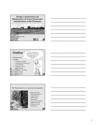
- 1. 1 Design, Construction and Maintenance of Green Stormwater Infrastructure in the Pinelands Clay Emerson PhD PE CFM Princeton Hydro May 24, 2016 Outline • Background • Design Geology and Soils Landscape location and Groundwater Influence of/on groundwater Infiltration Testing • Construction • Maintenance If you’re focusing on stormwater design from the ground up, you’re getting ahead of yourself! The Pinelands from a stormwater perspective: Pinelands Commission • What about the Pinelands makes it unique from a Stormwater perspective? • Focus on the design application and science, not the regulations.
- 2. 2 The Pinelands from a stormwater perspective: Pinelands Commission • Flat topographic relief. • Sandy soil with layers of silt and clay. • Shallow depth to groundwater. The Pinelands from a stormwater perspective: Pinelands Commission • Generally, in undeveloped, relatively upland areas in the Pinelands there is no surface runoff. • Infiltration is a key GSI approach. Geology • Coastal Plain • 140 million years of sea level rise and fall • Layers of sand silt and clay • Cohansey Sand USGS
- 3. 3 Soils • Unique soil-water- plant-animal relationship is a function of the soil. • Dominated by medium to coarse grained sand. • Often highly permeable. Pinelands Commission Soils Soils formation is driven by: • Time • Landscape Location • Parent Material • Climate • Biological Activity Landscape Location Common Pinelands Drainage Sequence USDA
- 4. 4 Landscape Location Common Pinelands Drainage Sequence USDA Fallsington Downer Landscape Location Common Pinelands Drainage Sequence Groundwater • The Pinelands is underlain by the surficial Kirkwood-Cohansey Aquifer USGS
- 5. 5 Groundwater All you really need to know is: “Groundwater flows down-gradient” How fast it flows depends on soil properties (primarily hydraulic conductivity, K) and how steep that gradient thing is… USGS Groundwater • Photograph taken in an under- performing infiltration basin… Groundwater • Close-up shows thin clay lenses. • Lenses effectively make the highly permeable medium to coarse sand irrelevant.
- 6. 6 Seasonal High Water Table • A field determination by someone who has the necessary experience. • Wet season monitoring is the most reliable. MeanStreamFlow(cfs) Seasonal High Water Table Seasonal High Water Table USGS
- 7. 7 Influence of/on Groundwater • Infiltration BMPs can be divided into two distinct categories with respect to groundwater. • Their classification (Case 1 or 2) will have a major impact on their operation. Influence of Groundwater CASE 1: Infiltration BMP is unaware of the groundwater table. • Infiltration from the BMP flows unimpeded through the unsaturated zone • Hydraulic gradient is greater than, but approaches one (1) • K is a good, yet conservative estimate of the recession rate in the BMP CASE 2: Infiltration BMP is VERY aware of the groundwater table. • Saturated groundwater mound intersects basin bottom • If only vertical (1D) flow is considered, the hydraulic gradient is zero (0), no flow • K is a gross overestimate of the recession rate in the BMP Influence of Groundwater Assuming 1D , vertical flow
- 8. 8 Common Misconception NJDEP Critical Considerations • Estimations of the mound height can help determine Case 1 or 2 conditions. • Potential impacts to adjacent properties and structures. • Consider the impacts of a permanently elevated water table. Groundwater Mounding USGS, Carleton, 2010 Calculation Methodology • USGS Report contains a spreadsheet for rapid assessment. • Understanding the input data is critical. Groundwater Mounding
- 9. 9 • Recharge Rate • Specific Yield • (Horizontal) Hydraulic Conductivity • Duration of Infiltration • Initial Aquifer Thickness Groundwater Mounding Hyd. Cond. (assumes Case 1), watch units! “Drainable” porosity, ~0.15. Usually higher than vertical K, scale issue. Usually 3 days (Inf. Vol.=Rate x Duration). Keep it small <20 ft, minimal influence. Calculation Methodology Groundwater Mounding USGS, Carleton, 2010 Groundwater Mounding Data from an under-performing infiltration basin
- 10. 10 Infiltration Testing • There are a million ways you can measure the rate that water soaks into the ground, but… Does your test give you useful data? Are the test results directly applicable to your design? 6.0 in/hr K=3.1 in/hr [@ 20˚C] Single Ring Test • Calibrate to the observed late time steady-state intake rate. • Relationship between intake rate and K is a function of test geometry (diameter, depth driven, head). Infiltration Testing • Hydraulic conductivity is used to fit the simulated curve to the observed intake curve. Infiltration Testing
- 11. 11 • Proper construction practices are key. • No rubber tire equipment on finished surface. • Diligent E&S measures. • Give the soil a kick start with organic matter and low bulk density. Soil in Design Soil in Design Sometimes sod isn’t the best approach, and by “sometimes” I mean all the time. The Nature and Properties of Soil Soil in Design
- 12. 12 1. Investigate site geology/soils and look for opportunity (desktop analysis). 2. Conduct soil investigation. 3. Maximize the distribution infiltration on the site. 4. Determine if Case 1 is reasonable expectation. a. Conduct mounding analysis 5. Use hydraulic conductivity as an estimate for your draw down, minimize depth. 6. Under excavate basin until full site stabilization, amend soils if necessary. Recommended Design Process Laurel Commons Example Pre-Existing Conditions Pre-Existing Storm Conditions Laurel Commons Example
- 13. 13 Drainage Area Laurel Commons Example Concept Plan Laurel Commons Example Soil Investigation • Thin veneer of sod on a layer of highly compacted sandy loam • No root penetration or earthworm activity present • Underlain by coarse sand • Adequate separation from groundwater Laurel Commons Example
- 14. 14 Soil Investigation Laurel Commons Example Compacted Layer Native Sand Post Remediation USDA Texture Sandy Loam Sand Loamy Sand Bulk Density (g/cc) 1.9 1.6 <1.6 Organic Matter (%) 2.2 NT 6.0 Hydraulic Conductivity (in/hr) <0.1 6.0 1.1 Soil Investigation Laurel Commons Example Soil Investigation Gravel Sand Silt Clay Laurel Commons Example
- 15. 15 Construction Laurel Commons Example Construction Laurel Commons Example Construction Laurel Commons Example
- 16. 16 One Month Later… Laurel Commons Example One Month Later… Laurel Commons Example One Year Later… Laurel Commons Example
- 17. 17 One Year Later… Laurel Commons Example One growing season. Living Systems Traditional Green Infrastructure • Mowing • Fertilization • Invasive species monitoring • Periodic mowing Operations & Maintenance
- 18. 18 Bio-Infiltration Basin • Constructed in 2001. • Planted with plants native to NJ coastal plain. • Working great with no maintenance to date. Operations & Maintenance Long-term Performance Mean = 0.24 in/hr Photos from an under-performing infiltration basin Operations & Maintenance
- 19. 19 • Pinelands: unique geology, soil, and groundwater conditions. • Understand the basics of groundwater flow. • Look at your site in the context of groundwater and landscape location. • Understand the importance of soil and vegetation and the design stage. • Ensure that an otherwise good design isn’t ruined during construction. Summary Questions? Clay Emerson PhD PE CFM Princeton Hydro cemerson@princetonhydro.com