SlideShare una empresa de Scribd logo
1 de 53
Descargar para leer sin conexión
C h a m p l a i n C a n a l w a y Tr a i l A c t i o n P l a n
                           Waterford to Whitehall


 Village of Whitehall

Town of Whitehall


 Town of Fort Ann
Village of Fort Ann


Town of Kingsbury


Village of Fort Edward
Town of Fort Edward


 Town of Northumberland

 Town of Greenwich
Village of Schuylerville
Village of Victory

 Town of Saratoga


 Town of Stillwater

 Village of Stillwater

City of Mechanicville

 Town of Halfmoon


 Town of Waterford
 Village of Waterford


                                                    Prepared by:


        M a r c h 2 0 11
C h a m p l a i n C a n a l w a y Tr a i l A c t i o n P l a n

                                                                Acknowledgements
                                       The Champlain Canalway Trail Working Group (Working Group)
The Champlain Canalway Trail Action    is a volunteer, ad hoc partnership that includes local and
      Plan was prepared for:           regional canal and trail groups, public agencies, and park and
                                       preservation organizations. The Working Group benefits from
                                       the existing network of the Canalway Trail Association of New
                                       York, a statewide, all-volunteer organization of trail owners and
                                       managers formed to assist localities to develop, manage, and
                                       maintain the Canalway Trail. The Champlain Canalway Trail
                                       Action Plan (Action Plan) was funded by a grant from the National
                                       Park Service Challenge Cost Share Program, administered by the
                                       Rails to Trails Conservancy. The Rivers, Trails and Conservation
                                       Assistance Program of the National Park Service provided
                                       outreach and planning assistance to the Working Group.

                                       The following organizations contributed to the Action Plan:

                                       Agricultural Stewardship Association
                                       Canalway Trails Association New York
                                       Erie Canalway National Heritage Corridor
                                       Feeder Canal Alliance
                                       Hudson Crossing Park, INC
                                       Hudson River Valley Greenway
                                       Lakes to Locks Passage
                                       National Park Service Rivers, Trails and Conservation
                                       Assistance Program
                                       New York State Canal Corporation
                                       New York State Department of State
                                       New York State Department of Transportation
                                       New York State Office of Parks, Recreation, and Historic
                                       Preservation
The Champlain Canalway Trail Action    New York State Snowmobile Association
Plan was developed with assistance
                                       Parks and Trails New York
              from:
                                       Rogers Island Heritage Development Alliance
                                       Saratoga County Snowmobile Association
                                       Saratoga National Historical Park
                                       Saratoga PLAN
                                       Town of Halfmoon
       Photos Provided By:             Washington County Association of Snowmobile Clubs
 Saratoga National Historical Park
            Dave Perkins               In addition, the Action Plan was developed with input and
             the LA group              support from communities in Saratoga, Washington and Warren
      Marlene and Alan Bissell         counties.
              Mike Klein
Agricultural Stewardship Association
    Derek Pruitt of the Post Star
          Nelson Ronsvalle
     N.Y.S. Canal Corporation
        Holmes & Associates
C h a m p l a i n C a n a l w a y Tr a i l A c t i o n P l a n

                                              Table of Contents
                  We Have a Vision.......................................1

                  A History of Movement................................2

                  Purpose and Development of this
                  Action Plan..................................................2

                  Trail Benefits................................................4

                  The Champlain Canalway Trail in Context...6

                  Short-Term Recommendations.................10

                  Longer-Term Recommendations...............11

                  Implementation and Funding....................12

                  The Trail Route, One Piece at a Time........14

                  Conclusion, Putting it All Together.............49
C h a m p l a i n C a n a l w a y Tr a i l A c t i o n P l a n

                                                                    We Have a Vision
                                    … for an attractive and continuous Champlain Canalway Trail
                                    route from Waterford to Whitehall, that utilizes historic towpaths,
                                    Champlain Canal shoreline, existing local and regional trails,
                                    on-street bicycle routes and links to regional and community
                    Hudson River    attractions.

                                    Parts of this vision have been developed through state and local
                                    plans and projects over several years. Some communities already
                                    have trail sections completed or underway, or are cultivating
                                    local attractions. Nearly 200 local residents came together in a
                                    series of public workshops from 2008 to 2010 to help refine the
                                    vision for the Champlain Canalway Trail. People talked, viewed
                                    pictures, slideshows, maps and flipcharts, listened to programs
                                    about bicycle and heritage tourism, and explored alternatives
                                    from a variety of viewpoints. A few clear goals emerged:

                                    •   Establish trails, linear parks, bike routes and water trails that
                                        connect along the Champlain Canal corridor. These build
                                        upon historic towpaths, trails, portions of the present-day
                                        canal, abandoned railroad corridors and low-traffic roads.

                                    •   Link key historic and cultural sites and features along the
                                        way.

                                    •   Provide downtown and neighborhood trail connections in
                                        historic river and canal communities. Bring trail benefits to
                                        places where people live and businesses operate.

                                    •   Establish links with a regional network of trails. These include
                                        the Crescent Trail (Mohawk River), Glens Falls Feeder Canal
                                        Trail, Warren County Bikeway, the Zim Smith Trail, Hudson
                                        River Valley Greenway Trail, Erie Canalway Trail, regional
                                        snowmobile trails, on-road bicycle touring routes, and water
                                        trails.

                                    •   Communicate and strengthen a corridor-wide identity linking
                                        historic, recreational and economic resources, and help local
                                        communities to capture their benefits.

                                    •   Coordinate local action. Encourage and support local projects
                                        by sharing the resources and technical assistance needed to
                                        get the job done.


1916 Junction Lock at Fort Edward


                                                                                                Page 1
C h a m p l a i n C a n a l w a y Tr a i l A c t i o n P l a n

                                              A History of Movement
                          The Champlain Canalway Trail weaves through a long and
                          beautiful valley from Lake Champlain to the Hudson River Valley.
                          It picks up stories along the way, and ties them together.

                          To Native Americans, the river and carry route between the
                          Hudson River and Lake Champlain was a pathway for trade,
   Lock 12 in Whitehall
                          settlement and conflict for centuries before Europeans arrived.
                          As the main travel corridor between New York and Canada, the
                          long valley also proved to be of pivotal importance during the
                          French and Indian War, the American Revolution and the War of
                          1812. Over time these travel routes were supplemented by wagon
                          roads. The Champlain Canal opened in 1822, establishing the
                          first all-water route through the valley and a direct link between
                          New York and Montreal.

                          New York’s canal system was enlarged several times to
                          accommodate larger vessels and increased traffic. The latest
                          version of the Champlain Canal, constructed between 1905 and
                          1915, had far larger locks and channels than its predecessors.
                          It was built for self-propelled vessels and followed a slightly
                          different route utilizing a modified channel in the Hudson River
                          from Waterford to Fort Edward and a parallel land-cut from there
                          north to Whitehall.

                          Railroads and trolleys sprang up alongside and began operating
                          year-round, competing with the seasonal canal. The invention
                          of the automobile and truck spurred road improvements, and
                          eventually highways gained dominance over both the canal and
                          railroads.

                          The Champlain Canalway Trail builds upon all of these stories,
                          and many others that are still written in the landscapes and
                          communities of the Champlain Canal corridor. It follows their
                          footsteps and wheel tracks.


                                 Purpose and Development of
                                             this Action Plan
                          First, this Action Plan conveys a vision for the Champlain
                          Canalway Trail corridor. Several communities are already
Old Lock 16 in Fort Ann   bringing parts of this vision to life. Some have already completed


                                                                                   Page 2
C h a m p l a i n C a n a l w a y Tr a i l A c t i o n P l a n

                                       sections of trail along historic canal or railroad routes, or have
                                       prepared formal plans to build them. Many communities are
                                       home to historic sites, parks and other attractions that can be
                                       better served by trails linking them to each other and to other
                                       parts of the community. This Action Plan helps unify these trails
                                       within a single vision.

                                       Second, this Action Plan offers recommendations to help
                                       support and coordinate regional as well as community-based
                                       efforts, showing how you, your business and your community
  Labyrinth at Hudson Crossing Park    can get involved. The Action Plan provides some general
                                       recommendations that apply corridor-wide. It also breaks the
                                       corridor into segments within each community, each with its own
                                       recommendations. This helps keep trail projects to a manageable
                                       scale that is practical to implement at the local level.

                                       This Action Plan grew from the informal Champlain Canalway
                                       Trail Working Group, which convened in 2008 to find ways to
                                       complete the Champlain Canalway Trail. The initial conveners,
                                       Lakes to Locks Passage and the Town of Halfmoon, applied
                                       for and received assistance from the National Park Service
                                       Rivers, Trails and Conservation Assistance Program (RTCA).
                                       RTCA helped convene local and regional canal and trail groups,
                                       public agencies, and town and county park and preservation
                                       organizations. The Working Group quickly began meeting
                                       with local communities and learning from dozens of maps and
                                       planning reports. To gather additional ideas and information,
                                       the group convened two public workshops in 2008 -2009. In
                                       2009 and 2010, they sponsored two Bicycles Bring Business
                                       workshops to explore how other New York communities, notably
                                       those along the Canalway Trail system, are reaping economic
                                       benefits of bicycle tourism and trails.

                                       The Working Group benefits from the Canalway Trails Association
                                       New York (CTANY), a statewide, all-volunteer network of trail
                                       managers and supporters formed to help localities develop,
                                       manage and maintain the Canalway Trail. CTANY works in
                                       partnership with the NYS Canal Corporation, as well as with
                                       municipal, county, and state officials who build, manage and
                                       maintain trail segments.


Bike Route 9 in the Town of Saratoga


                                                                                                Page 3
C h a m p l a i n C a n a l w a y Tr a i l A c t i o n P l a n

                                                                                  Trail Benefits
                                          In addition to providing recreational opportunities, the Champlain
                                          Canalway Trail will provide a variety of other benefits to our
                                          communities, including economic, public health and transportation
                                          benefits. It can also have a positive effect on community pride
                    Historic Dix Bridge
                                          and identity. Taken as a whole, the evidence about the benefits of
                                          trails and greenways is compelling, especially given the modest
                                          level of public investment needed compared to other undertakings
                                          with similar community goals.

                                          Economic Benefits: The economic effects of trails and
                                          greenways are generally viewed in two ways. The first is the
                                          impact of expenditures by trail users, both direct and indirect; the
                                          second is the impact of trails upon property values near the trail.

                                          Over the past two decades, many studies from all around the
                                          country have shown that day-users of trails spend between $1
                                          to over $30 per visit. Overnight and multi-day trail users spend
                                          significantly more, including food, lodging and other items.
                                          Depending upon the locality, this can total $100 to $300 per day.

                                          An economic impact study of the Erie Canalway Trail was
                                          conducted by Eric Mower and Associates in 2007. The study
                                          examined the results of previous trail traffic studies conducted at
                                          different locations along the Canalway Trail, and also examined
                                          daily expenditures by trail users. By combining the trail usage
                                          rates with the average daily expenditure per trail user (averaging
                                          $11.50 per day), the study estimated the annual revenue
                                          generated by Canalway Trail users statewide to be between $27
                                          million and $28 million.

                                          Snowmobiling is a popular activity in the Champlain Canalway
                                          Trail corridor, and it is an important source of business income.
                                          New York has more than 10,000 miles of snowmobile trails
                                          which host an estimated 70% of the state’s snowmobile activity.
                                          The NYS Office of Parks, Recreation and Historic Preservation
                                          estimated the total economic impact of snowmobiling during the
                                          1996-97season to be $476.2 million. By 2003, the snowmobiling
                                          industry was estimated to be contributing about $850 million
                                          statewide, including $217 million in direct expenditures.

Local Business Support of Snowmobilers    When new trails are proposed, neighboring property owners
                                          often express understandable concern that their property values
                                          might be negatively impacted. This is an important issue that
                                          has also been studied by many around the country. Findings
                                          from these studies have been fairly consistent, that proximity to

                                                                                                     Page 4
C h a m p l a i n C a n a l w a y Tr a i l A c t i o n P l a n

                                    trails and greenways tend to bolster values of nearby property,
                                    and also make them easier to sell. A study of communities along
                                    the Minuteman Trail in Massachusetts found that homes along
                                    the trail sold for a higher percentage of the asking price and sold
                                    faster than homes in the same towns that were farther away from
                                    the trail. A survey by the National Association of Homebuilders
                                    in 2000 took a different approach, asking prospective buyers
                                    what local amenities could influence them in their purchase of
                                    a new home. Proximity of greenway trails was listed by 36% of
                                    respondents, exceeded only by highway access.
     Bikers along the Erie Canal
                                    Health Benefits: The Champlain Canalway Trail can play an
                                    integral role in improving the health and well being of the people
                                    living in the corridor by a providing close-to-home place for
                                    physical activity. Research by the Centers for Disease Control
                                    and Prevention (CDC) has shown that providing access to places
                                    for physical activity, such as trails, increases the level of physical
                                    activity in a community. Trails and greenways provide people of
                                    all ages with attractive, safe, accessible and low-cost places to
                                    walk, hike, jog, bicycle or in-line skate. And trails help people
                                    incorporate exercise into their daily routines by connecting
                                    them to places where they want or need to go. According to
                                    the American Heart Association, even a moderate walk can help
                                    a 150-pound person burn 240 calories per hour. The American
                                    Heart Association and the American College of Sports Medicine
                                    recommend 30 minutes of moderate-intensity aerobic exercise
                                    (a brisk walk) five times per week.

                                    Transportation / Livability Benefits: Greenways and trails often
                                    function as transportation corridors, and they can be a crucial
                                    element in a seamless local or regional multimodal transportation
                                    system. The ability to avoid streets and highways, and travel
                                    though natural areas on foot or by other non-motorized means,
                                    is a large factor in a community’s overall “livability.” In addition,
                                    many boaters traveling along the NYS Canal system carry bikes
                                    for landside transportation when they are docked. The Champlain
                                    Canalway Trail will enhance the non-motorized transportation
                                    facilities available to boaters.

                                    Conservation and Environmental Benefits:                Trail and
                                    greenway corridors can help preserve natural landscapes, and
                                    can also provide “green” corridors for various plant and animal
                                    communities, linking otherwise fragmented habitats. They can
Bicyclists along Bunker Hill Road   help protect the quality of wetland areas by providing vegetated
                                    buffers, and trees within the trail corridor can help improve
                                    air quality, especially in developed areas. In addition, trails
                                    can help bring people closer to the natural world with minimal
                                    environmental impact.


                                                                                                 Page 5
C h a m p l a i n C a n a l w a y Tr a i l A c t i o n P l a n


                             Historic Preservation and Community Identity:                     The
                             Champlain Canalway Trail will help highlight and preserve a
                             historically significant transportation corridor – the Old Champlain
                             Canal. Many communities along New York’s Canalway Trail
                             corridor (and elsewhere) have found that their trails become a
                             source of community identity and pride. Trails that link or provide
                             access to historic and cultural resources can help a community
                             understand and better appreciate its own distinctive character.
                             By “packaging” interesting places together, these trails may
      Old Lock Remnant
                             also attract visitors interested in seeking a variety of historic and
                             recreational experiences. The Champlain Canalway corridor is
                             rich in variety, ranging from individual canal locks and sections
                             of waterways to the Saratoga National Historical Park, along with
                             other important parks, historic sites and downtown areas.


                                  The Champlain Canalway Trail
                                                   in Context
                             The Champlain Canalway Trail is one of four in New York State’s
                             Canalway Trail system, and it is the second longest. The other
                             Canalway Trails are the Erie (365 mi), Oswego (37 mi) and Cayuga-
                             Seneca (22mi). When completed, the Champlain Canalway Trail
                             will extend 62 miles between Whitehall and Waterford, plus an
                             additional 9 miles along the connecting Glens Falls Feeder Canal
                             Trail. Together, these form a major connective spine through the
                             region.

                             When completed, New York’s Canalway Trail system will extend
                             over 524 miles, making it one of the nation’s longest continuous
                             recreational trail systems. This vision was promoted by the
                             “NYS Canal Recreationway Plan,” which was formally adopted
                             by the New York State Canal Recreationway Commission in
                             1995. The following year, the “Saratoga County Heritage Trails
                             Handbook for Action” portrayed a county-wide vision for trails,
                             which included the Champlain Canalway Trail. In Warren and
                             Washington Counties, the Canal Corporation began doing its
                             part by working with the local community to complete the Glens
                             Falls Feeder Canal Trail.

                             The potential for establishing a trail through the Champlain Canal
                             corridor was evaluated in a set of studies from 2000 to 2003,
                             which included three “Canalway Trail Gap Assessment” reports
                             and the “Saratoga County, NY Champlain Canal Trail Concept
Stillwater Canalway Tralil   Plan.” Since then, elements of the Champlain Canalway Trail

                                                                                         Page 6
C h a m p l a i n C a n a l w a y Tr a i l A c t i o n P l a n

                                 have also been reflected in a variety of transportation plans and
                                 Local Waterfront Revitalization Plans undertaken by individual
                                 communities. It has also been embraced by regional plans such
                                 as the Lakes to Locks Passage Scenic Byway, and the New York
                                 State Trails Plan.

                                 This Action Plan builds upon these previous studies and plans. A
                                 general goal is to keep the Champlain Canalway Trail consistent
                                 with the design standards of the rest of New York’s Canalway
                                 Trail system. This means placing the trail off of roads and along
                                 historic towpaths and abandoned railroad corridors to the greatest
                                 extent possible. It also means respecting private property rights
                                 where these historic routes are not in public ownership but are
                                 owned by private companies or individuals. A snapshot of the
                                 Trail’s status in 2010 is shown in the accompanying table.


                                      “Vital Signs” of the Champlain Canalway Trail
       Waterfront in Waterford
                                                                                        Percent
                                 Trail Status in 2010                          Miles
                                                                                        of Total
                                  Champlain Canalway Trail completed and
                                                                                 8        11%
                                  in use
                                  Glens Falls Feeder Canal Trail completed
                                                                                 9        13%
                                  and in use

                                  Trail planned or in construction               14       20%

                                  Trail route defined but not pieced together     14       20%

                                  Trail route undefined                           26       37%

                                  Total Length                                   71      100%


Fort Edward Lock Tumble Door


                                                                                          Page 7
C h a m p l a i n C a n a l w a y Tr a i l A c t i o n P l a n


Dix Bridge Linking Saratoga/Washington
                              Counties


                                         Local and regional efforts to complete and promote the Champlain
                                         Canalway Trail can benefit from coordination with other trail and
                                         bikeways systems that either overlap parts of the Champlain
                                         Canal corridor, or provide outward linkages. Some of these are
                                         described below.

                                         Erie Canalway Trail: The NYS Canal Corporation is working with
                                         NYS Office of Parks Recreation and Historic Preservation, the
                                         nonprofit Parks and Trails New York and many others to establish
                                         the NYS Canalway Trail system all across the state. Over three-
                                         fourths of the Erie Canalway Trail’s 365 miles are now built and
                                         complete. An annual bicycle event, Cycling the Erie Canal,
                                         travels the trail end-to-end each year, and the trail is becoming a
                                         national and international destination. The Champlain and Erie
                                         Canalway Trails connect with each other at Waterford / Cohoes.

                                         NYS Bike Route 9: The New York State Department of
                                         Transportation maintains three long-distance, on-road bicycle
                                         routes for experienced cyclists. Bike Route 9 extends 340 miles
                                         from New York City to Montreal and traverses the Champlain
                                         Canal corridor. Within the Champlain Canal corridor, Bike Route
                                         9 follows US Route 4 and parts of State Routes 32 and 22. In
                                         addition to being an important bicycling route in its own right,
                                         Bike Route 9 can provide on-road linkages between trail sections
                                         in areas where an off-road trail route has not been established or
                                         is not feasible.

                                         Lake Champlain Bikeways: A network of bicycle routes more
               Joggers along the Canal
                                         than 1,300 miles long winds through the Lake Champlain Valley of


                                                                                                   Page 8
C h a m p l a i n C a n a l w a y Tr a i l A c t i o n P l a n

                                         New York, Vermont and Quebec. The on-road network includes
                                         35 loops and tours ranging from 10 to 60 miles in length, in addition
                                         to a 363-mile principal route around the entire Lake and along the
                                         Richelieu River to Chambly, Quebec. The routes are based on
                                         a rich array of natural, cultural and historic themes, and mostly
                                         follow quiet back roads highlighting the Valley’s incomparable
                                         scenery. The southern end of the Champlain Bikeways system
                                         connects to the Champlain Canalway Trail at Whitehall.

                                         Hudson River Valley Greenway: A major goal of New York
Old Champlain Canal Locks in Fort Ann    State’s Hudson River Valley Greenway is to help communities
                                         establish a system of trails along the Hudson River from the
                                         northern borders of Saratoga and Washington Counties to
                                         Manhattan. There are two main trail components: a system of
                                         land trails along both sides of the Hudson River, and a water
                                         trail for paddling and boating. NYS Bike Route 9 is an important
                                         component of the land trail system. The Hudson River Greenway
                                         overlaps the Champlain Canalway Trail corridor, and also provides
                                         potential linkages southward along the Hudson River.

                                         Glens Falls Feeder Canal Trail: This 9-mile walking and biking
                                         trail extends from Glens Falls to Fort Edward along the historic
                                         Glens Falls Feeder Canal. Although technically separate from
                                         the Champlain Canalway Trail, it is managed by the NYS Canal
                                         Corporation in partnership with the Feeder Canal Alliance - - and
                                         it also provides an important trail linkage to the City of Glens Falls
                                         and other major resources and destinations. For purposes of this
                                         Action Plan, it is treated as a functional part of the Champlain
                                         Canalway Trail.
             Fort Edward Train Station

                                         Warren County Bikeway: The Warren County Bikeway extends
                                         9.5 miles from Lake George Village to downtown Glens Falls,
                                         where it connects to the Glens Falls Feeder Canal Trail. Most
                                         of the Warren County Bikeway is a paved, off-road trail for non-
                                         motorized use. Some sections of the route share the shoulder
                                         of local roads.

                                         Snowmobile Trails: A network of active snowmobile trails
                                         extends throughout Washington and Saratoga counties. The
                                         Washington County Association of Snowmobile Clubs has 9
                                         member clubs who together maintain over 60 miles of groomed
                                         trails. The Saratoga County Association of Snowmobile Clubs
                                         is comprised of 6 clubs who maintain more than 180 miles of
                                         groomed trails. Sections of the Champlain Canalway Trail are
                                         important components of these trail systems, and the Dix Bridge
                                         will provide an important off-road trail connection between the
                                         snowmobile trail systems in Saratoga and Washington counties.
    Snowmobilers on Champlain Canal


                                                                                                      Page 9
C h a m p l a i n C a n a l w a y Tr a i l A c t i o n P l a n

                                           Saratoga County Trails: The Champlain Canalway Trail is a
                                           major component of the Saratoga County Trail System envisioned
                                           in Saratoga County’s Green Infrastructure Plan. It will connect
                                           to the Zim Smith Trail, in Mechanicville, and five towns and two
                                           villages as well as the Luther Forest Technology Campus. The
                                           southern terminus of the Canalway connects to the Vischer Ferry
                                           Road Trail and other town and city trail systems in Halfmoon,
                                           Ballston, Stillwater, Saratoga and Malta already planned to
                                           connect to the two trail systems that make up the beginning of
                                           the county-wide trail.


                                               Short Term Recommendations
                                                                                              (1-3 years)
        Canalway Trail Sign in Fort Ann

                                           •   Plan, design and build new Champlain Canalway Trail
                                               segments where feasible.

                                           •   Engage local communities by promoting the trail through local
                                               and regional events. The Canal Splash, the Tour de Farm and
                                               triathlons are examples of events that can help promote trails
                                               and trail-related benefits. Events like National Trails Day and
                                               the Canal Clean Sweep can help gain publicity and promote
                                               volunteer stewardship.

                                           •   Work with touring businesses, local businesses, and cycle
                                               groups to create a working prototype cycle tour to jump-
                                               start tourism-based economic development and boost
                                               awareness.

                                           •   Expand the role of the Canalway Trails Association of
                                               NY (CTANY) as a regional coordinating body to continue
                                               supporting local projects, such as events and promotions,
                                               trail construction and linkages to other regional trails.

                                           •   Utilize Champlain Canalway Trail signage, publications and
                                               the web to enhance visibility. Develop interpretive signage
                                               at appropriate locations based on the distinctive history,
                                               communities and resources that distinguish the Champlain
                                               Canal corridor. Draw on the strength by association with
                                               the Champlain Valley National Heritage Partnership, Erie
                                               Canalway National Heritage Corridor, Hudson River Valley
                                               National Heritage Area, and NYS Canal Corporation and
                                               Lakes To Locks Passage.

Built Canalway Trail in Town of Saratoga   •   Identify and sign lesser traveled on-street routes to incorporate


                                                                                                     Page 10
C h a m p l a i n C a n a l w a y Tr a i l A c t i o n P l a n

                                           as part of the Champlain Canalway Trail route.

                                       •   Explore new business opportunities through a next generation
                                           of Bicycles Bring Business workshops and other business
                                           growth programs.


                                           Longer Term Recommendations
                                                                                        (3-10 years)
Rebuilt Clay Hill Bridge in Fort Ann


                                       •   Plan, design and build new Champlain Canalway Trail
                                           segments where feasible.

                                       •   Enhance NYS Bike Route 9 through the entire corridor, as
                                           an on-road bicycle transportation route. Work with NYS
                                           Department of Transportation (DOT) to promote bicycle and
                                           pedestrian enhancements through the entire corridor.

                                       •   Market the trail more broadly using on-line tools such as
                                           Google maps, the Lakes to Locks Passage Geotourism
                                           Initiative and the Parks and Trails New York (PTNY) Trail
                                           Finder website. Produce, and post online, recommended trail
                                           tours or multi-day tourism itineraries for various types of trail
                                           users.

                                       •   Boost the local business base by expanding services for
                                           trail and canal users. The historic building stock of many
                                           communities offers distinctive appeal for adaptive re-use.

                                       •   Include key elements of Canalway Trail and related local
                                           projects into major plans, such as the NYS Trails Plan, and
                                           state and regional Transportation Improvement Plans (TIP).

                                       •   Explore establishment of additional specialty attraction, such
                                           as a birding theme trail.

                                       •   Establish a clear Canalway Trail “gateway” presence in key
                                           communities. Gateway features may include:
                                           • Directional signage and kiosks guiding residents and
                                              visitors to nearby trail sections;
                                           • Murals and other public art;
                                           • Enhanced physical and thematic linkages between
                                              business districts and the trail;
                                           • Interpretive signage and thematic mileage markers along
                                              the trail; and
                                           • Adopt-a-trail programs involving community groups.
  Trail along Old Champlain Canal


                                                                                                  Page 11
C h a m p l a i n C a n a l w a y Tr a i l A c t i o n P l a n

                                   •   Target certain areas for special planning studies. Parts of the
                                       potential trail corridor face complications or blockages that
                                       demand thoughtful solutions. Seek additional funding and
                                       assistance to focus on developing alternative solutions for
                                       these, one at a time.

                                   •   Incorporate water trail access and accommodations into
                                       planning for the land-side trail. Canal locks are obvious
                                       places to consider for water trail access or overnight
                                       stopovers as well as trailheads or interpretive locations for
 Old Champlain Canal Chamber in
                    Fort Edward        the land trail. Consider establishing other shared-purpose
                                       services and linkages, involving parks, marinas or waterfront
                                       accommodations.

                                   •   Create side loops and connections to cultural/tourism
                                       attractions and downtown business districts to provide all
                                       day or multi-day tourism activities. Create linkages to and
                                       from Amtrak Stations, shoreline access points, and scenic
                                       corridors. Improve connectivity and access between water
                                       resources and land attractions throughout Saratoga and
                                       Washington counties.

                                   •   Support appropriate amenities such as bike racks, kayak
                                       launch areas and lockers, transient docking facilities and
                                       other multi-modal facilities to secure personal property and
                                       provide a safe and enjoyable visit. Identify comfort stations at
                                       strategic points along major routes.


                                           Implementation and Funding
                                   The NYS Canal Corporation serves to maintain, operate and
                                   promote the historic 520-mile Canal system, including the
                                   Champlain Canal. The Canal Corporation plans to build trails
                                   on those parts of the corridor it owns. However, since most of
                                   the potential trail route is owned by local municipalities and other
                                   entities, most Champlain Canalway Trail projects will need to be
                                   initiated and implemented at the local level.

                                   Taking a coordinated, partnership approach to the elements
                                   suggested in this Action Plan will help position Champlain Canal
                                   communities to obtain trail funding while minimizing competition
                                   with each other. Increased coordination and support between
                                   communities can help complete the entire trail, and ensure that
                                   all local communities capture the full range of benefits for local
                                   residents and visitors alike.
Hudson Crossing Park Canal Event


                                                                                            Page 12
C h a m p l a i n C a n a l w a y Tr a i l A c t i o n P l a n

                                         Sources for funding the Champlain Canalway Trail are subject to
                                         change. The following are programs that focus on trail planning
                                         and development.

                                         Federal Transportation Funding:         Federal transportation
                                         funds, especially the Transportation Enhancements Program,
                                         have funded most large-scale trail projects nationwide. These
                                         programs are typically administered by NYS Department of
                                         Transportation. (www.nysdot.gov/funding)

                                         National Scenic Byways Program: NYS Department of the
                                         Transportation manages the Scenic Byways Program, which
                                         consists of roadways that provide access to outstanding scenic,
                                         natural, cultural or recreational resources. Projects that support
                                         and enhance National Scenic Byways are eligible include trails,
                                         signage and kiosks, and bicycle-pedestrian amenities. The
                                         entire Champlain Canal corridor is within the Lakes to Locks
                                         Passage Scenic Byway, which also tracks available grants.
Whitehall Heritage Area Visitor Center   (www.lakestolocks.com/news1.cfm)

                                         General information on Scenic Byways grants is also available
                                         from the National Scenic Byways Program. (www.bywaysonline.
                                         org/grants/)

                                         Hudson River Valley Greenway: HRVG Conservancy Grants
                                         offer funding for trail projects. Eligible trail projects include
                                         planning and design, construction and rehabilitation, and
                                         education and interpretation. Small grants are also available
                                         for designated water trail sites. (http://hudsongreenway.ny.gov/
                                         GrantFunding/GrantsOverview.aspx)

                                         NYS Department of State Waterfront Revitalization: NYS
                                         DOS works with communities through the Local Waterfront
                                         Revitalization Program to promote community revitalization and
                                         resource protection through community-based plans and projects
                                         that enhance public access to waterways and state lands for water-
                                         based recreation, promoting sustainable economic development,
                                         protecting and improving water quality, and revitalizing hamlets
                                         and downtowns. Communities are eligible for grants from the
                                         Environmental Protection Fund for a wide variety of planning,
                                         design, and construction projects including waterfront trails,
                                         blueway trails, enhanced access to waterways, and strengthening
                                         linkages between waterfronts and downtowns.
                                         (www.nyswaterfronts.com/grantopps_epf.asp)

                                         NYS Office of Parks, Recreation and Historic Preservation:
                                         The Recreational Trails Program is a matching grant program for
             Scenic Byways Signage       the acquisition, development, rehabilitation and maintenance of


                                                                                                 Page 13
C h a m p l a i n C a n a l w a y Tr a i l A c t i o n P l a n

                                       trails and trail-related projects. Funded projects must be identified
                                       in, or further a specific goal of the NYS Statewide Comprehensive
                                       Outdoor Recreation Plan (SCORP) and must be available to
                                       the general public. The source of funds is the Federal Highway
                                       Administration.

                                       The Snowmobile Trail Grant Program allocates funds to local
                                       governments that engage in the development and maintenance of
                                       snowmobile trails as part of the State Snowmobile Trails system.
                                       (www.nysparks.com/grants/state-funded-programs.aspx)
Skenesborough Museum in Whitehall
                                       Parks and Trails New York: PTNY offers advice and technical
                                       assistance to communities who are trying to get a new trail
                                       started, or expanding an existing trail. Small grants for capacity
                                       building are also available. (www.ptny.org)

                                       Champlain Valley National Heritage Partnership: While the
                                       LCBP traditionally focuses on the landscape that drains into Lake
                                       Champlain, the area of consideration for the CVNHP includes any
                                       historic site or community along the “linked navigable waterways”
                                       of Lake Champlain, Lake George, the Champlain Canal, and the
                                       Upper Hudson River that contains a physical, cultural, or historical
                                       resource that represent the CVNHP’s interpretive themes. The
                                       Vermont and New York counties within the Partnership include
                                       Grand Isle, Franklin, Chittenden, Addison, Rutland, Bennington,
                                       Clinton, Essex, Warren, Saratoga and Washington.

                                       Grants are available through the Lake Champlain Basin Program.
                                       (http://www.lcbp.org/grant_search.aspx)


                                                                    The Trail Route,
                                                                 One Piece at a Time
                                       The Champlain Canalway Trail will never equal the Erie in overall
                                       length or in the number of cities along its route. But whatever
                                       the numbers, the Champlain Canal corridor is rich in its history,
                                       scenery and communities. It includes many parks and historic
                                       sites, farmlands and active waterways, as well as quiet sections
       Canal Waterfront in Whitehall   of old canal, towpath and abandoned railroad. The smaller-scale
                                       cities and villages along the way all include attractive historic
                                       sections, business districts and residential areas. The New
                                       York State Trails Plan calls trails “a quiet economic engine.” The
                                       distinctive elements of the Champlain Canal corridor provide all
                                       the working parts of that engine.


                                                                                                Page 14
C h a m p l a i n C a n a l w a y Tr a i l A c t i o n P l a n

                            To create a trail that is equal to the Erie Canalway Trail in quality and
                            appeal, trail building efforts throughout the Champlain Canalway
                            corridor must be coordinated. At the same time, creating a trail
                            that is truly distinctive, that fits within each individual community
                            and that serves its local residents effectively will depend heavily
                            upon local interest and initiative.

                            This Action Plan is intended to help foster and inform locally-based
                            efforts to complete the Champlain Canalway Trail. The following
                            pages use narrative, maps and photographs to describe the
Stillwater Canalway Trail   existing conditions, issues and opportunities along the proposed
                            trail route. The entire trail route is separated into 30 segments,
                            each 1 to 3 miles in length. These are the building blocks for
                            the complete trail. Each segment can be used as a stand-alone
                            by an individual community, to help focus attention and prompt
                            constructive dialog. Taken all together, the segments present a
                            complete vision for the trail.

                            Many segments offer one or more alternative routes where there
                            are known obstacles or issues along the “preferred” route, which
                            is marked in purple. The preferred route generally represents a
                            high standard of trail: a route that is consistent with the design
                            standards of the rest of New York’s Canalway Trail system,
                            and that is placed off of roads and along canal banks, historic
                            towpaths, and similar corridors to the greatest extent possible.
                            The preferred route is not always the most feasible route. In
                            places where these historic routes are not in public ownership but
                            are owned by private companies or individuals, it is imperative to
                            respect the rights and interests of private property owners. Far
                            from imposing a uniform standard, this Action Plan offers both
                            recommendations and alternatives to help guide local action.


                                                                                          Page 15
C h a m p l a i n C a n a l w a y Tr a i l A c t i o n P l a n


The Champlain Canalway Trail is envisioned primarily as an off-road, shared-use path, similar to other parts of New
York’s world-class Canalway Trail system. Bike routes and bike lanes can provide links between off-road trail sections,
or serve where an off-road route is not feasible. Bike routes can also provide links or loops to nearby neighborhoods
or downtowns, or to the broader region. NYS Bike Route 9 provides an on-road link through the Champlain Canal
corridor.
                                                                                                            Page 16
Whitehall
                   Fort Ann
                                              C h a m p l a i n C a n a l w a y Tr a i l A c t i o n P l a n
            Kings-
 Queensbury bury              Hartford                                            Mohawk River to Old Champlain Canal Lock 5
Glens
Falls
                         Argyle
    Moreau          Fort
                    Edward
     Northum-
      berland Greenwich

     Saratoga
                    Easton
  Stillwater

      Schagh-
Half- t
moon
           aterford
           ate

                                                     Waterford Tugboat Roundup                               Champlain Canalway Trail in Waterford


               Location                                    Length
                                                                                                                                                       Higgins Rd
               Town of Waterford and                       2.5 Miles
               Village of Waterford                                                                        Old Champlain Canal
               Existing Conditions                                                                         Lock 5 and Boatyard Site
                                                                                                           Lock E4
               •          Resources Include: Old Champlain Canal Locks 4 and
                          5, Waterford Visitors Center, Peebles Island State Park,
                          and Mattens Shipyard.


                                                                                                                                                                RR
               •          Stone dust trail sections constructed, owned by Canal                                  WATERFORD                 !
                                                                                                                                           (
                                                                                                                                           2

                          Corp and maintained by Waterford.                                                                                                    32
               •          Parking available at Visitors Center and Fulton Street.
               •          Connections to Peebles Island, Waterford, Crescent
                                                                                        Lock E3
                          Trail, and Mohawk Towpath Trail.
               Recommendations & Actions                                                                                                  Waterford Side
                                                                                              VILLAGE OF
                                                                                              VILLAGE OF
               1.         Establish trail gateway linkages in Waterford using public          WATERFORD
                                                                                              WATERFORD                                   Cut Locks

               2.
                          art, appropriate signage and other amenities.
                          Formalize the trail link to Peebles Island State Park,
                                                                                                                                        £ E2
                                                                                                                                        ¤
                                                                                                                                        4
                                                                                                                                        Lock
                          Flight of Locks and Waterford Side-Cut:                                                        !
                                                                                                                         (
                                                                                                                         1

                          • Coordinate with OPRHP and Waterford Harbor                  Waterford Harbor
                                Visitors Center.                                        Visitor Center
               3.         Establish National Recreation Trail and Hudson
                                                                                        Peebles Island
                          Greenway Trail designation.
                                                                                        State Park


                                                                                                                                                           r
                                                                                                                                                       Rive
               4.         Enhance and interpret Old Champlain Canal Lock 5 and
                          Historic Boatyard.                                                                                                       son
                                                                                                             Fulton Street
                                                                                                                                                Hud

                                                                                         32
                                                                                                             Old Champlain
                                                                                                                                          OE S


                                                                                                             Canal Lock 4
                                                                                                                                          Y
                                                                                                                                      TRO
                                                                                                                                      COH


                                                                                              !
                                                                                              (
                                                                                              0


                                                                                         Mo
                                                                                           ha
                                                                                             wk
                                                                                                   Riv
                                                                                                      er
                                                                                                                                0       1,000           2,000
                                                                                                                                                           Feet


                                                                                         Legend
                                                                                         Existing Trail                      Mile Point                   1


                                                                                         Proposed Trail                      Alternate Trail
                                                                                         Public Lands                        Alignment

                                                Old Stone Supported Railroad Bridge
                                                                                                                                                  Page 17
Whitehall
                Fort Ann
                                            C h a m p l a i n C a n a l w a y Tr a i l A c t i o n P l a n
            Kings-
 Queensbury bury           Hartford
                                                                                  Old Champlain Canal Lock 5 to Clute Street
Glens
Falls
                       Argyle
    Moreau        Fort
                  Edward
     Northum-
      berland Greenwich

     Saratoga
                  Easton
  Stillwater

         Schagh-
            ke
               Waterford

                                              New Water Line on Closed Landfill


         Location                                        Length
         Town of Waterford                               .5 Miles
         Existing Conditions
         •          Resources Include: Old Champlain Canal, Old Champlain
                    Canal Lock 5, and existing trail section.                                  Existing Trail Section at Old Champlain Canal Lock 5
         •          Most of proposed trail section owned by City of
                    Mechanicville.
         •          Access to Old Champlain Canal along eastern base of
                    landfill.
         •          Site is complicated by landfill and adjacent industrial
                    activity.
         Recommendations & Actions
         1.         Explore the potential to use waterline on top of closed
                    landfill for trail alignment.
         2.         Work with the Town of Waterford and City of                               WATERFORD
                    Mechanicville to determine a workable strategy for
                    ownership, construction, maintenance and stewardship.
                                                                                     tow                           Clute St
                                                                                        nR
                                                                                          d
                                                                                                      Clute Street                                         32

                                                                                                                              !
                                                                                                                              (
                                                                                                                              3
                                                                                                                                                           £
                                                                                                                                                           ¤
                                                                                                                                                           4
                                                                                                                                                RR


                                                                                                                                       Capped Landfill
                                                                                                                                       and Proposed Trail
                                                                                                                                       Location


                                                                                              Existing Trail Section               Higgins Rd


                                                                                              Old Champlain Canal
                                                                                              Lock 5 and Boatyard


                                                                                         Legend
                                                                                         Existing Trail                       Mile Point               1


                                                                                         Proposed Trail                       Alternate Trail
                                                Trail along Old Champlain Canal
                                                                                                                              Alignment
                                                                                         Public Lands
                                                                                                                                                     Page 18
Whitehall
                   Fort Ann
                                              C h a m p l a i n C a n a l w a y Tr a i l A c t i o n P l a n
            Kings-
 Queensbury bury              Hartford                                                        Clute Street to Schoolhouse Lane
Glens
Falls
                         Argyle
    Moreau          Fort
                    Edward
     Northum-
      berland Greenwich

     Saratoga
                    Easton
  Stillwater

               h h-
Half-
moon
                      rford

                                                                       Canalway Trail                                                     Bells Lane


               Location                                        Length
               Town of Waterford                               .4 Miles
               Existing Conditions
               •          Resources Include: Old Champlain Canal and partially
                          watered prism and riprap embankment along Bells Lane;
                          most of route owned by the City of Mechanicville.
               •          Industrial road crossings at Schoolhouse Lane an issue.

               Recommendations & Actions
               1. Place trail on top riprap berm parallel to Bells Lane or
                  explore potential shared uses of Bells Lane.
               2. Work with Town of Waterford and City of Mechanicville
                  to determine a workable ownership, construction, and
                  stewardship strategy.
               3. Explore issues of industrial road crossings at Clute Street
                  and Schoolhouse Lane:
                  • Assess needs for signage and pavement markings
                      needed.                                                                                                                          32

                                                                                         Schoolhouse                       HALFM
                                                                                                                                 OON
                                                                                         Lane                             WATE
                                                                                                                          WATER
                                                                                                                               RFORD
                                                                                                                                FORD
                                                                                                                                   Schoo lhouse Ln
                                                    Be


                                                                                          WATERFORD
                                                     lls
                                                      Lan


                                                                                         Bells Lane
                                                                                                                                              RR


                                                                                                                                                            £
                                                                                                                                                            ¤
                                                         e


                                                                                                                                                            4
                                                                                                               Clute St


                                 Proposed Trail
                                 Alignment at Bells                                                                       !
                                                                                                                          (
                                                                                                                          3
                                                                                                Clute Street
                                 Lane and Clute
                                 Street Intersection


                                              Clute Street                               Legend
                                                                                         Existing Trail                       Mile Point                1


                                                                                         Proposed Trail                       Alternate Trail
                                                                                         Public Lands                         Alignment

                                  Bells Lane and Clute Street Intersection Enlargement
                                                                                                                                                     Page 19
Whitehall
                Fort Ann
                                             C h a m p l a i n C a n a l w a y Tr a i l A c t i o n P l a n
            Kings-
 Queensbury bury           Hartford                                                     Schoolhouse Lane to Brookwood Road
Glens
Falls
                       Argyle
    Moreau        Fort
                  Edward
     Northum-
      berland Greenwich

     Saratoga
                  Easton
  Stillwater

          chagh-
           oke
               Waterford

                                                           Informal Trail at Halfmoon                            Stream Crossing in Need of Replacement


                                                                                                                                                                  SCHAG
         Location                                             Length
                                                                                          Halfmoon Trail
                                                                                                                         !
                                                                                                                         (
                                                                                                                         5

         Town of Waterford and                                1.3 Miles
         Town of Halfmoon                                                                 Section
                                                                                          Brookwood
         Existing Conditions


                                                                                                                                     RR
                                                                                          Road
         •          Resources Include: Halfmoon Riverfront Park, Champlain                Halfmoon


                                                                                                                                                           SCH LFMO
                                                                                                                                                           S H LFMO
                    Canal Lock 1, Old Champlain Canal, and Halfmoon Trail                 Riverfront Park


                                                                                                                                                             HA
                                                                                                                                                             HA
                    Section.


                                                                                                                                                              AG
                                                                                                             R   d


                                                                                                                                                               GH ON
                                                                                                          od
         •          Short section of proposed trail owned by the City of                            k   wo


                                                                                                                                                                 TIIC
                                                                                                 oo
                    Mechanicville between Schoolhouse Lane and Halfmoon                        Br


                                                                                                                                                                    C
                                                                                                                                                                    CO
                                                                                                                                                                      ON
                    town line.


                                                                                                                                                                       KE
                                                                                                                                                                       K
         •          Stream crossing needs new bridge to replace existing
                    informal bridge crossing.


                                                                                                                                                                Hud
         •          Towpath section receives informal trail use (mostly
                    snowmobiles) but is not actively maintained.


                                                                                                                                                                   son
         •          Occasional flooding from beaver activity.
                                                                                                                                                           £
                                                                                                                                                           ¤
                                                                                                                                                           4


                                                                                                                                                                       Rive
                                                                                        HALFMOON
         Recommendations & Actions                                                                                              !
                                                                                                                                (
                                                                                                                                4


                                                                                                                                                                         r
         1.         Work with municipalities to determine a workable                                                                      Champlain Canal
                    ownership, construction, maintenance, and stewardship                                                                 Lock 1
                    strategy to complete trail from Schoolhouse Lane to town
                    boundary.
                                                                                                                                     HALFM
                                                                                                                                            OON
                                                                                                                                    WATE
                                                                                                                                    WATER
                                                                                                                                          RFORD
                                                                                                                                           FORD
                                                                                                                                        Schoolhouse   Ln


                                                                                                                                          Schoolhouse
                                                                                        WATERFORD
                                                                                                                                          Lane
                                                                                                                                                                   32
                                                                                                                     Clute St
                                                                                          Clute Street

                                                                                                                                !
                                                                                                                                (
                                                                                                                                3


                                                                                          Legend
                                                                                          Existing Trail                                  Mile Point               1


                                                                                          Proposed Trail                                  Alternate Trail
                                                                                                                                          Alignment
                                                                                          Public Lands
                                            Concept Map for Halfmoon Riverfront Park
                                                                                                                                                             Page 20
Whitehall
                   Fort Ann
                                              C h a m p l a i n C a n a l w a y Tr a i l A c t i o n P l a n
            Kings-
 Queensbury bury              Hartford                                            Brookwood Road to Upper Newtown Road
Glens
Falls
                         Argyle
    Moreau          Fort
                    Edward
     Northum-
      berland Greenwich

     Saratoga
                    Easton
  Stillwater

                    -
Hal -
moon
               Waterford

                                                   Old Champlain Canal Lock 7                                               Hudson Crossing Park


               Location                                 Length
               Town of Halfmoon                         2.3 Miles                       Upper Newtown
                                                                                        Road
               Existing Conditions
               •          Resources Include: McDonald’s Creek Culvert and
                                                                                             Upper New town Rd
                          waste weir, Halfmoon Riverfront Park, Old Champlain
                          Canal Lock 7, and Owl Creek Culvert.
               •          Trail follows Old Champlain Canal (partially watered) and
                          towpath route owned by town of Halfmoon.
               •          Stone dust trail with trail head parking on both ends
                          completed, and signage installed.
               •          Trail connection to new Riverfront Park funded and
                          easement acquired.


                                                                                                                                RR
               •          Resource protection has been established through
                                                                                                                        !
                                                                                                                        (
                                                                                                                        6


                                                                                                                                                       ICOKE
                          the Town of Halfmoon Champlain Canalway Overlay                                                            32


                                                                                                                                              SCHAGHT
                                                                                                                                                          N
                          Historic District.


                                                                                                                                                 HALFMOO
                                                                                      HALFMOON


                                                                                                                                                HALFMOO
               •          McDonald’s Culvert received restoration funding from


                                                                                                                                               SCHAGHT
                                                                                      Old Champlain Canal
                          EPF.                                                        Lock 7


                                                                                                                                                      ICOKE
               Recommendations & Actions                                              McDonald’s Culvert
                                                                                                                                     £
                                                                                                                                     ¤

                                                                                                                                                        N
               1.        Enhance and expand trail use:                                                                               4
                                                                                      and Waste Weir
                         • Identify partner and develop interpretive trails
                                                                                                        Lo
                                                                                                         we


                            brochure and map.
                                                                                                             rN
                                                                                                              ew


                         • Develop events, programming, and stewardship.
                                                                                                                  to


                                                                                                                                                Hudso
                                                                                                                   wn


                         • Form an Adopt-a-Trail stewardship committee.
                                                                                                                       Rd


                                                                                             Halfmoon Riverfront
                                                                                                                                                   n River

                                                                                             Park
                                                                                             Owl’s Creek Culvert
                                                                                             Brookwood Road                      !
                                                                                                                                 (
                                                                                                                                 5


                                                                                       Legend
                                                                                       Existing Trail                       Mile Point                   1


                                                                                       Proposed Trail                       Alternate Trail
                                                                                       Public Lands                         Alignment

                        McDonald Creek with Old Champlain Canal Towpath Trail
                                                                                                                                                Page 21
Champlain Canal Trail Action Plan

Más contenido relacionado

La actualidad más candente

Gateway ASP_letter_print_Hews.Kalhori.Odogu
Gateway ASP_letter_print_Hews.Kalhori.OdoguGateway ASP_letter_print_Hews.Kalhori.Odogu
Gateway ASP_letter_print_Hews.Kalhori.Odogu
TEGA ODOGU
 
Friends of Pathways 2012 Annual Report
Friends of Pathways 2012 Annual ReportFriends of Pathways 2012 Annual Report
Friends of Pathways 2012 Annual Report
Mike Geraci
 
College Station Comprehensive Plan and Unified Development Ordinance Review
College Station Comprehensive Plan and Unified Development Ordinance ReviewCollege Station Comprehensive Plan and Unified Development Ordinance Review
College Station Comprehensive Plan and Unified Development Ordinance Review
City of College Station
 
UCT Winter Report - Conway School - Final
UCT Winter Report - Conway School - FinalUCT Winter Report - Conway School - Final
UCT Winter Report - Conway School - Final
Jordan Clark
 

La actualidad más candente (20)

Slide Presentation from Public Update Meeting no.1 - A Story of the Park: Peo...
Slide Presentation from Public Update Meeting no.1 - A Story of the Park: Peo...Slide Presentation from Public Update Meeting no.1 - A Story of the Park: Peo...
Slide Presentation from Public Update Meeting no.1 - A Story of the Park: Peo...
 
Urban Forestry as a Means of Fostering Economic Development and Environmental...
Urban Forestry as a Means of Fostering Economic Development and Environmental...Urban Forestry as a Means of Fostering Economic Development and Environmental...
Urban Forestry as a Means of Fostering Economic Development and Environmental...
 
Memorial Park Tomorrow March 2015
Memorial Park Tomorrow March 2015Memorial Park Tomorrow March 2015
Memorial Park Tomorrow March 2015
 
Memorial Park Tomorrow January 2015
Memorial Park Tomorrow January 2015Memorial Park Tomorrow January 2015
Memorial Park Tomorrow January 2015
 
Memorial Park Tomorrow November 2014
Memorial Park Tomorrow November 2014Memorial Park Tomorrow November 2014
Memorial Park Tomorrow November 2014
 
Gateway ASP_letter_print_Hews.Kalhori.Odogu
Gateway ASP_letter_print_Hews.Kalhori.OdoguGateway ASP_letter_print_Hews.Kalhori.Odogu
Gateway ASP_letter_print_Hews.Kalhori.Odogu
 
"West Houston (TX): An introduction to the plan that links people, places and...
"West Houston (TX): An introduction to the plan that links people, places and..."West Houston (TX): An introduction to the plan that links people, places and...
"West Houston (TX): An introduction to the plan that links people, places and...
 
Restoring the Urban Root River
Restoring the Urban Root River Restoring the Urban Root River
Restoring the Urban Root River
 
Friends of Pathways 2012 Annual Report
Friends of Pathways 2012 Annual ReportFriends of Pathways 2012 Annual Report
Friends of Pathways 2012 Annual Report
 
The Circuit: Building Trails that Connect Cities, Suburbs, and Everywhere In ...
The Circuit: Building Trails that Connect Cities, Suburbs, and Everywhere In ...The Circuit: Building Trails that Connect Cities, Suburbs, and Everywhere In ...
The Circuit: Building Trails that Connect Cities, Suburbs, and Everywhere In ...
 
Keystone Median Concept - Keystone, CO
Keystone Median Concept - Keystone, COKeystone Median Concept - Keystone, CO
Keystone Median Concept - Keystone, CO
 
Legacy Trail Extension Project - Feasibility Study
Legacy Trail Extension Project - Feasibility StudyLegacy Trail Extension Project - Feasibility Study
Legacy Trail Extension Project - Feasibility Study
 
College Station Comprehensive Plan and Unified Development Ordinance Review
College Station Comprehensive Plan and Unified Development Ordinance ReviewCollege Station Comprehensive Plan and Unified Development Ordinance Review
College Station Comprehensive Plan and Unified Development Ordinance Review
 
Cherry Creek Valley Ecological Park Activity Book Teacher’s Guide
Cherry Creek Valley Ecological Park Activity Book Teacher’s GuideCherry Creek Valley Ecological Park Activity Book Teacher’s Guide
Cherry Creek Valley Ecological Park Activity Book Teacher’s Guide
 
MICA Kilisut Harbor Restoration Project Presentation- January 20th, 2014
MICA Kilisut Harbor Restoration Project Presentation- January 20th, 2014MICA Kilisut Harbor Restoration Project Presentation- January 20th, 2014
MICA Kilisut Harbor Restoration Project Presentation- January 20th, 2014
 
Rivers Edge Park Concept - Silverthorne, CO
Rivers Edge Park Concept - Silverthorne, CORivers Edge Park Concept - Silverthorne, CO
Rivers Edge Park Concept - Silverthorne, CO
 
UCT Winter Report - Conway School - Final
UCT Winter Report - Conway School - FinalUCT Winter Report - Conway School - Final
UCT Winter Report - Conway School - Final
 
Portfolyo 2020
Portfolyo 2020 Portfolyo 2020
Portfolyo 2020
 
MICA Kilisut Harbor Restoration Project Presentation- January 20th, 2014
MICA Kilisut Harbor Restoration Project Presentation- January 20th, 2014MICA Kilisut Harbor Restoration Project Presentation- January 20th, 2014
MICA Kilisut Harbor Restoration Project Presentation- January 20th, 2014
 
Manukau matters issue 17 2007
Manukau matters issue 17 2007Manukau matters issue 17 2007
Manukau matters issue 17 2007
 

Destacado

Bay Colony Rail Trail
Bay Colony Rail TrailBay Colony Rail Trail
Bay Colony Rail Trail
tstaley
 

Destacado (7)

Park Description
Park DescriptionPark Description
Park Description
 
Franklin Rail Trail
Franklin Rail TrailFranklin Rail Trail
Franklin Rail Trail
 
12 1 Park Site Plan
12 1 Park Site Plan12 1 Park Site Plan
12 1 Park Site Plan
 
Champ can trail action plan ppt
Champ can trail action plan pptChamp can trail action plan ppt
Champ can trail action plan ppt
 
Finding resources
Finding resourcesFinding resources
Finding resources
 
Bay Colony Rail Trail
Bay Colony Rail TrailBay Colony Rail Trail
Bay Colony Rail Trail
 
2010 02-27 saratoga-plan-r0
2010 02-27 saratoga-plan-r02010 02-27 saratoga-plan-r0
2010 02-27 saratoga-plan-r0
 

Similar a Champlain Canal Trail Action Plan

CMPP Draft 6.10.14 SJans
CMPP Draft 6.10.14 SJansCMPP Draft 6.10.14 SJans
CMPP Draft 6.10.14 SJans
Sheila Jans
 
USACE National Award of Excellance-Tailrace Launch
USACE National Award of Excellance-Tailrace LaunchUSACE National Award of Excellance-Tailrace Launch
USACE National Award of Excellance-Tailrace Launch
Michael Lowe
 
Champlain Canalway Trail Plan
Champlain Canalway Trail PlanChamplain Canalway Trail Plan
Champlain Canalway Trail Plan
Nelson Ronsvalle
 
Lake Nasworthy Redevelopment Initiative Presentation - Gateway San Angelo Com...
Lake Nasworthy Redevelopment Initiative Presentation - Gateway San Angelo Com...Lake Nasworthy Redevelopment Initiative Presentation - Gateway San Angelo Com...
Lake Nasworthy Redevelopment Initiative Presentation - Gateway San Angelo Com...
City of San Angelo Texas
 
Ventura River Parkway
Ventura River ParkwayVentura River Parkway
Ventura River Parkway
vchporg
 
20130225 rail trail presentation
20130225 rail trail presentation20130225 rail trail presentation
20130225 rail trail presentation
edmund015
 
D.Burns, M.Yost - Schoharie Watershed Advisory Committee Update
D.Burns, M.Yost - Schoharie Watershed Advisory Committee UpdateD.Burns, M.Yost - Schoharie Watershed Advisory Committee Update
D.Burns, M.Yost - Schoharie Watershed Advisory Committee Update
jgrieser
 

Similar a Champlain Canal Trail Action Plan (20)

2014 Annual Trails Report
2014 Annual Trails Report2014 Annual Trails Report
2014 Annual Trails Report
 
CMPP Draft 6.10.14 SJans
CMPP Draft 6.10.14 SJansCMPP Draft 6.10.14 SJans
CMPP Draft 6.10.14 SJans
 
USACE National Award of Excellance-Tailrace Launch
USACE National Award of Excellance-Tailrace LaunchUSACE National Award of Excellance-Tailrace Launch
USACE National Award of Excellance-Tailrace Launch
 
Champlain Canalway Trail Plan
Champlain Canalway Trail PlanChamplain Canalway Trail Plan
Champlain Canalway Trail Plan
 
Champlain Canal Trail Planning
Champlain Canal Trail PlanningChamplain Canal Trail Planning
Champlain Canal Trail Planning
 
Connections in a Heritage Landscape (Gwen Miller)
Connections in a Heritage Landscape (Gwen Miller)Connections in a Heritage Landscape (Gwen Miller)
Connections in a Heritage Landscape (Gwen Miller)
 
Long Range Transportation Planning Partnership
Long Range Transportation Planning PartnershipLong Range Transportation Planning Partnership
Long Range Transportation Planning Partnership
 
Lake Nasworthy Redevelopment Initiative Presentation - Gateway San Angelo Com...
Lake Nasworthy Redevelopment Initiative Presentation - Gateway San Angelo Com...Lake Nasworthy Redevelopment Initiative Presentation - Gateway San Angelo Com...
Lake Nasworthy Redevelopment Initiative Presentation - Gateway San Angelo Com...
 
Nisqually River Access & Water Trail
Nisqually River Access & Water TrailNisqually River Access & Water Trail
Nisqually River Access & Water Trail
 
Building creative economies kreps
Building creative economies   krepsBuilding creative economies   kreps
Building creative economies kreps
 
The Bay Way Plan 2009
The Bay Way Plan 2009The Bay Way Plan 2009
The Bay Way Plan 2009
 
Ventura River Parkway
Ventura River ParkwayVentura River Parkway
Ventura River Parkway
 
Connecting People to the River by Jeff Anzevino
Connecting People to the River by Jeff AnzevinoConnecting People to the River by Jeff Anzevino
Connecting People to the River by Jeff Anzevino
 
Intro to KVHA
Intro to KVHAIntro to KVHA
Intro to KVHA
 
13. Engaging with Local Communities - Fran Igoe
13. Engaging with Local Communities - Fran Igoe13. Engaging with Local Communities - Fran Igoe
13. Engaging with Local Communities - Fran Igoe
 
Uncompahgre Watershed Partnership 2014 Update
Uncompahgre Watershed Partnership 2014 UpdateUncompahgre Watershed Partnership 2014 Update
Uncompahgre Watershed Partnership 2014 Update
 
20130225 rail trail presentation
20130225 rail trail presentation20130225 rail trail presentation
20130225 rail trail presentation
 
D.Burns, M.Yost - Schoharie Watershed Advisory Committee Update
D.Burns, M.Yost - Schoharie Watershed Advisory Committee UpdateD.Burns, M.Yost - Schoharie Watershed Advisory Committee Update
D.Burns, M.Yost - Schoharie Watershed Advisory Committee Update
 
Long Range Transportation Planning Partnership
Long Range Transportation Planning PartnershipLong Range Transportation Planning Partnership
Long Range Transportation Planning Partnership
 
OH: Central Ohio Rain Garden Initiative 2010 Annual Report
OH: Central Ohio Rain Garden Initiative 2010 Annual ReportOH: Central Ohio Rain Garden Initiative 2010 Annual Report
OH: Central Ohio Rain Garden Initiative 2010 Annual Report
 

Más de Nelson Ronsvalle

Más de Nelson Ronsvalle (17)

Ten thingstoknow cfa
Ten thingstoknow cfaTen thingstoknow cfa
Ten thingstoknow cfa
 
Bid documents
Bid documentsBid documents
Bid documents
 
Engineering RFQ
Engineering RFQEngineering RFQ
Engineering RFQ
 
Application part 1
Application part 1Application part 1
Application part 1
 
12 1 Water Access
12 1 Water Access12 1 Water Access
12 1 Water Access
 
12 1 Water Access
12 1 Water Access12 1 Water Access
12 1 Water Access
 
12 1 Park Site Plan
12 1 Park Site Plan12 1 Park Site Plan
12 1 Park Site Plan
 
Park Description
Park DescriptionPark Description
Park Description
 
Halfmoon Exit 9 Linkage Study
Halfmoon Exit 9 Linkage StudyHalfmoon Exit 9 Linkage Study
Halfmoon Exit 9 Linkage Study
 
Grant Report
Grant ReportGrant Report
Grant Report
 
Waterfront Park Site Location Map
Waterfront Park Site Location MapWaterfront Park Site Location Map
Waterfront Park Site Location Map
 
Halfmoon Trails Map
Halfmoon Trails MapHalfmoon Trails Map
Halfmoon Trails Map
 
Halfmoon Trail Master Plan
Halfmoon Trail Master PlanHalfmoon Trail Master Plan
Halfmoon Trail Master Plan
 
Draft Open Space Plan for the Town of Halfmoon
Draft Open Space Plan for the Town of HalfmoonDraft Open Space Plan for the Town of Halfmoon
Draft Open Space Plan for the Town of Halfmoon
 
Waterfront 6 1 07
Waterfront 6 1 07Waterfront 6 1 07
Waterfront 6 1 07
 
006726 Rei Final
006726 Rei Final006726 Rei Final
006726 Rei Final
 
006823 Rei Final
006823 Rei Final006823 Rei Final
006823 Rei Final
 

Champlain Canal Trail Action Plan

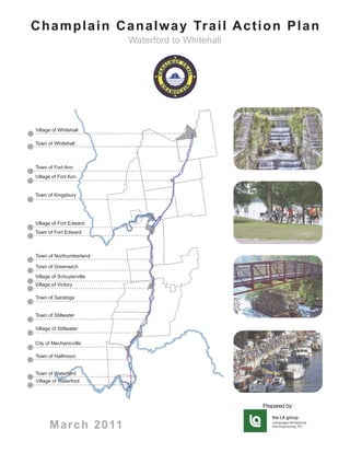
  • 1. C h a m p l a i n C a n a l w a y Tr a i l A c t i o n P l a n Waterford to Whitehall Village of Whitehall Town of Whitehall Town of Fort Ann Village of Fort Ann Town of Kingsbury Village of Fort Edward Town of Fort Edward Town of Northumberland Town of Greenwich Village of Schuylerville Village of Victory Town of Saratoga Town of Stillwater Village of Stillwater City of Mechanicville Town of Halfmoon Town of Waterford Village of Waterford Prepared by: M a r c h 2 0 11
  • 2. C h a m p l a i n C a n a l w a y Tr a i l A c t i o n P l a n Acknowledgements The Champlain Canalway Trail Working Group (Working Group) The Champlain Canalway Trail Action is a volunteer, ad hoc partnership that includes local and Plan was prepared for: regional canal and trail groups, public agencies, and park and preservation organizations. The Working Group benefits from the existing network of the Canalway Trail Association of New York, a statewide, all-volunteer organization of trail owners and managers formed to assist localities to develop, manage, and maintain the Canalway Trail. The Champlain Canalway Trail Action Plan (Action Plan) was funded by a grant from the National Park Service Challenge Cost Share Program, administered by the Rails to Trails Conservancy. The Rivers, Trails and Conservation Assistance Program of the National Park Service provided outreach and planning assistance to the Working Group. The following organizations contributed to the Action Plan: Agricultural Stewardship Association Canalway Trails Association New York Erie Canalway National Heritage Corridor Feeder Canal Alliance Hudson Crossing Park, INC Hudson River Valley Greenway Lakes to Locks Passage National Park Service Rivers, Trails and Conservation Assistance Program New York State Canal Corporation New York State Department of State New York State Department of Transportation New York State Office of Parks, Recreation, and Historic Preservation The Champlain Canalway Trail Action New York State Snowmobile Association Plan was developed with assistance Parks and Trails New York from: Rogers Island Heritage Development Alliance Saratoga County Snowmobile Association Saratoga National Historical Park Saratoga PLAN Town of Halfmoon Photos Provided By: Washington County Association of Snowmobile Clubs Saratoga National Historical Park Dave Perkins In addition, the Action Plan was developed with input and the LA group support from communities in Saratoga, Washington and Warren Marlene and Alan Bissell counties. Mike Klein Agricultural Stewardship Association Derek Pruitt of the Post Star Nelson Ronsvalle N.Y.S. Canal Corporation Holmes & Associates
  • 3. C h a m p l a i n C a n a l w a y Tr a i l A c t i o n P l a n Table of Contents We Have a Vision.......................................1 A History of Movement................................2 Purpose and Development of this Action Plan..................................................2 Trail Benefits................................................4 The Champlain Canalway Trail in Context...6 Short-Term Recommendations.................10 Longer-Term Recommendations...............11 Implementation and Funding....................12 The Trail Route, One Piece at a Time........14 Conclusion, Putting it All Together.............49
  • 4. C h a m p l a i n C a n a l w a y Tr a i l A c t i o n P l a n We Have a Vision … for an attractive and continuous Champlain Canalway Trail route from Waterford to Whitehall, that utilizes historic towpaths, Champlain Canal shoreline, existing local and regional trails, on-street bicycle routes and links to regional and community Hudson River attractions. Parts of this vision have been developed through state and local plans and projects over several years. Some communities already have trail sections completed or underway, or are cultivating local attractions. Nearly 200 local residents came together in a series of public workshops from 2008 to 2010 to help refine the vision for the Champlain Canalway Trail. People talked, viewed pictures, slideshows, maps and flipcharts, listened to programs about bicycle and heritage tourism, and explored alternatives from a variety of viewpoints. A few clear goals emerged: • Establish trails, linear parks, bike routes and water trails that connect along the Champlain Canal corridor. These build upon historic towpaths, trails, portions of the present-day canal, abandoned railroad corridors and low-traffic roads. • Link key historic and cultural sites and features along the way. • Provide downtown and neighborhood trail connections in historic river and canal communities. Bring trail benefits to places where people live and businesses operate. • Establish links with a regional network of trails. These include the Crescent Trail (Mohawk River), Glens Falls Feeder Canal Trail, Warren County Bikeway, the Zim Smith Trail, Hudson River Valley Greenway Trail, Erie Canalway Trail, regional snowmobile trails, on-road bicycle touring routes, and water trails. • Communicate and strengthen a corridor-wide identity linking historic, recreational and economic resources, and help local communities to capture their benefits. • Coordinate local action. Encourage and support local projects by sharing the resources and technical assistance needed to get the job done. 1916 Junction Lock at Fort Edward Page 1
  • 5. C h a m p l a i n C a n a l w a y Tr a i l A c t i o n P l a n A History of Movement The Champlain Canalway Trail weaves through a long and beautiful valley from Lake Champlain to the Hudson River Valley. It picks up stories along the way, and ties them together. To Native Americans, the river and carry route between the Hudson River and Lake Champlain was a pathway for trade, Lock 12 in Whitehall settlement and conflict for centuries before Europeans arrived. As the main travel corridor between New York and Canada, the long valley also proved to be of pivotal importance during the French and Indian War, the American Revolution and the War of 1812. Over time these travel routes were supplemented by wagon roads. The Champlain Canal opened in 1822, establishing the first all-water route through the valley and a direct link between New York and Montreal. New York’s canal system was enlarged several times to accommodate larger vessels and increased traffic. The latest version of the Champlain Canal, constructed between 1905 and 1915, had far larger locks and channels than its predecessors. It was built for self-propelled vessels and followed a slightly different route utilizing a modified channel in the Hudson River from Waterford to Fort Edward and a parallel land-cut from there north to Whitehall. Railroads and trolleys sprang up alongside and began operating year-round, competing with the seasonal canal. The invention of the automobile and truck spurred road improvements, and eventually highways gained dominance over both the canal and railroads. The Champlain Canalway Trail builds upon all of these stories, and many others that are still written in the landscapes and communities of the Champlain Canal corridor. It follows their footsteps and wheel tracks. Purpose and Development of this Action Plan First, this Action Plan conveys a vision for the Champlain Canalway Trail corridor. Several communities are already Old Lock 16 in Fort Ann bringing parts of this vision to life. Some have already completed Page 2
  • 6. C h a m p l a i n C a n a l w a y Tr a i l A c t i o n P l a n sections of trail along historic canal or railroad routes, or have prepared formal plans to build them. Many communities are home to historic sites, parks and other attractions that can be better served by trails linking them to each other and to other parts of the community. This Action Plan helps unify these trails within a single vision. Second, this Action Plan offers recommendations to help support and coordinate regional as well as community-based efforts, showing how you, your business and your community Labyrinth at Hudson Crossing Park can get involved. The Action Plan provides some general recommendations that apply corridor-wide. It also breaks the corridor into segments within each community, each with its own recommendations. This helps keep trail projects to a manageable scale that is practical to implement at the local level. This Action Plan grew from the informal Champlain Canalway Trail Working Group, which convened in 2008 to find ways to complete the Champlain Canalway Trail. The initial conveners, Lakes to Locks Passage and the Town of Halfmoon, applied for and received assistance from the National Park Service Rivers, Trails and Conservation Assistance Program (RTCA). RTCA helped convene local and regional canal and trail groups, public agencies, and town and county park and preservation organizations. The Working Group quickly began meeting with local communities and learning from dozens of maps and planning reports. To gather additional ideas and information, the group convened two public workshops in 2008 -2009. In 2009 and 2010, they sponsored two Bicycles Bring Business workshops to explore how other New York communities, notably those along the Canalway Trail system, are reaping economic benefits of bicycle tourism and trails. The Working Group benefits from the Canalway Trails Association New York (CTANY), a statewide, all-volunteer network of trail managers and supporters formed to help localities develop, manage and maintain the Canalway Trail. CTANY works in partnership with the NYS Canal Corporation, as well as with municipal, county, and state officials who build, manage and maintain trail segments. Bike Route 9 in the Town of Saratoga Page 3
  • 7. C h a m p l a i n C a n a l w a y Tr a i l A c t i o n P l a n Trail Benefits In addition to providing recreational opportunities, the Champlain Canalway Trail will provide a variety of other benefits to our communities, including economic, public health and transportation benefits. It can also have a positive effect on community pride Historic Dix Bridge and identity. Taken as a whole, the evidence about the benefits of trails and greenways is compelling, especially given the modest level of public investment needed compared to other undertakings with similar community goals. Economic Benefits: The economic effects of trails and greenways are generally viewed in two ways. The first is the impact of expenditures by trail users, both direct and indirect; the second is the impact of trails upon property values near the trail. Over the past two decades, many studies from all around the country have shown that day-users of trails spend between $1 to over $30 per visit. Overnight and multi-day trail users spend significantly more, including food, lodging and other items. Depending upon the locality, this can total $100 to $300 per day. An economic impact study of the Erie Canalway Trail was conducted by Eric Mower and Associates in 2007. The study examined the results of previous trail traffic studies conducted at different locations along the Canalway Trail, and also examined daily expenditures by trail users. By combining the trail usage rates with the average daily expenditure per trail user (averaging $11.50 per day), the study estimated the annual revenue generated by Canalway Trail users statewide to be between $27 million and $28 million. Snowmobiling is a popular activity in the Champlain Canalway Trail corridor, and it is an important source of business income. New York has more than 10,000 miles of snowmobile trails which host an estimated 70% of the state’s snowmobile activity. The NYS Office of Parks, Recreation and Historic Preservation estimated the total economic impact of snowmobiling during the 1996-97season to be $476.2 million. By 2003, the snowmobiling industry was estimated to be contributing about $850 million statewide, including $217 million in direct expenditures. Local Business Support of Snowmobilers When new trails are proposed, neighboring property owners often express understandable concern that their property values might be negatively impacted. This is an important issue that has also been studied by many around the country. Findings from these studies have been fairly consistent, that proximity to Page 4
  • 8. C h a m p l a i n C a n a l w a y Tr a i l A c t i o n P l a n trails and greenways tend to bolster values of nearby property, and also make them easier to sell. A study of communities along the Minuteman Trail in Massachusetts found that homes along the trail sold for a higher percentage of the asking price and sold faster than homes in the same towns that were farther away from the trail. A survey by the National Association of Homebuilders in 2000 took a different approach, asking prospective buyers what local amenities could influence them in their purchase of a new home. Proximity of greenway trails was listed by 36% of respondents, exceeded only by highway access. Bikers along the Erie Canal Health Benefits: The Champlain Canalway Trail can play an integral role in improving the health and well being of the people living in the corridor by a providing close-to-home place for physical activity. Research by the Centers for Disease Control and Prevention (CDC) has shown that providing access to places for physical activity, such as trails, increases the level of physical activity in a community. Trails and greenways provide people of all ages with attractive, safe, accessible and low-cost places to walk, hike, jog, bicycle or in-line skate. And trails help people incorporate exercise into their daily routines by connecting them to places where they want or need to go. According to the American Heart Association, even a moderate walk can help a 150-pound person burn 240 calories per hour. The American Heart Association and the American College of Sports Medicine recommend 30 minutes of moderate-intensity aerobic exercise (a brisk walk) five times per week. Transportation / Livability Benefits: Greenways and trails often function as transportation corridors, and they can be a crucial element in a seamless local or regional multimodal transportation system. The ability to avoid streets and highways, and travel though natural areas on foot or by other non-motorized means, is a large factor in a community’s overall “livability.” In addition, many boaters traveling along the NYS Canal system carry bikes for landside transportation when they are docked. The Champlain Canalway Trail will enhance the non-motorized transportation facilities available to boaters. Conservation and Environmental Benefits: Trail and greenway corridors can help preserve natural landscapes, and can also provide “green” corridors for various plant and animal communities, linking otherwise fragmented habitats. They can Bicyclists along Bunker Hill Road help protect the quality of wetland areas by providing vegetated buffers, and trees within the trail corridor can help improve air quality, especially in developed areas. In addition, trails can help bring people closer to the natural world with minimal environmental impact. Page 5
  • 9. C h a m p l a i n C a n a l w a y Tr a i l A c t i o n P l a n Historic Preservation and Community Identity: The Champlain Canalway Trail will help highlight and preserve a historically significant transportation corridor – the Old Champlain Canal. Many communities along New York’s Canalway Trail corridor (and elsewhere) have found that their trails become a source of community identity and pride. Trails that link or provide access to historic and cultural resources can help a community understand and better appreciate its own distinctive character. By “packaging” interesting places together, these trails may Old Lock Remnant also attract visitors interested in seeking a variety of historic and recreational experiences. The Champlain Canalway corridor is rich in variety, ranging from individual canal locks and sections of waterways to the Saratoga National Historical Park, along with other important parks, historic sites and downtown areas. The Champlain Canalway Trail in Context The Champlain Canalway Trail is one of four in New York State’s Canalway Trail system, and it is the second longest. The other Canalway Trails are the Erie (365 mi), Oswego (37 mi) and Cayuga- Seneca (22mi). When completed, the Champlain Canalway Trail will extend 62 miles between Whitehall and Waterford, plus an additional 9 miles along the connecting Glens Falls Feeder Canal Trail. Together, these form a major connective spine through the region. When completed, New York’s Canalway Trail system will extend over 524 miles, making it one of the nation’s longest continuous recreational trail systems. This vision was promoted by the “NYS Canal Recreationway Plan,” which was formally adopted by the New York State Canal Recreationway Commission in 1995. The following year, the “Saratoga County Heritage Trails Handbook for Action” portrayed a county-wide vision for trails, which included the Champlain Canalway Trail. In Warren and Washington Counties, the Canal Corporation began doing its part by working with the local community to complete the Glens Falls Feeder Canal Trail. The potential for establishing a trail through the Champlain Canal corridor was evaluated in a set of studies from 2000 to 2003, which included three “Canalway Trail Gap Assessment” reports and the “Saratoga County, NY Champlain Canal Trail Concept Stillwater Canalway Tralil Plan.” Since then, elements of the Champlain Canalway Trail Page 6
  • 10. C h a m p l a i n C a n a l w a y Tr a i l A c t i o n P l a n have also been reflected in a variety of transportation plans and Local Waterfront Revitalization Plans undertaken by individual communities. It has also been embraced by regional plans such as the Lakes to Locks Passage Scenic Byway, and the New York State Trails Plan. This Action Plan builds upon these previous studies and plans. A general goal is to keep the Champlain Canalway Trail consistent with the design standards of the rest of New York’s Canalway Trail system. This means placing the trail off of roads and along historic towpaths and abandoned railroad corridors to the greatest extent possible. It also means respecting private property rights where these historic routes are not in public ownership but are owned by private companies or individuals. A snapshot of the Trail’s status in 2010 is shown in the accompanying table. “Vital Signs” of the Champlain Canalway Trail Waterfront in Waterford Percent Trail Status in 2010 Miles of Total Champlain Canalway Trail completed and 8 11% in use Glens Falls Feeder Canal Trail completed 9 13% and in use Trail planned or in construction 14 20% Trail route defined but not pieced together 14 20% Trail route undefined 26 37% Total Length 71 100% Fort Edward Lock Tumble Door Page 7
  • 11. C h a m p l a i n C a n a l w a y Tr a i l A c t i o n P l a n Dix Bridge Linking Saratoga/Washington Counties Local and regional efforts to complete and promote the Champlain Canalway Trail can benefit from coordination with other trail and bikeways systems that either overlap parts of the Champlain Canal corridor, or provide outward linkages. Some of these are described below. Erie Canalway Trail: The NYS Canal Corporation is working with NYS Office of Parks Recreation and Historic Preservation, the nonprofit Parks and Trails New York and many others to establish the NYS Canalway Trail system all across the state. Over three- fourths of the Erie Canalway Trail’s 365 miles are now built and complete. An annual bicycle event, Cycling the Erie Canal, travels the trail end-to-end each year, and the trail is becoming a national and international destination. The Champlain and Erie Canalway Trails connect with each other at Waterford / Cohoes. NYS Bike Route 9: The New York State Department of Transportation maintains three long-distance, on-road bicycle routes for experienced cyclists. Bike Route 9 extends 340 miles from New York City to Montreal and traverses the Champlain Canal corridor. Within the Champlain Canal corridor, Bike Route 9 follows US Route 4 and parts of State Routes 32 and 22. In addition to being an important bicycling route in its own right, Bike Route 9 can provide on-road linkages between trail sections in areas where an off-road trail route has not been established or is not feasible. Lake Champlain Bikeways: A network of bicycle routes more Joggers along the Canal than 1,300 miles long winds through the Lake Champlain Valley of Page 8
  • 12. C h a m p l a i n C a n a l w a y Tr a i l A c t i o n P l a n New York, Vermont and Quebec. The on-road network includes 35 loops and tours ranging from 10 to 60 miles in length, in addition to a 363-mile principal route around the entire Lake and along the Richelieu River to Chambly, Quebec. The routes are based on a rich array of natural, cultural and historic themes, and mostly follow quiet back roads highlighting the Valley’s incomparable scenery. The southern end of the Champlain Bikeways system connects to the Champlain Canalway Trail at Whitehall. Hudson River Valley Greenway: A major goal of New York Old Champlain Canal Locks in Fort Ann State’s Hudson River Valley Greenway is to help communities establish a system of trails along the Hudson River from the northern borders of Saratoga and Washington Counties to Manhattan. There are two main trail components: a system of land trails along both sides of the Hudson River, and a water trail for paddling and boating. NYS Bike Route 9 is an important component of the land trail system. The Hudson River Greenway overlaps the Champlain Canalway Trail corridor, and also provides potential linkages southward along the Hudson River. Glens Falls Feeder Canal Trail: This 9-mile walking and biking trail extends from Glens Falls to Fort Edward along the historic Glens Falls Feeder Canal. Although technically separate from the Champlain Canalway Trail, it is managed by the NYS Canal Corporation in partnership with the Feeder Canal Alliance - - and it also provides an important trail linkage to the City of Glens Falls and other major resources and destinations. For purposes of this Action Plan, it is treated as a functional part of the Champlain Canalway Trail. Fort Edward Train Station Warren County Bikeway: The Warren County Bikeway extends 9.5 miles from Lake George Village to downtown Glens Falls, where it connects to the Glens Falls Feeder Canal Trail. Most of the Warren County Bikeway is a paved, off-road trail for non- motorized use. Some sections of the route share the shoulder of local roads. Snowmobile Trails: A network of active snowmobile trails extends throughout Washington and Saratoga counties. The Washington County Association of Snowmobile Clubs has 9 member clubs who together maintain over 60 miles of groomed trails. The Saratoga County Association of Snowmobile Clubs is comprised of 6 clubs who maintain more than 180 miles of groomed trails. Sections of the Champlain Canalway Trail are important components of these trail systems, and the Dix Bridge will provide an important off-road trail connection between the snowmobile trail systems in Saratoga and Washington counties. Snowmobilers on Champlain Canal Page 9
  • 13. C h a m p l a i n C a n a l w a y Tr a i l A c t i o n P l a n Saratoga County Trails: The Champlain Canalway Trail is a major component of the Saratoga County Trail System envisioned in Saratoga County’s Green Infrastructure Plan. It will connect to the Zim Smith Trail, in Mechanicville, and five towns and two villages as well as the Luther Forest Technology Campus. The southern terminus of the Canalway connects to the Vischer Ferry Road Trail and other town and city trail systems in Halfmoon, Ballston, Stillwater, Saratoga and Malta already planned to connect to the two trail systems that make up the beginning of the county-wide trail. Short Term Recommendations (1-3 years) Canalway Trail Sign in Fort Ann • Plan, design and build new Champlain Canalway Trail segments where feasible. • Engage local communities by promoting the trail through local and regional events. The Canal Splash, the Tour de Farm and triathlons are examples of events that can help promote trails and trail-related benefits. Events like National Trails Day and the Canal Clean Sweep can help gain publicity and promote volunteer stewardship. • Work with touring businesses, local businesses, and cycle groups to create a working prototype cycle tour to jump- start tourism-based economic development and boost awareness. • Expand the role of the Canalway Trails Association of NY (CTANY) as a regional coordinating body to continue supporting local projects, such as events and promotions, trail construction and linkages to other regional trails. • Utilize Champlain Canalway Trail signage, publications and the web to enhance visibility. Develop interpretive signage at appropriate locations based on the distinctive history, communities and resources that distinguish the Champlain Canal corridor. Draw on the strength by association with the Champlain Valley National Heritage Partnership, Erie Canalway National Heritage Corridor, Hudson River Valley National Heritage Area, and NYS Canal Corporation and Lakes To Locks Passage. Built Canalway Trail in Town of Saratoga • Identify and sign lesser traveled on-street routes to incorporate Page 10
  • 14. C h a m p l a i n C a n a l w a y Tr a i l A c t i o n P l a n as part of the Champlain Canalway Trail route. • Explore new business opportunities through a next generation of Bicycles Bring Business workshops and other business growth programs. Longer Term Recommendations (3-10 years) Rebuilt Clay Hill Bridge in Fort Ann • Plan, design and build new Champlain Canalway Trail segments where feasible. • Enhance NYS Bike Route 9 through the entire corridor, as an on-road bicycle transportation route. Work with NYS Department of Transportation (DOT) to promote bicycle and pedestrian enhancements through the entire corridor. • Market the trail more broadly using on-line tools such as Google maps, the Lakes to Locks Passage Geotourism Initiative and the Parks and Trails New York (PTNY) Trail Finder website. Produce, and post online, recommended trail tours or multi-day tourism itineraries for various types of trail users. • Boost the local business base by expanding services for trail and canal users. The historic building stock of many communities offers distinctive appeal for adaptive re-use. • Include key elements of Canalway Trail and related local projects into major plans, such as the NYS Trails Plan, and state and regional Transportation Improvement Plans (TIP). • Explore establishment of additional specialty attraction, such as a birding theme trail. • Establish a clear Canalway Trail “gateway” presence in key communities. Gateway features may include: • Directional signage and kiosks guiding residents and visitors to nearby trail sections; • Murals and other public art; • Enhanced physical and thematic linkages between business districts and the trail; • Interpretive signage and thematic mileage markers along the trail; and • Adopt-a-trail programs involving community groups. Trail along Old Champlain Canal Page 11
  • 15. C h a m p l a i n C a n a l w a y Tr a i l A c t i o n P l a n • Target certain areas for special planning studies. Parts of the potential trail corridor face complications or blockages that demand thoughtful solutions. Seek additional funding and assistance to focus on developing alternative solutions for these, one at a time. • Incorporate water trail access and accommodations into planning for the land-side trail. Canal locks are obvious places to consider for water trail access or overnight stopovers as well as trailheads or interpretive locations for Old Champlain Canal Chamber in Fort Edward the land trail. Consider establishing other shared-purpose services and linkages, involving parks, marinas or waterfront accommodations. • Create side loops and connections to cultural/tourism attractions and downtown business districts to provide all day or multi-day tourism activities. Create linkages to and from Amtrak Stations, shoreline access points, and scenic corridors. Improve connectivity and access between water resources and land attractions throughout Saratoga and Washington counties. • Support appropriate amenities such as bike racks, kayak launch areas and lockers, transient docking facilities and other multi-modal facilities to secure personal property and provide a safe and enjoyable visit. Identify comfort stations at strategic points along major routes. Implementation and Funding The NYS Canal Corporation serves to maintain, operate and promote the historic 520-mile Canal system, including the Champlain Canal. The Canal Corporation plans to build trails on those parts of the corridor it owns. However, since most of the potential trail route is owned by local municipalities and other entities, most Champlain Canalway Trail projects will need to be initiated and implemented at the local level. Taking a coordinated, partnership approach to the elements suggested in this Action Plan will help position Champlain Canal communities to obtain trail funding while minimizing competition with each other. Increased coordination and support between communities can help complete the entire trail, and ensure that all local communities capture the full range of benefits for local residents and visitors alike. Hudson Crossing Park Canal Event Page 12
  • 16. C h a m p l a i n C a n a l w a y Tr a i l A c t i o n P l a n Sources for funding the Champlain Canalway Trail are subject to change. The following are programs that focus on trail planning and development. Federal Transportation Funding: Federal transportation funds, especially the Transportation Enhancements Program, have funded most large-scale trail projects nationwide. These programs are typically administered by NYS Department of Transportation. (www.nysdot.gov/funding) National Scenic Byways Program: NYS Department of the Transportation manages the Scenic Byways Program, which consists of roadways that provide access to outstanding scenic, natural, cultural or recreational resources. Projects that support and enhance National Scenic Byways are eligible include trails, signage and kiosks, and bicycle-pedestrian amenities. The entire Champlain Canal corridor is within the Lakes to Locks Passage Scenic Byway, which also tracks available grants. Whitehall Heritage Area Visitor Center (www.lakestolocks.com/news1.cfm) General information on Scenic Byways grants is also available from the National Scenic Byways Program. (www.bywaysonline. org/grants/) Hudson River Valley Greenway: HRVG Conservancy Grants offer funding for trail projects. Eligible trail projects include planning and design, construction and rehabilitation, and education and interpretation. Small grants are also available for designated water trail sites. (http://hudsongreenway.ny.gov/ GrantFunding/GrantsOverview.aspx) NYS Department of State Waterfront Revitalization: NYS DOS works with communities through the Local Waterfront Revitalization Program to promote community revitalization and resource protection through community-based plans and projects that enhance public access to waterways and state lands for water- based recreation, promoting sustainable economic development, protecting and improving water quality, and revitalizing hamlets and downtowns. Communities are eligible for grants from the Environmental Protection Fund for a wide variety of planning, design, and construction projects including waterfront trails, blueway trails, enhanced access to waterways, and strengthening linkages between waterfronts and downtowns. (www.nyswaterfronts.com/grantopps_epf.asp) NYS Office of Parks, Recreation and Historic Preservation: The Recreational Trails Program is a matching grant program for Scenic Byways Signage the acquisition, development, rehabilitation and maintenance of Page 13
  • 17. C h a m p l a i n C a n a l w a y Tr a i l A c t i o n P l a n trails and trail-related projects. Funded projects must be identified in, or further a specific goal of the NYS Statewide Comprehensive Outdoor Recreation Plan (SCORP) and must be available to the general public. The source of funds is the Federal Highway Administration. The Snowmobile Trail Grant Program allocates funds to local governments that engage in the development and maintenance of snowmobile trails as part of the State Snowmobile Trails system. (www.nysparks.com/grants/state-funded-programs.aspx) Skenesborough Museum in Whitehall Parks and Trails New York: PTNY offers advice and technical assistance to communities who are trying to get a new trail started, or expanding an existing trail. Small grants for capacity building are also available. (www.ptny.org) Champlain Valley National Heritage Partnership: While the LCBP traditionally focuses on the landscape that drains into Lake Champlain, the area of consideration for the CVNHP includes any historic site or community along the “linked navigable waterways” of Lake Champlain, Lake George, the Champlain Canal, and the Upper Hudson River that contains a physical, cultural, or historical resource that represent the CVNHP’s interpretive themes. The Vermont and New York counties within the Partnership include Grand Isle, Franklin, Chittenden, Addison, Rutland, Bennington, Clinton, Essex, Warren, Saratoga and Washington. Grants are available through the Lake Champlain Basin Program. (http://www.lcbp.org/grant_search.aspx) The Trail Route, One Piece at a Time The Champlain Canalway Trail will never equal the Erie in overall length or in the number of cities along its route. But whatever the numbers, the Champlain Canal corridor is rich in its history, scenery and communities. It includes many parks and historic sites, farmlands and active waterways, as well as quiet sections Canal Waterfront in Whitehall of old canal, towpath and abandoned railroad. The smaller-scale cities and villages along the way all include attractive historic sections, business districts and residential areas. The New York State Trails Plan calls trails “a quiet economic engine.” The distinctive elements of the Champlain Canal corridor provide all the working parts of that engine. Page 14
  • 18. C h a m p l a i n C a n a l w a y Tr a i l A c t i o n P l a n To create a trail that is equal to the Erie Canalway Trail in quality and appeal, trail building efforts throughout the Champlain Canalway corridor must be coordinated. At the same time, creating a trail that is truly distinctive, that fits within each individual community and that serves its local residents effectively will depend heavily upon local interest and initiative. This Action Plan is intended to help foster and inform locally-based efforts to complete the Champlain Canalway Trail. The following pages use narrative, maps and photographs to describe the Stillwater Canalway Trail existing conditions, issues and opportunities along the proposed trail route. The entire trail route is separated into 30 segments, each 1 to 3 miles in length. These are the building blocks for the complete trail. Each segment can be used as a stand-alone by an individual community, to help focus attention and prompt constructive dialog. Taken all together, the segments present a complete vision for the trail. Many segments offer one or more alternative routes where there are known obstacles or issues along the “preferred” route, which is marked in purple. The preferred route generally represents a high standard of trail: a route that is consistent with the design standards of the rest of New York’s Canalway Trail system, and that is placed off of roads and along canal banks, historic towpaths, and similar corridors to the greatest extent possible. The preferred route is not always the most feasible route. In places where these historic routes are not in public ownership but are owned by private companies or individuals, it is imperative to respect the rights and interests of private property owners. Far from imposing a uniform standard, this Action Plan offers both recommendations and alternatives to help guide local action. Page 15
  • 19. C h a m p l a i n C a n a l w a y Tr a i l A c t i o n P l a n The Champlain Canalway Trail is envisioned primarily as an off-road, shared-use path, similar to other parts of New York’s world-class Canalway Trail system. Bike routes and bike lanes can provide links between off-road trail sections, or serve where an off-road route is not feasible. Bike routes can also provide links or loops to nearby neighborhoods or downtowns, or to the broader region. NYS Bike Route 9 provides an on-road link through the Champlain Canal corridor. Page 16
  • 20. Whitehall Fort Ann C h a m p l a i n C a n a l w a y Tr a i l A c t i o n P l a n Kings- Queensbury bury Hartford Mohawk River to Old Champlain Canal Lock 5 Glens Falls Argyle Moreau Fort Edward Northum- berland Greenwich Saratoga Easton Stillwater Schagh- Half- t moon aterford ate Waterford Tugboat Roundup Champlain Canalway Trail in Waterford Location Length Higgins Rd Town of Waterford and 2.5 Miles Village of Waterford Old Champlain Canal Existing Conditions Lock 5 and Boatyard Site Lock E4 • Resources Include: Old Champlain Canal Locks 4 and 5, Waterford Visitors Center, Peebles Island State Park, and Mattens Shipyard. RR • Stone dust trail sections constructed, owned by Canal WATERFORD ! ( 2 Corp and maintained by Waterford. 32 • Parking available at Visitors Center and Fulton Street. • Connections to Peebles Island, Waterford, Crescent Lock E3 Trail, and Mohawk Towpath Trail. Recommendations & Actions Waterford Side VILLAGE OF VILLAGE OF 1. Establish trail gateway linkages in Waterford using public WATERFORD WATERFORD Cut Locks 2. art, appropriate signage and other amenities. Formalize the trail link to Peebles Island State Park, £ E2 ¤ 4 Lock Flight of Locks and Waterford Side-Cut: ! ( 1 • Coordinate with OPRHP and Waterford Harbor Waterford Harbor Visitors Center. Visitor Center 3. Establish National Recreation Trail and Hudson Peebles Island Greenway Trail designation. State Park r Rive 4. Enhance and interpret Old Champlain Canal Lock 5 and Historic Boatyard. son Fulton Street Hud 32 Old Champlain OE S Canal Lock 4 Y TRO COH ! ( 0 Mo ha wk Riv er 0 1,000 2,000 Feet Legend Existing Trail Mile Point 1 Proposed Trail Alternate Trail Public Lands Alignment Old Stone Supported Railroad Bridge Page 17
  • 21. Whitehall Fort Ann C h a m p l a i n C a n a l w a y Tr a i l A c t i o n P l a n Kings- Queensbury bury Hartford Old Champlain Canal Lock 5 to Clute Street Glens Falls Argyle Moreau Fort Edward Northum- berland Greenwich Saratoga Easton Stillwater Schagh- ke Waterford New Water Line on Closed Landfill Location Length Town of Waterford .5 Miles Existing Conditions • Resources Include: Old Champlain Canal, Old Champlain Canal Lock 5, and existing trail section. Existing Trail Section at Old Champlain Canal Lock 5 • Most of proposed trail section owned by City of Mechanicville. • Access to Old Champlain Canal along eastern base of landfill. • Site is complicated by landfill and adjacent industrial activity. Recommendations & Actions 1. Explore the potential to use waterline on top of closed landfill for trail alignment. 2. Work with the Town of Waterford and City of WATERFORD Mechanicville to determine a workable strategy for ownership, construction, maintenance and stewardship. tow Clute St nR d Clute Street 32 ! ( 3 £ ¤ 4 RR Capped Landfill and Proposed Trail Location Existing Trail Section Higgins Rd Old Champlain Canal Lock 5 and Boatyard Legend Existing Trail Mile Point 1 Proposed Trail Alternate Trail Trail along Old Champlain Canal Alignment Public Lands Page 18
  • 22. Whitehall Fort Ann C h a m p l a i n C a n a l w a y Tr a i l A c t i o n P l a n Kings- Queensbury bury Hartford Clute Street to Schoolhouse Lane Glens Falls Argyle Moreau Fort Edward Northum- berland Greenwich Saratoga Easton Stillwater h h- Half- moon rford Canalway Trail Bells Lane Location Length Town of Waterford .4 Miles Existing Conditions • Resources Include: Old Champlain Canal and partially watered prism and riprap embankment along Bells Lane; most of route owned by the City of Mechanicville. • Industrial road crossings at Schoolhouse Lane an issue. Recommendations & Actions 1. Place trail on top riprap berm parallel to Bells Lane or explore potential shared uses of Bells Lane. 2. Work with Town of Waterford and City of Mechanicville to determine a workable ownership, construction, and stewardship strategy. 3. Explore issues of industrial road crossings at Clute Street and Schoolhouse Lane: • Assess needs for signage and pavement markings needed. 32 Schoolhouse HALFM OON Lane WATE WATER RFORD FORD Schoo lhouse Ln Be WATERFORD lls Lan Bells Lane RR £ ¤ e 4 Clute St Proposed Trail Alignment at Bells ! ( 3 Clute Street Lane and Clute Street Intersection Clute Street Legend Existing Trail Mile Point 1 Proposed Trail Alternate Trail Public Lands Alignment Bells Lane and Clute Street Intersection Enlargement Page 19
  • 23. Whitehall Fort Ann C h a m p l a i n C a n a l w a y Tr a i l A c t i o n P l a n Kings- Queensbury bury Hartford Schoolhouse Lane to Brookwood Road Glens Falls Argyle Moreau Fort Edward Northum- berland Greenwich Saratoga Easton Stillwater chagh- oke Waterford Informal Trail at Halfmoon Stream Crossing in Need of Replacement SCHAG Location Length Halfmoon Trail ! ( 5 Town of Waterford and 1.3 Miles Town of Halfmoon Section Brookwood Existing Conditions RR Road • Resources Include: Halfmoon Riverfront Park, Champlain Halfmoon SCH LFMO S H LFMO Canal Lock 1, Old Champlain Canal, and Halfmoon Trail Riverfront Park HA HA Section. AG R d GH ON od • Short section of proposed trail owned by the City of k wo TIIC oo Mechanicville between Schoolhouse Lane and Halfmoon Br C CO ON town line. KE K • Stream crossing needs new bridge to replace existing informal bridge crossing. Hud • Towpath section receives informal trail use (mostly snowmobiles) but is not actively maintained. son • Occasional flooding from beaver activity. £ ¤ 4 Rive HALFMOON Recommendations & Actions ! ( 4 r 1. Work with municipalities to determine a workable Champlain Canal ownership, construction, maintenance, and stewardship Lock 1 strategy to complete trail from Schoolhouse Lane to town boundary. HALFM OON WATE WATER RFORD FORD Schoolhouse Ln Schoolhouse WATERFORD Lane 32 Clute St Clute Street ! ( 3 Legend Existing Trail Mile Point 1 Proposed Trail Alternate Trail Alignment Public Lands Concept Map for Halfmoon Riverfront Park Page 20
  • 24. Whitehall Fort Ann C h a m p l a i n C a n a l w a y Tr a i l A c t i o n P l a n Kings- Queensbury bury Hartford Brookwood Road to Upper Newtown Road Glens Falls Argyle Moreau Fort Edward Northum- berland Greenwich Saratoga Easton Stillwater - Hal - moon Waterford Old Champlain Canal Lock 7 Hudson Crossing Park Location Length Town of Halfmoon 2.3 Miles Upper Newtown Road Existing Conditions • Resources Include: McDonald’s Creek Culvert and Upper New town Rd waste weir, Halfmoon Riverfront Park, Old Champlain Canal Lock 7, and Owl Creek Culvert. • Trail follows Old Champlain Canal (partially watered) and towpath route owned by town of Halfmoon. • Stone dust trail with trail head parking on both ends completed, and signage installed. • Trail connection to new Riverfront Park funded and easement acquired. RR • Resource protection has been established through ! ( 6 ICOKE the Town of Halfmoon Champlain Canalway Overlay 32 SCHAGHT N Historic District. HALFMOO HALFMOON HALFMOO • McDonald’s Culvert received restoration funding from SCHAGHT Old Champlain Canal EPF. Lock 7 ICOKE Recommendations & Actions McDonald’s Culvert £ ¤ N 1. Enhance and expand trail use: 4 and Waste Weir • Identify partner and develop interpretive trails Lo we brochure and map. rN ew • Develop events, programming, and stewardship. to Hudso wn • Form an Adopt-a-Trail stewardship committee. Rd Halfmoon Riverfront n River Park Owl’s Creek Culvert Brookwood Road ! ( 5 Legend Existing Trail Mile Point 1 Proposed Trail Alternate Trail Public Lands Alignment McDonald Creek with Old Champlain Canal Towpath Trail Page 21