3. Carlisle's location
Carlisle is situated on the flood plain of the
River Eden with three rivers meeting in the
city.
The catchment is made up of the Rivers
Eden, Eamont, Irthing, Petteril and the
Caldew, as well as smaller rivers and
streams draining into the Eden estuary.
The catchment covers approximately
2400km2 and is home to approximately
244,000 people.
The catchment is mainly rural, with only
1% classified as urban: the main urban
areas are Carlisle, Penrith and Appleby.
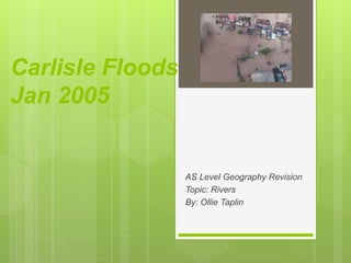
Carlisle has a history of flooding with flood
events recorded as far back as the 1700s.
In recent years there have been significant
floods in 1963, 1968, 1979, 1980, 1984,
and recently in 2005.
4. Carlisle’s location
This map shows the area around
Carlisle and the three rivers that
meet in the city. The largest being
the river Eden
5. Carlisle's location
This map shows the catchment
area of the river Eden. Carlisle is
represented by the circle.
As you can see it sits in the
middle of the wettest area of
Cumbria.
7. Causes of the Carlisle flood
Rainfall
Rainfall was very high for the period 6th
to 8th January, during which two
months' worth of rainfall were released
in 24 hours. However, it followed a
month of high rainfall in the Carlisle
area, so the ground was saturated and
would no longer allow water to infiltrate,
and surface run-off was excessive. The
result was rapidly rising water levels in a
number of rivers ( Eden, Kent and
Derwent )
67% of the flooding resulted from
rivers and watercourses
25% of flooding was caused by
surface water
8% was due to flooding from
sewage and infrastructure failures.
9. Causes of the Carlisle flood
Physical
Low lying flood plain less
than 20m
Many tributaries joining
the Eden e.g. River
Petteril
Lack of vegetation limits
interception rates.
Higher than average
rainfall
High drainage density
10. Causes of the Carlisle flood
Human
Homes built on the
floodplain (wet point site)
Edentown
Levees along river banks
may have been artificially
strengthened
Recreational activities
deliberately built on the
floodplain e.g. golf course
Impermeable surfaces
increasing surface run-off
created by the urban
environment of Carlisle.
Sewage works
12. Impacts of the Carlisle flood
Across the catchment, the January 2005
flooding affected 2,700 homes
In Carlisle three people died
The cost of the flooding was estimated at
over £400 million.
50% of residents in the flood risk area had
not signed up to receive a warning.
The area immediately to the south of the
River Eden was worst affected, where the
floodplain had been used for
development.
flood waters neared the second floors of a
few houses, leaving residents stranded-
Evacuation was dangerous in darkness
and high winds
2.5 metres of water flooded the fire station
and police station adding to the problem
of help by these services.
14. Responses
Immediate
Evacuation of people from
buildings was undertaken as
best as emergency services
could.
Use of private boats for
transport was used
Large relief centres set up for
those whose homes were
destroyed by the floods.
Rapid response by sewage
companies in the area to try
and limit spillages.