This document discusses using maps and mapping activities to help students explore their personal identities and sense of belonging. It provides 10 mapping ideas or prompts that encourage students to visually represent where they live, who they spend time with, how they connect to different places, and how their identities and perspectives are shaped by environmental and social factors. The mapping activities are presented as a way to better understand oneself and gain cultural understanding of others.
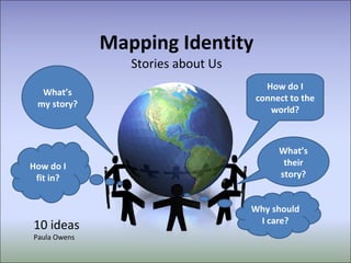
1. Mapping Identity Stories about Us What’s my story? How do I fit in? How do I connect to the world? What’s their story? Why should I care? 10 ideas Paula Owens
2.
3.
4.
5. 1. What’s my story? I was born in London. My parents lived with Mum’s parents while they saved to buy a house My dad got a better paid job in Herne Bay – houses were cheaper there too. Dad got a new job in Wales – near his family Mum missed her family in London – Dad got a new job there, we moved to Sittingbourne , where there was a good school. I left home to live with friends, got married and stayed on Sheppey. PULL Factors JOB FAMILY HOUSE PRICES LOCATION SCHOOLS Create flow diagrams to show moves and /or significant events and where and why they happened. For yourself, for others, for fictional characters. Describe, explain, compare, analyse... ...
6. 1. What’s my story? You could: research family history if children have not experienced moving home. Ask children who have moved, (and who may be relatively new to the school) to ‘be the expert’ and explain how it feels coming to a new place. www.scribblemaps.com Represent using a relevantly scaled map
7. 2. Where do I hang out? LLLLLLLLLLL LLLLLLLLLLL LLLLLLLLLLL LLLLLLLLLLL LLLLLLLLLLL +++++++++++++++++ ++++++++ +++++ Daughter’s house Sittingbourne Beach Local shop Local Hall tap dancing Sheerness Ebbsfleet St Pancras London Cliffs Train Town City Walk Car Station 0000000000 Friend’s house ADULT last week Shop House 0000000 Bike Where do you go to in an average week? Where did you go last week? What is your ‘everyday’ geography?
8. Nanny’s house My house The beach Paris’s house Jungle way home Daddy’s shop Bus stop Oliver’s map Aged 5 2. Where do I hang out? Child’s beginning map - unstructured
9. 2. Where do I hang out? LLLLLLLLLLL LLLLLLLLLLL LLLLLLLLLLL LLLLLLLLLLL LLLLLLLLLLL Nanny and Granddad's house Sittingbourne Beach Local shop Eastchurch School Sheerness Cliffs Bus Town Walk Car School xxxxxxxxxxxxxxxxx Nanny and Granddad's house xxxxxx LLLLLLLLLLL Daddy’s shop House CHILD Supported map What does this tell you about this child’s range and freedom to explore? How might this range develop in the next few years? Shops
10. 3. Who do I hang out with? LLLLLLLLLLL LLLLLLLLLLL LLLLLLLLLLL LLLLLLLLLLL LLLLLLLLLLL Nanny and Granddad’s house Sittingbourne Beach Local shop Friends Sheerness Cliffs Bus Town Walk Car School xxxxxxxxxxxxxxxxx Nanny and Granddad xxxxxx LLLLLLLLLLL Daddy’s shop House CHILD Mummy Mummy Mummy Mummy and Daddy Mummy Uncle Danny Uncle Zac Auntie Kerri My cousin Mummy and Daddy Mummy and Daddy Add significant people to the map Who are these people? Where do you meet them and why? Shops
11.
12.
13.
14. 5. Go Compare Mapping similarities and difference Do you live alone? Do you speak English? Do you live in a palace? Do you have a dog? Do you speak more than one language? Do you live in a flat? ‘ No’ answers ‘ Yes’ answers Why not ... design six questions and compare your answers with someone else from your class, from another UK school, from an overseas school. Show responses on a map.
15. 6. Me in the World What everyday items do you use each day? How do they connect you to the world? Breakfast items? Clothes? Toys? Compare your map to others – what do you notice? How will you research? www.scribblemaps.com
16. 7. Country Connections I live in England, UK. ME Spain Canada China Malaysia Wales Ireland France Australia Iran Scotland Family links Visited Friends Lived What categories could you add? Cultural links? Food, clothes etc? Email links? Music TV and other media?
17. 8. Why should I care? Why should you reduce your environmental footprint? Or why not? What can you do? How could you map local actions and global impacts? Energy use? re-useable bag? Walk rather than drive? Locally sourced Food? What do I need to know ?
18.
19. 9. Fantasy places Mysterious mountains Summer Sands Secret Sea Rogue River Wild woods Tricky track Forgotten forest Vvv vvv vvv Vvv vvv vvv Vvv vvv vvv Vvv vvv vvv Vvv vvv vvv Vvv vvv vvv Vvv vvv vvv Lost Lake Moorhen Marshes What would your fantasy place look like? What kind of landscape would it show? Skyscrapers? Glaciers? Caverns? Castles? Funfairs?
20. 10. Community Maps In this British Library project, different communities in the Kings Cross area of London were each given a grid square of a map of the local area to illustrate.
21. 10. Community Maps Groups of users interpret places differently. Places hold unique, shared and diverse meanings. Our relationships with places both reflect and define our identity.
22. Photos Nell Seal Pupils from Hillside Avenue Primary School doing fieldwork at Wells – next - Sea For more ideas see Mywalks and Messy maps See http://www.geography.org.uk/cpdevents/onlinecpd/myplaceyourplaceourplace/mywalksandmessymaps / Explore these ideas further through the second family of free, online CPD courses on Identity and Social Cohesion coming soon to the GA site. These ideas are only the tip of the iceberg .... What could you do?
23. Identity: Geography Plus ....? Geography mapping activity title ________________________________________________________________ Geography Big Ideas: place, space, scale, cultural understanding, diversity, environmental interaction, physical and human processes, interdependence. Knowledge – what do you want pupils to know ? Skills Other subject links
Notas del editor
Why do we move and relocate? Understanding why people move is one of the big ‘stories’ of human geography and how they are influenced by factors such as environment, location, culture, social connections and economics. These are stories that even very young children can relate to.
Useful to explore children’s use of relevant vocabulary and their understanding of landscape features. This could also be a 3D fantasy place – or a sustainable place. For example, what would your vision of your school grounds in the future look like? What knowledge of effective landscapes would you draw on and why? Who would it be designed for? Lots of possibilities.
![[object Object],[object Object],[object Object],[object Object],[object Object],[object Object],[object Object]](data:image/gif;base64,R0lGODlhAQABAIAAAAAAAP///yH5BAEAAAAALAAAAAABAAEAAAIBRAA7)