Open streetmap response-to-ebola-crisis-geong-2014-09-23
•Descargar como ODP, PDF•
3 recomendaciones•4,823 vistas

Conference at GeONG, Chambery, Sept. 23 2013 about OpenStreetMap Response to the 2014 Ebola Outbreak in West Africa.

Recomendados
Recomendados
Más contenido relacionado
La actualidad más candente
La actualidad más candente (20)
Destacado
Similar a Open streetmap response-to-ebola-crisis-geong-2014-09-23
Similar a Open streetmap response-to-ebola-crisis-geong-2014-09-23 (20)
Último
Último (20)
Open streetmap response-to-ebola-crisis-geong-2014-09-23
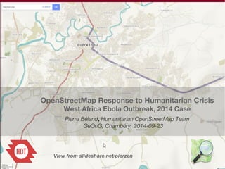
- 1. OpenStreetMap Response to Humanitarian Crisis West Africa Ebola Outbreak, 2014 Case Pierre Béland, Humanitarian OpenStreetMap Team GeOnG, Chambéry, 2014-09-23 View from slideshare.net/pierzen
- 2. OpenStreetMap : An ecosystem for rapid and efficient intervention With the OpenStreetMap rapid intervention for Haiyan, Philippines and West Africa Ebola, this was the defacto Reference map for these international interventions. The capacity to mobilize international volunteers through Internet assures access to essential products and services The Black and white map - OSM database and Maps updated to the minute - Humanitarian style - Paper Maps + FieldPapers Maps for field survey - Offline Android / IOS - GIS Download Let's color the map with thematics We need a change of culture and adapt to small mobile technology. What data and how the government and humanitarians could share with other organizations ? Government OpenData to share administrative limits and other public data Humanitarian Organizations Field Teams Collecting - infrastructure data - Locality names - etc Coordination with UN and humanitarians Humanitarian OpenStreetMap team makes the bridge with the humanitarians
- 3. OSM Crowdsourcing contribution - Task Manager Jobs Haiyan Typhoon West Africa Ebola, first 6 months 1,600 contributors / 4.5 million objects 1,333 contributors, 7.4 million objects 200 km x 200 km uMap Data : OpenStreetMap Contributors Nov-Dec 2013 March – Sept 2014
- 4. Ebola Outbreak, West Africa, Mar.2014 Mobilisation against an unprecedented Ebola epidemic ● Deadly and very contagious epidemy ● Spreads for the first time in vast regions and urban areas ● Mapping helps to : – Locate people in contact with infected persons – Support economic recovery
- 5. West Africa Ebola outbreak Crowdsource map of Monrovia http://pierzen.dev.openstreetmap.org/hot/leaflet/OSM-Compare-before-after.html#14/6.3306/-10.7866
- 6. West Africa Ebola outbreak Compare OSM – Google pierzen.dev.openstreetmap.org/hot/leaflet/OSM-Compare-osm-google.html#14/6.3306/-10.7866
- 7. Ebola Outbreak Activation Workflow , ● Identify Areas to map, services to provide, priorities : Coordination with CartONG / MSF, Red Cross, UN-OCHA, WHO ● Interface with Field GIS officers through CartONG ● Imagery acquisition, processing, host imagery on servers (OSM-Fr, HIU and Mapbox servers) ● Digitize from Imagery the roads, villages outbounds, buildings ● Data Imports for Administrative limits, Locality names (OpenData needed) ● Infrastructures data collection : An ecosystem to develop with humanitarians plus data preparedness programs. ODK the solution? ● Support the Crowdsource mapping effort – Coordination via the Task Manager, Learning material, Mapathon, Communications ● Daily update for GIS analysis, Mobile devices maps and road navigation. Are also available : Online Map and Road navigation, Paper maps, FieldPapers
- 8. The OpenStreetMap response is possible with the contribution of many volunteers and supporters ● Imagery providers that offer free imagery and hosting ● OSM in general with his infrastructure ● Remote participation of contributors from around the world ● Humanitarian OpenStreetMap Team coordinators that assure the bridge between the community and the humanitarian organizations ● The HOT Board and Executive that supports the coordinator actions ● Support team that takes care of Imagery, Validation, Imports, learning material ● Developpers
- 9. West Africa Ebola Outbreak PPhhaassee 11 MMaarrcchh 2255 –– AApprriill 77 ● Rapid mapping of Guéckédou and the other towns affected ● 5,000 places, 207,000 buildings AApprriill 88 –– JJuunnee 220 OSM contributors and the humanitarian GIS in the field enhance the map ● ++ 11,,000 ppllaacceess,, 3355,,000 bbuuiillddiinnggss ● PPhhaassee 22 ffrroomm JJuunnee 2200 ● FFrroomm AAuugguusstt 88 AAtt tthhee rreeqquueesstt ooff WWHHOO aanndd UUNN--OOCCHHAA,, tthhee OOSSMM ccoommmmuunniittyy aallssoo ccoonnttrriibbuutteess ttoo tthhee iinntteerrnnaattiioonnaall pprrooggrraamm ooff aaccttiioonn ttoo ssuuppppoorrtt tthhee ccoouunnttrriieess aaffffeecctteedd FFrroomm MMaarrcchh 2255 TToo SSeepptt.. 1122 1199,,556600 ppllaacceess,, 559933,,886655 bbuuiillddiinnggss,, 77,,335588,,338844 oobbjjeeccttss AA zzoonnee ooff mmoorree tthheenn 2200 kkmm xx 2200 kkmm iiss ttrraacceedd Date Contri-butors Places Buil-dings Objects 2014-04-07 403 5,422 206,841 2,072,042 2014-07-01 589 6,927 293,235 3,289,431 2014-09-12 1,333 19,560 593,865 7,358,384 2014-09-22 8,000,000
- 10. West Africa OSM map progression we need names to color the map Object type 2012-02-12 2014-09-12 Variation Places 1,706 22,478 20,772 Buildings 1,799 652,484 650,685 Highways 21,597 km 32 % with name 111,168 km 8 % with name 89,570 km Waterways 9,452 km 18,641 km 9189 km Railways 1,366 km 1,169 km - 196 km
- 11. West Africa map objects, 2012-09-12 OpenStreetMap, Guinea, Liberia and Sierra Leone Example of Objects in the OSM database, 2014-09-12 Total of Objects 7 577 165 including Nodes with no tag (part of other objects) 6 680 184 Half for the buidlings outbound Others, to trace highway, waterway, railway, landuse, etc. way=Building 643 125 way=highway 144 620 way=landuse 39 994 node=place 22 140
- 12. Imagery to digitize essential elements ● OSM has free access to all Bing High-res imagery (50 cm). But coverage is not yet complete in parts of West-Africa. Imagery acquisition was an important aspect of this activation ● MSF bought imagery for the first three towns ● All other images have been donated by HIU, MapBox and Airbus Defense & Space ● Image search, process and hosting was done by OSM-fr, HIU and Mapbox → TMS servers ● Resolution of 50 cm. for most of the images let's digitize the buildings ● Imagery of lower Resolution (Spot6, landsat8) was useful to complete roads and villages outbounds
- 13. Interface with field teams ● CartONG / MSF have sent in march a GIS officer in West Africa to support the GIS needs. With the resurgence of the epidemy in june, three officers were sent. They provided us feedback, settlement names corrections and identification of priorities thus contributing to a better OSM response
- 14. Data Imports ● For each new crisis, the problem of importing Settlement place names, administrative boundaries and vital infrastructures emerge ● Given the limited technical capacities of the administration of many Development countries, there is often no georeferenced data readily available about important infrastructures such as hospitals, schools, features that can be used as shelters. ● When the data is available, there are often Data access limitations or Licensing problems to use rapidly such data in context of rapid response to humanitarian needs ● A plan should be developped to support governments in the development of OpenData that can be shared with humanitarian organizations in the context of humanitarian crisis ● To assure that such data be imported in OpenStreetMap, the data should be accessible with standard formats of exchange and there should be no license restriction for commercial use
- 15. West Africa OSM map progression We need names to color the map Object type 2012-02-12 2014-09-12 Variation Places 1,706 22,478 20,772 Buildings 1,799 652,484 650,685 Highways 21,597 km 32 % with name 111,168 km 8 % with name 89,570 km Waterways 9,452 km 18,641 km 9189 km Railways 1,366 km 1,169 km - 196 km
- 16. Infrastructures data collection ● A lot of efforts are made by various organizations, coordinating with OCHA and other actors to provide geolocated data. The process is complex and there are licensing issues ● Collecting the data in emergency context, licenses issues are not considered. ODK Data collection Forms could be used to feed OSM ● OSM offers the possibility to develop an ecosystem very flexible where various organizations can collaborate, add edit sharable data Plan for other activations ● A Plan should be implemented to assure that the Data collection is better systematized and sharable – Data collection methods should assure to license as OpenData (avoid using commercial geolocation tools) – New mobile devices offer new possibilities. The humanitarian organizations should plan to collect and share as OpenData – The possibility to share data stored on OpenStreetMap should be examined – OSM edit tools and Data Collection Forms for Mobile devices should be adapted to facilitate collection of humanitarian sharable data
- 17. Global Ebola Response Coalition A vast Plan of support of national governments is underway UN agencies, NGOs and other partners as they work on healthcare, food security, sanitation and protection issues need accurate and detailed geographic data ● The international organizations recognize OpenStreetMap as the more detailed and accurate basemap ● OSM place names will be used as the base for the Settlements database with unique ID pcodes ● WHO boundaries will be used as the basis of the Administrative boundary with unique ID pcodes ● For OSM, License restrictions limit the capacity to bring rapidly more accurate data and support the humanitarian organizations
- 18. Support to Crowdsource mapping initiatives ● Mapping : Task Manager to coordinate / distribute tasks ● Validation – Task Manager to revise what's traced in a given square – Wiki pages to support validators – Osmose and similar Tools : Verify / correct suspected errors (routing, invalid tags,etc) ● Training material – Learnosm.org – Wiki pages for instructions how to map specific features ● Communication channels : Email discussions, IRC, Mumble, HOT Update
- 19. OpenStreetMap crowdsource effort Analysis of the contributors profile OSM Experience of contributors from creation date of their account New contributor – Account opened after Mar.25 2014 0-5 months 6-12 months 13-23 months 24 months and plus The various Diagrams will show the increasing participation of new contributors has the Activation goes on 39% of contributors 18.5% of total contributions Over the last month, increasing participation with nearly 50% of contributions in the last few weeks Motivating for the new contributors to start participating to OSM
- 20. Crowdsourcing :Profile of Contribution Mar.25 – Sept 12 2014 Experience with OSM estimated from the Creation date of the account Interesting to follow the New Contributors (account opened after Mar.25)
- 21. Many mappers with 1-2 days. How to retain them ? 46 + '31-45 '15-30 08-14 03-07 01-02 West Africa Ebola Outbreak, Profile of contribution, 2014-04-25 -- 09-12 Objects edited by months of Activity with OSM before the Outbreak and days of contribution 0 100 200 300 400 500 600 700 800 900 1000 24 + months 12-23 months 6-11 months 0-5 months New contributors Number of Contributors Activity in OSM
- 22. Most contributions comes from less then 300 contributors 46 + '31-45 '15-30 08-14 03-07 01-02 West Africa Ebola Outbreak Contribution, 2014-03-25 to 09-12 Objects edited 0 200000 400000 600000 800000 1000000 1200000 1400000 1600000 1800000 2000000 24 + months 12-23 months 6-11 months 0-5 months New contributors Days of contribution to the Activation Profile : Days of participation to the Ebola Activation / Months of contribution before the Outbreak
- 23. Weekly progression Phase 1 (1-4), Phase 2 from week 14 → New contributors 1 2 3 4 5 6 7 8 9 10 11 12 13 14 15 16 17 18 19 20 21 22 23 24 25 1400000 1200000 1000000 800000 600000 400000 200000 0 Objects edited by week OSM account before Activation (months) 24 + '12-<24 '06-<12 '01-<6 -0 M A M J J A S
- 24. % of weekly edit contribution by Duration of OSM contrib before the Activation ● → Significant participation of New Contributors ●
- 25. Cumulative objects Created → Sept 22, 8 Millions 1 2 3 4 5 6 7 8 9 10 11 12 13 14 15 16 17 18 19 20 21 22 23 24 25 8000000 7000000 6000000 5000000 4000000 3000000 2000000 1000000 0 Cumulative objects edited by week OSM account before the Activation (months) 24 + '12-<24 '06-<12 '01-<6 none M A M J J A S
- 26. Haiyan Typhoon Nov.8 2013 Possibly the most powerful storm ever recorded in history. For the teams that prepare to deploy : ► Urgent need of Geospatial data : Base Map + Damage Assessment ► A large territory with many remote islands and villages Ph,oto theguardian.com
- 27. HHaaiiyyaann TTyypphhoooonn OOppeennSSttrreeeettMMaapp RReessppoonnssee Despite the lack of information and difficulty to coordinate, The first days of the Activation, quick answer from OSM, both crowdsourcing and developpers ● Digitize the Base Map and start Damage assessment for Tacloban ● OSM Extracts for GIS Analysis, GPS and Android smartphones (daily / hourly updates) ● Adapt the Map Style and products for damage assessment ● 10 days after the typhoon Humanitarian Map Style and Products available with Damaged buildings (orange) and Collapsed buildings (red) ● All derived maps can use it ● FieldPapers Paper Maps with grid for field survey, ● MapOSMatic Large Paper Maps with grid, street index and POI and ● Osmose Validation / Correction tool. ● Maps to support field survey, to detect zones with infrastructures at risk ● Truck drivers find new roads when road blockages / Debris ● OSM database and Maps updated to the minute
- 28. Haiyan Typhoon Damage Assessments was not succesful because of technical limits. How to do better next time? UNOSAT, European Copernicus, OpenStreetMap and probably other groups ● Coordination of the various groups, both UNOSAT, Copernicus, OpenStreetMap and others, common methodology, distribution of areas to map ● Account for the limits of aerial imagery. Assessment from imagery is a first step to prioritize the areas of intervention ● Field assessment is necessary to evaluate individual buildings ● Assure to have both Pre and Post Imagery for all the areas to cover, ideally both from the same source (better alignment of features) ● In the context of a meteo related disaster, Imagery of 50 cm of poor quality do not let evaluate with high precision the damages ► Necessity to coordinate and prepare before disasters, have clear methodology, goals and coordination between the various organizations; this was already proposed after Haiti Rapid access to Imagery Archive Catalogs of Imagery Providers for better response For more granularity and flexibility, Civil Drone or Oblique images could come to the rescue
- 29. Assessing damages in the context of weather related disasters Post-disaster image, Tacloban taken in bad weather conditions DigitalGlobe, 50 cm Post-disaster image, Tacloban flight at some 150 meters, under the cloud coverage Civil Drone, 4cm
- 30. Tacloban, Civil Drone, Post-Disaster DETAIL
- 31. OpenStreetMap Tools and Services In the context of Activations
- 32. Tasking Manager Organizing the Mapping effort ● Partition the effort / Control simultaneous access ● Instructions, links to editors ● Confirm completion / Validate / Invalidate ● Assures complete coverage; Monitors progress ● Follow contributors Crowdsourced volunteer efforts work most efficiently when there is an organizing force behind the work www.e-education. psu.edu
- 33. Tasking Manager – tasks.hotosm.org Interacts with Editor tools ◄ Square highlights zone to map Automatic download of existing data JOSM RemoteControl
- 34. ID : Online easy editing
- 35. OpenStreetMap Humanitarian Style Transport Style ---> Minimal
- 36. Osmose : Quality control
- 37. Query Tools : Overpass Service, Building and Road status visualization using Overpass OSM Extract Queries http://overpass-turbo.eu/s/1xj https://wiki.openstreetmap.org/wiki/Damaged_buildings_crisis _mapping
- 38. HOT Exports ● Exports in various formats for Gis Analysis
- 39. Derived OSM Maps OSM layers are integrated in various products
- 40. IOM personal Joe Lowry CCBYSA2.0 http://flic.kr/p/hHMxee “You should see people's faces light up when we arrive with a load of OpenStreetMap posters” Dale Kunce – American Red Cross American Red Cross. Used with permission https://twitter.com/RedCross/status/401088520481042432
- 41. Impact Maps (Ushahidi or the like) Visov https://haiyan.crowdmap.com/
- 42. Haiyan Typhoon Navigation data Robert Banick, Red Cross “When I was in Tacloban, I ran into a Red Cross team handing out relief supplies. They told me that OpenStreetMap—which we loaded onto their GPS devices as they deployed—was super useful. The maps saved them from getting lost or wasting time when they had to reroute off damaged roads. They were able to give directions to Filipino drivers. It all leads to more efficient delivery of supplies to people affected by Typhoon Haiyan.”
- 43. Wireless tools OSMTracker for Android ● Download OSM Background ● Edit Offline, save tracks, update with JOSM ● add note
- 44. Wireless tools OsmAnd, Route Details
- 45. Ebola Outbreak Wiki coordination https://wiki.openstreetmap.org/wiki/2014_West_Africa_Ebola_Response
- 46. OpenStreetMap Tools and Services In the context of Activations
- 47. OpenStreetMap Tools and Services In the context of Activations
- 48. Ebola Outbreak Crowdsourcing Contributor follow-up
- 49. West Africa Ebola Outbreak OpenStreetMap Export Services – Daily updates
- 50. Crowdsourcing geospatial data Haiti , 2010 (600 mappers, 1.3 million objects approx.) Philippines, Nov.2013 (1,600 mappers, 4.5 million objects) Ebola Outbreak, West Africa, Mar.25 – Sept.12 2014 (1,333 mappers, 7,358,384 objects) → 8 Millions objects Sept.22 ● Extracts for GIS Analysis : Daily updates ● Navigation data for rescue teams : Daily updates (Garmin and OSMAnd Android) ● MSF ►Geospatial tools should be part of the answer for future epidemics
- 51. West Africa Ebola Outbreak, from March 2014 Response Coordination and support ● Pierre Béland amd Andrew Buck; Jean-Guilhem Cailton for imagery support; support team for various actions ● Coordination with CartONG/MSF, Red Cross, WHO, UN-OCHA and DHN partners ● Support from HIU, MapBox, Airbus Defense&Space for imagery requests ● Support from the OSM community, developpers and contributors
Notas del editor
- Nov.7, Andrew Buck invites the HOT community. 10,000 buildings traced in Tacloban. Sunday 10th Nov: HOT official Activation &gt; Coordination with various actors including OCHA, the American Red Cross, VISOV and the US State Dept Humanitarian Information Unit (HIU). The International Charter &apos;Space & Major Disasters&apos; imagery providers realigning satellites to obtain post-disaster imagery. Our imagery specialists look for Imagery, process and host it. A revised humanitarian mapping workflow is setup with a tagging scheme for damaged buildings and infrastructures Adaptation of the various tools to deliver appropriate maps. Monday 11th Nov : The European Commission released the first post-disaster imageries of Tacloban. Wednesday 13th Nov : HIU delivers Post-disaster imagery from Digital Globe and the first Post-disaster Task Manager job is available for mappers to look at damaged buildings of Tacloban.
- http://umap.openstreetmap.fr/en/map/hot-yolanda-haiyan-typhoon-activation_3628#8/11.558/124.887 Red : Post-disaster, blue : pre-disaster HOT / OSM community Activation for the Haiyan Typhoon, Nov 8, 2013 This map shows grossly the affected zone. We also see the various zones remotely mapped by the OSM community from internet, coordinating via the HOT task Manager.
- https://www.gfdrr.org/sites/gfdrr.org/files/3_JRC-Remote_Sensing.pdf Damage assesments What are the limits? •Satellite images map products have limitations: – due to spatial resolution, viewing configuration, non-optimal timing – because of non-optimal atmospheric conditions (haze, clouds) – due to errors in processing (e.g. geocoding) or interpretation (subjectivity) – due to incompleteness, lack of reference data, etc. Port-au-Prince 2010 – The underestimation of damages in satellite data compared to aerial imagery and field observations was striking
- ,
- ,
- https://www.gfdrr.org/sites/gfdrr.org/files/3_JRC-Remote_Sensing.pdf Damage assesments What are the limits? •Satellite images map products have limitations: – due to spatial resolution, viewing configuration, non-optimal timing – because of non-optimal atmospheric conditions (haze, clouds) – due to errors in processing (e.g. geocoding) or interpretation (subjectivity) – due to incompleteness, lack of reference data, etc. Port-au-Prince 2010 – The underestimation of damages in satellite data compared to aerial imagery and field observations was striking
- https://www.gfdrr.org/sites/gfdrr.org/files/3_JRC-Remote_Sensing.pdf Damage assesments What are the limits? •Satellite images map products have limitations: – due to spatial resolution, viewing configuration, non-optimal timing – because of non-optimal atmospheric conditions (haze, clouds) – due to errors in processing (e.g. geocoding) or interpretation (subjectivity) – due to incompleteness, lack of reference data, etc. Port-au-Prince 2010 – The underestimation of damages in satellite data compared to aerial imagery and field observations was striking
- ,
- https://www.gfdrr.org/sites/gfdrr.org/files/3_JRC-Remote_Sensing.pdf Damage assesments What are the limits? •Satellite images map products have limitations: – due to spatial resolution, viewing configuration, non-optimal timing – because of non-optimal atmospheric conditions (haze, clouds) – due to errors in processing (e.g. geocoding) or interpretation (subjectivity) – due to incompleteness, lack of reference data, etc. Port-au-Prince 2010 – The underestimation of damages in satellite data compared to aerial imagery and field observations was striking
- ,
- , ContributorsNew contributors 0-5 months 6-11 months12-23 months24 + monthsTotal 519117621265081332 39,0%8,8%4,7%9,5%38,1%100,0% ObjectsNew contributors 0-5 months 6-11 months12-23 months24 + monthsTotal 136006144188630505693270943196397359351 18,5%6,0%4,1%12,7%58,7%100,0%
- ,
- ,
- ,
- In percentage of contribution, we see the importance of less then a year of experience. They account for 50% of contributions in the last weeks.
- Cumulative data, We see 1. weekly progression of effor 2. repartition of the effort quite stable among the various groups
- http://www.unocha.org/top-stories/all-stories/philippines-super-typhoon-haiyan-makes-landfall-un-and-humanitarian
- Nov.7, Andrew Buck invites the HOT community. 10,000 buildings traced in Tacloban. Sunday 10th Nov: HOT official Activation &gt; Coordination with various actors including OCHA, the American Red Cross, VISOV and the US State Dept Humanitarian Information Unit (HIU). The International Charter &apos;Space & Major Disasters&apos; imagery providers realigning satellites to obtain post-disaster imagery. Our imagery specialists look for Imagery, process and host it. A revised humanitarian mapping workflow is setup with a tagging scheme for damaged buildings and infrastructures Adaptation of the various tools to deliver appropriate maps. Monday 11th Nov : The European Commission released the first post-disaster imageries of Tacloban. Wednesday 13th Nov : HIU delivers Post-disaster imagery from Digital Globe and the first Post-disaster Task Manager job is available for mappers to look at damaged buildings of Tacloban.
- https://www.gfdrr.org/sites/gfdrr.org/files/3_JRC-Remote_Sensing.pdf Damage assesments What are the limits? •Satellite images map products have limitations: – due to spatial resolution, viewing configuration, non-optimal timing – because of non-optimal atmospheric conditions (haze, clouds) – due to errors in processing (e.g. geocoding) or interpretation (subjectivity) – due to incompleteness, lack of reference data, etc. Port-au-Prince 2010 – The underestimation of damages in satellite data compared to aerial imagery and field observations was striking
- https://www.gfdrr.org/sites/gfdrr.org/files/3_JRC-Remote_Sensing.pdf Damage assesments What are the limits? •Satellite images map products have limitations: – due to spatial resolution, viewing configuration, non-optimal timing – because of non-optimal atmospheric conditions (haze, clouds) – due to errors in processing (e.g. geocoding) or interpretation (subjectivity) – due to incompleteness, lack of reference data, etc. Port-au-Prince 2010 – The underestimation of damages in satellite data compared to aerial imagery and field observations was striking
- http://umap.openstreetmap.fr/en/map/hot-yolanda-haiyan-typhoon-activation_3628#8/11.558/124.887 Red : Post-disaster, blue : pre-disaster HOT / OSM community Activation for the Haiyan Typhoon, Nov 8, 2013 This map shows grossly the affected zone. We also see the various zones remotely mapped by the OSM community from internet, coordinating via the HOT task Manager.
- Since Haiti we&apos;ve formed the Humanitarian OpenStreetMap Team, and got organised in various ways. We&apos;ve developed some tools and processes including the “Tasking Manager” at http://tasks.hotosm.org . The idea is to help new users see an answer to the question “Where do I start mapping?”. It&apos;s also a coordination tool for the community. Mappers click on a square to acquire it, open the area in an OpenStreetMap editor, and click “done” when they&apos;ve finished mapping.
- To get lots of people involved we try to make the editing process very simple. It is a form of GIS (Geographic Information System) and it does involve editing vectors, so it&apos;s always going to be a little bit complicated, but we try to simplifying it down as much as possible
- And here&apos;s the maps in use in the Philippines. Various aid agencies decided to print map posters from OpenStreetMap. The Red Cross can be seen here on the right doing some big printouts. They also got involved in actually contributing to the map. The British Red cross had a team of volunteers in their office here in the London, adding data following the same community processes as the rest of us. In general we&apos;ve seen more buy-in from aid agencies, and more up-front participation. Whereas in Haiti in 2010 they seemed to discover OpenStreetMap by surprise, with this response we see them going straight to OpenStreetMap, and pro-actively taking part in a process of improving the maps.
- https://haiyan.crowdmap.com/ Crowdmap Crisis Mapping Tool This site collected pictures of damages in this vast territory with many isolated islands.
- https://www.gfdrr.org/sites/gfdrr.org/files/3_JRC-Remote_Sensing.pdf Damage assesments What are the limits? •Satellite images map products have limitations: – due to spatial resolution, viewing configuration, non-optimal timing – because of non-optimal atmospheric conditions (haze, clouds) – due to errors in processing (e.g. geocoding) or interpretation (subjectivity) – due to incompleteness, lack of reference data, etc. Port-au-Prince 2010 – The underestimation of damages in satellite data compared to aerial imagery and field observations was striking
- https://www.gfdrr.org/sites/gfdrr.org/files/3_JRC-Remote_Sensing.pdf Damage assesments What are the limits? •Satellite images map products have limitations: – due to spatial resolution, viewing configuration, non-optimal timing – because of non-optimal atmospheric conditions (haze, clouds) – due to errors in processing (e.g. geocoding) or interpretation (subjectivity) – due to incompleteness, lack of reference data, etc. Port-au-Prince 2010 – The underestimation of damages in satellite data compared to aerial imagery and field observations was striking
- https://www.gfdrr.org/sites/gfdrr.org/files/3_JRC-Remote_Sensing.pdf Damage assesments What are the limits? •Satellite images map products have limitations: – due to spatial resolution, viewing configuration, non-optimal timing – because of non-optimal atmospheric conditions (haze, clouds) – due to errors in processing (e.g. geocoding) or interpretation (subjectivity) – due to incompleteness, lack of reference data, etc. Port-au-Prince 2010 – The underestimation of damages in satellite data compared to aerial imagery and field observations was striking
- Haiti 2010 revealed how mature was the OSM platform and community Major impact of remote volunteers mapping to support UN Agencies and humanitarian organizations C. Heipke / ISPRS Journal of Photogrammetry and Remote Sensing 65 (2010) http://www.earthzine.org/2011/03/23/remote-sensing-based-post-disaster-damage-mapping-%E2%80%93-ready-for-a-collaborative-approach/
- https://www.gfdrr.org/sites/gfdrr.org/files/3_JRC-Remote_Sensing.pdf Damage assesments What are the limits? •Satellite images map products have limitations: – due to spatial resolution, viewing configuration, non-optimal timing – because of non-optimal atmospheric conditions (haze, clouds) – due to errors in processing (e.g. geocoding) or interpretation (subjectivity) – due to incompleteness, lack of reference data, etc. Port-au-Prince 2010 – The underestimation of damages in satellite data compared to aerial imagery and field observations was striking