SlideShare una empresa de Scribd logo
1 de 25
1

Report on Earthquake:
o
o
o
o
o

Causes of Earthquake
Various Seismic zones in India
Epicenter, Seismic focus, Richter Scale
Seismograph
Protection against Earthquake

EARTH QUAKE

Pooja
IG-1117
Class - 8th B
2

What Causes Earthquakes?
Introduction
What causes earthquakes? Earthquakes are vibrations inside the Earth that follow the
release of energy that has built up inside rocks. Rocks fracturing, volcanoes erupting, and
man made explosions can all release the energy stored in the rocks.

Loma Prieta earthquake damage to
homes in Marina District, USGS
P waves and Love waves
All earthquakes produce earthquake waves. There are four types of earthquake waves. P
waves are also know as primary waves that travel through all parts of the Earth. Love
waves are only produced by the most powerful earthquakes. They travel around the surface
of the Earth.
Earthquake zones and megathrust earthquakes
Earthquakes occur in earthquake zones. These zones form around crustal plates. As the
plates smash into other plates, move apart and subduct they create earthquake
faults. Megathrust earthquakes are associated with subduction zones where powerful
earthquakes cause tsunamis.
Great earthquakes
The moment magnitude scale was developed after the 1960 Chile earthquake and the 1964
Alaska earthquake. These were the two most powerful earthquakes of the 20th Century.
New Madrid and Haiti earthquakes
The New Madrid earthquakes occurred in 1811 and 1812 were very powerful quakes that
rang bells in Boston. The Haiti earthquake occurred in an area that has large numbers of
very powerful earthquakes.
What causes earthquakes
Earthquakes waves radiate outward in all directions from the earthquake focus. The focus is
where the rocks first break apart during an earthquake.Earthquake faults are places where
two crustal plates are moving together, apart or slipping past each other. Normal
faults occur when plates are moving apart and one section of land moves downward.

earthquake, trembling or shaking movement of the earth's surface. Most earthquakes are minor
tremors. Larger earthquakes usually begin with slight tremors but rapidly take the form of one or more
3
violent shocks, and end in vibrations of gradually diminishing force called aftershocks. The subterranean
point of origin of an earthquake is called its focus; the point on the surface directly above the focus is the
epicenter. The magnitude and intensity of an earthquake is determined by the use of scales, e.g., the
moment magnitude scale, Richter scale

Richter scale , measure of the magnitude of seismic waves

from an earthquake. Devised in 1935 by the American seismologist Charles F. Richter (1900–1985) and
technically known as the local magnitude scale, it has been superseded by the moment magnitude
scale,
..... Click the link for more information. , and the modified Mercalli scale.

Causes of Earthquakes
Most earthquakes are causally related to compressional or tensional stresses built up at the margins of
the huge moving lithospheric plates that make up the earth's surface (see lithosphere

lithosphere

, brittle uppermost shell of the earth, broken into a number of tectonic plates. The lithosphere consists of
the heavy oceanic and lighter continental crusts, and the uppermost portion of the mantle.
..... Click the link for more information. ). The immediate cause of most shallow earthquakes is the sudden
release of stress along a fault

fault, in geology, fracture in the earth's crust in which the rock on one

side of the fracture has measurable movement in relation to the rock on the other side. Faults on other
planets and satellites of the solar system also have been recognized.
..... Click the link for more information. , or fracture in the earth's crust, resulting in movement of the
opposing blocks of rock past one another. These movements cause vibrations to pass through and
around the earth in wave form, just as ripples are generated when a pebble is dropped into water.
Volcanic eruptions, rockfalls, landslides, and explosions can also cause a quake, but most of these are of
only local extent. Shock waves from a powerful earthquake can trigger smaller earthquakes in a distant
location hundreds of miles away if the geologic conditions are favorable.
See also plate tectonics

plate tectonics, theory that unifies many of the features and

characteristics of continental drift and seafloor spreading into a coherent model and has revolutionized
geologists' understanding of continents, ocean basins, mountains, and earth history.
..... Click the link for more information. .

Seismic Waves
There are several types of earthquake waves including P, or primary, waves, which are compressional
and travel fastest; and S, or secondary, waves, which are transverse, i.e., they cause the earth to vibrate
perpendicularly to the direction of their motion. Surface waves consist of several major types and are
called L, or long, waves. Since the velocities of the P and S waves are affected by changes in the density
and rigidity of the material through which they pass, the boundaries between the regions of the earth
known as the crust, mantle, and core have been discerned by seismologists, scientists who deal with the
analysis and interpretation of earthquake waves (see earth

earth, in geology and astronomy, 3rd

planet of the solar system and the 5th largest, the only planet definitely known to support life.
4

Gravitational forces have molded the earth, like all celestial bodies, into a spherical shape.
Seismographs (see seismology

seismology , scientific study of earthquakes and related

phenomena, including the propagation of waves and shocks on or within the earth by natural or
artificially generated seismic signals.
are used to record P, S, and L waves. The disappearance of S waves below depths of 1,800 mi (2,900
km) indicates that at least the outer part of the earth's core is liquid.

Damage Caused by Earthquakes
The effects of an earthquake are strongest in a broad zone surrounding the epicenter. Surface ground
cracking associated with faults that reach the surface often occurs, with horizontal and vertical
displacements of several yards common. Such movement does not have to occur during a major
earthquake; slight periodic movements called fault creep can be accompanied by microearthquakes too
small to be felt. The extent of earthquake vibration and subsequent damage to a region is partly
dependent on characteristics of the ground. For example, earthquake vibrations last longer and are of
greater wave amplitudes in unconsolidated surface material, such as poorly compacted fill or river
deposits; bedrock areas receive fewer effects. The worst damage occurs in densely populated urban
areas where structures are not built to withstand intense shaking. There, L waves can produce
destructive vibrations in buildings and break water and gas lines, starting uncontrollable fires.
Damage and loss of life sustained during an earthquake result from falling structures and flying glass and
objects. Flexible structures built on bedrock are generally more resistant to earthquake damage than rigid
structures built on loose soil. In certain areas, an earthquake can trigger mudslides, which slip down
mountain slopes and can bury habitations below. A submarine earthquake can cause a tsunami

tsunami , series of catastrophic ocean waves generated by submarine movements, which may be
caused by earthquakes, volcanic eruptions, landslides beneath the ocean, or an asteroid striking the
earth. , a series of damaging waves that ripple outward from the earthquake epicenter and inundate
coastal cities.

Major Earthquakes
On average about 1,000 earthquakes with intensities of 5.0 or greater are recorded each year. Great
earthquakes (magnitude 8.0 or higher) occur once a year, major earthquakes (magnitude 7.0–7.9) occur
18 times a year, strong earthquakes (magnitude 6.0–6.9) 10 times a month, and moderate earthquakes
(magnitude 5.0–5.9) more than twice a day. Because most of these occur under the ocean or in
underpopulated areas, they pass unnoticed by all but seismologists. Moderate to strong earthquakes can
cause more significant destruction if they occur closer to the earth's surface. Notable earthquakes have
occurred at Lisbon, Portugal (1755); New Madrid, Mo. (1811 and 1812); Charleston, S.C. (1886); Assam,
India (1897 and 1950); San Francisco (1906); Messina, Italy (1908); Gansu, China (1920); Tokyo, Japan
(1923); Chile (1960); Iran (1962); S Alaska (1964); Managua, Nicaragua (1972); Guatemala (1976);
Hebei, China (1976); Mexico (1985); Armenia (1988); Luzon, Philippines (1990); N Japan (1993); Kobe,
Japan (1995); Izmit, Turkey (1999); central Taiwan (1999); Oaxaca state, Mexico (1999); Bam, Iran
(2003); NW Sumatra, Indonesia (2004); Sichuan, China (2008); S Haiti (2010); Chile (2010); South
Island, New Zealand (2010, 2011); and NE Japan (2011). The Lisbon, Chilean, Alaskan, Sumatran, and
NE Japan earthquakes were accompanied by significant tsunamis.
Twelve of the twenty largest earthquakes in the United States have occurred in Alaska. Most of the
largest in the continental United States have occurred in California or elsewhere along the Pacific Coast,
but the three New Madrid earthquakes (1811–12) also were among the largest continental events, as was
5
the Charleston, S.C., earthquake (1886). On Good Friday 1964, one of the most severe North American
earthquakes ever recorded struck near Anchorage, Alaska, measuring 8.4 to 8.6 in magnitude. Besides
elevating some 70,000 sq mi (181,300 sq km) of land and devastating several cities, it generated a
tsunami that caused damage as far south as California. Other recent earthquakes that have affected the
United States include the Feb., 1971, movement of the San Fernando fault near Los Angeles. It rocked
the area for 10 sec, thrust parts of mountains 8 ft (2.4 m) upward, killed 64 persons, and caused damage
amounting to $500 million. In 1989, the Loma Prieta earthquake above Santa Cruz shook for 15 seconds
at an magnitude of 7.1, killed 67 people, and toppled buildings and bridges. In Jan., 1994, an earthquake
measuring 6.6 with its epicenter in N Los Angeles caused major damage to the city's infrastructure and
left thousands homeless.

earthquake
Sudden shaking of the ground caused by a disturbance deeper within the crust of the Earth. Most
earthquakes occur when masses of rock straining against one another along fault lines suddenly fracture
and slip. The Earth's major earthquakes occur mainly in belts coinciding with the margins of tectonic
plates. These include the Circum-Pacific Belt, which affects New Zealand, New Guinea, Japan, the
Aleutian Islands, Alaska, and the western coasts of North and South America; the Alpide Belt, which
passes through the Mediterranean region eastward through Asia; oceanic ridges in the Arctic, Atlantic,
and western Indian oceans; and the rift valleys of East Africa. The “size,” or magnitude, of earthquakes is
usually expressed in terms of the Richter scale, which assigns levels from 1.0 or lower to 8.0 or higher.
The largest quake ever recorded (Richter magnitude 9.5) occurred off the coast of Chile in 1960. The
“strength” of an earthquake is rated in intensity scales such as the Mercalli scale, which assigns
qualitative measures of damage to terrain and structures that range from “not felt” to “damage nearly
total.” The most destructive quake of modern times occurred in 1976, when the city of Tangshan, China,
was leveled and more than 250,000 people killed

earthquake
a sudden release of energy in the earth's crust or upper mantle, usually caused by movement along a
fault plane or by volcanic activity and resulting in the generation of seismic waves which can be
destructive

Sesmic zone in India
Basic Geography and Tectonic Features
India lies at the northwestern end of the IndoAustralian Plate, which encompasses India, Australia, a
major portion of the Indian Ocean and other smaller
countries. This plate is colliding against the huge
Eurasian Plate (Figure 1) and going under the Eurasian
Plate; this process of one tectonic plate getting under
another is called subduction. A sea, Tethys, separated
these plates before they collided. Part of the
lithosphere, the Earth’s Crust, is covered by oceans
and the rest by the continents. The former can undergo
subduction at great depths when it converges against
another plate, but the latter is buoyant and so tends to
remain close to the surface. When continents converge,
large amounts of shortening and thickening takes

e

place, like at the Himalayas and the Tibet.
Three chief tectonic sub-regions of India are the
mighty Himalayas along the north, the plains of the
Ganges and other rivers, and the peninsula. The
Himalayas consist primarily of sediments accumulated
6
over long geological time in the Tethys. The IndoGangetic basin with deep alluvium is a great
depression caused by the load of the Himalayas on the
continent. The peninsular part of the country consists
of ancient rocks deformed in the past Himalayan-like
collisions. Erosion has exposed the roots of the old
mountains and removed most of the topography. The
rocks are very hard, but are softened by weathering
near the surface. Before the Himalayan collision,
several tens of millions of years ago, lava flowed
across the central part of peninsular India leaving
layers of basalt rock. Coastal areas like Kachchh show
marine deposits testifying to submergence under the
sea millions of years ago.

Prominent Past Earthquakes in India
A number of significant earthquakes occurred in
and around India over the past century (Figure 2).
Some of these occurred in populated and urbanized
areas and hence caused great damage. Many went
unnoticed, as they occurred deep under the Earth’s
surface or in relatively un-inhabited places. Some of
the damaging and recent earthquakes are listed in
Table 1. Most earthquakes occur along the Himalayan
plate boundary (these are inter-plate earthquakes), but
a number of earthquakes have also occurred in the
peninsular region (these are intra-plate earthquakes).

rTable 1: Some Past Earthquakes in India:
Date Event Time Magnitude Max.
Intensity Deaths

16
12
8
4
15
31
15
21
10
23
21
20
30
22
29
26

June 1819
June 1897
Feb. 1900
Apr. 1905
Jan. 1934
May 1935
Aug. 1950
Jul. 1956
Dec. 1967
Mar. 1970
Aug. 1988
Oct. 1991
Sep. 1993
May 1997
Mar. 1999
Jan . 2001
.

Cutch
Assam
Coimbatore
Kangra
Bihar-Nepal
Quetta
Assam
Anjar
Koyna
Bharuch
Bihar-Nepal
Uttarkashi
Killari (Latur)
Jabalpur
Chamoli
Bhuj

11:00 8.3 VIII 1,500
17:11 8.7 XII 1,500
03:11 6.0 X Nil
06:20 8.6 X 19,000
14:13 8.4 X 11,000
03:03 7.6 X 30,000
19:31 8.5 X 1,530
21:02 7.0 IX 115
04:30 6.5 VIII 200
20:56 5.4 VII 30
04:39 6.6 IX 1,004
02:53 6.6 IX 768
03:53 6.4 IX 7,928
04:22 6.0 VIII 38
12:35 6.6 VIII 63
08:46 7.7 X 13,805

re the Seismic Zones in India?
7

The Richter Magnitude Scale ( in short Richter Scale)
Seismic waves are the vibrations from earthquakes that travel through the Earth; they are recorded on
instruments called seismographs. Seismographs record a zig-zag trace that shows the varying
amplitude of ground oscillations beneath the instrument. Sensitive seismographs, which greatly
magnify these ground motions, can detect strong earthquakes from sources anywhere in the world.
The time, locations, and magnitude of an earthquake can be determined from the data recorded by
seismograph stations.
The power of an earthquake is expressed in terms of magnitude on a scale called Richter scale.
The Richter magnitude scale was developed in 1935 by Charles F. Richter of the California Institute of
Technology as a mathematical device to compare the size of earthquakes. The magnitude of an
earthquake is determined from the logarithm of the amplitude of waves recorded by seismographs.
Adjustments are included for the variation in the distance between the various seismographs and the
epicenter of the earthquakes. On the Richter Scale, magnitude is expressed in whole numbers and
decimal fractions. For example, a magnitude 5.3 might be computed for a moderate earthquake, and a
strong earthquake might be rated as magnitude 6.3. Because of the logarithmic basis of the scale,
each whole number increase in magnitude represents a tenfold increase in measured amplitude; as an
estimate of energy, each whole number step in the magnitude scale corresponds to the release of
about 31 times more energy than the amount associated with the preceding whole number value.
At first, the Richter Scale could be applied only to the records from instruments of identical
manufacture. Now, instruments are carefully calibrated with respect to each other. Thus, magnitude
can be computed from the record of any calibrated seismograph.
Earthquakes with magnitude of about 2.0 or less are usually called microearthquakes; they are not
commonly felt by people and are generally recorded only on local seismographs. Events with
magnitudes of about 4.5 or greater - there are several thousand such shocks annually - are strong
enough to be recorded by sensitive seismographs all over the world. Great earthquakes, such as the
1964 Good Friday earthquake in Alaska, have magnitudes of 8.0 or higher. On the average, one
earthquake of such size occurs somewhere in the world each year. The Richter Scale has no upper
limit. Recently, another scale called the moment magnitude scale has been devised for more precise
study of great earthquakes.
The Richter Scale is not used to express damage. An earthquake in a densely populated area which
results in many deaths and considerable damage may have the same magnitude as a shock in a
remote area that does nothing more than frighten the wildlife. Large-magnitude earthquakes that occur
beneath the oceans may not even be felt by humans.
The Richter scale is a standard scale used to compare earthquakes. It is a logarithmic scale, meaning
that the numbers on the scale measure factors of 10. So, for example, an earthquake that measures 4.0
on the Richter scale is 10 times larger than one that measures 3.0. On the Richter scale, anything below
2.0 is undetectable to a normal person and is called a microquake.
8

Meaning of Epicenter:
An epicenter is the point on Earth that is just above where an earthquake starts out from. This is
where a fault begins and usually causes the most damage. There have been times where this area
was not where the most damage occurred during an earthquake though, like in 2002 when an
earthquake hit Denali, Alaska.
Or
The epicenter or epicentre is the point on the Earth's surface that is directly above
the hypocenter or focus, the point where an earthquake or underground explosion originates.

epicentre

ˈ pɪ sɛ ntə/
ɛ
noun
noun: epicenter
1. 1.
the point on the earth's surface vertically above the focus of an earthquake.
o the central point of something, typically a difficult or unpleasant situation.
"the epicentre of labour militancy was the capital itself"
Origin
late 19th cent.: from Greek epikentros „situated on a centre‟, from epi „upon‟
+ kentron„centre‟.
9

What is an Earthquake
Focus and Epicenter?
Introduction
Where is the earthquake focus? The focus of an earthquake is the point where the
rocks start to fracture. It is the origin of the earthquake. The epicenter is the point
on land directly above the focus.

Focus of an Earthquake, USGS
Focus of an earthquake
The focus is also called the hypocenter of an earthquake. The vibrating waves travel
away from the focus of the earthquake in all directions. The waves can be so
powerful they will reach all parts of the Earth and cause it to vibrate like a turning
fork.
Epicenter of an earthquake
Directly above the focus on the Earth's surface is the earthquake epicenter.
Earthquake waves start at he focus and travel outward in all directions. Earthquake
waves do not originate at the epicenter.
News stories about earthquakes
Most news stories on earthquakes will list the epicenter of an earthquake and then
tell how deep the earthquake was from the epicenter. Great earthquakes that occur
in subduction zones may give an earthquake focus but they actually break along
hundreds of kilometers. The 1960 Chilean earthquake broke along 800 kilometers
of the fault line.
Richter scale used for shallow-focus earthquakes
Shallow-focus earthquakes occur between 0 and 40 miles deep. Shallow-focus
earthquakes are much more common than deep-focus earthquakes. Crustal plates
moving against each other produce most of the shallow-focus earthquakes here on
10
Earth. These earthquakes are generally smaller and scientists use the Richter scale
when measuring these earthquakes.
Energy released by shallow focus earthquakes
Shallow-focus earthquakes are much more dangerous than deep-focus
earthquakes. They release 75% of all the energy produced by earthquakes each
year. They are crustal earthquakes that are smaller than deep-focus earthquakes.
Deep-focus earthquakes use moment magnitude scale
Deep-focus earthquakes occur 180 miles or more below the Earth's surface. These
earthquakes occur in island arc or deep ocean trenches where one plate is slipping
over another in subduction zones. Great earthquakes where one plate is slipping
over another plate in a subduction zone trigger deep-focus earthquakes. They are
the largest earthquakes and scientists use the moment magnitude scale to measure
them.

Fault Types
Fault surfaces are surfaces along which rocks move under, over,
or past each other. Rocks may get “stuck” along the fault surface,
causing a build-up of strain energy, and resulting in an
earthquake
when the rocks break free of each other. There are 3 types of
stress that can affect rocks, resulting in
3 different types of faults:

1. Tension pulls rocks
apart resulting in
normal faults
11

2. Compression squeezes rock
together resulting in reverse
faults

3. Shear stress causes rocks
to slide past each other
resulting in strike-slip

faults

Folding
During mountain building processes rocks can undergo
folding as well as faulting.
12

Sometimes rocks deform ductilely, particularly if they are
subjected to heat and pressure. At
elevated temperature and pressure within the crust, folds can
form from compressional forces.
Entire mountain rages, like the Appalachians, have extensive
fold systems.
The conditions of whether a rock faults or folds vary with
temperature, pressure, rock
composition, and strain rate. In the same location, some rocks can
fold while others fault. Often
folding is just a precursor to faulting.

Z-fold in schist with white felsic dike (hammer for
scale). Near Lake Murray, S.C. Photo courtesy of K.
McCarney-Castle

Large fold in outcrop (geologists for scale). Near
Oakridge, Tennessee, Appalachian Mtns. Photo courtesy
of K. McCarney-Castle.
13

Seismic Waves
Seismic waves are generated by the release of energy during
an earthquake. They travel
through the earth like waves travel through water.
The location within the Earth where the rock actually breaks
is called the focus of the
earthquake. Most foci are located within 65 km of the Earth‟ s
surface; however, some have
been recorded at depths of 700 km. The location on the Earth‟ s
surface directly above the focus
is called the epicenter.
The study of seismic waves and earthquakes is called
seismology, which is a branch of
geophysics.
Two types of seismic waves are generated at the earthquake
focus:
1. Body waves spread outward from the focus in all directions.
2. Surface waves spread outward from the epicenter to the
Earth‟ s surface, similar to
ripples on a pond. These waves can move rock particles in a
rolling motion that very few
structures can withstand. These waves move slower than body
waves

Seismic Waves: Epicenter
location
Although S-waves, P-waves and surface waves all start out at
the same time, they travel at
14

different speeds. The speed of a traveling seismic wave can be
used to determine the location of an
earthquake epicenter.
A seismograph records the arrival time and the magnitude of
horizontal and vertical
movements caused by an earthquake. The arrival time between
different seismic waves is used to
calculate the travel time and the distance from the epicenter.
The difference in arrival time between primary waves and
secondary waves is used to calculate
the distance from the seismograph station to the epicenter.
It is crucial that seismic waves are recorded by three different
seismograph stations in order to
estimate the location of the epicenter (see next slide.)
Standard 8-3.3: Infer an earthquake’s epicenter from seismographic data.

This example shows seismic waves
arriving at different times at two
seismograph stations. Station B is
farther away from Station A so the
waves take longer to reach Station
B. Primary waves arrive first,
followed by secondary waves, and
then surface waves.

Earthquake classification scales
Earthquakes can be very destructive at the Earth‟ s surface.
The magnitude of an earthquake is a
measure of how destructive it is. Basically the magnitude
corresponds to how much energy is
released.
15

The Richter Scale is used to express earthquake magnitude on
the basis of the height (amplitude)
of the largest line (seismic wave, P or S) on a seismogram. The
Richter scale was originally
developed for earthquakes in Southern California. The utility of
this scale was its ability to account
for decreased wave amplitude with increased distance from the
epicenter. Richter‟ s scale is also a
logarithmic scale.
Today, a standard magnitude scale is used, Seismic Moment,
which more accurately represents
the energy released in an earthquake, especially large magnitude
events.
The majority of earthquakes are minor and have magnitudes
of 3-4.9 on the Richter scale. These
can be felt, but cause little or no damage, and there are about
55,000 of these earthquakes each year.
Thousands of earthquakes are recorded every day with
magnitudes < 3.0 but are almost never
felt.
The Mercalli scale is different from the Richter scale because
it measures the intensity of how
people and structures are affected by the seismic event. In
essence, it measures damage. It is much
more subjective and uses numbers ranging from 1 (no damage)
to 12 (total destruction).
16

Seismograph
measure Seismograph are instruments that motions of the ground, including those of seismic
waves generated by earthquakes, volcanic eruptions, and otherseismic sources. Records of seismic waves
allow seismologists to map the interior of the Earth, and locate and measure the size of these different sources.
The word derives from the Greek σεισμός, seismós, a shaking or quake, from the verb σείω, seíō, to shake;
and μέτρον, métron, measure and was coined by David Milne-Home in 1841, to describe an instrument
designed by Scottish physicist James David Forbes.[1]
Seismograph is another Greek term from seismós and γράυω, gráphō, to draw. It is often used to
mean seismometer, though it is more applicable to the older instruments in which the measuring and recording
of ground motion were combined than to modern systems, in which these functions are separated. Both types
provide a continuous record of ground motion; this distinguishes them from seismoscopes, which merely
indicate that motion has occurred, perhaps with some simple measure of how large it was.[2]
The concerning technical discipline is called seismometry,[3] a branch of seismology.

Basic principles
A simple seismometer that is sensitive to up-down motions of the earth can be understood by visualizing a
weight hanging on a spring. The spring and weight are suspended from a frame that moves along with the
earthˈs surface. As the earth moves, the relati e motion between the weight and the earth provides a measure
v
of the vertical ground motion. If a recording system is installed, such as a rotat- ing drum attached to the frame,
and a pen attached to the mass, this relative motion between the weight and earth can be recorded to produce
a history of ground motion, called a seismogram.
Any movement of the ground moves the frame. The mass tends not to move because of its inertia, and by
measuring the movement between the frame and the mass, the motion of the ground can be determined.
Early seismometers used optical levers or mechanical linkages to amplify the small motions involved, recording
on soot-covered paper or photographic paper. Modern instruments use electronics. In some systems, the mass
is held nearly motionless relative to the frame by an electronic negative feedback loop. The motion of the mass
relative to the frame is measured, and the feedback loop applies a magnetic or electrostatic force to keep the
mass nearly motionless. The voltage needed to produce this force is the output of the seismometer, which is
recorded digitally. In other systems the weight is allowed to move, and its motion produces a voltage in a coil
attached to the mass and moving through the magnetic field of a magnet attached to the frame. This design is
often used in the geophones used in seismic surveys for oil and gas.
17

Professional seismic observatories usually have instruments measuring three axes: north-south, east-west, and
the vertical. If only one axis can be measured, this is usually the vertical because it is less noisy and gives
better records of some seismic waves.
The foundation of a seismic station is critical.[4] A professional station is sometimes mounted on bedrock. The
best mountings may be in deep boreholes, which avoid thermal effects, ground noise and tilting from weather
and tides. Other instruments are often mounted in insulated enclosures on small buried piers of unreinforced
concrete. Reinforcing rods and aggregates would distort the pier as the temperature changes. A site is always
surveyed for ground noise with a temporary installation before pouring the pier and laying conduit. Originally,
European seismographs were placed in a particular area after a destructive earthquake. Today, they are
spread to provide appropriate coverage (in the case of weak-motion seismology) or concentrated in high-risk
regions (strong-motion seismology).[5]

Teleseismometers

A low-frequency 3-direction ocean-bottom seismometer (cover removed). Two masses for x- and y-direction can be seen,
the third one for z-direction is below. This model is a CMG-40TOBS, manufactured by Güralp Systems Ltd and is part of
theMonterey Accelerated Research System.

The modern broadband seismograph can record a very broad range of frequencies. It consists of a small "proof
mass", confined by electrical forces, driven by sophisticated electronics. As the earth moves, the electronics
attempt to hold the mass steady through a feedback circuit. The amount of force necessary to achieve this is
then recorded.
In most designs the electronics holds a mass motionless relative to the frame. This device is called a "force
balance accelerometer". It measuresacceleration instead of velocity of ground movement. Basically, the
distance between the mass and some part of the frame is measured very precisely, by a linear variable
differential transformer. Some instruments use a linear variable differential capacitor.
18

That measurement is then amplified by electronic amplifiers attached to parts of an electronic negative
feedback loop. One of the amplified currents from the negative feedback loop drives a coil very like
a loudspeaker, except that the coil is attached to the mass, and the magnet is mounted on the frame. The
result is that the mass stays nearly motionless.
Most instruments measure directly the ground motion using the distance sensor. The voltage generated in a
sense coil on the mass by the magnet directly measures the instantaneous velocity of the ground. The current
to the drive coil provides a sensitive, accurate measurement of the force between the mass and frame, thus
measuring directly the ground's acceleration (using f=ma where f=force, m=mass, a=acceleration).
One of the continuing problems with sensitive vertical seismographs is the buoyancy of their masses. The
uneven changes in pressure caused by wind blowing on an open window can easily change the density of the
air in a room enough to cause a vertical seismograph to show spurious signals. Therefore, most professional
seismographs are sealed in rigid gas-tight enclosures. For example, this is why a common Streckheisen model
has a thick glass base that must be glued to its pier without bubbles in the glue.
It might seem logical to make the heavy magnet serve as a mass, but that subjects the seismograph to errors
when the Earth's magnetic field moves. This is also why seismograph's moving parts are constructed from a
material that interacts minimally with magnetic fields. A seismograph is also sensitive to changes in
temperature so many instruments are constructed from low expansion materials such as nonmagnetic invar.
The hinges on a seismograph are usually patented, and by the time the patent has expired, the design has
been improved. The most successful public domain designs use thin foil hinges in a clamp.
Another issue is that the transfer function of a seismograph must be accurately characterized, so that its
frequency response is known. This is often the crucial difference between professional and amateur
instruments. Most instruments are characterized on a variable frequency shaking table.

Strong-motion seismograph
Another type of seismometer is a digital strong-motion seismograph, or accelerograph. The data from such an
instrument is essential to understand how an earthquake affects manmade structures.
A strong-motion seismograph measures acceleration. This can be mathematically integrated later to give
velocity and position. Strong-motion seismometers are not as sensitive to ground motions as teleseismic
instruments but they stay on scale during the strongest seismic shaking.
19

Other forms

A Kinemetrics seismograph, formerly used by the United States Department of the Interior.

Accelerographs and geophones are often heavy cylindrical magnets with a spring-mounted coil inside. As case
moves, the coil tends to stay stationary, so the magnetic field cuts the wires, inducing current in the output
wires. They receive frequencies from several hundred hertz down to 1 Hz. Some have electronic damping, a
low-budget way to get some of the performance of the closed-loop wide-band geologic seismographs.
Strain-beam accelerometers constructed as integrated circuits are too insensitive for geologic seismographs
(2002), but are widely used in geophones.
Some other sensitive designs measure the current generated by the flow of a non-corrosive ionic fluid through
an electret sponge or a conductive fluid through a magnetic field.

Modern recording
Today, the most common recorder is a computer with an analog-to-digital converter, a disk drive and an
internet connection; for amateurs, a PC with a sound card and associated software is adequate. Most systems
record continuously, but some record only when a signal is detected, as shown by a short-term increase in the
variation of the signal, compared to its long-term average (which can vary slowly because of changes in
seismic noise).

Interconnected seismometers
Seismometers spaced in an array can also be used to precisely locate, in three dimensions, the source of an
earthquake, using the time it takes for seismic waves to propagate away from thehypocenter, the initiating point
of fault rupture (See also Earthquake location). Interconnected seismometers are also used to detect
underground nuclear test explosions. These seismometer are often used as part of a large scale, multi-million
dollar governmental or scientific project, but some organizations, such as the Quake-Catcher Network, can use
residential size detectors built into computers to detect earthquakes as well.
20

In reflection seismology, an array of seismometers image sub-surface features. The data are reduced to
images using algorithms similar to tomography. The data reduction methods resemble those of computer-aided
tomographic medical imaging X-ray machines (CAT-scans), or imaging sonars.
A world-wide array of seismometers can actually image the interior of the Earth in wave-speed and
transmissivity. This type of system uses events such as earthquakes, impact events or nuclear explosions as
wave sources. The first efforts at this method used manual data reduction from paper seismograph charts.
Modern digital seismograph records are better adapted to direct computer use. With inexpensive seismometer
designs and internet access, amateurs and small institutions have even formed a "public seismograph
network."[10]
Seismographic systems used for petroleum or other mineral exploration historically used an explosive and a
wireline of geophones unrolled behind a truck. Now most short-range systems use "thumpers" that hit the
ground, and some small commercial systems have such good digital signal processing that a few
sledgehammer strikes provide enough signal for short-distance refractive surveys. Exotic cross or twodimensional arrays of geophones are sometimes used to perform three-dimensional reflective imaging of
subsurface features. Basic linear refractive geomapping software (once a black art) is available off-the-shelf,
running on laptop computers, using strings as small as three geophones. Some systems now come in an 18"
(0.5 m) plastic field case with a computer, display and printer in the cover.
Small seismic imaging systems are now sufficiently inexpensive to be used by civil engineers to survey
foundation sites, locate bedrock, and find subsurface water.
21

Protection against Earthquakes
HOW TO PROTECT YOURSELF DURING AN EARTHQUAKE...
OFFICIAL RESCUE TEAMS from the U.S. and other countries who have searched for trapped people in
collapsed structures around the world, as well as emergency managers, researchers, and school safety
advocates, all agree that "Drop, Cover, and Hold On" is the appropriate action to reduce injury and death
during earthquakes. Methods like standing in a doorway, running outside, and "triangle of life" method are
considered dangerous and are not recommended.
WHAT TO DO IMMEDIATELY WHEN SHAKING BEGINS
Your past experience in earthquakes may give you a false sense of safety; you didn't do anything, or you
ran outside, yet you survived with no injuries. Or perhaps you got under your desk and others thought you
overreacted. However, you likely have never experienced the kind of strong earthquake shaking that is
possible in much large earthquakes: sudden and intense back and forth motions of several feet per
second will cause the floor or the ground to jerk sideways out from under you, and every unsecured
object around you could topple, fall, or become airborne, potentially causing serious injury. This is why
you must learn to immediately protect yourself after the first jolt... don't wait to see if the earthquake
shaking will be strong!
In MOST situations, you will reduce your chance of injury if you:
DROP down onto your hands and knees (before the earthquakes knocks you down). This position
protects you from falling but allows you to still move if necessary.
COVER your head and neck (and your entire body if possible) under a sturdy table or desk. If there is no
shelter nearby, only then should you get down near an interior wall (or next to low-lying furniture that
won't fall on you), and cover your head and neck with your arms and hands.
HOLD ON to your shelter (or to your head and neck) until the shaking stops. Be prepared to move with
your shelter if the shaking shifts it around.

Wherever you are, protect yourself! You may be in situation where you cannot find shelter beneath
furniture (or low against a wall, with your arms covering your head and neck). It is important to think about
what you will do to protect yourself wherever you are. What if you are driving, in a theater, in bed, at the
beach, etc.? Step 5 of the Seven Steps to Earthquake Safety describes what to do in various situations,
no matter where you are when you feel earthquake shaking.

WHY RESCUERS AND EXPERTS RECOMMEND DROP, COVER, AND HOLD ON
Trying to moving during shaking puts you at risk:Earthquakes occur without any warning and may be
so violent that you cannot run or crawl; you therefore will most likely be knocked to the ground where you
happen to be. So it is best to drop before the earthquake drops you, and find nearby shelter or use your
arms and hands to protect your head and neck. "Drop, Cover, and Hold On" gives you the best overall
22
chance of quickly protecting yourself during an earthquake... even during quakes that cause furniture to
move about rooms, and even in buildings that might ultimately collapse.
The greatest danger is from falling and flying objects: Studies of injuries and
deaths caused by earthquakes over the last several decades show that you are
much more likely to be injured by falling or flying objects (TVs, lamps, glass,
bookcases, etc.) than to die in a collapsed building. "Drop, Cover, and Hold On"
(as described above) will protect you from most of these injuries.
If there is no furniture nearby, you can still reduce the chance
of injury from falling objects by getting down next to an interior wall and covering
your head and neck with your arms (exterior walls are more likely to collapse and
have windows that may break). If you are in bed, the best thing to do is to stay there
and cover your head with a pillow. Studies of injuries in earthquakes show that
people who moved from their beds would not have been injured if they had
remained in bed.

You can also reduce your change of injury or damage to your belongings by securing them in the first
place. Secure top heavy furniture to walls with flexible straps. Use earthquake putty or velcro fasteners for
objects on tables, shelves, or other furniture. Install safety latches on cabinets to keep them closed.
Instructions for how to "secure your space" are at www.daretoprepare.org.
Building collapse is less of a danger: While images of collapsed structures in earthquakes around the
world are frightening and get the most attention from the media, most buildings do not collapse at all, and
few completely collapse. In earthquake prone areas of the U.S. and in many other countries, strict
building codes have worked to greatly reduce the potential of structure collapse. However, there is the
possibility of structural failure in certain building types, especially unreinforced masonry (brick buildings),
and in certain structures constructed before the latest building codes. Rescue professionals are trained to
understand how these structures collapse in order to identify potential locations of survivors within
"survivable void spaces."
The main goal of "Drop, Cover, and Hold On" is to protect you from falling and flying debris and other
nonstructural hazards, and to increase the chance of your ending up in a Survivable Void Space if the
building actually collapses. The space under a sturdy table or desk is likely to remain even if the building
collapses- pictures from around the world show tables and desks standing with rubble all around them,
and even holding up floors that have collapsed. Experienced rescuers agree that successfully predicting
other safe locations in advance is nearly impossible, as where these voids will be depends on the
direction of the shaking and many other factors. (See "triangle of life" below.)
The ONLY exception to the "Drop, Cover and Hold On" rule is if you are in a country with unengineered
construction, and if you are on the ground floor of an unreinforced mud-brick (adobe) building, with a
23
heavy ceiling. In that case, you should try to move quickly outside to an open space. This cannot be
recommended as a substitute for building earthquake-resistant structures in the first place!

WHAT RESCUERS AND EXPERTS *DO NOT* RECOMMEND YOU DO DURING AN EARTHQUAKE
Based on years of research about how people are injured or killed during earthquakes, and the
experiences of U.S. and international search and rescue teams, these three actions
are not recommended to protect yourself during earthquakes:
DO NOT run outside or to other rooms during shaking: The area near the exterior walls of a building
is the most dangerous place to be. Windows, facades and architectural details are often the first parts of
the building to collapse. To stay away from this danger zone, stay inside if you are inside and outside if
you are outside. Also, shaking can be so strong that you will not be able to move far without falling down,
and objects may fall or be thrown at you that you do not expect. Injuries can be avoided if you drop to the
ground before the earthquake drops you.
DO NOT stand in a doorway: An enduring earthquake image of California is a collapsed adobe home
with the door frame as the only standing part. From this came our belief that a doorway is the safest place
to be during an earthquake. True- if you live in an old, unreinforced adobe house or some older
woodframe houses. In modern houses, doorways are no stronger than any other part of the house, and
the doorway does not protect you from the most likely source of injury- falling or flying objects. You also
may not be able to brace yourself in the door during strong
shaking. You are safer under a table.
DO NOT get in the "triangle of life": In recent years, an e-mail has been circulating which describes an
alternative to the long-established "Drop, Cover, and Hold On" advice. The so-called "triangle of life" and
some of the other actions recommended in the e-mail are potentially life threatening, and the credibility of
the source of these recommendations has been broadly questioned (see links at left).
The "triangle of life" advice (always get next to a table rather than underneath it) is based on
several wrong assumptions:
buildings always collapse in earthquakes (wrong- especially in developed nations, and flat "pancake"
collapse is rare anywhere);
when buildings collapse they always crush all furniture inside (wrong- people DO survive under furniture
or other shelters);
people can always anticipate how their building might collapse and anticipate the location of survivable
void spaces (wrong- the direction of shaking and unique structural aspects of the building make this
nearly impossible) ; and
during strong shaking people can move to a desired location (wrong- strong shaking can make moving
very difficult and dangerous).

Some other recommendations in the "triangle of life" e-mail are also based on wrong assumptions and
very hazardous. For example, the recommendation to get out of your car during an earthquake and lie
down next to it assumes that there is always an elevated freeway above you that will fall and crush your
24
car. Of course there are very few elevated freeways, and lying next to your car is very dangerous
because the car can move and crush you, and other drivers may not see you on the ground! A
compilation of rebuttals from many organizations to these alternative recommendations, as well
as news articles about the controversy, is listed at left.

PRACTICE THE RIGHT THING TO DO… IT COULD SAVE YOUR LIFE
You will be more likely to react quickly when shaking begins if you have actually practiced how to protect
yourself on a regular basis. A great time to practice Drop, Cover, and Hold On is by participating in
a Great ShakeOut Earthquake Drill (each October in most areas).

If you are at home:
 Take shelter under a table and stay there till the shaking stops.
 Stay away from tall and heavy objects that may fall on you.
 If you are in bed, do not get up. Protect your head with the pillow.

If you are outdoor:
 Find a clear spot, away from building, trees and overhead power lines. Drop to the
ground.
 If you are in a car or bus, do not come out. Ask the driver to drive slowly to a clear spot.
Do not come out till the tremors stop.
25

Earthquake Short Summary
A natural phenomenon that cannot be predicted is anearthquake. The
earth consists of three major layers, called the crust, the mantle and
the core. The core is further divided into the inner core and the outer
core. The mantle consists of semi-solid material above which the crust
floats. The crust consists of oceans and continents. The crust is divided
into several parts, called tectonic plates. The regions where one tectonic
plate slides against another are referred to as fault zones, and these are
the regions where an earthquake is likely to occur. Hence, these zones are
referred to as seismic zones.
The place in the interior of the earth where an earthquake occurs is the
focus, and the region on the surface of the earth that is the closest to focus
is likely to experience the largest damage. This region is called
the epicentre of the earthquake.
The instrument that measures the severity of an earthquake is
a seismograph. It basically consists of a drum that rolls and a pendulum
with a stylus that traces the waves of an earthquake on a sheet like a graph
paper. The severity of an earthquake is measured on the Richter scale. A
major earthquake measures 7 or more on the Richter scale.

Más contenido relacionado

La actualidad más candente

La actualidad más candente (20)

Tsunami
TsunamiTsunami
Tsunami
 
all about tsunami
all about tsunamiall about tsunami
all about tsunami
 
Disaster management Presentation (PPT) by Faisal
Disaster management Presentation (PPT) by Faisal Disaster management Presentation (PPT) by Faisal
Disaster management Presentation (PPT) by Faisal
 
Tsunami
TsunamiTsunami
Tsunami
 
Earthquake ppt
Earthquake pptEarthquake ppt
Earthquake ppt
 
Earthquake
EarthquakeEarthquake
Earthquake
 
Tsunami
Tsunami Tsunami
Tsunami
 
SEISMIC ZONES OF INDIA
SEISMIC ZONES OF INDIASEISMIC ZONES OF INDIA
SEISMIC ZONES OF INDIA
 
Presentation with case study on earhquake
Presentation with case study on earhquake Presentation with case study on earhquake
Presentation with case study on earhquake
 
Earthquake case study
Earthquake case studyEarthquake case study
Earthquake case study
 
All about earthquakes!
All about earthquakes!All about earthquakes!
All about earthquakes!
 
Earthquake causes and safety measurements
Earthquake causes and safety measurementsEarthquake causes and safety measurements
Earthquake causes and safety measurements
 
Tsunami
TsunamiTsunami
Tsunami
 
Earthquake ppt
Earthquake pptEarthquake ppt
Earthquake ppt
 
BHUJ EARTHQUAKE
BHUJ EARTHQUAKEBHUJ EARTHQUAKE
BHUJ EARTHQUAKE
 
Tsunami
TsunamiTsunami
Tsunami
 
Earthquake and its causes
Earthquake and its causesEarthquake and its causes
Earthquake and its causes
 
Man made disasters
Man made disastersMan made disasters
Man made disasters
 
Cyclone in india
Cyclone in indiaCyclone in india
Cyclone in india
 
Earthquake
EarthquakeEarthquake
Earthquake
 

Destacado

About earthquake
About earthquakeAbout earthquake
About earthquakeStacey
 
Earthquake 3 Ps Nsr
Earthquake 3 Ps NsrEarthquake 3 Ps Nsr
Earthquake 3 Ps Nsrtudorgeog
 
Earthquake management
Earthquake managementEarthquake management
Earthquake managementshovon costa
 
L10. predict, plan and prepare ap 2013
L10. predict, plan and prepare ap 2013L10. predict, plan and prepare ap 2013
L10. predict, plan and prepare ap 2013SHS Geog
 
7 ways to protect from earthquake - arise roby
7 ways to protect from  earthquake  -  arise roby7 ways to protect from  earthquake  -  arise roby
7 ways to protect from earthquake - arise robyArise Roby
 
Eyjafjallajökull Icelandic Eruption 2010
Eyjafjallajökull Icelandic Eruption 2010Eyjafjallajökull Icelandic Eruption 2010
Eyjafjallajökull Icelandic Eruption 2010geography101
 
Managing Earthquakes
Managing EarthquakesManaging Earthquakes
Managing Earthquakespeishi huang
 
Earthquakes ppt for class
Earthquakes ppt for classEarthquakes ppt for class
Earthquakes ppt for classJeanie Lacob
 
Lesson On Earthquakes Powerpoint.Ppt
Lesson On Earthquakes Powerpoint.PptLesson On Earthquakes Powerpoint.Ppt
Lesson On Earthquakes Powerpoint.Pptbasketballff4
 

Destacado (10)

About earthquake
About earthquakeAbout earthquake
About earthquake
 
Earthquake 3 Ps Nsr
Earthquake 3 Ps NsrEarthquake 3 Ps Nsr
Earthquake 3 Ps Nsr
 
Earthquake management
Earthquake managementEarthquake management
Earthquake management
 
L10. predict, plan and prepare ap 2013
L10. predict, plan and prepare ap 2013L10. predict, plan and prepare ap 2013
L10. predict, plan and prepare ap 2013
 
7 ways to protect from earthquake - arise roby
7 ways to protect from  earthquake  -  arise roby7 ways to protect from  earthquake  -  arise roby
7 ways to protect from earthquake - arise roby
 
Eyjafjallajökull Icelandic Eruption 2010
Eyjafjallajökull Icelandic Eruption 2010Eyjafjallajökull Icelandic Eruption 2010
Eyjafjallajökull Icelandic Eruption 2010
 
Managing Earthquakes
Managing EarthquakesManaging Earthquakes
Managing Earthquakes
 
Earthquakes ppt for class
Earthquakes ppt for classEarthquakes ppt for class
Earthquakes ppt for class
 
Lesson On Earthquakes Powerpoint.Ppt
Lesson On Earthquakes Powerpoint.PptLesson On Earthquakes Powerpoint.Ppt
Lesson On Earthquakes Powerpoint.Ppt
 
Earthquakes
EarthquakesEarthquakes
Earthquakes
 

Similar a Earthquake project (20)

Endogenous disasters earth quakes
Endogenous disasters   earth quakesEndogenous disasters   earth quakes
Endogenous disasters earth quakes
 
What is an Earthquake.docx
What is an Earthquake.docxWhat is an Earthquake.docx
What is an Earthquake.docx
 
3.4.1 Earthquake Hazards
3.4.1 Earthquake Hazards3.4.1 Earthquake Hazards
3.4.1 Earthquake Hazards
 
EarthQuake.pptx
EarthQuake.pptxEarthQuake.pptx
EarthQuake.pptx
 
Earthquake.pptx
Earthquake.pptxEarthquake.pptx
Earthquake.pptx
 
Earthquake , Tsunami and Subduction zone
Earthquake , Tsunami and Subduction zoneEarthquake , Tsunami and Subduction zone
Earthquake , Tsunami and Subduction zone
 
Earthquakes.
Earthquakes.Earthquakes.
Earthquakes.
 
Earthquake
EarthquakeEarthquake
Earthquake
 
Earth quake
Earth quakeEarth quake
Earth quake
 
Earthquake Notes Summary
Earthquake Notes SummaryEarthquake Notes Summary
Earthquake Notes Summary
 
Wow earthquake
Wow earthquakeWow earthquake
Wow earthquake
 
Earthquakes.pptx
Earthquakes.pptxEarthquakes.pptx
Earthquakes.pptx
 
Earthquake
EarthquakeEarthquake
Earthquake
 
Earthquake
Earthquake Earthquake
Earthquake
 
earthquake.pptx
earthquake.pptxearthquake.pptx
earthquake.pptx
 
Earthquakes
EarthquakesEarthquakes
Earthquakes
 
Earthquake
EarthquakeEarthquake
Earthquake
 
Earth quake
Earth quakeEarth quake
Earth quake
 
Earthquake.pptx
Earthquake.pptxEarthquake.pptx
Earthquake.pptx
 
Earthquakes by Matteo di Vita, 3.02
Earthquakes by Matteo di Vita, 3.02Earthquakes by Matteo di Vita, 3.02
Earthquakes by Matteo di Vita, 3.02
 

Último

ENGLISH 7_Q4_LESSON 2_ Employing a Variety of Strategies for Effective Interp...
ENGLISH 7_Q4_LESSON 2_ Employing a Variety of Strategies for Effective Interp...ENGLISH 7_Q4_LESSON 2_ Employing a Variety of Strategies for Effective Interp...
ENGLISH 7_Q4_LESSON 2_ Employing a Variety of Strategies for Effective Interp...JhezDiaz1
 
Science 7 Quarter 4 Module 2: Natural Resources.pptx
Science 7 Quarter 4 Module 2: Natural Resources.pptxScience 7 Quarter 4 Module 2: Natural Resources.pptx
Science 7 Quarter 4 Module 2: Natural Resources.pptxMaryGraceBautista27
 
Field Attribute Index Feature in Odoo 17
Field Attribute Index Feature in Odoo 17Field Attribute Index Feature in Odoo 17
Field Attribute Index Feature in Odoo 17Celine George
 
What is Model Inheritance in Odoo 17 ERP
What is Model Inheritance in Odoo 17 ERPWhat is Model Inheritance in Odoo 17 ERP
What is Model Inheritance in Odoo 17 ERPCeline George
 
Q4 English4 Week3 PPT Melcnmg-based.pptx
Q4 English4 Week3 PPT Melcnmg-based.pptxQ4 English4 Week3 PPT Melcnmg-based.pptx
Q4 English4 Week3 PPT Melcnmg-based.pptxnelietumpap1
 
Grade 9 Q4-MELC1-Active and Passive Voice.pptx
Grade 9 Q4-MELC1-Active and Passive Voice.pptxGrade 9 Q4-MELC1-Active and Passive Voice.pptx
Grade 9 Q4-MELC1-Active and Passive Voice.pptxChelloAnnAsuncion2
 
How to Add Barcode on PDF Report in Odoo 17
How to Add Barcode on PDF Report in Odoo 17How to Add Barcode on PDF Report in Odoo 17
How to Add Barcode on PDF Report in Odoo 17Celine George
 
Barangay Council for the Protection of Children (BCPC) Orientation.pptx
Barangay Council for the Protection of Children (BCPC) Orientation.pptxBarangay Council for the Protection of Children (BCPC) Orientation.pptx
Barangay Council for the Protection of Children (BCPC) Orientation.pptxCarlos105
 
ACC 2024 Chronicles. Cardiology. Exam.pdf
ACC 2024 Chronicles. Cardiology. Exam.pdfACC 2024 Chronicles. Cardiology. Exam.pdf
ACC 2024 Chronicles. Cardiology. Exam.pdfSpandanaRallapalli
 
GRADE 4 - SUMMATIVE TEST QUARTER 4 ALL SUBJECTS
GRADE 4 - SUMMATIVE TEST QUARTER 4 ALL SUBJECTSGRADE 4 - SUMMATIVE TEST QUARTER 4 ALL SUBJECTS
GRADE 4 - SUMMATIVE TEST QUARTER 4 ALL SUBJECTSJoshuaGantuangco2
 
Roles & Responsibilities in Pharmacovigilance
Roles & Responsibilities in PharmacovigilanceRoles & Responsibilities in Pharmacovigilance
Roles & Responsibilities in PharmacovigilanceSamikshaHamane
 
ECONOMIC CONTEXT - PAPER 1 Q3: NEWSPAPERS.pptx
ECONOMIC CONTEXT - PAPER 1 Q3: NEWSPAPERS.pptxECONOMIC CONTEXT - PAPER 1 Q3: NEWSPAPERS.pptx
ECONOMIC CONTEXT - PAPER 1 Q3: NEWSPAPERS.pptxiammrhaywood
 
HỌC TỐT TIẾNG ANH 11 THEO CHƯƠNG TRÌNH GLOBAL SUCCESS ĐÁP ÁN CHI TIẾT - CẢ NĂ...
HỌC TỐT TIẾNG ANH 11 THEO CHƯƠNG TRÌNH GLOBAL SUCCESS ĐÁP ÁN CHI TIẾT - CẢ NĂ...HỌC TỐT TIẾNG ANH 11 THEO CHƯƠNG TRÌNH GLOBAL SUCCESS ĐÁP ÁN CHI TIẾT - CẢ NĂ...
HỌC TỐT TIẾNG ANH 11 THEO CHƯƠNG TRÌNH GLOBAL SUCCESS ĐÁP ÁN CHI TIẾT - CẢ NĂ...Nguyen Thanh Tu Collection
 
Procuring digital preservation CAN be quick and painless with our new dynamic...
Procuring digital preservation CAN be quick and painless with our new dynamic...Procuring digital preservation CAN be quick and painless with our new dynamic...
Procuring digital preservation CAN be quick and painless with our new dynamic...Jisc
 
DATA STRUCTURE AND ALGORITHM for beginners
DATA STRUCTURE AND ALGORITHM for beginnersDATA STRUCTURE AND ALGORITHM for beginners
DATA STRUCTURE AND ALGORITHM for beginnersSabitha Banu
 
Full Stack Web Development Course for Beginners
Full Stack Web Development Course  for BeginnersFull Stack Web Development Course  for Beginners
Full Stack Web Development Course for BeginnersSabitha Banu
 
INTRODUCTION TO CATHOLIC CHRISTOLOGY.pptx
INTRODUCTION TO CATHOLIC CHRISTOLOGY.pptxINTRODUCTION TO CATHOLIC CHRISTOLOGY.pptx
INTRODUCTION TO CATHOLIC CHRISTOLOGY.pptxHumphrey A Beña
 
Like-prefer-love -hate+verb+ing & silent letters & citizenship text.pdf
Like-prefer-love -hate+verb+ing & silent letters & citizenship text.pdfLike-prefer-love -hate+verb+ing & silent letters & citizenship text.pdf
Like-prefer-love -hate+verb+ing & silent letters & citizenship text.pdfMr Bounab Samir
 

Último (20)

ENGLISH 7_Q4_LESSON 2_ Employing a Variety of Strategies for Effective Interp...
ENGLISH 7_Q4_LESSON 2_ Employing a Variety of Strategies for Effective Interp...ENGLISH 7_Q4_LESSON 2_ Employing a Variety of Strategies for Effective Interp...
ENGLISH 7_Q4_LESSON 2_ Employing a Variety of Strategies for Effective Interp...
 
Science 7 Quarter 4 Module 2: Natural Resources.pptx
Science 7 Quarter 4 Module 2: Natural Resources.pptxScience 7 Quarter 4 Module 2: Natural Resources.pptx
Science 7 Quarter 4 Module 2: Natural Resources.pptx
 
Field Attribute Index Feature in Odoo 17
Field Attribute Index Feature in Odoo 17Field Attribute Index Feature in Odoo 17
Field Attribute Index Feature in Odoo 17
 
What is Model Inheritance in Odoo 17 ERP
What is Model Inheritance in Odoo 17 ERPWhat is Model Inheritance in Odoo 17 ERP
What is Model Inheritance in Odoo 17 ERP
 
Q4 English4 Week3 PPT Melcnmg-based.pptx
Q4 English4 Week3 PPT Melcnmg-based.pptxQ4 English4 Week3 PPT Melcnmg-based.pptx
Q4 English4 Week3 PPT Melcnmg-based.pptx
 
Grade 9 Q4-MELC1-Active and Passive Voice.pptx
Grade 9 Q4-MELC1-Active and Passive Voice.pptxGrade 9 Q4-MELC1-Active and Passive Voice.pptx
Grade 9 Q4-MELC1-Active and Passive Voice.pptx
 
YOUVE GOT EMAIL_FINALS_EL_DORADO_2024.pptx
YOUVE GOT EMAIL_FINALS_EL_DORADO_2024.pptxYOUVE GOT EMAIL_FINALS_EL_DORADO_2024.pptx
YOUVE GOT EMAIL_FINALS_EL_DORADO_2024.pptx
 
How to Add Barcode on PDF Report in Odoo 17
How to Add Barcode on PDF Report in Odoo 17How to Add Barcode on PDF Report in Odoo 17
How to Add Barcode on PDF Report in Odoo 17
 
Barangay Council for the Protection of Children (BCPC) Orientation.pptx
Barangay Council for the Protection of Children (BCPC) Orientation.pptxBarangay Council for the Protection of Children (BCPC) Orientation.pptx
Barangay Council for the Protection of Children (BCPC) Orientation.pptx
 
ACC 2024 Chronicles. Cardiology. Exam.pdf
ACC 2024 Chronicles. Cardiology. Exam.pdfACC 2024 Chronicles. Cardiology. Exam.pdf
ACC 2024 Chronicles. Cardiology. Exam.pdf
 
GRADE 4 - SUMMATIVE TEST QUARTER 4 ALL SUBJECTS
GRADE 4 - SUMMATIVE TEST QUARTER 4 ALL SUBJECTSGRADE 4 - SUMMATIVE TEST QUARTER 4 ALL SUBJECTS
GRADE 4 - SUMMATIVE TEST QUARTER 4 ALL SUBJECTS
 
Roles & Responsibilities in Pharmacovigilance
Roles & Responsibilities in PharmacovigilanceRoles & Responsibilities in Pharmacovigilance
Roles & Responsibilities in Pharmacovigilance
 
ECONOMIC CONTEXT - PAPER 1 Q3: NEWSPAPERS.pptx
ECONOMIC CONTEXT - PAPER 1 Q3: NEWSPAPERS.pptxECONOMIC CONTEXT - PAPER 1 Q3: NEWSPAPERS.pptx
ECONOMIC CONTEXT - PAPER 1 Q3: NEWSPAPERS.pptx
 
HỌC TỐT TIẾNG ANH 11 THEO CHƯƠNG TRÌNH GLOBAL SUCCESS ĐÁP ÁN CHI TIẾT - CẢ NĂ...
HỌC TỐT TIẾNG ANH 11 THEO CHƯƠNG TRÌNH GLOBAL SUCCESS ĐÁP ÁN CHI TIẾT - CẢ NĂ...HỌC TỐT TIẾNG ANH 11 THEO CHƯƠNG TRÌNH GLOBAL SUCCESS ĐÁP ÁN CHI TIẾT - CẢ NĂ...
HỌC TỐT TIẾNG ANH 11 THEO CHƯƠNG TRÌNH GLOBAL SUCCESS ĐÁP ÁN CHI TIẾT - CẢ NĂ...
 
Procuring digital preservation CAN be quick and painless with our new dynamic...
Procuring digital preservation CAN be quick and painless with our new dynamic...Procuring digital preservation CAN be quick and painless with our new dynamic...
Procuring digital preservation CAN be quick and painless with our new dynamic...
 
DATA STRUCTURE AND ALGORITHM for beginners
DATA STRUCTURE AND ALGORITHM for beginnersDATA STRUCTURE AND ALGORITHM for beginners
DATA STRUCTURE AND ALGORITHM for beginners
 
Raw materials used in Herbal Cosmetics.pptx
Raw materials used in Herbal Cosmetics.pptxRaw materials used in Herbal Cosmetics.pptx
Raw materials used in Herbal Cosmetics.pptx
 
Full Stack Web Development Course for Beginners
Full Stack Web Development Course  for BeginnersFull Stack Web Development Course  for Beginners
Full Stack Web Development Course for Beginners
 
INTRODUCTION TO CATHOLIC CHRISTOLOGY.pptx
INTRODUCTION TO CATHOLIC CHRISTOLOGY.pptxINTRODUCTION TO CATHOLIC CHRISTOLOGY.pptx
INTRODUCTION TO CATHOLIC CHRISTOLOGY.pptx
 
Like-prefer-love -hate+verb+ing & silent letters & citizenship text.pdf
Like-prefer-love -hate+verb+ing & silent letters & citizenship text.pdfLike-prefer-love -hate+verb+ing & silent letters & citizenship text.pdf
Like-prefer-love -hate+verb+ing & silent letters & citizenship text.pdf
 

Earthquake project

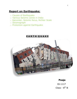
  • 1. 1 Report on Earthquake: o o o o o Causes of Earthquake Various Seismic zones in India Epicenter, Seismic focus, Richter Scale Seismograph Protection against Earthquake EARTH QUAKE Pooja IG-1117 Class - 8th B
  • 2. 2 What Causes Earthquakes? Introduction What causes earthquakes? Earthquakes are vibrations inside the Earth that follow the release of energy that has built up inside rocks. Rocks fracturing, volcanoes erupting, and man made explosions can all release the energy stored in the rocks. Loma Prieta earthquake damage to homes in Marina District, USGS P waves and Love waves All earthquakes produce earthquake waves. There are four types of earthquake waves. P waves are also know as primary waves that travel through all parts of the Earth. Love waves are only produced by the most powerful earthquakes. They travel around the surface of the Earth. Earthquake zones and megathrust earthquakes Earthquakes occur in earthquake zones. These zones form around crustal plates. As the plates smash into other plates, move apart and subduct they create earthquake faults. Megathrust earthquakes are associated with subduction zones where powerful earthquakes cause tsunamis. Great earthquakes The moment magnitude scale was developed after the 1960 Chile earthquake and the 1964 Alaska earthquake. These were the two most powerful earthquakes of the 20th Century. New Madrid and Haiti earthquakes The New Madrid earthquakes occurred in 1811 and 1812 were very powerful quakes that rang bells in Boston. The Haiti earthquake occurred in an area that has large numbers of very powerful earthquakes. What causes earthquakes Earthquakes waves radiate outward in all directions from the earthquake focus. The focus is where the rocks first break apart during an earthquake.Earthquake faults are places where two crustal plates are moving together, apart or slipping past each other. Normal faults occur when plates are moving apart and one section of land moves downward. earthquake, trembling or shaking movement of the earth's surface. Most earthquakes are minor tremors. Larger earthquakes usually begin with slight tremors but rapidly take the form of one or more
  • 3. 3 violent shocks, and end in vibrations of gradually diminishing force called aftershocks. The subterranean point of origin of an earthquake is called its focus; the point on the surface directly above the focus is the epicenter. The magnitude and intensity of an earthquake is determined by the use of scales, e.g., the moment magnitude scale, Richter scale Richter scale , measure of the magnitude of seismic waves from an earthquake. Devised in 1935 by the American seismologist Charles F. Richter (1900–1985) and technically known as the local magnitude scale, it has been superseded by the moment magnitude scale, ..... Click the link for more information. , and the modified Mercalli scale. Causes of Earthquakes Most earthquakes are causally related to compressional or tensional stresses built up at the margins of the huge moving lithospheric plates that make up the earth's surface (see lithosphere lithosphere , brittle uppermost shell of the earth, broken into a number of tectonic plates. The lithosphere consists of the heavy oceanic and lighter continental crusts, and the uppermost portion of the mantle. ..... Click the link for more information. ). The immediate cause of most shallow earthquakes is the sudden release of stress along a fault fault, in geology, fracture in the earth's crust in which the rock on one side of the fracture has measurable movement in relation to the rock on the other side. Faults on other planets and satellites of the solar system also have been recognized. ..... Click the link for more information. , or fracture in the earth's crust, resulting in movement of the opposing blocks of rock past one another. These movements cause vibrations to pass through and around the earth in wave form, just as ripples are generated when a pebble is dropped into water. Volcanic eruptions, rockfalls, landslides, and explosions can also cause a quake, but most of these are of only local extent. Shock waves from a powerful earthquake can trigger smaller earthquakes in a distant location hundreds of miles away if the geologic conditions are favorable. See also plate tectonics plate tectonics, theory that unifies many of the features and characteristics of continental drift and seafloor spreading into a coherent model and has revolutionized geologists' understanding of continents, ocean basins, mountains, and earth history. ..... Click the link for more information. . Seismic Waves There are several types of earthquake waves including P, or primary, waves, which are compressional and travel fastest; and S, or secondary, waves, which are transverse, i.e., they cause the earth to vibrate perpendicularly to the direction of their motion. Surface waves consist of several major types and are called L, or long, waves. Since the velocities of the P and S waves are affected by changes in the density and rigidity of the material through which they pass, the boundaries between the regions of the earth known as the crust, mantle, and core have been discerned by seismologists, scientists who deal with the analysis and interpretation of earthquake waves (see earth earth, in geology and astronomy, 3rd planet of the solar system and the 5th largest, the only planet definitely known to support life.
  • 4. 4 Gravitational forces have molded the earth, like all celestial bodies, into a spherical shape. Seismographs (see seismology seismology , scientific study of earthquakes and related phenomena, including the propagation of waves and shocks on or within the earth by natural or artificially generated seismic signals. are used to record P, S, and L waves. The disappearance of S waves below depths of 1,800 mi (2,900 km) indicates that at least the outer part of the earth's core is liquid. Damage Caused by Earthquakes The effects of an earthquake are strongest in a broad zone surrounding the epicenter. Surface ground cracking associated with faults that reach the surface often occurs, with horizontal and vertical displacements of several yards common. Such movement does not have to occur during a major earthquake; slight periodic movements called fault creep can be accompanied by microearthquakes too small to be felt. The extent of earthquake vibration and subsequent damage to a region is partly dependent on characteristics of the ground. For example, earthquake vibrations last longer and are of greater wave amplitudes in unconsolidated surface material, such as poorly compacted fill or river deposits; bedrock areas receive fewer effects. The worst damage occurs in densely populated urban areas where structures are not built to withstand intense shaking. There, L waves can produce destructive vibrations in buildings and break water and gas lines, starting uncontrollable fires. Damage and loss of life sustained during an earthquake result from falling structures and flying glass and objects. Flexible structures built on bedrock are generally more resistant to earthquake damage than rigid structures built on loose soil. In certain areas, an earthquake can trigger mudslides, which slip down mountain slopes and can bury habitations below. A submarine earthquake can cause a tsunami tsunami , series of catastrophic ocean waves generated by submarine movements, which may be caused by earthquakes, volcanic eruptions, landslides beneath the ocean, or an asteroid striking the earth. , a series of damaging waves that ripple outward from the earthquake epicenter and inundate coastal cities. Major Earthquakes On average about 1,000 earthquakes with intensities of 5.0 or greater are recorded each year. Great earthquakes (magnitude 8.0 or higher) occur once a year, major earthquakes (magnitude 7.0–7.9) occur 18 times a year, strong earthquakes (magnitude 6.0–6.9) 10 times a month, and moderate earthquakes (magnitude 5.0–5.9) more than twice a day. Because most of these occur under the ocean or in underpopulated areas, they pass unnoticed by all but seismologists. Moderate to strong earthquakes can cause more significant destruction if they occur closer to the earth's surface. Notable earthquakes have occurred at Lisbon, Portugal (1755); New Madrid, Mo. (1811 and 1812); Charleston, S.C. (1886); Assam, India (1897 and 1950); San Francisco (1906); Messina, Italy (1908); Gansu, China (1920); Tokyo, Japan (1923); Chile (1960); Iran (1962); S Alaska (1964); Managua, Nicaragua (1972); Guatemala (1976); Hebei, China (1976); Mexico (1985); Armenia (1988); Luzon, Philippines (1990); N Japan (1993); Kobe, Japan (1995); Izmit, Turkey (1999); central Taiwan (1999); Oaxaca state, Mexico (1999); Bam, Iran (2003); NW Sumatra, Indonesia (2004); Sichuan, China (2008); S Haiti (2010); Chile (2010); South Island, New Zealand (2010, 2011); and NE Japan (2011). The Lisbon, Chilean, Alaskan, Sumatran, and NE Japan earthquakes were accompanied by significant tsunamis. Twelve of the twenty largest earthquakes in the United States have occurred in Alaska. Most of the largest in the continental United States have occurred in California or elsewhere along the Pacific Coast, but the three New Madrid earthquakes (1811–12) also were among the largest continental events, as was
  • 5. 5 the Charleston, S.C., earthquake (1886). On Good Friday 1964, one of the most severe North American earthquakes ever recorded struck near Anchorage, Alaska, measuring 8.4 to 8.6 in magnitude. Besides elevating some 70,000 sq mi (181,300 sq km) of land and devastating several cities, it generated a tsunami that caused damage as far south as California. Other recent earthquakes that have affected the United States include the Feb., 1971, movement of the San Fernando fault near Los Angeles. It rocked the area for 10 sec, thrust parts of mountains 8 ft (2.4 m) upward, killed 64 persons, and caused damage amounting to $500 million. In 1989, the Loma Prieta earthquake above Santa Cruz shook for 15 seconds at an magnitude of 7.1, killed 67 people, and toppled buildings and bridges. In Jan., 1994, an earthquake measuring 6.6 with its epicenter in N Los Angeles caused major damage to the city's infrastructure and left thousands homeless. earthquake Sudden shaking of the ground caused by a disturbance deeper within the crust of the Earth. Most earthquakes occur when masses of rock straining against one another along fault lines suddenly fracture and slip. The Earth's major earthquakes occur mainly in belts coinciding with the margins of tectonic plates. These include the Circum-Pacific Belt, which affects New Zealand, New Guinea, Japan, the Aleutian Islands, Alaska, and the western coasts of North and South America; the Alpide Belt, which passes through the Mediterranean region eastward through Asia; oceanic ridges in the Arctic, Atlantic, and western Indian oceans; and the rift valleys of East Africa. The “size,” or magnitude, of earthquakes is usually expressed in terms of the Richter scale, which assigns levels from 1.0 or lower to 8.0 or higher. The largest quake ever recorded (Richter magnitude 9.5) occurred off the coast of Chile in 1960. The “strength” of an earthquake is rated in intensity scales such as the Mercalli scale, which assigns qualitative measures of damage to terrain and structures that range from “not felt” to “damage nearly total.” The most destructive quake of modern times occurred in 1976, when the city of Tangshan, China, was leveled and more than 250,000 people killed earthquake a sudden release of energy in the earth's crust or upper mantle, usually caused by movement along a fault plane or by volcanic activity and resulting in the generation of seismic waves which can be destructive Sesmic zone in India Basic Geography and Tectonic Features India lies at the northwestern end of the IndoAustralian Plate, which encompasses India, Australia, a major portion of the Indian Ocean and other smaller countries. This plate is colliding against the huge Eurasian Plate (Figure 1) and going under the Eurasian Plate; this process of one tectonic plate getting under another is called subduction. A sea, Tethys, separated these plates before they collided. Part of the lithosphere, the Earth’s Crust, is covered by oceans and the rest by the continents. The former can undergo subduction at great depths when it converges against another plate, but the latter is buoyant and so tends to remain close to the surface. When continents converge, large amounts of shortening and thickening takes e place, like at the Himalayas and the Tibet. Three chief tectonic sub-regions of India are the mighty Himalayas along the north, the plains of the Ganges and other rivers, and the peninsula. The Himalayas consist primarily of sediments accumulated
  • 6. 6 over long geological time in the Tethys. The IndoGangetic basin with deep alluvium is a great depression caused by the load of the Himalayas on the continent. The peninsular part of the country consists of ancient rocks deformed in the past Himalayan-like collisions. Erosion has exposed the roots of the old mountains and removed most of the topography. The rocks are very hard, but are softened by weathering near the surface. Before the Himalayan collision, several tens of millions of years ago, lava flowed across the central part of peninsular India leaving layers of basalt rock. Coastal areas like Kachchh show marine deposits testifying to submergence under the sea millions of years ago. Prominent Past Earthquakes in India A number of significant earthquakes occurred in and around India over the past century (Figure 2). Some of these occurred in populated and urbanized areas and hence caused great damage. Many went unnoticed, as they occurred deep under the Earth’s surface or in relatively un-inhabited places. Some of the damaging and recent earthquakes are listed in Table 1. Most earthquakes occur along the Himalayan plate boundary (these are inter-plate earthquakes), but a number of earthquakes have also occurred in the peninsular region (these are intra-plate earthquakes). rTable 1: Some Past Earthquakes in India: Date Event Time Magnitude Max. Intensity Deaths 16 12 8 4 15 31 15 21 10 23 21 20 30 22 29 26 June 1819 June 1897 Feb. 1900 Apr. 1905 Jan. 1934 May 1935 Aug. 1950 Jul. 1956 Dec. 1967 Mar. 1970 Aug. 1988 Oct. 1991 Sep. 1993 May 1997 Mar. 1999 Jan . 2001 . Cutch Assam Coimbatore Kangra Bihar-Nepal Quetta Assam Anjar Koyna Bharuch Bihar-Nepal Uttarkashi Killari (Latur) Jabalpur Chamoli Bhuj 11:00 8.3 VIII 1,500 17:11 8.7 XII 1,500 03:11 6.0 X Nil 06:20 8.6 X 19,000 14:13 8.4 X 11,000 03:03 7.6 X 30,000 19:31 8.5 X 1,530 21:02 7.0 IX 115 04:30 6.5 VIII 200 20:56 5.4 VII 30 04:39 6.6 IX 1,004 02:53 6.6 IX 768 03:53 6.4 IX 7,928 04:22 6.0 VIII 38 12:35 6.6 VIII 63 08:46 7.7 X 13,805 re the Seismic Zones in India?
  • 7. 7 The Richter Magnitude Scale ( in short Richter Scale) Seismic waves are the vibrations from earthquakes that travel through the Earth; they are recorded on instruments called seismographs. Seismographs record a zig-zag trace that shows the varying amplitude of ground oscillations beneath the instrument. Sensitive seismographs, which greatly magnify these ground motions, can detect strong earthquakes from sources anywhere in the world. The time, locations, and magnitude of an earthquake can be determined from the data recorded by seismograph stations. The power of an earthquake is expressed in terms of magnitude on a scale called Richter scale. The Richter magnitude scale was developed in 1935 by Charles F. Richter of the California Institute of Technology as a mathematical device to compare the size of earthquakes. The magnitude of an earthquake is determined from the logarithm of the amplitude of waves recorded by seismographs. Adjustments are included for the variation in the distance between the various seismographs and the epicenter of the earthquakes. On the Richter Scale, magnitude is expressed in whole numbers and decimal fractions. For example, a magnitude 5.3 might be computed for a moderate earthquake, and a strong earthquake might be rated as magnitude 6.3. Because of the logarithmic basis of the scale, each whole number increase in magnitude represents a tenfold increase in measured amplitude; as an estimate of energy, each whole number step in the magnitude scale corresponds to the release of about 31 times more energy than the amount associated with the preceding whole number value. At first, the Richter Scale could be applied only to the records from instruments of identical manufacture. Now, instruments are carefully calibrated with respect to each other. Thus, magnitude can be computed from the record of any calibrated seismograph. Earthquakes with magnitude of about 2.0 or less are usually called microearthquakes; they are not commonly felt by people and are generally recorded only on local seismographs. Events with magnitudes of about 4.5 or greater - there are several thousand such shocks annually - are strong enough to be recorded by sensitive seismographs all over the world. Great earthquakes, such as the 1964 Good Friday earthquake in Alaska, have magnitudes of 8.0 or higher. On the average, one earthquake of such size occurs somewhere in the world each year. The Richter Scale has no upper limit. Recently, another scale called the moment magnitude scale has been devised for more precise study of great earthquakes. The Richter Scale is not used to express damage. An earthquake in a densely populated area which results in many deaths and considerable damage may have the same magnitude as a shock in a remote area that does nothing more than frighten the wildlife. Large-magnitude earthquakes that occur beneath the oceans may not even be felt by humans. The Richter scale is a standard scale used to compare earthquakes. It is a logarithmic scale, meaning that the numbers on the scale measure factors of 10. So, for example, an earthquake that measures 4.0 on the Richter scale is 10 times larger than one that measures 3.0. On the Richter scale, anything below 2.0 is undetectable to a normal person and is called a microquake.
  • 8. 8 Meaning of Epicenter: An epicenter is the point on Earth that is just above where an earthquake starts out from. This is where a fault begins and usually causes the most damage. There have been times where this area was not where the most damage occurred during an earthquake though, like in 2002 when an earthquake hit Denali, Alaska. Or The epicenter or epicentre is the point on the Earth's surface that is directly above the hypocenter or focus, the point where an earthquake or underground explosion originates. epicentre ˈ pɪ sɛ ntə/ ɛ noun noun: epicenter 1. 1. the point on the earth's surface vertically above the focus of an earthquake. o the central point of something, typically a difficult or unpleasant situation. "the epicentre of labour militancy was the capital itself" Origin late 19th cent.: from Greek epikentros „situated on a centre‟, from epi „upon‟ + kentron„centre‟.
  • 9. 9 What is an Earthquake Focus and Epicenter? Introduction Where is the earthquake focus? The focus of an earthquake is the point where the rocks start to fracture. It is the origin of the earthquake. The epicenter is the point on land directly above the focus. Focus of an Earthquake, USGS Focus of an earthquake The focus is also called the hypocenter of an earthquake. The vibrating waves travel away from the focus of the earthquake in all directions. The waves can be so powerful they will reach all parts of the Earth and cause it to vibrate like a turning fork. Epicenter of an earthquake Directly above the focus on the Earth's surface is the earthquake epicenter. Earthquake waves start at he focus and travel outward in all directions. Earthquake waves do not originate at the epicenter. News stories about earthquakes Most news stories on earthquakes will list the epicenter of an earthquake and then tell how deep the earthquake was from the epicenter. Great earthquakes that occur in subduction zones may give an earthquake focus but they actually break along hundreds of kilometers. The 1960 Chilean earthquake broke along 800 kilometers of the fault line. Richter scale used for shallow-focus earthquakes Shallow-focus earthquakes occur between 0 and 40 miles deep. Shallow-focus earthquakes are much more common than deep-focus earthquakes. Crustal plates moving against each other produce most of the shallow-focus earthquakes here on
  • 10. 10 Earth. These earthquakes are generally smaller and scientists use the Richter scale when measuring these earthquakes. Energy released by shallow focus earthquakes Shallow-focus earthquakes are much more dangerous than deep-focus earthquakes. They release 75% of all the energy produced by earthquakes each year. They are crustal earthquakes that are smaller than deep-focus earthquakes. Deep-focus earthquakes use moment magnitude scale Deep-focus earthquakes occur 180 miles or more below the Earth's surface. These earthquakes occur in island arc or deep ocean trenches where one plate is slipping over another in subduction zones. Great earthquakes where one plate is slipping over another plate in a subduction zone trigger deep-focus earthquakes. They are the largest earthquakes and scientists use the moment magnitude scale to measure them. Fault Types Fault surfaces are surfaces along which rocks move under, over, or past each other. Rocks may get “stuck” along the fault surface, causing a build-up of strain energy, and resulting in an earthquake when the rocks break free of each other. There are 3 types of stress that can affect rocks, resulting in 3 different types of faults: 1. Tension pulls rocks apart resulting in normal faults
  • 11. 11 2. Compression squeezes rock together resulting in reverse faults 3. Shear stress causes rocks to slide past each other resulting in strike-slip faults Folding During mountain building processes rocks can undergo folding as well as faulting.
  • 12. 12 Sometimes rocks deform ductilely, particularly if they are subjected to heat and pressure. At elevated temperature and pressure within the crust, folds can form from compressional forces. Entire mountain rages, like the Appalachians, have extensive fold systems. The conditions of whether a rock faults or folds vary with temperature, pressure, rock composition, and strain rate. In the same location, some rocks can fold while others fault. Often folding is just a precursor to faulting. Z-fold in schist with white felsic dike (hammer for scale). Near Lake Murray, S.C. Photo courtesy of K. McCarney-Castle Large fold in outcrop (geologists for scale). Near Oakridge, Tennessee, Appalachian Mtns. Photo courtesy of K. McCarney-Castle.
  • 13. 13 Seismic Waves Seismic waves are generated by the release of energy during an earthquake. They travel through the earth like waves travel through water. The location within the Earth where the rock actually breaks is called the focus of the earthquake. Most foci are located within 65 km of the Earth‟ s surface; however, some have been recorded at depths of 700 km. The location on the Earth‟ s surface directly above the focus is called the epicenter. The study of seismic waves and earthquakes is called seismology, which is a branch of geophysics. Two types of seismic waves are generated at the earthquake focus: 1. Body waves spread outward from the focus in all directions. 2. Surface waves spread outward from the epicenter to the Earth‟ s surface, similar to ripples on a pond. These waves can move rock particles in a rolling motion that very few structures can withstand. These waves move slower than body waves Seismic Waves: Epicenter location Although S-waves, P-waves and surface waves all start out at the same time, they travel at
  • 14. 14 different speeds. The speed of a traveling seismic wave can be used to determine the location of an earthquake epicenter. A seismograph records the arrival time and the magnitude of horizontal and vertical movements caused by an earthquake. The arrival time between different seismic waves is used to calculate the travel time and the distance from the epicenter. The difference in arrival time between primary waves and secondary waves is used to calculate the distance from the seismograph station to the epicenter. It is crucial that seismic waves are recorded by three different seismograph stations in order to estimate the location of the epicenter (see next slide.) Standard 8-3.3: Infer an earthquake’s epicenter from seismographic data. This example shows seismic waves arriving at different times at two seismograph stations. Station B is farther away from Station A so the waves take longer to reach Station B. Primary waves arrive first, followed by secondary waves, and then surface waves. Earthquake classification scales Earthquakes can be very destructive at the Earth‟ s surface. The magnitude of an earthquake is a measure of how destructive it is. Basically the magnitude corresponds to how much energy is released.
  • 15. 15 The Richter Scale is used to express earthquake magnitude on the basis of the height (amplitude) of the largest line (seismic wave, P or S) on a seismogram. The Richter scale was originally developed for earthquakes in Southern California. The utility of this scale was its ability to account for decreased wave amplitude with increased distance from the epicenter. Richter‟ s scale is also a logarithmic scale. Today, a standard magnitude scale is used, Seismic Moment, which more accurately represents the energy released in an earthquake, especially large magnitude events. The majority of earthquakes are minor and have magnitudes of 3-4.9 on the Richter scale. These can be felt, but cause little or no damage, and there are about 55,000 of these earthquakes each year. Thousands of earthquakes are recorded every day with magnitudes < 3.0 but are almost never felt. The Mercalli scale is different from the Richter scale because it measures the intensity of how people and structures are affected by the seismic event. In essence, it measures damage. It is much more subjective and uses numbers ranging from 1 (no damage) to 12 (total destruction).
  • 16. 16 Seismograph measure Seismograph are instruments that motions of the ground, including those of seismic waves generated by earthquakes, volcanic eruptions, and otherseismic sources. Records of seismic waves allow seismologists to map the interior of the Earth, and locate and measure the size of these different sources. The word derives from the Greek σεισμός, seismós, a shaking or quake, from the verb σείω, seíō, to shake; and μέτρον, métron, measure and was coined by David Milne-Home in 1841, to describe an instrument designed by Scottish physicist James David Forbes.[1] Seismograph is another Greek term from seismós and γράυω, gráphō, to draw. It is often used to mean seismometer, though it is more applicable to the older instruments in which the measuring and recording of ground motion were combined than to modern systems, in which these functions are separated. Both types provide a continuous record of ground motion; this distinguishes them from seismoscopes, which merely indicate that motion has occurred, perhaps with some simple measure of how large it was.[2] The concerning technical discipline is called seismometry,[3] a branch of seismology. Basic principles A simple seismometer that is sensitive to up-down motions of the earth can be understood by visualizing a weight hanging on a spring. The spring and weight are suspended from a frame that moves along with the earthˈs surface. As the earth moves, the relati e motion between the weight and the earth provides a measure v of the vertical ground motion. If a recording system is installed, such as a rotat- ing drum attached to the frame, and a pen attached to the mass, this relative motion between the weight and earth can be recorded to produce a history of ground motion, called a seismogram. Any movement of the ground moves the frame. The mass tends not to move because of its inertia, and by measuring the movement between the frame and the mass, the motion of the ground can be determined. Early seismometers used optical levers or mechanical linkages to amplify the small motions involved, recording on soot-covered paper or photographic paper. Modern instruments use electronics. In some systems, the mass is held nearly motionless relative to the frame by an electronic negative feedback loop. The motion of the mass relative to the frame is measured, and the feedback loop applies a magnetic or electrostatic force to keep the mass nearly motionless. The voltage needed to produce this force is the output of the seismometer, which is recorded digitally. In other systems the weight is allowed to move, and its motion produces a voltage in a coil attached to the mass and moving through the magnetic field of a magnet attached to the frame. This design is often used in the geophones used in seismic surveys for oil and gas.
  • 17. 17 Professional seismic observatories usually have instruments measuring three axes: north-south, east-west, and the vertical. If only one axis can be measured, this is usually the vertical because it is less noisy and gives better records of some seismic waves. The foundation of a seismic station is critical.[4] A professional station is sometimes mounted on bedrock. The best mountings may be in deep boreholes, which avoid thermal effects, ground noise and tilting from weather and tides. Other instruments are often mounted in insulated enclosures on small buried piers of unreinforced concrete. Reinforcing rods and aggregates would distort the pier as the temperature changes. A site is always surveyed for ground noise with a temporary installation before pouring the pier and laying conduit. Originally, European seismographs were placed in a particular area after a destructive earthquake. Today, they are spread to provide appropriate coverage (in the case of weak-motion seismology) or concentrated in high-risk regions (strong-motion seismology).[5] Teleseismometers A low-frequency 3-direction ocean-bottom seismometer (cover removed). Two masses for x- and y-direction can be seen, the third one for z-direction is below. This model is a CMG-40TOBS, manufactured by Güralp Systems Ltd and is part of theMonterey Accelerated Research System. The modern broadband seismograph can record a very broad range of frequencies. It consists of a small "proof mass", confined by electrical forces, driven by sophisticated electronics. As the earth moves, the electronics attempt to hold the mass steady through a feedback circuit. The amount of force necessary to achieve this is then recorded. In most designs the electronics holds a mass motionless relative to the frame. This device is called a "force balance accelerometer". It measuresacceleration instead of velocity of ground movement. Basically, the distance between the mass and some part of the frame is measured very precisely, by a linear variable differential transformer. Some instruments use a linear variable differential capacitor.
  • 18. 18 That measurement is then amplified by electronic amplifiers attached to parts of an electronic negative feedback loop. One of the amplified currents from the negative feedback loop drives a coil very like a loudspeaker, except that the coil is attached to the mass, and the magnet is mounted on the frame. The result is that the mass stays nearly motionless. Most instruments measure directly the ground motion using the distance sensor. The voltage generated in a sense coil on the mass by the magnet directly measures the instantaneous velocity of the ground. The current to the drive coil provides a sensitive, accurate measurement of the force between the mass and frame, thus measuring directly the ground's acceleration (using f=ma where f=force, m=mass, a=acceleration). One of the continuing problems with sensitive vertical seismographs is the buoyancy of their masses. The uneven changes in pressure caused by wind blowing on an open window can easily change the density of the air in a room enough to cause a vertical seismograph to show spurious signals. Therefore, most professional seismographs are sealed in rigid gas-tight enclosures. For example, this is why a common Streckheisen model has a thick glass base that must be glued to its pier without bubbles in the glue. It might seem logical to make the heavy magnet serve as a mass, but that subjects the seismograph to errors when the Earth's magnetic field moves. This is also why seismograph's moving parts are constructed from a material that interacts minimally with magnetic fields. A seismograph is also sensitive to changes in temperature so many instruments are constructed from low expansion materials such as nonmagnetic invar. The hinges on a seismograph are usually patented, and by the time the patent has expired, the design has been improved. The most successful public domain designs use thin foil hinges in a clamp. Another issue is that the transfer function of a seismograph must be accurately characterized, so that its frequency response is known. This is often the crucial difference between professional and amateur instruments. Most instruments are characterized on a variable frequency shaking table. Strong-motion seismograph Another type of seismometer is a digital strong-motion seismograph, or accelerograph. The data from such an instrument is essential to understand how an earthquake affects manmade structures. A strong-motion seismograph measures acceleration. This can be mathematically integrated later to give velocity and position. Strong-motion seismometers are not as sensitive to ground motions as teleseismic instruments but they stay on scale during the strongest seismic shaking.
  • 19. 19 Other forms A Kinemetrics seismograph, formerly used by the United States Department of the Interior. Accelerographs and geophones are often heavy cylindrical magnets with a spring-mounted coil inside. As case moves, the coil tends to stay stationary, so the magnetic field cuts the wires, inducing current in the output wires. They receive frequencies from several hundred hertz down to 1 Hz. Some have electronic damping, a low-budget way to get some of the performance of the closed-loop wide-band geologic seismographs. Strain-beam accelerometers constructed as integrated circuits are too insensitive for geologic seismographs (2002), but are widely used in geophones. Some other sensitive designs measure the current generated by the flow of a non-corrosive ionic fluid through an electret sponge or a conductive fluid through a magnetic field. Modern recording Today, the most common recorder is a computer with an analog-to-digital converter, a disk drive and an internet connection; for amateurs, a PC with a sound card and associated software is adequate. Most systems record continuously, but some record only when a signal is detected, as shown by a short-term increase in the variation of the signal, compared to its long-term average (which can vary slowly because of changes in seismic noise). Interconnected seismometers Seismometers spaced in an array can also be used to precisely locate, in three dimensions, the source of an earthquake, using the time it takes for seismic waves to propagate away from thehypocenter, the initiating point of fault rupture (See also Earthquake location). Interconnected seismometers are also used to detect underground nuclear test explosions. These seismometer are often used as part of a large scale, multi-million dollar governmental or scientific project, but some organizations, such as the Quake-Catcher Network, can use residential size detectors built into computers to detect earthquakes as well.
  • 20. 20 In reflection seismology, an array of seismometers image sub-surface features. The data are reduced to images using algorithms similar to tomography. The data reduction methods resemble those of computer-aided tomographic medical imaging X-ray machines (CAT-scans), or imaging sonars. A world-wide array of seismometers can actually image the interior of the Earth in wave-speed and transmissivity. This type of system uses events such as earthquakes, impact events or nuclear explosions as wave sources. The first efforts at this method used manual data reduction from paper seismograph charts. Modern digital seismograph records are better adapted to direct computer use. With inexpensive seismometer designs and internet access, amateurs and small institutions have even formed a "public seismograph network."[10] Seismographic systems used for petroleum or other mineral exploration historically used an explosive and a wireline of geophones unrolled behind a truck. Now most short-range systems use "thumpers" that hit the ground, and some small commercial systems have such good digital signal processing that a few sledgehammer strikes provide enough signal for short-distance refractive surveys. Exotic cross or twodimensional arrays of geophones are sometimes used to perform three-dimensional reflective imaging of subsurface features. Basic linear refractive geomapping software (once a black art) is available off-the-shelf, running on laptop computers, using strings as small as three geophones. Some systems now come in an 18" (0.5 m) plastic field case with a computer, display and printer in the cover. Small seismic imaging systems are now sufficiently inexpensive to be used by civil engineers to survey foundation sites, locate bedrock, and find subsurface water.
  • 21. 21 Protection against Earthquakes HOW TO PROTECT YOURSELF DURING AN EARTHQUAKE... OFFICIAL RESCUE TEAMS from the U.S. and other countries who have searched for trapped people in collapsed structures around the world, as well as emergency managers, researchers, and school safety advocates, all agree that "Drop, Cover, and Hold On" is the appropriate action to reduce injury and death during earthquakes. Methods like standing in a doorway, running outside, and "triangle of life" method are considered dangerous and are not recommended. WHAT TO DO IMMEDIATELY WHEN SHAKING BEGINS Your past experience in earthquakes may give you a false sense of safety; you didn't do anything, or you ran outside, yet you survived with no injuries. Or perhaps you got under your desk and others thought you overreacted. However, you likely have never experienced the kind of strong earthquake shaking that is possible in much large earthquakes: sudden and intense back and forth motions of several feet per second will cause the floor or the ground to jerk sideways out from under you, and every unsecured object around you could topple, fall, or become airborne, potentially causing serious injury. This is why you must learn to immediately protect yourself after the first jolt... don't wait to see if the earthquake shaking will be strong! In MOST situations, you will reduce your chance of injury if you: DROP down onto your hands and knees (before the earthquakes knocks you down). This position protects you from falling but allows you to still move if necessary. COVER your head and neck (and your entire body if possible) under a sturdy table or desk. If there is no shelter nearby, only then should you get down near an interior wall (or next to low-lying furniture that won't fall on you), and cover your head and neck with your arms and hands. HOLD ON to your shelter (or to your head and neck) until the shaking stops. Be prepared to move with your shelter if the shaking shifts it around. Wherever you are, protect yourself! You may be in situation where you cannot find shelter beneath furniture (or low against a wall, with your arms covering your head and neck). It is important to think about what you will do to protect yourself wherever you are. What if you are driving, in a theater, in bed, at the beach, etc.? Step 5 of the Seven Steps to Earthquake Safety describes what to do in various situations, no matter where you are when you feel earthquake shaking. WHY RESCUERS AND EXPERTS RECOMMEND DROP, COVER, AND HOLD ON Trying to moving during shaking puts you at risk:Earthquakes occur without any warning and may be so violent that you cannot run or crawl; you therefore will most likely be knocked to the ground where you happen to be. So it is best to drop before the earthquake drops you, and find nearby shelter or use your arms and hands to protect your head and neck. "Drop, Cover, and Hold On" gives you the best overall
  • 22. 22 chance of quickly protecting yourself during an earthquake... even during quakes that cause furniture to move about rooms, and even in buildings that might ultimately collapse. The greatest danger is from falling and flying objects: Studies of injuries and deaths caused by earthquakes over the last several decades show that you are much more likely to be injured by falling or flying objects (TVs, lamps, glass, bookcases, etc.) than to die in a collapsed building. "Drop, Cover, and Hold On" (as described above) will protect you from most of these injuries. If there is no furniture nearby, you can still reduce the chance of injury from falling objects by getting down next to an interior wall and covering your head and neck with your arms (exterior walls are more likely to collapse and have windows that may break). If you are in bed, the best thing to do is to stay there and cover your head with a pillow. Studies of injuries in earthquakes show that people who moved from their beds would not have been injured if they had remained in bed. You can also reduce your change of injury or damage to your belongings by securing them in the first place. Secure top heavy furniture to walls with flexible straps. Use earthquake putty or velcro fasteners for objects on tables, shelves, or other furniture. Install safety latches on cabinets to keep them closed. Instructions for how to "secure your space" are at www.daretoprepare.org. Building collapse is less of a danger: While images of collapsed structures in earthquakes around the world are frightening and get the most attention from the media, most buildings do not collapse at all, and few completely collapse. In earthquake prone areas of the U.S. and in many other countries, strict building codes have worked to greatly reduce the potential of structure collapse. However, there is the possibility of structural failure in certain building types, especially unreinforced masonry (brick buildings), and in certain structures constructed before the latest building codes. Rescue professionals are trained to understand how these structures collapse in order to identify potential locations of survivors within "survivable void spaces." The main goal of "Drop, Cover, and Hold On" is to protect you from falling and flying debris and other nonstructural hazards, and to increase the chance of your ending up in a Survivable Void Space if the building actually collapses. The space under a sturdy table or desk is likely to remain even if the building collapses- pictures from around the world show tables and desks standing with rubble all around them, and even holding up floors that have collapsed. Experienced rescuers agree that successfully predicting other safe locations in advance is nearly impossible, as where these voids will be depends on the direction of the shaking and many other factors. (See "triangle of life" below.) The ONLY exception to the "Drop, Cover and Hold On" rule is if you are in a country with unengineered construction, and if you are on the ground floor of an unreinforced mud-brick (adobe) building, with a
  • 23. 23 heavy ceiling. In that case, you should try to move quickly outside to an open space. This cannot be recommended as a substitute for building earthquake-resistant structures in the first place! WHAT RESCUERS AND EXPERTS *DO NOT* RECOMMEND YOU DO DURING AN EARTHQUAKE Based on years of research about how people are injured or killed during earthquakes, and the experiences of U.S. and international search and rescue teams, these three actions are not recommended to protect yourself during earthquakes: DO NOT run outside or to other rooms during shaking: The area near the exterior walls of a building is the most dangerous place to be. Windows, facades and architectural details are often the first parts of the building to collapse. To stay away from this danger zone, stay inside if you are inside and outside if you are outside. Also, shaking can be so strong that you will not be able to move far without falling down, and objects may fall or be thrown at you that you do not expect. Injuries can be avoided if you drop to the ground before the earthquake drops you. DO NOT stand in a doorway: An enduring earthquake image of California is a collapsed adobe home with the door frame as the only standing part. From this came our belief that a doorway is the safest place to be during an earthquake. True- if you live in an old, unreinforced adobe house or some older woodframe houses. In modern houses, doorways are no stronger than any other part of the house, and the doorway does not protect you from the most likely source of injury- falling or flying objects. You also may not be able to brace yourself in the door during strong shaking. You are safer under a table. DO NOT get in the "triangle of life": In recent years, an e-mail has been circulating which describes an alternative to the long-established "Drop, Cover, and Hold On" advice. The so-called "triangle of life" and some of the other actions recommended in the e-mail are potentially life threatening, and the credibility of the source of these recommendations has been broadly questioned (see links at left). The "triangle of life" advice (always get next to a table rather than underneath it) is based on several wrong assumptions: buildings always collapse in earthquakes (wrong- especially in developed nations, and flat "pancake" collapse is rare anywhere); when buildings collapse they always crush all furniture inside (wrong- people DO survive under furniture or other shelters); people can always anticipate how their building might collapse and anticipate the location of survivable void spaces (wrong- the direction of shaking and unique structural aspects of the building make this nearly impossible) ; and during strong shaking people can move to a desired location (wrong- strong shaking can make moving very difficult and dangerous). Some other recommendations in the "triangle of life" e-mail are also based on wrong assumptions and very hazardous. For example, the recommendation to get out of your car during an earthquake and lie down next to it assumes that there is always an elevated freeway above you that will fall and crush your
  • 24. 24 car. Of course there are very few elevated freeways, and lying next to your car is very dangerous because the car can move and crush you, and other drivers may not see you on the ground! A compilation of rebuttals from many organizations to these alternative recommendations, as well as news articles about the controversy, is listed at left. PRACTICE THE RIGHT THING TO DO… IT COULD SAVE YOUR LIFE You will be more likely to react quickly when shaking begins if you have actually practiced how to protect yourself on a regular basis. A great time to practice Drop, Cover, and Hold On is by participating in a Great ShakeOut Earthquake Drill (each October in most areas). If you are at home:  Take shelter under a table and stay there till the shaking stops.  Stay away from tall and heavy objects that may fall on you.  If you are in bed, do not get up. Protect your head with the pillow. If you are outdoor:  Find a clear spot, away from building, trees and overhead power lines. Drop to the ground.  If you are in a car or bus, do not come out. Ask the driver to drive slowly to a clear spot. Do not come out till the tremors stop.
  • 25. 25 Earthquake Short Summary A natural phenomenon that cannot be predicted is anearthquake. The earth consists of three major layers, called the crust, the mantle and the core. The core is further divided into the inner core and the outer core. The mantle consists of semi-solid material above which the crust floats. The crust consists of oceans and continents. The crust is divided into several parts, called tectonic plates. The regions where one tectonic plate slides against another are referred to as fault zones, and these are the regions where an earthquake is likely to occur. Hence, these zones are referred to as seismic zones. The place in the interior of the earth where an earthquake occurs is the focus, and the region on the surface of the earth that is the closest to focus is likely to experience the largest damage. This region is called the epicentre of the earthquake. The instrument that measures the severity of an earthquake is a seismograph. It basically consists of a drum that rolls and a pendulum with a stylus that traces the waves of an earthquake on a sheet like a graph paper. The severity of an earthquake is measured on the Richter scale. A major earthquake measures 7 or more on the Richter scale.