RV 2014: Innovative Partnerships- Silo Hopping to Engage Communities

Innovative Partnerships: Silo Hopping to Engage Communities How can we collaborate to educate, inform and involve the public? How can we work together -- across departmental and agency lines -- to engage citizens more meaningfully and efficiently? Large capital projects, especially transit projects, involve many departments, agencies and objectives. Collaborating in an intentional way helps build and strengthen communities. Explore examples of successful teamwork designed to keep the public informed, including social media tools, branding techniques, and more. Moderator: David C Dickey Jr., AICP, Senior Vice President and National Director, Transit & Railroads, URS, Charlotte, North Carolina Kathleen Cornett, AICP, Senior Planning Coordinator, Charlotte-Mecklenburg Planning Commission, Charlotte, North Carolina Kathryn Hansen, Manager, TOD and Land Use, SWLRT Project Office, Metro Transit, St. Louis Park, Minnesota Liz Walton, Landscape Architect, Minnesota Department of Transportation, St. Paul, Minnesota

Recomendados
Recomendados
Más contenido relacionado
La actualidad más candente
La actualidad más candente (20)
Similar a RV 2014: Innovative Partnerships- Silo Hopping to Engage Communities
Similar a RV 2014: Innovative Partnerships- Silo Hopping to Engage Communities (20)
Más de Rail~Volution
Más de Rail~Volution (20)
Último
Último (20)
RV 2014: Innovative Partnerships- Silo Hopping to Engage Communities
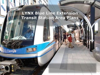
- 1. LYNX Blue Line Extension Transit Station Area Plans
- 2. LYNX Blue Line LYNX Blue Line • 9.6 miles • 15 stations • Opened 2007 • +26,000 daily riders • Connects south side at Interstate 485 to Uptown Charlotte LYNX Blue Line Extension (BLE) • 9.3 miles • 11 stations • Implementation 2017 • +25,000 daily riders • Connects Uptown Charlotte to UNC Charlotte
- 3. CATS LYNX Context & Ridership
- 4. Lynx Light Rail line South Blvd
- 5. • 11 Stations (7 walk-up / 4 park-and-ride) • Accommodates 3-car trains • Approximately 3,100 parking spaces • Congestion-free commute • Connecting bus services BLE Profile • Convenient and safe station amenities for customers o Security features o Bicycle parking o Public art o Shelters, garbage cans, benches o Trees o Lighting o Ticket vending machines (TVMs) o Maps and schedules
- 6. BLE Update Milestone Date State FFGA Executed March 2012 Request to Enter Final Design March 2012 FTA Approval to Enter Final Design July 2012 Federal FFGA Signed October 2012 Advanced Utility Relocation Begins May 2013 Right-of-Way Acquisition Complete January 2014 Complete Final Design May 2014 Start Construction November 2013 Initiate Revenue Service March 2017 *Schedule subject to change
- 7. TOD Planning Framework Centers, Corridors & Wedges (1994) Transit Station Area Principles (2001) Station Area Plans (BLE Stations - 2013) Station Corridor City Zoning Tools TS (Transit Supportive Overlay) TOD (Transit Oriented Development) MUDD UMUD UR Parcel Implementation Policy & Plan Development Station Area Vision Knitting Policy & Implementation Together Community Vision Neighborhood Protection Future Land Use Transportation Infrastructure Open Space Building Type Parking Floor Area Ratio (FAR) Residential Density (DUA) Height Plane Site Design Building Massing & Form Station Development Concept Development Plan Structure Plan Mobility Plan Transit Oriented Development Transit Supportive Overlay
- 8. How is the BLE Station Area Planning Process Different?
- 9. Staff Team • Charlotte-Mecklenburg Planning Department • Charlotte Area Transit System (CATS) • Engineering & Property Management • Corporate Communications • Charlotte Department of Transportation (CDOT) • Mecklenburg County Park and Recreation • Neighborhood & Business Services • Charlotte-Mecklenburg Utilities (CMU) • Charlotte Fire Department • Charlotte-Mecklenburg Police Department • Solid Waste Services • Stormwater Services • Land Use and Environmental Service
- 10. How is CATS different? Most Transit Agencies • Many are authorities, operating independently from local government • Authorities have their own governing boards CATS • CATS is part of the City government structure • Benefit of the City budget • Many decisions must go through City Council and sometimes voter approval
- 11. New Strategies Electronic Sign-in & QR code on postcard Series of interactive workshops Discussed 6 stations at each workshop Provide initial concepts
- 12. Collaboration Social Media Collaboration Business Liaison BLE Communications Team (CATS) Planning BLE Communications Team Contractor State Transportation Engineering City Transportation CATS Project Management One Stop-Shop Public Workshops
- 15. Transit Station Area Principles Land Use Community Design Mobility Concentrate a mix of complementary, well-integrated land uses within walking distance of the transit station. Enhance the existing transportation network to promote good walking, bicycle and transit connections” Use urban design to enhance the community identity of station areas and to make them attractive, safe and convenient places.
- 16. Station Area Plan Policies Development Concept Development Plan Structure Plan Mobility Plan • Vision & Goals • General Development Character • Neighborhood Preservation vs. TOD • Future Land Use • Community Design • Infrastructure • Natural Environment • Building type/design • Building Height in specific character areas • Capital Projects • Transportation Improvements • Street Design (USDG) New to BLE Station Area Plans (2013) Policies General Specific
- 17. One-Stop Shop Document • One document for six station plans • Serves as an easy reference and facilitates a predictable development patterns
- 18. Lessons Learned Provide ideas for public to react to Group stations into one planning process when possible Provide interactive opportunities for public engagement Incorporate technology where possible Collaborate with other city agencies Community education is key