SAILING FROM NEW ZEALAND TO AUSTRALIA
•Descargar como DOC, PDF•
1 recomendación•1,090 vistas

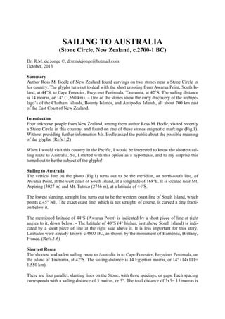
SAILING TO AUSTRALIA (Stone Circle, New Zealand, c.2700-1 BC) Dr. R.M. de Jonge ©, drsrmdejonge@hotmail.com October, 2013 Summary Author Ross M. Bodle of New Zealand found carvings on two stones near a Stone Circle in his country. The glyphs turn out to deal with the short crossing from Awarua Point, South Is-land, at 44°S, to Cape Forestier, Freycinet Peninsula, Tasmania, at 42°S. The sailing distance is 14 moiras, or 14° (1,550 km). – One of the stones show the early discovery of the archipe-lago’s of the Chatham Islands, Bounty Islands, and Antipodes Islands, all about 700 km east of the East Coast of New Zealand.

Recomendados
Más contenido relacionado
Similar a SAILING FROM NEW ZEALAND TO AUSTRALIA
Similar a SAILING FROM NEW ZEALAND TO AUSTRALIA (20)
Más de INSTITUTE OF MEGALITHIC RESEARCH
Más de INSTITUTE OF MEGALITHIC RESEARCH (14)
Último
Último (20)
SAILING FROM NEW ZEALAND TO AUSTRALIA
- 1. SAILING TO AUSTRALIA (Stone Circle, New Zealand, c.2700-1 BC) Dr. R.M. de Jonge ©, drsrmdejonge@hotmail.com October, 2013 Summary Author Ross M. Bodle of New Zealand found carvings on two stones near a Stone Circle in his country. The glyphs turn out to deal with the short crossing from Awarua Point, South Island, at 44°S, to Cape Forestier, Freycinet Peninsula, Tasmania, at 42°S. The sailing distance is 14 moiras, or 14° (1,550 km). – One of the stones show the early discovery of the archipelago’s of the Chatham Islands, Bounty Islands, and Antipodes Islands, all about 700 km east of the East Coast of New Zealand. Introduction Four unknown people from New Zealand, among them author Ross M. Bodle, visited recently a Stone Circle in this country, and found on one of these stones enigmatic markings (Fig.1). Without providing further information Mr. Bodle asked the public about the possible meaning of the glyphs. (Refs.1,2) When I would visit this country in the Pacific, I would be interested to know the shortest sailing route to Australia. So, I started with this option as a hypothesis, and to my surprise this turned out to be the subject of the glyphs! Sailing to Australia The vertical line on the photo (Fig.1) turns out to be the meridian, or north-south line, of Awarua Point, at the west coast of South Island, at a longitude of 168°E. It is located near Mt. Aspiring (3027 m) and Mt. Tutoko (2746 m), at a latitude of 44°S. The lowest slanting, straight line turns out to be the western coast line of South Island, which points c.45° NE. The exact coast line, which is not straight, of course, is carved a tiny fraction below it. The mentioned latitude of 44°S (Awarua Point) is indicated by a short piece of line at right angles to it, down below. - The latitude of 40°S (4° higher, just above South Island) is indicated by a short piece of line at the right side above it. It is less important for this story. Latitudes were already known c.4800 BC, as shown by the monument of Barnénez, Brittany, France. (Refs.3-6) Shortest Route The shortest and safest sailing route to Australia is to Cape Forestier, Freycinet Peninsula, on the island of Tasmania, at 42°S. The sailing distance is 14 Egyptian moiras, or 14° (14x111= 1,550 km). There are four parallel, slanting lines on the Stone, with three spacings, or gaps. Each spacing corresponds with a sailing distance of 5 moiras, or 5°. The total distance of 3x5= 15 moiras is
- 2. slightly more than the true sailing distance to Cape Forestier, Tasmania, of 14 moiras, mentioned above. At the west side of the meridian of Awarua Point (the vertical line) are three short pieces of line at right angles, which represent the latitudes of 44°S (already mentioned), 43°S, and 42°S, respectively. The last latitude line finishes at Cape Forestier, Tasmania, the probable goal of the voyage. – It completes the explanation of the carving! (Refs.7-12) Fig.1 Carving on a Stone (Stone Circle, New Zealand) (Courtesy: Mr. Ross M. Bodle) Discussion The shortest sailing route from New Zealand to Tasmania starts 1° lower, at 44+1= 45°S (or even at 46°S), and finishes at Port Arthur on the Tasman Peninsula, at 42+1= 43°S. The sailing distance is 14-1= 13 moiras, or 13° (13x111= 1,440 km). However, the glyph on the Stone clearly shows departure at Awarua Point, where the coast line protrudes to the west. The probable reason for this choice is this sailing route was considered safer at the conditions when the carving was made. Date New Zealand was discovered by the 8th king Huni (c.2685-2661 BC) of the Third Dynasty of Egypt (Refs.11,18,26). So, the carving cannot be older than c.2700 BC. – Stone Circles are part of the Megalithic Culture. In SE Asia this culture ended around the birth of Christ. So, the most probable date of the carving is between c.2700 and 1 BC. (Refs.13-26)
- 3. Appendix Fig.2 Same Carving on another Stone (Stone Circle, New Zealand) (Courtesy: Mr. Ross M. Bodle) A similar carving was found on another Stone nearby, shown in Fig.2. It has the same meaning. Here an extra parallel line is shown at the right side, at a distance of 2x5= c.10 moiras, or 10° (1,110 km) from the west coast of New Zealand (see Fig.2). It should be considered as a proof of the discovery of several small archipelago’s in this area: the Chatham Islands at 44°S, the Bounty Islands at 48°S, and the Antipodes Islands at 50°S. The small piece of line at right angles at the right side is interesting, because it does not correspond to the location of one of these archipelago’s. Instead it marks the latitude of the west cape of New Zealand, at 46°S. References 1. Mr. Ross M. Bodle, Facebook. 2. Susan English, Yahoo Group of the Ancient Waterways Society. 3. De Jonge, R.M., and Wakefield, J.S., How the SunGod Reached America c.2500 BC, A Guide to Megalithic Sites, 2002 (ISBN 0-917054-19-9). Available: MCS Inc., Box 3392, Kirkland, Wa 98083, also on CD. Website: www.howthesungod.com 4. Wakefield, J.S., and De Jonge, R.M., Rocks & Rows, Sailing Routes across the Atlantic and the Copper Trade, MCS Inc, 2010 (ISBN 0-917054-20-2). Available: MCS Inc, Box 3392, Kirkland, Wa USA 98083. Website: www.rocksandrows.com 5. De Jonge, R.M., Website: www.slideshare.net/rmdejonge 6. Pellech, Chr., Website: www.migration-diffusion.info 7. De Jonge, R.M., “The Discovery of Three Continents (Santo Stefano, North Sardinia, Italy, c.2300 BC)”, Ancient American, Vol.12, No.76, pgs.28-29 (2007), Ref.5. 8. De Jonge, R.M., “The Battersea Shield (River Thames, London, c.190 BC)” (2009), Ref.5. 9. De Jonge, R.M., and Wakefield, J.S., “Discovery of the Islands in the Ocean (Cairn T, Loughcrew, Co. Meath, Ireland, c.3200 BC)” (2011), Refs.5,6. 10. De Jonge, R.M., “Stonehenge, Monument for the Discovery of America (Salisbury Plain, South England, c.2000 BC)” (2011), Refs.5,6. 11. De Jonge, R.M., The Phaistos Disc Decoded, New Testimony of a Lost Civilization, 300 pgs., Netherlands (2008). Website: www.slideshare.net/drsrmdejonge 12. De Jonge, R.M., http://independent.academia.edu/ReinoudDeJonge
- 4. 13. White, P., In Search of Ancient Secrets, 1994. 14. White, P., “Exposure Magazine”, Vol.2, No.6, 1996. 15. De Jonge, R.M., “Egyptians in Australia, Fourth Dynasty of Egypt, (Gosford, NSW), Refs.5,6. 16. De Jonge, R.M., “The Discovery of Australia by King Djoser of the 3rd Dynasty (The Rainbow Serpent Shelter, Mount Borradaile, Arnhem Land)”, Ref.5. 17. De Jonge, R.M., “Rock Paintings of the Grampians (2700-2000 BC, Victoria, SE Australia)”, to be published. 18. De Jonge, R.M., “The Early Discovery of New Zealand (King Huni of the Third Dynasty of Egypt, c.26852661 BC)”, Ref.5. 19. De Jonge, R.M., “Discovery of America and the Flood (c.2300 BC, Ita Letra, Villarrica, Paraguay)”, Ref.5. 20. De Jonge, R.M., “Egyptian Discovery of America (c.2470 BC, Indian Rock House, Fairfield Bay, Arkansas)”, Ref.5. 21. Von Senff, H.-D., Prohibited Egyptology, Is the Kariong Hieroglyphic Site a Hoax?, Sumptibus Publ., Swansea, Australia (2004), (ISBN 1-875741-10-0). 22. Von Senff, H.-D., The Kariong Glyphs, Reality or Hoax, A Challenge to Academics, Sumptibus (2005). 23. Morwood, M.J., Visions from the Past (The Archaeology of Australian Aboriginal Art), Allen & Unwin (Ed.), Crows Nest NSW (2002), (ISBN 1-86448-717-8). 24. Wilson, I., Lost World of the Kimberley (Extraordinary glimpses of Australia’s Ice Age ancestors), Allen & Unwin (Ed.), Crows Nest NSW (2006), (ISBN 1-74114-391-8). 25. De Jonge, R.M., “Megalithic Writing (I), (Orkney’s, Scotland, c.2450 BC)”, (2013), Refs.2,5,12. 26. De Jonge, R.M., “Megalithic Writing (II), (Orkney’s, Scotland, c.2370 BC)”, (2013), Refs.2,5,12.