Natural calamities and diseases of sundarbans mangrove forest

Bangladesh with an area of 147,570 square km is bordered by India to the northeast and west, Myanmar to the southeast, and the Bay of Bengal to the south. Bangladesh is one of the most densely populated countries in the world and its population is still growing by over 2 million people per year. The Sundarbans mangrove forest has a history of scientific management since 1879. The Sundarbans are the world's largest halophytic mangrove forests and one of the most biologically productive of all natural ecosystems. The forest is an essential buffer for inland areas against the ravages of frequent cyclones from the Bay of Bengal. For outstanding natural value, the World Heritage committee of UNESCO inscribed the Sundarban of Bangladesh in the 798th World Heritage list in 1997 and accordingly the Government of the People’s Republic of Bangladesh declared the Sundarban as World Heritage Site in 1999. The Sundarbans is the largest remaining habitat in the world for the Royal-Bengal Tiger. According to Ramsar convention, the wetland of Sundarban area in very complex and it is recognized as one of the most organic productive area in the world. The livelihood survival of the Sundarban community is linked with the forest resources of the Sundarbans, aquatic resources of the saline and fresh water wetlands.

Recomendados
Recomendados
Más contenido relacionado
La actualidad más candente
La actualidad más candente (20)
Destacado
Destacado (15)
Similar a Natural calamities and diseases of sundarbans mangrove forest
Similar a Natural calamities and diseases of sundarbans mangrove forest (20)
Más de ihn FreeStyle Corp.
Más de ihn FreeStyle Corp. (20)
Último
Último (20)
Natural calamities and diseases of sundarbans mangrove forest
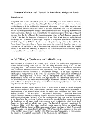
- 1. Natural Calamities and Diseases of Sundarbans Mangrove Forest Introduction Bangladesh with an area of 147,570 square km is bordered by India to the northeast and west, Myanmar to the southeast, and the Bay of Bengal to the south. Bangladesh is one of the most densely populated countries in the world and its population is still growing by over 2 million people per year. The Sundarbans mangrove forest has a history of scientific management since 1879. The Sundarbans are the world's largest halophytic mangrove forests and one of the most biologically productive of all natural ecosystems. The forest is an essential buffer for inland areas against the ravages of frequent cyclones from the Bay of Bengal. For outstanding natural value, the World Heritage committee of UNESCO inscribed the Sundarban of Bangladesh in the 798th World Heritage list in 1997 and accordingly the Government of the People’s Republic of Bangladesh declared the Sundarban as World Heritage Site in 1999. The Sundarbans is the largest remaining habitat in the world for the Royal-Bengal Tiger. According to Ramsar convention, the wetland of Sundarban area in very complex and it is recognized as one of the most organic productive area in the world. The livelihood survival of the Sundarban community is linked with the forest resources of the Sundarbans, aquatic resources of the saline and fresh water wetlands. A Brief History of Sundarbans and its Biodiversity The Sundarbans is located at 210 30’–220 30’N, 880 05’–890 55’E. The monthly mean temperature and relative humidity normally varies from 230 C and 70% during December–January to 350 C and 80% during May–June. There are three wildlife sanctuaries in the Bangladesh Sundarbans: Sundarbans East, Sundarbans South and Sundarbans West; together they form a UNESCO World Heritage Site. The Sundarbans (সুন্দরবন, Shundorbon) is a natural region in Bengal. It is the largest single block of tidal halophytic mangrove forest in the world.The Sundarbans covers approximately 10,000 square kilometres (3,900 square miles) of which 60% is in Bangladesh with the remainder in India. The Sundarbans National Park is a National Park, Tiger Reserve, and a Biosphere Reserve located in the Sundarbans delta in the Indian state of West Bengal. Sundarbans South, East and West are three protected forests in Bangladesh. This region is densely covered by mangrove forests, and is one of the largest reserves for the Bengal tiger. The dominant mangrove species Heritiera fomes is locally known as sundri or sundari. Mangrove forests are not home to a great variety of plants. They have a thick canopy, and the undergrowth is mostly seedlings of the mangrove trees. Besides the sundari, other species that make up the forest include Avicennia spp.,Xylocarpus mekongensis, Xylocarpus granatum, Sonneratia apetala, Bruguiera gymnorrhiza,Cereops decandra, Aegiceras corniculatum,Rhizophora mucronata, and Nypa fruticans palms.Twenty-six of the fifty broad mangrove types found in the world grow well in the Sundarbans. The commonly identifiable vegetation that grow in the dense mangrove forests at the Sundarbans are salt water mixed forest, mangrove scrub, brackish water mixed forest, littoral forest, wet forest and wet alluvial grass forests. The Bangladesh mangrove vegetation of the Sundarbans differs greatly from other non-deltaic coastal mangrove forests and upland forests associations. Unlike the former, the Rhizophoraceae are of minor importance. A total 245 genera and 334 plant species were recorded by David Prain in 1903. While most of the mangroves in other parts of the world are characterised by members of the Rhizophoraceae, Avicenneaceae or Combretaceae, the mangroves of Bangladesh are dominated by the Malvaceae and Euphorbiaceae.
- 2. The Sundarbans provides a unique ecosystem and a rich wildlife habitat. According to the 2011 tiger census, the Sundarbans have about 270 tigers. Although previous rough estimates had suggested much higher figures close to 300, the 2011 census provided the first ever scientific estimate of tigers from the area Tiger attacks are frequent in the Sundarbans. Between 100 and 250 people are killed per year.There is much more wildlife here than just the endangered Royal Bengal tiger (Panthera tigris). Most importantly, mangroves are a transition from the marine to freshwater and terrestrial systems, and provide critical habitat for numerous species of small fish, crabs, shrimps and other crustaceans that adapt to feed and shelter, and reproduce among the tangled mass of roots, known as pneumatophores, which grow upward from the anaerobic mud to get the supply of oxygen. Fishing cats, macaques, wild boars, common grey mongooses, foxes, jungle cats, flying foxes, pangolins, and spotted deer are also found in abundance in the Sundarbans. A 1991 study has revealed that the Bangladeshi part of the Sundarbans supports diverse biological resources including at least 150 species of commercially important fish, 270 species of birds, 42 species of mammals, 35 reptiles and 8 amphibian species. This represents a significant proportion of the species present in Bangladesh (i.e. about 30% of the reptiles, 37% the birds and 34% of the mammals) and includes a large number of species which are now extinct elsewhere in the country. Two amphibians, 14 reptiles, 25 aves and five mammals are endangered. The Sundarbans is an important wintering area for migrant water birds and is an area suitable for watching and studying avifauna. Figure 01 (Hyperlink:images) Figure 02 1. This aerial photograph of the Sundarbans, made in 2010, shows a densely forested landscape interlaced with creeks and channels. (Source: Photograph by JONAS BENDIKSEN, National Geographic Channel) 2. After Oil Spill in Bangladesh's Unique Mangrove Forest, Fears About Rare Animals.
- 3. Figure 03 Map showing the distribution of mangrove forest of Sundarban in Bangladesh. Natural Calamities Hampering Sundarbans Overall Growth Sundarbans mangrove forest is the most threatened habitats in the world (Rahman 2009). Climate change is amongst the most dreaded problems of the new millennium. Bangladesh is a coastal country bounded by Bay of Bengal on its southern part and here natural disasters (tropical cyclones, storm surges, coastal erosion etc. and sea level rise in the coastal community of Bangladesh) are an on-going part of human life. Impacts of climate change alter the function, diversity and productivity of ecosystem and livelihood. Climate change keeps the coastal community in risk and destroys property. Facilities of sanitation, home and drinking water are damaged. Food crisis arise and disease outbreak. With a population of 160 million, Bangladesh is already facing the impacts of climate change. No people of other country know about the impact of climate change better than Bangladesh, where millions of people are already suffering. The life and livelihoods of coastal people are more vulnerable than any other non-coastal area of Bangladesh, because they are facing continuously natural calamities especially cyclone, storm surge and flood and becoming a victim of it. To reduce the impact of climate change Mangrove forest are playing an important role, which are also vital for our socio economic development. A large portion of population of Bangladesh lives in coastal area and depends on local natural resources for their livelihood. Mangroves play an important role for maintaining the coastal ecosystem and provide a variety of environmental supports. Bangladesh is located between two different settings. Himalayas in north and Bay of Bengal in south. These two setting regulate and modify the climate of this region. Bangladesh is one of the countries which are suffering from adverse impact of climate change. The geographical location of Bangladesh makes the country vulnerable to climate change. Threats of climate change are sea level rise, droughts, floods, cyclones, land erosion, salinity intrusion and epidemic disease. As Bangladesh is a disaster-prone country and population density is high, the abovementioned types of disasters make the life of people more complicated. Due to increase of greenhouse gases in atmosphere for combustion of fuel, fossil and from industrial source global warming causes sea level rise. Between 1991 and 2000, 93 major disasters were recorded in Bangladesh. The impacts of climate change effect community badly and the coastal community of Bangladesh first felt in 1970 and 1991,
- 4. when two super cyclones hit the country and caused death of about 500,000 and 138,000 people respectively. In Bangladesh south west part of the country was affected by Category 4 Cyclone, Cyclone Sidr, in November 2007. Cyclone Nargis also occurred in 2007 and causes loss of forest in Myanmar. Cyclone Aila began as a disturbance on 21 May in the Bay of Bengal, strengthened as Category 1 cyclone, causes death of about 200 people and left hundreds of thousands more homeless. The flood affected area of Bangladesh has also undergone significant increase. From 1954 onwards, flood record exists. Significant peak flooding occurred in 1955, 1974, 1987, 1988, 1998 and 2004; in 1988 and 1998 about two-thirds of the country was flooded, which cause significant loss of life and property. Mangrove and risk reduction of Climate change Climate change constitutes a significant impact on the coastal areas of Bangladesh. Mangrove provides economic and environmental benefits that extend well beyond the function served in reducing impacts from climate change. Mangroves can fix greater amounts of CO2 per unit area than in tropical ocean, where fixed by phytoplankton. Mangroves protect the environment by protecting coastal areas and communities from storm surges, waves, tidal currents and typhoons. Mangrove acts as a buffer against wave energy. The structures of the trees enable them to withstand rare heavy wave impacts and help to dissipate wave action from severe storms. The crown and stem of mangroves serve as physical barriers against wind action. Mangrove forest, a network of coastal defenses, is capable of absorbing 30 to 40 per cent of the total force of a tsunami or typhoon and ensuring waves before they swirl over inhabited areas by the shore. Their specialized fringes like root system traps and holds sediments and reduce coastal erosion. The accumulation of sediment by the roots in mangrove forests also helps build land mass. Mangrove vegetation can alter topography and bathymetry through the process of sedimentation; reduce the vulnerability of the landscape to inundation due to sea level rise. Figure 04 Spotted deers forage at the Kokolmoni Forest in The Sundarbans, a UNNESCO World Heritage Site. (Source: Photograph by Muhammad Mostafigur Rahman During Massive Oil Spill in Sundarbans.)
- 5. Why should we protect Mangrove Forest Sundarbans of Our Country? Mangroves are a diverse group of salt-tolerant trees and other plant species that are found along the sheltered tropical and subtropical shores and estuaries. Mangroves can be found in over 118 countries and territories in the tropical and subtropical regions of the world. Approximately 75% of world‘s mangroves are distributed in just 15 countries. Forty percent of global mangrove cover is in Asia and the rest is in tropical coasts of Africa and Americas. Asia has the largest proportion (42%) of the world‘s mangroves, followed by Africa (20%), North/Central America (15%), Oceania (12%) and South America (11%). Worldwide mangrove forests are continually declining due to conversion to agriculture, aquaculture (shrimp), tourism, urban development and overexploitation for fuel wood, timber production, and coastal development, mining, pollution and damming of rivers etc. Sea-level rise (SLR) is an additional and a new threat to mangroves. For example, the Sundarbans mangroves (largest single block of tidal halophytic mangrove forest in the world and a UNESCO World Heritage site covering parts of Bangladesh and India) is projected to be most vulnerable to SLR. A 1 metre SLR may cause complete losses of the Sundarbans resulting loss of heritage, biodiversity, and fisheries. Sundarbans is the home of iconic Royal Bengal Tigers (Panthera tigris tigris) and a recent research reveals that a 28 cm SLR will cause a decline of 96% tiger habitat. Mangroves provide three principal benefits to us: (a) livelihood support, (b) carbon sinks and climate change mitigation and (c) disaster mitigation. Mangroves contribute directly to rural livelihoods by providing wood and non-wood forest products (food, timber, fuel, medicines, poles, synthetic fibers, fuel wood, glue, wax, vinegar, paper, and building materials such as thatch for houses). It support human since they are often important nursery grounds and spawning sites of birds, mammals, reptiles, fish, crustaceans, shellfish. Mangrove forests store more carbon than most other tropical forests, in particular, mangrove-sediment stores about five times more carbon compared to temperate, boreal and tropical terrestrial forests. Mangrove ecosystems play an important role during natural disasters and act as a barrier (live sea walls) against disasters and help minimise damage done to property and life. In India, the Philippines and Vietnam for example, people have been protected or caused less damage to lives and property from disasters like tsunamis, cyclones and other natural disasters in locations where mangroves were intact (shielded with dense forest) but suffered where mangroves were lost or cleared or absent. Common Diseases Of Trees and Fishes of Sundarbans “Top dying” is the disease of the dominant Sundari trees (Heritiera fomes) one of the big causes for deteriorating the forest. At least 5-6% of the total H. fomes across the Sundarbans is now suffering from the disease and around 50% of them have already been affected in most areas of high salinity. According to the Forest Department, spreading of “top dying” started on a large scale since 1980. Recent index also shows that approximately 70% of H. fomes stems are moderately or severely affected by “top dying” (Islam & Wahab 2005). A survey conducted by the Forest Department of Bangladesh from 1994 to 1996, showed that on an average 134291.701 m³ of H. fomes die from the disease every year and thus the disease poses a significant cause in terms of economic and biodiversity losses. According to the Forest Department Research Centre of Bangladesh, accepted salinity levels in the rivers and canals are 5- 10% and in rivers and canals in the Satkhira Range of the Sundarban is 27-33%. Rising salinity in rivers, canals and other water bodies in the mangrove forest is one of the big threat for the death of trees.
- 6. A number of diseases has been identified as chief causes of population decline of the tree species Avicennia spp., Rhizophora spp., Heritiera spp., Pandanus spp., Phoenix spp. And Acanthus spp.. Data are scarse on disease problems of Nypa spp., Ceriops spp., Excoecaria spp., Bruguiera spp. and Sonneratia spp. Certain important diseases of Sundarbans mangroves are leaf blight (Alternaria alternata (Keissl, 1912)), Dieback (Phytophthora nicotianae (Breda de Haan, 1896)), stump and collar rot (Fomes spp.) and damping off (Pythium spp. and Phytophthora spp.) affecting Avicennia spp.; Leaf spot (Cercospora rhizosphorae), trunk gall and decline (Cylindrocarpon didymum (Wollenw, 1926)), prop root rot (Capillataspora corticola (Hyde,1989)) and seed rot (Fusarium spp.) affecting Rhizophora spp.; Wilt (Fusarium oxysporum), quick decline and lethal yellowing (Mycoposma like bodies), leaf blight (Gliocladium versoeseni), bleeding disease (Ceratocystis ulmi (Brisman, 1918)), leaf necrosis (Pestalotia spp.). Affecting Phoenix spp.; Dieback (Fomes spp.) and other diseases affecting Heritiera spp.; Leaf spot (Alternaria tenuis (Nees, 1817)), anthracnose (Glomerella cingulata (Spauld. & Schrenk, 1903)), leaf blight (Botrydiploida theobromae and Phyllosticta spp.), sootymold (Meliola spp.), leaf and fruit rot (Erwinia carotovora var carotovora), Cadang cadang (Unkonwn aetiology) affecting Pandanus spp.; Mosaic (virus), leaf blight (Septoria acanthii), powdery mildew (Oidium spp.), rusts affecting Acanthus spp. and sooty mold affecting Aegiceras spp.(Banerjee et al 1991).