
Recomendados
Recomendados
Más contenido relacionado
Más de RPO America
Más de RPO America (20)
Último
Último (20)
Lessons Learned from Irene: Regional Planning Commission Involvement in Recovery of Vermont’s Transportation Network
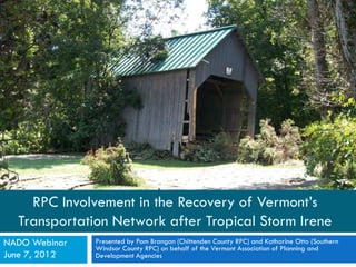
- 1. RPC Involvement in the Recovery of Vermont’s Transportation Network after Tropical Storm Irene NADO Webinar Presented by Pam Brangan (Chittenden County RPC) and Katharine Otto (Southern Windsor County RPC) on behalf of the Vermont Association of Planning and June 7, 2012 Development Agencies
- 2. Agenda What happened in Vermont? Case Study of Southern Windsor County What was our task and why? Element 1 – RPC work in the field Element 2 – RPC work at the Coordination Center Element 3 – RPC work at the State Emergency Operations Center Lessons learned Where are we now?
- 3. What happened in Vermont? August 28, 2011
- 4. What happened in Vermont?
- 5. Damage across Vermont Maps produced by Pam Brangan at the Irene Local Roads Response Resource Coordination Center. 9/30/2011. pbrangan@ccrpcvt.org
- 6. Case Study – Southern Windsor County Map extract from National Weather Service, 2011. Photographs from Weathersfield Facebook Page
- 8. Cavendish – Winery Road Bridge Photograph by SWCRPC staff
- 9. Cavendish – Carlton Road Photograph by SWCRPC staff
- 10. Windsor – Brook Road Photograph by SWCRPC staff
- 11. Weathersfield – Upper Falls Road Photograph by SWCRPC staff
- 12. “Cavendish Canyon” on VT-131 Photograph by SWCRPC staff
- 13. VT-106 in Weathersfield Photograph from facebook
- 14. The RPC’s task Photograph from Town of Weathersfield facebook page
- 15. Traditional Role of Vermont’s RPCs Coordinated regional planning Transportation planning Local land use planning & zoning Emergency planning & preparedness Natural resource planning GIS mapping & analysis
- 16. Transportation role of RPCs Primarily funded through the “Transportation Planning Initiative” (FHWA funding through VTrans) Sample of tasks which were relevant post-Irene: Infrastructure inventories – bridges, culverts, roads Facilitating regional road foreman meetings Traffic counts Regular involvement in project development and prioritization Project management Map making and data management
- 17. What was our task? VTrans requested assistance from Vermont’s 11 RPCs Specific tasks Mapping & data collection Resource matching Communications FEMA PA assistance Technical assistance
- 18. 1. RPC work in the field Detailed inventory of every damaged road segment Inventory damaged bridges Inventory damaged culverts where possible
- 19. Example field sheet from Chester
- 20. FEMA PA Program Roll Out Scheduling Applicant’s Briefings & Kick Off Meetings Request for Public Assistance Forms Tracking Coordination of Local Paperwork for FEMA PA Visits Provision of Maps & Base Data for FEMA Teams Attendance at PA Site Visits as Needed
- 21. 2. RPC work at the Regional Coordination Center Daily Status Reports Damage Assessment Collection Create forms Base maps to record damage Compile all damage reports Disseminate the damage report information
- 22. Daily Status Report Irene Flood Damage Town Highway Regional Status Report Daily Summary by Town To be submitted BY NOON daily to mboomhower@ccmpo.org Preliminary assessment Date 9/9/2011 FIRST SET RPC CODE IN YELLOW PULLDOWN CELL BELOW - this will then only show towns in the RPC region in the town name column pulldown Regional Planning Commission SWCRPC Southern Windsor County RPC Road Status Bridge Status Culvert Status # Partially # Open but Open # Emergency Total # Open but # Partially Open # Emergency Total # Open but # Partially Open # Emergency Total Town Name Damaged (e.g. 1 lane) Only # Closed Damaged Damaged (e.g. 1 lane) Only # Closed Damaged Damaged (e.g. 1 lane) Only # Closed Damaged Andover 28 5 3 36 1 1 0 Baltimore 1 1 0 0 Cavendish 2 67 5 74 1 1 0 Chester 123 1 124 9 9 0 Ludlow 110 14 124 1 2 3 0 Reading 25 14 1 40 1 1 0 Springfield 4 4 0 0 Weathersfield 9 4 1 14 0 0 West Windsor 38 1 2 41 1 1 0 Windsor 3 2 5 1 1 2 0 Example of report from September 9th.
- 24. Damage Assessment Collection Version 1 Version 4 Irene Flood Response - Regional Resource Coordination Irene Flood Response - Regional Resource Coordination Local Road Initial Damage Assessment Data Form Version 4 Initial Damage Assessment Data Form ***Fill out One Form for Each Damage Area*** ***Fill out One Form for Each Damage Area*** Town: _________________________________________ RPC: ___________________________ Town: ____________________________________________ Date: _____________________________ Road Name/ Number and Location Description (provide Town Contact: ______________________ Road Name/ Number and Location Description (fill out Town Contact: ______________________ adequate detail to locate project on a map such as road name, Title/Position: _______________________ information listed below if known): _______________________ Title/Position: _______________________ route number, GPS coordinates (Lat, Long in dec. deg), E911 ___________________________________________________ Phone/email: ________________________ Address, Mile Marker): ________________________________ Recorded by: ________________________ GPS coordinates From:__________________________ Recorded by: ________________________ ___________________________________________________ Date: _____________________________ To: ____________________________ ___________________________________________________ E911 Address: _______________________________ Municipal Repair Priority: Bridge/Culvert Number: ____________________________ Municipal Repair Priority: Mile Marker _______________________________ High Medium Low Length (feet) of Segment (for roads): __________________ High Medium Low Bridge/Culvert Number: ____________________________ Residences Stranded: Yes Length (feet) of Segment (for roads): __________________ How Many: ____________ Facility Type: (check all that apply): Road Bridge Culvert Other Highway Status: Closed Emergency vehicle only Open with lane/weight restriction Open, repair needed Facility Type: (check all that apply): Road Bridge* Culvert Other Highway If facility is closed, is a detour route in place? Yes No *Will a Temporary Bridge be needed before Winter? Yes Length in feet if known: _______ Damage description: _______________________________________________________________________ __________________________________________________________________________________________ Status: Closed Emergency vehicle only Open with lane/weight restriction __________________________________________________________________________________________ Open, repair needed Open, Fixed Have temporary repairs been made: Yes No Cost of Temporary Repairs ________________________ Describe temporary repairs: ___________________________________________________________________ If facility is closed, is a detour route in place? Yes No Describe immediate repair needs (repairs that must be made before winter): ___________________________ Will the detour be in place for more than one week? Yes __________________________________________________________________________________________ __________________________________________________________________________________________ Damage description: ________________________________________________________________ Describe resources needed for immediate repairs (equipment, staff, etc.): _____________________________ __________________________________________________________________________________ __________________________________________________________________________________________ __________________________________________________________________________________ __________________________________________________________________________________________ __________________________________________________________________________________ Estimated immediate repair costs, if known: ______________ Have temporary repairs been made: Yes No Cost of Temporary Repairs _________________ Will additional repairs be needed? Yes No Will an engineering study be needed? Yes No Describe temporary repairs: ___________________________________________________________ Don’t know Location is Important for (check all that apply): Critical access point for residents Critical access point for businesses Does Town need assistance in getting repairs started? Yes Critical access route for school buses Other (describe) _________________ Number of Homes Accessed: _________ Number of Businesses Accessed: __________ Describe resources needed: ____________________________________________________________ Other Highway Issues: ___________________________________________________________ __________________________________________________________________________________ ______________________________________________________________________________ __________________________________________________________________________________ ______________________________________________________________________________
- 25. Example Base Map of Stockbridge
- 26. Compile and Report Local Highway Damage Assessment As of September 30, 2011 Road Segments Total Damaged 2,260 Still Closed 175 12/21/11 12/14/2011 12/7/2011 Emergency Only 33 Closed Bridges 43 49 52 Bridges Total Damaged 289 Still Closed 90 Closed Road Emergency Only 6 Segments 21 85 89 Culverts Total Damaged 992 Still Closed 335
- 27. 3. RPC work at the SEOC SEOC – State Emergency Operation Center Incident Command System’s Planning and Logistics Sections role Assisted FEMA Incident Command System (ICS) structure was set up for the RPCS to report to VTrans with status updates to the SEOC Staffed multiple positions at SSF1 (State Support Function 1)
- 28. Lessons Learned Photograph by SWCRPC staff
- 29. Strengths Pre-established relationships with municipalities Transportation GIS mapping and infrastructure inventories Pre-established working relationships and partnerships with state agencies and volunteers Inter-RPC mutual aid assistance – less impacted RPCs help more impacted RPCs
- 30. Areas for improvements No pre-defined role for RPCs to assist VTrans in the manner requested Not all RPC staff had adequate knowledge and/or training for tasks Communications challenges Continuously changing expectations Collecting too much information
- 31. Recommendations From the November 2011 After Action Report Plan to include RPCs in emergency response Create funding provision for approved emergency activations Train RPC staff Facilitate clear, concise and coordinated communications List of FAQs ahead of time Central website/ clearinghouse Distill and prioritize information needs for local officials
- 32. Where are we now? Photograph by SWCRPC staff
- 33. Update – June 2012 2011 construction season extended into December April 2012 – New construction season started May 16, 2012 – Federal Disaster Declaration amended May 30, 2012 - Governor Shumlin signed largest transportation budget in Vermont’s history Ongoing discussion
- 34. Picture from Town of Weathersfield facebook page Questions? Contact: Katharine Otto kotto@swcrpc.org Pam Brangan pbrangan@ccrpcvt.org