
Recomendados
Recomendados
Más contenido relacionado
Destacado
Destacado (20)
Overwintering Habitat Of The Danaus Plexippus L
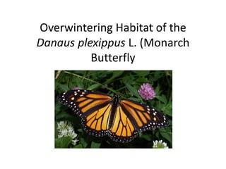
- 1. Overwintering Habitat of the Danaus plexippus L. (Monarch Butterfly
- 2. Monarch Butterfly • Herbivore • Overwinters in cool, moist forests • Found along the coast of California and in the state of Michoacán, Mexico • Preferred trees are the Oyamel Pine in Mexico and the Monterey Pine, Monterey Cypress and Blue Gum trees in California
- 3. Sources of Information • Habitat characteristic data from: • Brower, Lincoln. “Monarch Butterfly Orientation: Missing Pieces of a Magnificent Puzzle”. The Journal of Experimental Biology 1996: 93-103. • Brower, Lincoln, Williams, Ernest, Slayback, Daniel, Fink, Linda, Ramirez, Isabel, Zubieta, Raul, Garcia, M. Ivan, Gier, Paul, Lear, Jennifer and Van Hook, Tonya. “Oyamel fir forest trunks provide thermal advantages for overwintering monarch butterflies in Mexico”. The Royal Entomological Society 2009: 163-175. • Tuskes, P.M., Brower, L.P., “Overwintering ecology of the monarch butterfly, Danaus plexippus L., in California”. Ecological Entomology 1978: 141-153 • Weiss, Stuart, Rich, Paul, Murphy, Dennis, Calvert, William, Ehrlich, Paul. “Forest Canopy Structure at Overwintering Monarch Butterfly Sites: Measurements with Hemispherical Photography” Conservation Biology 1991: 165-175. • Clavert, William and Brower, Lincoln. “The location of Monarch Butterfly (Danaus plexippus L.) overwintering colonies in Mexico in relation to topography and climate”. Journal of the Lepidopterists’ Society 1986: 164-187. • Spatial and attribute data for California from: • http://data.geocomm.com • www.prism.oregonstate.edu • Spatial and attribute data for Mexico from: • Dr. Kyle E. Murray • http://forest.moscowfsl.wsu.edu/climate/current
- 4. Suitable Factors • Vegetation: Evergreen Forest • Minimum Temperatures: 3°C • Maximum Temperatures: 22°C • Precipitation: 64cm to 162 cm • Elevation: 2400m to 3500m in Mexico • Elevation: 0m to 300m (0ft – 1000ft) in California
- 5. GIS Data Processing-California • Added datasets to ArcCatalog • Processed vector datasets through the ArcCatalog Toolbox-Import from Interchange • Unzipped raster datasets and processed through the Tool-ASCII to Raster • Defined projection on raster data sets to GCS_North America_1983, to match vector data sets • Raster maps for precipitation, maximum temperature and minimum temperatures were clipped • Built attribute tables for raster datasets • Increased unique values allowed to include highest number of unique values • Added new field to minimum and maximum temperatures and precipitation attribute tables • Recalculated temperatures in new fields to Celsius and precipitation to centimeters • Converted elevation and vegetation vector data to raster data • Reclassified all data to show suitable and unsuitable habitat • Used the weighted overlay tool to bring all information together into one dataset • Created various maps
- 6. California Minimum and Maximum Temperatures
- 8. California Land Usage and Elevation
- 9. GIS Data Processing-Mexico • Added datasets to ArcCatalog • Unzipped raster datasets and processed through the Tool-ASCII to Raster • Defined projection on raster data sets to GCS_North America_1927, to match vector data sets • Raster maps for precipitation, maximum temperature and minimum temperatures were clipped • Converted elevation and vegetation vector data to raster data • Reclassified all data to show suitable and unsuitable habitat • Used the weighted overlay tool to bring together the elevation and vegetation information • Used the weighted overlay tool to bring together the maximum and minimum temperatures and precipitation • Created various maps
- 10. Mexico Minimum and Maximum Temperatures
- 12. Mexico Vegetation and Elevation
- 13. Results • Large areas appear to be suitable overwintering habitats for the Monarch Butterfly • Monarch Butterflies are found in just a few small areas • Monarchs prefer the older trees for added warmth • Forest type, temperature and precipitation seemed to be the most important factors • Elevation was not consistent between California and Mexico habitat sites • Urbanization and deforestation are destroying their overwintering habitats
- 15. Results-Mexico