
Más contenido relacionado
Similar a Bai Giang T T A P G 2
Similar a Bai Giang T T A P G 2 (20)
Más de Ngo Hung Long
Más de Ngo Hung Long (20)
Bai Giang T T A P G 2
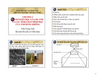
- 1. 1 CHƯƠNG 2 CƠ S TOÁN H C C A O NH VÀ CÁC TÍNH CH T HÌNH H C C A NH HÀNG KHÔNG Tr n Trung Anh B môn o nh và Vi n thám B GIÁO D C VÀ ÀO T O TRƯ NG I H C M A CH T Tran Trung Anh Photogrammetry and Remote Sensing 2 M C L C nh o Phép chi u xuyên tâm và phép chi u tr c giao M c tiêu c a o nh Các y u t hình h c cơ b n c a nh o T l nh Các h t a dùng trong o nh Ma tr n quay Các nguyên t nh hư ng c a nh o Các bài toán chuy n i h t a Các bi n d ng hình h c trên nh hàng không Tran Trung Anh Photogrammetry and Remote Sensing 3 nh o nh o là hình nh thu ư c c a các i tư ng o, nh o th a mãn nh ng i u ki n k thu t nh t nh và ư c dùng vào m c ích o c. nh o nh gi i trí Tran Trung Anh Photogrammetry and Remote Sensing 4 nh o là s n ph m c a phép chi u xuyên tâm
- 2. 2 Tran Trung Anh Photogrammetry and Remote Sensing 5 1. N i dung ph n ánh trung th c nhưng chưa y và chính xác (hình dáng, kích thư c i tư ng o, thông tin thu c tính…); 2. M c chi ti t và kh năng o c ph thu c nhi u y u t : i u ki n, phương th c ch p nh (t l nh, tiêu c , chi u cao bay ch p, máy ch p nh, môi trư ng ch p…); 3. nh o ch là ngu n thông tin ban u không th s d ng tr c ti p như b n vì nh o có phép chi u xuyên tâm, t l không ng nh t, hình nh b bi n d ng Tính ch t c a nh o Tran Trung Anh Photogrammetry and Remote Sensing 6 nh o và b n S n ph m u raTư li u g cV trí y , ư c mã hóaV a th a, v a thi uThông tin Chính xác, th a mãn h n sai theo quy nh Bi n d ng, xê d ch v trí i m nh Sai s ng nh tBi n iT l Tr c giaoXuyên tâmPhép chi u B nnh o Tran Trung Anh Photogrammetry and Remote Sensing 7 Phép chi u xuyên tâm Phép chi u xuyên tâm và phép chi u tr c giao Phép chi u tr c giao Tran Trung Anh Photogrammetry and Remote Sensing 8 Phép chi u xuyên tâm Phép chi u tr c giao Phép chi u xuyên tâm và phép chi u tr c giao
- 3. 3 Tran Trung Anh Photogrammetry and Remote Sensing 9 Phép chi u xuyên tâm Phép chi u tr c giao Phép chi u xuyên tâm và phép chi u tr c giao Tran Trung Anh Photogrammetry and Remote Sensing 10 M c tiêu c a o nh? S n ph m b n có phép chi u tr c giao nh n ư c t nh có phép chi u xuyên tâm. Xây d ng thông tin 3D (ba chi u) t nh 2D (hai chi u) Tran Trung Anh Photogrammetry and Remote Sensing 11 Các y u t hình h c cơ b n c a nh o E W S .o c n O C N I .hi .hi α α/2 V V v v T T Hf Tran Trung Anh Photogrammetry and Remote Sensing 12 Các y u t hình h c cơ b n c a nh hàng không Tr c x Hư ng bay ch pTr c y D u khung .n .o .o’ S ư ng dây d i Tr c quang chính α .xo .yo • i m chính nh o • i m áy nh n •Kho ng cách chính So≈f • i m tâm ch p S • cao bay ch p H •Tr c t a nh x (hư ng ch p) •Tr c t a nh y •Góc nghiêng c a nh α
- 4. 4 Tran Trung Anh Photogrammetry and Remote Sensing 13 nh lý tư ng S o,n,c O,N,CE P W, I S o,I N,n E P W, I nh hàng không α=00 nh m t t α=900 Tran Trung Anh Photogrammetry and Remote Sensing 14 nh lý cơ b n v phép chi u xuyên tâm nh lý v phép chi u i m A a S A1 a S A2 An nh lý thu n nh lý ngh ch Tran Trung Anh Photogrammetry and Remote Sensing 15 nh lý v phép chi u ư ng A B S a b C D c A S a C C c A A C nh lý thu n nh lý ngh ch Tran Trung Anh Photogrammetry and Remote Sensing 16 T L NH tb0a hH f H f AB ab m 1 − === S .a nh b A B TH C A f H M t th y chu n g c H0 htb amabAB ×=
- 5. 5 Tran Trung Anh Photogrammetry and Remote Sensing 17 htb T L I M NH VÀ T L NH TRUNG BÌNH A0A)a(a hH f AO oa m 1 − == B0B)b(a hH f BO ob m 1 − == TB0a hH f m 1 − = Tran Trung Anh Photogrammetry and Remote Sensing 18 T L NH TRÊN NH NGHIÊNG 22 A0a AAa yxr hH sinrsecf m 1 SO oS AO ao m 1 ′+′=′ − α×′−α× = ′ = ′′ = S .o’ .a nh lý tư ng .a’ nh nghiêng .o .n N .c r .o r’ .O .A H0 M t th y chu n g c .hA .OA α f Tran Trung Anh Photogrammetry and Remote Sensing 19 CÁC Y U T NH HƯ NG N T L NH Tiêu c : f cao bay ch p: H Chênh cao a hình khu ch p: h Góc nghiêng c a nh:α Tran Trung Anh Photogrammetry and Remote Sensing 20 S THAY I TIÊU C CH P NH HƯ NG N T L NH S ,f1 ,f2 ,H M t t nh 1 nh 2 H f m 1 H f m 1 2 2a 1 1a = =
- 6. 6 Tran Trung Anh Photogrammetry and Remote Sensing 21 S THAY I CHI U CAO BAY CH P NH HƯ NG N T L NH S ,f ,H2 M t t nh 1 nh 2 S ,f ,H1 22a 11a H f m 1 H f m 1 = = Tran Trung Anh Photogrammetry and Remote Sensing 22 CHÊNH CAO A HÌNH NH HƯ NG N T L NH htb A0A)a(a hH f AO oa m 1 − == B0B)b(a hH f BO ob m 1 − == Tran Trung Anh Photogrammetry and Remote Sensing 23 NH HƯ NG C A GÓC NGHIÊNG NH N T L NH A0a A0a hH f m 1 0 hH sinrsecf m 1 − =⇒=α − α×′−α× = S .o’ .a nh lý tư ng .a’ nh nghiêng .o .n N .c r .o r’ .O .A H0 M t th y chu n g c .hA .OA α f Tran Trung Anh Photogrammetry and Remote Sensing 24 Các h t a dùng trong o nh H t a trong không gian nh H t a trong không gian v t
- 7. 7 Tran Trung Anh Photogrammetry and Remote Sensing 25 Các h t a trong không gian nh − − − = f yy xx r 0 0 1. H t a m t ph ng nh o’xy 2. H t a không gian nh Sxyz Tran Trung Anh Photogrammetry and Remote Sensing 26 *Các h t a trong không gian v t = Z Y X R 1. H t a không gian o nh OXYZ 2. H t a qu c gia OGXGYGZG 3. H t a a lý BLH Tran Trung Anh Photogrammetry and Remote Sensing 27 *Các h t a trong không gian v t *H t a không gian o nh O-XYZ ch n b t kì X Y Z yz P(X,Y,Z) O2 z x2 y2 x y x P1 x1 y1 p2 Tran Trung Anh Photogrammetry and Remote Sensing 28 H t a không gian o nh O-XYZ ch n c bi t YZ P(X,Y,Z) x2 y2 X p1 x1 y1 O1(0,0,0) Bx By Bz ω φ κ p2
- 8. 8 Tran Trung Anh Photogrammetry and Remote Sensing 29 *Các h t a trong không gian v t *H t a , cao qu c gia OG -XGYGZG nh v : HQVnh v : Láng K=0,9996; 0,9999k:=1 P: UTMP: Gauss-kruger Hòn d u – H i Phòng E: WGS84E: Krasovski caoVN2000HN72 Tran Trung Anh Photogrammetry and Remote Sensing 30 H t a a lý BLH S P(λλλλ,ϕϕϕϕ) λλλλ ϕϕϕϕ N Kinh tuy n g c (Greenwick) Xích o Tran Trung Anh Photogrammetry and Remote Sensing 31 XÂY D NG MÔ HÌNH TOÁN H C C A O NH Xây d ng m i quan h toán h c gi a t a i m nh và t a i m v t Tran Trung Anh Photogrammetry and Remote Sensing 32 Ma tr n quay trong m t ph ng
- 9. 9 Tran Trung Anh Photogrammetry and Remote Sensing 33 Xây d ng ma tr n quay trong m t ph ng α90 + αY’ 90 - ααX’ YXCác tr c = αα− αα = αα+ α−α = 2221 1211 aa aa A )cossin )sincos A cos)90cos( )90cos(cos A • Ma tr n xoay A là m t ma tr n tr c giao, có tính ch t AT=A-1 ATA=AAT=E, 3 i u ki n: .a2 11 + a2 12= 1 .a2 21 + a2 22= 1 .a11a12 + a21a22= 0 • A có 4 ph n t (cosin ch hư ng) ph thu c 1 thành ph n α Tran Trung Anh Photogrammetry and Remote Sensing 34 Ma tr n quay trong không gian .xω .yφ .z(zκ) Quanh tr c ωO-ZY.y,Y .z,Z φO-XZ.z,Z .x,X κO-XY.x,X .y,Y Góc k p Trên m t ph ng Tr c k p X Z Y z y x (zκ) (yφ) (xω) ω φ κ κ O Tran Trung Anh Photogrammetry and Remote Sensing 35 Thành l p ma tr n quay L n lư t quay các góc quay κ, φ, ω 1. Quay góc th nh t κ quanh tr c z 09090Zκ 90κ90-κYκ 9090+κκXκ .z.y.x rAR 100 0cossin 0sincos A κκ κ = κκ κ−κ = .z (Zκ) .y .x Yκ Xκ κ κO Tran Trung Anh Photogrammetry and Remote Sensing 36 2. Quay góc th hai φ quanh tr c yφ φ9090+φZφκ 90090Yφκ 90-φ90φXφκ ZκYκXκ rAARAR cos0sin 010 sin0cos A κϕκϕϕκ ϕ == ϕϕ− ϕϕ = Zφκ Yφ Xκ Xφκ φ O φ Zκ
- 10. 10 Tran Trung Anh Photogrammetry and Remote Sensing 37 3. Quay góc th ba ω quanh tr c xω ω90-ω90Zωφκ 90+ωω90Yωφκ 90900Xωφκ ZφκYφκXφκ rAAARARR cossin0 sincos0 001 A κϕωϕκωωϕκ ω === ωω ω−ω= Zφκ Yφκ Xω ω O ω Zωφκ Yωφκ Tran Trung Anh Photogrammetry and Remote Sensing 38 Ma tr n quay trong không gian = ⇔== ωϕκωϕκκϕω z y x A Z Y X rArAAAR κκ κ−κ ϕϕ− ϕϕ ωω ω−ω== κϕωωϕκ 100 0cossin 0sincos cos0sin 010 sin0cos cossin0 sincos0 001 AAAA =ωϕκ 333231 232221 131211 aaa aaa aaa A ϕω= κϕω+κω= κϕω−κω= ϕω−= κϕω−κω= κϕω+κω= ϕ= κϕ−= κϕ= coscosa sinsincoscossina cossincossinsina cossina sinsinsincoscosa cossinsinsincosa sina sincosa coscosa 33 32 31 23 22 21 13 12 11 Tran Trung Anh Photogrammetry and Remote Sensing 39 Tính ch t c a ma tr n quay A 1. A là ma tr n tr c giao AT=A-1 ATA=AAT=E; Cm: ATA=(AωAφAκ)T(AωAφAκ)= AT κAT φAT ωAωAφAκ=E3x3 Vì: Aω TAω=E; Aφ TAφ=E; Aκ TAκ=E; nên ATA=E; pcm Có 6 i u ki n c a 3 góc quay c l p φ,ω,κ: .a2 11+ a2 12+ a2 13=1; .a2 21+ a2 22+ a2 23=1; .a2 31+ a2 32+ a2 33=1; .a11a12+ a21a22+ a31a32=0; .a11a13+ a21a23+ a31a33=0; .a12a13+ a22a23+ a32a33=0; Tran Trung Anh Photogrammetry and Remote Sensing 40 2. Cosin ch hư ng ph thu c trình t quay các góc: κ φ ω khác ω κ φ; Aωφκ khác Aφκω Tính ch t c a ma tr n quay A ϕκω ωκϕϕκω == 333231 232221 131211 aaa aaa aaa AAAA κωϕ−ωϕκωϕ+ωϕκϕ κω−κωκ κωϕ+ωϕκωϕ−ωϕκϕ =ϕκω sinsinsincoscossincossinsincoscossin cossincoscossin sinsincoscossinsincoscossinsincoscos A ωϕκ κϕωωϕκ == 333231 232221 131211 aaa aaa aaa AAAA ϕωκϕω+κωκϕω−κω ϕω−κϕω−κωκϕω+κω ϕκϕ−κϕ =ωϕκ coscossinsincoscossincossincossinsin cossinsinsinsincoscoscossinsinsincos sinsincoscoscos A
- 11. 11 Tran Trung Anh Photogrammetry and Remote Sensing 41 GÓC XOAY TRONG CH P NH HK φ ω κ Tran Trung Anh Photogrammetry and Remote Sensing 42 Các y u t hình h c xác nh v trí tâm ch p so v i m t ph ng nh và m t ph ng nh i v i i tư ng o nh m xây d ng m i quan h chi u hình ph c v o nh g i là các y u t (nguyên t ) nh hư ng c a nh o. Các nguyên t nh hư ng c a nh o Tran Trung Anh Photogrammetry and Remote Sensing 43 Các nguyên t nh hư ng trong Các y u t hình h c xác nh v trí c a tâm ch p S i v i m t ph ng nh nh m ph c h i chùm tia chi u như lúc ch p nh. G m có 3 nguyên t : - Tiêu c f - T a i m chính nh (x0, y0) Xác nh các nguyên t nh hư ng trong thông qua bài toán ki m nh Tran Trung Anh Photogrammetry and Remote Sensing 44 Khôi ph c chùm tia như lúc ch p nh .a b c P C B A Tâm ch p S c b a P Tâm chi u S.f, x0, y0
- 12. 12 Tran Trung Anh Photogrammetry and Remote Sensing 45 Ki m nh v i máy chu n tr c Tran Trung Anh Photogrammetry and Remote Sensing 46 Bãi ki m nh trong phòng Tran Trung Anh Photogrammetry and Remote Sensing 47 Bãi ki m nh ngoài tr i Tran Trung Anh Photogrammetry and Remote Sensing 48 Các y u t nh hư ng ngoài Các y u t hình h c xác nh v trí chùm tia trong h t a không gian v t. T a g c S: X0, Y0, Z0 Các góc xoay gi a các tr c h t a không gian nh và h t a không gian v t: φ,ω,κ 6 y u t nh hư ng ngoài có th xác nh nh vào các i m kh ng ch m t t ho c thi t b GPS/INS trong khi ch p nh hàng không
- 13. 13 Tran Trung Anh Photogrammetry and Remote Sensing 49 Xác nh các nguyên t H ngoài nh các i m kh ng ch m t t Tran Trung Anh Photogrammetry and Remote Sensing 50 Xác nh các nguyên t H ngoài nh thi t b GPS/INS Tran Trung Anh Photogrammetry and Remote Sensing 51 QUAN H T A TRONG O NH Công th c ng phương: M c ích: xây d ng m i quan h gi a h t a không gian nh và h t a không gian v t. i u ki n: Tâm chi u S, i m nh a, i m a v t A n m trên m t ư ng th ng. Tran Trung Anh Photogrammetry and Remote Sensing 52 CÔNG TH C NG PHƯƠNG ( ) ( ) ( ) ( ) ( ) ( ) ( ) ( ) ( ) ( ) ( ) ( ) ( ) ( ) ( ) ( ) ( ) −−−+− −−−+− −= −−−+− −−−+− −= −−−+− −= − − − = − − − −=⇔−=⇒+= − 033023013 032022012 0 033023013 031021011 0 033023013 0 0 0 332313 322212 312111 0 0 0 T 0 1 0 ZZaYYaXXa ZZaYYaXXa fyy ZZaYYaXXa ZZaYYaXXa fxx ZZaYYaXXa 1 f m 1 ZZ YY XX aaa aaa aaa m 1 f yy xx RRA m 1 rRRA m 1 rmArRR
- 14. 14 Tran Trung Anh Photogrammetry and Remote Sensing 53 CÁC BÀI TOÁN CHUY N I H T A PH NG M c ích: chuy n i t a ph ng x’,y’ t h t a cũ sang t a ph ng x,y trong h t a m i. ng d ng: chuy n i t a nh s (ho c t a h tr c máy o) sang t a m t ph ng nh, n n ch nh hình h c t m nh. 1. Chuy n i Helmert 2. Chuy n i Affine 3. Chuy n i Projective 4. Chuy n i a th c b c cao Tran Trung Anh Photogrammetry and Remote Sensing 54 CHUY N I HELMERT 4 tham s chuy n i:.a0, b0, m, α ′ ′ αα− αα + = y x cossin sincos m b a y x 0 0 ′+′+= ′+′+= ybxbby yaxaax 210 210 CHUY N I AFFINE 6 tham s chuy n i:.a0, a1, a2, b0, b1, b2 Tran Trung Anh Photogrammetry and Remote Sensing 55 CHUY N I PROJECTIVE +′+′ +′+′ = +′+′ +′+′ = 1ycxc bybxb y 1ycxc ayaxa x 21 321 21 321 8 tham s chuy n i:.a1, a2, a3, b1, b2, b3, c1, c2 CHUY N I A TH C B C CAO ′′= ′′= ∑∑ ∑∑ = = − = = − n 0i 0 ij jij ij n 0i 0 ij jij ij yxby yxax .n – s b c c a a th c. .aij, bij – các tham s chuy n i, có s lư ng là 2*[n(n+1)/2+n+1] Tran Trung Anh Photogrammetry and Remote Sensing 56 1. Sai s do bi n d ng phim nh 2. Sai s do ép phim không ph ng 3. Sai s do méo hình kính v t 1. Sai s méo hình kính v t xuyên tâm 2. Sai s méo hình kính v t ti p tuy n 4. Sai s do chi t quang khí quy n 5. Sai s do cong trái t 6. Sai s t ng h p c a xê d ch v trí i m nh Gây nên s xê d ch v trí i m nh (ch y u là xê d ch h th ng). C n ph i tính toán xác nh s xê d ch này hi u ch nh vào tr o t a nh nâng cao chính xác. HI U CH NH T A NH
- 15. 15 Tran Trung Anh Photogrammetry and Remote Sensing 57 Xu t hi n: ch y u tuân theo quy lu t c a phép bi n i affine khi s bi n d ng theo các tr c, các hư ng là khác nhau. Do quá trình hóa nh… i u ki n lo i tr : có các d u khung chu n có t a ư c ki m nh và t a o trên nh gi i ra các h s c a phép bi n i hình h c affine, projective… SAI S BI N D NG PHIM NH ′+′+= ′+′+= ybxbby yaxaax 210 210 +′+′ +′+′ = +′+′ +′+′ = 1ycxc bybxb y 1ycxc ayaxa x 21 321 21 321 Tran Trung Anh Photogrammetry and Remote Sensing 58 SAI S ÉP PHIM KHÔNG PH NG .f S .dr r .dh M t ph ng lý thuy t ép phim M t ph ng nh th c t f r dhdr dh dr f r =⇒= Xu t hi n: Do ép phim không sát v i khung ch a phim trong quá trình ch p, ép phim không sát v i m t nh n nh trong quá trình in nh dương b n. i u ki n h n ch : ép phim ph i dùng b ph n hút chân không, ho c nén khí v i áp l c cao ép phim Tran Trung Anh Photogrammetry and Remote Sensing 59 Máy in ép phim dương b n Tran Trung Anh Photogrammetry and Remote Sensing 60 SAI S MÉO HÌNH KÍNH V T GS BROWN (1961) Méo hình kính v t xuyên tâm Méo hình kính v t ti p tuy n
- 16. 16 Tran Trung Anh Photogrammetry and Remote Sensing 61 SAI S MÉO HÌNH KÍNH V T XUYÊN TÂM * Tia sáng b thay i hư ng khi i qua tâm kính v t. * Nguyên nhân: -Kính v t góc r ng -Ch t o th u kính có v t r n. * Bi n d ng d c theo bán kính hư ng tâm ( n i m chính nh) c a i m nh. * Có th lo i tr Tran Trung Anh Photogrammetry and Remote Sensing 62 Các d ng méo hình xuyên tâm Tran Trung Anh Photogrammetry and Remote Sensing 63 Hi u ch nh sai s méo hình xuyên tâm ( ) ( ) ( ) ( )2 0 2 0 5 3 3 21 0 0 yyxxr rKrKrKdr r dr yyy r dr xxx −′+−′= ++= −′=∆ −′=∆ Tran Trung Anh Photogrammetry and Remote Sensing 64 SAI S MÉO HÌNH KÍNH V T TI P TUY N Nguyên nhân: S l p ráp không ng tr c gi a các th u kính
- 17. 17 Tran Trung Anh Photogrammetry and Remote Sensing 65 Hi u ng c a méo hình ti p tuy n .φ0 tr c có méo hình l n nh t trccóméohình=0 .φ Tran Trung Anh Photogrammetry and Remote Sensing 66 Công th c hi u ch nh méo hình ti p tuy n Conrady-Brown ( ) ( ) ϕ +−ϕ+++=δ ϕ−ϕ −+++=δ 02 2 02 6 3 4 2 2 1 0202 2 6 3 4 2 2 1 cos r y2 1sin r yx2 ...rJrJrJy cos r yx2 sin r x2 1...rJrJrJx ( )[ ][ ] ( )[ ][ ] +++++=δ +++++=δ ...rPrP1yxP2y2rPy ...rPrP1yxP2x2rPx 4 4 2 31 22 2 4 4 2 32 22 1 1 3 4 1 2 3 0 12011 22 00 J J P J JPcosJPsinJP yxryyyxxx ==ϕ=ϕ−= +=−′=−′= Tran Trung Anh Photogrammetry and Remote Sensing 67 SAI S DO CHI T QUANG KHÍ QUY N T0, D, P, CO2… Tran Trung Anh Photogrammetry and Remote Sensing 68 nh Lu t Snell: .ni – chi t su t c a l p không khí i .dn – s gia chi t su t gi a 2 l p không khí .θ – góc tia sáng t i .θ+dα – góc tia khúc x khi i qua 2 l p không khí Khai tri n và t ng h p có: .n0 - chi t su t không khí t i tâm ch p, .np – chi t su t không khí t i i m m t t Xây d ng công th c tính sai s do chi t quang khí quy n ( ) ( )α+θ=θ+ dsinnsindnn iiii ( ) 0 p 0 p 0 p n n n n nlntan n dn tandtan n dn d θ=θ=α=α⇒θ=α ∫ ∫ α α
- 18. 18 Tran Trung Anh Photogrammetry and Remote Sensing 69 Tìm ư c dθ theo công th c Trong ó K là h ng s khúc x c a khí quy n. i v i nh hàng không, θ ư c bi u di n qua bán kính hư ng tâm c a i m nh .dr – sai s v trí i m do chi t quang khí quy n ( ) θ + =⇒∴θ +=θθ+=θθ= θ= d f rf drd f r 1fdtan1fdsecfdr tanfr 22 2 2 22 θ= α =θ tanK 2 d Xây d ng công th c tính sai s do chi t quang khí quy n ...rkrkrkdr 5 3 3 21 +++= Tran Trung Anh Photogrammetry and Remote Sensing 70 Xây d ng công th c tính sai s do chi t quang khí quy n +=∴ ⇒ + =θ + =⇒θ=θ 2 3 2222 f r rKdr f r K f rf tanK f rf drtanKd ( ) ( ) ( ) ( ) −′ +=−′=δ −′ +=−′=δ 02 2 0 02 2 0 yy f r 1K r dr yyy xx f r 1K r dr xxx Hi u ch nh cho t a nh V n : Tìm h ng s K Tran Trung Anh Photogrammetry and Remote Sensing 71 ( ) ( )[ ]hH202,01hH000013,0K 00 +⋅−−⋅= +− − = 250H6H hH H 00241,0 K 0 2 0 22 0 0 Công th c th c nghi m c a K ( ) ( ) ( )[ ]245,4 0 256,5 0 256,5 0 H02257,01277H02257,01h022576,01 H 001225,0 K −∗−−−⋅−= 1. Mô hình Bertram ADRC (1959 TT phát tri n không gian Rome) 2. Mô hình Saastamoinen (H0 <=11km ) 3. Mô hình H0 <= 9km Tran Trung Anh Photogrammetry and Remote Sensing 72 S xê d ch v trí i m nh do cong trái t E M0 M’ M h O R K m mo fk H δrc S nP G N θ S R 2 3 c c 0c 2 22 a 2 2 0 fR2 rH r H h rr H h NM MM r r fR2 rH h fR Hr R mr R S 2 R 2 sinR2h cosRROKONMMh ⋅ ⋅ =δ∴ =δ⇒= ′ ′ = δ ⋅ ⋅ = ⋅ ⋅ = ⋅ ==θ θ = θ = θ−=−==
- 19. 19 Tran Trung Anh Photogrammetry and Remote Sensing 73 nh hư ng c a chênh cao a hình n s xê d ch v trí i m nh r H h d = Tran Trung Anh Photogrammetry and Remote Sensing 74 NH HƯ NG T NG H P C A CÁC SAI S H TH NG N T A NH ;b 3 2 yb 3 2 xbb 3 2 yxbb 3 2 xyb b 4 3 xbb 4 3 y2bxybxbyby ;b 3 2 yb 3 2 xbb 3 2 xybb 3 2 yxb b 4 3 ybxybb 4 3 x2bybxbx 2222 12 22 10 22 8 22 6 22 4321 2222 11 22 9 22 7 22 54 22 321 − −+ −+ −+ + −+ −−++−=∆ − −+ −+ −+ + −++ −−+=∆ Mô hình c a GS Ebner (1976): 12 tham s bi .b – c nh áy nh (c nh 23x23cm thì b≈90mm) Tran Trung Anh Photogrammetry and Remote Sensing 75 NH HƯ NG C A H S 1, 2, 3 Tran Trung Anh Photogrammetry and Remote Sensing 76 NH HƯ NG C A H S 4, 5, 6
- 20. 20 Tran Trung Anh Photogrammetry and Remote Sensing 77 NH HƯ NG C A H S 7, 8, 9 Tran Trung Anh Photogrammetry and Remote Sensing 78 NH HƯ NG C A H S 10, 11, 12 Tran Trung Anh Photogrammetry and Remote Sensing 79 S khác nhau gi a phép chi u xuyên tâm và phép chi u tr c giao Hi u rõ m c tiêu c a o nh Các y u t hình h c cơ b n c a nh o T l nh và các y u t nh hư ng n t l nh M c ích s d ng c a các h t a dùng trong o nh Nguyên nhân sinh ra ma tr n xuay và cách xây d ng ma tr n xoay B n ch t và s lư ng c a các y u t nh hư ng c a nh o Các bài toán chuy n i h t a Các bi n d ng hình h c trên nh hàng không, nguyên nhân xu t hi n và công th c lo i tr Các n i dung c n n m b t ư c