SlideShare una empresa de Scribd logo
1 de 8
Descargar para leer sin conexión
GEOFÍSICA
DE ALTA RESOLUCIÓN
APLICADA A LA INGENIERIA
CURRICULUM
EMPRESARIAL
Nueva tecnología Rusa
en prospección geofísica
El “GPR LOZA” es el dispositivo
mas seguro, no invasivo y amigable
con el medio ambiente
2018
GEOFÍSICA
DE ALTA RESOLUCIÓN
APLICADA A LA INGENIERIA
www.gpr-tech.com contact@georadar.tech
Nueva tecnología Rusa
en prospección geofísica
El “GPR LOZA” es el dispositivo
mas seguro, no invasivo y amigable
con el medio ambiente
+380 97 975 5002
¿QUIÉNES SOMOS?
GPR INVESTIGATION es una empresa dedicada a la prospección geofísica-
geológica exploración y estudio del subsuelo con tecnología rusa de última
generación, mediante metodología de Georadar (GPR – Radar de Penetración
Terrestre) NO INVASIVAyAMIGABLE con el medio ambiente.
MISIÓN
Brindar servicios ingenieriles especializados en prospección minera, aguas
subterráneas, estudios geotécnicos con la más alta calidad y confianza, enfocado
en garantizar la satisfacción de nuestros clientes a base del cumplimiento fiel de
nuestros compromisos.
VISIÓN
Consolidarnos como una empresa líder y reconocida en servicios geofísicos-
geológicos aplicados a la exploración minera, recursos hídricos,
medioambientales y geotécnicos a nivel nacional e internacional, brindando
servicios al más alto nivel con el mejor staff de profesionales nacionales y
extranjeros con tecnología de vanguardia.
www.gpr-tech.com contact@georadar.tech +380 97 975 5002
POLÍTICA DE SEGURIDAD Y MEDIO AMBIENTE
GPR INVESTIGATION, asume el compromiso de desarrollar sus
actividades considerando como valores esenciales la seguridad, la salud de
las personas y la protección del medio ambiente.
Por lo tanto se adoptan como principios.
џ Proporción de recursos necesarios asegurándose de que todo el
personal conoce y trabaja de acuerdo con los principios establecidos.
џ Atender los requisitos legales aplicables y otros requisitos que la
empresa suscriba.
џ Implementar medidas preventivas para garantizar la integridad física de
los empleados y contratistas, la protección del patrimonio, del medio
ambiente y productos.
www.gpr-tech.com contact@georadar.tech +380 97 975 5002
DATOS GENERALES
DATOS DE LA EMPRESA
GPR INVESTIGATION.
Head Office: Str. Ilfa and Petrova, 18a
Odessa - Ukraine
+380 97 975 5002
www.gpr-tech.com
contact@georadar.tech
DESARROLLO
Ucrania, Odessa - 2006
Lugar y fecha en que inició actividades
Leonid Krynytskyi
Representantes
Ucrania
En el país
Rusia, Ucrania, España, Australia
En el extranjero
www.gpr-tech.com contact@georadar.tech +380 97 975 5002
NUESTRO EQUIPO
Nuestros equipos pueden llegar hasta los 200m
de profundidad y con mayor resolución, nitidez y
exactitud en los resultados obtenidos.
Dependiendo de la cantidad de perfiles realizados
podemos generar un modelado en 3D.
Somos representantes exclusivos y contamos
con la certificación, asesoría y soporte técnico del
Instituto VNIISMI (Moscu) creador de esta nueva
tecnología Rusa.
En la actualidad se encuentra en operaciones de
test la ampliación de mayor rango de profundidad.
Nuestra tecnología ha demostrado excelentes
resultados en distintos países como: Rusia,
Ucrania, España, República Checa, Estonia, Irán,
Kirguistán, Egipto, Italia, Letonia, Polonia en casi
todo el continente africano, Colombia, Honduras,
Chile y ahora en Perú.
GEORADAR «LOZA - 2V» GEORADAR «LOZA - 2N»
Frecuencia de banda, MHZ 50 – 300
Potencial de radar-Performance, dB 120
Duración del registro, nseg 256,512,1024, 2048
Tasa de discretización, nseg 1, 2 y 4
Transmisor, kV 5 -10
Antenas, MHz 300, 200, 100 y 50
Frecuencia de banda, MHZ 1 - 50
Potencial de radar-Performance, dB 120
Duración del registro,nseg 256,512,1024,2048,4096
Tasa de discretización,nseg 1, 2, 4 y 8
Transmisor, kV 10 - 21
Antenas, MHZ 15, 25 y 50
Los georadares de serie “LOZA” pertenecen al
grupo de equipos geofísicos para estudios
estructurales del subsuelo a profundidades hasta
cientos de metros, dependiendo del modelo del
equipo y antenas utilizadas así como
características del suelo estudiado.
Una de las ventajas de los Georadares “LOZA” en
comparación a los demás Georadares es su
potencial energético que le permite funcionar
perfectamente en suelos “difíciles” con gran
conductividad, tales como suelos arcillosos o arcilla
húmeda.
Potencia del impulso del transmisor aumentado en
más de 100.000 veces comparando con los GPR
comunes. Ademas la conversión de señal
estroboscópica es reemplazada en el proceso de
registro directo de la señal.
Basado en el principio de la descarga eléctrica en el
hidrógeno, potencia del impulso del transmisor esta
aumentado en más de 100.000 veces comparando
con los GPR comunes. Ademas la conversión de
señal estroboscópica es reemplazada en el proceso
de registro directo de la señal.
www.gpr-tech.com contact@georadar.tech +380 97 975 5002
NUESTROS SERVICIOS
EXPLORACIÓN MINERA GEOTECNIA
ESTUDIOS
ARQUEOLÓGICOS
RECURSOS HÍDRICOS
SUBTERRÁNEOS
www.gpr-tech.com contact@georadar.tech +380 97 975 5002
STAFF DE PROFESIONALES
Viacheslav Kiorohlo
Ing. Geólogo Marino
Jefe de Proyectos
Departamento de Perú
Ucrania
Sergio Marchenko
Geólogo
Departamento de Chile
Ucrania
Derek Reeves
Geólogo
Gerente de exploración
Australia
Sergii Kadurin
Ing. Geólogo
Ing. Geofísico
Ucrania
Leonid Krynytskyi
Gerente general
Geofísico principal
Ing. Geólogo
Ucrania
Ivan Golturenko
Geólogo
Departamento de Ucrania
Ucrania
www.gpr-tech.com contact@georadar.tech +380 97 975 5002
SOCIOS
CLIENTES
VNIISMI
geo-radar.ru www.worldwidegeological.com.au

Más contenido relacionado

Más de Leonid Krinitsky

Geo-radar LOZA and it application for sounding high resistive sections in Sou...
Geo-radar LOZA and it application for sounding high resistive sections in Sou...Geo-radar LOZA and it application for sounding high resistive sections in Sou...
Geo-radar LOZA and it application for sounding high resistive sections in Sou...Leonid Krinitsky
 
Measuring sea ice thickness with the LOZA GPR
Measuring sea ice thickness with the LOZA GPRMeasuring sea ice thickness with the LOZA GPR
Measuring sea ice thickness with the LOZA GPRLeonid Krinitsky
 
GPR-mapping of the old granite quarry
GPR-mapping of the old granite quarryGPR-mapping of the old granite quarry
GPR-mapping of the old granite quarryLeonid Krinitsky
 
GPR Probing of Smoothly Layered Subsurface Medium: 3D Analytical Model
GPR Probing of Smoothly Layered Subsurface Medium: 3D Analytical ModelGPR Probing of Smoothly Layered Subsurface Medium: 3D Analytical Model
GPR Probing of Smoothly Layered Subsurface Medium: 3D Analytical ModelLeonid Krinitsky
 
GPR survey of the bottom of Lake Chebarkul. Six years after the fall of the C...
GPR survey of the bottom of Lake Chebarkul. Six years after the fall of the C...GPR survey of the bottom of Lake Chebarkul. Six years after the fall of the C...
GPR survey of the bottom of Lake Chebarkul. Six years after the fall of the C...Leonid Krinitsky
 
Numerical studies of the radiation patterns of resistively loaded dipoles
Numerical studies of the radiation patterns of resistively loaded dipolesNumerical studies of the radiation patterns of resistively loaded dipoles
Numerical studies of the radiation patterns of resistively loaded dipolesLeonid Krinitsky
 
Deep Penetration Radar. Exploration of Geological Substructures. Experimental...
Deep Penetration Radar. Exploration of Geological Substructures. Experimental...Deep Penetration Radar. Exploration of Geological Substructures. Experimental...
Deep Penetration Radar. Exploration of Geological Substructures. Experimental...Leonid Krinitsky
 
Deep Penetration Radar: Hydrogeology and Paleorelief of Underlying Medium
Deep Penetration Radar: Hydrogeology and Paleorelief of Underlying MediumDeep Penetration Radar: Hydrogeology and Paleorelief of Underlying Medium
Deep Penetration Radar: Hydrogeology and Paleorelief of Underlying MediumLeonid Krinitsky
 
Paper presented at the First International Congress of Geosciences: Innovatio...
Paper presented at the First International Congress of Geosciences: Innovatio...Paper presented at the First International Congress of Geosciences: Innovatio...
Paper presented at the First International Congress of Geosciences: Innovatio...Leonid Krinitsky
 
The amber. Search method alluvial deposits of amber.
The amber. Search method alluvial deposits of amber.The amber. Search method alluvial deposits of amber.
The amber. Search method alluvial deposits of amber.Leonid Krinitsky
 
Georadar survey of the fall of the METEORITE fragment Сhebarcul
Georadar survey of the fall of the METEORITE fragment СhebarculGeoradar survey of the fall of the METEORITE fragment Сhebarcul
Georadar survey of the fall of the METEORITE fragment СhebarculLeonid Krinitsky
 

Más de Leonid Krinitsky (12)

Geo-radar LOZA and it application for sounding high resistive sections in Sou...
Geo-radar LOZA and it application for sounding high resistive sections in Sou...Geo-radar LOZA and it application for sounding high resistive sections in Sou...
Geo-radar LOZA and it application for sounding high resistive sections in Sou...
 
Measuring sea ice thickness with the LOZA GPR
Measuring sea ice thickness with the LOZA GPRMeasuring sea ice thickness with the LOZA GPR
Measuring sea ice thickness with the LOZA GPR
 
GPR-mapping of the old granite quarry
GPR-mapping of the old granite quarryGPR-mapping of the old granite quarry
GPR-mapping of the old granite quarry
 
GPR Probing of Smoothly Layered Subsurface Medium: 3D Analytical Model
GPR Probing of Smoothly Layered Subsurface Medium: 3D Analytical ModelGPR Probing of Smoothly Layered Subsurface Medium: 3D Analytical Model
GPR Probing of Smoothly Layered Subsurface Medium: 3D Analytical Model
 
GPR survey of the bottom of Lake Chebarkul. Six years after the fall of the C...
GPR survey of the bottom of Lake Chebarkul. Six years after the fall of the C...GPR survey of the bottom of Lake Chebarkul. Six years after the fall of the C...
GPR survey of the bottom of Lake Chebarkul. Six years after the fall of the C...
 
Numerical studies of the radiation patterns of resistively loaded dipoles
Numerical studies of the radiation patterns of resistively loaded dipolesNumerical studies of the radiation patterns of resistively loaded dipoles
Numerical studies of the radiation patterns of resistively loaded dipoles
 
Deep Penetration Radar. Exploration of Geological Substructures. Experimental...
Deep Penetration Radar. Exploration of Geological Substructures. Experimental...Deep Penetration Radar. Exploration of Geological Substructures. Experimental...
Deep Penetration Radar. Exploration of Geological Substructures. Experimental...
 
Deep Penetration Radar: Hydrogeology and Paleorelief of Underlying Medium
Deep Penetration Radar: Hydrogeology and Paleorelief of Underlying MediumDeep Penetration Radar: Hydrogeology and Paleorelief of Underlying Medium
Deep Penetration Radar: Hydrogeology and Paleorelief of Underlying Medium
 
Paper presented at the First International Congress of Geosciences: Innovatio...
Paper presented at the First International Congress of Geosciences: Innovatio...Paper presented at the First International Congress of Geosciences: Innovatio...
Paper presented at the First International Congress of Geosciences: Innovatio...
 
The amber. Search method alluvial deposits of amber.
The amber. Search method alluvial deposits of amber.The amber. Search method alluvial deposits of amber.
The amber. Search method alluvial deposits of amber.
 
Water research
Water researchWater research
Water research
 
Georadar survey of the fall of the METEORITE fragment Сhebarcul
Georadar survey of the fall of the METEORITE fragment СhebarculGeoradar survey of the fall of the METEORITE fragment Сhebarcul
Georadar survey of the fall of the METEORITE fragment Сhebarcul
 

GPR Investigation

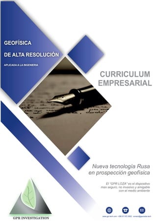
  • 1. GEOFÍSICA DE ALTA RESOLUCIÓN APLICADA A LA INGENIERIA CURRICULUM EMPRESARIAL Nueva tecnología Rusa en prospección geofísica El “GPR LOZA” es el dispositivo mas seguro, no invasivo y amigable con el medio ambiente 2018 GEOFÍSICA DE ALTA RESOLUCIÓN APLICADA A LA INGENIERIA www.gpr-tech.com contact@georadar.tech Nueva tecnología Rusa en prospección geofísica El “GPR LOZA” es el dispositivo mas seguro, no invasivo y amigable con el medio ambiente +380 97 975 5002
  • 2. ¿QUIÉNES SOMOS? GPR INVESTIGATION es una empresa dedicada a la prospección geofísica- geológica exploración y estudio del subsuelo con tecnología rusa de última generación, mediante metodología de Georadar (GPR – Radar de Penetración Terrestre) NO INVASIVAyAMIGABLE con el medio ambiente. MISIÓN Brindar servicios ingenieriles especializados en prospección minera, aguas subterráneas, estudios geotécnicos con la más alta calidad y confianza, enfocado en garantizar la satisfacción de nuestros clientes a base del cumplimiento fiel de nuestros compromisos. VISIÓN Consolidarnos como una empresa líder y reconocida en servicios geofísicos- geológicos aplicados a la exploración minera, recursos hídricos, medioambientales y geotécnicos a nivel nacional e internacional, brindando servicios al más alto nivel con el mejor staff de profesionales nacionales y extranjeros con tecnología de vanguardia. www.gpr-tech.com contact@georadar.tech +380 97 975 5002
  • 3. POLÍTICA DE SEGURIDAD Y MEDIO AMBIENTE GPR INVESTIGATION, asume el compromiso de desarrollar sus actividades considerando como valores esenciales la seguridad, la salud de las personas y la protección del medio ambiente. Por lo tanto se adoptan como principios. џ Proporción de recursos necesarios asegurándose de que todo el personal conoce y trabaja de acuerdo con los principios establecidos. џ Atender los requisitos legales aplicables y otros requisitos que la empresa suscriba. џ Implementar medidas preventivas para garantizar la integridad física de los empleados y contratistas, la protección del patrimonio, del medio ambiente y productos. www.gpr-tech.com contact@georadar.tech +380 97 975 5002
  • 4. DATOS GENERALES DATOS DE LA EMPRESA GPR INVESTIGATION. Head Office: Str. Ilfa and Petrova, 18a Odessa - Ukraine +380 97 975 5002 www.gpr-tech.com contact@georadar.tech DESARROLLO Ucrania, Odessa - 2006 Lugar y fecha en que inició actividades Leonid Krynytskyi Representantes Ucrania En el país Rusia, Ucrania, España, Australia En el extranjero www.gpr-tech.com contact@georadar.tech +380 97 975 5002
  • 5. NUESTRO EQUIPO Nuestros equipos pueden llegar hasta los 200m de profundidad y con mayor resolución, nitidez y exactitud en los resultados obtenidos. Dependiendo de la cantidad de perfiles realizados podemos generar un modelado en 3D. Somos representantes exclusivos y contamos con la certificación, asesoría y soporte técnico del Instituto VNIISMI (Moscu) creador de esta nueva tecnología Rusa. En la actualidad se encuentra en operaciones de test la ampliación de mayor rango de profundidad. Nuestra tecnología ha demostrado excelentes resultados en distintos países como: Rusia, Ucrania, España, República Checa, Estonia, Irán, Kirguistán, Egipto, Italia, Letonia, Polonia en casi todo el continente africano, Colombia, Honduras, Chile y ahora en Perú. GEORADAR «LOZA - 2V» GEORADAR «LOZA - 2N» Frecuencia de banda, MHZ 50 – 300 Potencial de radar-Performance, dB 120 Duración del registro, nseg 256,512,1024, 2048 Tasa de discretización, nseg 1, 2 y 4 Transmisor, kV 5 -10 Antenas, MHz 300, 200, 100 y 50 Frecuencia de banda, MHZ 1 - 50 Potencial de radar-Performance, dB 120 Duración del registro,nseg 256,512,1024,2048,4096 Tasa de discretización,nseg 1, 2, 4 y 8 Transmisor, kV 10 - 21 Antenas, MHZ 15, 25 y 50 Los georadares de serie “LOZA” pertenecen al grupo de equipos geofísicos para estudios estructurales del subsuelo a profundidades hasta cientos de metros, dependiendo del modelo del equipo y antenas utilizadas así como características del suelo estudiado. Una de las ventajas de los Georadares “LOZA” en comparación a los demás Georadares es su potencial energético que le permite funcionar perfectamente en suelos “difíciles” con gran conductividad, tales como suelos arcillosos o arcilla húmeda. Potencia del impulso del transmisor aumentado en más de 100.000 veces comparando con los GPR comunes. Ademas la conversión de señal estroboscópica es reemplazada en el proceso de registro directo de la señal. Basado en el principio de la descarga eléctrica en el hidrógeno, potencia del impulso del transmisor esta aumentado en más de 100.000 veces comparando con los GPR comunes. Ademas la conversión de señal estroboscópica es reemplazada en el proceso de registro directo de la señal. www.gpr-tech.com contact@georadar.tech +380 97 975 5002
  • 6. NUESTROS SERVICIOS EXPLORACIÓN MINERA GEOTECNIA ESTUDIOS ARQUEOLÓGICOS RECURSOS HÍDRICOS SUBTERRÁNEOS www.gpr-tech.com contact@georadar.tech +380 97 975 5002
  • 7. STAFF DE PROFESIONALES Viacheslav Kiorohlo Ing. Geólogo Marino Jefe de Proyectos Departamento de Perú Ucrania Sergio Marchenko Geólogo Departamento de Chile Ucrania Derek Reeves Geólogo Gerente de exploración Australia Sergii Kadurin Ing. Geólogo Ing. Geofísico Ucrania Leonid Krynytskyi Gerente general Geofísico principal Ing. Geólogo Ucrania Ivan Golturenko Geólogo Departamento de Ucrania Ucrania www.gpr-tech.com contact@georadar.tech +380 97 975 5002