SlideShare una empresa de Scribd logo
1 de 28
SCOPE
• INTRODUCTION.
• TYPES OF MODELS.
• PURPOSES OF A MODEL.
• PROPERTIES OF SAND MODEL
• MODEL PLANNING.
• MODEL DETAILS.
• SCALES.
• REQUIRED DATA.
• MODELLING PROCEDURE.
• RELIEF MODELLING.
• GROUND FEATURE MODELLING.
• MAPS REQUIRED.
BREIFING GENERAL
Stage management
Procedure
INTRODUCTION
– A model is a schematic reproduction of a special
piece of a ground on a small scale on a flat surface
showing all physical features.(both natural and
artificial) in a way to give a birds eye view of the
ground
– To be a good professional model maker, one has
to be a good map reader
TYPES OF MODEL
• Cloth model.
• Clay model.
• Glass model.
• Plastic model.
• Sand Model.
• Saw Dust model.
NB: Note that sand models are commonly used in
Military today.
MODEL PROPERTIES
The following properties of a sand model
distinguish it from a map , sketch or
photograph.
Relief format.
Significant details are emphasized and
insignificant ones omitted.
 scale determined by the purpose of the model.
Model simplifies the assessment of ground and
enemy deployment.
PURPOSE OF A SAND
MODEL
• Training purpose.
• To brief the Commander and soldiers
for a mission e.g. Recce or raids.
• As an aid in planning Military Ops.
SAND MODEL PLANNING
The following conditions should be met.
o Should be constructed in the appropriate scale
o Should properly express the properties of terrain it
represents (valley, Hills, Cliffs etc).
o Should cover the entire required areas.
SCALES
• Horizontal scales is determined by the required
accuracy and some times the dimensions and
sand quantity required.
• The scales must be calculated and square
dimensions on the model will give more
accuracy.
REQUIRED DATA
• The following data is required:
• Area boundaries. MAP FOLDS
• Horizontal scale.
• Vertical scale.
MODELLING PROCEDURE
• Prep for modeling.
–Sand prep.
–Draw co-ordinate lines. Strings,nails
–Height chart. Eg 30m = 2cm on sand table
–Marking of lines.
Relief Modeling
– Modeling sequence is from high to low areas.
• Determine skeleton lines according to location
and pile the sand fm lines to ridges.
• Determine the location of hill top, stick the
straight edge vertically and fit the sand height
according to the chart.
• Model the terrain contours and slopes according
to contour lines and their location on the net.
• Recheck forms and slopes against the map.
Make necessary correction.
• Now press the sand with your hands.
IMPROVISED SAND MODEL
• A Unit in the field conditions, where sand box
is not available, may erect an improvised,
sand table to model in the area by estimation.
BRIEFING IN THE FIELD
• Models will be used for briefing for patrols, special
missions, commanders of an impending ops.
• Stage management.
– Those to be briefed will be seated, standing kneeling
in order of nominee as in ‘O’ gp.
– Briefing officer will be standing at a position not to
obscure the model party being briefed.
– Briefing officer will use a long pointer to avoid
walking in the model.
– It is necessary to rehearse before the party arrives to
have the material flowing in a logical manner.
• Have one member pointing all the features
mentioned on the brief to avoid breaking of
the flow and continuity.
• Pauses in between statements is essential
to allow the party to assimilate or take
down notes.
• Have all the information clearly marked on
model e.g. locations, Assy Areas, FUPs, LDs
etc.
BRIEFING
• INTRODUCTION
• REPRESENTATION
• EXTRACTED FROM MAPS OF ….. SCALE
• COVERAGE
• EASTINGS ……….. TO ……..
• NORTHING ………..TO …….
• ORIENTATION …… NORTH
• HORIZONTAL ……….SCALE ONE SQ ON THE MODEL REP …. KM SQ ON GD
AND VERTICAL ……
BRIEFING
• ………… Permission to carry on Sir
• The model in front of us represents our immediate area of operation, it
has been extracted from the map of ISIOLO of scale 1:50,000, it covers
from Eastings 32 to 42 and Northings 28 to 37, it has been orientated to
the general direction of North as shown by the arrow over there. It has
been made in such away that one side of the small square of the model
represents one KM on the actual ground.
• I have used different aids to depict both natural and man made features;
high molds of soil represents mountains and hills for example mutonyi hill,
green coloration to depict forests and vegetation for example……… , blue
coloration to depict water bodies for example Lewa river, black coloration
to depict tarmacked roads for example Nanyuki – Isiolo road, Saw dust to
depict all weather road for example ………, paper cuttings to depict grid
coordinates and names of places eg Anti poaching unit
BRIEFING
• AIDS USED
• USED VARIOUS AIDS………
• NATURAL FEATURES …. HIGH TO LOW
HIGH MOULDS OF SOIL, GREEN TWIGS, BLUE COLOURINGS
• ARTIFICIAL FEATURES … HIGH TO LOW
BROWN DUST, BLACK DUST, TOYS, PAPER CUTTINGS AND ANY
OTHER AIDS USED
BRIEIFNG
GROUND IN DETAIL
OBSERVATION AND FIELDS OF FIRE
 VISUAL OBSERVATION
 OPTICAL OBSERVATION
 HILL TOPS
 DOMINATING FEATURES
 FIELDS OF FIRE FOR DIRECT WPNS
 FIELDS OF FIRE FOR INDIRECT WPNS
ROOF TOPS,PLAINS, DEFORESTATIONS, GRASSLAND,TREE
TOPS
BRIEFING
• GROUND GENERAL
• OWN LOC
• EN LOC OR DIRECTION OF APPROACH OR AXIS
• DOMINATING FEATURES
• MSR OR MAIN COMMUNICATION NETWORKS
• MAIN RIVERS OR WATER BODIES
• VEGETATION COVERAGE
• DRAINAGE PATTERNS
• MAIN OBSTACLES OR CANALIZING TERRAINS
• GENERAL CLIMATIC CONDITIONS
• GENERAL POPULATION DETAILS
BRIEFING
GROUND IN DETAIL
COVER AND CONCEALMENT
 FM GD OBSERVATION
 FM AIR OBSERVATION
 COVER FM DIRECT FIRE
 COVER FM INDIRECT FIRE
 GOOD TO EXCELLENT
VEGETATION, STREAMS, FOG, DEAD GDS, BIULT UP AREAS,
PLANTATIONS, DEEP LAGGAHS, HEDGE GROWS, OVERGROWTHS
AND FENCES/TREELINES
 CONCEALED AIR APPROACHES
BRIEFING
GROUND IN DETAIL
OBSTACLES
 NATURAL OBSTACLES
 MAN MADE OBSTACLES
 QUICK SANDS
 FLASH FLOODS
 LOOSE BLACK COTTON SOIL
 SWAMPS
 LAGGAHS
 DENSE VEGETATION
 GULLIES /CLIFFS
 LAVA ROCKS
 STEEP SLOPES
 BUILT UP AREAS
 WEATHER EFFECTS FOG, SNOW, HY RAINS
 CORAL REEFS
OBST CONT……
SEVERELY RESTRICTED AREAS
STOPS ALL FORMS OF MAOEUVRE
 BUILT UP AREAS --- WIDER THAN 500MS
 WATER OBST - RIVER 1.5 M CURRENT PER SEC DEPTH 1.2M
 SLOPES - MORE THAN 50% GRADIENT
 WOODS - TREES 15 – 20 CM AND 5 M GAPS
 ARTIFICIAL OBST - MINES, TANK DITCHES, TREES BLOWN DOWN,
BRIDGES PREP FOR DEMOLITION
OBST CONT….
RESTRICTED AREAS
MANOEUVRE IS POSSIBLE WITH DIFFICULTY
 SLOPES 30-50% GRADIENT
 WOODS TREES 5 CMS THICK LESS THAN 5 M GAPS
 WATER OBST LESS THAN S RESTICTED
 BUILT UP AREAS LESS THAN 500 M WIDE
OBST CONT….
MNVR AREASALL FORMS OF MANOEUVRE IS POSSIBLE
 WATER OBST LESS THAN 1.5 M WIDE LESS THAN 0.6 M DEEP
 SLOPES LESS THAN 30% GRADIENT
 WOODS TREES LESS THAN 5 CM THICK OR GAPS GREATER THAN 5 M
KEY TERRAIN/AREAS
TERRAIN OR AREAS WHOSE SEIZURE OR CONTROL MUST BE CONSIDERED
IN FORMULATING AND SELECTING A COA
 VITAL AREAS
 GTI
 DOMINATING FEATURES
 BRIDGES
 PASS/CANALIZING TERRAIN
 TOWNS/CENTRES
 FORDING AREAS
 HARBOURS
 AIRFIELDS/STRIPS/PORT
 ROAD JUNC IN JUNGLE/DESERT OPS
 WATER POINTS
 MSR
 COMMS FACILITIES
 CIVIL STRATEGIC FACILITIES
 ECT
AVENUES OF APPROACH
A ROUTE FROM A PARTICULAR SITE TO REACH
AN OBJECTIVE OR KEY TERRAIN
IT MUST PROVIDE SOME EASE OF MOVEMENT
AND HAVE ENOUGH WIDTH THAT ALLOW FOR
THE MANOEUVRE OF A FORCE WITH
SUFFICIENT STRENGTH TO EFFECT THE
OUTCOME OF THE OPS
 MOBILTY CORRIDORS
 SEA AVENUES OF APPROACH
 AIR AA
WEATHER AND GEOGRAPHICAL
CONDITION
WEATHER INFO IS INTERPRETED AS TO ITS OPS EFFECT i.e VISIBILTY, CLOUDS,
PRECIPITATIONS, TEMPERATURE, WIND
 EFFECT ON PERSONNEL, HEAT EXHAUSTION, FROST BITE, SNOW BLINDNESS,
MT SICKNESS.
 EFFECT ON EQPT& SUPPLY CORROSIONS,DETERIORATION,DECOMPOSITION on,
LEATHER, WOODS, PAPER, FOOD, MEDICINES, ELECTRONICS
 EFFECT ON MAN MADE FEATURES ROADS, BRIDGES, RAILWAYS, RUNWAYS,
PORTS, COMMS FACILITIES AND HARBOURS
 EFFECT ON TACTICAL ACTIVITIES - AIR MOVT, NAVIGATION, FIELDS OF FIRE
FOR DIRECT AND INDIRECT WPNS,
MOON STATE
FIRST LIGHT
LAST LIGHT
TEMPERATURE
HUMIDITY
PRECIPITATIONS
OCEAN WAVES
Q&A
CLARIFICATIONS

Más contenido relacionado

La actualidad más candente

La actualidad más candente (20)

Map Reading
Map ReadingMap Reading
Map Reading
 
Contouring Survey.ppt
Contouring Survey.pptContouring Survey.ppt
Contouring Survey.ppt
 
6. lecture 5 cadastral maps
6. lecture 5 cadastral maps6. lecture 5 cadastral maps
6. lecture 5 cadastral maps
 
SSG Black Land Nav
SSG Black Land NavSSG Black Land Nav
SSG Black Land Nav
 
Map grids
Map gridsMap grids
Map grids
 
Geometric geodesy
Geometric geodesyGeometric geodesy
Geometric geodesy
 
Total station surveying
Total station surveyingTotal station surveying
Total station surveying
 
EDM ( Electronic distance meter)
EDM ( Electronic distance meter)EDM ( Electronic distance meter)
EDM ( Electronic distance meter)
 
GIS Applications in Military.pptx
GIS Applications in Military.pptxGIS Applications in Military.pptx
GIS Applications in Military.pptx
 
Basic map reading
Basic map readingBasic map reading
Basic map reading
 
Topo map package w images
Topo map package w imagesTopo map package w images
Topo map package w images
 
Types of aerial cameras - photogrammetry
Types of aerial cameras - photogrammetry Types of aerial cameras - photogrammetry
Types of aerial cameras - photogrammetry
 
Arc gis introduction-ppt
Arc gis introduction-pptArc gis introduction-ppt
Arc gis introduction-ppt
 
Contour Lines
Contour LinesContour Lines
Contour Lines
 
Total station
Total station Total station
Total station
 
Surveying introduction
Surveying introductionSurveying introduction
Surveying introduction
 
Gis georeference
Gis georeferenceGis georeference
Gis georeference
 
Map Reading
Map ReadingMap Reading
Map Reading
 
Photogrammetry- Surveying
Photogrammetry- SurveyingPhotogrammetry- Surveying
Photogrammetry- Surveying
 
( G . i . s )
( G . i . s )( G . i . s )
( G . i . s )
 

Similar a Model making and briefing

PRACTICAL AND DESIGN ASPECTS OF TERRACING (2)-4.pptx
PRACTICAL AND DESIGN ASPECTS OF TERRACING (2)-4.pptxPRACTICAL AND DESIGN ASPECTS OF TERRACING (2)-4.pptx
PRACTICAL AND DESIGN ASPECTS OF TERRACING (2)-4.pptxsiddhantshukla53
 
L-5 LANDSCAPE site analysis.pdf
L-5 LANDSCAPE site analysis.pdfL-5 LANDSCAPE site analysis.pdf
L-5 LANDSCAPE site analysis.pdfshrutikapur5
 
STRAND 3 NATURAL AND HISTORIC BUILT ENVIRONMENT.pptx
STRAND 3 NATURAL AND HISTORIC BUILT ENVIRONMENT.pptxSTRAND 3 NATURAL AND HISTORIC BUILT ENVIRONMENT.pptx
STRAND 3 NATURAL AND HISTORIC BUILT ENVIRONMENT.pptxkimdan468
 
Hydraulic Design of Sprinkler System,
Hydraulic Design of Sprinkler System, Hydraulic Design of Sprinkler System,
Hydraulic Design of Sprinkler System, Suyog Khose
 
Geomapping in Engineering Geology UMT.pptx
Geomapping in Engineering Geology UMT.pptxGeomapping in Engineering Geology UMT.pptx
Geomapping in Engineering Geology UMT.pptxNurIsmailRahman1
 
Planning of a housing scheme
Planning of a housing schemePlanning of a housing scheme
Planning of a housing schemeKU Leuven
 
TUgis2010 Conference Presentation
TUgis2010 Conference PresentationTUgis2010 Conference Presentation
TUgis2010 Conference Presentationjmwheatley
 
Module 1 Highway Engg (1).pdf
Module 1 Highway Engg (1).pdfModule 1 Highway Engg (1).pdf
Module 1 Highway Engg (1).pdfDhananjayM13
 
Ripper production
Ripper productionRipper production
Ripper productionVIJAY KUMAR
 
SOIL MECHANICS INTRODUCTION WITH ADVANTAGES AND WHY SOIL MECHANICS STUDY IS S...
SOIL MECHANICS INTRODUCTION WITH ADVANTAGES AND WHY SOIL MECHANICS STUDY IS S...SOIL MECHANICS INTRODUCTION WITH ADVANTAGES AND WHY SOIL MECHANICS STUDY IS S...
SOIL MECHANICS INTRODUCTION WITH ADVANTAGES AND WHY SOIL MECHANICS STUDY IS S...MuhangiChristopher
 
LAND USE LAND COVER FEATURES IN AND AROUND SURYAPET TOWN FOR URBAN PLANNING
LAND USE LANDCOVER FEATURES IN AND AROUND SURYAPET TOWN FOR URBAN PLANNINGLAND USE LANDCOVER FEATURES IN AND AROUND SURYAPET TOWN FOR URBAN PLANNING
LAND USE LAND COVER FEATURES IN AND AROUND SURYAPET TOWN FOR URBAN PLANNINGKam Raju
 
Use of toposheets in civil engineering projects
Use of toposheets in civil engineering projectsUse of toposheets in civil engineering projects
Use of toposheets in civil engineering projectsProf. A.Balasubramanian
 
18 subsurfacemapping
18 subsurfacemapping18 subsurfacemapping
18 subsurfacemappingtexasgeoman
 

Similar a Model making and briefing (20)

PRACTICAL AND DESIGN ASPECTS OF TERRACING (2)-4.pptx
PRACTICAL AND DESIGN ASPECTS OF TERRACING (2)-4.pptxPRACTICAL AND DESIGN ASPECTS OF TERRACING (2)-4.pptx
PRACTICAL AND DESIGN ASPECTS OF TERRACING (2)-4.pptx
 
L-5 LANDSCAPE site analysis.pdf
L-5 LANDSCAPE site analysis.pdfL-5 LANDSCAPE site analysis.pdf
L-5 LANDSCAPE site analysis.pdf
 
STRAND 3 NATURAL AND HISTORIC BUILT ENVIRONMENT.pptx
STRAND 3 NATURAL AND HISTORIC BUILT ENVIRONMENT.pptxSTRAND 3 NATURAL AND HISTORIC BUILT ENVIRONMENT.pptx
STRAND 3 NATURAL AND HISTORIC BUILT ENVIRONMENT.pptx
 
Site grading.pptx
Site grading.pptxSite grading.pptx
Site grading.pptx
 
Hydraulic Design of Sprinkler System,
Hydraulic Design of Sprinkler System, Hydraulic Design of Sprinkler System,
Hydraulic Design of Sprinkler System,
 
landscape Grading
landscape Grading  landscape Grading
landscape Grading
 
Geomapping in Engineering Geology UMT.pptx
Geomapping in Engineering Geology UMT.pptxGeomapping in Engineering Geology UMT.pptx
Geomapping in Engineering Geology UMT.pptx
 
Vm house,DENMARK, NORTH EUROPE
Vm house,DENMARK, NORTH EUROPEVm house,DENMARK, NORTH EUROPE
Vm house,DENMARK, NORTH EUROPE
 
Planning of a housing scheme
Planning of a housing schemePlanning of a housing scheme
Planning of a housing scheme
 
TUgis2010 Conference Presentation
TUgis2010 Conference PresentationTUgis2010 Conference Presentation
TUgis2010 Conference Presentation
 
Module 1 Highway Engg (1).pdf
Module 1 Highway Engg (1).pdfModule 1 Highway Engg (1).pdf
Module 1 Highway Engg (1).pdf
 
Nbc 10 a
Nbc 10 aNbc 10 a
Nbc 10 a
 
Ripper production
Ripper productionRipper production
Ripper production
 
PE etraining mtg
PE etraining mtgPE etraining mtg
PE etraining mtg
 
SOIL MECHANICS INTRODUCTION WITH ADVANTAGES AND WHY SOIL MECHANICS STUDY IS S...
SOIL MECHANICS INTRODUCTION WITH ADVANTAGES AND WHY SOIL MECHANICS STUDY IS S...SOIL MECHANICS INTRODUCTION WITH ADVANTAGES AND WHY SOIL MECHANICS STUDY IS S...
SOIL MECHANICS INTRODUCTION WITH ADVANTAGES AND WHY SOIL MECHANICS STUDY IS S...
 
LAND USE LAND COVER FEATURES IN AND AROUND SURYAPET TOWN FOR URBAN PLANNING
LAND USE LANDCOVER FEATURES IN AND AROUND SURYAPET TOWN FOR URBAN PLANNINGLAND USE LANDCOVER FEATURES IN AND AROUND SURYAPET TOWN FOR URBAN PLANNING
LAND USE LAND COVER FEATURES IN AND AROUND SURYAPET TOWN FOR URBAN PLANNING
 
Site analysis
Site analysisSite analysis
Site analysis
 
Use of toposheets in civil engineering projects
Use of toposheets in civil engineering projectsUse of toposheets in civil engineering projects
Use of toposheets in civil engineering projects
 
Highway presentation
Highway presentationHighway presentation
Highway presentation
 
18 subsurfacemapping
18 subsurfacemapping18 subsurfacemapping
18 subsurfacemapping
 

Último

Work Remotely with Confluence ACE 2.pptx
Work Remotely with Confluence ACE 2.pptxWork Remotely with Confluence ACE 2.pptx
Work Remotely with Confluence ACE 2.pptxmavinoikein
 
NATIONAL ANTHEMS OF AFRICA (National Anthems of Africa)
NATIONAL ANTHEMS OF AFRICA (National Anthems of Africa)NATIONAL ANTHEMS OF AFRICA (National Anthems of Africa)
NATIONAL ANTHEMS OF AFRICA (National Anthems of Africa)Basil Achie
 
Open Source Camp Kubernetes 2024 | Monitoring Kubernetes With Icinga by Eric ...
Open Source Camp Kubernetes 2024 | Monitoring Kubernetes With Icinga by Eric ...Open Source Camp Kubernetes 2024 | Monitoring Kubernetes With Icinga by Eric ...
Open Source Camp Kubernetes 2024 | Monitoring Kubernetes With Icinga by Eric ...NETWAYS
 
OSCamp Kubernetes 2024 | A Tester's Guide to CI_CD as an Automated Quality Co...
OSCamp Kubernetes 2024 | A Tester's Guide to CI_CD as an Automated Quality Co...OSCamp Kubernetes 2024 | A Tester's Guide to CI_CD as an Automated Quality Co...
OSCamp Kubernetes 2024 | A Tester's Guide to CI_CD as an Automated Quality Co...NETWAYS
 
CTAC 2024 Valencia - Sven Zoelle - Most Crucial Invest to Digitalisation_slid...
CTAC 2024 Valencia - Sven Zoelle - Most Crucial Invest to Digitalisation_slid...CTAC 2024 Valencia - Sven Zoelle - Most Crucial Invest to Digitalisation_slid...
CTAC 2024 Valencia - Sven Zoelle - Most Crucial Invest to Digitalisation_slid...henrik385807
 
Open Source Camp Kubernetes 2024 | Running WebAssembly on Kubernetes by Alex ...
Open Source Camp Kubernetes 2024 | Running WebAssembly on Kubernetes by Alex ...Open Source Camp Kubernetes 2024 | Running WebAssembly on Kubernetes by Alex ...
Open Source Camp Kubernetes 2024 | Running WebAssembly on Kubernetes by Alex ...NETWAYS
 
The 3rd Intl. Workshop on NL-based Software Engineering
The 3rd Intl. Workshop on NL-based Software EngineeringThe 3rd Intl. Workshop on NL-based Software Engineering
The 3rd Intl. Workshop on NL-based Software EngineeringSebastiano Panichella
 
Genesis part 2 Isaiah Scudder 04-24-2024.pptx
Genesis part 2 Isaiah Scudder 04-24-2024.pptxGenesis part 2 Isaiah Scudder 04-24-2024.pptx
Genesis part 2 Isaiah Scudder 04-24-2024.pptxFamilyWorshipCenterD
 
Navi Mumbai Call Girls Service Pooja 9892124323 Real Russian Girls Looking Mo...
Navi Mumbai Call Girls Service Pooja 9892124323 Real Russian Girls Looking Mo...Navi Mumbai Call Girls Service Pooja 9892124323 Real Russian Girls Looking Mo...
Navi Mumbai Call Girls Service Pooja 9892124323 Real Russian Girls Looking Mo...Pooja Nehwal
 
Mathan flower ppt.pptx slide orchids ✨🌸
Mathan flower ppt.pptx slide orchids ✨🌸Mathan flower ppt.pptx slide orchids ✨🌸
Mathan flower ppt.pptx slide orchids ✨🌸mathanramanathan2005
 
OSCamp Kubernetes 2024 | Zero-Touch OS-Infrastruktur für Container und Kubern...
OSCamp Kubernetes 2024 | Zero-Touch OS-Infrastruktur für Container und Kubern...OSCamp Kubernetes 2024 | Zero-Touch OS-Infrastruktur für Container und Kubern...
OSCamp Kubernetes 2024 | Zero-Touch OS-Infrastruktur für Container und Kubern...NETWAYS
 
Genshin Impact PPT Template by EaTemp.pptx
Genshin Impact PPT Template by EaTemp.pptxGenshin Impact PPT Template by EaTemp.pptx
Genshin Impact PPT Template by EaTemp.pptxJohnree4
 
call girls in delhi malviya nagar @9811711561@
call girls in delhi malviya nagar @9811711561@call girls in delhi malviya nagar @9811711561@
call girls in delhi malviya nagar @9811711561@vikas rana
 
Exploring protein-protein interactions by Weak Affinity Chromatography (WAC) ...
Exploring protein-protein interactions by Weak Affinity Chromatography (WAC) ...Exploring protein-protein interactions by Weak Affinity Chromatography (WAC) ...
Exploring protein-protein interactions by Weak Affinity Chromatography (WAC) ...Salam Al-Karadaghi
 
OSCamp Kubernetes 2024 | SRE Challenges in Monolith to Microservices Shift at...
OSCamp Kubernetes 2024 | SRE Challenges in Monolith to Microservices Shift at...OSCamp Kubernetes 2024 | SRE Challenges in Monolith to Microservices Shift at...
OSCamp Kubernetes 2024 | SRE Challenges in Monolith to Microservices Shift at...NETWAYS
 
The Ten Facts About People With Autism Presentation
The Ten Facts About People With Autism PresentationThe Ten Facts About People With Autism Presentation
The Ten Facts About People With Autism PresentationNathan Young
 
Event 4 Introduction to Open Source.pptx
Event 4 Introduction to Open Source.pptxEvent 4 Introduction to Open Source.pptx
Event 4 Introduction to Open Source.pptxaryanv1753
 
Open Source Strategy in Logistics 2015_Henrik Hankedvz-d-nl-log-conference.pdf
Open Source Strategy in Logistics 2015_Henrik Hankedvz-d-nl-log-conference.pdfOpen Source Strategy in Logistics 2015_Henrik Hankedvz-d-nl-log-conference.pdf
Open Source Strategy in Logistics 2015_Henrik Hankedvz-d-nl-log-conference.pdfhenrik385807
 
CTAC 2024 Valencia - Henrik Hanke - Reduce to the max - slideshare.pdf
CTAC 2024 Valencia - Henrik Hanke - Reduce to the max - slideshare.pdfCTAC 2024 Valencia - Henrik Hanke - Reduce to the max - slideshare.pdf
CTAC 2024 Valencia - Henrik Hanke - Reduce to the max - slideshare.pdfhenrik385807
 
Philippine History cavite Mutiny Report.ppt
Philippine History cavite Mutiny Report.pptPhilippine History cavite Mutiny Report.ppt
Philippine History cavite Mutiny Report.pptssuser319dad
 

Último (20)

Work Remotely with Confluence ACE 2.pptx
Work Remotely with Confluence ACE 2.pptxWork Remotely with Confluence ACE 2.pptx
Work Remotely with Confluence ACE 2.pptx
 
NATIONAL ANTHEMS OF AFRICA (National Anthems of Africa)
NATIONAL ANTHEMS OF AFRICA (National Anthems of Africa)NATIONAL ANTHEMS OF AFRICA (National Anthems of Africa)
NATIONAL ANTHEMS OF AFRICA (National Anthems of Africa)
 
Open Source Camp Kubernetes 2024 | Monitoring Kubernetes With Icinga by Eric ...
Open Source Camp Kubernetes 2024 | Monitoring Kubernetes With Icinga by Eric ...Open Source Camp Kubernetes 2024 | Monitoring Kubernetes With Icinga by Eric ...
Open Source Camp Kubernetes 2024 | Monitoring Kubernetes With Icinga by Eric ...
 
OSCamp Kubernetes 2024 | A Tester's Guide to CI_CD as an Automated Quality Co...
OSCamp Kubernetes 2024 | A Tester's Guide to CI_CD as an Automated Quality Co...OSCamp Kubernetes 2024 | A Tester's Guide to CI_CD as an Automated Quality Co...
OSCamp Kubernetes 2024 | A Tester's Guide to CI_CD as an Automated Quality Co...
 
CTAC 2024 Valencia - Sven Zoelle - Most Crucial Invest to Digitalisation_slid...
CTAC 2024 Valencia - Sven Zoelle - Most Crucial Invest to Digitalisation_slid...CTAC 2024 Valencia - Sven Zoelle - Most Crucial Invest to Digitalisation_slid...
CTAC 2024 Valencia - Sven Zoelle - Most Crucial Invest to Digitalisation_slid...
 
Open Source Camp Kubernetes 2024 | Running WebAssembly on Kubernetes by Alex ...
Open Source Camp Kubernetes 2024 | Running WebAssembly on Kubernetes by Alex ...Open Source Camp Kubernetes 2024 | Running WebAssembly on Kubernetes by Alex ...
Open Source Camp Kubernetes 2024 | Running WebAssembly on Kubernetes by Alex ...
 
The 3rd Intl. Workshop on NL-based Software Engineering
The 3rd Intl. Workshop on NL-based Software EngineeringThe 3rd Intl. Workshop on NL-based Software Engineering
The 3rd Intl. Workshop on NL-based Software Engineering
 
Genesis part 2 Isaiah Scudder 04-24-2024.pptx
Genesis part 2 Isaiah Scudder 04-24-2024.pptxGenesis part 2 Isaiah Scudder 04-24-2024.pptx
Genesis part 2 Isaiah Scudder 04-24-2024.pptx
 
Navi Mumbai Call Girls Service Pooja 9892124323 Real Russian Girls Looking Mo...
Navi Mumbai Call Girls Service Pooja 9892124323 Real Russian Girls Looking Mo...Navi Mumbai Call Girls Service Pooja 9892124323 Real Russian Girls Looking Mo...
Navi Mumbai Call Girls Service Pooja 9892124323 Real Russian Girls Looking Mo...
 
Mathan flower ppt.pptx slide orchids ✨🌸
Mathan flower ppt.pptx slide orchids ✨🌸Mathan flower ppt.pptx slide orchids ✨🌸
Mathan flower ppt.pptx slide orchids ✨🌸
 
OSCamp Kubernetes 2024 | Zero-Touch OS-Infrastruktur für Container und Kubern...
OSCamp Kubernetes 2024 | Zero-Touch OS-Infrastruktur für Container und Kubern...OSCamp Kubernetes 2024 | Zero-Touch OS-Infrastruktur für Container und Kubern...
OSCamp Kubernetes 2024 | Zero-Touch OS-Infrastruktur für Container und Kubern...
 
Genshin Impact PPT Template by EaTemp.pptx
Genshin Impact PPT Template by EaTemp.pptxGenshin Impact PPT Template by EaTemp.pptx
Genshin Impact PPT Template by EaTemp.pptx
 
call girls in delhi malviya nagar @9811711561@
call girls in delhi malviya nagar @9811711561@call girls in delhi malviya nagar @9811711561@
call girls in delhi malviya nagar @9811711561@
 
Exploring protein-protein interactions by Weak Affinity Chromatography (WAC) ...
Exploring protein-protein interactions by Weak Affinity Chromatography (WAC) ...Exploring protein-protein interactions by Weak Affinity Chromatography (WAC) ...
Exploring protein-protein interactions by Weak Affinity Chromatography (WAC) ...
 
OSCamp Kubernetes 2024 | SRE Challenges in Monolith to Microservices Shift at...
OSCamp Kubernetes 2024 | SRE Challenges in Monolith to Microservices Shift at...OSCamp Kubernetes 2024 | SRE Challenges in Monolith to Microservices Shift at...
OSCamp Kubernetes 2024 | SRE Challenges in Monolith to Microservices Shift at...
 
The Ten Facts About People With Autism Presentation
The Ten Facts About People With Autism PresentationThe Ten Facts About People With Autism Presentation
The Ten Facts About People With Autism Presentation
 
Event 4 Introduction to Open Source.pptx
Event 4 Introduction to Open Source.pptxEvent 4 Introduction to Open Source.pptx
Event 4 Introduction to Open Source.pptx
 
Open Source Strategy in Logistics 2015_Henrik Hankedvz-d-nl-log-conference.pdf
Open Source Strategy in Logistics 2015_Henrik Hankedvz-d-nl-log-conference.pdfOpen Source Strategy in Logistics 2015_Henrik Hankedvz-d-nl-log-conference.pdf
Open Source Strategy in Logistics 2015_Henrik Hankedvz-d-nl-log-conference.pdf
 
CTAC 2024 Valencia - Henrik Hanke - Reduce to the max - slideshare.pdf
CTAC 2024 Valencia - Henrik Hanke - Reduce to the max - slideshare.pdfCTAC 2024 Valencia - Henrik Hanke - Reduce to the max - slideshare.pdf
CTAC 2024 Valencia - Henrik Hanke - Reduce to the max - slideshare.pdf
 
Philippine History cavite Mutiny Report.ppt
Philippine History cavite Mutiny Report.pptPhilippine History cavite Mutiny Report.ppt
Philippine History cavite Mutiny Report.ppt
 

Model making and briefing

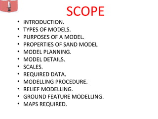
  • 1. SCOPE • INTRODUCTION. • TYPES OF MODELS. • PURPOSES OF A MODEL. • PROPERTIES OF SAND MODEL • MODEL PLANNING. • MODEL DETAILS. • SCALES. • REQUIRED DATA. • MODELLING PROCEDURE. • RELIEF MODELLING. • GROUND FEATURE MODELLING. • MAPS REQUIRED.
  • 3. INTRODUCTION – A model is a schematic reproduction of a special piece of a ground on a small scale on a flat surface showing all physical features.(both natural and artificial) in a way to give a birds eye view of the ground – To be a good professional model maker, one has to be a good map reader
  • 4. TYPES OF MODEL • Cloth model. • Clay model. • Glass model. • Plastic model. • Sand Model. • Saw Dust model. NB: Note that sand models are commonly used in Military today.
  • 5. MODEL PROPERTIES The following properties of a sand model distinguish it from a map , sketch or photograph. Relief format. Significant details are emphasized and insignificant ones omitted.  scale determined by the purpose of the model. Model simplifies the assessment of ground and enemy deployment.
  • 6. PURPOSE OF A SAND MODEL • Training purpose. • To brief the Commander and soldiers for a mission e.g. Recce or raids. • As an aid in planning Military Ops.
  • 7. SAND MODEL PLANNING The following conditions should be met. o Should be constructed in the appropriate scale o Should properly express the properties of terrain it represents (valley, Hills, Cliffs etc). o Should cover the entire required areas.
  • 8. SCALES • Horizontal scales is determined by the required accuracy and some times the dimensions and sand quantity required. • The scales must be calculated and square dimensions on the model will give more accuracy.
  • 9. REQUIRED DATA • The following data is required: • Area boundaries. MAP FOLDS • Horizontal scale. • Vertical scale.
  • 10. MODELLING PROCEDURE • Prep for modeling. –Sand prep. –Draw co-ordinate lines. Strings,nails –Height chart. Eg 30m = 2cm on sand table –Marking of lines.
  • 11. Relief Modeling – Modeling sequence is from high to low areas. • Determine skeleton lines according to location and pile the sand fm lines to ridges. • Determine the location of hill top, stick the straight edge vertically and fit the sand height according to the chart. • Model the terrain contours and slopes according to contour lines and their location on the net. • Recheck forms and slopes against the map. Make necessary correction. • Now press the sand with your hands.
  • 12. IMPROVISED SAND MODEL • A Unit in the field conditions, where sand box is not available, may erect an improvised, sand table to model in the area by estimation.
  • 13. BRIEFING IN THE FIELD • Models will be used for briefing for patrols, special missions, commanders of an impending ops. • Stage management. – Those to be briefed will be seated, standing kneeling in order of nominee as in ‘O’ gp. – Briefing officer will be standing at a position not to obscure the model party being briefed. – Briefing officer will use a long pointer to avoid walking in the model. – It is necessary to rehearse before the party arrives to have the material flowing in a logical manner.
  • 14. • Have one member pointing all the features mentioned on the brief to avoid breaking of the flow and continuity. • Pauses in between statements is essential to allow the party to assimilate or take down notes. • Have all the information clearly marked on model e.g. locations, Assy Areas, FUPs, LDs etc.
  • 15. BRIEFING • INTRODUCTION • REPRESENTATION • EXTRACTED FROM MAPS OF ….. SCALE • COVERAGE • EASTINGS ……….. TO …….. • NORTHING ………..TO ……. • ORIENTATION …… NORTH • HORIZONTAL ……….SCALE ONE SQ ON THE MODEL REP …. KM SQ ON GD AND VERTICAL ……
  • 16. BRIEFING • ………… Permission to carry on Sir • The model in front of us represents our immediate area of operation, it has been extracted from the map of ISIOLO of scale 1:50,000, it covers from Eastings 32 to 42 and Northings 28 to 37, it has been orientated to the general direction of North as shown by the arrow over there. It has been made in such away that one side of the small square of the model represents one KM on the actual ground. • I have used different aids to depict both natural and man made features; high molds of soil represents mountains and hills for example mutonyi hill, green coloration to depict forests and vegetation for example……… , blue coloration to depict water bodies for example Lewa river, black coloration to depict tarmacked roads for example Nanyuki – Isiolo road, Saw dust to depict all weather road for example ………, paper cuttings to depict grid coordinates and names of places eg Anti poaching unit
  • 17. BRIEFING • AIDS USED • USED VARIOUS AIDS……… • NATURAL FEATURES …. HIGH TO LOW HIGH MOULDS OF SOIL, GREEN TWIGS, BLUE COLOURINGS • ARTIFICIAL FEATURES … HIGH TO LOW BROWN DUST, BLACK DUST, TOYS, PAPER CUTTINGS AND ANY OTHER AIDS USED
  • 18. BRIEIFNG GROUND IN DETAIL OBSERVATION AND FIELDS OF FIRE  VISUAL OBSERVATION  OPTICAL OBSERVATION  HILL TOPS  DOMINATING FEATURES  FIELDS OF FIRE FOR DIRECT WPNS  FIELDS OF FIRE FOR INDIRECT WPNS ROOF TOPS,PLAINS, DEFORESTATIONS, GRASSLAND,TREE TOPS
  • 19. BRIEFING • GROUND GENERAL • OWN LOC • EN LOC OR DIRECTION OF APPROACH OR AXIS • DOMINATING FEATURES • MSR OR MAIN COMMUNICATION NETWORKS • MAIN RIVERS OR WATER BODIES • VEGETATION COVERAGE • DRAINAGE PATTERNS • MAIN OBSTACLES OR CANALIZING TERRAINS • GENERAL CLIMATIC CONDITIONS • GENERAL POPULATION DETAILS
  • 20. BRIEFING GROUND IN DETAIL COVER AND CONCEALMENT  FM GD OBSERVATION  FM AIR OBSERVATION  COVER FM DIRECT FIRE  COVER FM INDIRECT FIRE  GOOD TO EXCELLENT VEGETATION, STREAMS, FOG, DEAD GDS, BIULT UP AREAS, PLANTATIONS, DEEP LAGGAHS, HEDGE GROWS, OVERGROWTHS AND FENCES/TREELINES  CONCEALED AIR APPROACHES
  • 21. BRIEFING GROUND IN DETAIL OBSTACLES  NATURAL OBSTACLES  MAN MADE OBSTACLES  QUICK SANDS  FLASH FLOODS  LOOSE BLACK COTTON SOIL  SWAMPS  LAGGAHS  DENSE VEGETATION  GULLIES /CLIFFS  LAVA ROCKS  STEEP SLOPES  BUILT UP AREAS  WEATHER EFFECTS FOG, SNOW, HY RAINS  CORAL REEFS
  • 22. OBST CONT…… SEVERELY RESTRICTED AREAS STOPS ALL FORMS OF MAOEUVRE  BUILT UP AREAS --- WIDER THAN 500MS  WATER OBST - RIVER 1.5 M CURRENT PER SEC DEPTH 1.2M  SLOPES - MORE THAN 50% GRADIENT  WOODS - TREES 15 – 20 CM AND 5 M GAPS  ARTIFICIAL OBST - MINES, TANK DITCHES, TREES BLOWN DOWN, BRIDGES PREP FOR DEMOLITION
  • 23. OBST CONT…. RESTRICTED AREAS MANOEUVRE IS POSSIBLE WITH DIFFICULTY  SLOPES 30-50% GRADIENT  WOODS TREES 5 CMS THICK LESS THAN 5 M GAPS  WATER OBST LESS THAN S RESTICTED  BUILT UP AREAS LESS THAN 500 M WIDE
  • 24. OBST CONT…. MNVR AREASALL FORMS OF MANOEUVRE IS POSSIBLE  WATER OBST LESS THAN 1.5 M WIDE LESS THAN 0.6 M DEEP  SLOPES LESS THAN 30% GRADIENT  WOODS TREES LESS THAN 5 CM THICK OR GAPS GREATER THAN 5 M
  • 25. KEY TERRAIN/AREAS TERRAIN OR AREAS WHOSE SEIZURE OR CONTROL MUST BE CONSIDERED IN FORMULATING AND SELECTING A COA  VITAL AREAS  GTI  DOMINATING FEATURES  BRIDGES  PASS/CANALIZING TERRAIN  TOWNS/CENTRES  FORDING AREAS  HARBOURS  AIRFIELDS/STRIPS/PORT  ROAD JUNC IN JUNGLE/DESERT OPS  WATER POINTS  MSR  COMMS FACILITIES  CIVIL STRATEGIC FACILITIES  ECT
  • 26. AVENUES OF APPROACH A ROUTE FROM A PARTICULAR SITE TO REACH AN OBJECTIVE OR KEY TERRAIN IT MUST PROVIDE SOME EASE OF MOVEMENT AND HAVE ENOUGH WIDTH THAT ALLOW FOR THE MANOEUVRE OF A FORCE WITH SUFFICIENT STRENGTH TO EFFECT THE OUTCOME OF THE OPS  MOBILTY CORRIDORS  SEA AVENUES OF APPROACH  AIR AA
  • 27. WEATHER AND GEOGRAPHICAL CONDITION WEATHER INFO IS INTERPRETED AS TO ITS OPS EFFECT i.e VISIBILTY, CLOUDS, PRECIPITATIONS, TEMPERATURE, WIND  EFFECT ON PERSONNEL, HEAT EXHAUSTION, FROST BITE, SNOW BLINDNESS, MT SICKNESS.  EFFECT ON EQPT& SUPPLY CORROSIONS,DETERIORATION,DECOMPOSITION on, LEATHER, WOODS, PAPER, FOOD, MEDICINES, ELECTRONICS  EFFECT ON MAN MADE FEATURES ROADS, BRIDGES, RAILWAYS, RUNWAYS, PORTS, COMMS FACILITIES AND HARBOURS  EFFECT ON TACTICAL ACTIVITIES - AIR MOVT, NAVIGATION, FIELDS OF FIRE FOR DIRECT AND INDIRECT WPNS, MOON STATE FIRST LIGHT LAST LIGHT TEMPERATURE HUMIDITY PRECIPITATIONS OCEAN WAVES