SlideShare una empresa de Scribd logo
1 de 34
Potential use of drones for
infrastructure inspection and survey
Dr. George Grozev, Honorary Senior Fellow
SMART Infrastructure Facility, University of Wollongong
27th of March 2018
Outline
•Acknowledgments
•Introduction
•Drone technology
•Risks when using drones
•Rules when flying drones
•Examples of drone applications
for infrastructure inspection
•Conclusion and questions
•Pleased to visit SMART Infrastructure Facility and UoW
•Thanks to Prof. Pascal Perez for his support and for
inviting me to present this seminar
• Ms Kate Kofod, Ms Lynda Hezemans, Ms Leanne
Harmison and Tim Davis for their admin and IT help in
relation to my seminar
•Thanks to Mr. Donald Armstrong and Mr. Matt Lawson
from V/Line Pty Ltd for their discussions related to
potential drone application in railway transport
•Thank you to all of you for attending
Acknowledgments
Some photos - DJI Mavic Pro
More photos - DJI Mavic Pro
The remote control of DJI Mavic Pro
The remote control connected to
smart devices
Components and subsystems
PropellersMotorsBattery
Start button
Autopilot
Power management
Camera
Gimbal
Micro SD cardForward vision sensors
LEDindicator
Radio receiver
GPS/GLONASS
Electronic speed
controller
LED indicator
Elbanhawi M et al (2017). Enabling technologies for autonomous MAV
operations. Progress in Aerospace sciences, 91: 27-52
Wi-Fi
Downward vision sensors
Smart phone and iPad-based
applications
Aircraft movements
Vertical axis
Longitudinalaxis
Lateral axis
Yawing
Rolling
Pitching
Rolling about Longitudinal axis
Pitching about Lateral axis
Yawing about the vertical axis
Quad-rotor propeller configuration
T1 ω1
F1
T2 ω2
F2
T4 ω4
F4
T3 ω3
F3
Fi – Thrust Force of propeller i
Ti – Reactive Moment of propeller i
ωi – angular velocity of propeller i
G – Vehicle weight
G
Adapted from:
Amezquita-Brooks L. et al. (2017). Towards a standard design model for quad-rotors: A review of
current models, their accuracy and a novel simplified model. Progress in Aerospace sciences, 95: 1-23.
Fi = 0.5 ρSCT(kVi)2
S – disk area of the propeller
CT – thrust coefficient of the propeller
ρ – air density
kVi – angular speed of the propeller
motor with voltage Vi
Propeller control and UAV movements
ω2
ω4
ω1
ω3
ω2
ω4
ω1
ω3
ω2
ω4
ω1
ω3
ω2
ω4
ω1
ω3
Thrust movement
ω1 = ω2 = ω3 = ω4
Roll movement
ω4 > ω2
ω1 = ω3
Pitch movement
ω1 > ω3
ω2 = ω4
Yaw movement
{ω2 = ω4} > {ω1 = ω3}
Based on: Amezquita-Brooks L. et al. (2017). Towards a standard design model for quad-rotors: A
review of current models, their accuracy and a novel simplified model. Progress in Aerospace
sciences, 95: 1-23.
See also: Máthé K. and Busoniu L. (2015). Vision and control for UAVs: A survey of general methods
and of inexpensive platforms for infrastructure inspection. Sensors, 15:14887-14916.
doi:10.3390/s150714887
Forward direction
One drone classification
Drones
UAV μUAV MAV NAV SD
Fixed
wing
Flapping
Wing
VTOL Tilt rotor
Ducted
fan
Helicopter
Orni
copter
Unconven
tional
Bio MAV
Rotary
wing
Mono
copter
Twin
copter
Tricopter
Quad
rotor
Penta
copter
Octo
copter
Deca
copter
Dodeca
copter
Hexa
copter
Based on:
Hassanalian M and Abdelkefi A (2017). Classifications, applications, and design challenges of drones: A review.
Progress in Aerospace Sciences, 91 (2017) 99-131. doi:10.1016/j.paerosci.2017.04.003
PAV
A brief comparison of some popular
recreational drones
Drone Name Top Speed Max Flying
Time
Max Flight
Distance
Video Resolution
DJI Phantom 4 Pro 72 km/h (S-mode) 30 min 10 km 4K Ultra HD, 60p
DJI Phantom 4 72 km/h (S-mode) 28 min 10 km 4K Ultra HD, 30p
DJI Mavic Pro 65 km/h (S-mode) 27 min 13 km 4K Ultra HD, 30p
DJI Mavic Air 68.4 km/h (S-mode) 21 min 10 km 4K Ultra HD, 30p
DJI Spark 50 km/h 16 min 5.5 km FHD: 1920×1080 30p
Drone Name Mechanical Gimbal Camera Battery
Capacity
Supported SD Remote
Controller
Weight
DJI Phantom 4 Pro 3-axis (pitch, roll, yaw) 20 MP 5870 mAh microSD (up to 128G) Yes 1388 g
DJI Phantom 4 3-axis (pitch, roll, yaw) 12 MP 5350 mAh microSD (up to 64G) Yes 1380 g
DJI Mavic Pro 3-axis (pitch, roll, yaw) 12 MP 3830 mAh microSD (up to 64G) Yes 734 g
DJI Mavic Air 3-axis (tilt, roll, pan) 12 MP 2375 mAh microSD (up to 128G) Yes 430 g
DJI Spark 2-axis (pitch, roll) 12 MP 1480 mAh microSD (up to 64G) Yes 300 g
Weblink
https://www.dji.com/phantom-4-pro/info
https://www.dji.com/phantom-4/info
https://www.dji.com/mavic/info
https://www.dji.com/mavic-air/info
https://www.dji.com/spark/info
A brief comparison of some popular
recreational drones – cont.
A brief comparison of some popular
commercial drones
Drone Name Type Dimensions (unfolded) Battery Capacity Number of
batteries
Hovering time Weight
Matrice 600 Pro Hexacopter 1668mm × 1518mm × 727mm4500 mAh (TB47S); 5700 mAh
(TB48S)
6 No payload: 32 min; 6
kg payload: 16 min
9.5 kg (with six
TB47S batteries)
Matrice 200 Quad rotor 887×880×378 mm 4280 mAh (TB50) 2 3.80 kg (TB50)
Matrice 100 Quad rotor Diagonal Wheelbase: 650
mm
4500 mAh (TB47D) 1 or 2 TB48D battery: No
payload: 28 min; 500g
payload: 20 min; 1kg
payload: 16 min
2.431 kg (TB48D)
Drone Name Max Flying
Time
Top Speed Max Service Ceiling Above
Sea Level
Max
Takeoff
Weight
Max Payload Operating
temperature
Weblink
Matrice 600 Pro 65 km/h 2500 m with 2170R propellers;
4500 m with 2195 propellers
15.5 kg 6 kg -10° C to 40° C https://www.dji.com
/matrice600-
pro/info#specs
Matrice 200 38 min, no
payload, TB55;
24 min with full
payload, TB55
82.8 km/h (S-mode) 3000 m 6.14 kg 2.34 kg (TB50) -20° C to 45° C https://www.dji.com
/matrice-200-
series/info#specs
Matrice 100 79.2 km (ATTI mode, no
payload)
3.6 kg 1.245 kg (TB47D) -10° C to 40° C https://www.dji.com
/matrice100/info#spe
cs
Risk models of UAVs
There are two main hazards identified when
using drones:
• A collision or near collision between a UAV
and another aircraft (in the air or on the
ground)
• The impact of the UAV or its components with
people or structures on the ground (Ground
Risk Model)
Ground risk model
• Failure model
• Impact location model
• Recovery model
• Stress model
• Exposure model
• Incident stress model
• Harm model
Washington A et al. (2017). A review of unmanned aircraft system ground risk models.
Progress in aerospace sciences, 95: 24-44. https://doi.org/10.1016/j.paerosci.2017.10.001
Rules when flying drones for
recreational purposes
• You must not fly the drone higher than 120 metres above the
ground
• You must not fly your drone over or near an area affecting public
safety or where emergency operations are underway. Examples
include situations such as a car crash, police operations, a fire and
fire fighting, search and rescue operations
• You must not fly your drone within 30 metres of people, unless the
other person is part of controlling or navigating the drone
• You must fly only one drone at a time
• You must not fly over or above people. This could include festivals,
sporting ovals, populated beaches, parks, busy roads, etc.
• You must not operate your drone in a way that creates a hazard to
another aircraft, person, or property
• You must not operate your drone in prohibited or restricted areas.
Source: CASA
https://www.casa.gov.au/modelaircraft
Rules when flying drones for
recreational purposes - continued
• If your drone weighs more than 100 grams:
– You must keep your drone at least 3 nautical miles (5.5 km)
away from controlled aerodromes (usually those with a control
tower)
– You may fly within 3 nautical miles (5.5 km) of a non-controlled
aerodrome or helicopter landing site (HLS) only if manned
aircraft are not operating to or from the aerodrome. If you
become aware of manned aircraft operating to or from the
aerodrome/ HLS, you must manoeuvre away from the aircraft
and land as soon as safely possible.
– You must only fly during the day and keep the drone within
visual line-of sight. This means being able to orientate, navigate
and see the aircraft with your own eyes at all times (rather than
through a device, for example, through goggles or on a video
screen).
Source: CASA 96/17: Direction — operation of certain unmanned aircraft
(https://www.legislation.gov.au/Details/F2017L01370)
Licensing for commercial use
• Study Civil Aviation Safety Authority’s (CASA) web site -
www.casa.gov.au/drones
• Get an Aviation Reference Number from CASA
• Excluded “<= 2 kg” category for commercial use
• Remote Pilot License (RePL) - requires one week training and
examination from a certified training organisation
• Aeronautical Radio Operator Certificate
• Remotely Piloted Aircraft Operator Certificate (ReOC) – for a
sole trader or company
Battery rules and battery safety
• LIPO – Lithium Polymer Batteries are the preferred batteries for most
light drones
• Regular battery checks for charge level, swelling, leakage and overall
conditions
• Checking battery life
• Use only approved chargers
• Never charge the batteries unattended
• Do not puncture a battery cell
• If you crash your drone and have access to it, carefully remove the
battery from the drone, if possible. Wait and watch the battery for at
least 20 min as a damaged battery could catch fire even when it may
look fine initially.
• Charge the batteries in open and ventilated area on a safe surface.
• Special rules for batteries in your carry on luggage
Research challenges/questions
• Risk analysis and risk reduction in drone
applications
• Image processing and image analytics
• Full autonomy and preprogramming the flying path
• Swarm of drones – multi-agent cooperation
• Many others
Advantages provided by drone
applications
• High resolution images and video (new digital
capabilities)
• Cheap inspection and access to hard-to-reach
infrastructure elements (cost and access)
• Safer and quicker than dangerous inspections by
humans (safety and efficiency)
• No need to disconnect operations (availability
and reliability)
• Improve and new business processes based on
regular and precise inspection (new
opportunities)
Challenges in drone applications
• Difficult to remotely/manually operate in complex
and dynamic environments
• Difficult to operate in all weather conditions
• Autonomy restrictions and difficulties in flight path
planning/mission planning
• Payload and flight duration restrictions
• Communication limitations (range, speed,
bandwidth, interference, etc.)
• Risks from potential collision in the air or impact on
the ground
• Operations Beyond the Visual Line of Sight (BVLOS)
Elbanhawi M et al (2017). Enabling technologies for autonomous MAV operations.
Progress in Aerospace Sciences, 91: 27-52.
https://doi.org/10.1016/j.paerosci.2017.03.002
Applications
PWC (Sep, 2017). Clarity from
above: leveraging drone
technologies to secure utilities
systems
• Market of drone power solutions
in the utility sector ~USD 9.46
billion
• Pre-construction and investment
monitoring
• Asset inventory and
maintenance management
(asset dispersion, safety)
• Vegetation management
• Enhancing water quality
monitoring
https://www.pwc.com.au/pdf/clarity-from-above-leveraging-drone-technologies-to-secure-utilities-systems-pwc.pdf
https://www.pwc.pl/en/drone-powered-solutions.html
Asset inspection – Example 1
• Melbourne water – spillway, treatment plant carrier
https://utilitymagazine.com.au/aerial-drones-the-future-of-asset-inspection/
• Assessment of Spillway structure for
– Cracking
– Chipping
– Shifting
– Surface degradation
– Weed encroachment
Asset inspection – energy utilities
Electricity and gas utilities examples:
http://ulcrobotics.com/services/unmanned-aerial-utility-inspection-services/
Key benefits:
• Improve safety of the workers
• Reduced inspection and patrol cost
• Improve system reliability
• More efficient use of resources
• Access advanced asset data
Some application areas:
• Identify problematic components
• Thermal imaging for hot spots and poor connections
• To guide a rapid response after disasters and outages
• Inspection of hard-to-access areas of electricity networks
• Helping to inform vegetation management
• Mapping and survey for construction projects
Australian utilities had total revenue ~$70 billion in 2016;
~$50 billion – from the electricity sector
Asset inspection
• Offshore oil and gas inspection
http://www.asctec.de/en/cyberhawks-offshore-roav-oil-gas-inspection-video/
• Building inspection (building façades, roofs, other surfaces, cracks and
damages after earth quakes, etc.)
• Counting penguins with a drone in Antarctica
https://www.theage.com.au/world/oceania/licence-to-krill-penguin-hot-spot-found-near-
antarctica-20180306-p4z30y.html
• Hazard identification in disasters
Leizer GKK and Tokody D (2017). Radiofrequency identification by using drones in railway
accidents and disaster situations. Interdisciplinary Description of Complex Systems 15(2):
114-132.
Máthé K. and Busoniu L. (2015). Vision and control for UAVs: A survey of general
methods and of inexpensive platforms for infrastructure inspection. Sensors,
15:14887-14916. doi:10.3390/s150714887
Summary and conclusion
• Drone technology is developing very fast, creating a range
of new application opportunities
• Many challenges related to the technology capabilities,
risks, regulation (or lack of) and human control
• Emerging commercial applications for inspection and
survey of infrastructure systems, power and utilities:
– Cost-effective solutions
– Replacing dangerous work by humans
– Increasing availability of infrastructure systems
– High quality images and video, including life streaming and
monitoring
– Variety of cameras, different purpose payload and sensors can
be used
Thank you
George Grozev
ggrozev@uow.edu.au
SMART Infrastructure Facility
University of Wollongong

Más contenido relacionado

La actualidad más candente

Uav presentation
Uav presentationUav presentation
Uav presentation
Meshut
 
Best ppt on Micro air vehicle with flapping wings
Best ppt on Micro air vehicle with flapping wingsBest ppt on Micro air vehicle with flapping wings
Best ppt on Micro air vehicle with flapping wings
Ronak Thakare
 

La actualidad más candente (20)

Drones
DronesDrones
Drones
 
Qaudcopters
QaudcoptersQaudcopters
Qaudcopters
 
Drone
DroneDrone
Drone
 
DRONE ACADEMY.pptx
DRONE ACADEMY.pptxDRONE ACADEMY.pptx
DRONE ACADEMY.pptx
 
UAV(unmanned aerial vehicle) and its application
UAV(unmanned aerial vehicle) and its application UAV(unmanned aerial vehicle) and its application
UAV(unmanned aerial vehicle) and its application
 
drones future need
drones future needdrones future need
drones future need
 
Unmanned Aerial Vehicle - Aerial Robotics
Unmanned Aerial Vehicle - Aerial RoboticsUnmanned Aerial Vehicle - Aerial Robotics
Unmanned Aerial Vehicle - Aerial Robotics
 
Drones: Present & Future
Drones: Present & FutureDrones: Present & Future
Drones: Present & Future
 
Uav presentation
Uav presentationUav presentation
Uav presentation
 
Unmanned aerial vehicle
Unmanned aerial vehicleUnmanned aerial vehicle
Unmanned aerial vehicle
 
Drone and its application
Drone and its applicationDrone and its application
Drone and its application
 
UAV Presentation
UAV PresentationUAV Presentation
UAV Presentation
 
UNMANNED AERIAL VEHICLE
UNMANNED AERIAL VEHICLEUNMANNED AERIAL VEHICLE
UNMANNED AERIAL VEHICLE
 
Drone technology,UAV
Drone technology,UAVDrone technology,UAV
Drone technology,UAV
 
Drones
DronesDrones
Drones
 
Micro air vehicles
Micro air vehiclesMicro air vehicles
Micro air vehicles
 
Best ppt on Micro air vehicle with flapping wings
Best ppt on Micro air vehicle with flapping wingsBest ppt on Micro air vehicle with flapping wings
Best ppt on Micro air vehicle with flapping wings
 
Unmanned aerial vehicles
Unmanned aerial vehiclesUnmanned aerial vehicles
Unmanned aerial vehicles
 
bca final year project drone presentation
bca final year project drone presentationbca final year project drone presentation
bca final year project drone presentation
 
Drone Building 101
Drone Building 101Drone Building 101
Drone Building 101
 

Similar a SMART Seminar Series: "Potential use of drones for infrastructure inspection and survey". Presented by Dr George Grozev

Timmins how would you like to use ua vs
Timmins how would you like to use ua vsTimmins how would you like to use ua vs
Timmins how would you like to use ua vs
GeCo in the Rockies
 
The Incredible Potential of Unmanned Aerial Systems Technology...and Why You ...
The Incredible Potential of Unmanned Aerial Systems Technology...and Why You ...The Incredible Potential of Unmanned Aerial Systems Technology...and Why You ...
The Incredible Potential of Unmanned Aerial Systems Technology...and Why You ...
Northeast Arc Users Group Presentations
 
Using Drones For Aerial Imagery
Using Drones For Aerial ImageryUsing Drones For Aerial Imagery
Using Drones For Aerial Imagery
Simon Handley
 
End of Semester Design Report Final Version
End of Semester Design Report Final VersionEnd of Semester Design Report Final Version
End of Semester Design Report Final Version
Daniel Worts
 
Dhruv Drone Thesis FInal PPT
Dhruv Drone Thesis FInal PPTDhruv Drone Thesis FInal PPT
Dhruv Drone Thesis FInal PPT
Dhruv Tandon
 

Similar a SMART Seminar Series: "Potential use of drones for infrastructure inspection and survey". Presented by Dr George Grozev (20)

Drone sUAV Forensics
Drone sUAV ForensicsDrone sUAV Forensics
Drone sUAV Forensics
 
Timmins how would you like to use ua vs
Timmins how would you like to use ua vsTimmins how would you like to use ua vs
Timmins how would you like to use ua vs
 
The Incredible Potential of Unmanned Aerial Systems Technology...and Why You ...
The Incredible Potential of Unmanned Aerial Systems Technology...and Why You ...The Incredible Potential of Unmanned Aerial Systems Technology...and Why You ...
The Incredible Potential of Unmanned Aerial Systems Technology...and Why You ...
 
Using Drones For Aerial Imagery
Using Drones For Aerial ImageryUsing Drones For Aerial Imagery
Using Drones For Aerial Imagery
 
Alphabet Soup of Drones
Alphabet Soup of DronesAlphabet Soup of Drones
Alphabet Soup of Drones
 
Community Eco-Drone Workshop March 2016
Community Eco-Drone Workshop March 2016Community Eco-Drone Workshop March 2016
Community Eco-Drone Workshop March 2016
 
Drones for Good - The Event!
Drones for Good - The Event!Drones for Good - The Event!
Drones for Good - The Event!
 
Drone delivery project proposal
Drone delivery project proposalDrone delivery project proposal
Drone delivery project proposal
 
Ultimate History of All Things Drones
Ultimate History of All Things DronesUltimate History of All Things Drones
Ultimate History of All Things Drones
 
End of Semester Design Report Final Version
End of Semester Design Report Final VersionEnd of Semester Design Report Final Version
End of Semester Design Report Final Version
 
Machine Vision for Intelligent Drones: An Overview
Machine Vision for Intelligent Drones: An OverviewMachine Vision for Intelligent Drones: An Overview
Machine Vision for Intelligent Drones: An Overview
 
drones-an introduction to design
drones-an introduction to designdrones-an introduction to design
drones-an introduction to design
 
Luke Monette, OSMRE, “Drones and their use in Environmental Monitoring”
Luke Monette, OSMRE, “Drones and their use in Environmental Monitoring”Luke Monette, OSMRE, “Drones and their use in Environmental Monitoring”
Luke Monette, OSMRE, “Drones and their use in Environmental Monitoring”
 
IRJET- Underwater Drone
IRJET- Underwater DroneIRJET- Underwater Drone
IRJET- Underwater Drone
 
Capturing the unseen from above: uavs as platforms for imaging techniques
Capturing the unseen from above: uavs as platforms for imaging techniquesCapturing the unseen from above: uavs as platforms for imaging techniques
Capturing the unseen from above: uavs as platforms for imaging techniques
 
DRONE PPT.pptx
DRONE PPT.pptxDRONE PPT.pptx
DRONE PPT.pptx
 
Drone Applications.pptx
Drone Applications.pptxDrone Applications.pptx
Drone Applications.pptx
 
Dhruv Drone Thesis FInal PPT
Dhruv Drone Thesis FInal PPTDhruv Drone Thesis FInal PPT
Dhruv Drone Thesis FInal PPT
 
Control of aircraft from the base station using eog siganl transmission
Control of aircraft from the base station using eog siganl transmissionControl of aircraft from the base station using eog siganl transmission
Control of aircraft from the base station using eog siganl transmission
 
Control of aircraft from the base station using eog siganl transmission
Control of aircraft from the base station using eog siganl transmissionControl of aircraft from the base station using eog siganl transmission
Control of aircraft from the base station using eog siganl transmission
 

Más de SMART Infrastructure Facility

Más de SMART Infrastructure Facility (20)

SMART Seminar Series: "Cognitive Illusions in Virtual Reality: What do I mean...
SMART Seminar Series: "Cognitive Illusions in Virtual Reality: What do I mean...SMART Seminar Series: "Cognitive Illusions in Virtual Reality: What do I mean...
SMART Seminar Series: "Cognitive Illusions in Virtual Reality: What do I mean...
 
SMART Seminar Series: "Trusted Autonomous Systems as System of Systems". Pres...
SMART Seminar Series: "Trusted Autonomous Systems as System of Systems". Pres...SMART Seminar Series: "Trusted Autonomous Systems as System of Systems". Pres...
SMART Seminar Series: "Trusted Autonomous Systems as System of Systems". Pres...
 
SMART Seminar Series: "User-centric digital collaboration to build resilient ...
SMART Seminar Series: "User-centric digital collaboration to build resilient ...SMART Seminar Series: "User-centric digital collaboration to build resilient ...
SMART Seminar Series: "User-centric digital collaboration to build resilient ...
 
SMART Seminar Series: "The Evolution of the Metric System: From Precious Lump...
SMART Seminar Series: "The Evolution of the Metric System: From Precious Lump...SMART Seminar Series: "The Evolution of the Metric System: From Precious Lump...
SMART Seminar Series: "The Evolution of the Metric System: From Precious Lump...
 
SMART Seminar Series: "Using AI and edge computing devices for traffic flow m...
SMART Seminar Series: "Using AI and edge computing devices for traffic flow m...SMART Seminar Series: "Using AI and edge computing devices for traffic flow m...
SMART Seminar Series: "Using AI and edge computing devices for traffic flow m...
 
SMART Seminar Series: "Blockchain and its Applications". Presented by Prof Wi...
SMART Seminar Series: "Blockchain and its Applications". Presented by Prof Wi...SMART Seminar Series: "Blockchain and its Applications". Presented by Prof Wi...
SMART Seminar Series: "Blockchain and its Applications". Presented by Prof Wi...
 
SMART Seminar Series: "From an IoT cloud based architecture to Edge for dynam...
SMART Seminar Series: "From an IoT cloud based architecture to Edge for dynam...SMART Seminar Series: "From an IoT cloud based architecture to Edge for dynam...
SMART Seminar Series: "From an IoT cloud based architecture to Edge for dynam...
 
SMART Seminar Series: "Is bus bunching serious in Sydney? Preliminary finding...
SMART Seminar Series: "Is bus bunching serious in Sydney? Preliminary finding...SMART Seminar Series: "Is bus bunching serious in Sydney? Preliminary finding...
SMART Seminar Series: "Is bus bunching serious in Sydney? Preliminary finding...
 
SMART Seminar Series: "Keep it SMART, keep it simple! – Challenging complexit...
SMART Seminar Series: "Keep it SMART, keep it simple! – Challenging complexit...SMART Seminar Series: "Keep it SMART, keep it simple! – Challenging complexit...
SMART Seminar Series: "Keep it SMART, keep it simple! – Challenging complexit...
 
SMART Seminar Series: "Risk-based bridge assessment under changing load-deman...
SMART Seminar Series: "Risk-based bridge assessment under changing load-deman...SMART Seminar Series: "Risk-based bridge assessment under changing load-deman...
SMART Seminar Series: "Risk-based bridge assessment under changing load-deman...
 
SMART Seminar Series: "Deep Learning: Fundamentals and Practice". Presented b...
SMART Seminar Series: "Deep Learning: Fundamentals and Practice". Presented b...SMART Seminar Series: "Deep Learning: Fundamentals and Practice". Presented b...
SMART Seminar Series: "Deep Learning: Fundamentals and Practice". Presented b...
 
SMART Seminar Series: "Infrastructure Resilience: Planning for Future Extreme...
SMART Seminar Series: "Infrastructure Resilience: Planning for Future Extreme...SMART Seminar Series: "Infrastructure Resilience: Planning for Future Extreme...
SMART Seminar Series: "Infrastructure Resilience: Planning for Future Extreme...
 
SMART Seminar Series: "A journey in the zoo of Turing patterns: the topology ...
SMART Seminar Series: "A journey in the zoo of Turing patterns: the topology ...SMART Seminar Series: "A journey in the zoo of Turing patterns: the topology ...
SMART Seminar Series: "A journey in the zoo of Turing patterns: the topology ...
 
SMART Seminar Series: "Human behaviour modelling and simulation for crisis ma...
SMART Seminar Series: "Human behaviour modelling and simulation for crisis ma...SMART Seminar Series: "Human behaviour modelling and simulation for crisis ma...
SMART Seminar Series: "Human behaviour modelling and simulation for crisis ma...
 
SMART Seminar Series: "Dealing with uncertainty: With the observer in the loo...
SMART Seminar Series: "Dealing with uncertainty: With the observer in the loo...SMART Seminar Series: "Dealing with uncertainty: With the observer in the loo...
SMART Seminar Series: "Dealing with uncertainty: With the observer in the loo...
 
SMART Seminar Series: "Smart Cities: The Good, The Bad & The Ugly"
SMART Seminar Series: "Smart Cities: The Good, The Bad & The Ugly"SMART Seminar Series: "Smart Cities: The Good, The Bad & The Ugly"
SMART Seminar Series: "Smart Cities: The Good, The Bad & The Ugly"
 
SMART Seminar Series: "How to improve the order of evolutionary models in age...
SMART Seminar Series: "How to improve the order of evolutionary models in age...SMART Seminar Series: "How to improve the order of evolutionary models in age...
SMART Seminar Series: "How to improve the order of evolutionary models in age...
 
SMART Seminar Series: "OneM2M – Towards end-to-end interoperability of the IoT"
SMART Seminar Series: "OneM2M – Towards end-to-end interoperability of the IoT"SMART Seminar Series: "OneM2M – Towards end-to-end interoperability of the IoT"
SMART Seminar Series: "OneM2M – Towards end-to-end interoperability of the IoT"
 
SMART Seminar Series: "Blue-Green vs. Grey-Black infrastructure – which is be...
SMART Seminar Series: "Blue-Green vs. Grey-Black infrastructure – which is be...SMART Seminar Series: "Blue-Green vs. Grey-Black infrastructure – which is be...
SMART Seminar Series: "Blue-Green vs. Grey-Black infrastructure – which is be...
 
SMART Seminar Series: "Coastal Infrastructure, Urban Mobility and Vulnerabili...
SMART Seminar Series: "Coastal Infrastructure, Urban Mobility and Vulnerabili...SMART Seminar Series: "Coastal Infrastructure, Urban Mobility and Vulnerabili...
SMART Seminar Series: "Coastal Infrastructure, Urban Mobility and Vulnerabili...
 

Último

Salient Features of India constitution especially power and functions
Salient Features of India constitution especially power and functionsSalient Features of India constitution especially power and functions
Salient Features of India constitution especially power and functions
KarakKing
 
The basics of sentences session 3pptx.pptx
The basics of sentences session 3pptx.pptxThe basics of sentences session 3pptx.pptx
The basics of sentences session 3pptx.pptx
heathfieldcps1
 

Último (20)

How to Give a Domain for a Field in Odoo 17
How to Give a Domain for a Field in Odoo 17How to Give a Domain for a Field in Odoo 17
How to Give a Domain for a Field in Odoo 17
 
80 ĐỀ THI THỬ TUYỂN SINH TIẾNG ANH VÀO 10 SỞ GD – ĐT THÀNH PHỐ HỒ CHÍ MINH NĂ...
80 ĐỀ THI THỬ TUYỂN SINH TIẾNG ANH VÀO 10 SỞ GD – ĐT THÀNH PHỐ HỒ CHÍ MINH NĂ...80 ĐỀ THI THỬ TUYỂN SINH TIẾNG ANH VÀO 10 SỞ GD – ĐT THÀNH PHỐ HỒ CHÍ MINH NĂ...
80 ĐỀ THI THỬ TUYỂN SINH TIẾNG ANH VÀO 10 SỞ GD – ĐT THÀNH PHỐ HỒ CHÍ MINH NĂ...
 
Google Gemini An AI Revolution in Education.pptx
Google Gemini An AI Revolution in Education.pptxGoogle Gemini An AI Revolution in Education.pptx
Google Gemini An AI Revolution in Education.pptx
 
Food safety_Challenges food safety laboratories_.pdf
Food safety_Challenges food safety laboratories_.pdfFood safety_Challenges food safety laboratories_.pdf
Food safety_Challenges food safety laboratories_.pdf
 
Application orientated numerical on hev.ppt
Application orientated numerical on hev.pptApplication orientated numerical on hev.ppt
Application orientated numerical on hev.ppt
 
Salient Features of India constitution especially power and functions
Salient Features of India constitution especially power and functionsSalient Features of India constitution especially power and functions
Salient Features of India constitution especially power and functions
 
Wellbeing inclusion and digital dystopias.pptx
Wellbeing inclusion and digital dystopias.pptxWellbeing inclusion and digital dystopias.pptx
Wellbeing inclusion and digital dystopias.pptx
 
This PowerPoint helps students to consider the concept of infinity.
This PowerPoint helps students to consider the concept of infinity.This PowerPoint helps students to consider the concept of infinity.
This PowerPoint helps students to consider the concept of infinity.
 
Sensory_Experience_and_Emotional_Resonance_in_Gabriel_Okaras_The_Piano_and_Th...
Sensory_Experience_and_Emotional_Resonance_in_Gabriel_Okaras_The_Piano_and_Th...Sensory_Experience_and_Emotional_Resonance_in_Gabriel_Okaras_The_Piano_and_Th...
Sensory_Experience_and_Emotional_Resonance_in_Gabriel_Okaras_The_Piano_and_Th...
 
Python Notes for mca i year students osmania university.docx
Python Notes for mca i year students osmania university.docxPython Notes for mca i year students osmania university.docx
Python Notes for mca i year students osmania university.docx
 
NO1 Top Black Magic Specialist In Lahore Black magic In Pakistan Kala Ilam Ex...
NO1 Top Black Magic Specialist In Lahore Black magic In Pakistan Kala Ilam Ex...NO1 Top Black Magic Specialist In Lahore Black magic In Pakistan Kala Ilam Ex...
NO1 Top Black Magic Specialist In Lahore Black magic In Pakistan Kala Ilam Ex...
 
The basics of sentences session 3pptx.pptx
The basics of sentences session 3pptx.pptxThe basics of sentences session 3pptx.pptx
The basics of sentences session 3pptx.pptx
 
ICT Role in 21st Century Education & its Challenges.pptx
ICT Role in 21st Century Education & its Challenges.pptxICT Role in 21st Century Education & its Challenges.pptx
ICT Role in 21st Century Education & its Challenges.pptx
 
REMIFENTANIL: An Ultra short acting opioid.pptx
REMIFENTANIL: An Ultra short acting opioid.pptxREMIFENTANIL: An Ultra short acting opioid.pptx
REMIFENTANIL: An Ultra short acting opioid.pptx
 
How to Create and Manage Wizard in Odoo 17
How to Create and Manage Wizard in Odoo 17How to Create and Manage Wizard in Odoo 17
How to Create and Manage Wizard in Odoo 17
 
Fostering Friendships - Enhancing Social Bonds in the Classroom
Fostering Friendships - Enhancing Social Bonds  in the ClassroomFostering Friendships - Enhancing Social Bonds  in the Classroom
Fostering Friendships - Enhancing Social Bonds in the Classroom
 
HMCS Vancouver Pre-Deployment Brief - May 2024 (Web Version).pptx
HMCS Vancouver Pre-Deployment Brief - May 2024 (Web Version).pptxHMCS Vancouver Pre-Deployment Brief - May 2024 (Web Version).pptx
HMCS Vancouver Pre-Deployment Brief - May 2024 (Web Version).pptx
 
Understanding Accommodations and Modifications
Understanding  Accommodations and ModificationsUnderstanding  Accommodations and Modifications
Understanding Accommodations and Modifications
 
Basic Civil Engineering first year Notes- Chapter 4 Building.pptx
Basic Civil Engineering first year Notes- Chapter 4 Building.pptxBasic Civil Engineering first year Notes- Chapter 4 Building.pptx
Basic Civil Engineering first year Notes- Chapter 4 Building.pptx
 
On_Translating_a_Tamil_Poem_by_A_K_Ramanujan.pptx
On_Translating_a_Tamil_Poem_by_A_K_Ramanujan.pptxOn_Translating_a_Tamil_Poem_by_A_K_Ramanujan.pptx
On_Translating_a_Tamil_Poem_by_A_K_Ramanujan.pptx
 

SMART Seminar Series: "Potential use of drones for infrastructure inspection and survey". Presented by Dr George Grozev

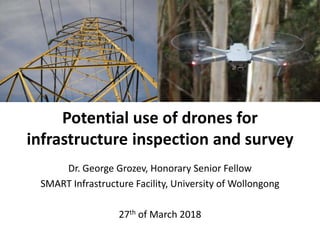
  • 1. Potential use of drones for infrastructure inspection and survey Dr. George Grozev, Honorary Senior Fellow SMART Infrastructure Facility, University of Wollongong 27th of March 2018
  • 2. Outline •Acknowledgments •Introduction •Drone technology •Risks when using drones •Rules when flying drones •Examples of drone applications for infrastructure inspection •Conclusion and questions
  • 3. •Pleased to visit SMART Infrastructure Facility and UoW •Thanks to Prof. Pascal Perez for his support and for inviting me to present this seminar • Ms Kate Kofod, Ms Lynda Hezemans, Ms Leanne Harmison and Tim Davis for their admin and IT help in relation to my seminar •Thanks to Mr. Donald Armstrong and Mr. Matt Lawson from V/Line Pty Ltd for their discussions related to potential drone application in railway transport •Thank you to all of you for attending Acknowledgments
  • 4. Some photos - DJI Mavic Pro
  • 5. More photos - DJI Mavic Pro
  • 6. The remote control of DJI Mavic Pro
  • 7. The remote control connected to smart devices
  • 8. Components and subsystems PropellersMotorsBattery Start button Autopilot Power management Camera Gimbal Micro SD cardForward vision sensors LEDindicator Radio receiver GPS/GLONASS Electronic speed controller LED indicator Elbanhawi M et al (2017). Enabling technologies for autonomous MAV operations. Progress in Aerospace sciences, 91: 27-52 Wi-Fi Downward vision sensors
  • 9. Smart phone and iPad-based applications
  • 13. Yawing about the vertical axis
  • 14. Quad-rotor propeller configuration T1 ω1 F1 T2 ω2 F2 T4 ω4 F4 T3 ω3 F3 Fi – Thrust Force of propeller i Ti – Reactive Moment of propeller i ωi – angular velocity of propeller i G – Vehicle weight G Adapted from: Amezquita-Brooks L. et al. (2017). Towards a standard design model for quad-rotors: A review of current models, their accuracy and a novel simplified model. Progress in Aerospace sciences, 95: 1-23. Fi = 0.5 ρSCT(kVi)2 S – disk area of the propeller CT – thrust coefficient of the propeller ρ – air density kVi – angular speed of the propeller motor with voltage Vi
  • 15. Propeller control and UAV movements ω2 ω4 ω1 ω3 ω2 ω4 ω1 ω3 ω2 ω4 ω1 ω3 ω2 ω4 ω1 ω3 Thrust movement ω1 = ω2 = ω3 = ω4 Roll movement ω4 > ω2 ω1 = ω3 Pitch movement ω1 > ω3 ω2 = ω4 Yaw movement {ω2 = ω4} > {ω1 = ω3} Based on: Amezquita-Brooks L. et al. (2017). Towards a standard design model for quad-rotors: A review of current models, their accuracy and a novel simplified model. Progress in Aerospace sciences, 95: 1-23. See also: Máthé K. and Busoniu L. (2015). Vision and control for UAVs: A survey of general methods and of inexpensive platforms for infrastructure inspection. Sensors, 15:14887-14916. doi:10.3390/s150714887 Forward direction
  • 16. One drone classification Drones UAV μUAV MAV NAV SD Fixed wing Flapping Wing VTOL Tilt rotor Ducted fan Helicopter Orni copter Unconven tional Bio MAV Rotary wing Mono copter Twin copter Tricopter Quad rotor Penta copter Octo copter Deca copter Dodeca copter Hexa copter Based on: Hassanalian M and Abdelkefi A (2017). Classifications, applications, and design challenges of drones: A review. Progress in Aerospace Sciences, 91 (2017) 99-131. doi:10.1016/j.paerosci.2017.04.003 PAV
  • 17. A brief comparison of some popular recreational drones Drone Name Top Speed Max Flying Time Max Flight Distance Video Resolution DJI Phantom 4 Pro 72 km/h (S-mode) 30 min 10 km 4K Ultra HD, 60p DJI Phantom 4 72 km/h (S-mode) 28 min 10 km 4K Ultra HD, 30p DJI Mavic Pro 65 km/h (S-mode) 27 min 13 km 4K Ultra HD, 30p DJI Mavic Air 68.4 km/h (S-mode) 21 min 10 km 4K Ultra HD, 30p DJI Spark 50 km/h 16 min 5.5 km FHD: 1920×1080 30p
  • 18. Drone Name Mechanical Gimbal Camera Battery Capacity Supported SD Remote Controller Weight DJI Phantom 4 Pro 3-axis (pitch, roll, yaw) 20 MP 5870 mAh microSD (up to 128G) Yes 1388 g DJI Phantom 4 3-axis (pitch, roll, yaw) 12 MP 5350 mAh microSD (up to 64G) Yes 1380 g DJI Mavic Pro 3-axis (pitch, roll, yaw) 12 MP 3830 mAh microSD (up to 64G) Yes 734 g DJI Mavic Air 3-axis (tilt, roll, pan) 12 MP 2375 mAh microSD (up to 128G) Yes 430 g DJI Spark 2-axis (pitch, roll) 12 MP 1480 mAh microSD (up to 64G) Yes 300 g Weblink https://www.dji.com/phantom-4-pro/info https://www.dji.com/phantom-4/info https://www.dji.com/mavic/info https://www.dji.com/mavic-air/info https://www.dji.com/spark/info A brief comparison of some popular recreational drones – cont.
  • 19. A brief comparison of some popular commercial drones Drone Name Type Dimensions (unfolded) Battery Capacity Number of batteries Hovering time Weight Matrice 600 Pro Hexacopter 1668mm × 1518mm × 727mm4500 mAh (TB47S); 5700 mAh (TB48S) 6 No payload: 32 min; 6 kg payload: 16 min 9.5 kg (with six TB47S batteries) Matrice 200 Quad rotor 887×880×378 mm 4280 mAh (TB50) 2 3.80 kg (TB50) Matrice 100 Quad rotor Diagonal Wheelbase: 650 mm 4500 mAh (TB47D) 1 or 2 TB48D battery: No payload: 28 min; 500g payload: 20 min; 1kg payload: 16 min 2.431 kg (TB48D) Drone Name Max Flying Time Top Speed Max Service Ceiling Above Sea Level Max Takeoff Weight Max Payload Operating temperature Weblink Matrice 600 Pro 65 km/h 2500 m with 2170R propellers; 4500 m with 2195 propellers 15.5 kg 6 kg -10° C to 40° C https://www.dji.com /matrice600- pro/info#specs Matrice 200 38 min, no payload, TB55; 24 min with full payload, TB55 82.8 km/h (S-mode) 3000 m 6.14 kg 2.34 kg (TB50) -20° C to 45° C https://www.dji.com /matrice-200- series/info#specs Matrice 100 79.2 km (ATTI mode, no payload) 3.6 kg 1.245 kg (TB47D) -10° C to 40° C https://www.dji.com /matrice100/info#spe cs
  • 20. Risk models of UAVs There are two main hazards identified when using drones: • A collision or near collision between a UAV and another aircraft (in the air or on the ground) • The impact of the UAV or its components with people or structures on the ground (Ground Risk Model)
  • 21. Ground risk model • Failure model • Impact location model • Recovery model • Stress model • Exposure model • Incident stress model • Harm model Washington A et al. (2017). A review of unmanned aircraft system ground risk models. Progress in aerospace sciences, 95: 24-44. https://doi.org/10.1016/j.paerosci.2017.10.001
  • 22. Rules when flying drones for recreational purposes • You must not fly the drone higher than 120 metres above the ground • You must not fly your drone over or near an area affecting public safety or where emergency operations are underway. Examples include situations such as a car crash, police operations, a fire and fire fighting, search and rescue operations • You must not fly your drone within 30 metres of people, unless the other person is part of controlling or navigating the drone • You must fly only one drone at a time • You must not fly over or above people. This could include festivals, sporting ovals, populated beaches, parks, busy roads, etc. • You must not operate your drone in a way that creates a hazard to another aircraft, person, or property • You must not operate your drone in prohibited or restricted areas. Source: CASA https://www.casa.gov.au/modelaircraft
  • 23. Rules when flying drones for recreational purposes - continued • If your drone weighs more than 100 grams: – You must keep your drone at least 3 nautical miles (5.5 km) away from controlled aerodromes (usually those with a control tower) – You may fly within 3 nautical miles (5.5 km) of a non-controlled aerodrome or helicopter landing site (HLS) only if manned aircraft are not operating to or from the aerodrome. If you become aware of manned aircraft operating to or from the aerodrome/ HLS, you must manoeuvre away from the aircraft and land as soon as safely possible. – You must only fly during the day and keep the drone within visual line-of sight. This means being able to orientate, navigate and see the aircraft with your own eyes at all times (rather than through a device, for example, through goggles or on a video screen). Source: CASA 96/17: Direction — operation of certain unmanned aircraft (https://www.legislation.gov.au/Details/F2017L01370)
  • 24. Licensing for commercial use • Study Civil Aviation Safety Authority’s (CASA) web site - www.casa.gov.au/drones • Get an Aviation Reference Number from CASA • Excluded “<= 2 kg” category for commercial use • Remote Pilot License (RePL) - requires one week training and examination from a certified training organisation • Aeronautical Radio Operator Certificate • Remotely Piloted Aircraft Operator Certificate (ReOC) – for a sole trader or company
  • 25. Battery rules and battery safety • LIPO – Lithium Polymer Batteries are the preferred batteries for most light drones • Regular battery checks for charge level, swelling, leakage and overall conditions • Checking battery life • Use only approved chargers • Never charge the batteries unattended • Do not puncture a battery cell • If you crash your drone and have access to it, carefully remove the battery from the drone, if possible. Wait and watch the battery for at least 20 min as a damaged battery could catch fire even when it may look fine initially. • Charge the batteries in open and ventilated area on a safe surface. • Special rules for batteries in your carry on luggage
  • 26. Research challenges/questions • Risk analysis and risk reduction in drone applications • Image processing and image analytics • Full autonomy and preprogramming the flying path • Swarm of drones – multi-agent cooperation • Many others
  • 27. Advantages provided by drone applications • High resolution images and video (new digital capabilities) • Cheap inspection and access to hard-to-reach infrastructure elements (cost and access) • Safer and quicker than dangerous inspections by humans (safety and efficiency) • No need to disconnect operations (availability and reliability) • Improve and new business processes based on regular and precise inspection (new opportunities)
  • 28. Challenges in drone applications • Difficult to remotely/manually operate in complex and dynamic environments • Difficult to operate in all weather conditions • Autonomy restrictions and difficulties in flight path planning/mission planning • Payload and flight duration restrictions • Communication limitations (range, speed, bandwidth, interference, etc.) • Risks from potential collision in the air or impact on the ground • Operations Beyond the Visual Line of Sight (BVLOS) Elbanhawi M et al (2017). Enabling technologies for autonomous MAV operations. Progress in Aerospace Sciences, 91: 27-52. https://doi.org/10.1016/j.paerosci.2017.03.002
  • 29. Applications PWC (Sep, 2017). Clarity from above: leveraging drone technologies to secure utilities systems • Market of drone power solutions in the utility sector ~USD 9.46 billion • Pre-construction and investment monitoring • Asset inventory and maintenance management (asset dispersion, safety) • Vegetation management • Enhancing water quality monitoring https://www.pwc.com.au/pdf/clarity-from-above-leveraging-drone-technologies-to-secure-utilities-systems-pwc.pdf https://www.pwc.pl/en/drone-powered-solutions.html
  • 30. Asset inspection – Example 1 • Melbourne water – spillway, treatment plant carrier https://utilitymagazine.com.au/aerial-drones-the-future-of-asset-inspection/ • Assessment of Spillway structure for – Cracking – Chipping – Shifting – Surface degradation – Weed encroachment
  • 31. Asset inspection – energy utilities Electricity and gas utilities examples: http://ulcrobotics.com/services/unmanned-aerial-utility-inspection-services/ Key benefits: • Improve safety of the workers • Reduced inspection and patrol cost • Improve system reliability • More efficient use of resources • Access advanced asset data Some application areas: • Identify problematic components • Thermal imaging for hot spots and poor connections • To guide a rapid response after disasters and outages • Inspection of hard-to-access areas of electricity networks • Helping to inform vegetation management • Mapping and survey for construction projects Australian utilities had total revenue ~$70 billion in 2016; ~$50 billion – from the electricity sector
  • 32. Asset inspection • Offshore oil and gas inspection http://www.asctec.de/en/cyberhawks-offshore-roav-oil-gas-inspection-video/ • Building inspection (building façades, roofs, other surfaces, cracks and damages after earth quakes, etc.) • Counting penguins with a drone in Antarctica https://www.theage.com.au/world/oceania/licence-to-krill-penguin-hot-spot-found-near- antarctica-20180306-p4z30y.html • Hazard identification in disasters Leizer GKK and Tokody D (2017). Radiofrequency identification by using drones in railway accidents and disaster situations. Interdisciplinary Description of Complex Systems 15(2): 114-132. Máthé K. and Busoniu L. (2015). Vision and control for UAVs: A survey of general methods and of inexpensive platforms for infrastructure inspection. Sensors, 15:14887-14916. doi:10.3390/s150714887
  • 33. Summary and conclusion • Drone technology is developing very fast, creating a range of new application opportunities • Many challenges related to the technology capabilities, risks, regulation (or lack of) and human control • Emerging commercial applications for inspection and survey of infrastructure systems, power and utilities: – Cost-effective solutions – Replacing dangerous work by humans – Increasing availability of infrastructure systems – High quality images and video, including life streaming and monitoring – Variety of cameras, different purpose payload and sensors can be used
  • 34. Thank you George Grozev ggrozev@uow.edu.au SMART Infrastructure Facility University of Wollongong