PhD defence - Steven Vanonckelen
•
2 recomendaciones•543 vistas

Atmospheric and topographic corrections improve Landsat satellite imagery for analysis of forest cover dynamics in mountainous areas. Corrections increase pixel homogeneity and reduce dependency of reflectance values on terrain illumination. Image preprocessing, including topographic correction and compositing, leads to more accurate land cover classification and change mapping over large areas. Factors controlling forest cover dynamics in the Romanian Carpathians from 1985-2010 include accessibility, demographic changes, land use policies, slope, elevation, and soil type.

Recomendados
Más contenido relacionado
La actualidad más candente
La actualidad más candente (17)
Similar a PhD defence - Steven Vanonckelen
Similar a PhD defence - Steven Vanonckelen (20)
Último
Último (20)
PhD defence - Steven Vanonckelen
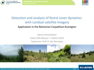
- 1. Detection and analysis of forest cover dynamics with Landsat satellite imagery Application in the Romanian Carpathian Ecoregion Steven Vanonckelen Public PhD defense – 5 March 2014 Supervisor: Prof. A. Van Rompaey ARENBERG DOCTORAL SCHOOL Faculty of Science Detection and analysis of forest cover dynamics with Landsat satellite imagery 1/38
- 2. • Large dynamics Introduction Conclusions4 Research Questions Forests • Large dynamics • Worldwide: deforestation and afforestation • Provision of ecosystem services Detection and analysis of forest cover dynamics with Landsat satellite imagery 2/38
- 3. Need for reliable data: – Definition of forest – Up and downward trends – Patchy structures – Validation data – Remote areas Introduction Conclusions4 Research Questions Forests Need for reliable data: – Definition of forest – Up and downward trends – Patchy structures – Validation data – Remote areas Remote sensing data: + Recurrence time, costs, accessibility, … - Distortions, calibration, mosaicking, … (USGS, 2013) Detection and analysis of forest cover dynamics with Landsat satellite imagery 3/38
- 4. Forest cover dynamics Introduction Conclusions4 Research Questions Detection and analysis of forest cover dynamics with Landsat satellite imagery 4/38 Vergelijking bosbestand in centraal Europa: 900 AD en. 1900 AD (Schlüter, 1952) Jaarlijkse snelheid van verandering in landgebruik in de Karpatan tussen 1760 -2010 (Munteanu et al., 2014)
- 5. . Conceptual forest transition curve. Introduction Conclusions4 Research Questions Forest transition “the process in which the forested area in a given region or country changes from decreasing to expanding” (Mather and Needle, 1998) Detection and analysis of forest cover dynamics with Landsat satellite imagery 5/38
- 6. Estimated deforestation, by type of forest and time period. (Williams, 2002; FAO, 2010). Forest transition (FAO, 2010) Introduction Conclusions4 Research Questions Detection and analysis of forest cover dynamics with Landsat satellite imagery 6/38
- 7. Forest transition Recent forest transitions (Meyfroidt and Lambin, 2011). Introduction Conclusions4 Research Questions Detection and analysis of forest cover dynamics with Landsat satellite imagery 7/38
- 8. Scientific challenges? Reliable forest assessments • standardized procedures at regional scale, • link with ecosystem services, • allow policies and financial compensations. Detection of forest cover dynamics • fluctuating forest cover trends and patchy landscapes, • in remote and inaccessible areas, • inclusion of translocation processes. Use of satellite data (remote sensing tools) • different remote sensors, • improvement of mapping procedures, • allows mapping of large areas, • trade-off: complexity automation. (FAO, 2010) (FAO, 2010) Introduction Conclusions4 Research Questions Detection and analysis of forest cover dynamics with Landsat satellite imagery 8/38
- 9. 4 Research questions 1. Do atmospheric and topographic corrections improve Landsat satellite imagery in mountain areas? 2. Does image preprocessing (corrections) lead to more accurate land cover classification? Introduction 4 Research Questions Conclusions (Riaño et al., 2003) (ASTRIUM, 2013) Detection and analysis of forest cover dynamics with Landsat satellite imagery 9/38
- 10. 4 Research questions 3. Does topographic correction and pixel-based image compositing improve large area change mapping? 4. What are the controlling factors of forest cover dynamics in the Romanian Carpathians? Introduction 4 Research Questions Conclusions Detection and analysis of forest cover dynamics with Landsat satellite imagery 10/38
- 11. 1. Do atmospheric and topographic corrections improve Landsat satellite imagery in mountain areas? Problems with satellite imagery: • Sensor calibration, • Orbital drift, • Atmospheric and topographic distortions correction decomposition and evaluation Atmospheric correction: Introduction Research Question 1 Conclusions Process of solar (ir)radiance entering a sensor: (a) path radiance, (b) solar direct irradiance, (c) sky diffuse irradiance, and (d) adjacent terrain reflected irradiance. Detection and analysis of forest cover dynamics with Landsat satellite imagery 11/38 Selection of 2 atmospheric correction (AC) methods (Vanonckelen et al., 2013). complex
- 12. Introduction Research Question 1 Conclusions Topographic correction: 15 combined corrections Detection and analysis of forest cover dynamics with Landsat satellite imagery 12/38 1. Do atmospheric and topographic corrections improve Landsat satellite imagery in mountain areas? Selection of 4 topographic correction (TC) methods (Vanonckelen et al., 2013). complex AC/TC No TC Band Ratio Cosine PBM PBC No AC DOS TF
- 13. Study area One Landsat footprint in the Romanian Carpathians (185 x 185 km, 2009). (a) Mixed and broadleaved forests, (b) coniferous forests, (c) small vegetation, and (d) grasses above the tree line. Introduction Research Question 1 Conclusions Detection and analysis of forest cover dynamics with Landsat satellite imagery 13/38 1. Do atmospheric and topographic corrections improve Landsat satellite imagery in mountain areas? Elevation range (SRTM, 2010).
- 14. Methodology Overview of the methodology (Vanonckelen et al., accepted). Introduction Research Question 1 Conclusions Detection and analysis of forest cover dynamics with Landsat satellite imagery 14/38 1. Do atmospheric and topographic corrections improve Landsat satellite imagery in mountain areas?
- 15. Evaluation methods a. Differences in reflectance values between shaded and illuminated slope groups, b. Coefficient of variation, c. Correlation between reflectance and cos β. Average reflectance (%) calculated in the forest class as a function of spectral band (Vanonckelen et al., accepted). Introduction Research Question 1 Conclusions Detection and analysis of forest cover dynamics with Landsat satellite imagery 15/38 1. Do atmospheric and topographic corrections improve Landsat satellite imagery in mountain areas? True color composite images (RGB: band 3, 2 and 1) of the study area (Vanonckelen et al., accepted). (a) no ACorTC (b) TFwith cosine (c) TF withPBC
- 16. Evaluation methods a. Differences in reflectance values between shaded and illuminated slope groups, b. Coefficient of variation of reflectance values, c. Correlation between reflectance values and cos β. Yes! Introduction Research Question 1 Conclusions (a) no AC or TC (b) DOS without TC (c) DOS with band ratio (d) TF with cosine (e) TF with PBM (f) TF with PBC True color composite images (RGB: band 3, 2 and 1) of the study area (Vanonckelen et al., accepted). Detection and analysis of forest cover dynamics with Landsat satellite imagery 16/38 1. Do atmospheric and topographic corrections improve Landsat satellite imagery in mountain areas?
- 17. 2. Does image preprocessing lead to more accurate land cover classification? Methodology 2009 and 2010 Overview of the methodology (Vanonckelen et al., 2013). Introduction Research Question 2 Conclusions Detection and analysis of forest cover dynamics with Landsat satellite imagery 17/38
- 18. 2. Does image preprocessing lead to more accurate land cover classification? Evaluation methods a. Separability of reflectance values, b. Overall accuracy, c. Class accuracy, d. Accuracy in 3 illumination conditions. Introduction Research Question 2 Conclusions TF-PBMreflectance(%) Wavelength (µm) 0 5 10 15 20 25 30 35 40 0.49 0.56 0.66 0.82 1.65 2.25 0 5 10 15 20 25 30 35 40 0.49 0.56 0.66 0.82 1.65 2.25 Uncorr.reflectance(%) (a) (b) Wavelength (µm) Detection and analysis of forest cover dynamics with Landsat satellite imagery 18/38 Average reflectance values per wavelength and land cover type : uncorrected and corrected ( Vanonckelen et al., 2013).
- 19. 2. Does image preprocessing lead to more accurate land cover classification? Evaluation methods a. Separability of reflectances, b. Overall accuracy (average kappa), c. Class accuracy, d. Accuracy in 3 illumination conditions. Introduction Research Question 2 Conclusions 0.2 0.3 0.4 0.5 0.6 0.7 0.8 0.9 1 NoTC Bandratio Cosine PBC PBM NoTC Bandratio Cosine PBC PBM NoTC Bandratio Cosine PBC PBM NoAC DOS TF Averagekappa Detection and analysis of forest cover dynamics with Landsat satellite imagery 19/38 Average kappa coefficients of the 2009 and 2010 images (Vanonckelen et al., 2013).
- 20. 2. Does image preprocessing lead to more accurate land cover classification? Evaluation methods a. Separability of reflectance values, b. Overall accuracy, c. Class accuracy (δkappa values), d. Accuracy in 3 illumination conditions. OVERALL Average 2009-2010 δkappa per class between uncorrected and corrected images (Vanonckelen et al., 2013). Introduction Research Question 2 Conclusions Detection and analysis of forest cover dynamics with Landsat satellite imagery 20/38
- 21. 2. Does image preprocessing lead to more accurate land cover classification? Evaluation methods a. Separability of reflectance values, b. Overall accuracy, c. Class accuracy, d. Accuracy in 3 illumination conditions (average kappa). 0.2 0.3 0.4 0.5 0.6 0.7 0.8 0.9 NoTC Bandratio Cosine PBC PBM NoTC Bandratio Cosine PBC PBM NoTC Bandratio Cosine PBC PBM NoAC DOS TF AverageKappa Introduction Research Question 2 Conclusions Detection and analysis of forest cover dynamics with Landsat satellite imagery 21/38 Average kappa coefficients of the 2009 and 2010 images for three different illumination characteristics (Vanonckelen et al., 2013).
- 22. 2. Does image preprocessing lead to more accurate land cover classification? Evaluation methods a. Separability of reflectance values, b. Overall accuracy, c. Class accuracy, d. Accuracy in 3 illumination conditions. Yes! Introduction Research Question 2 Conclusions Detection and analysis of forest cover dynamics with Landsat satellite imagery 22/38 True color composite (RGB: band 3, 2 and 1) and ML classification of 2009 (Vanonckelen et al., 2013). (c) TF withPBC (a) no ACorTC (b) TFwith cosine
- 23. 3. Does topographic correction and pixel-based image compositing improve large area change mapping? Study area: Romanian Carpathian Ecoregion Introduction Research Question 3 Conclusions Detection and analysis of forest cover dynamics with Landsat satellite imagery 23/38 Elevation range (Vanonckelen et al., submitted)
- 24. Pixel-based compositing: - Selection of the most suitable pixels from available imagery, - For three years: 1985, 1995 and 2010, Topographic correction: PBM, Two classification methods: ML and SVM. (Vanonckelen et al., submitted) 3. Does topographic correction and pixel-based image compositing improve large area change mapping? Introduction Research Question 3 Conclusions Detection and analysis of forest cover dynamics with Landsat satellite imagery 24/38 (Vanonckelen et al., submitted)
- 25. 3. Does topographic correction and pixel-based image compositing improve large area change mapping? Methodology Introduction Research Question 3 Conclusions Detection and analysis of forest cover dynamics with Landsat satellite imagery 25/38 Overview of the methodology.
- 26. a. Overall accuracy for different scenarios: - uncorrected and corrected, - 2 classifiers: ML and SVM, - number of classes: 8 or 4. Yes! b. Land cover maps, c. Land cover change maps. 3. Does topographic correction and pixel-based image compositing improve large area change mapping? Introduction Research Question 3 Conclusions Detection and analysis of forest cover dynamics with Landsat satellite imagery 26/38 Overall accuracies between uncorrected (uncorr.) and corrected (corr.) data.
- 27. 1985 3. Does topographic correction and pixel-based image compositing improve large area change mapping? Introduction Research Question 3 Conclusions Detection and analysis of forest cover dynamics with Landsat satellite imagery 27/38 20101995b.
- 28. 1985-1995 1995-2010 3. Does topographic correction and pixel-based image compositing improve large area change mapping? Introduction Research Question 3 Conclusions (foto: Deliever, 2011) Detection and analysis of forest cover dynamics with Landsat satellite imagery 28/38 c.
- 29. 1995-2010 3. Does topographic correction and pixel-based image compositing improve large area change mapping? Introduction Research Question 3 Conclusions 2000-2010 (Hansen et al., 2013) vs. Detection and analysis of forest cover dynamics with Landsat satellite imagery 29/38 c.
- 30. a. Accessibility, distance to • primary roads, • secondary roads, • nearby settlement. b. Demography • demographic evolution. c. Land use policy • protection level (SCI or SPA). d. Biophysical environment • slope gradient, • elevation, • soil type (7 types). 4. What are the controlling factors of forest cover dynamics in the Romanian Carpathians? Introduction Research Question 4 Conclusions (foto’s: Deliever, 2011)Afforestation (AFFOR) Detection and analysis of forest cover dynamics with Landsat satellite imagery 30/38 Deforestation (DEFOR) 1985-1995 1995-2010
- 31. a. Accessibility, distance to • primary roads + corr. for AFFOR, - corr. for DEFOR • secondary roads - corr. for AFFOR and DEFOR • nearby settlement + corr. for AFFOR, - corr. for DEFOR b. Demography • demographic evolution. c. Land use policy • protection level (SCI or SCA). d. Biophysical environment • slope gradient, • elevation, • soil type (7 types). 4. What are the controlling factors of forest cover dynamics in the Romanian Carpathians? Introduction Research Question 4 Conclusions Primary and secondary roads (European Commission, 2013b). Detection and analysis of forest cover dynamics with Landsat satellite imagery 31/38
- 32. a. Accessibility, distance to • primary roads, • secondary roads, • nearby settlement. b. Demography • demographic evolution + corr. for AFFOR and DEFOR (2nd per.) c. Land use policy • protection level (SCI or SPA). d. Biophysical environment • slope gradient, • elevation, • soil type (7 types). 4. What are the controlling factors of forest cover dynamics in the Romanian Carpathians? Introduction Research Question 4 Conclusions (foto’s: Deliever, 2011) Detection and analysis of forest cover dynamics with Landsat satellite imagery 32/38 Change in inhabitants per km2 between 1986-2000 (NIS, 2013).
- 33. a. Accessibility, distance to • primary roads, • secondary roads, • nearby settlement. b. Demography • demographic evolution. c. Land use policy • protection level (SCI or SPA) + corr. for DEFOR (2nd per.) d. Biophysical environment • slope gradient, • elevation, • soil type (7 types). 4. What are the controlling factors of forest cover dynamics in the Romanian Carpathians? Introduction Research Question 4 Conclusions Protected area s (European Commission, 2013b). Detection and analysis of forest cover dynamics with Landsat satellite imagery 33/38
- 34. a. Accessibility, distance to • primary roads, • secondary roads, • nearby settlement. b. Demography • demographic evolution. c. Land use policy • protection level (SCI or SPA). d. Biophysical environment • slope gradient + corr. for AFFOR and DEFOR • elevation + corr. for AFFOR and DEFOR • soil type (7 types) Podzols + corr. for DEFOR 4. What are the controlling factors of forest cover dynamics in the Romanian Carpathians? Introduction Research Question 4 Conclusions Detection and analysis of forest cover dynamics with Landsat satellite imagery 34/38 Elevation range (SRTM, 2010). Main soil types (FAO/UNESCO, 1998).
- 35. Conclusions 1. Do atmospheric and topographic corrections improve Landsat satellite imagery in mountain areas? Yes, homogeneity of pixels increased and dependency of reflectance values on terrain illumination was reduced after correction. 2. Does image preprocessing lead to more accurate land cover classification? Yes, corrected images resulted in higher overall classification accuracies than uncorrected images, especially on weakly illuminated slopes. Introduction Conclusions4 Research Questions Detection and analysis of forest cover dynamics with Landsat satellite imagery 35/38
- 36. Conclusions 3. Does topographic correction and pixel-based image compositing improve large area change mapping? Yes, highest classification accuracies for corrected scenario with 4 classes and observation of a steady greening between 1985 and 2010. 4. What are the controlling factors of forest cover dynamics in the Romanian Carpathians? Mainly positively related to the biophysical environment (elevation and slope gradient) for both periods. Introduction Conclusions4 Research Questions Detection and analysis of forest cover dynamics with Landsat satellite imagery 36/38
- 37. Further research • Improvement of forest maps and monitoring of ecosystem services, • Basis for policy instruments and conservation measures, • Comparative analyses of corrections, • Evaluation of trade-offs between correction complexity and automation, • Topographic correction before pixel-based compositing, • Addition of extra parameters in the pixel-based compositing technique. Introduction Conclusions4 Research Questions Detection and analysis of forest cover dynamics with Landsat satellite imagery 37/38
- 38. ARENBERG DOCTORAL SCHOOL Faculty of Science Thanks for your attention!