SlideShare una empresa de Scribd logo
1 de 28
GLOBAL POSITIONING SYSTEM
(G.P.S)
TANMAY SHARMA
VGEC (GTU), Ahmedabad
Conventional Navigation Systems
Landmarks: Works in local area , subjected to
Environmental factors.
Celestial : Works at night and in good
Weather
Global Positioning System
World Wide Navigation:
Accurate Positioning:
Satellite based System
Visible from whole earth
Atomic Clocks and
Microprocessors are used
Need for GPS
GPS-Introduction
Global Positioning System (GPS) is satellite
navigation system which is based on a constellation of
24 satellites orbiting the earth at a very high altitude, that
can be used to continuously measures the position of
the object on the earth’s surface.
GPS was developed by the Department of Defense,
United Sates Of America to simplify accurate navigation.
US government is investing over $12 billion to build the
system which really works.
Other Satellite Based Navigation System
 Global Navigation Satellite System GLONASS
Developed by Russia during Cold War initially for Defense.
24 Satellite Constellation placed at 120
.
apart distributed in
3 planes each having 8 Satellites
Accuracy is not effective as GPS
 GALILEO
Developed by European Space Agency ESA, Only for
Civilians
Funded by INDIA nearly 35Crore USD
• GAGAN
The Earth Coordinate System : Latitude
Latitude parallel to equator
It gives position from North to South of
equator.
Range is from 0 deg to 90 deg.
Latitude
At Equator 1 deg = 110.88 Kms
1 Min = 1848 mts. = 1.848 Kms.
1 Sec = 30.8 mts
The Earth Coordinate System : Longitude
Longitude runs parallel to Prime Meridian
Gives us our position from East to West of
Prime meridian
Range is form 0 deg. To 180 deg.
Longitude
At Equator 1 deg. = 112.09 km
At Pole 1 deg. = 0 km
1 Min = 1868.16 mts = 1.87 Kms.
1 Sec = 31.13 mts
The Earth Coordinate System
•Horizontal lines are lines of
equal latitude (parallels)
•Vertical lines are lines of equal
longitude (meridians)
•Both together form the
Graticule network.
LONGITUDE and LATITUDE values are angles measured from the earth’s center
to the required point on the earth’s surface.
A point anywhere within the earth surface is addressed by its LONGITUDE and
LATITUDE value.
Satellites Available For GPS Service
Satellite Signaling and Orbital Details
• Global Coverage : Minimum 4 Satellites in view from
any place on Earth
• Operational in All Weather Conditions
• Distributed in 6 Orbital Plane each have 4 satellites
• 12 Hours Circular Orbit
• 20,200Kms Height Inclined at 55deg.
• Operates on L band Frequency.
• Messaging is Pseudo Random Code (PRC)
The 24 satellites that
make up the GPS space segment
are orbiting the earth about
20,200 km above us. They are
constantly moving, making two
complete orbits in less than 24
hours. These satellites are
travelling at speeds of roughly
7,000 miles an hour.
GPS satellites are
powered by solar energy. They
have backup batteries onboard to
keep them running in the event of
a solar eclipse, when there's no
solar power. Small rocket
boosters on each satellite keep
them flying in the correct path
GPS
satellites
A GPS signal contains three different bits of information —
(i) Pseudo random code, (ii) Ephemeris data (iii) Almanac data.
Pseudorandom code is simply an I.D. code that identifies which
satellite is transmitting information. You can view this number on
your GPS unit's satellite page, as it identifies which satellites it's
receiving.
Ephemeris data, which is constantly transmitted by each
satellite, contains important information about the status of the
satellite (healthy or unhealthy), current date and time. This part of
the signal is essential for determining a position.
Almanac data tells the GPS receiver where each GPS satellite
should be at any time throughout the day. Each satellite transmits
almanac data showing the orbital information for that satellite and
for every other satellite in the system.
Pseudo Random Code and Frequency
Band Information
L band (Carrier frequency) is spitted in 2 portion L1 and L2.
L1 works at 1575.42 MHz. And L2 works at 1227.60 MHz.
L1 contains PRC and Status Messaging
L1 is used for Civilian Purpose, called Coarse Acquitisation
(C/A Code)
L2 contains PRC
Used for Military Purpose which can be Encrypted by DoD
Whole of L2 information is called Precise Code (P Code)
How GPS works ?
This can be summarized by five individual processes:
1. Triangulation from Satellites is the basis of the system
2. To triangulate, GPS measures distance using the travel
time of a radio signal.
3. To measure travel time, GPS needs very accurate clocks.
4. Once you know distance to a satellite, you then need to
know where the satellite is in space.
5. Finally you must correct for any delays the signal
experiences as it travels through the atmosphere.
To make life easier
• In a 2D Co-ordinate system we require 2 point to locate our self
•We are 5 unit far from point ‘a’ and 10 unit far from point ‘b’
• Circles from point ‘a’ of radius 5 unit and of 10 unit from ‘b’
would intersect at point P which is desire location.
Let’s Explore now GPS
Positioning
• a
• b
5
10
P
R- plane
GPS Measurements
GPS is based on satellite
ranging, measuring distance from
Satellite
Two measurements puts us
somewhere on this circles
Three measurements puts us at one
of two points
Out of which only one is true another is far from
Earth
GPS Measurements
Accurate timing is key to measuring distance to satellites.
Satellites are accurate because they have atomic clocks on
board.
Mathematically, we need four measurements to determine
exact position because we are in 3D environment where we
require latitude(x), longitude(y),and height(z)
The GPS system works by timing how long it takes a radio
signal to reach us from a satellite and then calculating the
distance from that, it means :
Distance = (Speed of light) * (Time)
How do we know when the signal left the
satellite ?
We assume that both the satellite and our receiver are
generating the same pseudo random code at exactly
the same time
We know how long it took for the satellite’s signal
to get to us by comparing how late its pseudo
random code is, compared to our code
Knowing where a satellite is in space
To calculate our position we need precise
distance, for precise distance we need to
know where our satellites are in space
GPS satellites are so high up, their orbits are
very predictable.
Minor variations in orbits measured constantly
by the Department Of Defense and that data is
transmitted from the satellites themselves
GPS Receivers
GPS receiver comprises of an Antenna, a
Decoder and a Display unit.
Antenna - receives the electromagnetic
signals.
Decoder – decodes the information from
demodulated signal
Display – displays the filtered information
of position of the object
Sources of Errors
•Ionosphere and troposphere delays — The satellite signal slows as it
passes through the atmosphere.
•Signal multipath — This occurs when the GPS signal is reflected off objects
such as tall buildings etc. before it reaches the receiver.
•Receiver clock errors — A receiver's built-in clock is not as accurate as the
atomic clocks onboard the GPS satellites.
•Orbital errors — Also known as ephemeris errors, these are inaccuracies of
the satellite's reported location.
•Number of satellites visible — The more satellites a GPS receiver can "see,"
the better the accuracy.
•Satellite geometry/shading — This refers to the relative position of the
satellites at any given time. Ideal satellite geometry exists when the satellites
are located at wide angles relative to each other.
•Intentional degradation of the satellite signal — Selective Availability (SA)
is an intentional degradation of the signal once imposed by the U.S. Turn off SA
in May 2000, significantly improved the accuracy of civilian GPS receivers.
Differential GPS
GPS provides an accurate position for some
applications with the error of more than 10 meters.
Applications demanding
better accuracy of 10
Centimeters e.g. Robot
Movement during a
Disaster,Zero Visibility
Landing etc. requires a
precise positioning
System So…..
Differential GPS
DGPS requires co-operation of GPS receivers, one is fixed and
remaining are roving around it. Fixed GPS Receiver is a key and
serves as a Solid Reference to all other roving Receivers
Key idea is : A Reference receiver will measure timing error and
provide a correction to all other roving stations. Reference Station
has a separate RF link to all other Rovers
Differential GPS
All the receivers simultaneously
receives Satellite signals but since a
small motion on Earth’s surface is
insignificant from Satellite's view so
both the ROVER and Reference Point
will receive same signal from Satellite.
Reference Station is a accurately
surveyed point and it attacks the GPS
signal reversely i.e. it uses it’s position to
determine the timing. It figures out, “ What
travel time should a signal take to reach it
self and compares it with the actual
acquired timing.
Wide Area Augmentation System (WASS)
The Wide Area Augmentation
System (WAAS) is an extremely
accurate navigation system
developed for civil aviation. The
system augments the GPS to
provide the additional accuracy,
integrity, and availability necessary
to enable users to rely on GPS
within the WAAS coverage area.
The worst-case accuracy is within 7.6 meters of the true position 95% of
the time. This is achieved via a network of ground stations which monitor
and measure the GPS signal. Measurements from the reference stations
are routed to two master stations which generate and send the correction
messages to gestationary satellites. Those satellites broadcast the
correction messages back to Earth, where WAAS-enabled GPS receivers
apply the corrections to their computed GPS position.
 GPS Receivers may range, both by the level of accuracy
and cost.
 A GPS Receiver may range by an accuracy of the order of
30 Meters to the order of 10 mm.
 By using the Latest technologies like Digital Signal
Processing, the accuracy, cost and size of the receiver
can be optimized at a reasonable level.
GPS Receivers
Applications & Future Aspects
Location based Services
• Vehicle Tracking System
• Transport Engineering
Disaster Monitoring System
• Earthquake Monitoring
Surveying
Resource Utilization
Thank You

Más contenido relacionado

La actualidad más candente

Global positioning system (GPS)
Global positioning system (GPS)Global positioning system (GPS)
Global positioning system (GPS)
Gautham Reddy
 
Global positioning system (gps)
Global positioning system (gps)Global positioning system (gps)
Global positioning system (gps)
Gokul Saud
 
Introduction to gps [compatibility mode]
Introduction to gps [compatibility mode]Introduction to gps [compatibility mode]
Introduction to gps [compatibility mode]
Sumanta Das
 
Global positioning system ppt
Global positioning system pptGlobal positioning system ppt
Global positioning system ppt
Swapnil Ramgirwar
 
Introduction to gps and gnss
Introduction to gps and gnssIntroduction to gps and gnss
Introduction to gps and gnss
Vivek Srivastava
 
Gps presentation
Gps presentationGps presentation
Gps presentation
pavimalpani
 

La actualidad más candente (20)

Global Positioning system GPS - Dr. S. Balamurugan
Global Positioning system GPS - Dr. S. BalamuruganGlobal Positioning system GPS - Dr. S. Balamurugan
Global Positioning system GPS - Dr. S. Balamurugan
 
Global positioning system (GPS)
Global positioning system (GPS)Global positioning system (GPS)
Global positioning system (GPS)
 
Global positioning system (gps)
Global positioning system (gps)Global positioning system (gps)
Global positioning system (gps)
 
Introduction to gps [compatibility mode]
Introduction to gps [compatibility mode]Introduction to gps [compatibility mode]
Introduction to gps [compatibility mode]
 
Global positioning system(GPS)
Global positioning system(GPS)Global positioning system(GPS)
Global positioning system(GPS)
 
Introduction to global position system
Introduction to global position systemIntroduction to global position system
Introduction to global position system
 
Global positioning system ppt
Global positioning system pptGlobal positioning system ppt
Global positioning system ppt
 
Introduction to GNSS (1)
Introduction to GNSS (1)Introduction to GNSS (1)
Introduction to GNSS (1)
 
Presentation on GPS (Global Positioning System)
Presentation on GPS (Global Positioning System)Presentation on GPS (Global Positioning System)
Presentation on GPS (Global Positioning System)
 
Global positioning System
Global positioning SystemGlobal positioning System
Global positioning System
 
Gnss data-processing
Gnss data-processingGnss data-processing
Gnss data-processing
 
gps technology
gps technologygps technology
gps technology
 
Global Positioning System
Global Positioning SystemGlobal Positioning System
Global Positioning System
 
Introduction to gps and gnss
Introduction to gps and gnssIntroduction to gps and gnss
Introduction to gps and gnss
 
Glonass
GlonassGlonass
Glonass
 
Global positioning system (gps)
Global positioning  system (gps)Global positioning  system (gps)
Global positioning system (gps)
 
Gps presentation
Gps presentationGps presentation
Gps presentation
 
GNSS - GPS Surveying
GNSS - GPS SurveyingGNSS - GPS Surveying
GNSS - GPS Surveying
 
How gps works
How gps worksHow gps works
How gps works
 
GNSS - Global Navigation Satellite System
GNSS - Global Navigation Satellite SystemGNSS - Global Navigation Satellite System
GNSS - Global Navigation Satellite System
 

Similar a GPS (Global Positioning System)

GPS[Global Positioning System]
GPS[Global Positioning System]GPS[Global Positioning System]
GPS[Global Positioning System]
Ishwar Bulbule
 
Global Positioning System
Global Positioning SystemGlobal Positioning System
Global Positioning System
Ishwar Bulbule
 

Similar a GPS (Global Positioning System) (20)

GPS.ppt
GPS.pptGPS.ppt
GPS.ppt
 
Global positioningsystem
Global positioningsystemGlobal positioningsystem
Global positioningsystem
 
GPS[Global Positioning System]
GPS[Global Positioning System]GPS[Global Positioning System]
GPS[Global Positioning System]
 
Global Positioning System
Global Positioning SystemGlobal Positioning System
Global Positioning System
 
Dgps
DgpsDgps
Dgps
 
Global positioning system
Global positioning systemGlobal positioning system
Global positioning system
 
Global Positioning System
Global Positioning SystemGlobal Positioning System
Global Positioning System
 
Ajal gps
Ajal gpsAjal gps
Ajal gps
 
Seminar Report For GPS Technology
Seminar Report For GPS TechnologySeminar Report For GPS Technology
Seminar Report For GPS Technology
 
Gps final main
Gps final mainGps final main
Gps final main
 
Gps Niladri
Gps NiladriGps Niladri
Gps Niladri
 
Abstract of gps
Abstract of gpsAbstract of gps
Abstract of gps
 
Electronic Navigations: GPS,GPS terms, GPS use and using Waypoints
Electronic Navigations: GPS,GPS terms, GPS use and using WaypointsElectronic Navigations: GPS,GPS terms, GPS use and using Waypoints
Electronic Navigations: GPS,GPS terms, GPS use and using Waypoints
 
GPS DOCUMENT
GPS DOCUMENTGPS DOCUMENT
GPS DOCUMENT
 
Gps
GpsGps
Gps
 
Gps
GpsGps
Gps
 
GPS
GPS GPS
GPS
 
Global positioning system (Gps)
Global positioning system (Gps)Global positioning system (Gps)
Global positioning system (Gps)
 
The GPS.pptx
The GPS.pptxThe GPS.pptx
The GPS.pptx
 
Concept of gps
Concept of gpsConcept of gps
Concept of gps
 

Último

Artificial Intelligence: Facts and Myths
Artificial Intelligence: Facts and MythsArtificial Intelligence: Facts and Myths
Artificial Intelligence: Facts and Myths
Joaquim Jorge
 

Último (20)

Partners Life - Insurer Innovation Award 2024
Partners Life - Insurer Innovation Award 2024Partners Life - Insurer Innovation Award 2024
Partners Life - Insurer Innovation Award 2024
 
Connector Corner: Accelerate revenue generation using UiPath API-centric busi...
Connector Corner: Accelerate revenue generation using UiPath API-centric busi...Connector Corner: Accelerate revenue generation using UiPath API-centric busi...
Connector Corner: Accelerate revenue generation using UiPath API-centric busi...
 
How to Troubleshoot Apps for the Modern Connected Worker
How to Troubleshoot Apps for the Modern Connected WorkerHow to Troubleshoot Apps for the Modern Connected Worker
How to Troubleshoot Apps for the Modern Connected Worker
 
Strategies for Unlocking Knowledge Management in Microsoft 365 in the Copilot...
Strategies for Unlocking Knowledge Management in Microsoft 365 in the Copilot...Strategies for Unlocking Knowledge Management in Microsoft 365 in the Copilot...
Strategies for Unlocking Knowledge Management in Microsoft 365 in the Copilot...
 
Powerful Google developer tools for immediate impact! (2023-24 C)
Powerful Google developer tools for immediate impact! (2023-24 C)Powerful Google developer tools for immediate impact! (2023-24 C)
Powerful Google developer tools for immediate impact! (2023-24 C)
 
🐬 The future of MySQL is Postgres 🐘
🐬  The future of MySQL is Postgres   🐘🐬  The future of MySQL is Postgres   🐘
🐬 The future of MySQL is Postgres 🐘
 
Understanding Discord NSFW Servers A Guide for Responsible Users.pdf
Understanding Discord NSFW Servers A Guide for Responsible Users.pdfUnderstanding Discord NSFW Servers A Guide for Responsible Users.pdf
Understanding Discord NSFW Servers A Guide for Responsible Users.pdf
 
Artificial Intelligence: Facts and Myths
Artificial Intelligence: Facts and MythsArtificial Intelligence: Facts and Myths
Artificial Intelligence: Facts and Myths
 
Real Time Object Detection Using Open CV
Real Time Object Detection Using Open CVReal Time Object Detection Using Open CV
Real Time Object Detection Using Open CV
 
Apidays New York 2024 - The value of a flexible API Management solution for O...
Apidays New York 2024 - The value of a flexible API Management solution for O...Apidays New York 2024 - The value of a flexible API Management solution for O...
Apidays New York 2024 - The value of a flexible API Management solution for O...
 
HTML Injection Attacks: Impact and Mitigation Strategies
HTML Injection Attacks: Impact and Mitigation StrategiesHTML Injection Attacks: Impact and Mitigation Strategies
HTML Injection Attacks: Impact and Mitigation Strategies
 
Boost Fertility New Invention Ups Success Rates.pdf
Boost Fertility New Invention Ups Success Rates.pdfBoost Fertility New Invention Ups Success Rates.pdf
Boost Fertility New Invention Ups Success Rates.pdf
 
Boost PC performance: How more available memory can improve productivity
Boost PC performance: How more available memory can improve productivityBoost PC performance: How more available memory can improve productivity
Boost PC performance: How more available memory can improve productivity
 
Scaling API-first – The story of a global engineering organization
Scaling API-first – The story of a global engineering organizationScaling API-first – The story of a global engineering organization
Scaling API-first – The story of a global engineering organization
 
A Domino Admins Adventures (Engage 2024)
A Domino Admins Adventures (Engage 2024)A Domino Admins Adventures (Engage 2024)
A Domino Admins Adventures (Engage 2024)
 
[2024]Digital Global Overview Report 2024 Meltwater.pdf
[2024]Digital Global Overview Report 2024 Meltwater.pdf[2024]Digital Global Overview Report 2024 Meltwater.pdf
[2024]Digital Global Overview Report 2024 Meltwater.pdf
 
presentation ICT roal in 21st century education
presentation ICT roal in 21st century educationpresentation ICT roal in 21st century education
presentation ICT roal in 21st century education
 
Handwritten Text Recognition for manuscripts and early printed texts
Handwritten Text Recognition for manuscripts and early printed textsHandwritten Text Recognition for manuscripts and early printed texts
Handwritten Text Recognition for manuscripts and early printed texts
 
Mastering MySQL Database Architecture: Deep Dive into MySQL Shell and MySQL R...
Mastering MySQL Database Architecture: Deep Dive into MySQL Shell and MySQL R...Mastering MySQL Database Architecture: Deep Dive into MySQL Shell and MySQL R...
Mastering MySQL Database Architecture: Deep Dive into MySQL Shell and MySQL R...
 
Tata AIG General Insurance Company - Insurer Innovation Award 2024
Tata AIG General Insurance Company - Insurer Innovation Award 2024Tata AIG General Insurance Company - Insurer Innovation Award 2024
Tata AIG General Insurance Company - Insurer Innovation Award 2024
 

GPS (Global Positioning System)

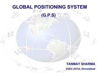
  • 1. GLOBAL POSITIONING SYSTEM (G.P.S) TANMAY SHARMA VGEC (GTU), Ahmedabad
  • 2. Conventional Navigation Systems Landmarks: Works in local area , subjected to Environmental factors. Celestial : Works at night and in good Weather Global Positioning System World Wide Navigation: Accurate Positioning: Satellite based System Visible from whole earth Atomic Clocks and Microprocessors are used Need for GPS
  • 3. GPS-Introduction Global Positioning System (GPS) is satellite navigation system which is based on a constellation of 24 satellites orbiting the earth at a very high altitude, that can be used to continuously measures the position of the object on the earth’s surface. GPS was developed by the Department of Defense, United Sates Of America to simplify accurate navigation. US government is investing over $12 billion to build the system which really works.
  • 4. Other Satellite Based Navigation System  Global Navigation Satellite System GLONASS Developed by Russia during Cold War initially for Defense. 24 Satellite Constellation placed at 120 . apart distributed in 3 planes each having 8 Satellites Accuracy is not effective as GPS  GALILEO Developed by European Space Agency ESA, Only for Civilians Funded by INDIA nearly 35Crore USD • GAGAN
  • 5. The Earth Coordinate System : Latitude Latitude parallel to equator It gives position from North to South of equator. Range is from 0 deg to 90 deg. Latitude At Equator 1 deg = 110.88 Kms 1 Min = 1848 mts. = 1.848 Kms. 1 Sec = 30.8 mts
  • 6. The Earth Coordinate System : Longitude Longitude runs parallel to Prime Meridian Gives us our position from East to West of Prime meridian Range is form 0 deg. To 180 deg. Longitude At Equator 1 deg. = 112.09 km At Pole 1 deg. = 0 km 1 Min = 1868.16 mts = 1.87 Kms. 1 Sec = 31.13 mts
  • 7. The Earth Coordinate System •Horizontal lines are lines of equal latitude (parallels) •Vertical lines are lines of equal longitude (meridians) •Both together form the Graticule network. LONGITUDE and LATITUDE values are angles measured from the earth’s center to the required point on the earth’s surface. A point anywhere within the earth surface is addressed by its LONGITUDE and LATITUDE value.
  • 9. Satellite Signaling and Orbital Details • Global Coverage : Minimum 4 Satellites in view from any place on Earth • Operational in All Weather Conditions • Distributed in 6 Orbital Plane each have 4 satellites • 12 Hours Circular Orbit • 20,200Kms Height Inclined at 55deg. • Operates on L band Frequency. • Messaging is Pseudo Random Code (PRC)
  • 10. The 24 satellites that make up the GPS space segment are orbiting the earth about 20,200 km above us. They are constantly moving, making two complete orbits in less than 24 hours. These satellites are travelling at speeds of roughly 7,000 miles an hour. GPS satellites are powered by solar energy. They have backup batteries onboard to keep them running in the event of a solar eclipse, when there's no solar power. Small rocket boosters on each satellite keep them flying in the correct path GPS satellites
  • 11. A GPS signal contains three different bits of information — (i) Pseudo random code, (ii) Ephemeris data (iii) Almanac data. Pseudorandom code is simply an I.D. code that identifies which satellite is transmitting information. You can view this number on your GPS unit's satellite page, as it identifies which satellites it's receiving. Ephemeris data, which is constantly transmitted by each satellite, contains important information about the status of the satellite (healthy or unhealthy), current date and time. This part of the signal is essential for determining a position. Almanac data tells the GPS receiver where each GPS satellite should be at any time throughout the day. Each satellite transmits almanac data showing the orbital information for that satellite and for every other satellite in the system.
  • 12. Pseudo Random Code and Frequency Band Information L band (Carrier frequency) is spitted in 2 portion L1 and L2. L1 works at 1575.42 MHz. And L2 works at 1227.60 MHz. L1 contains PRC and Status Messaging L1 is used for Civilian Purpose, called Coarse Acquitisation (C/A Code) L2 contains PRC Used for Military Purpose which can be Encrypted by DoD Whole of L2 information is called Precise Code (P Code)
  • 13. How GPS works ? This can be summarized by five individual processes: 1. Triangulation from Satellites is the basis of the system 2. To triangulate, GPS measures distance using the travel time of a radio signal. 3. To measure travel time, GPS needs very accurate clocks. 4. Once you know distance to a satellite, you then need to know where the satellite is in space. 5. Finally you must correct for any delays the signal experiences as it travels through the atmosphere.
  • 14. To make life easier • In a 2D Co-ordinate system we require 2 point to locate our self •We are 5 unit far from point ‘a’ and 10 unit far from point ‘b’ • Circles from point ‘a’ of radius 5 unit and of 10 unit from ‘b’ would intersect at point P which is desire location. Let’s Explore now GPS Positioning • a • b 5 10 P R- plane
  • 15. GPS Measurements GPS is based on satellite ranging, measuring distance from Satellite Two measurements puts us somewhere on this circles Three measurements puts us at one of two points Out of which only one is true another is far from Earth
  • 16. GPS Measurements Accurate timing is key to measuring distance to satellites. Satellites are accurate because they have atomic clocks on board. Mathematically, we need four measurements to determine exact position because we are in 3D environment where we require latitude(x), longitude(y),and height(z) The GPS system works by timing how long it takes a radio signal to reach us from a satellite and then calculating the distance from that, it means : Distance = (Speed of light) * (Time)
  • 17. How do we know when the signal left the satellite ? We assume that both the satellite and our receiver are generating the same pseudo random code at exactly the same time We know how long it took for the satellite’s signal to get to us by comparing how late its pseudo random code is, compared to our code
  • 18. Knowing where a satellite is in space To calculate our position we need precise distance, for precise distance we need to know where our satellites are in space GPS satellites are so high up, their orbits are very predictable. Minor variations in orbits measured constantly by the Department Of Defense and that data is transmitted from the satellites themselves
  • 19. GPS Receivers GPS receiver comprises of an Antenna, a Decoder and a Display unit. Antenna - receives the electromagnetic signals. Decoder – decodes the information from demodulated signal Display – displays the filtered information of position of the object
  • 20.
  • 21. Sources of Errors •Ionosphere and troposphere delays — The satellite signal slows as it passes through the atmosphere. •Signal multipath — This occurs when the GPS signal is reflected off objects such as tall buildings etc. before it reaches the receiver. •Receiver clock errors — A receiver's built-in clock is not as accurate as the atomic clocks onboard the GPS satellites. •Orbital errors — Also known as ephemeris errors, these are inaccuracies of the satellite's reported location. •Number of satellites visible — The more satellites a GPS receiver can "see," the better the accuracy. •Satellite geometry/shading — This refers to the relative position of the satellites at any given time. Ideal satellite geometry exists when the satellites are located at wide angles relative to each other. •Intentional degradation of the satellite signal — Selective Availability (SA) is an intentional degradation of the signal once imposed by the U.S. Turn off SA in May 2000, significantly improved the accuracy of civilian GPS receivers.
  • 22. Differential GPS GPS provides an accurate position for some applications with the error of more than 10 meters. Applications demanding better accuracy of 10 Centimeters e.g. Robot Movement during a Disaster,Zero Visibility Landing etc. requires a precise positioning System So…..
  • 23. Differential GPS DGPS requires co-operation of GPS receivers, one is fixed and remaining are roving around it. Fixed GPS Receiver is a key and serves as a Solid Reference to all other roving Receivers Key idea is : A Reference receiver will measure timing error and provide a correction to all other roving stations. Reference Station has a separate RF link to all other Rovers
  • 24. Differential GPS All the receivers simultaneously receives Satellite signals but since a small motion on Earth’s surface is insignificant from Satellite's view so both the ROVER and Reference Point will receive same signal from Satellite. Reference Station is a accurately surveyed point and it attacks the GPS signal reversely i.e. it uses it’s position to determine the timing. It figures out, “ What travel time should a signal take to reach it self and compares it with the actual acquired timing.
  • 25. Wide Area Augmentation System (WASS) The Wide Area Augmentation System (WAAS) is an extremely accurate navigation system developed for civil aviation. The system augments the GPS to provide the additional accuracy, integrity, and availability necessary to enable users to rely on GPS within the WAAS coverage area. The worst-case accuracy is within 7.6 meters of the true position 95% of the time. This is achieved via a network of ground stations which monitor and measure the GPS signal. Measurements from the reference stations are routed to two master stations which generate and send the correction messages to gestationary satellites. Those satellites broadcast the correction messages back to Earth, where WAAS-enabled GPS receivers apply the corrections to their computed GPS position.
  • 26.  GPS Receivers may range, both by the level of accuracy and cost.  A GPS Receiver may range by an accuracy of the order of 30 Meters to the order of 10 mm.  By using the Latest technologies like Digital Signal Processing, the accuracy, cost and size of the receiver can be optimized at a reasonable level. GPS Receivers
  • 27. Applications & Future Aspects Location based Services • Vehicle Tracking System • Transport Engineering Disaster Monitoring System • Earthquake Monitoring Surveying Resource Utilization