![The following were important factors in the two decades preceding the Civil War. ,[object Object],[object Object],[object Object],[object Object],[object Object]](data:image/gif;base64,R0lGODlhAQABAIAAAAAAAP///yH5BAEAAAAALAAAAAABAAEAAAIBRAA7)
Recomendados
Recomendados
Más contenido relacionado
Destacado
Destacado (9)
Similar a Civil war road to secession
Similar a Civil war road to secession (20)
Último
Último (20)
Civil war road to secession
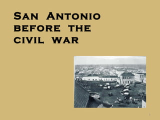
- 1. San Antonio before the civil war
- 4. To the North San Antonio extended to the north along Soledad, North Flores, and Acequia (now Main) streets to Romana Street and the Ursuline Academy. North Flores was the most beautiful street with gardens and houses to San Pedro Creek. On Soledad was the famous Veramendi home where Ben Milam had been killed in 1835.
- 6. Soledad Street looking north in the 1850s.
- 7. Soledad Street (late 1860s) looking south to Main Plaza .
- 8. Military Plaza Military Plaza was a center of commercial activity. The Spanish Governor’s Palace was there, but no longer a palace. There were small stores and Mexican jacals. By 1860 the infamous “Bat Cave” dominated the plaza. The lower floor served as City court and departments; the upper as the district court; and the jail was in the rear. Across from the Bat Cave (north side of Commerce St.) was the Orphan’s Home and residence of the Catholic priests.
- 10. Military Plaza looking west from San Fernando, shortly after 1873. The “Bat Cave” is the two-story building toward the back right of the plaza. The Spanish Governor’s Palace is the building just to the left and rear of the Bat Cave.
- 11. A view of the northeast corner of Military Plaza, this time showing the rear of the Bat Cave (1860s) .
- 12. Another view of Military Plaza, this time looking northwest, during the middle 1870s. The plaza was a very busy place .
- 13. Main Plaza San Fernando was only what is now the rear (original structure) and looked much like one of the missions. Just north of San Fernando in the plaza was the Frost Bank, Carolan’s one-story auction house, and a few adobe and rock structures. The east side had several small buildings and one three stories. To the south was Quinta Street with the City’s first post office, which served as a storage facility during the Civil War. The French building was on the corner.
- 15. Northwest corner of Main Plaza in the 1860s .
- 16. North side of Main Plaza (Commerce & Main) ca. 1868. The Yturri house is behind the wagon on the right.
- 17. The north side of Main Plaza about 1868. From left to right: Yturri house, Plaza House (built 1847), Jack Harris’ Variety Theatre. The tall building at the far right was the Masonic lodge (courthouse).
- 19. Alamo Plaza The Alamo was in poor condition. The Army had made some repairs and gave it its current facade. However, it served as the Army’s storage depot for hay, grain, etc. Just south was the Menger Hotel, much smaller than it is today, with its brewery. In the center was the meat market. This one was replaced in 1858 with one just east of Main Plaza on the north side of Market Street. In the summer Alamo Plaza, along with the other plazas and streets were hot and dusty. When it rained they became mud holes.
- 20. Looking southwest toward Alamo Plaza and Blum from the Menger Hotel (1866).
- 21. Looking west across Alamo Plaza from the Menger Hotel, probably in the late 1860s.
- 22. Elsewhere Commerce Street lived up to its name being lined with businesses. Houston Street had only the Vance House (where the Gunter Hotel is today) which the U. S. Army contracted as Officers’ Quarters and later served as headquarters for the Confederate Army. Otherwise, there were only a few houses. West of San Pedro Creek was generally the Mexican part of town. There were some adobe and rock homes, and many jacals (adobe, straw, and sticks), with a chimney, small windows, and a door. Dance halls and gambling dens were well represented here.
- 23. Commerce Street in the late 1860s .
- 24. Looking west down Commerce Street from Military Plaza – 1870s.
- 25. Looking east down Commerce Street, in the early 1860s, from the second story of the Plaza House at the corner of Main and Dolorosa.
- 26. Commerce Street looking east from Main Plaza in the 1870s.
- 27. The Alameda (late 1850s) by Herman Lungkwitz. Alameda was the name of Commerce street east of the San Antonio River.
- 28. To the South The southern portion of the city was occupied by two very different neighborhoods. One was La Villita, the settlement of the Canary Island settlers of the 1730s. The other was the King William area with large homes and beautiful gardens. Near King William was the Arsenal - military headquarters. Below these two neighborhoods, except along the San Antonio River, was prairie.
- 32. River scene in about 1876 with St. Mary’s Church in the center and the rear of the Twohig house at the right.
- 33. Mill bridge and river about 1878. La Villita on the left and St. John’s Lutheran Church in the center.
- 34. Women doing laundry (ca. 1877) near the crossing at Navarro St. with the French building and tower of San Fernando center rear.
- 36. This map shows the San Antonio River, San Pedro Creek, and the acequias (ditches), all of which brought life-giving water to residents.
- 37. Architecture “ After entering the city, “For five minutes the houses were evidently German, of fresh square-cut blocks of creamy-white limestone, mostly of a single story and humble proportions, but neat, and thoroughly roofed and finished. … From these we enter the square of the Alamo. This is all Mexican. Windowless cabins of stakes, plastered with mud and roofed with river-grass, or ‘tula;’ or low, windowless, but better thatched, houses of adobes (gray, unburnt bricks), …” A Journey Through Texas by Frederick Law Olmsted (NY: Dix, Edwards & Co., 1857)
- 38. Mission San Juan de Capistrano (1856) – Herman Lungkwitz
- 39. The Veramendi Palace. Built by Fernando Veramendi, local merchant and public servant. One of the largest homes in town. [Doors now at the Alamo.]
- 40. The Quinta, originally home of the Curbelo family. Later, John Bowen’s house and the first U. S. post office in San Antonio. It was on Dwyer Ave.
- 41. Mail Schedule Tri-Weekly Alamo Express 19 February 1861
- 42. A Mexican jacal
- 45. Samuel Maverick’s house as seen from Alamo Plaza.
- 46. The Groos Bank on Commerce Street as it was from 1866 to 1879.
- 47. The French building built in 1858 served as the San Antonio National Bank during 1866-1868.
- 48. “… near the Alamo a fine new hotel is being erected by an enterprising German,” -- Leslie’s Weekly January 18, 1859
- 49. A booming town, San Antonio construction work regularly blocked the narrow streets.
- 51. Sometimes a fandango, some times just a barroom dance
- 52. Schools In 1860 San Antonio had 15 public and private schools. Enrollment: Private – 342 Public – 221 German-English School - 187 Churches San Fernando and St. Mary’s Catholic churches Paine Methodist Episcopal Church South (now Travis Park United Methodist Church) St. Mark’s Episcopal Church, building started just before the Civil War and was halted until after the war. St. John’s Lutheran Church First Presbyterian Church Organizations in 1860
- 53. Social Groups Masonic Lodge Alamo Literary Society Youth’s Debating Club Alamo Rifles Casino Club Libraries The City had 10 private and church libraries with 5,460 volumes, but no public one.
- 54. Chili Queens of San Antonio’s Military Plaza, circa 1850
- 55. 1850 – 1860 U. S. Census Population 1850 1860 Austin 629 3,495 Galveston 4,529 7,307 Houston 2,396 4,845 San Antonio 3,488 7,643
- 60. Advertisement from The Daily Ledger and Texan , 25 February 1861, showing some of the types of items available to the citizens of San Antonio .
- 62. The Military
- 68. Military trails, like this one surveyed by Joseph Johnston and his team across Texas, opened the west and brought commerce to San Antonio.
- 70. Government trains provided economic impact
- 74. George T. Howard arrived in Texas in 1836. Coming to San Antonio in 1839 he served in many events: the Council House fight, Battle of Plum Creek (1840), the Santa Fe expedition, Somervell expedition, & the Mexican War. He served as Bexar County sheriff (1843-1845). From 1850 to 1855 he served as Indian agent for Texas. From 1855, until his death in 1866, he acted as a contractor for the United States and Confederate gover nments.
- 75. Under Army contracts, “Howard ran nearly eight hundred ox and mule teams, averaging a profit of $30,000 to $50,000 per year…” In 1856, the U.S. Army employed 138 civilians with a $39,000 payroll. Total military expenditures in Texas surpassed $950,000 annually, 1849-1860. Thomas T. Smith, The U.S. Army & the Texas Frontier Economy, pages 11 & 54
- 84. The Alamo Express , the Unionist paper of San Antonio, published by James P. Newcomb. This item from 18 February 1861.
- 89. Secession Election Results County For Against % Against Bandera 33 32 49 Blanco 108 170 61 Burnet 157 248 61 Kerr 76 57 43 Gillespie 16 398 96 Medina 140 207 60 Uvalde 16 76 83 Bexar 827 709 46
- 90. Even before the secession vote was held Southern sympathizers sought to take control of federal supplies in San Antonio. Alamo Express , 20 February 1 861
- 91. General Twiggs, seeking to avoid a physical confrontation between Federal and States troops, issued General Order No. 5, surrendering certain federal property, but not all, to State troops. If he had not done so, the Civil War would probably have begun in San Antonio, rather than Fort Sumter. Alamo Express , 20 February 1861
- 92. Main Plaza, February 19, 1861 by Carl von Iwonski for Harper’s Monthly
- 94. The Alamo Express describes the evacuation of United States troops to San Pedro Park. Soon these troops and those from the western posts would march to the Texas coast to leave for the North. Alamo Express , 19 February 1861
- 95. In the letter on the next two slides, Joseph Wood wrote to his sister on 21 February 1861. He mentions the arrival of Col. Ben McCulloch’s Texas troops and General Twiggs’ surrender of his 160 men and government stores to the Committee of Public Safety. “… Last week however the State troops came in and took possession of the Government Property which was given up by the U. S. officers and the Soldiers are now on their March to Indianola to be shipped to the North. It was a melancholy sight to see the “Star Spangled banner” hauled down to give place to the “Lone Star” and many turned away in tears. I don’t think that now there is any chance of an adjustment of the difficulties, and the Union will be completely divided, I hope without bloodshed, but fear the worst.”