SlideShare una empresa de Scribd logo
1 de 60
PROJECT:
 GPS MAPPING 70K MILES OF
LOCAL ROADS IN 5 YEARS (Ai)


                 Mike Lewis
               Vice President
     Navstar Mapping Corporation (NMC)
               June 13, 2012
     Email - mike_lewis@navstarmapping.com
Navstar Mapping Corp. History
            o Incorporated October 27, 1987

            o Full time business operation since 1990

            o Grown to 10 full time/3 part time employees
                              Customer List
• Tennessee Department of Transportation - Planning Division
• Tennessee Department of Transportation - Maintenance Division
• Alaska Department of Transportation and Public Facilities – Planning Division
• Alaska Department of Transportation and Public Facilities – Maintenance Division
• Nebraska Department of Roads – Planning Division
• Nebraska Department of Roads – Information Systems Division
• Washington State Department of Transportation – Planning Division
• Mississippi Department of Transportation – Planning Division
• Pike County, Mississippi – Mapping Department
• Pike County, Mississippi – 911 Office
• Warren County, Mississippi – Mapping Department
• South Dakota Department of Transportation – Planning Division
Customer Vehicle Installations
NMC/TDOT History

o 1990 – First Contract to replace manual paper and pencil inventory updates


o 1997 -> 2003 – Sold 2 RoadMapper Systems for TDOT to collect and process
        @ 37,000 miles of Interstate, State Highways, and Functional Routes


o 2007 -> 2012 – Automated Inventory Local Roads Project


o 1990 ->2012 – Under production and development contracts on continual basis
Automated Inventory (Ai)
        Project Overview
1. Update existing 55K miles in TDOT database in
   95 counties on a county by county basis
Automated Inventory (Ai)
        Project Overview
1. Update existing 55K miles in TDOT database in
   95 counties on a county by county basis
2. Tag all database records with GPS
Automated Inventory (Ai)
        Project Overview
1. Update existing 55K miles in TDOT database in
   95 counties on a county by county basis
2. Tag all database records with GPS
3. Perform a ‘Windshield Survey’ comparison
   between existing data and what is viewed out
   windshield
Automated Inventory (Ai)
        Project Overview
1. Update existing 55K miles in TDOT database in
   95 counties on a county by county basis
2. Tag all database records with GPS
3. Perform a ‘Windshield Survey’ comparison
   between existing data and what is viewed out
   windshield
4. Post-process all data in Austin office
5. Perform automated and manual QC
6. Cartographically cleanse mapping data
7. Deliver updated data to TDOT in text format
3 Categories of Roadways in TN

1. Interstate/State Highways
3 Categories of Roadways in TN

1. Interstate/State Highways

2. Functional Classification of Highways
     Routes that carry vehicles between
     Interstate/State Highways to/from Local Roads
3 Categories of Roadways in TN

1. Interstate/State Highways

2. Functional Classification of Highways
     Routes that carry vehicles between
     Interstate/State Highways and Local Roads

3. Local Roads
     Residential/Neighborhood Roads
Microstation DGN Base Map
Typical TN County Map
Zoomed-in County Map


Road Name, Route #, & Directional Arrow
Tennessee Roadway Information
 Management System (TRIMS)
• Client/Server Application
• Linear Reference System Database
  (Oracle)
• Roadway
  Inventory, Structures, Crash, Traffic, Pa
  vement, Photolog, etc.
• Development of Web Based E-TRIMS
5 DATABASE TABLES UPDATED
• Road System – Parent table; Establishes
 routes
• Route Feature – Event Data
• Geometrics – Speed Limits, No. of
  Lanes, Land Use, 1 or 2 Way Traffic etc.
• Roadway Description – Road Cross
  Section (Left to Right)
• Road Segment – Functional Class, Road
  Name, In City, etc.
Key Operating Principles & Approach
 Data Quality & Accuracy are only as good as your worst data
Key Operating Principles & Approach
 Data Quality & Accuracy are only as good as your worst data
 Keep the vehicle moving at near traffic flow speeds for safety/efficiency
Key Operating Principles & Approach
 Data Quality & Accuracy are only as good as your worst data
 Keep the vehicle moving at near traffic flow speeds for safety/efficiency
 Transfer as much of the workload from the vehicle to the office
Key Operating Principles & Approach
 Data Quality & Accuracy are only as good as your worst data
 Keep the vehicle moving at near traffic flow speeds for safety/efficiency
 Transfer as much of the workload from the vehicle to the office
 Use the existing database the agency has spent $$$ and many years to
         populate and maintain
 Embed logmile (elapsed distance from DMI) into every data record
Key Operating Principles & Approach
 Data Quality & Accuracy are only as good as your worst data
 Keep the vehicle moving at near traffic flow speeds for safety/efficiency
 Transfer as much of the workload from the vehicle to the office
 Use the existing database the agency has spent $$$ and many years to
          populate and maintain
 Embed logmile (elapsed distance from DMI) into every data record
 Fill the gaps caused by GPS Blockage to create a seamless roadtrack
 Provide cartographic centerline roadtrack data for GIS and Map
        Generation
 Only run GPS to get a road centerline one time, then use DMI for logmile
         updates
 Provide a method and procedure to update the database when full cycle
         inventory completes
 Reduce deadhead miles by allowing routes to be run in FWD or REV inventory
         direction
Key Operating Principles & Approach
 Data Quality & Accuracy are only as good as your worst data
 Keep the vehicle moving at near traffic flow speeds for safety/efficiency
 Transfer as much of the workload from the vehicle to the office
 Use the existing database the agency has spent $$$ and many years to
          populate and maintain
 Embed logmile (elapsed distance from DMI) into every data record
 Fill the gaps caused by GPS Blockage to create a seamless roadtrack
 Provide cartographic centerline roadtrack data for GIS and Map
        Generation
 Only run GPS to get a road centerline one time, then use DMI for logmile
           updates
 Provide a method and procedure to update the database when full cycle
           inventory completes
 Reduce deadhead miles by allowing routes to be run in FWD or REV inventory
           direction
 Utility to adjust logmile data to match existing data values or treat ours as truth
 Always keep underlying data in sync with graphics during cartographic cleansing
NMC Field Inventory Vehicle


                          Two Person Crew

Driver – Safely drive and Operate Distance Measuring Instrument (DMI)
Operator – Update existing database on notebook controlled system
Positioning Hardware


•   Numetrics Distance Measuring Instrument (DMI)
•   Trimble AG332 DGPS
•   NMC’s AuxBox
•   OmniSTAR VBS L1 only, code phase pseudo-range solution
NMC AuxBox


• Dead Reckoning System allows mapping in areas of GPS blockage
   • Aircraft gyro for heading

   • Barometer for elevation

   • DMI Wheel Sensor and Targets for accurate elapsed distance

   • Dead reckoning computer to format and package the data at 5 p.p.s.
Voice Data Entry System
                           patent #5,170,164
• Notebook computer controlled field data collection system
• Position information written to data file when action key is pressed

• Action keys:

       1st <Spacebar> keypress tags record under highlight with
       position and begins audio .wav recording

       2nd <Spacebar> keypress turns off audio .wav recording and resets
       system for next feature

       Hokey – Pressing the corresponding hotkey letter automatically
       inserts and tags pre-canned text description

       <Enter> keypress automatically tags the current data record with
       position information
DIGITAL CAMERA ENHANCEMENTS


• Jpeg’s captured every 52.8 ft or .001 miles

• Each jpg Labeled with route, date, time and elapsed distance

• Only store images that correspond with action keys (GPS tags)

• Office edit software automatically displays image to editor
INV_MAP (Inventory Map)
Ai Project Workflow
     Description
Convert TRIMS Data   •Convert 5 export files to 6 working files
Convert TRIMS Data   •Converts 5 export files to 6 working files


                     •Run routes in forward or reverse inventory direction
Update TRIMS Data    •Field software displays current database data
                     •Field Crews record hotkeys and digital voice notes
     in Field        •Actions stamped with GPS time and DMI logmile values
                     •Collect continuous GPS and auxiliary sensor data


 Process Data in     •Update data based on the field crews’ voice notes
                     •Generate working files to use in post-processing
     Office          •Converge intersections
2


1


3

4


5
Voice 1:


                                                           Voice 2:


                                                           Voice 3:


• Operator performs windshield survey
   – Changes or new features require voice notes
   – Unchanged existing TRIMS features are simply tagged
• Edit software plays voice notes automatically
Intersection Convergence
• Locates matching intersections based on a
  distance buffer
• Calculates/determines heading values of
  intersections
• Projects along heading values to a common
  lat/long value
• Relocates intersections and associated
  features to the common lat/long value
Before Intersection Convergence
After Intersection Convergence


 •Converged intersection locations are automatically updated in both routes
INTERSECTION UNDER-SHOOT


 RED = NON-CONVERGED   BLACK = FINAL CONVERGED
INTERSECTION UNDER-SHOOT


 RED = NON-CONVERGED   BLACK = FINAL CONVERGED
INTERSECTION OVER-SHOOT


 RED = NON-CONVERGED   BLACK = FINAL CONVERGED
INTERSECTION OVER-SHOOT


 RED = NON-CONVERGED   BLACK = FINAL CONVERGED
TYPICAL CONVERGED ROADTRACK
Convert TRIMS Data   •Convert 5 export files to 6 working files


                     •Run routes in forward or reverse inventory direction
Update TRIMS Data    •Field software displays current database data
                     •Field Crews record hotkeys and digital voice notes
     in Field        •Actions stamped with GPS time and DMI logmile values
                     •Collect continuous GPS and auxiliary sensor data


 Process Data in     •Update data based on the field crews’ voice notes
                     •Generate working files to use in post-processing
     Office          •Converge intersections


                     •Verify the integrity of graphics
 Post-Processing     •Verify integrity of the data that will go back into TRIMS
2


        1


    3


4
Convert TRIMS Data   •Convert five TRIMS export files to six working files


                     •Run routes in forward or reverse inventory direction
Update TRIMS Data    •Field software displays current database data
                     •Field Crews record hotkeys and digital voice notes
     in Field        •Actions stamped with GPS time and DMI logmile values
                     •Collect continuous GPS and auxiliary sensor data


 Process Data in     •Update data based on the field crews’ voice notes
                     •Generate working files to use in post-processing
     Office          •Converge intersections


                     •Verify the integrity of graphics
 Post-Processing     • Verify integrity of the data that will go back into TRIMS


                     •Provide TDOT with:
   Output Data            • Files for graphics generation
                          • Five updated TRIMS files in text format
PROJECT STATUS

• 5 Year Project Ends in August 2012
• Field Data/Post Processing Completed
• Over 70k Miles of Roadway Inventory
      collected, processed, and delivered
• 2 – two person field crews, 2 vehicles
• 10 hour day – 4 days per week
• Average data miles collected per day = 67
• 135,000 local roads delivered
QUESTIONS?
We would like to work closer to home…


       mike_lewis@navstarmapping.com
            office - 512-339-4564

Más contenido relacionado

Destacado (8)

The national atlas of the united states 11,000,000 scale hydrography dataset ...
The national atlas of the united states 11,000,000 scale hydrography dataset ...The national atlas of the united states 11,000,000 scale hydrography dataset ...
The national atlas of the united states 11,000,000 scale hydrography dataset ...
 
Hgac commute solutions viewer
Hgac commute solutions viewerHgac commute solutions viewer
Hgac commute solutions viewer
 
Registro Net Sistem
Registro Net SistemRegistro Net Sistem
Registro Net Sistem
 
Building a water resources geodatabase for the rio grande basin
Building a water resources geodatabase for the rio grande basinBuilding a water resources geodatabase for the rio grande basin
Building a water resources geodatabase for the rio grande basin
 
Early warning forecast of an oil spill bp deepwater horizon in the gulf
Early warning forecast of an oil spill bp deepwater horizon in the gulfEarly warning forecast of an oil spill bp deepwater horizon in the gulf
Early warning forecast of an oil spill bp deepwater horizon in the gulf
 
Volunteered geographic information (vgi) for the national map
Volunteered geographic information (vgi) for the national mapVolunteered geographic information (vgi) for the national map
Volunteered geographic information (vgi) for the national map
 
Mobile app for i pad water resources
Mobile app for i pad water resourcesMobile app for i pad water resources
Mobile app for i pad water resources
 
Social Media: Can It Deliver To Your Bottom Line
Social Media: Can It Deliver To Your Bottom LineSocial Media: Can It Deliver To Your Bottom Line
Social Media: Can It Deliver To Your Bottom Line
 

Similar a Nmc ussls charter 2012

2010 Gist
2010 Gist2010 Gist
2010 Gistfjudson
 
2010 Usdot Asset Management Presentation
2010 Usdot Asset Management Presentation2010 Usdot Asset Management Presentation
2010 Usdot Asset Management Presentationfjudson
 
ATS-16: Making Data Count, Krista Nordback
ATS-16: Making Data Count, Krista NordbackATS-16: Making Data Count, Krista Nordback
ATS-16: Making Data Count, Krista NordbackBTAOregon
 
2010 Ohio Gis Conference Small
2010 Ohio Gis Conference Small2010 Ohio Gis Conference Small
2010 Ohio Gis Conference Smallfjudson
 
2015 Broadband Tech Summit - Todd Westberg UPS Presentation
2015 Broadband Tech Summit - Todd Westberg UPS Presentation2015 Broadband Tech Summit - Todd Westberg UPS Presentation
2015 Broadband Tech Summit - Todd Westberg UPS PresentationUtah Broadband Project
 
Analyzing GIS Staff Usage and Allocation for Improved GIS Operations
Analyzing GIS Staff Usage and Allocation for Improved GIS OperationsAnalyzing GIS Staff Usage and Allocation for Improved GIS Operations
Analyzing GIS Staff Usage and Allocation for Improved GIS OperationsGreg Babinski
 
Data DevOps - Arif Wider and Sean Gustafson (ThoughtWorks Live)
Data DevOps - Arif Wider and Sean Gustafson (ThoughtWorks Live)Data DevOps - Arif Wider and Sean Gustafson (ThoughtWorks Live)
Data DevOps - Arif Wider and Sean Gustafson (ThoughtWorks Live)Thoughtworks
 
Analyzing Streets, Traffic, and Drivetimes in MapInfo Pro
Analyzing Streets, Traffic, and Drivetimes in MapInfo ProAnalyzing Streets, Traffic, and Drivetimes in MapInfo Pro
Analyzing Streets, Traffic, and Drivetimes in MapInfo ProPrecisely
 
Timmons Group ESRI Replication Solutions
Timmons Group ESRI Replication SolutionsTimmons Group ESRI Replication Solutions
Timmons Group ESRI Replication SolutionsTimmons Group
 
Blu Fax Recent Advances 2 24 2011
Blu Fax Recent Advances 2 24 2011Blu Fax Recent Advances 2 24 2011
Blu Fax Recent Advances 2 24 2011nelsondonnac
 
Full planning support system at your fingertips mvopc p&amp;z_120712
Full planning support system at your fingertips mvopc p&amp;z_120712Full planning support system at your fingertips mvopc p&amp;z_120712
Full planning support system at your fingertips mvopc p&amp;z_120712MVRPC
 
Baseride Technologies - solutions for smart transportation & logistics
Baseride Technologies - solutions for smart transportation & logisticsBaseride Technologies - solutions for smart transportation & logistics
Baseride Technologies - solutions for smart transportation & logisticsEvgeni
 
Open Transit Data - A Developer's Perspective
Open Transit Data - A Developer's PerspectiveOpen Transit Data - A Developer's Perspective
Open Transit Data - A Developer's PerspectiveSean Barbeau
 
Development of On-Road Emissions for the 2011 National Emissions Inventory
Development of On-Road Emissions for the 2011 National Emissions InventoryDevelopment of On-Road Emissions for the 2011 National Emissions Inventory
Development of On-Road Emissions for the 2011 National Emissions InventoryJennifer Sharp
 
SoTM US Routing
SoTM US RoutingSoTM US Routing
SoTM US RoutingMapQuest
 
Guilford Intern Project Presentation
Guilford Intern Project PresentationGuilford Intern Project Presentation
Guilford Intern Project PresentationproAJBROWN
 
ThingTech - RouteIT Product Overview
ThingTech - RouteIT Product OverviewThingTech - RouteIT Product Overview
ThingTech - RouteIT Product OverviewBrian Corcoran
 
Transit sketch planning (webinar slides)
Transit sketch planning (webinar slides)Transit sketch planning (webinar slides)
Transit sketch planning (webinar slides)garrjacobs
 

Similar a Nmc ussls charter 2012 (20)

2010 Gist
2010 Gist2010 Gist
2010 Gist
 
2010 Usdot Asset Management Presentation
2010 Usdot Asset Management Presentation2010 Usdot Asset Management Presentation
2010 Usdot Asset Management Presentation
 
ATS-16: Making Data Count, Krista Nordback
ATS-16: Making Data Count, Krista NordbackATS-16: Making Data Count, Krista Nordback
ATS-16: Making Data Count, Krista Nordback
 
2010 Ohio Gis Conference Small
2010 Ohio Gis Conference Small2010 Ohio Gis Conference Small
2010 Ohio Gis Conference Small
 
2015 Broadband Tech Summit - Todd Westberg UPS Presentation
2015 Broadband Tech Summit - Todd Westberg UPS Presentation2015 Broadband Tech Summit - Todd Westberg UPS Presentation
2015 Broadband Tech Summit - Todd Westberg UPS Presentation
 
WV DOT Transportatino GIS User Day (2010)
WV DOT Transportatino GIS User Day (2010)WV DOT Transportatino GIS User Day (2010)
WV DOT Transportatino GIS User Day (2010)
 
Routing
RoutingRouting
Routing
 
Analyzing GIS Staff Usage and Allocation for Improved GIS Operations
Analyzing GIS Staff Usage and Allocation for Improved GIS OperationsAnalyzing GIS Staff Usage and Allocation for Improved GIS Operations
Analyzing GIS Staff Usage and Allocation for Improved GIS Operations
 
Data DevOps - Arif Wider and Sean Gustafson (ThoughtWorks Live)
Data DevOps - Arif Wider and Sean Gustafson (ThoughtWorks Live)Data DevOps - Arif Wider and Sean Gustafson (ThoughtWorks Live)
Data DevOps - Arif Wider and Sean Gustafson (ThoughtWorks Live)
 
Analyzing Streets, Traffic, and Drivetimes in MapInfo Pro
Analyzing Streets, Traffic, and Drivetimes in MapInfo ProAnalyzing Streets, Traffic, and Drivetimes in MapInfo Pro
Analyzing Streets, Traffic, and Drivetimes in MapInfo Pro
 
Timmons Group ESRI Replication Solutions
Timmons Group ESRI Replication SolutionsTimmons Group ESRI Replication Solutions
Timmons Group ESRI Replication Solutions
 
Blu Fax Recent Advances 2 24 2011
Blu Fax Recent Advances 2 24 2011Blu Fax Recent Advances 2 24 2011
Blu Fax Recent Advances 2 24 2011
 
Full planning support system at your fingertips mvopc p&amp;z_120712
Full planning support system at your fingertips mvopc p&amp;z_120712Full planning support system at your fingertips mvopc p&amp;z_120712
Full planning support system at your fingertips mvopc p&amp;z_120712
 
Baseride Technologies - solutions for smart transportation & logistics
Baseride Technologies - solutions for smart transportation & logisticsBaseride Technologies - solutions for smart transportation & logistics
Baseride Technologies - solutions for smart transportation & logistics
 
Open Transit Data - A Developer's Perspective
Open Transit Data - A Developer's PerspectiveOpen Transit Data - A Developer's Perspective
Open Transit Data - A Developer's Perspective
 
Development of On-Road Emissions for the 2011 National Emissions Inventory
Development of On-Road Emissions for the 2011 National Emissions InventoryDevelopment of On-Road Emissions for the 2011 National Emissions Inventory
Development of On-Road Emissions for the 2011 National Emissions Inventory
 
SoTM US Routing
SoTM US RoutingSoTM US Routing
SoTM US Routing
 
Guilford Intern Project Presentation
Guilford Intern Project PresentationGuilford Intern Project Presentation
Guilford Intern Project Presentation
 
ThingTech - RouteIT Product Overview
ThingTech - RouteIT Product OverviewThingTech - RouteIT Product Overview
ThingTech - RouteIT Product Overview
 
Transit sketch planning (webinar slides)
Transit sketch planning (webinar slides)Transit sketch planning (webinar slides)
Transit sketch planning (webinar slides)
 

Más de Texas Natural Resources Information System

From creekology to rocket science the evolution of remote sensing gis in oilg...
From creekology to rocket science the evolution of remote sensing gis in oilg...From creekology to rocket science the evolution of remote sensing gis in oilg...
From creekology to rocket science the evolution of remote sensing gis in oilg...Texas Natural Resources Information System
 

Más de Texas Natural Resources Information System (20)

Txgio presentation rgsm_gps_pearson_062012
Txgio presentation rgsm_gps_pearson_062012Txgio presentation rgsm_gps_pearson_062012
Txgio presentation rgsm_gps_pearson_062012
 
Usslsc cgsic regional austin 061312
Usslsc cgsic regional austin 061312Usslsc cgsic regional austin 061312
Usslsc cgsic regional austin 061312
 
Using gps technology at the texas general land
Using gps technology at the texas general landUsing gps technology at the texas general land
Using gps technology at the texas general land
 
Ussls austin civil utility - klein - 061312 - final
Ussls austin   civil utility - klein - 061312 - finalUssls austin   civil utility - klein - 061312 - final
Ussls austin civil utility - klein - 061312 - final
 
Tx dot gps applications fuegner
Tx dot gps applications   fuegnerTx dot gps applications   fuegner
Tx dot gps applications fuegner
 
Tnris 2012
Tnris 2012Tnris 2012
Tnris 2012
 
Nationwide dgps (ndgps) lt mendoza
Nationwide dgps (ndgps)   lt mendozaNationwide dgps (ndgps)   lt mendoza
Nationwide dgps (ndgps) lt mendoza
 
Lyle tamucc 2
Lyle tamucc 2Lyle tamucc 2
Lyle tamucc 2
 
Dirks cgsic brief 2012
Dirks cgsic brief 2012Dirks cgsic brief 2012
Dirks cgsic brief 2012
 
Connected vehicle highway network applications
Connected vehicle highway network applicationsConnected vehicle highway network applications
Connected vehicle highway network applications
 
Cgsic presentation humphreys
Cgsic presentation humphreysCgsic presentation humphreys
Cgsic presentation humphreys
 
Cgsic navcen
Cgsic navcenCgsic navcen
Cgsic navcen
 
Gnss international policy regional cgsic (austin - jun2012)
Gnss international policy   regional cgsic (austin - jun2012)Gnss international policy   regional cgsic (austin - jun2012)
Gnss international policy regional cgsic (austin - jun2012)
 
From creekology to rocket science the evolution of remote sensing gis in oilg...
From creekology to rocket science the evolution of remote sensing gis in oilg...From creekology to rocket science the evolution of remote sensing gis in oilg...
From creekology to rocket science the evolution of remote sensing gis in oilg...
 
We are the music makers and we are the dreamers of dreams
We are the music makers and we are the dreamers of dreamsWe are the music makers and we are the dreamers of dreams
We are the music makers and we are the dreamers of dreams
 
Uav image recognition technology and applications
Uav image recognition technology and applicationsUav image recognition technology and applications
Uav image recognition technology and applications
 
Texas high water marks crowd sourcing history, culture, and geography
Texas high water marks   crowd sourcing history, culture, and geographyTexas high water marks   crowd sourcing history, culture, and geography
Texas high water marks crowd sourcing history, culture, and geography
 
Texas coastal atlas
Texas coastal atlasTexas coastal atlas
Texas coastal atlas
 
Nws floodplain inundation project
Nws floodplain inundation projectNws floodplain inundation project
Nws floodplain inundation project
 
New york city case study lidar and the power of solar
New york city case study   lidar and the power of solarNew york city case study   lidar and the power of solar
New york city case study lidar and the power of solar
 

Último

CloudStudio User manual (basic edition):
CloudStudio User manual (basic edition):CloudStudio User manual (basic edition):
CloudStudio User manual (basic edition):comworks
 
Powerpoint exploring the locations used in television show Time Clash
Powerpoint exploring the locations used in television show Time ClashPowerpoint exploring the locations used in television show Time Clash
Powerpoint exploring the locations used in television show Time Clashcharlottematthew16
 
"Subclassing and Composition – A Pythonic Tour of Trade-Offs", Hynek Schlawack
"Subclassing and Composition – A Pythonic Tour of Trade-Offs", Hynek Schlawack"Subclassing and Composition – A Pythonic Tour of Trade-Offs", Hynek Schlawack
"Subclassing and Composition – A Pythonic Tour of Trade-Offs", Hynek SchlawackFwdays
 
Bun (KitWorks Team Study 노별마루 발표 2024.4.22)
Bun (KitWorks Team Study 노별마루 발표 2024.4.22)Bun (KitWorks Team Study 노별마루 발표 2024.4.22)
Bun (KitWorks Team Study 노별마루 발표 2024.4.22)Wonjun Hwang
 
Anypoint Exchange: It’s Not Just a Repo!
Anypoint Exchange: It’s Not Just a Repo!Anypoint Exchange: It’s Not Just a Repo!
Anypoint Exchange: It’s Not Just a Repo!Manik S Magar
 
"LLMs for Python Engineers: Advanced Data Analysis and Semantic Kernel",Oleks...
"LLMs for Python Engineers: Advanced Data Analysis and Semantic Kernel",Oleks..."LLMs for Python Engineers: Advanced Data Analysis and Semantic Kernel",Oleks...
"LLMs for Python Engineers: Advanced Data Analysis and Semantic Kernel",Oleks...Fwdays
 
The Future of Software Development - Devin AI Innovative Approach.pdf
The Future of Software Development - Devin AI Innovative Approach.pdfThe Future of Software Development - Devin AI Innovative Approach.pdf
The Future of Software Development - Devin AI Innovative Approach.pdfSeasiaInfotech2
 
Designing IA for AI - Information Architecture Conference 2024
Designing IA for AI - Information Architecture Conference 2024Designing IA for AI - Information Architecture Conference 2024
Designing IA for AI - Information Architecture Conference 2024Enterprise Knowledge
 
Transcript: New from BookNet Canada for 2024: BNC CataList - Tech Forum 2024
Transcript: New from BookNet Canada for 2024: BNC CataList - Tech Forum 2024Transcript: New from BookNet Canada for 2024: BNC CataList - Tech Forum 2024
Transcript: New from BookNet Canada for 2024: BNC CataList - Tech Forum 2024BookNet Canada
 
Human Factors of XR: Using Human Factors to Design XR Systems
Human Factors of XR: Using Human Factors to Design XR SystemsHuman Factors of XR: Using Human Factors to Design XR Systems
Human Factors of XR: Using Human Factors to Design XR SystemsMark Billinghurst
 
WordPress Websites for Engineers: Elevate Your Brand
WordPress Websites for Engineers: Elevate Your BrandWordPress Websites for Engineers: Elevate Your Brand
WordPress Websites for Engineers: Elevate Your Brandgvaughan
 
Unleash Your Potential - Namagunga Girls Coding Club
Unleash Your Potential - Namagunga Girls Coding ClubUnleash Your Potential - Namagunga Girls Coding Club
Unleash Your Potential - Namagunga Girls Coding ClubKalema Edgar
 
Integration and Automation in Practice: CI/CD in Mule Integration and Automat...
Integration and Automation in Practice: CI/CD in Mule Integration and Automat...Integration and Automation in Practice: CI/CD in Mule Integration and Automat...
Integration and Automation in Practice: CI/CD in Mule Integration and Automat...Patryk Bandurski
 
Commit 2024 - Secret Management made easy
Commit 2024 - Secret Management made easyCommit 2024 - Secret Management made easy
Commit 2024 - Secret Management made easyAlfredo García Lavilla
 
Streamlining Python Development: A Guide to a Modern Project Setup
Streamlining Python Development: A Guide to a Modern Project SetupStreamlining Python Development: A Guide to a Modern Project Setup
Streamlining Python Development: A Guide to a Modern Project SetupFlorian Wilhelm
 
AI as an Interface for Commercial Buildings
AI as an Interface for Commercial BuildingsAI as an Interface for Commercial Buildings
AI as an Interface for Commercial BuildingsMemoori
 
Ensuring Technical Readiness For Copilot in Microsoft 365
Ensuring Technical Readiness For Copilot in Microsoft 365Ensuring Technical Readiness For Copilot in Microsoft 365
Ensuring Technical Readiness For Copilot in Microsoft 3652toLead Limited
 
Tampa BSides - Chef's Tour of Microsoft Security Adoption Framework (SAF)
Tampa BSides - Chef's Tour of Microsoft Security Adoption Framework (SAF)Tampa BSides - Chef's Tour of Microsoft Security Adoption Framework (SAF)
Tampa BSides - Chef's Tour of Microsoft Security Adoption Framework (SAF)Mark Simos
 
"ML in Production",Oleksandr Bagan
"ML in Production",Oleksandr Bagan"ML in Production",Oleksandr Bagan
"ML in Production",Oleksandr BaganFwdays
 

Último (20)

CloudStudio User manual (basic edition):
CloudStudio User manual (basic edition):CloudStudio User manual (basic edition):
CloudStudio User manual (basic edition):
 
Powerpoint exploring the locations used in television show Time Clash
Powerpoint exploring the locations used in television show Time ClashPowerpoint exploring the locations used in television show Time Clash
Powerpoint exploring the locations used in television show Time Clash
 
"Subclassing and Composition – A Pythonic Tour of Trade-Offs", Hynek Schlawack
"Subclassing and Composition – A Pythonic Tour of Trade-Offs", Hynek Schlawack"Subclassing and Composition – A Pythonic Tour of Trade-Offs", Hynek Schlawack
"Subclassing and Composition – A Pythonic Tour of Trade-Offs", Hynek Schlawack
 
Bun (KitWorks Team Study 노별마루 발표 2024.4.22)
Bun (KitWorks Team Study 노별마루 발표 2024.4.22)Bun (KitWorks Team Study 노별마루 발표 2024.4.22)
Bun (KitWorks Team Study 노별마루 발표 2024.4.22)
 
Anypoint Exchange: It’s Not Just a Repo!
Anypoint Exchange: It’s Not Just a Repo!Anypoint Exchange: It’s Not Just a Repo!
Anypoint Exchange: It’s Not Just a Repo!
 
"LLMs for Python Engineers: Advanced Data Analysis and Semantic Kernel",Oleks...
"LLMs for Python Engineers: Advanced Data Analysis and Semantic Kernel",Oleks..."LLMs for Python Engineers: Advanced Data Analysis and Semantic Kernel",Oleks...
"LLMs for Python Engineers: Advanced Data Analysis and Semantic Kernel",Oleks...
 
The Future of Software Development - Devin AI Innovative Approach.pdf
The Future of Software Development - Devin AI Innovative Approach.pdfThe Future of Software Development - Devin AI Innovative Approach.pdf
The Future of Software Development - Devin AI Innovative Approach.pdf
 
Designing IA for AI - Information Architecture Conference 2024
Designing IA for AI - Information Architecture Conference 2024Designing IA for AI - Information Architecture Conference 2024
Designing IA for AI - Information Architecture Conference 2024
 
Transcript: New from BookNet Canada for 2024: BNC CataList - Tech Forum 2024
Transcript: New from BookNet Canada for 2024: BNC CataList - Tech Forum 2024Transcript: New from BookNet Canada for 2024: BNC CataList - Tech Forum 2024
Transcript: New from BookNet Canada for 2024: BNC CataList - Tech Forum 2024
 
Human Factors of XR: Using Human Factors to Design XR Systems
Human Factors of XR: Using Human Factors to Design XR SystemsHuman Factors of XR: Using Human Factors to Design XR Systems
Human Factors of XR: Using Human Factors to Design XR Systems
 
WordPress Websites for Engineers: Elevate Your Brand
WordPress Websites for Engineers: Elevate Your BrandWordPress Websites for Engineers: Elevate Your Brand
WordPress Websites for Engineers: Elevate Your Brand
 
Unleash Your Potential - Namagunga Girls Coding Club
Unleash Your Potential - Namagunga Girls Coding ClubUnleash Your Potential - Namagunga Girls Coding Club
Unleash Your Potential - Namagunga Girls Coding Club
 
E-Vehicle_Hacking_by_Parul Sharma_null_owasp.pptx
E-Vehicle_Hacking_by_Parul Sharma_null_owasp.pptxE-Vehicle_Hacking_by_Parul Sharma_null_owasp.pptx
E-Vehicle_Hacking_by_Parul Sharma_null_owasp.pptx
 
Integration and Automation in Practice: CI/CD in Mule Integration and Automat...
Integration and Automation in Practice: CI/CD in Mule Integration and Automat...Integration and Automation in Practice: CI/CD in Mule Integration and Automat...
Integration and Automation in Practice: CI/CD in Mule Integration and Automat...
 
Commit 2024 - Secret Management made easy
Commit 2024 - Secret Management made easyCommit 2024 - Secret Management made easy
Commit 2024 - Secret Management made easy
 
Streamlining Python Development: A Guide to a Modern Project Setup
Streamlining Python Development: A Guide to a Modern Project SetupStreamlining Python Development: A Guide to a Modern Project Setup
Streamlining Python Development: A Guide to a Modern Project Setup
 
AI as an Interface for Commercial Buildings
AI as an Interface for Commercial BuildingsAI as an Interface for Commercial Buildings
AI as an Interface for Commercial Buildings
 
Ensuring Technical Readiness For Copilot in Microsoft 365
Ensuring Technical Readiness For Copilot in Microsoft 365Ensuring Technical Readiness For Copilot in Microsoft 365
Ensuring Technical Readiness For Copilot in Microsoft 365
 
Tampa BSides - Chef's Tour of Microsoft Security Adoption Framework (SAF)
Tampa BSides - Chef's Tour of Microsoft Security Adoption Framework (SAF)Tampa BSides - Chef's Tour of Microsoft Security Adoption Framework (SAF)
Tampa BSides - Chef's Tour of Microsoft Security Adoption Framework (SAF)
 
"ML in Production",Oleksandr Bagan
"ML in Production",Oleksandr Bagan"ML in Production",Oleksandr Bagan
"ML in Production",Oleksandr Bagan
 

Nmc ussls charter 2012

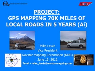
  • 1. PROJECT: GPS MAPPING 70K MILES OF LOCAL ROADS IN 5 YEARS (Ai) Mike Lewis Vice President Navstar Mapping Corporation (NMC) June 13, 2012 Email - mike_lewis@navstarmapping.com
  • 2. Navstar Mapping Corp. History o Incorporated October 27, 1987 o Full time business operation since 1990 o Grown to 10 full time/3 part time employees Customer List • Tennessee Department of Transportation - Planning Division • Tennessee Department of Transportation - Maintenance Division • Alaska Department of Transportation and Public Facilities – Planning Division • Alaska Department of Transportation and Public Facilities – Maintenance Division • Nebraska Department of Roads – Planning Division • Nebraska Department of Roads – Information Systems Division • Washington State Department of Transportation – Planning Division • Mississippi Department of Transportation – Planning Division • Pike County, Mississippi – Mapping Department • Pike County, Mississippi – 911 Office • Warren County, Mississippi – Mapping Department • South Dakota Department of Transportation – Planning Division
  • 4. NMC/TDOT History o 1990 – First Contract to replace manual paper and pencil inventory updates o 1997 -> 2003 – Sold 2 RoadMapper Systems for TDOT to collect and process @ 37,000 miles of Interstate, State Highways, and Functional Routes o 2007 -> 2012 – Automated Inventory Local Roads Project o 1990 ->2012 – Under production and development contracts on continual basis
  • 5. Automated Inventory (Ai) Project Overview 1. Update existing 55K miles in TDOT database in 95 counties on a county by county basis
  • 6. Automated Inventory (Ai) Project Overview 1. Update existing 55K miles in TDOT database in 95 counties on a county by county basis 2. Tag all database records with GPS
  • 7. Automated Inventory (Ai) Project Overview 1. Update existing 55K miles in TDOT database in 95 counties on a county by county basis 2. Tag all database records with GPS 3. Perform a ‘Windshield Survey’ comparison between existing data and what is viewed out windshield
  • 8. Automated Inventory (Ai) Project Overview 1. Update existing 55K miles in TDOT database in 95 counties on a county by county basis 2. Tag all database records with GPS 3. Perform a ‘Windshield Survey’ comparison between existing data and what is viewed out windshield 4. Post-process all data in Austin office
  • 9. Automated Inventory (Ai) Project Overview 1. Update existing 55K miles in TDOT database in 95 counties on a county by county basis 2. Tag all database records with GPS 3. Perform a ‘Windshield Survey’ comparison between existing data and what is viewed out windshield 4. Post-process all data in Austin office 5. Perform automated and manual QC
  • 10. Automated Inventory (Ai) Project Overview 1. Update existing 55K miles in TDOT database in 95 counties on a county by county basis 2. Tag all database records with GPS 3. Perform a ‘Windshield Survey’ comparison between existing data and what is viewed out windshield 4. Post-process all data in Austin office 5. Perform automated and manual QC 6. Cartographically cleanse mapping data
  • 11. Automated Inventory (Ai) Project Overview 1. Update existing 55K miles in TDOT database in 95 counties on a county by county basis 2. Tag all database records with GPS 3. Perform a ‘Windshield Survey’ comparison between existing data and what is viewed out windshield 4. Post-process all data in Austin office 5. Perform automated and manual QC 6. Cartographically cleanse mapping data 7. Deliver updated data to TDOT in text format
  • 12. 3 Categories of Roadways in TN 1. Interstate/State Highways
  • 13. 3 Categories of Roadways in TN 1. Interstate/State Highways 2. Functional Classification of Highways Routes that carry vehicles between Interstate/State Highways to/from Local Roads
  • 14. 3 Categories of Roadways in TN 1. Interstate/State Highways 2. Functional Classification of Highways Routes that carry vehicles between Interstate/State Highways and Local Roads 3. Local Roads Residential/Neighborhood Roads
  • 17. Zoomed-in County Map Road Name, Route #, & Directional Arrow
  • 18. Tennessee Roadway Information Management System (TRIMS) • Client/Server Application • Linear Reference System Database (Oracle) • Roadway Inventory, Structures, Crash, Traffic, Pa vement, Photolog, etc. • Development of Web Based E-TRIMS
  • 19. 5 DATABASE TABLES UPDATED • Road System – Parent table; Establishes routes • Route Feature – Event Data • Geometrics – Speed Limits, No. of Lanes, Land Use, 1 or 2 Way Traffic etc. • Roadway Description – Road Cross Section (Left to Right) • Road Segment – Functional Class, Road Name, In City, etc.
  • 20. Key Operating Principles & Approach  Data Quality & Accuracy are only as good as your worst data
  • 21. Key Operating Principles & Approach  Data Quality & Accuracy are only as good as your worst data  Keep the vehicle moving at near traffic flow speeds for safety/efficiency
  • 22. Key Operating Principles & Approach  Data Quality & Accuracy are only as good as your worst data  Keep the vehicle moving at near traffic flow speeds for safety/efficiency  Transfer as much of the workload from the vehicle to the office
  • 23. Key Operating Principles & Approach  Data Quality & Accuracy are only as good as your worst data  Keep the vehicle moving at near traffic flow speeds for safety/efficiency  Transfer as much of the workload from the vehicle to the office  Use the existing database the agency has spent $$$ and many years to populate and maintain
  • 24. Key Operating Principles & Approach  Data Quality & Accuracy are only as good as your worst data  Keep the vehicle moving at near traffic flow speeds for safety/efficiency  Transfer as much of the workload from the vehicle to the office  Use the existing database the agency has spent $$$ and many years to populate and maintain  Embed logmile (elapsed distance from DMI) into every data record
  • 25. Key Operating Principles & Approach  Data Quality & Accuracy are only as good as your worst data  Keep the vehicle moving at near traffic flow speeds for safety/efficiency  Transfer as much of the workload from the vehicle to the office  Use the existing database the agency has spent $$$ and many years to populate and maintain  Embed logmile (elapsed distance from DMI) into every data record  Fill the gaps caused by GPS Blockage to create a seamless roadtrack
  • 26. Key Operating Principles & Approach  Data Quality & Accuracy are only as good as your worst data  Keep the vehicle moving at near traffic flow speeds for safety/efficiency  Transfer as much of the workload from the vehicle to the office  Use the existing database the agency has spent $$$ and many years to populate and maintain  Embed logmile (elapsed distance from DMI) into every data record  Fill the gaps caused by GPS Blockage to create a seamless roadtrack  Provide cartographic centerline roadtrack data for GIS and Map Generation
  • 27. Key Operating Principles & Approach  Data Quality & Accuracy are only as good as your worst data  Keep the vehicle moving at near traffic flow speeds for safety/efficiency  Transfer as much of the workload from the vehicle to the office  Use the existing database the agency has spent $$$ and many years to populate and maintain  Embed logmile (elapsed distance from DMI) into every data record  Fill the gaps caused by GPS Blockage to create a seamless roadtrack  Provide cartographic centerline roadtrack data for GIS and Map Generation  Only run GPS to get a road centerline one time, then use DMI for logmile updates
  • 28. Key Operating Principles & Approach  Data Quality & Accuracy are only as good as your worst data  Keep the vehicle moving at near traffic flow speeds for safety/efficiency  Transfer as much of the workload from the vehicle to the office  Use the existing database the agency has spent $$$ and many years to populate and maintain  Embed logmile (elapsed distance from DMI) into every data record  Fill the gaps caused by GPS Blockage to create a seamless roadtrack  Provide cartographic centerline roadtrack data for GIS and Map Generation  Only run GPS to get a road centerline one time, then use DMI for logmile updates  Provide a method and procedure to update the database when full cycle inventory completes
  • 29. Key Operating Principles & Approach  Data Quality & Accuracy are only as good as your worst data  Keep the vehicle moving at near traffic flow speeds for safety/efficiency  Transfer as much of the workload from the vehicle to the office  Use the existing database the agency has spent $$$ and many years to populate and maintain  Embed logmile (elapsed distance from DMI) into every data record  Fill the gaps caused by GPS Blockage to create a seamless roadtrack  Provide cartographic centerline roadtrack data for GIS and Map Generation  Only run GPS to get a road centerline one time, then use DMI for logmile updates  Provide a method and procedure to update the database when full cycle inventory completes  Reduce deadhead miles by allowing routes to be run in FWD or REV inventory direction
  • 30. Key Operating Principles & Approach  Data Quality & Accuracy are only as good as your worst data  Keep the vehicle moving at near traffic flow speeds for safety/efficiency  Transfer as much of the workload from the vehicle to the office  Use the existing database the agency has spent $$$ and many years to populate and maintain  Embed logmile (elapsed distance from DMI) into every data record  Fill the gaps caused by GPS Blockage to create a seamless roadtrack  Provide cartographic centerline roadtrack data for GIS and Map Generation  Only run GPS to get a road centerline one time, then use DMI for logmile updates  Provide a method and procedure to update the database when full cycle inventory completes  Reduce deadhead miles by allowing routes to be run in FWD or REV inventory direction  Utility to adjust logmile data to match existing data values or treat ours as truth
  • 31. Key Operating Principles & Approach  Data Quality & Accuracy are only as good as your worst data  Keep the vehicle moving at near traffic flow speeds for safety/efficiency  Transfer as much of the workload from the vehicle to the office  Use the existing database the agency has spent $$$ and many years to populate and maintain  Embed logmile (elapsed distance from DMI) into every data record  Fill the gaps caused by GPS Blockage to create a seamless roadtrack  Provide cartographic centerline roadtrack data for GIS and Map Generation  Only run GPS to get a road centerline one time, then use DMI for logmile updates  Provide a method and procedure to update the database when full cycle inventory completes  Reduce deadhead miles by allowing routes to be run in FWD or REV inventory direction  Utility to adjust logmile data to match existing data values or treat ours as truth  Always keep underlying data in sync with graphics during cartographic cleansing
  • 32. NMC Field Inventory Vehicle Two Person Crew Driver – Safely drive and Operate Distance Measuring Instrument (DMI) Operator – Update existing database on notebook controlled system
  • 33. Positioning Hardware • Numetrics Distance Measuring Instrument (DMI) • Trimble AG332 DGPS • NMC’s AuxBox • OmniSTAR VBS L1 only, code phase pseudo-range solution
  • 34. NMC AuxBox • Dead Reckoning System allows mapping in areas of GPS blockage • Aircraft gyro for heading • Barometer for elevation • DMI Wheel Sensor and Targets for accurate elapsed distance • Dead reckoning computer to format and package the data at 5 p.p.s.
  • 35. Voice Data Entry System patent #5,170,164 • Notebook computer controlled field data collection system • Position information written to data file when action key is pressed • Action keys: 1st <Spacebar> keypress tags record under highlight with position and begins audio .wav recording 2nd <Spacebar> keypress turns off audio .wav recording and resets system for next feature Hokey – Pressing the corresponding hotkey letter automatically inserts and tags pre-canned text description <Enter> keypress automatically tags the current data record with position information
  • 36. DIGITAL CAMERA ENHANCEMENTS • Jpeg’s captured every 52.8 ft or .001 miles • Each jpg Labeled with route, date, time and elapsed distance • Only store images that correspond with action keys (GPS tags) • Office edit software automatically displays image to editor
  • 42. Ai Project Workflow Description
  • 43. Convert TRIMS Data •Convert 5 export files to 6 working files
  • 44. Convert TRIMS Data •Converts 5 export files to 6 working files •Run routes in forward or reverse inventory direction Update TRIMS Data •Field software displays current database data •Field Crews record hotkeys and digital voice notes in Field •Actions stamped with GPS time and DMI logmile values •Collect continuous GPS and auxiliary sensor data
  • 45. Convert TRIMS Data •Converts 5 export files to 6 working files •Run routes in forward or reverse inventory direction Update TRIMS Data •Field software displays current database data •Field Crews record hotkeys and digital voice notes in Field •Actions stamped with GPS time and DMI logmile values •Collect continuous GPS and auxiliary sensor data Process Data in •Update data based on the field crews’ voice notes •Generate working files to use in post-processing Office •Converge intersections
  • 47. Voice 1: Voice 2: Voice 3: • Operator performs windshield survey – Changes or new features require voice notes – Unchanged existing TRIMS features are simply tagged • Edit software plays voice notes automatically
  • 48. Intersection Convergence • Locates matching intersections based on a distance buffer • Calculates/determines heading values of intersections • Projects along heading values to a common lat/long value • Relocates intersections and associated features to the common lat/long value
  • 50. After Intersection Convergence •Converged intersection locations are automatically updated in both routes
  • 51. INTERSECTION UNDER-SHOOT RED = NON-CONVERGED BLACK = FINAL CONVERGED
  • 52. INTERSECTION UNDER-SHOOT RED = NON-CONVERGED BLACK = FINAL CONVERGED
  • 53. INTERSECTION OVER-SHOOT RED = NON-CONVERGED BLACK = FINAL CONVERGED
  • 54. INTERSECTION OVER-SHOOT RED = NON-CONVERGED BLACK = FINAL CONVERGED
  • 56. Convert TRIMS Data •Convert 5 export files to 6 working files •Run routes in forward or reverse inventory direction Update TRIMS Data •Field software displays current database data •Field Crews record hotkeys and digital voice notes in Field •Actions stamped with GPS time and DMI logmile values •Collect continuous GPS and auxiliary sensor data Process Data in •Update data based on the field crews’ voice notes •Generate working files to use in post-processing Office •Converge intersections •Verify the integrity of graphics Post-Processing •Verify integrity of the data that will go back into TRIMS
  • 57. 2 1 3 4
  • 58. Convert TRIMS Data •Convert five TRIMS export files to six working files •Run routes in forward or reverse inventory direction Update TRIMS Data •Field software displays current database data •Field Crews record hotkeys and digital voice notes in Field •Actions stamped with GPS time and DMI logmile values •Collect continuous GPS and auxiliary sensor data Process Data in •Update data based on the field crews’ voice notes •Generate working files to use in post-processing Office •Converge intersections •Verify the integrity of graphics Post-Processing • Verify integrity of the data that will go back into TRIMS •Provide TDOT with: Output Data • Files for graphics generation • Five updated TRIMS files in text format
  • 59. PROJECT STATUS • 5 Year Project Ends in August 2012 • Field Data/Post Processing Completed • Over 70k Miles of Roadway Inventory collected, processed, and delivered • 2 – two person field crews, 2 vehicles • 10 hour day – 4 days per week • Average data miles collected per day = 67 • 135,000 local roads delivered
  • 60. QUESTIONS? We would like to work closer to home… mike_lewis@navstarmapping.com office - 512-339-4564