
Recomendados
Más contenido relacionado
La actualidad más candente
La actualidad más candente (11)
Destacado
Destacado (11)
Similar a Next-Gen CAD Software for Multi-Agency Public Safety
Similar a Next-Gen CAD Software for Multi-Agency Public Safety (20)
Último
Último (20)
Next-Gen CAD Software for Multi-Agency Public Safety
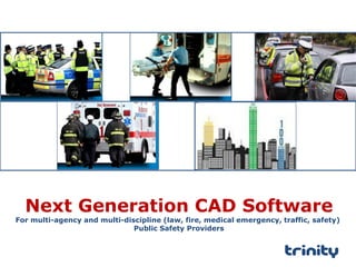
- 1. Next Generation CAD Software For multi-agency and multi-discipline (law, fire, medical emergency, traffic, safety) Public Safety Providers
- 2. For Multi-Agencies Service Providers (Law,Fire,Medical,Traffic & Safety) Who Have to respond quickly and efficiently to call for service Our trinityRESPOND - Computer Aided Dispatch (CAD ) Software Provides A common operating picture for Public Safety Personnel to field calls, create and update Call for Service Incident details, manage critical mobile resources and dispatch mobile resources in real-time to save lives and properties. Unlike Traditional inter-connected disparate system our CAD software is based on an end-to-end integrated framework that seamlessly enables real-time workflow from the citizen, to field Mobile Responders and other agencies so that the first Responders are fully equipped with the actionable data for rapid response.
- 3. Map based Analysis Social Mobile Analytics Cloud Enable citizen to use Social Collaboration Platforms and Apps to connect with Public Safety Agents The first CAD Software Platform for Public Safety leveraging technology synergies in SMAC Enable Mobile Responders with information for rapid response Enable Spatial Analytics for deeper visibility & insights GPS In-Fleet Devices Mobile Data Terminal Mobile Apps Enable a Connected Workforce Thematic Maps Remote Supervisory Mobile Asset
- 4. Communication Interface CAD Video and Sensor Interface GIS Traffic Management Database Location Analytics AVLS/ Communication/ Media /Mobile Video Management (Video Management, Video Analytics) Remote Supervisory Call Taker/Dispatcher/Supervisor Police Station PSTNMobile IP EPABX Cloud Mobile Responder CCTV/ ANPR eChallan Supervisor Mobile App Unified Communication An integrated CAD Workflow framework
- 5. trinityRESPOND Mobile Responder for CAD trinityRESPOND AVLS for CAD trinityRESPOND Call Taking/Dispatch Supervisor for CAD trinityRESPOND GIS for CAD trinityRESPOND Unified Communication Platform for CAD trinityRESPOND Call Taking Dispatch Supervision Mobile Responder Analytics An end-to-end fully integrated Seven CAD software Modules trinityRESPOND Remote Supervisory for CAD trinityRESPOND Spatial Analytics for CAD 1 2 3 4 5 7 6
- 6. trinityRESPOND Unified Communication Platform for CAD Integrated with Global Leader in Communication System Support for PSTN/Cellular /VoIP CTI Integration with trinityRESPOND CAD Automatic Call Distribution Voice Logger capabilities tagged to Call for Service Incident for a single view. Scalable platform to support high volume traffic with Automatic Failover (option) Email & SMS Integration Connectors for Social Media Platforms Social Apps (SoS ) integrated to Policing 1 Advanced call management capabilities that enable Call Takers to field all type of calls – voice, message, email, social media and social Apps (SoS)
- 7. trinityRESPOND GIS for CAD Open Source Software GIS platform Fully Integrated with trinityRESPOND CAD for call taking, dispatch and supervisory functions Geo-Reference support Foundation for Spatial Analytics Rich support for Geo Processing – Routing, Shortest Distance, Route Planning ,etc Easy to use with marking tools, search, map tools for highly interactive usage. Custom Map and Map Data creation service trinityGIS Open Source Geospatial Foundation Application Server Database System Desktop Browser Mobile Data Base Map, Custom Data 2 The only Open Source GIS Platform for CAD provides compelling advantage over proprietary system
- 8. trinityRESPOND Call Taker for CAD Integrated two screen covering Application and Map Softphone Telephone Window ANI and ALI support Rich GUI for Call Takers to quickly create Call for Service events, Call Classification Locate the event on the map Capture the event details based on Standard Operating Procedure (SOP) Caller History Similar Call decision support Partial Dispatch support Open Source Software GIS platform Acknowledge Call for Service to Caller through SMS. Flexible Dispatch Options – Zone, Event type, by Dispatcher, etc. Call taking made easy 3
- 9. trinityRESPOND Dispatcher for CAD Advanced Dispatch Decision support system Integrated three screen covering Application, Map and Video Softphone Telephone Window Complete Visibility of Call for Service Details as recorded by Call Taker. Application based interface to all Voice Tags attached to a CFS incident. Dispatch Decision support for handling dispatch based on jurisdictions, Proximity, Specialization, Availability of Mobile Resources Map based Track and route Assist support. Real-time visibility of Dispatch Status Review Compliance of Action Taken by Mobile Responder . Integrated Radio and Conferencing capabilities
- 10. trinityRESPOND Supervisory for CAD Provide real-time visibility and puts you in control The CAD software provides total visibility to Control Room Commanders to track the status of the events, co-ordinate response with responding units, review compliance to action taken ( details, Audio Logs, Image, Video ) and provide a high degree of service to the public
- 11. trinityRESPOND Remote Supervisory for CAD Connect Workforce Anytime, Anywhere with Anydevice Provides total visibility of the Call for Service to workforce Cloud Based Delivery Map based Decisions support Real-time visibility of Dispatch Status Review Compliance of Action Taken by Mobile Responder . Access all records – event details, voice tags, action taken , image, video, audio records on the move Available for use on any device – smartphone, Tablets, Web Console, Rugged Notebooks. Jurisdictions and hierarchy based access Track Service Levels 4
- 12. trinityRESPOND Mobile Responder for CAD Most advanced Mobile App integrates data, location, image, audio and video for reporting Action Taken. Provides total visibility of the Call for Service to workforce Map based Decisions support Report Action Taken using Audio records, Image, Video in real-time. Update status of Call for Service on the move Support for Vehicle Mounted Unit and Handheld Android & Windows support Update Availability status 5
- 13. trinityRESPOND AVLS for CAD Facilitate data Communication with field mobile devices and other CAD modules Interface with all type of GPS devices and Mobile Data Terminals Tools to manage all type of data message TCP/IP protocol based communication. GSM-GPRS method of data communication. Receive & Send messages and interface with other CAD modules. Manage Mobile Resources & Asset 6 Fully Integrated with the other CAD Modules
- 14. trinityRESPOND Spatial Analytics for CAD Fully integrated with CAD and provides a map based Visualization and analytics Spatial Analytics based BI Thematic Maps to get a geographical understanding Map based Analysis for trends, patterns and territories. Predictive Analytics Query based reporting tool Fully integrated to CAD database Delivered over the cloud 7 Thematic Maps Map based Analysis
- 15. Replicable business model build on strong eco-system partner framework to deliver scale 360 degree OEM Service Delivery Application SI
- 16. trinityRESPOND CAD Software is now a Gold Standard for Public Safety in India. 1. Highest market share in new installations rolled out for Public Safety ( for law ) in India over the last three years. 2. More than 15 Installation in key cities with more than 1 million population 3. Implementation span City based control room model and state wide based on Private Cloud Model - Data Center with Distributed Response Management Centers. 4. Complimentary model of leveraging System Integration strengths and Trinity core domain solution offering 5. Fully functional CAD Center of Excellence (COE) for proof of concept and solution modeling. 6. In-house capabilities to undertake Blue Printing and customization to tailor the software to unique needs and undertake project management.
- 17. About Trinity Trinity Transform’s the way Enterprise and Government automate management of Mobile Work, Mobile Workers and Mobile Assets. Trinity’s Integrated Technology Stack Framework (ITSF) is built on advances in SMAC ( Social, Mobile, Analytics and Cloud ) technologies and is the IP framework on which differentiated Value Proposition is created . Trinity’s portfolio of Product, Platform and Services exploits high growth markets , create and sustain exponential revenue growth and exponential returns . Software Products SaaS Platform Computer Aided Dispatch (CAD) Location Intelligence & Analytics Mobile Workforce Management Fleet Telematics Trinity Connected Fleet Trinity Connected Workforce Trinity Connected Remote Asset Portfolio Hardware Products Telematics Unit Asset Tracker & Monitoring Unit Services GIS Platform , Map & Map Data
- 18. Smart Mobility Platforms, Products & Services For More Information Visit : www.trinitymobility.com Mail : info@trinitymobility.com