Prairie Restoration
•Descargar como PPTX, PDF•
0 recomendaciones•380 vistas

Describes steps for landowners to convert to native prairie and discuss monitoring techniques.

Recomendados
Recomendados
Más contenido relacionado
La actualidad más candente
La actualidad más candente (19)
Destacado
Destacado (15)
Similar a Prairie Restoration
Similar a Prairie Restoration (20)
Más de Trinity Waters
Más de Trinity Waters (7)
Último
Último (20)
Prairie Restoration
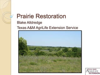
- 1. Prairie Restoration Blake Alldredge Texas A&M AgriLife Extension Service
- 3. What Is Native Prairie? Mixture of native grasses and forbs (aka weeds) Prairie specific wildlife, soil, geology, and fire are important Texas was 75% prairie and savanna Less than 1% of 20 million acres remains!
- 4. Ecoregions
- 5. What Are Native Grasses? Little Bluestem Big Bluestem Indiangrass Switchgrass Eastern Gamagrass Side-Oats Grama
- 6. What Are Native Forbs? Engelman Daisy Illinois Bundleflower Maximilian Sunflower Coneflowers Partridge Pea Prairie Clover Western Ragweed
- 7. Why Is Native Prairie Important? Wildlife habitat Livestock forage Watershed protection
- 8. Wildlife Habitat Quail, Turkey, Deer Bunchgrasses provide cover Forbs provide food and cover Bare ground for travel 40% of NA bird species dependent on prairie
- 9. Livestock Forage Excellent forage Drought tolerant Deep root system Microbes cycle nutrients Don’t graze tallgrasses below 10 inches
- 10. Watershed Protection Surface runoff = 24% Infiltration = 75% Wildlife habitat! Bunchgrasses Sodgrasses Surface runoff = 45% Infiltration = 54% Fertilizers?
- 11. Restoration Steps Establish Goals Site Selection Site Preparation Establishment of Natives MONITOR!!!
- 12. Establish Goals Purpose ◦ Increase wildlife habitat ◦ Less input forage type ◦ Watershed protection Guides Restoration Plan Measureable indicators Budget ◦ $100-$200/acre
- 13. Site Selection Inventory of property Connect to existing habitat Easements, riparia n areas, fencelines Examine soils (Web Soil Survey) 10% of land per year or every other year
- 15. Trinity River Information Management System Accessible Interactive Watershed scale (local to regional) Soils, vegetation , elevation, strea m data Restoration potential trims.tamu.edu
- 17. Site Preparation For introduced grasses ◦ Stop fertilizing to allow growth 10-12 in ◦ Spray 4-5 quarts of Glyphosate per acre ◦ For bahiagrass, spray 3/8 oz of Metsulfuron methyl per acre ◦ Best time to spray is June - August
- 18. Establishment of Natives Soil test prior to establishment Establishment Methods ◦ Passive restoration ◦ No-Till ◦ Broadcast Seed and Hay Minimum 2 years for establishment
- 19. Passive Restoration Relying on seed bank Minimum 10% native coverage Factors such as grazing need to be accounted for
- 20. Active Restoration No-Till seed drill ◦ Better success ◦ Good for highly erodible, flat sites ◦ Expensive ◦ Mowing first 2 years to knock back forbs or other grasses
- 21. Active Restoration Broadcasting ◦ Places seed on top of ground ◦ More economical? ◦ Best suited for rough terrain ◦ Can use different spreaders ◦ Hoof action, harrowing, ch aining, cultipacking
- 22. Seed Selection Match with soil properties in your area ◦ Ecological Site Descriptions Within 100 miles E/W, 200 miles N/S Pure Live Seed (PLS) - % of bulk seed material that is live, viable seed Recommended seeding rates are 20 live seed per ft2 Most seed mix seeding rates vary from 3-5 pounds PLS per acre
- 23. Seeding Depth critical because seed germination requires good seed to soil contact, with sufficient moisture and light Plant ¼ to ½ inch deep Best time to plant is late fall to early spring Need 30 days of adequate soil moisture to germinate Don’t plant during drought conditions!
- 25. Considerations Post-restoration Plan Drought impacts on seeding and prices Equipment costs Cooperatives - WNBRI seed drill
- 26. Monitoring Photo Points ◦ Landscape and ground level photos ◦ Mark with T post ◦ Same day every year if possible Grazing Exclosures ◦ Evaluates grazing pressure ◦ Take photos every year
- 27. Monitoring Nest Clump Surveys ◦ Quail habitat ◦ Count # of nest clumps along transect ◦ Measure 0.1 acre Cover Surveys ◦ Land area that plants occupy or “cover” ◦ Evaluate
- 28. Monitoring Grass Stubble Height ◦ Plant vigor, watershed protection ◦ 10-12 inches for tallgrasses Forage Clipping ◦ Measures forage production ◦ Minimum 1,200 – 1,500 lbs/acre in tallgrass prairies
- 29. Management
- 30. Questions?
Notas del editor
- Point out the various ecoregions
- A study done a few years ago compared runoff, erosion, and infiltration rates on native bunchgrasses vssodgrasses like bermuda. Based on 4 inch rainfall rate in 30 minutes bunchgrasses had lower runoff and erosion and greater infiltration. This means more water stays in the soil where it fell and can promote greater grass production in the future. But for those with pastures and hay fields, leave more residue on the ground and don’t let grasses like bermuda get eaten to less than 4-6 inches, and runoff and erosion can be reduced that way as well.These are benefits of natives vs. introduced
- Now that I’ve convinced you to restore prairies, I will discuss some general steps to take in your restoration plan. Work with your TPWD, NRCS biologists and county extension agents because they have the local expertise to help you develop this plan.
- Establishing goals is vital to a restoration project and will help determine which activities need to be implemented and in the correct sequence. There are many reasons to restore native prairies, increasing wildlife habitat which could help diversify ranch income, a less input forage source, or to control erosion prone areas and other watershed protection objectives. Set up measureable indicators that you can use to assess the success of the project. For example, you might say once you reach 50% cover of native grasses, then you can start managing by using burning or grazing to promote more coverage. These indicators can be developed with local biologists. Develop a budget for the project that you can afford. You don’t want to buy herbicide and spray and then realize you cant buy seed! Once you know how much you can spend, you can then focus on priority areas. There are many cost share programs available thru NRCS, TPWD, and others that can provide some financial assistance for these projects.
- Take an inventory of your property to see which areas might be best suited for restoration and to select priority areas. If any exists, connect to existing prairie habitat on your property or surrounding properties (WHF example). If no habitat exists, good places to start are powerline easements, riparian areas, fencelines that can serve as corridors. (Discuss photo) It is best to examine your soils on web soil survey to see what will grow best there and to develop your seed mix to match that. NRCS or TPWD biologists can help with this too. It’s recommended that you not restore more than 10% of your land every year or every other year so that, especially for cattle producers, your not putting yourself out of business. It takes 2-3 years before you’ll get a good stand of native grasses, so patience is needed. In drought years, may take longer.
- From a regional standpoint, I would focus on western navarro county and limestone county, but local scales may be much different.Hard to tell at this scale good areas to restore. Need web soil survey and TRIMS on your property
- A great tool that has come out is the Trinity River Information Management System, or TRIMS, developed by the Texas A&M Institute of Renewable Natural Resources. This is similar to a GIS program but is available for free on the web at www.trims.tamu.edu. On this interactive website, you can zoom to your specific piece of land, or look at a watershed as a whole. Features on this website allow you to determine soil and vegetation types on the land, measure land area, access elevation and stream gauge data, and others all in the overall goal of conservation planning. On this site, you can determine areas that are best suited for restoration.Replace screen shot, maybe with amy teaching someone at screen
- Point out areas that they may want to start (riparian areas) and avoid cropland. Talk about ease of restoring classes
- Mycorrhizae and other soil organisms