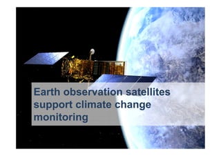
Green Day 2016 - Earth Observation satellites support climate change monitoring
•
0 recomendaciones•1,239 vistas

During the 2016 Green Day conference organized by AGOL and LUISS University, Massimo Comparini, CEO of e-Geos introduced us on how satellite technology can support climate change monitoring

Recomendados
Más contenido relacionado
La actualidad más candente
La actualidad más candente (20)
Destacado
Destacado (20)
Similar a Green Day 2016 - Earth Observation satellites support climate change monitoring
Similar a Green Day 2016 - Earth Observation satellites support climate change monitoring (20)
Más de Leonardo
Más de Leonardo (20)
Último
Último (20)
Green Day 2016 - Earth Observation satellites support climate change monitoring
- 1. Earth observation satellites support climate change monitoring
- 2. Optical and RADAR satellite and aerial data are a reliable source for continuous information on a global and local scale
- 3. Optical and RADAR satellite and aerial data are a reliable source for continuous information on a global and local scale
- 4. • Intensive farming practices • Water consumption • Uncontrolled deforestation Satellite technology Climate change Observe Measure
- 5. Intensive farming practices Intensive agriculture alters natural resources balance and stock-rearing increases CO2 emissions
- 6. Intensive farming practices Satellite technology provides support for land management, agronomic planning and control of plantation growth
- 7. September 2014 March 2015 July 2015 Composite image of 3 different dates Each radar image corresponds to a color band
- 8. Imm concept irrigazione Massive water consumption Due to the higher temperatures, irrigation in agriculture is increasing, threatening water balances
- 9. Radar satellites help to monitor and control farm planning in order to preserve natural resources Massive water consumption
- 10. Radar data are suitable for measuring soil changes due to soil water quantity for agriculture activity Intensive activity related to crops: vegetation growth Set aside fields. Natural vegetation Uncultivated terrain Harvested fields
- 11. Imm concept deforestation Uncontrolled deforestation Extensive forest cuts and intentional fires and are often used to create new land for pasture and intensive agriculture
- 12. The infrared satellite sensors allow the measurement of burned and deforested areas Uncontrolled deforestation
- 13. Red color range highlights the index of vegetation Uncontrolled deforestation
- 16. BURNED AREA Satellites certify 1550 trees killed 150ha burned area
- 17. • Desertification • Drought • Melting Ice • Sea level rising • Natural disasters Satellite technology Climate change Observe Measure
- 18. Desertification Climate change is accelerating the expansion rate of the deserts and also the reduction of ecosystem services. But desertification itself also impacts on climate change
- 20. Desertification Satellites report the development of artificial oasis islands, supporting land preservation against the advance of the desert
- 21. Drought Climate change is altering weather and water patterns around the world, causing shortages and droughts
- 22. Satellite technology records lake variation measurements Drought
- 23. August 1972 Massive lakes drought long term monitoring Sea Aral between Kazakhstan north Uzbekistan, Modis © NASA August 1972
- 24. August 1972
- 25. August 1972
- 26. August 1972
- 27. August 1972
- 28. August 1972
- 29. August 1972
- 30. August 1972
- 31. August 1972
- 32. August 1972
- 35. Leveraging on their polar orbit, COSMO-SkyMed Radar satellites are able to acquire images of both north and south Poles. The high revisit time of the constellation allows the acquisition of a huge series of images of icebergs behavior and trend analysis glacier
- 36. Satellites can detect and follow glacier movements and evolution, as well as ice surface reduction Melting ice
- 38. Melting ice High revisit time of the Italian radar constellation enables continuous monitoring of iceberg movements
- 39. 14 dec 2013 7 Jan 2014 22 Dec 2013
- 40. 14 dec 2013 7 Jan 2014 22 Dec 2013
- 41. 14 dec 2013 7 Jan 2014 22 Dec 2013
- 42. 14 dec 2013 7 Jan 2014 22 Dec 2013
- 43. 14 dec 2013 7 Jan 2014 22 Dec 2013
- 44. 14 dec 2013 7 Jan 2014 22 Dec 2013
- 45. 14 dec 2013 7 Jan 2014 22 Dec 2013
- 46. 14 dec 2013 7 Jan 2014 22 Dec 2013
- 47. 14 dec 2013 7 Jan 2014 22 Dec 2013
- 48. 14 dec 2013 22 Dec 2013 7 Jan 2014
- 49. 14 dec 2013 7 Jan 2014 22 Dec 2013
- 50. Sea level rising Oceans and seas have enormous importance in regulating global climate
- 51. No Radar penetration 5mt 20 mt 10 mt Signal Penetration Up to 20 mt COSMO-SkyMedLandsat 7 RADAR provides Better measurement of land/water limit ! Optical Signal RADAR Signal
- 52. Optical Signal RADAR Signal Visibility: day/night through clouds Up to 4 images per day thanks to the 4 satellites constellation High revisit time
- 53. Natural disasters Climate change leads to increased frequency of extreme weather events such as high rainfall causing disasters
- 54. Radar technology clearly allows water detection, even through clouds, during the night. COSMO-SkyMed constellation acquires up to 4 images/day for rapid damage assessment maps Natural disasters