3 d visualisation of information
•
1 recomendación•646 vistas

1) The document discusses challenges with 3D visualization of geographic and mapping data compared to traditional 2D representations. 2) Specifically, it notes that symbols used in 2D maps do not always translate well to 3D environments and questions whether a single symbol set can represent information effectively in both 2D and 3D. 3) The document explores issues with scales, perspectives, lighting and other factors that make consistent representation of symbols across dimensions difficult.

Recomendados
Recomendados
Más contenido relacionado
Destacado
Destacado (20)
Similar a 3 d visualisation of information
Similar a 3 d visualisation of information (20)
Más de British Cartographic Society
Más de British Cartographic Society (20)
3 d visualisation of information
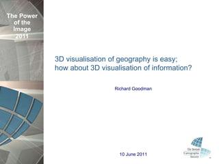
- 1. The Power of the Image 2011 3D visualisation of geography is easy; how about 3D visualisation of information? Richard Goodman 10 June 2011
- 2. The Power of the Image What am I talking about? 2011 “Cartographers have spent millennia fine tuning beautiful and practical symbology for the 2D, vertical representation of geographic and human features. Recently, computer game programmers have given us the 3D visualisation environment, into which the existing symbology is often pushed. However, these symbols often do not stand up (literally) to the visual rigors of this new environment. Can one symbol set deliver a practical and beautiful representation of its information in both the 2D and 3D views? If not, how can the same mapping data be viewed in these different environments without duplicating the data? Using some of the most modern visualisation tools to demonstrate different symbol displays from utilities, defence and government mapping applications.”
- 4. The Power Introduction of the Image 2011
- 6. The Power 3D explosion of the Image 2011
- 7. PLA IN 3D
- 8. The Power Point features of the Image 2011
- 9. The Power Point features of the Image 2011
- 10. The Power Point features of the Image 2011
- 11. The Power Point features of the Image 2011
- 12. The Power Point features of the Image 2011
- 13. The Power Point features of the Image 2011
- 14. The Power Point features of the Image 2011
- 15. The Power Point features of the Image 2011
- 16. The Power Area Features of the Image 2011
- 17. The Power Area Features of the Image 2011
- 18. The Power Linear Features of the Image 2011
- 19. The Power Linear Features of the Image 2011
- 20. SYMBOL ISSUES IN 3D
- 21. The Power Scale of the Image 2011
- 22. The Power Scale of the Image 2011
- 23. The Power Scale of the Image 2011
- 24. The Power Perspective of the Image 2011
- 25. The Power Perspective of the Image 2011
- 26. The Power Perspective of the Image 2011
- 27. The Power Symbol Background of the Image 2011
- 28. The Power Symbol Background of the Image 2011
- 29. The Power Other issues of the Image 2011 Lighting of symbols Atmospheric effects Scaling & reality of symbol models Model origin
- 30. The Power 3D Symbol standards? of the Image 2011 Mil 2525c Home Office Civil Contingency Common Symbology Ordnance Survey OGC – extend Styled Layer Descriptors (SLD) (OGC 09-042)
- 31. The Power of the Image 2011
- 32. The Power of the Image 2011 Richard Goodman Principal Application Engineer Security, Government & Infrastructure Intergraph (UK) Ltd Delta Business Park Swindon SN5 7XP M +44 (0)7977 256846 F +44 (0)1793 694999 richard.goodman@intergraph.com www.intergraph.co.uk
- 33. The Power References of the Image OGC – extend Styled Layer Descriptors (SLD) (OGC 09- 2011 042) Pegg, http://lazarus.elte.hu/cet/academic/pegg.pdf, Design Issues with 3D Maps and the Need for 3D Cartographic Design Principles http://www.lockheedmartin.com/products/Infoscene/Explori ngInfoscene.html