SlideShare una empresa de Scribd logo
1 de 90
Descargar para leer sin conexión
(Quivira)
Ambrosia Lake Site 2
Ambrosia Lake Site
(UNC) Church Rock Site
Bluewater Site
(SOHIO) LBAR Site
South Valley Superfund Site
Shiprock Site
New Mexico
(Homestake)
Grants Site
Gasbuggy Site
Los Alamos
National Laboratory
Lovelace
Respiratory
Research Institute
Sandia National
Laboratories - New
Mexico
Waste Isolation Pilot Plant
Gnome-Coach
Long-Term Stewardship Site Highlights
Ambrosia Lake Site (page 3)
Major Activities- disposal cell monitoring
Site Size- 116 hectares (288 acres)
Start/End Years- 1998/in perpetuity
Estimated Average Annual Cost FY 2000-2006-
$19,300
Bayo Canyon (page 7)
Major Activities- surveillance and institutional
controls
Site Size- 0.6 hectares (1.5 acres)
Start/End Years- 198212142
Estimated Average Annual Cost FY2000-2006-
$1,000
Bluewater Site (page 11)
Major Activities- disposal cell monitoring;
groundwater monitoring; access restrictions
Site Size- 1,335 hectares (3,300 acres)
Start/End Years- 1997/in perpetuity
Estimated Average Annual Cost FY2000-2006-
$20,100
Gasbuggy Site (page 17)
Major Activities - groundwater monitoring; access
restrictions for subsurface contamination
Site Size- 259 hectares (640 acres)
Surface Start/End Years- 2006/in perpetuity
Subsurface Start/End Years- 2014/in perpetuity
Estimated Average Annual Cost FY2000-2006-
$41,000
Gnome-Coach (page 21)
Major Activities -groundwater monitoring; restrictions
for access to and use of the subsurface
Site Size- 275 hectares (680 acres)
Surface Start/End Years- 2005/in perpetuity
Subsurface Start/End Years- 2012/in perpetuity
Estimated Average Annual Cost FY2000-2006-
$38,000
(Homestake) Grants Site (page 25)
Expected Activities -groundwater monitoring;
disposal cell monitoring and maintenance; erosion
control; institutional controls; inspections
Site Size- 490 hectares (1 ,200 acres)
Expected Start Date- 2015
Current Landlord- Homestake Mining Company
Expected Future Landlord- U.S. Department of
Energy, Grand Junction Office
Los Alamos National Laboratory (page 29)
Major Activities- surveillance and maintenance of
engineered units; ground and surface water
monitoring; institutional controls
Site Size- 11,000 hectares (28,000 acres)
Start/End Years- 1993/in perpetuity
Estimated Average Annual Cost FY2000-2006- n/a
(costs begin FY 2007)
Lovelace Respiratory Research Institute (page 41)
Major Activities - groundwater monitoring; institutional
controls
Site Size- 55 hectares (135 acres)
Estimated Average Annual Cost FY 2000-2006-
$140,000
(Quivira) Ambrosia Lake Site 2(page 51)
Expected Activities -groundwater monitoring; disposal
cell monitoring and maintenance; institutional controls
Site Size- 810 hectares (2,000 acres)
Expected Start Year- 2015
Current Landlord- Quivira Mining Company
Expected Future Landlord- U.S. Department of
Energy, Grand Junction Office
Long-Term Stewardship Site Highlights
Sandia National Laboratories - New Mexico (page 55)
Major Activities- groundwater monitoring; vadose zone
monitoring; disposal cell maintenance and monitoring
Site Size- 1,130 hectares (2,820 acres)
Estimated Average Annual Cost FY2000-2006-
$900,000
Shiprock Site (page 69)
Major Activities· disposal cell monitoring; institutional
control enforcement; access restrictions; groundwater
monitoring
Site Size- 42 hectares (105 acres)
Start/End Years· groundwater- 2012/in perpetuity;
engineered unit - 1996/in perpetuity
Estimated Average Annual Cost FY2000-2006-
$121,000
(SOHIO) LBAR Site (page 75)
Major Activities- access control; disposal cell monitoring
and maintenance; groundwater monitoring
Site Size-162 hectares (740 acres)
Start/End Years- 2001/in perpetuity
Estimated Average Annual Cost FY2000-2006- $33,657
South Valley Superfund Site (page 79)
Site Size- 13 hectares (33 acres)
Current Owner- General Electric
Start Year- 1966
Expected Future Owner- General Electric
(UNC) Church Rock Site (page 81)
Site Area- 259 hectares (640 acres) (exact acreage to
be transferred to U.S. Department of Energy for long-
term stewardship activities is unknown)
Current Landlord· United Nuclear Corporation
Expected Start/End Years· 2015/in perpetuity
Expected Future Landlord- U.S. Department of
Energy, Grand Junction Office
Waste Isolation Pilot Plant (page 85)
Site Area- 124 acres (50 hectares)
Current Landlord- U.S. Department of Energy (DOE)
Expected Start-End Years- 2040/in perpetuity
Expected Future Landlord- DOE
Table of Contents
Table of Contents
Ambrosia Lake Site ...................................................................... 3
Bayo Canyon ........................................................................... 7
Bluewater Site ......................................................................... 11
Gasbuggy Site ......................................................................... 17
Gnome-Coach ......................................................................... 21
(Homestake) Grants Site ................................................................. 25
Los Alamos National Laboratory ........................................................... 29
Lovelace Respiratory Research Institute ..................................................... 41
(Quivira) Ambrosia Lake Site 2 ............................................................ 51
Sandia National Laboratories-New Mexico .................................................. 55
Shiprock Site .......................................................................... 69
(SOHIO) LBAR Site .................................................................... 75
South Valley Superfund Site .............................................................. 79
(UNC) Church Rock Site ................................................................. 81
Waste Isolation Pilot Plant ................................................................ 85
New Mexico 1
National Defense Authol'ization Act (NDAA) Long-Term Stewanlship Report
New Mexico 2
Ambrosia Lake Site
AMBROSIA LAKE SITE
1.0 SITE SUMMARY
1.1 Site Description and Mission
The Ambrosia Lake Site is the location of a former
uranium milling site that operated between 1958 and
1963, and again in the late 1970s and early 1980s. The
site also contains a disposal cell for the uranium mill
tailings and other process-related wastes that resulted
from operations. The site is located on a 116-hectare
(288-acre) tract of land in McKinley County in
northwest New Mexico, approximately 40 kilometers
(25 miles) north of Grants and 114 kilometers (85
miles) northwest of Albuquerque. The immediate area
surrounding the Ambrosia Lake Site is sparsely
populated. The site is within the Ambrosia Lake
Mining District, near the center of the Grants Mineral
Belt. Decommissioned uranium milling sites,
LONG~TERM STEWARDSHIP HIGHLIGHTS
Major Long-Term Stewardship Activities - disposal
cell monitoring
Total Site Area- 116 hectares (288 acres)
Estimated Volume ofResidual Contaminants- disposal
cell 4 million cubic meters (5.2 million cubic yards)
Long-Term Stewardship Start-End Years- 1998-in
perpetuity
Average Annual Long-Term Stewardship Cost FY
2000-2006- $19,300
Landlord- U. S. Department of Energy, Grand
Junction Office
abandoned underground mines, mine shafts, and ore piles are located near the site.
The U.S. Department of Energy's (DOE) current mission at the Ambrosia Lake Site is to perform long-term
stewardship activities, including monitoring and maintenance ofthe disposal cell. The former mill site is subject
to Title I ofthe Uranium Mill Tailings Radiation Control Act of1978 (UMTRCA). As such, DOE is responsible
for remediation and long-term stewardship activities. DOE completed remediation of the site in 1995.
The historic mission of the Ambrosia Lake Site was to mill uranium for the United States national defense
program. Phillips PetroleumCompany originally owned and operated the mill, which was built in 1957. Uranium
ore was processed at the site between 1958 and 1963. The United Nuclear Corporation purchased the mill in 1963
and operated it for a briefperiod. In the late 1970s and early 1980s, United Nuclear Corporation operated an ion
exchange system, extracting uranium from mine water. Homestake Mining purchased United Nuclear
Corporation's interest in 1981. Processing operations at the site ceased in 1982.
1.2 Site Cleanup and Accomplishments
Milling operations at the site created process-related wastes and uranium mill tailings. The tailings originally
covered approximately 42 hectares (105 acres). Wind and water erosion spread some ofthe tailings across a 230-
hectare (570-acre) area. After remediation activities were completed in 1995, the contamination was restricted
to a single 37-hectare (91-acre) onsite disposal cell containing approximately four million cubic meters (5.2
million cubic yards) of contaminated material.
No groundwater remediation occurred at the Ambrosia Lake Site. The uppermost aquifer is not usable as a
drinking or irrigation water resource because of low yield. Consequently, supplemental standards, as defined
in Title 40 of the Code of Federal Regulations Part 192.22, were applied to the site's groundwater. No
groundwater monitoring is required at this site.
New Mexico 3
National Defense Authorization Act (NDAA) Long-Term Ste ardship Report
Disposal Cell
Ambrosia Lake Site
2.0 SITE-WIDE LONG-TERM STEWARDSHIP
2.1 Long-Term Stewardship Activities
D
=
To Albuquerque, NM
(-85 miles)
~
0.25 0.5
Miles
DOE's Grand Junction Office is responsible for long-term stewardship activities at the AmbrosiaLake Site. DOE
manages the site according to a long-term surveillance plan prepared specifically for the Ambrosia Lake Site and
approved by the U.S. Nuclear Regulatory Commission (NRC). DOE performs long-term stewardship activities,
as required under the NRC general license, to maintain protectiveness and regulatory compliance.
DOE conducts annual inspections at the Ambrosia Lake Site to evaluate the condition of surface features and to
perform maintenance, as necessary. Because the uppermost aquifer is considered a "limited use" aquifer, it is
not a groundwater resource. Therefore, groundwater monitoring at the Ambrosia Lake Site is not required. The
site is not fenced, but access is restricted through the use of warning signs posted every 152 meters (500 feet)
along the site boundary. DOE staffs a 24-hour phone line for reporting site concerns. To prevent exposure to
the buried waste, drilling and other intrusive activities are prevented within site boundaries through institutional
controls. A deed restriction on the adjacent private property to the west prevents mining or drilling. DOE
maintains a restrictive easement on adjacent land owned by the Quivera Mining Company to ensure that DOE
has perpetual access to the Ambrosia Lake Site.
Site records are kept in permanent storage at the DOE Grand Junction Office in Colorado. The types of records
kept include site characterization data, remedial action design, the completionreport, long-term monitoring plan,
annual inspection reports, and monitoring data. Real property records are maintained at DOE's Albuquerque
Office in New Mexico.
New Mexico 4
2.2 Specific Long-Term Stewardship Activities
Engineered Units
The Ambrosia Lake Site disposal cell is roughly
rectangular and measures approximately 762 meters by
488 meters (2,500 feet by 1,600 feet). The cell rises
approximately 15 meters (50 feet) above the
surrounding terrain and occupies approximately 37
hectares (91 acres) of the 116-hectare (288-acre) site.
The disposal cell contains 6,931,000 dry tons of
contaminated material, with a total activity of 1,850
curies of radium-226.
The cell cover is a multi-component system designed to
Ambrosia Lake Site
STAKEHOLDER INVOLVEMENT
Community interaction has been minimal since the
remedial action was completed. Copies of the annual
inspection report for the Ambrosia Lake Site and other
sites are distributed to the local library and any
stakeholder that requests one. Annual inspection
reports are also published on the DOE Grand Junction
Office website at www.doegjpo.com.
encapsulate and protect the contaminated materials for 200 to 1,000 years. A low-permeability radon barrier,
consisting of compacted clay soils was placed over the compacted tailings. This layer is designed to prevent
precipitation from percolating through the contaminated materials and into the underlying soils, and to reduce
radon emissions. Erosion protection for the top and side slopes consists of a layer of rock underlain by a layer
of granular bedding material. The cell design promotes rapid runoff of precipitation to minimize leachate and
deter bio-intrusion. The sole long-term stewardship activity is annual surface inspections of the disposal cell.
2.3 Regulatory Regime
In 1998, the Ambrosia Lake Site came under a general license issued by NRC for custody and long-term care of
residual radioactive disposal sites (contained at Title 10 ofthe Code ofFederal Regulations, Section 40.27). The
purpose ofthe general license is to ensure that such sites will be cared for in a manner that protects human health
and safety and the environment. The general license went into effect when NRC concurred that the site
conformed to cleanup standards and formally accepted the site-specific long-term surveillance plan.
Long-term stewardship activities at the Ambrosia Lake Site are governed by several regulations, including the
Uranium Mill Tailings Radiation Control Act of 1978; the Atomic Energy Act of 1954, as amended; EPA
Groundwater Protection Standards, including Subparts A, B, and C of Title 40 of the Code of Federal
Regulations Part 192, and the National Environmental Policy Act of 1969, as amended.
2.4 Assumptions and Uncertainties
The scope of long-term stewardship activities is well documented since DOE has been performing long-term
stewardship activities since 1998, and the scope is not expected to change dramatically over time.
The engineered unit cap is not expected to be replaced for at least 200 years.
3.0 ESTIMATED LONG-TERM STEWARDSHIP COSTS
Long-term stewardship costs for the Ambrosia Lake Site, identified in the table below, are expected to remain
relatively constant over the period of the cost estimate and are associated with monitoring and maintaining the
disposal cell. The cost estimate is based on the current actual costs of conducting long-term stewardship
activities at the Ambrosia Lake Site. The cost estimate reflects the current site agreements and monitoring
frequencies.
New Mexico 5
National Defense Authorization Act (NOAA) Long-Term Stewardship Report
. Site Long-Term Stewardship Costs (Constant Year 2000 Dollars)
Year(s) Amount Year(s) Amount Year(s) . Amount
FY2000 $4,200 FY 2008 $21,100 FY 2036-2040 $102,300
FY 2001 $25,000 FY 2009 $21,100 FY 2041-2045 $102,300
FY 2002 $21,700 FY2010 $20,600 FY 2046-2050 $102,300
FY 2003 $20,900 FY 2011-2015 $98,100 FY 2051-2055 $102,300
FY 2004 $21,100 FY 2016-2020 $95,500 FY 2056-2060 $102,300
FY 2005 $21,300 FY 2021-2025 $95,800 FY 2061-2065 $102,300
FY 2006 $20,900 FY 2026-2030 $101,200 FY 2066-2070 $102,300
FY 2007 $21,200 FY 2031-2035 $102,300
4.0 FUTURE USES
The future use of the site will be restricted to monitoring and maintaining the disposal cell in perpetuity.
For more information about the Ambrosia Lake Site, please contact:
Art Kleinrath, Long-Term Surveillance and Maintenance Program Manager
U.S. Department of Energy ,Grand Junction Office
2597 B3/4 Road, Grand Junction, CO 81503
Phone: 970-248-6037
or visit the Internet website at http://www.doegjpo.com
New Mexico 6
Bayo Canyon
BAYOCANYON
1.0 SITE SUMMARY
1.1 Site Description and Mission
The Bayo Canyon site, near Los Alamos, New Mexico,
was used by U.S. Department of Energy (DOE)
predecessor agencies for explosive compressiontests on
metals. Facilities (radiochemistry laboratory, assembly
buildings, personnel buildings, etc.) supporting these
tests were also located in the area. The 0.6-hectare
(1.5-acre) site is located 40 kilometers (25 miles)
northwest of Santa Fe and 99 kilometers (62 miles)
northeast of Albuquerque. The site is located in the
bottom of Bayo Canyon approximately five kilometers
(three miles) east of tlie City of Los Alamos, on the
border of Los Alamos and Santa Fe Counties.
LONG-TERM STEWARDSHIP HIGHLIGHTS
Major Long-Term Stewardship Activities - surveillance
and institutional controls
Total Site Area- 0.6 hectares (1.5 acres)
Estimated Volume ofResidual Contaminants-
unknown
Long-Term Stewardship Start-End Years- 1982-2142
Average Annual Long-Term Stewardship Cost FY
2000-2006-$1,000
Landlord- U.S. Department of Energy
The site became contaminated with strontium-90, which was a contaminant in some of the materials used in
explosive compression tests. The radioactivity was released into the environment by both the explosive tests and
the disposal of solid and liquid wastes from the facilities supporting the tests. In 1982, as part of the Formerly
Utilized Sites Remedial Action Program, DOE completed remediation of the radioactive contamination at the
site. DOE removed a total of 1,160 cubic meters (1,520 cubic yards) of contaminated soil and closed the
excavations with clean fill. However, subsurface contamination above the cleanup standards of 100 picocuries
per gram (pCi/g) remains in some areas at depths between 2.4 meters (eight feet) and 12.2 meters (40 feet). Six
permanent markers were established at the site after the completion of remedial action. Currently, DOE is
responsible for long-term stewardship activities, which includes periodically inspecting the site and verifying the
continued presence of the markers.
1.2 Site Cleanup and Accomplishments
In 1974, the U.S. Atomic Energy Commission (the predecessor agency to DOE) established a programto evaluate
the radiological condition of real property which had supported early atomic energy development efforts. This
activity became the Formerly Utilized Sites Remedial Action Program (FUSRAP). Cleanup ofthe Bayo Canyon
site was managed and funded through the DOE Oak Ridge Operations Office.
Due to the past explosive compression tests and disposal activities at Bayo Canyon, approximately four hectares
(ten acres) of soil was primarily contaminated with strontium-90. DOE remediated the site by excavating the top
one-two meters (three-seven feet) of contaminated soil. The excavated area was backfilled with clean soil;
however, residual contamination remains between 2.4 meters and 12.2 meters (8 to 40 feet). Over time, the
remaining strontium-90 will decay naturally with a half life of 28.3 years; it is estimated that about 35 percent
has decayed since 1982.
New Mexico 7
National Defense Authotization Act (NDAA) Long-Tenn Stewardship Rcpo.-t
Miles Bayo Canyon Site
Bayo Canyon
2.0 SITE-WIDE LONG-TERM STEWARDSHIP
2.1 Long-Term Stewardship Activities
j····, 0 (/)
"' ~
~ :w
3 "T1
0 (1)
"'
otowi Mesa
'san !ldefonso Pueblo
DOE is responsible for long-term stewardship activities at the Bayo Canyon site. Long-term stewardship
activities include maintaining institutional controls, as well as surveillance and maintenance of the markers, to
ensure continued protection ofhuman health and the environment. Surface access is not restricted; however, this
region is sparsely populated. No drilling or other intrusive activities are allowed within the property unless
authorized by DOE.
DOE maintains and updates the specific records and reports required to document long-term stewardship
activities at the Bayo Canyon site. The types of records maintained include site characterization data, remedial
action design information, the site completion report, inspection reports, and historic monitoring data.
The area where subsurface contamination remains is identified by six site markers. The inscription reads:
"Buried Radioactive Materials. No Excavation Prior to 2142 A.D. See County Records. N 21 48 21 W." DOE
is responsible for surveillance and maintenance of the Bayo Canyon site to ensure the selected remedy remains
protective.
New Mexico 8
Bayo Canyon
2.2 Regulatory Regime
The primary standard governing long-term stewardship activities at Bayo Canyon is the Atomic Energy Act of
1954, as amended.
2.3 Assumptions and Uncertainties
Because the site has been monitored since 1982, long-term stewardship activities at the site are well known and
are not expected to change dramatically.
3.0 ESTIMATED LONG-TERM STEWARDSHIP COSTS
The long-term stewardship costs represent periodic inspections and verification ofthe continued presence ofthe
markers. Costs are estimated to be no more than $1,000 per year and are anticipated to continue until fiscal year
2142 or sooner.
4.0 FUTURE USES
Future use of the site will be limited to monitoring the site until the subsurface contamination has decayed.
Public access is not restricted and the land surrounding the site is currently open. These uses are expected to
continue in the future.
For additional information about the Bayo Canyon site, please contact:
Ted Taylor, Los Alamos Environmental Restoration Project Manager
U.S. Department of Energy
528 35'h Street
Los Alamos, NM 87544
Phone:SOS-665-7203
or visit the Internet website at http://emroject.lanl.gov/about us.html
New Mexico 9
National Defense Authorization Act (NOAA) Long-Term Stcanlship Rcpm·t
New Mexico 10
Bluewater Site
BLUEWATER SITE
1.0 SITE SUMMARY
1.1 Site Description and Mission
The Bluewater Site is the location of a former uranium
milling site that operated from 1953 to 1982. The site
has three disposal cells containing contaminated waste
and materials remediated from the site and vicinity
properties. The site is in west-central New Mexico,
approximately 14 kilometers (9 miles) northwest of the
City of Grants, and about 2.4 kilometers (1.5 miles)
northeast of the village of Bluewater. The land
immediately surrounding the Bluewater Site is sparsely
populated and the area's predominant land use is
grazing. The three disposal cells comprise 156 hectares
(386 acres) of the site's 1,335 hectares (3,300 acres).
The current mission ofthe Bluewater Site is performing
long-term stewardship activities, including monitoring
and maintenance of the engineered disposal cells and
LONG-TERM STEWARDSHIP HIGHLIGHTS
Major Long-Term Stewardship Activities- disposal
cell monitoring; groundwater monitoring; access
restrictions
Total Site Area -1,335 hectares (3,300 acres)
Estimated Volume ofResidual Contaminants- disposal
cell13.8 million cubic meters (18 million cubic yards);
groundwater unknown
Long-Term Stewardship Start-End Years- 1997-in
perpetuity
Average Annual Long-Term Stewardship Cost FY
2000-2006- $20,100
Landlord- U.S. Department of Energy, Grand
Junction Office
groundwater monitoring. The site is governed by Title IT of the Uranium Mill Tailings Radiation Control Act
of1978 (UMTRCA). As such, the U.S. Department of Energy (DOE) is responsible for long-term stewardship
activities at the site but was not responsible for site remediation. Remediation was completed by the owner, and
DOE began performing long-term stewardship activities in 1997.
The historic mission of the site was to process uranium for commercial purposes, but some material was sold to
the U.S. Atomic Energy Commission (a predecessor agency to DOE) to support national defense missions. The
Bluewater Site was initially the site of a carbonate-leach uranium mill built and owned by the Anaconda Copper
Company to process ore from nearby mines. The carbonate-leach uranium mill began operations in 1953. The
discovery of sandstone uranium ores and the development of the Jackpile and Paguate mines resulted in the
construction of an acid-leach mill at the site that began operations in 1957. Most of the uranium mill tailings at
the Bluewater Site are from the acid-leach process. Milling operations ceased in 1982. In 1986, the Anaconda
Copper Company became the Atlantic Richfield Company (ARCO). ARCO began mill decommissioning
activities in 1989, site reclamation in 1991, and encapsulation of the disposal cells in 1995. These cells contain
mill tailings, soils, and construction debris contaminated with uranium, radium, and thorium. The site was
transferred to DOE for custody and long-term care in 1997.
1.2 Site Cleanup and Accomplishments
Between 1991 and the end of 1995, all the radioactive material from the BluewaterSite, including the demolished
mill structures and contaminated vicinity properties, was transported to and placed in three onsite disposal cells.
The combined volume of the three disposal cells is approximately 13.8 million cubic meters (18 million cubic
yards). The tailings were placed in separate disposal cells, based on chemical characteristics resulting from the
process used to mill the ore. Wastes generated from the acid-leaching process were segregated from those
generated from the carbonate-leaching process to prevent chemical reactions from occurring as a result ofmixing
acidic and basic compounds. The third disposal cell contains uranium mill tailings and soils mixed with
polychlorinated biphenyls (PCBs).
New Mexico 11
National Defense Authorization Act (NDAA) Long-Term SteHtrdship Report
The largest of the three cells, the acid
tailings disposal cell, is about 129
hectares (320 acres) in size and
contains an estimated 23 million tons
of tailings and other contaminated
materials having a radioactive content
of approximately 11,200 curies of
radium-226. This cell has a low-
permeability radon barrier ranging in
thickness from 31 to 74 centimeters
(12 to 29 inches). The radon barrier is
covered with a riprap (rock) surface
layer 10 to 31 centimeters (4 to 12
inches) thick for erosion control.
The second cell contains the carbonate
tailings. It covers approximately 27
hectares (65 acres) and contains an
estimated 1.3 million tons of
contaminated materials having a
radioactive content of approximately
1,130 curies of radium-226. The
carbonate tailings disposal cell is
covered by a similar radon barrier and
a layer ofriprap (rock layer) to protect
the disposal cell from erosion.
Both of these cells are designed to
promote rapid run-off of precipitation
and to minimize leachate. All the
surrounding disturbed areas have been
regraded and reseeded with native
species to further minimize erosion.
Bluewater Site
To Grant, NM
(·9 Miles)
1
@ Groundwater Monitoring Well
O.l
Miles
The third and smallest disposal cell is less than 0.41 hectares (one acre) and contains PCB-contaminated uranium
mill tailings and soils. The PCB-contaminated material was sealed in 144 drums and placed on a one-meter
(three-foot) thick clay liner. Voids between the drums were filled with a soil-cement mixture to prevent long-
term subsidence. The PCB disposal cell was then covered with a 91-centimeter (36-inch) thick clay cap, a 46-
centimeter (18-inch) thick radon barrier, and a 15-centimeter (6-inch) thick layer ofriprap for erosion protection.
This disposal cell has been permitted by the U.S. Environmental Protection Agency (EPA) and is in compliance
with the Toxic Substances Control Act of1976 (TSCA).
After several years of active groundwater treatment, the contaminant levels for uranium, molybdenum, and
seleniumin the site's groundwater, have not been reduced to background concentration levels. Therefore, the site
was granted alternate concentration limits (ACLs), cleanup standards that are based on site-specific
considerations, by the U.S. Nuclear Regulatory Commission (NRC). For the alternate concentrations to be
approved, evidence must be provided that the ACLs will not have an adverse impact on human health or the
environment. The Bluewater Site has complied with the revised contaminant concentration limits and, therefore,
no further groundwater remediation is required.
New Mexico 12
Bluewater Site
In September 1997, NRC accepted the Bluewater Site under a general license for custody and long-term care of
residual radioactive disposal sites.
2.0 SITE-WIDE LONG-TERM STEWARDSHIP
2.1 Long-Term Stewardship Activities
The DOE Grand Junction Office is responsible for all
long-term stewardship activities, including monitoring
and maintenance, access restrictions, institutional
controls, and groundwater monitoring. Other activities
include minor maintenance, such as fence repairs and
sign replacement. Although DOE is responsible for all
long-term stewardship activities, in the event that the
PCB disposal cell fails, ARCO will be responsible for
corrective action in accordance with the
indemnification agreement signed between ARCO and
DOE.
STAKEHOWER INVOLVEMENT
Community interaction has been minimal since the
remedial action was completed. Copies of the annual
inspection report for the Bluewater Site and other sites
are distributed to the local library and any stakeholders
requesting them. The report is also published on the
DOE Grand Junction Office website at
www.doegjpo.com.
Access to the Bluewater Site is controlled with a locked and gated fence along the site perimeter to prevent
livestock grazing and discourage unauthorized entry. Stock fences also control access to four utility easements
that cross the property. Warning signs are posted every 152 meters (500 feet) along the perimeter of the cells
onsite. Purposeful intrusion is not expected to be a problem. However, if intrusion, vandalism, or other issues
such as grazing occur, site security will be re-evaluated.
DOE maintains and updates specific records and reports required to document the long-term stewardship
activities at the Bluewater Site. DOE submits an annual report to NRC that documents the results of site
surveillance, as required by the NRC regulations in Title 10 of the Code ofFederal Regulations Part 40.28, and
Appendix A of Title 10 of the Code of Federal Regulations, Part 40, Criterion 12. Site records are kept in
permanent storage at the DOE Grand Junction Office in Colorado. The types of records maintained include the
site characterization data, remedial action design information, the site completion report, long-term monitoring
plans, annual inspection reports, and current and historic monitoring data.
2.2 Specific Long-Term Stewardship Activities
Engineered Units
The three disposal cells will require long-term surveillance and maintenance to ensure continued protection of
human health and the environment. Long-term stewardship activities will include annual surface inspections to
ensure the continued integrity of the cap and other engineered features. Minor repairs will be conducted on an
as-needed basis. In accordance with EPA standards, the covers of all three disposal cells have been designed to
last 200 to 1,000 years. However, DOE will be responsible for conducting long-term stewardship activities in
perpetuity.
Groundwater
Since 1998, the DOE Grand Junction Office has been conducting annual monitoring of six different wells for
uranium, selenium, and molybdenum, and will continue to do so until2004. After 2004, the groundwater wells
will be monitored once every three years in perpetuity. As specified in the site's EPA-issued TSCA permit,
annual monitoring for PCBs will occur at four wells until 2017, and then will be discontinued if PCBs have not
New Mexico 13
National Defense Authorization Act (NDAA) Long-Term Stewardship Report
been detected. Thus far, no PCBs have been detected in the groundwater.
2.3 Regulatory Regime
ARCO completed site reclamation at the Bluewater Site under Title II of UMTRCA and encapsulated the
radioactive waste in an NRC-approved disposal cell. Cleanup and reclamation standards were promulgated by
NRC in Title 10 of the Code ofFederal Regulations, Part 40, Appendix A, and conform with EPA standards
specified in Title 40 of the Code ofFederal Regulations, Part 192.
In September 1997, the site was transferred by NRC under general license to DOE for custody and long-term care
(contained at Title 10 of the Code ofFederal Regulations, Section 40.28). The purpose of the general license
is to ensure that such sites will be cared for in a manner that protects human health and safety and the
environment. The general license went into effect when NRC concurred that the site conformed to cleanup
standards and formally accepted the site-specific long-term surveillance plan.
2.4 Assumptions and Uncertainties
Since the site has been monitored for the past two years, the long-term stewardship activities at the site are well
known and are not expected to change dramatically in the future. It is assumed that the caps are not expected
to be replaced for a minimum of 200 years.
3.0 ESTIMATED LONG-TERM STEWARDSHIP COSTS
The cost estimates, identified in the table below, are based on the actual costs oflong-term stewardship activities
at this site and other sites cells currently managed by DOE. Long-term surveillance and maintenance costs for
the disposal cells at the Bluewater Site average about $20,000 per year for fiscal year (FY) 2000 through FY
2006. The cost of long-term stewardship activities decreases in FY 2004, when the groundwater monitoring
frequency is reduced to once every three years. A similar decrease occurs after FY 2017, when monitoring for
PCB contamination releases is no longer expected to be required. Contingency costs, such as cap replacement,
have not been incorporated into cost estimates.
. ' .·· ....
... I.
... .t•'Am:a~itr·: •· ····,Y.ei~es; ··' ....,.·:'.•.. >· .·
. Year.(s) Amount Year(s). ::;..~;)?£;~ k:;;;;:;;cJii.mount
FY 2000 $41,000 FY 2008 $13,000 FY 2036-2040 $67,400
FY2001 $20,800 FY 2009 $13,000 FY 2041-2045 $67,400
FY 2002 $18,100 FY2010 $17,200 FY 2046-2050 $67,400
FY 2003 $17,400 FY 2011-2015 $69,600 FY 2051-2055 $67,400
FY2004 $17,600 FY 2016-2020 $71,200 FY 2056-2060 $67,400
FY 2005 $13,000 FY 2021-2025 $63,700 FY 2061-2065 $67,400
FY2006 $13,000 FY 2026-2030 $67,400 FY 2066-2070 $67,400
FY 2007 $17,700 FY 2031-2035 $67,400
New Mexico 14
Bluewater Site
4.0 FUTURE USES
The future use of the site will be restricted to monitoring and maintaining the disposal cell and groundwater in
perpetuity.
For more information about the Bluewater Site, please contact:
Art K.leinrath, Long-Term Surveillance and Maintenance Program Manager
U.S. Department of Energy, Grand Junction Office
2597 B3/4 Road, Grand Junction, CO 81503
Phone: 970-248-6037
or visit the Internet website at http://www.doegjpo.com
New Mexico 15
National Defense Authorization Act (NOAA) Long-Term Stewardship Report
New Mexico 16
Gasbuggy Site
GASBUGGY SITE
1.0 SITE SUMMARY
1.1 Site Description and Mission
The Gasbuggy Site covers approximately 259 hectares
(640 acres) and is located approximately 89 kilometers
(55 miles) east of Farmington, New Mexico. The site
was the location of a single subsurface nuclear test
conducted in December 1967, by the U.S. Atomic
Energy Commission (AEC) later known as the U.S.
Department of Energy (DOE). AEC conducted the
test to determine whether nuclear explosions would
stimulate the release of natural gas that was not
otherwise recoverable by conventional methods. This
project was the first joint government and industry gas
stimulation experiment.
The Gasbuggy Site is currently managed by the
Department of the Interior. The only current or
planned DOE mission at the site is to complete
environmental restoration of surface areas and to
continue long-term stewardship activities of residual
contamination.
1.2 Site Cleanup and Accomplishments
LONG-TERM STEWARDSHIP HIGHLIGHTS
Major Long-Term Stewardship Activities - groundwater
monitoring; access restrictions for subsurface
contamination
Total Site Area- 259 hectares (640 acres)
Estimated Volume ofResidual Contaminants- unknown
*Suiface Long-Term Stewardship Start-End Years-
2006-in perpetuity
*Subsuiface Long-Term Stewardship Start-End Years-
2014-in perpetuity
Average Annual Long-Term Stewardship Cost FY
2000-2006-$41,000
Landlord- U.S. Department of Interior
*For purposes of this report, long-term stewardship activities for the
surface will begin when surface remediation is complete in 2006.
However, DOE recognizes that subsurface investigation and modeling
activities will continue beyond the surface completion date.
Testing activities at the Gasbuggy Site resulted in surface and subsurface contamination. Surface contamination
at the site is the result of gas flaring operations and equipment decontamination and is present at two mud pits,
one gas flaring facility, and one shaker pad area. Potential contaminants of concern at the surface include
petroleum hydrocarbons from diesel and drilling additives, lead, chromium, and tritium. DOE will continue
characterization of the surface areas, and any surface contamination will either be closed in place and covered
with an engineered cap or left in place to naturally degrade, depending on the potential risk to human health and
the environment. DOE anticipates completing all surface closure activities by 2006.
Subsurface contamination occurs at depths of more than 1,290 meters (4,240 feet). The potential contaminants
of concern in the subsurface are mixed fission products, plutonium, uranium, and tritium. DOE assumes that
natural gas is the primary contaminant migration pathway at the site. DOE will conduct a natural gas reservoir
and subsurface condition analysis to model the subsurface contamination. Subsurface modeling will determine
the extent of subsurface contamination and define the areas that will require institutional controls. This
information will be utilized, ifrequired, to refine the existing subsurface intrusion restriction boundary. However,
DOE does not plan to remediate the subsurface contamination because of the lack of feasible technologies for
removing subsurface contamination. DOE expects that modeling activities will be conducted between 2006 and
2011, and that the subsurface closure report for the site will be developed between 2011 and 2014.
New Mexico 17
National Defense Authorization Act (NDAA) Long-Term Stewardship Report
2.0 SITE-WIDELONG-TERM STEWARDSIDP
2.1 •Chromo
Long-Term Stewardship Activities
Rlo A r r f~~ !:'~~-~,~ ~~~//=-"---""--"'-----~~}_..,__},..~
Surface remediation will be complete and
institutional controls, if necessary, will be in
place by 2006 for the long-term stewardship of
the surface. DOE will continue to investigate and
model subsurface contamination, which is not
expected to be complete until 2014. Existing
subsurface intrusion restrictions will be refined,
as necessary, based on the outcome of the
investigation and modeling efforts.
DOE will be responsible for monitoring and
maintaining institutional controls over the
residual subsurface contamination. Final long-
term stewardship requirements for the site will be
negotiated with the DepartmentofInterior and the
State ofNew Mexico. DOE will conduct periodic
monitoring to analyze for contaminant migration
from the test cavity to the groundwater.
0
>
To Farmington, NM
(-55 Miles)
..
Sandov!lll_9ounty
Mctlnley County
To Sanh~ Fe, NM
(..go Miles)
'JII
'-Dulce
DOE maintains the project-specific records at the
Nevada Operations Office in Las Vegas. These Gasbuggy Site
records include corrective action investigation
workplans and reports; corrective action decision
10 20
Miles
documents; health assessments; risk assessments; information submitted by the public; National Environmental
Policy Act documents; and the Public Involvement Plan. The DOE Public Reading Facility and the Nevada
Division of Environmental Protection Administrative Record are given copies of these documents. Upon the
completion of the project, all DOE project files will be transferred to controlled storage at DOE's Nevada
Operations Office. Records are retained according to DOE records retention procedures.
2.2 Specific Long-Term Stewardship Activities
Groundwater
DOE will maintain institutional controls in perpetuity
over the subsurface to prevent access to the test cavity,
groundwater, and associated subsurface contamination
in perpetuity. A monument has been placed at the site
to mark the location of the test. Institutional controls
will continue to restrict subsurface intrusions on the
site. DOE will continue to conduct annual groundwater
monitoring at the site for at least 100 years after closure
ofthe subsurface in 2014. DOE estimates that repair or
replacement of groundwater monitoring wells will be
necessary every 25 years. At the end ofthe post-closure
STAKEHOWER INVOLVEMENT
DOE held meetings with the New Mexico
Environmental Department(NMED) in October of
1999. Additional meetings were held with both the
NMED and representatives from the Jicarilla Apache
Tribe in March 2000. Discussions with stakeholders
addressed the site regulatory framework, exit strategy,
and the preliminary data quality objectives for the site.
groundwater monitoring period in 2114, the monitoring wells will be plugged and abandoned in place in
accordance with State regulations.
New Mexico 18
Gasbuggy Site
Contaminated surface areas that are left in place to naturally degrade will require annual monitoring of the
surface conditions. Areas closed in place with engineered caps will likely require institutional controls to restrict
access to the residual contamination. The specific long-term stewardship activities for the surface areas will be
detailed in the site closure report and may also include visual inspections, cap monitoring and maintenance,
information management, and environmental monitoring activities.
2.3 Regulatory Regime
DOE is responsible for identifying the nature and extent of contamination, determining potential risk to the
public and the environment, and performing the necessary corrective actions in compliance with guidelines and
requirements under applicable Federal and State standards. Key regulatory drivers include the following:
Resource Conservation and Recovery Act CRCRA): RCRA was the first comprehensive Federal effort to deal
with solid and hazardous waste. It regulates the generation, transportation, treatment, storage, and disposal of
hazardous waste. At Gasbuggy, RCRA is enforced to protect human health and the environment; conserve
energy and natural resources; reduce the amount of generated waste; and ensure that wastes are managed in an
environmentally sound manner.
Comprehensive Environmental Response. Compensation. and Liability Act CCERCLA): CERCLA supplies a
system for identifying and providing corrective action to sites where hazardous substances have been released
into air, water, groundwater, or land. Provisions of CERCLA include a National Contingency Plan, which
establishes procedures for corrective action for hazardous substance releases. Gasbuggy is not regulated under
CERCLA; however, the regulations are useful as developmental guidelines.
In addition to Federal regulations, DOE must comply with State regulatory requirements in New Mexico. In most
cases, State ofNew Mexico requirements are based onFederal requirements; however, in specific cases they may
be more detailed and stringent than Federal requirements.
Nuclear Regulatory Commission CNRC): NRC regulations establish "free release" criteria. Gasbuggy is not
regulated under the NRC; however, the regulations are useful as developmental guidelines.
2.4 Assumptions and Uncertainties
DOE has yet to fully characterize the site. DOE will develop subsurface models and use them to define a
contaminant boundary and refine the existing subsurface intrusion restrictions, if necessary.
DOE does not plan to remove subsurface waste in and around the test cavities. Groundwater monitoring will
continue annually until subsurface closure is finalized. Post-closure monitoring to detect changes in the
subsurface conditions will be conducted, as agreed upon in the site closure reports. The schedule for
groundwater monitoring after closure of the subsurface will be defined in the subsurface closure report. DOE
assumes that groundwater monitoring will be performed for 100 years (2014-2114).
Current land use designations and subsurface intrusion restrictions will continue into the foreseeable future.
However, DOE has not fully characterized the contamination and long-term stewardship activities have not yet
been finalized. Therefore, long-term stewardship activities and associated costs may change, depending on final
agreements with the State and regulators. DOE will reevaluate and modify the subsurface restrictions, as
appropriate, as part of the assessment and/or corrective action activities.
New Mexico 19
National Defense Authorization Act (NDAA) Long-Term Stewardship Report
3.0 ESTIMATED LONG·TERM STEWARDSHIP COSTS
The cost profile in the table below applies to the entire Gasbuggy Site. The major long-term stewardship costs
are for monitoring activities, data analysis, and repair and replacement of monitoring wells. The spikes in cost
are a result of costs associated with repairing or replacing monitoring wells, which were assumed to require
maintenance every 25 years.
The long-term stewardship costs for the Gasbuggy Site remain roughly constant at $40,000 annually. The cost
increase from $28,000 in FY 2000 to $40,000 in FY 2001 is the result of the costs associated with the new Real
Estate Operations Permit (RE-OP) requirements. The additional $21,000 to be incurred in FY 2004 and FY 2009
is for well-casing integrity-testing, which is done at the Gasbuggy Site at the request of the U.S. Bureau of Land
Management. DOE projects that the total post-FY 2070 cost will be approximately $4.3 million dollars, which
includes the cost of plugging and abandoning the monitoring wells at the end of the post-closure monitoring
period (anticipated to be in 2114).
Site Long-Term Stewar~hip, (;(}sts (;Co~t,QIJt'feqr 2000 [)ollqrs) '
Year(s) Amount Year(s) I Amount Year(s) Amount
FY 2000 $28,000 FY2008 $40,000 FY 2036-2040 $1,243,000
FY 2001 $40,000 FY 2009 $61,000 FY 2041-2045 $293,000
FY2002 $40,000 FY 2010 $40,000 FY 2046-2050 $293,000
FY 2003 $40,000 FY 2011-2015 $221,000 FY 2051-2055 $293,000
FY 2004 $61,000 FY 2016-2020 $294,000 FY 2056-2060 $293,000
FY 2005 $40,000 FY 2021-2025 $293,000 FY 2061-2065 $1,243,000
FY2006 $40,000 FY 2026-2030 $292,000 FY 2066-2070 $293,000
FY 2007 $40,000 FY 2031-2035 $292,000 Post FY 2070 $4,300,000
4.0 FUTURE USES
The anticipated future use for the surface area [259 hectares (640 acres)] is open space. DOE will place deed
restrictions on the property to prevent access to the test cavities, subsurface soil, and groundwater in perpetuity.
For additional information about the Gasbuggy Site, please contact:
Monica Sanchez
U.S. Department of Energy, Nevada Operations Office
Environmental Restoration Division
232 Energy Way
North Las Vegas, NV 89030-4199
Phone: 702-295-0160
sanchezm@nv.doe.gov
New Mexico 20
Gnome-Coach
GNOME-COACH
1.0 SITE SUMMARY
1.1 Site Description and Mission
The Gnome-Coach site covers approximately 275
hectares (680 acres) and is located approximately 50
kilometers (31 miles) southeast of Carlsbad, New
Mexico and approximately eight kilometers (five
miles) south of the U.S. Department of Energy's
(DOE's) Waste Isolation Pilot Plant (WIPP). The
Gnome-Coach site was part ofthe Plowshare program,
which was a series of nuclear and conventional tests
conducted by the U.S. Atomic Energy Commission
(AEC), a predecessor agency to DOE, to explore
peacetime uses of nuclear explosives. Gnome was the
location of a single subsurface nuclear test conducted
in December 1961 to determine the effects and
products ofa nuclear explosion in a salt medium. The
Gnome test vented radioactivity into the atmosphere,
which resulted in AEC canceling a second experiment
(the Coach test) that had been scheduled for the site.
LONG-TERM STEWARDSHIP HIGHLIGHTS
Major Long-Term Stewardship Activities - groundwater
monitoring; restrictions for access to and use of the
subsurface
Total Site Area- 275 hectares (680 acres)
Estimated Volume ofResidual Contaminants- unknown
*Suiface Long-Term Stewardship Start-End Years-
2005-in perpetuity
*Subsuiface Long-Term Stewardship Start-End Years-
2012-in perpetuity
Average Annual Long-Term Stewardship Cost FY 2000-
2006 - $38,000
Landlord- U.S. Department oflnterior
*For purposes of this report, long-term stewardship activities for the
surface will begin when surface remediation is complete in 2005.
However, DOE recognizes that subsurface investigation and modeling
activities will continue beyond the surface completion date.
The Gnome-Coach site is currently managed by the Department ofthe Interior. The only current or planned DOE
mission at the site is to complete environmental restoration of surface areas and to continue long-term
stewardship activities of residual contamination.
1.2 Site Cleanup and Accomplishments
Contamination at the Gnome-Coach site consists of radioactive contamination of the deep bedrock around the
test cavity and in a shallow aquifer as a result of a tracer test that DOE conducted shortly after the Gnome test.
The potential contaminants of concern for the subsurface are mixed fission products and nuclides. DOE does
not plan to remediate the subsurface contamination because of the lack of feasible technologies for removing
subsurface contamination. However, DOE will use site assessment activities, such as modeling and
characterization data, to determine the extent ofsubsurface contamination and to define the areas that will require
institutional controls. This information will be utilized, if necessary, to refine the existing subsurface intrusion
restriction. DOE expects that modeling activities will be conducted between 2006 and 2009 and that the
subsurface closure report for the site will be developed between 2010 and 2012.
Surface contamination at the site is the result ofdrilling activities and equipment decontamination operations and
is present in four mud pits, three landfills, and other release sites. Potential contaminants ofconcern at the surface
include petroleumhydrocarbons, metals from diesel and drilling additives, and radionuclides. DOE will continue
characterization of the surface areas; if warranted, any surface contamination will either be closed in place and
covered with an engineered cap or left in place to naturally degrade, depending on the potential risk to human
health and the environment. DOE anticipates completing all surface closure activities by 2005.
New Mexico 21
National Defense Authorization Act (NOAA) Long-Tenn Stewardship Report
2.0 SITE-WIDE LONG-TERM STEWARDSHIP
2.1 Long-Term Stewardship Activities
Surface remediation will be complete and
institutional controls, ifnecessary, will be in place
by 2005 for the long-term stewardship of the
surface. DOE will continue to investigate and
model subsurface contamination, which is not
expected to be complete until 2012. Existing
subsurface intrusion restrictions will be refined, as
necessary, based on the outcome of the
investigation and modeling efforts.
DOE will not maintain an active presence at this
site but will be responsible for monitoring and
maintaininginstitutional controls overthe residual
surface and subsurface contamination. Final long-
term stewardship requirements for the site will be
negotiated with the Department ofInterior and the
State of New Mexico. DOE will conduct periodic
monitoring to ensure that there is no contaminant
migration from the test cavity to the groundwater.
DOE maintains the project-specific records at the
Nevada Operations Office in Las Vegas. These
records include corrective action investigation
T E X A
•ona
Gnome-Coach
10 20
Miles
workplans and reports; corrective action decision documents; health assessments; risk assessments; information
submitted by the public; National Environmental Policy Act documents; and the Public Involvement Plan. The
DOE Public Reading Facility and the Nevada Division of Environmental Protection Administrative Record are
given copies of these documents. Upon the completion of the project, all DOE project files will be transferred
to controlled storage at the Nevada Operations Office. Records are retained according to DOE records retention
procedures.
2.2 Specific Long-Term Stewardship Activities
Groundwater
DOE will maintain institutional controls over the
subsurface to prevent access to the test cavity,
groundwater, and associated subsurface contamination
in perpetuity. A monument has been placed at the site
to mark the location ofthe test shot cavity. Institutional
controls currently include subsurface intrusion
restrictions, which may be refined as a result of
subsurface modeling results. DOE will continue to
conduct annual groundwater monitoring at the site for
at least 100 years after closure of the subsurface in
STAKEHOWERINVOLVEMENT
DOE held meetings with the New Mexico
Environmental Department (NMED) in October of
1999 and in March 2000. Discussions with
stakeholders addressed the site regulatory framework,
exit strategy, and the preliminary data quality
objectives for the site.
2012. DOE estimates that repair or replacement of groundwater monitoring wells will occur every 25 years. At
the end of the post-closure groundwater monitoring period in 2112, the monitoring wells will be plugged and
New Mexico 22
Gnome-Coach
abandoned in place in accordance with State regulations.
Any contaminated surface areas that are left in place to naturally degrade may require annual monitoring of the
surface conditions. If areas are closed in place with engineered caps, institutional controls to restrict access to
the residual contamination may be required. The specific long-term stewardship activities for the surface areas
will be detailed in the site closure report and may also include visual inspections, cap monitoring and
maintenance, information management, and environmental monitoring activities.
2.3 Regulatory Regime
DOE is responsible for identifying the nature and extent of contamination, determining potential risk to the
public and the environment, and performing the necessary corrective actions in compliance with guidelines and
requirements under Federal regulatory drivers, as well as the State-specific regulatory drivers associated with
the site location. Key regulatory drivers include the following:
Resource Conservation and Recovery Act (RCRA): RCRA was the first comprehensive Federal effort to deal
with solid and hazardous waste. It regulates the generation, transportation, treatment, storage, and disposal of
hazardous waste. At the Gnome-Coach site, RCRA is enforced to protect human health and the environment;
conserve energy and natural resources; reduce the amount of generated waste; and ensure that wastes are
managed in an environmentally sound manner.
Comprehensive Environmental Response. Compensation. and Liabilitv Act CCERCLA): CERCLA supplies a
system for identifying and providing corrective action to sites where hazardous substances have been released
into any part of the air, water, groundwater, or land. Provisions of CERCLA include a National Contingency
Plan, which establishes procedures for corrective action for hazardous substance releases. The Gnome-Coach
site is not regulated under CERCLA; however, the regulations are useful as developmental guidelines.
In addition to Federal regulations, DOE must comply with State regulatory requirements in New Mexico. In most
cases, State ofNew Mexico requirements are based on Federal requirements; however, in specific cases they may
be more detailed and stringent than Federal requirements.
Nuclear Regulatory Commission (NRC): NRC regulations establish "free release" criteria. The Gnome-Coach
site is not regulated under the NRC; however, the regulations are useful as developmental guidelines.
2.4 Assumptions and Uncertainties
DOE has yet to fully characterize the site. DOE will develop subsurface models and use them to define a
contaminant boundary and refine the existing subsurface intrusion restrictions, if necessary.
DOE does not plan to remove subsurface waste in and around the test cavities. Groundwater monitoring will
continue annually until subsurface closure is finalized. Post-closure monitoring to detect changes in the
subsurface conditions, will be conducted, as agreed upon in the site closure reports for the subsurface. The
schedule for groundwater monitoring after closure of the subsurface will be defined in the subsurface closure
report. DOE assumes that groundwater monitoring will be performed for 100 years (2012-2112).
Current land use designations and subsurface intrusion restrictions will continue into the foreseeable future.
However, DOE has not fully characterized the contamination and long-term stewardship activities have not yet
been finalized withthe State and regulators. Therefore, long-termstewardship activities and associated costs may
change, depending on final agreements. DOE will reevaluate and modify the subsurface restrictions, as
appropriate, as part of the assessment and/or corrective action activities.
New Mexico 23
National Defense Authorization Act (NOAA) Long-Term Stewardship Report
3.0 ESTIMATED LONG-TERM STEWARDSHIP COSTS
The cost profile, identified in the table below, applies to the entire Gnome-Coach site. The major long-term
stewardship costs are for monitoring activities, data analysis, and repair and replacement of monitoring wells.
The spikes in cost are a result of costs associated with repairing or replacing monitoring wells, which were
assumed to require maintenance every 25 years.
The long-term stewardship costs for the Gnome-Coach site remain roughly constant at $40,000 annually. The
cost increase from $28,000 in FY 2000 to $40,000 in FY 2001 is the result of the costs associated with the new
Real Estate Operations Permit (RE-OP) requirements. DOE projects that the total post-FY 2070 cost will be
approximately $2.7 million dollars, which includes the costs associated with plugging and abandoning
groundwater monitoring wells at the end of the monitoring period (anticipated to be in 2112).
'
. Site Long-Term Stewardship Costs (Constant Year 2000 Dollars)
Year(s) Amount Year(s) Amount . Year(s) .. Amount
FY2000 $28,000 FY 2008 $40,000 FY 2036-2040 $517,000
FY 2001 $40,000 FY 2009 $40,000 FY 2041-2045 $272,000
FY 2002 $40,000 FY2010 $40,000 FY 2046-2050 $272,000
FY2003 $40,000 FY 2011-2015 $200,000 FY 2051-2055 $272,000
FY 2004 $40,000 FY 2016-2020 $272,000 FY 2056-2060 $272,000
FY 2005 $40,000 FY 2021-2025 $272,000 FY 2061-2065 $517,000
FY2006 $40,000 FY 2026-2030 $272,000 FY 2066-2070 $272,000
FY 2007 $40,000 FY 2031-2035 $273,000 PostFY 2070 $2,700,000
4.0 FUTURE USES
The anticipated future use for the surface area (275 hectares, or 680 acres) is open space. DOE will place deed
restrictions on the subsurface areas to prevent access to the test cavities, subsurface areas, and groundwater in
perpetuity.
For additional information about the Gnome-Coach site, please contact:
Monica Sanchez
U.S. Department of Energy, Nevada Operations Office
Environmental Restoration Division
232 Energy Way
North Las Vegas, NV 89030-4199
Phone:702-295-0160
sanchezm@nv.doe.gov
New Mexico 24
(Homestake) Grants Site
(HOMESTAKE) GRANTS SITE1
1.0 SITE SUMMARY
1.1 Site Description and Mission
The (Homestake) Grants Site is the location ofa former
uranium milling site which operated from 1958 to 1990.
The site is located on a 490 hectare (1,200 acre) tract of
land in a predominantly rural area of northern New
Mexico, north of the town of Grants. The site is
privately owned and operated by Homestake Mining
Company. As a result of past milling operations,
contamination at the site consisted of approximately
20.2 million metric tons (22.3 million tons) of uranium
mill tailings, as well as radium, thorium, and uranium in
soils and construction debris. Initially, there were two
tailings piles which occupied 69 hectares (170 acres)
and 16 hectares (40 acres), respectively, as well as two
large evaporation ponds on the property. Homestake
Mining Company began remediation activities at the
LONG-TERM STEWARDSHIP HIGHLIGHTS
Expected Long-Term Stewardship Activities -
groundwater monitoring; disposal cell monitoring and
maintenance; erosion control; institutional controls;
inspections
Total Site Area- 490 hectares (1,200 acres)
Expected Long-Term Stewardship Start Date- 2015
Current Landlord - Homestake Mining Company
Expected Future Landlord- U.S. Department of
Energy, Grand Junction Office
Reason Not Subject to NDAA Requirements -This site
is an UMTRCA Title II site that will not be transferred
to the U.S. Department of Energy until2015.
site in 1993. Currently, the site contains a 69 hectare (170 acre) disposal cell, which has approximately 19
million metric tons (21 million tons) of contaminated material. The site also contains a smaller, 16-hectare (40-
acre) disposal cell which is currently being filled with approximately 2.1 million metric tons (2.3 million tons)
of remaining materials, including contaminated equipment and sludge from groundwater treatment operations.
The current mission ofthe (Homestake) Grants Site is to complete site remediation and permanently dispose the
remaining contaminated materials in the second of the site's two engineered disposal cells. The site is subject
to Title II of the Uranium Mill Tailings Radiation Control Act of1978 (UMTRCA). UMTRCA Title II sites are
privately owned and operated sites that were active when UMTRCA was passed, or thereafter. The majority of
the uranium produced at these sites was for private sale, but a portion was sold to the U.S. Government. DOE
is responsible for long-term stewardship activities at the site, but the site owner is responsible for remediation.
DOE expects to begin long-term stewardship activities at the site in 2015. The historic mission of the site was
to provide uranium for sale to private industry and the Federal Government.
1.2 Site Cleanup and Accomplishments
Homestake Mining Company has been remediating the site since 1993. The larger of the two tailings piles,
approximately 19 million of the 20.2 million metric tons (21 million of the 22.3 million tons), was completely
remediated and encapsulated in an engineered disposal unit under an interim cover in 1994. A final cover will
1
This report is developed in response to a Congressional request in the Fiscal Year (FY) 2000 National
Defense Authorization Act (NDAA). As requested by the Act, this report addresses current and anticipated long-
term stewardship activities at each site or portion of a site by the end of calendar year 2006 ("Conference Report on
S.1059, National Defense Authorization Act for Fiscal Year 2000," Congressional Record, August 5, 1999).
Based on current planning, the (Homestake) Grants Site is not expected to be transferred to the U.S. Department of
Energy (DOE) for long-term stewardship until2015, and for this reason the site is not the primary focus of this
report. This brief summary of the site cleanup activities is provided for background information and potential future
long-term stewardship activities. (See Section 3.2 of Volume I).
New Mexico 25
National Defense Authorization Act (NDAA) Long-Term Stewardship Report
not be installed until settlement is complete.
However, no additional waste will be added to the
large disposal cell. The other tailings pile and the
contaminatedresidues fromthe evaporationponds
are undergoing remediation and are being
encapsulated in the smaller engineered disposal
unit. Remediation is expected to be completed
with the permanent radon barrier cover installed
by 2015. The disposal cells will have a riprap
(rocky) surface layer for erosion control.
Disturbed areas will be revegetated.
The site is located on top of alluvium (sediments)
that overlay two aquifers, one of them shallow,
that supply domestic drinking water to the area.
Groundwater contamination was observed as
early as 1961. The groundwater is contaminated
by radionuclides, including radium and uranium.
In 1981, the New Mexico Environment
Department approved Homestake Mining
Company's groundwater discharge plan, which
covered groundwater and aquifer restoration
activities at the site. In November 1983,
Homestake Mining Company entered into a
Consent Decree with the U.S. Environmental
Protection Agency (EPA) to provide an alternate
source of water for subdivisions near the site
'';
_.,standlngRock 
',, .., /
C~i;;l.t
e(UNC) Church Rock Stte 
ePinedakl r:,(
1
/v/
10 20
(;.2
r--
Miles /'/___/--
(Homestake) Grants Site
whose wells were contaminated. In July 1994, the EPA released Homestake Mining Company from providing
water to the subdivisions because the groundwater restoration activities, as stipulated in the site's groundwater
discharge plan, were successfully completed.
Homestake Mining Company's groundwater corrective actions are expected to continue past the year 2010. The
site will require annual groundwater monitoring to ensure the efficacy of the disposal cells and to evaluate the
progress and success of groundwater remediation efforts. Groundwater remediation efforts are expected to
continue until at least until the second disposal cell is closed. The site has already had some success with
remediating the groundwater. The contaminant plume has retreated almost three-fourths of a mile back into the
site's boundary as a result ofinjecting fresh water into the aquifer downgradient ofthe site. This reverse-gradient
water injection process has allowed over eight billion cubic meters (10 billion cubic yards) of contaminated
groundwater to be removed and has made the groundwater usable in the downgradient areas.
The site is expected to be transferred to DOE for custody and long-term care in 2015. To transfer the
(Homestake) Grants Site to DOE, the Homestake Mining Company must conduct U.S. Nuclear Regulatory
Commission (NRC)-approved reclamation of any and all onsite radioactive waste and must make a one-time
payment to the U.S. Treasury fully funding inspections and ongoing maintenance under Title II of UMTRCA.
2.0 POTENTIAL LONG-TERM STEWARDSHIP ACTIVITIES
The potential long-term stewardship activities will predominantly involve groundwater monitoring, monitoring
and maintenance of the disposal cell, and implementing institutional controls.
New Mexico 26
(Homestake) Grants Site
3.0 EXPECTED FUTURE USES AND SITE RESPONSIBILITY
Homestake Mining Company is currently responsible for all activities at the (Homestake) Grants Site. After
remediation is complete, the site is expected to be transferred to DOE in 2015 for custody and long-term care.
The DOE Grand Junction Office will be responsible for long-term stewardship activities at the site. When
remediation activities are completed, both disposal cells will have a low-permeability radon barrier with an
erosion control layer. Erosion control will be provided for all potentially vulnerable features, and the site will
be graded to provide positive drainage. The disposal cells will be similar to other uranium mill tailings disposal
cells and will require similar long-term stewardship activities.
Anticipated site-wide long-term stewardship activities include restricting access by fencing and posting warning
signs along the site boundary. DOE will repair the fence and replace signs, as necessary. DOE will staff a 24-
hour phone line for reporting any site concerns. Drilling and other intrusive activities onsite will be prevented
through institutional controls.
DOE assumes that groundwater monitoring will be required on a periodic basis to ensure continued protection
ofhuman health and the environment. The precise monitoring requirements will be prescribed in the site-specific
long-term surveillance plan that will be developed and approved by the NRC at the time of site transfer.
Site records will be kept in permanent storage at the DOE Grand Junction Office in Colorado. The types of
records maintained will include site characterization data, remedial action design information, the site completion
report, long-term monitoring plans, annual inspection reports, and current and historic monitoring data.
For more information about the (Homestake) Grants Site, please contact:
Art Kleinrath, Long-Term Surveillance and
Maintenance Program Manager
U.S. Department of Energy, Grand Junction Office
2597 B3/4 Road
Grand Junction, CO 81503
Phone: 970-248-6037
or visit the Internet website at http://www.doegjpo.com
New Mexico
Ken Hook, Project Manager
Uranium Recovery and Low-Level Waste Branch
U.S. Nuclear Regulatory Commission
Mail Stop 7J9
Washington, DC 20555-001
Phone: 301-415-7777
or visit the Internet website at http://www.nrc.gov
27
National Dd'cnse Authorization Act (NDAA) Long-Ter·m Steanlship Rcpm·t
New Mexico 28
Los Alamos National Laboratory
LOS ALAMOS NATIONAL LABORATORY
1.0 SITE SUMMARY
1.1. Site Description and Mission
Los Alamos National Laboratory (LANL) is a multi-
program national laboratory with research and
development programs in a broad range of scientific
and technical fields. LANL is located in Los Alamos
and Santa Fe counties, in north-central New Mexico,
approximately 100 kilometers (60 miles) north-
northeast of Albuquerque and 40 kilometers (25 miles)
northwest of Santa Fe. The nearest neighboring
communities include the adjacent towns ofLos Alamos
and White Rock, and the pueblos of San Ildefonso,
Jemez, Santa Clara, and Cochiti. The Laboratory was
established in 1943 to design, develop, and test nuclear
weapons. LANL occupies an area of approximately
11,000 hectares (28,000 acres) and is divided into 47
Technical Areas that are used for scientific and support
building sites, experimental areas, waste disposal
locations, roads and utilities, and safety and security
buffers. The Fenton Hill site (Technical Area-57), a
remote site 32 kilometers (20 miles) west of LANL,
occupies six hectares (15 acres) in Sandoval County on
LONG-TERM STEWARDSHIP HIGHLIGHTS
Major Long-Term Stewardship Activities -
surveillance and maintenance of engineered units;
ground and surface water monitoring; institutional
controls
Total Site Area- 11,000 hectares (28,000 acres)
Estimated Volume ofResidual Contaminants- 7
million cubic meters (9.1 million cubic yards)
(primarily soils and sediments); facilities unknown;
groundwater unknown; engineered units 587,800 cubic
meters (769,000 cubic yards)
Long-Term Stewardship Start-End Years- 1993-in
perpetuity1
Average Annual Long-Term Stewardship Cost FY
2000-200&-n!a (costs begin FY 2007)
Landlord- U.S. Department of Energy, Office of
Defense Programs
land leased from the U.S. Forest Service. The LANL complex is managed by the Regents of the University of
California, but is a government-owned, U.S. Department of Energy (DOE) site.
Many ofthe Laboratory's operations required hazardous chemicals and radioactive materials, such as plutonium
and uranium. Use of these materials resulted in the contamination of facilities and, in some cases, of the
surrounding environment. A major source of environmental contamination was waste that was discharged into
the environment or buried in material disposal areas. In addition to hazardous chemicals and radioactive
materials, the contaminants of concern include explosive residues, unexploded ordnance, depleted uranium,
beryllium, and asbestos. By 2006, LANL plans to have proposed "No Further Action" for approximately 1,500
of its 2,146 potential release sites; however, remediation for the entire site will not be completed until 2013.
Approximately 24 sites are anticipated to require site-specific long-term stewardship activities, in addition to the
general site-wide long-term stewardship.
Although the Laboratory's current, primary mission remains focused on national security, it has retained and
broadened its secondary research mission. Because ofits position between academic and industrial research, the
Laboratory plays an important role in expediting the development and commercialization of emerging
1
This date represents completion of the interim measure for the first release site [Material Disposal Area "L"
(MDA "L")] that requires long-term stewardship activities.
2
Long-term stewardship costs are not reported from FY2000 through FY2006 since costs are not available at
the release site level. It should also be noted that the costs associated with the long-term stewardship and maintenance
of release sites are a minor part of the out year long-term stewardship costs.
New Mexico 29
National Defense Authorization Act (NDAA) Long-Term Stewardship Report
0
Bandelier
2
Miles
National
To Albuquerque, NM
(-53 miles)
-1-
Monument
4
Los Alamos National Laboratory
technologies. This secondary mission is expected to continue into the foreseeable future. Concurrently,
environmental restoration will continue, in addition to required long-term stewardship activities. The long-term
stewardship activities have and will consist of surveillance and maintenance of engineered units, monitoring
ground and surface water, and enforcing institutional controls. Additional long-term stewardship activities may
be required at certain sites, depending on the selected remedy and the results ofpost-remediation sampling. The
current and expected future landlord for the facility is DOE's Office of Defense Programs. In some cases
remediation has been completed at sites allowing for unrestricted use, therefore requiring no long-term
stewardship beyond record keeping. In other cases, sites will require long-term stewardship activities after
remediation has been completed to industrial land-use standards. Long-term stewardship related activities will
begin for these sites as remediation work is completed, which is expected to continue to 2013, at which time site-
wide long-term stewardship will begin.
1.2 Site Cleanup and Accomplishments
Of the 2,146 potential release sites identified at LANL, 719 were slated for further investigation or accelerated
remediation. These release sites range in size from less than one square meter to tens of hectares, contaminated
with various radionuclides, organic solvents, metals, and high explosives. Residual contamination may exist in
more than seven million cubic meters (9.1 million cubic yards) of environmental media, primarily soils and
sediments. The principal mechanism for potential release of contaminants is surface-water runoff, which can
carry potentially contaminated sediments, and erode soil, resulting in exposure ofburied waste. Potential release
sites are, thus, aggregated according to their respective watershed.
To date, DOE has proposed approximately 1,400 potential release sites to the State regulatory authority, the New
New Mexico 30
Mexico Environment Department (NMED), for" No
Further Action" (NFA). There are three major reasons
whypotential release sites are classified as NFAs. One
reason is that some sites that were thought to be
contaminated were found, upon further investigation, to
not be contaminated.3
Consequently, these sites only
require keeping records to maintain information or
results of investigations, samplings, past actions, and
decisions related to these sites. To date, approximately
620 (44%) of the NFAs submitted, have been of this
nature. For example, the Solid Waste Management
Unit (SWMU) 1-001(h) was a septic tank. Archival
information and engineering drawings demonstrated
that it received only domestic sewage, and never
managedResource Conservation RecoveryAct (RCRA)
solid or hazardous wastes (thus not meeting the
regulatory definition of a SWMU), consequently it was
considered a NFA site.
Secondly, there are also sites where investigators
discovered contamination existed at levels that did not
warrant remediation, based on the expected land use for
the site.4
For instance, SWMU C-08-010 was a former
drum storage area. The RCRA Facility Investigation
sampling results from the soil beneath the unit verified
that no contaminants had been released to the
environment in the past; therefore, no remediation was
necessary and none was performed. At some of these
NFA sites, no land-use restrictions are required, as the
levels of contaminants are appropriate for residential
use. However, land use controls are necessary at those
sites left at industrial land use levels to ensure
Los Alamos National Laboratory
SITE ACCOMPLISHMENTS
Completed total re-baseline of project based on
watershed approach
• Proposed approximately 1,400 potential release
sites for No Further Action
Installed eight regional deep wells for
groundwater monitoring purposes
• Completed approximately 100 remedial actions,
some of which will require long-term stewardship
• Decontamination and decommissioning of 40
facilities
• Completed documentation requirements leading to
potential land transfers
BY 2006 LANL WILL HAVE
Completed remediation atfive major material
disposal areas (MDA "M," MDA "P," MDA "R",
MDA "H" and the Airport Landfill)
• Disposed of virtually all legacy low-level mixed
waste
• Disposed approximately 50 percent of legacy
transuranic waste
• Proposed 100 additional potential release sites for
No Further Action
• Completed regional deep Well Drilling Program
• Transferred about 2,000 hectares (4,000 acres) of
land to outside parties
• Conducted several interim measures at highly
contaminated sites, such as 260 Outfall
continued protection of human health and the environment. Records of past actions, including decisions related
to these sites and the sites location, will be maintained. Approximately 630 sites have been submitted for NFA
where remediation was not performed based on risk assessment.
The third category of NFAs includes sites where DOE has performed remediation to a regulatory standard based
upon a risk analysis and assessment.5
There have been approximately 150 NFAs submitted for sites after a
corrective action was completed. For example, SWMU 00-016 was a former firing range used for small arms
target practice by the LANL security force, and later by local residents, from 1947 until 1992. Following
treatment and removal ofcontaminated materials, confirmation samples showed that residual contaminants were
3
These sites, known as "Administrative NFAs", are submitted in cases where a site identified on paper was found to have never
existed in reality, was double counted, there was never any potential for contamination, or where no contamination was found after being
investigated.
4
These sites are known as "Risk Based NFAs".
5
These sites are known as "Risk Based Corrective Action NFAs".
New Mexico 31
National Defense Authorization Act (NDAA) Long-Term Stewardship Report
at levels low enough to pose no unacceptable risks to the public under current or planned future land uses. Of
sites requiring remedial action, the majority were cleaned up to industrial land use standards, and will require
use restrictions. A small number of privately owned sites were remediated to residential use levels and do not
require any long-term stewardship activities other than record keeping. A few sites on public land were
remediated for recreational land use and no land use restrictions are necessary. As in all cases, records will be
kept to maintain information of past actions and decisions related to these sites.
DOE retains administrative control of all sites on DOE land, regardless of restrictions on use, until ownership
transfers. DOE ensures that the appropriate records and controls are in place to prevent an unauthorized action
(e.g. construction ofa non-industrial facility) from occurring at these sites. These sites are categorized according
to watersheds at LANL. Consequently, each site will not be managed individually but rather as an entire
watershed for long-term stewardship activities.
Eight major watersheds cross LANL boundaries and drain into an 18-kilometer (11-mile) segment of the Rio
Grande between the Otowi Bridge and Frijoles Canyon. These eight watersheds represent the environmental
systems through which any contamination from potential release sites will migrate in sediments, surface water,
soils, and alluvial groundwater. The runoff from the eight watersheds flows downstream to the Rio Grande
River, some ofit crossing the Pueblo ofSan Ildefonso. Sedimentcontamination in Upper and Lower Los Alamos
Canyon, and Pueblo Canyon has been evaluated. Evaluation of sediment contamination in the other six
watersheds is underway, but has not been completed at the time of this report. Contaminated sites in these eight
watersheds will be remediated, as required in accordance with LANL's RCRA permit and DOE Orders.
Neighboring Pueblos will continue to be involved in the decisions impacting their sovereign lands.
DOE is in the process ofcharacterizing the soil and, consequently the specific area and volume ofcontamination
is not yet determined. The contaminants of concern are diverse and include high explosives, RCRA, and Toxic
Substances Control Act contaminants, as well as radioactive waste (low-level, transuranic, and mixed waste).
Areas of soil contamination will either be covered by a regulator-approved engineered barrier, undergo
excavation and offsite disposal, or undergo some other form of remediation, as required. Generally, the site is
using the U.S. Environmental Protection Agency's (EPA) target incremental risk range of 10-4
to 10-6
to derive
cleanup levels for non-radioactive carcinogens and a target hazard index value of 1for non-carcinogens (i.e., the
probability of injury, disease, or death from exposure to a hazard or a combination of hazards). Radiological
contamination will be remediated to levels equivalent to, or less than, the 100 millirem per year dose limit as
determined by a as-low-as-reasonably-achievable analysis. In some areas of the site, residual metal, organic, or
radiological contamination will remain in the soil and may require some form of institutional control.
There are approximately 26 material disposal areas (MDAs) contaminated with radionuclides, metals, and
organics from past operations at LANL. MDAs are primarily unlined pits dug in the volcanic tuff that constitute
the bulk ofthe mesas on which the Laboratory sits; however, there are also shaft fields, trenches, absorption beds,
and several canyon wall dumps. In a number ofcases, there are multiple pits, shafts, and trenches associated with
a specific MDA. For instance, MDA "G" has 34 pits, 4 trenches, and 218 vertical shafts. A shaft field is
comprised of a series of shafts drilled into the ground at varying depths into which waste is placed. The primary
contaminants of potential concern are radionuclides, high explosives, volatile organic compounds, and metals.
Waste is no longer being accepted into the MDAs, except for MDA "G", which is still an active disposal area.
The monitoring and surveillance of the sites that have not been remediated serves as interim stewardship until
a long-termremedy canbe selected, designed, and constructed. Currently, the technical approach for remediating
the MDAs is being developed by LANL, DOE, and the regulator as part of an MDA Implementation Plan based
on the DOE/EPA "plug in" approach. DOE currently assumes that the majority ofLANL's MDAs will be left
intact and closed with an engineered cap; however, it is possible that some ofthe smaller ones will be excavated.
DOE estimates that less than 10 percent of the waste in the MDAs will be excavated and disposed of offsite.
Several of the MDAs are assumed to require long-term surveillance, monitoring, and maintenance. If any of the
New Mexico 32
Los Alamos National Laboratory
MDAs that will be remediated prior to 2006 (e.g., MDA "P") are clean closed, no restrictions on the use of the
property are anticipated to be required. However, most of the MDAs may require institutional controls, such as
access restrictions, and several may also require interim measures that will need to be monitored until such time
as final remedies are selected.
Currently, DOE is in the process of characterizing the groundwater. Radioactive contaminants have been
detected in the alluvial groundwater within the site's boundaries. However, DOE assumes that no groundwater
remediation of the alluvial system will be necessary because there is no current or projected use of the site's
alluvial groundwater. Sitewide groundwater is being monitored to determine its quality in the regional aquifer.
There will be at least 32 monitoring wells drilled into the deep regional aquifer. Eight of the 32 wells have
already been installed. Additional wells will be added to better define groundwater conditions. The well drilling
program is anticipated to be completed by 2006. Drilling ofmonitoring well R-25 near the Weapons Engineering
Tritium Facility revealed the presence of high-explosive constituents in the regional aquifer at concentrations
that are not compliant with EPA Health Advisory guidance values for drinking water. However, testing ofnearby
water supply wells showed that these compounds are not present in drinking water obtained from the wells. If
groundwater remediation is determined to be necessary, it will take place in accordance with plans approved by
the State of New Mexico Environment Department. Monitoring the local water supply has revealed levels of
strontium-90 below the maximum concentration levels identified in the Safe Drinking Water Act. The EPA
primary drinking water standard for strontium-90 is currently 8 picocuries per liter (pCi/L).
Facilities at LANL are primarily contaminated with radionuclides, high explosives, volatile organic compounds
(VOCs), and metals. Most of the site's 149 surplus facilities will be demolished; the remaining few will be
decontaminated for industrial re-use. Some of the 149 surplus facilities are contaminated. The material from
demolished facilities will be taken to appropriately permitted facilities. Two waste management facilities, the
Waste Characterization, Reduction, and Repackaging Facility; and the Radioactive Materials Research,
Operations, and Demonstration Facility will undergo decontamination and decommissioning by 2017, but final
closure has not yet been determined. Approximately 40 facilities have completed decontamination and
decommissioning. A number of other facilities have had work done to minimize the potential for further
contamination and extreme risk to human health. Most contaminated facilities are in controlled access areas.
DOE will complete RCRA corrective actions, facility
decommissioning, and RCRA closures by 2013. The
site expects to continue its current missions and
complete remediation at onsite locations to cleanup
levels suitable for industrial, commercial, or
recreational use. Any land that is released will be
remediated to cleanup levels consistent with anticipated
future land use and after consultation with regulators
and stakeholders. DOE estimates it will convey or
transfer about 2,000 hectares (4,000 acres) to the
County of Los Alamos and the San lldefonso Pueblo.
Approximately 10 parcels of land, or portions of the
parcels, are expected to be transferred by November
2007.
STAKEHOWER INVOLVEMENT
Los Alamos National Laboratory provides information
to the public about activities specified in the Baseline
Report, incorporates public involvement efforts into
existing activities performed by the Community
Relations Office, and coordinates them with the
Albuquerque Operations Office and the Los Alamos
Area Office. DOE holds periodic public meetings as
the situation warrants. Several community groups are
involved, such as the Citizens Advisory Board (Los
Alamos), groups from each of the four Accord
Pueblos, and others. The Citizens Advisory Board
holds monthly meetings and rotates meeting locations
in communities in northern New Mexico. The other
stakeholder groups meet on a semi-regular basis or as
In addition to current achievements, there are other issues arise.
areas of accomplishment that will be realized by 2006.
Of the 2,146 potential release sites, another 100 will be
completed by 2006, bringing the number proposed for No Further Action to 1,500. Four ofthe material disposal
areas (landfills) are also planned for completion by 2006. If any of these material disposal areas are "clean
New Mexico 33
National Defense Authorization Act (NDAAl Long-Term Steardship Report
closed" as discussed in Section 2.1, there will be almost no discernible long-term stewardship activities. As
stated later in Section 2.1, the deep well drilling program will be complete by 2006, allowing LANL to more fully
develop the conceptual site groundwater model. LANL will have also disposed of virtually all legacy low-level
mixed waste and approximately 50 percent of legacy transuranic waste currently stored above ground by 2006.
2.0 SITE-WIDE LONG-TERM STEWARDSHIP
2.1 Long-Term Stewardship Activities
In addition to the long-term stewardship activities that will take place after the completion ofthe remediation and
legacy waste projects, as described above, there are also long-term stewardship related activities currently
occurring and others that will begin prior to the completion of site corrective action within a watershed. For
example:
• LANL has begun implementing and planning efforts for long-term stewardship activities, such as the
long-term surveillance and monitoring efforts needed for the Material Disposal Areas that have covers
as a proposed remedy.
• Site-wide monitoring is in place at existing wells in order to establish the continued safety of drinking
water supplies.
• Active partnering with the regulatory authorities is ongoing to ensure their concerns are addressed well
in advance of completion of the projects.
• Release sites where interim measures have been used will be monitored until such time as final
Corrective Measure Implementation are completed. Otherrelease sites where remedial actions have been
completed are routinely inspected to determine that there has been no change to their condition.
DOE is expected to maintain ownership of most of the site once remediation is complete and, therefore, will be
responsible for performing long-term stewardship activities. Once all remediation is complete in 2013, those
areas ofthe Laboratory property that are not transferred to other entities for industrial use, or are already subject
to long-term stewardship activities, will likely be transferred to DOE's Defense Programs for long-term
surveillance and maintenance.
The long-term stewardship activities will include monitoring ground and surface water, maintaining engineered
controls (e.g., landfill and MDA cap covers, etc.), enforcing access restrictions, and maintaining institutional
controls. DOE is planning long-term stewardship activities through 2070; however, long-term stewardship
activities may extend beyond this date. The duration will be adjusted as requirements are better defined.
Institutional controls could consist of deed restrictions, which may include prohibiting onsite groundwater use
and residential development on DOEproperty. DOE will maintain a permitprogramthat will control excavation,
penetration, or other use of residually contaminated areas. Notices will be filed with the original acquisition
records. As required by Federal law, information regarding the residual contamination location and risk will be
filed with other entities under a plan currently under development. To assure that the Federal Government meets
its environment, safety, and health obligations, DOE will retain, in the conveyance and transfer instruments, the
no-cost right to enter in and upon the lands being provided to the County (and its designee) and Pueblo. Entry
rights will be retained for the purpose of conducting environmental monitoring and analysis (including the
installation, maintenance, and removal ofmonitoring stations) offlora, fauna, soils, water, and air; environmental
restoration; and cultural and archeological surveys and mitigation.
Several Technical Areas are surrounded by fences with locked gates. Some areas have guards posted to regulate
access. DOE will continue to control access, as well as maintain and repair fences, as needed, for as long as
necessary.
New Mexico 34
Los Alamos National Labm·atory
Currently, DOE is responsible for long-term record-keeping associated with environmental contamination at the
site. Site records are kept in permanent storage at the Los Alamos Environmental Restoration Project Office's
Records Processing Facility and at LANL's archives, and real property records are retained at the LANL site.
The types of records maintained include site characterization data, remedial action design information,
monitoring plans, monitoring results, and action completion reports.
2.2 Specific Long-Term Stewardship Activities
Soil
Areas with residual contamination may require surveillance and monitoring indefinitely. For example, PRS 16-
021, the 260 Outfall, will be excavated in FY 2002 to remove a source of groundwater contamination found at
R-25. This interim action will support the ultimate goals ofthe Corrective Measure Study/Corrective Measure
Implementation that is being completed at the site. Deed restrictions, such as prohibiting soil excavation, may
remain in place for all areas exceeding residential cleanup levels.
For properties being transferred, DOE may enter a deed notice with the County Clerk's office for areas beyond
site boundaries that have residual contamination, and any key information regarding the contamination and the
site's history will be attached to the deed or transfer instrument.
Groundwater
There will be at least 32 deep regional monitoring wells installed at LANL. DOE will conduct long-term
surveillance and maintenance for the vadose zone and groundwater in accordance with plans approved by the
administrative authority, the State ofNew Mexico EnvironmentDepartment. The groundwater will be monitored
for the presence and concentration of contamination for as long as necessary. Current baseline plans are that
monitoring will be required for 36 years, during which samples will be taken quarterly, for both radionuclides
and non-radionuclides. After the first 36-year period, monitoring may be reduced to annual monitoring if
approved by the regulator.
Surface Water/Sediments
Long-term surveillance and maintenance will consist of monitoring surface water stations by watershed
throughout LANL and surroundingareas. As for groundwater, baseline plans are that monitoring will be required
for 36 years, during which samples will be taken quarterly or following precipitation, for both radionuclides and
non-radionuclides. After the first 36-year period, monitoring may be reduced if approved by the regulator.
Engineered Units
Although remediation of the Los Alamos Airport Landfill will be completed before 2006, none of the major
MDAs, with the exception ofMDA "P," MDA "M," MDA "H" and possibly MDA "V," will be remediated by
2006. Before the establishment of a formal environmental restoration project in 1989, several of the inactive
MDAs were covered by some form of protective barrier, such as soil or asphalt (see table on the next page).
Other MDAs either have completed interim measures or will complete interim measures before 2006, which will
be monitored until such time as final remedies are selected. For example, an ISV interim measure on one of the
absorption beds in MDA "V" was completed in FY 2000 and will be monitored until a final remedy for the entire
MDA is selected later. Another example is MDA "L" at Technical Area-54. A pilot program involving
installation of monitoring wells to extract an organic vapor plume was performed back in 1993-1994. These
wells will likely continue to be monitored until the Corrective Measure Implementation is done for the rest of
the MDA. A passive vapor extraction system may be employed prior to completion of the Corrective Measure
New Mexico 35
National Defense Authorization Act (NDAA) Long-Term Stewardship Report
Implementation as well. In accordance with an approved plan by the regulatory agency, DOE will monitor and
maintain the MDAs to ensure continued protection ofhuman health and the environmentbefore and, ifnecessary,
after implementation of a final remedy. These MDAs may require institutional controls, such as access
restrictions.
MDA "G" (also known as Area G) is the primary active waste management facility for LANL, and is located on
Mesita del Buey. The disposal area consists of approximately 32 hectares (80 acres), of which 15 hectares (37
acres) has been in active use since 1958. Waste management activities at Area G are varied and include
engineered units that will require use restrictions indefinitely, as well as facilities that will be removed entirely
thereby requiring no long-term stewardship, except record keeping. Areas requiring land-use restrictions include
low-level waste disposal cells and shafts and a monofill disposal cell (a disposal cell containing a single waste
type) for radioactively contaminated asbestos. The latter includes a soil-covered asphalt pad containing stacks
ofwaste drums (which will be entirely removed, without any residual contamination expected, before 2006) and
temporary tension domes used to store drums of transuranic waste and low-level radioactive mixed waste
(currently planned to be removed by 2013). As each unit within the Area G landfills is filled, it is covered with
clean soil to prevent any airborne migration of wastes. Surveillance and monitoring are routinely performed on
these closed units. The Area G units where waste remains will be monitored and maintained in perpetuity to
ensure their continued protectiveness. As with all other closed landfills, the Area G landfills will be evaluated
periodically to determine if this manner of waste management continues to be appropriate.6
Once closed,
according to an approved closure plan, the landfill will be monitored and maintained in perpetuity.
Material Disposal Areas Which May Require Long-Term Stewardship Activities
Names ofthe Cells with Type ofInterim Size Hectares Volume
Interim Caps Cover (Acres) Cubic Meters (Cubic Yards)
A Soil 0.51 (1.25) 6,292 (8,230)
B Soil/ Asphalt 2.44 (6.03) 21,240 (27,781)
c Soil 4.97 (12.3) 145,905 (190,837)
D Soil 0.01 (0.03) 237 (310)
E Soil 0.56 (1.4) unknown
F Soil 0.56 (1.4) unknown
G Active 26 (65) 321,000 (420,000)
H SoiV Concrete 0.12 (0.3) unknown
J Soil 1.07 (2.65) 73,000 (95,000)
K Soil 0.4 (1.0) 12,335 (16,133)
L Asphalt 1.04 (2.58) unknown
N Soil 0.11 (0.28) unknown
6
Additional details regarding Area G can be found in the Site-Wide Environmental Impact Statementfor Continued
Operation ofthe Los Alamos National Laboratory (SWEIS), Volume II, Part I. There is also a 1998 Performance Assessment
that describes closure and post-closure requirements for the existing Area G. Both of these documents are available at the LANL
Reading Room. The SWEIS is also available on DOE's website.
New Mexico 36
New mexico
New mexico
New mexico
New mexico
New mexico
New mexico
New mexico
New mexico
New mexico
New mexico
New mexico
New mexico
New mexico
New mexico
New mexico
New mexico
New mexico
New mexico
New mexico
New mexico
New mexico
New mexico
New mexico
New mexico
New mexico
New mexico
New mexico
New mexico
New mexico
New mexico
New mexico
New mexico
New mexico
New mexico
New mexico
New mexico
New mexico
New mexico
New mexico
New mexico
New mexico
New mexico
New mexico
New mexico
New mexico
New mexico
New mexico
New mexico
New mexico
New mexico
New mexico
New mexico

Más contenido relacionado

La actualidad más candente (13)

Idaho
IdahoIdaho
Idaho
 
Pennsylvania
PennsylvaniaPennsylvania
Pennsylvania
 
West virginia
West virginiaWest virginia
West virginia
 
Gude landfill remediation 161019
Gude landfill remediation 161019Gude landfill remediation 161019
Gude landfill remediation 161019
 
Gude Landfill Remediation update
Gude Landfill Remediation updateGude Landfill Remediation update
Gude Landfill Remediation update
 
Gude Landfill Remediation - June 15, 2017
Gude Landfill Remediation - June 15, 2017Gude Landfill Remediation - June 15, 2017
Gude Landfill Remediation - June 15, 2017
 
Nevada
NevadaNevada
Nevada
 
Gude Landfill Remediation Approach Update, Community Meeting, September 18, 2012
Gude Landfill Remediation Approach Update, Community Meeting, September 18, 2012Gude Landfill Remediation Approach Update, Community Meeting, September 18, 2012
Gude Landfill Remediation Approach Update, Community Meeting, September 18, 2012
 
Riverbed mining - Rajasthan
Riverbed mining - RajasthanRiverbed mining - Rajasthan
Riverbed mining - Rajasthan
 
GLCC-DEP Presentation to Derwood Community, Waste Delineation & Nature and Ex...
GLCC-DEP Presentation to Derwood Community, Waste Delineation & Nature and Ex...GLCC-DEP Presentation to Derwood Community, Waste Delineation & Nature and Ex...
GLCC-DEP Presentation to Derwood Community, Waste Delineation & Nature and Ex...
 
SPE-15101-PA
SPE-15101-PASPE-15101-PA
SPE-15101-PA
 
South carolina ndaa summary vol 2
South carolina ndaa summary vol 2South carolina ndaa summary vol 2
South carolina ndaa summary vol 2
 
Puerto rico
Puerto ricoPuerto rico
Puerto rico
 

Destacado

File server by CLOUDIAN HyperStore
File server by CLOUDIAN HyperStoreFile server by CLOUDIAN HyperStore
File server by CLOUDIAN HyperStoreCLOUDIAN KK
 
Crystal, Raymond Eoc Jan10 1
Crystal, Raymond   Eoc   Jan10 1Crystal, Raymond   Eoc   Jan10 1
Crystal, Raymond Eoc Jan10 1RaymondCrystal
 
Yoocasa Pitch TWiST Paris Meetup
Yoocasa Pitch TWiST Paris MeetupYoocasa Pitch TWiST Paris Meetup
Yoocasa Pitch TWiST Paris MeetupKirsten Winkler
 
Final Business Plan Project
Final Business Plan ProjectFinal Business Plan Project
Final Business Plan Projectehofstetter
 
Pavasaris slidesharei
Pavasaris slideshareiPavasaris slidesharei
Pavasaris slideshareiValmibibl
 
Presentación productos de aragon
Presentación productos de aragonPresentación productos de aragon
Presentación productos de aragonARAGON&CALIDAD*****
 
From Cleanup to Stewardship Oct 1999
From Cleanup to Stewardship Oct 1999From Cleanup to Stewardship Oct 1999
From Cleanup to Stewardship Oct 1999Jim Werner
 
Coremicro systems at cloudian seminar 2013
Coremicro systems at cloudian seminar 2013Coremicro systems at cloudian seminar 2013
Coremicro systems at cloudian seminar 2013CLOUDIAN KK
 
Importanza delle competenze digitali
Importanza delle competenze digitaliImportanza delle competenze digitali
Importanza delle competenze digitaliPaolo Coppola
 
UC BRAID Network
UC BRAID NetworkUC BRAID Network
UC BRAID NetworkUC BRAID
 
Vietnam Soft Adventure Tour Travel Hanoi Mai Chau Tam Coc Sapa Halong Bay Sai...
Vietnam Soft Adventure Tour Travel Hanoi Mai Chau Tam Coc Sapa Halong Bay Sai...Vietnam Soft Adventure Tour Travel Hanoi Mai Chau Tam Coc Sapa Halong Bay Sai...
Vietnam Soft Adventure Tour Travel Hanoi Mai Chau Tam Coc Sapa Halong Bay Sai...vktbox
 

Destacado (15)

File server by CLOUDIAN HyperStore
File server by CLOUDIAN HyperStoreFile server by CLOUDIAN HyperStore
File server by CLOUDIAN HyperStore
 
Crystal, Raymond Eoc Jan10 1
Crystal, Raymond   Eoc   Jan10 1Crystal, Raymond   Eoc   Jan10 1
Crystal, Raymond Eoc Jan10 1
 
Yoocasa Pitch TWiST Paris Meetup
Yoocasa Pitch TWiST Paris MeetupYoocasa Pitch TWiST Paris Meetup
Yoocasa Pitch TWiST Paris Meetup
 
Final Business Plan Project
Final Business Plan ProjectFinal Business Plan Project
Final Business Plan Project
 
Pavasaris slidesharei
Pavasaris slideshareiPavasaris slidesharei
Pavasaris slidesharei
 
Ldks 2014 copy
Ldks 2014   copyLdks 2014   copy
Ldks 2014 copy
 
Connecticut
ConnecticutConnecticut
Connecticut
 
Presentación productos de aragon
Presentación productos de aragonPresentación productos de aragon
Presentación productos de aragon
 
From Cleanup to Stewardship Oct 1999
From Cleanup to Stewardship Oct 1999From Cleanup to Stewardship Oct 1999
From Cleanup to Stewardship Oct 1999
 
Opendata
OpendataOpendata
Opendata
 
Coremicro systems at cloudian seminar 2013
Coremicro systems at cloudian seminar 2013Coremicro systems at cloudian seminar 2013
Coremicro systems at cloudian seminar 2013
 
Importanza delle competenze digitali
Importanza delle competenze digitaliImportanza delle competenze digitali
Importanza delle competenze digitali
 
UC BRAID Network
UC BRAID NetworkUC BRAID Network
UC BRAID Network
 
Vietnam Soft Adventure Tour Travel Hanoi Mai Chau Tam Coc Sapa Halong Bay Sai...
Vietnam Soft Adventure Tour Travel Hanoi Mai Chau Tam Coc Sapa Halong Bay Sai...Vietnam Soft Adventure Tour Travel Hanoi Mai Chau Tam Coc Sapa Halong Bay Sai...
Vietnam Soft Adventure Tour Travel Hanoi Mai Chau Tam Coc Sapa Halong Bay Sai...
 
Sm
SmSm
Sm
 

Similar a New mexico (20)

Utah
UtahUtah
Utah
 
Oregon
OregonOregon
Oregon
 
Missouri summary ndaa
Missouri summary ndaaMissouri summary ndaa
Missouri summary ndaa
 
Texas
TexasTexas
Texas
 
Missouri summary ndaa
Missouri summary ndaaMissouri summary ndaa
Missouri summary ndaa
 
Missouri
MissouriMissouri
Missouri
 
Idaho
IdahoIdaho
Idaho
 
South dakota
South dakotaSouth dakota
South dakota
 
South dakota
South dakotaSouth dakota
South dakota
 
Illinois
IllinoisIllinois
Illinois
 
West virginia
West virginiaWest virginia
West virginia
 
Nebraska
NebraskaNebraska
Nebraska
 
Alaska
AlaskaAlaska
Alaska
 
Alaska
AlaskaAlaska
Alaska
 
Pennsylvania
PennsylvaniaPennsylvania
Pennsylvania
 
Nebraska
NebraskaNebraska
Nebraska
 
Kentucky
KentuckyKentucky
Kentucky
 
South carolina
South carolinaSouth carolina
South carolina
 
Ohio
OhioOhio
Ohio
 
South carolina
South carolinaSouth carolina
South carolina
 

Más de Jim Werner

Werner Jim Testomony FINAL Nov 2005 Senate EPW Subcommittee on Clean Air
Werner Jim Testomony FINAL Nov 2005 Senate EPW Subcommittee on Clean AirWerner Jim Testomony FINAL Nov 2005 Senate EPW Subcommittee on Clean Air
Werner Jim Testomony FINAL Nov 2005 Senate EPW Subcommittee on Clean AirJim Werner
 
EPW Tmy Werner July 2007 Final
EPW Tmy Werner July 2007 FinalEPW Tmy Werner July 2007 Final
EPW Tmy Werner July 2007 FinalJim Werner
 
ELR Rad Waste Article Werner
ELR Rad Waste Article WernerELR Rad Waste Article Werner
ELR Rad Waste Article WernerJim Werner
 
South carolina ndaa summary vol 2
South carolina ndaa summary vol 2South carolina ndaa summary vol 2
South carolina ndaa summary vol 2Jim Werner
 
Crpt 106hrpt301
Crpt 106hrpt301Crpt 106hrpt301
Crpt 106hrpt301Jim Werner
 

Más de Jim Werner (18)

Werner Jim Testomony FINAL Nov 2005 Senate EPW Subcommittee on Clean Air
Werner Jim Testomony FINAL Nov 2005 Senate EPW Subcommittee on Clean AirWerner Jim Testomony FINAL Nov 2005 Senate EPW Subcommittee on Clean Air
Werner Jim Testomony FINAL Nov 2005 Senate EPW Subcommittee on Clean Air
 
EPW Tmy Werner July 2007 Final
EPW Tmy Werner July 2007 FinalEPW Tmy Werner July 2007 Final
EPW Tmy Werner July 2007 Final
 
ELR Rad Waste Article Werner
ELR Rad Waste Article WernerELR Rad Waste Article Werner
ELR Rad Waste Article Werner
 
cover
covercover
cover
 
Wyoming
WyomingWyoming
Wyoming
 
Washington
WashingtonWashington
Washington
 
Tennessee
TennesseeTennessee
Tennessee
 
South carolina ndaa summary vol 2
South carolina ndaa summary vol 2South carolina ndaa summary vol 2
South carolina ndaa summary vol 2
 
Puerto rico
Puerto ricoPuerto rico
Puerto rico
 
Ohio
OhioOhio
Ohio
 
New jersey
New jerseyNew jersey
New jersey
 
Nevada
NevadaNevada
Nevada
 
Mississippi
MississippiMississippi
Mississippi
 
Mass
MassMass
Mass
 
Maryland
MarylandMaryland
Maryland
 
Iowa
IowaIowa
Iowa
 
Florida
FloridaFlorida
Florida
 
Crpt 106hrpt301
Crpt 106hrpt301Crpt 106hrpt301
Crpt 106hrpt301
 

New mexico

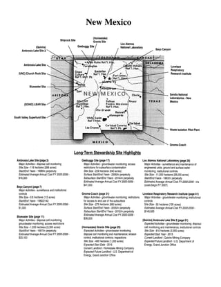
  • 1. (Quivira) Ambrosia Lake Site 2 Ambrosia Lake Site (UNC) Church Rock Site Bluewater Site (SOHIO) LBAR Site South Valley Superfund Site Shiprock Site New Mexico (Homestake) Grants Site Gasbuggy Site Los Alamos National Laboratory Lovelace Respiratory Research Institute Sandia National Laboratories - New Mexico Waste Isolation Pilot Plant Gnome-Coach Long-Term Stewardship Site Highlights Ambrosia Lake Site (page 3) Major Activities- disposal cell monitoring Site Size- 116 hectares (288 acres) Start/End Years- 1998/in perpetuity Estimated Average Annual Cost FY 2000-2006- $19,300 Bayo Canyon (page 7) Major Activities- surveillance and institutional controls Site Size- 0.6 hectares (1.5 acres) Start/End Years- 198212142 Estimated Average Annual Cost FY2000-2006- $1,000 Bluewater Site (page 11) Major Activities- disposal cell monitoring; groundwater monitoring; access restrictions Site Size- 1,335 hectares (3,300 acres) Start/End Years- 1997/in perpetuity Estimated Average Annual Cost FY2000-2006- $20,100 Gasbuggy Site (page 17) Major Activities - groundwater monitoring; access restrictions for subsurface contamination Site Size- 259 hectares (640 acres) Surface Start/End Years- 2006/in perpetuity Subsurface Start/End Years- 2014/in perpetuity Estimated Average Annual Cost FY2000-2006- $41,000 Gnome-Coach (page 21) Major Activities -groundwater monitoring; restrictions for access to and use of the subsurface Site Size- 275 hectares (680 acres) Surface Start/End Years- 2005/in perpetuity Subsurface Start/End Years- 2012/in perpetuity Estimated Average Annual Cost FY2000-2006- $38,000 (Homestake) Grants Site (page 25) Expected Activities -groundwater monitoring; disposal cell monitoring and maintenance; erosion control; institutional controls; inspections Site Size- 490 hectares (1 ,200 acres) Expected Start Date- 2015 Current Landlord- Homestake Mining Company Expected Future Landlord- U.S. Department of Energy, Grand Junction Office Los Alamos National Laboratory (page 29) Major Activities- surveillance and maintenance of engineered units; ground and surface water monitoring; institutional controls Site Size- 11,000 hectares (28,000 acres) Start/End Years- 1993/in perpetuity Estimated Average Annual Cost FY2000-2006- n/a (costs begin FY 2007) Lovelace Respiratory Research Institute (page 41) Major Activities - groundwater monitoring; institutional controls Site Size- 55 hectares (135 acres) Estimated Average Annual Cost FY 2000-2006- $140,000 (Quivira) Ambrosia Lake Site 2(page 51) Expected Activities -groundwater monitoring; disposal cell monitoring and maintenance; institutional controls Site Size- 810 hectares (2,000 acres) Expected Start Year- 2015 Current Landlord- Quivira Mining Company Expected Future Landlord- U.S. Department of Energy, Grand Junction Office
  • 2. Long-Term Stewardship Site Highlights Sandia National Laboratories - New Mexico (page 55) Major Activities- groundwater monitoring; vadose zone monitoring; disposal cell maintenance and monitoring Site Size- 1,130 hectares (2,820 acres) Estimated Average Annual Cost FY2000-2006- $900,000 Shiprock Site (page 69) Major Activities· disposal cell monitoring; institutional control enforcement; access restrictions; groundwater monitoring Site Size- 42 hectares (105 acres) Start/End Years· groundwater- 2012/in perpetuity; engineered unit - 1996/in perpetuity Estimated Average Annual Cost FY2000-2006- $121,000 (SOHIO) LBAR Site (page 75) Major Activities- access control; disposal cell monitoring and maintenance; groundwater monitoring Site Size-162 hectares (740 acres) Start/End Years- 2001/in perpetuity Estimated Average Annual Cost FY2000-2006- $33,657 South Valley Superfund Site (page 79) Site Size- 13 hectares (33 acres) Current Owner- General Electric Start Year- 1966 Expected Future Owner- General Electric (UNC) Church Rock Site (page 81) Site Area- 259 hectares (640 acres) (exact acreage to be transferred to U.S. Department of Energy for long- term stewardship activities is unknown) Current Landlord· United Nuclear Corporation Expected Start/End Years· 2015/in perpetuity Expected Future Landlord- U.S. Department of Energy, Grand Junction Office Waste Isolation Pilot Plant (page 85) Site Area- 124 acres (50 hectares) Current Landlord- U.S. Department of Energy (DOE) Expected Start-End Years- 2040/in perpetuity Expected Future Landlord- DOE
  • 3. Table of Contents Table of Contents Ambrosia Lake Site ...................................................................... 3 Bayo Canyon ........................................................................... 7 Bluewater Site ......................................................................... 11 Gasbuggy Site ......................................................................... 17 Gnome-Coach ......................................................................... 21 (Homestake) Grants Site ................................................................. 25 Los Alamos National Laboratory ........................................................... 29 Lovelace Respiratory Research Institute ..................................................... 41 (Quivira) Ambrosia Lake Site 2 ............................................................ 51 Sandia National Laboratories-New Mexico .................................................. 55 Shiprock Site .......................................................................... 69 (SOHIO) LBAR Site .................................................................... 75 South Valley Superfund Site .............................................................. 79 (UNC) Church Rock Site ................................................................. 81 Waste Isolation Pilot Plant ................................................................ 85 New Mexico 1
  • 4. National Defense Authol'ization Act (NDAA) Long-Term Stewanlship Report New Mexico 2
  • 5. Ambrosia Lake Site AMBROSIA LAKE SITE 1.0 SITE SUMMARY 1.1 Site Description and Mission The Ambrosia Lake Site is the location of a former uranium milling site that operated between 1958 and 1963, and again in the late 1970s and early 1980s. The site also contains a disposal cell for the uranium mill tailings and other process-related wastes that resulted from operations. The site is located on a 116-hectare (288-acre) tract of land in McKinley County in northwest New Mexico, approximately 40 kilometers (25 miles) north of Grants and 114 kilometers (85 miles) northwest of Albuquerque. The immediate area surrounding the Ambrosia Lake Site is sparsely populated. The site is within the Ambrosia Lake Mining District, near the center of the Grants Mineral Belt. Decommissioned uranium milling sites, LONG~TERM STEWARDSHIP HIGHLIGHTS Major Long-Term Stewardship Activities - disposal cell monitoring Total Site Area- 116 hectares (288 acres) Estimated Volume ofResidual Contaminants- disposal cell 4 million cubic meters (5.2 million cubic yards) Long-Term Stewardship Start-End Years- 1998-in perpetuity Average Annual Long-Term Stewardship Cost FY 2000-2006- $19,300 Landlord- U. S. Department of Energy, Grand Junction Office abandoned underground mines, mine shafts, and ore piles are located near the site. The U.S. Department of Energy's (DOE) current mission at the Ambrosia Lake Site is to perform long-term stewardship activities, including monitoring and maintenance ofthe disposal cell. The former mill site is subject to Title I ofthe Uranium Mill Tailings Radiation Control Act of1978 (UMTRCA). As such, DOE is responsible for remediation and long-term stewardship activities. DOE completed remediation of the site in 1995. The historic mission of the Ambrosia Lake Site was to mill uranium for the United States national defense program. Phillips PetroleumCompany originally owned and operated the mill, which was built in 1957. Uranium ore was processed at the site between 1958 and 1963. The United Nuclear Corporation purchased the mill in 1963 and operated it for a briefperiod. In the late 1970s and early 1980s, United Nuclear Corporation operated an ion exchange system, extracting uranium from mine water. Homestake Mining purchased United Nuclear Corporation's interest in 1981. Processing operations at the site ceased in 1982. 1.2 Site Cleanup and Accomplishments Milling operations at the site created process-related wastes and uranium mill tailings. The tailings originally covered approximately 42 hectares (105 acres). Wind and water erosion spread some ofthe tailings across a 230- hectare (570-acre) area. After remediation activities were completed in 1995, the contamination was restricted to a single 37-hectare (91-acre) onsite disposal cell containing approximately four million cubic meters (5.2 million cubic yards) of contaminated material. No groundwater remediation occurred at the Ambrosia Lake Site. The uppermost aquifer is not usable as a drinking or irrigation water resource because of low yield. Consequently, supplemental standards, as defined in Title 40 of the Code of Federal Regulations Part 192.22, were applied to the site's groundwater. No groundwater monitoring is required at this site. New Mexico 3
  • 6. National Defense Authorization Act (NDAA) Long-Term Ste ardship Report Disposal Cell Ambrosia Lake Site 2.0 SITE-WIDE LONG-TERM STEWARDSHIP 2.1 Long-Term Stewardship Activities D = To Albuquerque, NM (-85 miles) ~ 0.25 0.5 Miles DOE's Grand Junction Office is responsible for long-term stewardship activities at the AmbrosiaLake Site. DOE manages the site according to a long-term surveillance plan prepared specifically for the Ambrosia Lake Site and approved by the U.S. Nuclear Regulatory Commission (NRC). DOE performs long-term stewardship activities, as required under the NRC general license, to maintain protectiveness and regulatory compliance. DOE conducts annual inspections at the Ambrosia Lake Site to evaluate the condition of surface features and to perform maintenance, as necessary. Because the uppermost aquifer is considered a "limited use" aquifer, it is not a groundwater resource. Therefore, groundwater monitoring at the Ambrosia Lake Site is not required. The site is not fenced, but access is restricted through the use of warning signs posted every 152 meters (500 feet) along the site boundary. DOE staffs a 24-hour phone line for reporting site concerns. To prevent exposure to the buried waste, drilling and other intrusive activities are prevented within site boundaries through institutional controls. A deed restriction on the adjacent private property to the west prevents mining or drilling. DOE maintains a restrictive easement on adjacent land owned by the Quivera Mining Company to ensure that DOE has perpetual access to the Ambrosia Lake Site. Site records are kept in permanent storage at the DOE Grand Junction Office in Colorado. The types of records kept include site characterization data, remedial action design, the completionreport, long-term monitoring plan, annual inspection reports, and monitoring data. Real property records are maintained at DOE's Albuquerque Office in New Mexico. New Mexico 4
  • 7. 2.2 Specific Long-Term Stewardship Activities Engineered Units The Ambrosia Lake Site disposal cell is roughly rectangular and measures approximately 762 meters by 488 meters (2,500 feet by 1,600 feet). The cell rises approximately 15 meters (50 feet) above the surrounding terrain and occupies approximately 37 hectares (91 acres) of the 116-hectare (288-acre) site. The disposal cell contains 6,931,000 dry tons of contaminated material, with a total activity of 1,850 curies of radium-226. The cell cover is a multi-component system designed to Ambrosia Lake Site STAKEHOLDER INVOLVEMENT Community interaction has been minimal since the remedial action was completed. Copies of the annual inspection report for the Ambrosia Lake Site and other sites are distributed to the local library and any stakeholder that requests one. Annual inspection reports are also published on the DOE Grand Junction Office website at www.doegjpo.com. encapsulate and protect the contaminated materials for 200 to 1,000 years. A low-permeability radon barrier, consisting of compacted clay soils was placed over the compacted tailings. This layer is designed to prevent precipitation from percolating through the contaminated materials and into the underlying soils, and to reduce radon emissions. Erosion protection for the top and side slopes consists of a layer of rock underlain by a layer of granular bedding material. The cell design promotes rapid runoff of precipitation to minimize leachate and deter bio-intrusion. The sole long-term stewardship activity is annual surface inspections of the disposal cell. 2.3 Regulatory Regime In 1998, the Ambrosia Lake Site came under a general license issued by NRC for custody and long-term care of residual radioactive disposal sites (contained at Title 10 ofthe Code ofFederal Regulations, Section 40.27). The purpose ofthe general license is to ensure that such sites will be cared for in a manner that protects human health and safety and the environment. The general license went into effect when NRC concurred that the site conformed to cleanup standards and formally accepted the site-specific long-term surveillance plan. Long-term stewardship activities at the Ambrosia Lake Site are governed by several regulations, including the Uranium Mill Tailings Radiation Control Act of 1978; the Atomic Energy Act of 1954, as amended; EPA Groundwater Protection Standards, including Subparts A, B, and C of Title 40 of the Code of Federal Regulations Part 192, and the National Environmental Policy Act of 1969, as amended. 2.4 Assumptions and Uncertainties The scope of long-term stewardship activities is well documented since DOE has been performing long-term stewardship activities since 1998, and the scope is not expected to change dramatically over time. The engineered unit cap is not expected to be replaced for at least 200 years. 3.0 ESTIMATED LONG-TERM STEWARDSHIP COSTS Long-term stewardship costs for the Ambrosia Lake Site, identified in the table below, are expected to remain relatively constant over the period of the cost estimate and are associated with monitoring and maintaining the disposal cell. The cost estimate is based on the current actual costs of conducting long-term stewardship activities at the Ambrosia Lake Site. The cost estimate reflects the current site agreements and monitoring frequencies. New Mexico 5
  • 8. National Defense Authorization Act (NOAA) Long-Term Stewardship Report . Site Long-Term Stewardship Costs (Constant Year 2000 Dollars) Year(s) Amount Year(s) Amount Year(s) . Amount FY2000 $4,200 FY 2008 $21,100 FY 2036-2040 $102,300 FY 2001 $25,000 FY 2009 $21,100 FY 2041-2045 $102,300 FY 2002 $21,700 FY2010 $20,600 FY 2046-2050 $102,300 FY 2003 $20,900 FY 2011-2015 $98,100 FY 2051-2055 $102,300 FY 2004 $21,100 FY 2016-2020 $95,500 FY 2056-2060 $102,300 FY 2005 $21,300 FY 2021-2025 $95,800 FY 2061-2065 $102,300 FY 2006 $20,900 FY 2026-2030 $101,200 FY 2066-2070 $102,300 FY 2007 $21,200 FY 2031-2035 $102,300 4.0 FUTURE USES The future use of the site will be restricted to monitoring and maintaining the disposal cell in perpetuity. For more information about the Ambrosia Lake Site, please contact: Art Kleinrath, Long-Term Surveillance and Maintenance Program Manager U.S. Department of Energy ,Grand Junction Office 2597 B3/4 Road, Grand Junction, CO 81503 Phone: 970-248-6037 or visit the Internet website at http://www.doegjpo.com New Mexico 6
  • 9. Bayo Canyon BAYOCANYON 1.0 SITE SUMMARY 1.1 Site Description and Mission The Bayo Canyon site, near Los Alamos, New Mexico, was used by U.S. Department of Energy (DOE) predecessor agencies for explosive compressiontests on metals. Facilities (radiochemistry laboratory, assembly buildings, personnel buildings, etc.) supporting these tests were also located in the area. The 0.6-hectare (1.5-acre) site is located 40 kilometers (25 miles) northwest of Santa Fe and 99 kilometers (62 miles) northeast of Albuquerque. The site is located in the bottom of Bayo Canyon approximately five kilometers (three miles) east of tlie City of Los Alamos, on the border of Los Alamos and Santa Fe Counties. LONG-TERM STEWARDSHIP HIGHLIGHTS Major Long-Term Stewardship Activities - surveillance and institutional controls Total Site Area- 0.6 hectares (1.5 acres) Estimated Volume ofResidual Contaminants- unknown Long-Term Stewardship Start-End Years- 1982-2142 Average Annual Long-Term Stewardship Cost FY 2000-2006-$1,000 Landlord- U.S. Department of Energy The site became contaminated with strontium-90, which was a contaminant in some of the materials used in explosive compression tests. The radioactivity was released into the environment by both the explosive tests and the disposal of solid and liquid wastes from the facilities supporting the tests. In 1982, as part of the Formerly Utilized Sites Remedial Action Program, DOE completed remediation of the radioactive contamination at the site. DOE removed a total of 1,160 cubic meters (1,520 cubic yards) of contaminated soil and closed the excavations with clean fill. However, subsurface contamination above the cleanup standards of 100 picocuries per gram (pCi/g) remains in some areas at depths between 2.4 meters (eight feet) and 12.2 meters (40 feet). Six permanent markers were established at the site after the completion of remedial action. Currently, DOE is responsible for long-term stewardship activities, which includes periodically inspecting the site and verifying the continued presence of the markers. 1.2 Site Cleanup and Accomplishments In 1974, the U.S. Atomic Energy Commission (the predecessor agency to DOE) established a programto evaluate the radiological condition of real property which had supported early atomic energy development efforts. This activity became the Formerly Utilized Sites Remedial Action Program (FUSRAP). Cleanup ofthe Bayo Canyon site was managed and funded through the DOE Oak Ridge Operations Office. Due to the past explosive compression tests and disposal activities at Bayo Canyon, approximately four hectares (ten acres) of soil was primarily contaminated with strontium-90. DOE remediated the site by excavating the top one-two meters (three-seven feet) of contaminated soil. The excavated area was backfilled with clean soil; however, residual contamination remains between 2.4 meters and 12.2 meters (8 to 40 feet). Over time, the remaining strontium-90 will decay naturally with a half life of 28.3 years; it is estimated that about 35 percent has decayed since 1982. New Mexico 7
  • 10. National Defense Authotization Act (NDAA) Long-Tenn Stewardship Rcpo.-t Miles Bayo Canyon Site Bayo Canyon 2.0 SITE-WIDE LONG-TERM STEWARDSHIP 2.1 Long-Term Stewardship Activities j····, 0 (/) "' ~ ~ :w 3 "T1 0 (1) "' otowi Mesa 'san !ldefonso Pueblo DOE is responsible for long-term stewardship activities at the Bayo Canyon site. Long-term stewardship activities include maintaining institutional controls, as well as surveillance and maintenance of the markers, to ensure continued protection ofhuman health and the environment. Surface access is not restricted; however, this region is sparsely populated. No drilling or other intrusive activities are allowed within the property unless authorized by DOE. DOE maintains and updates the specific records and reports required to document long-term stewardship activities at the Bayo Canyon site. The types of records maintained include site characterization data, remedial action design information, the site completion report, inspection reports, and historic monitoring data. The area where subsurface contamination remains is identified by six site markers. The inscription reads: "Buried Radioactive Materials. No Excavation Prior to 2142 A.D. See County Records. N 21 48 21 W." DOE is responsible for surveillance and maintenance of the Bayo Canyon site to ensure the selected remedy remains protective. New Mexico 8
  • 11. Bayo Canyon 2.2 Regulatory Regime The primary standard governing long-term stewardship activities at Bayo Canyon is the Atomic Energy Act of 1954, as amended. 2.3 Assumptions and Uncertainties Because the site has been monitored since 1982, long-term stewardship activities at the site are well known and are not expected to change dramatically. 3.0 ESTIMATED LONG-TERM STEWARDSHIP COSTS The long-term stewardship costs represent periodic inspections and verification ofthe continued presence ofthe markers. Costs are estimated to be no more than $1,000 per year and are anticipated to continue until fiscal year 2142 or sooner. 4.0 FUTURE USES Future use of the site will be limited to monitoring the site until the subsurface contamination has decayed. Public access is not restricted and the land surrounding the site is currently open. These uses are expected to continue in the future. For additional information about the Bayo Canyon site, please contact: Ted Taylor, Los Alamos Environmental Restoration Project Manager U.S. Department of Energy 528 35'h Street Los Alamos, NM 87544 Phone:SOS-665-7203 or visit the Internet website at http://emroject.lanl.gov/about us.html New Mexico 9
  • 12. National Defense Authorization Act (NOAA) Long-Term Stcanlship Rcpm·t New Mexico 10
  • 13. Bluewater Site BLUEWATER SITE 1.0 SITE SUMMARY 1.1 Site Description and Mission The Bluewater Site is the location of a former uranium milling site that operated from 1953 to 1982. The site has three disposal cells containing contaminated waste and materials remediated from the site and vicinity properties. The site is in west-central New Mexico, approximately 14 kilometers (9 miles) northwest of the City of Grants, and about 2.4 kilometers (1.5 miles) northeast of the village of Bluewater. The land immediately surrounding the Bluewater Site is sparsely populated and the area's predominant land use is grazing. The three disposal cells comprise 156 hectares (386 acres) of the site's 1,335 hectares (3,300 acres). The current mission ofthe Bluewater Site is performing long-term stewardship activities, including monitoring and maintenance of the engineered disposal cells and LONG-TERM STEWARDSHIP HIGHLIGHTS Major Long-Term Stewardship Activities- disposal cell monitoring; groundwater monitoring; access restrictions Total Site Area -1,335 hectares (3,300 acres) Estimated Volume ofResidual Contaminants- disposal cell13.8 million cubic meters (18 million cubic yards); groundwater unknown Long-Term Stewardship Start-End Years- 1997-in perpetuity Average Annual Long-Term Stewardship Cost FY 2000-2006- $20,100 Landlord- U.S. Department of Energy, Grand Junction Office groundwater monitoring. The site is governed by Title IT of the Uranium Mill Tailings Radiation Control Act of1978 (UMTRCA). As such, the U.S. Department of Energy (DOE) is responsible for long-term stewardship activities at the site but was not responsible for site remediation. Remediation was completed by the owner, and DOE began performing long-term stewardship activities in 1997. The historic mission of the site was to process uranium for commercial purposes, but some material was sold to the U.S. Atomic Energy Commission (a predecessor agency to DOE) to support national defense missions. The Bluewater Site was initially the site of a carbonate-leach uranium mill built and owned by the Anaconda Copper Company to process ore from nearby mines. The carbonate-leach uranium mill began operations in 1953. The discovery of sandstone uranium ores and the development of the Jackpile and Paguate mines resulted in the construction of an acid-leach mill at the site that began operations in 1957. Most of the uranium mill tailings at the Bluewater Site are from the acid-leach process. Milling operations ceased in 1982. In 1986, the Anaconda Copper Company became the Atlantic Richfield Company (ARCO). ARCO began mill decommissioning activities in 1989, site reclamation in 1991, and encapsulation of the disposal cells in 1995. These cells contain mill tailings, soils, and construction debris contaminated with uranium, radium, and thorium. The site was transferred to DOE for custody and long-term care in 1997. 1.2 Site Cleanup and Accomplishments Between 1991 and the end of 1995, all the radioactive material from the BluewaterSite, including the demolished mill structures and contaminated vicinity properties, was transported to and placed in three onsite disposal cells. The combined volume of the three disposal cells is approximately 13.8 million cubic meters (18 million cubic yards). The tailings were placed in separate disposal cells, based on chemical characteristics resulting from the process used to mill the ore. Wastes generated from the acid-leaching process were segregated from those generated from the carbonate-leaching process to prevent chemical reactions from occurring as a result ofmixing acidic and basic compounds. The third disposal cell contains uranium mill tailings and soils mixed with polychlorinated biphenyls (PCBs). New Mexico 11
  • 14. National Defense Authorization Act (NDAA) Long-Term SteHtrdship Report The largest of the three cells, the acid tailings disposal cell, is about 129 hectares (320 acres) in size and contains an estimated 23 million tons of tailings and other contaminated materials having a radioactive content of approximately 11,200 curies of radium-226. This cell has a low- permeability radon barrier ranging in thickness from 31 to 74 centimeters (12 to 29 inches). The radon barrier is covered with a riprap (rock) surface layer 10 to 31 centimeters (4 to 12 inches) thick for erosion control. The second cell contains the carbonate tailings. It covers approximately 27 hectares (65 acres) and contains an estimated 1.3 million tons of contaminated materials having a radioactive content of approximately 1,130 curies of radium-226. The carbonate tailings disposal cell is covered by a similar radon barrier and a layer ofriprap (rock layer) to protect the disposal cell from erosion. Both of these cells are designed to promote rapid run-off of precipitation and to minimize leachate. All the surrounding disturbed areas have been regraded and reseeded with native species to further minimize erosion. Bluewater Site To Grant, NM (·9 Miles) 1 @ Groundwater Monitoring Well O.l Miles The third and smallest disposal cell is less than 0.41 hectares (one acre) and contains PCB-contaminated uranium mill tailings and soils. The PCB-contaminated material was sealed in 144 drums and placed on a one-meter (three-foot) thick clay liner. Voids between the drums were filled with a soil-cement mixture to prevent long- term subsidence. The PCB disposal cell was then covered with a 91-centimeter (36-inch) thick clay cap, a 46- centimeter (18-inch) thick radon barrier, and a 15-centimeter (6-inch) thick layer ofriprap for erosion protection. This disposal cell has been permitted by the U.S. Environmental Protection Agency (EPA) and is in compliance with the Toxic Substances Control Act of1976 (TSCA). After several years of active groundwater treatment, the contaminant levels for uranium, molybdenum, and seleniumin the site's groundwater, have not been reduced to background concentration levels. Therefore, the site was granted alternate concentration limits (ACLs), cleanup standards that are based on site-specific considerations, by the U.S. Nuclear Regulatory Commission (NRC). For the alternate concentrations to be approved, evidence must be provided that the ACLs will not have an adverse impact on human health or the environment. The Bluewater Site has complied with the revised contaminant concentration limits and, therefore, no further groundwater remediation is required. New Mexico 12
  • 15. Bluewater Site In September 1997, NRC accepted the Bluewater Site under a general license for custody and long-term care of residual radioactive disposal sites. 2.0 SITE-WIDE LONG-TERM STEWARDSHIP 2.1 Long-Term Stewardship Activities The DOE Grand Junction Office is responsible for all long-term stewardship activities, including monitoring and maintenance, access restrictions, institutional controls, and groundwater monitoring. Other activities include minor maintenance, such as fence repairs and sign replacement. Although DOE is responsible for all long-term stewardship activities, in the event that the PCB disposal cell fails, ARCO will be responsible for corrective action in accordance with the indemnification agreement signed between ARCO and DOE. STAKEHOWER INVOLVEMENT Community interaction has been minimal since the remedial action was completed. Copies of the annual inspection report for the Bluewater Site and other sites are distributed to the local library and any stakeholders requesting them. The report is also published on the DOE Grand Junction Office website at www.doegjpo.com. Access to the Bluewater Site is controlled with a locked and gated fence along the site perimeter to prevent livestock grazing and discourage unauthorized entry. Stock fences also control access to four utility easements that cross the property. Warning signs are posted every 152 meters (500 feet) along the perimeter of the cells onsite. Purposeful intrusion is not expected to be a problem. However, if intrusion, vandalism, or other issues such as grazing occur, site security will be re-evaluated. DOE maintains and updates specific records and reports required to document the long-term stewardship activities at the Bluewater Site. DOE submits an annual report to NRC that documents the results of site surveillance, as required by the NRC regulations in Title 10 of the Code ofFederal Regulations Part 40.28, and Appendix A of Title 10 of the Code of Federal Regulations, Part 40, Criterion 12. Site records are kept in permanent storage at the DOE Grand Junction Office in Colorado. The types of records maintained include the site characterization data, remedial action design information, the site completion report, long-term monitoring plans, annual inspection reports, and current and historic monitoring data. 2.2 Specific Long-Term Stewardship Activities Engineered Units The three disposal cells will require long-term surveillance and maintenance to ensure continued protection of human health and the environment. Long-term stewardship activities will include annual surface inspections to ensure the continued integrity of the cap and other engineered features. Minor repairs will be conducted on an as-needed basis. In accordance with EPA standards, the covers of all three disposal cells have been designed to last 200 to 1,000 years. However, DOE will be responsible for conducting long-term stewardship activities in perpetuity. Groundwater Since 1998, the DOE Grand Junction Office has been conducting annual monitoring of six different wells for uranium, selenium, and molybdenum, and will continue to do so until2004. After 2004, the groundwater wells will be monitored once every three years in perpetuity. As specified in the site's EPA-issued TSCA permit, annual monitoring for PCBs will occur at four wells until 2017, and then will be discontinued if PCBs have not New Mexico 13
  • 16. National Defense Authorization Act (NDAA) Long-Term Stewardship Report been detected. Thus far, no PCBs have been detected in the groundwater. 2.3 Regulatory Regime ARCO completed site reclamation at the Bluewater Site under Title II of UMTRCA and encapsulated the radioactive waste in an NRC-approved disposal cell. Cleanup and reclamation standards were promulgated by NRC in Title 10 of the Code ofFederal Regulations, Part 40, Appendix A, and conform with EPA standards specified in Title 40 of the Code ofFederal Regulations, Part 192. In September 1997, the site was transferred by NRC under general license to DOE for custody and long-term care (contained at Title 10 of the Code ofFederal Regulations, Section 40.28). The purpose of the general license is to ensure that such sites will be cared for in a manner that protects human health and safety and the environment. The general license went into effect when NRC concurred that the site conformed to cleanup standards and formally accepted the site-specific long-term surveillance plan. 2.4 Assumptions and Uncertainties Since the site has been monitored for the past two years, the long-term stewardship activities at the site are well known and are not expected to change dramatically in the future. It is assumed that the caps are not expected to be replaced for a minimum of 200 years. 3.0 ESTIMATED LONG-TERM STEWARDSHIP COSTS The cost estimates, identified in the table below, are based on the actual costs oflong-term stewardship activities at this site and other sites cells currently managed by DOE. Long-term surveillance and maintenance costs for the disposal cells at the Bluewater Site average about $20,000 per year for fiscal year (FY) 2000 through FY 2006. The cost of long-term stewardship activities decreases in FY 2004, when the groundwater monitoring frequency is reduced to once every three years. A similar decrease occurs after FY 2017, when monitoring for PCB contamination releases is no longer expected to be required. Contingency costs, such as cap replacement, have not been incorporated into cost estimates. . ' .·· .... ... I. ... .t•'Am:a~itr·: •· ····,Y.ei~es; ··' ....,.·:'.•.. >· .· . Year.(s) Amount Year(s). ::;..~;)?£;~ k:;;;;:;;cJii.mount FY 2000 $41,000 FY 2008 $13,000 FY 2036-2040 $67,400 FY2001 $20,800 FY 2009 $13,000 FY 2041-2045 $67,400 FY 2002 $18,100 FY2010 $17,200 FY 2046-2050 $67,400 FY 2003 $17,400 FY 2011-2015 $69,600 FY 2051-2055 $67,400 FY2004 $17,600 FY 2016-2020 $71,200 FY 2056-2060 $67,400 FY 2005 $13,000 FY 2021-2025 $63,700 FY 2061-2065 $67,400 FY2006 $13,000 FY 2026-2030 $67,400 FY 2066-2070 $67,400 FY 2007 $17,700 FY 2031-2035 $67,400 New Mexico 14
  • 17. Bluewater Site 4.0 FUTURE USES The future use of the site will be restricted to monitoring and maintaining the disposal cell and groundwater in perpetuity. For more information about the Bluewater Site, please contact: Art K.leinrath, Long-Term Surveillance and Maintenance Program Manager U.S. Department of Energy, Grand Junction Office 2597 B3/4 Road, Grand Junction, CO 81503 Phone: 970-248-6037 or visit the Internet website at http://www.doegjpo.com New Mexico 15
  • 18. National Defense Authorization Act (NOAA) Long-Term Stewardship Report New Mexico 16
  • 19. Gasbuggy Site GASBUGGY SITE 1.0 SITE SUMMARY 1.1 Site Description and Mission The Gasbuggy Site covers approximately 259 hectares (640 acres) and is located approximately 89 kilometers (55 miles) east of Farmington, New Mexico. The site was the location of a single subsurface nuclear test conducted in December 1967, by the U.S. Atomic Energy Commission (AEC) later known as the U.S. Department of Energy (DOE). AEC conducted the test to determine whether nuclear explosions would stimulate the release of natural gas that was not otherwise recoverable by conventional methods. This project was the first joint government and industry gas stimulation experiment. The Gasbuggy Site is currently managed by the Department of the Interior. The only current or planned DOE mission at the site is to complete environmental restoration of surface areas and to continue long-term stewardship activities of residual contamination. 1.2 Site Cleanup and Accomplishments LONG-TERM STEWARDSHIP HIGHLIGHTS Major Long-Term Stewardship Activities - groundwater monitoring; access restrictions for subsurface contamination Total Site Area- 259 hectares (640 acres) Estimated Volume ofResidual Contaminants- unknown *Suiface Long-Term Stewardship Start-End Years- 2006-in perpetuity *Subsuiface Long-Term Stewardship Start-End Years- 2014-in perpetuity Average Annual Long-Term Stewardship Cost FY 2000-2006-$41,000 Landlord- U.S. Department of Interior *For purposes of this report, long-term stewardship activities for the surface will begin when surface remediation is complete in 2006. However, DOE recognizes that subsurface investigation and modeling activities will continue beyond the surface completion date. Testing activities at the Gasbuggy Site resulted in surface and subsurface contamination. Surface contamination at the site is the result of gas flaring operations and equipment decontamination and is present at two mud pits, one gas flaring facility, and one shaker pad area. Potential contaminants of concern at the surface include petroleum hydrocarbons from diesel and drilling additives, lead, chromium, and tritium. DOE will continue characterization of the surface areas, and any surface contamination will either be closed in place and covered with an engineered cap or left in place to naturally degrade, depending on the potential risk to human health and the environment. DOE anticipates completing all surface closure activities by 2006. Subsurface contamination occurs at depths of more than 1,290 meters (4,240 feet). The potential contaminants of concern in the subsurface are mixed fission products, plutonium, uranium, and tritium. DOE assumes that natural gas is the primary contaminant migration pathway at the site. DOE will conduct a natural gas reservoir and subsurface condition analysis to model the subsurface contamination. Subsurface modeling will determine the extent of subsurface contamination and define the areas that will require institutional controls. This information will be utilized, ifrequired, to refine the existing subsurface intrusion restriction boundary. However, DOE does not plan to remediate the subsurface contamination because of the lack of feasible technologies for removing subsurface contamination. DOE expects that modeling activities will be conducted between 2006 and 2011, and that the subsurface closure report for the site will be developed between 2011 and 2014. New Mexico 17
  • 20. National Defense Authorization Act (NDAA) Long-Term Stewardship Report 2.0 SITE-WIDELONG-TERM STEWARDSIDP 2.1 •Chromo Long-Term Stewardship Activities Rlo A r r f~~ !:'~~-~,~ ~~~//=-"---""--"'-----~~}_..,__},..~ Surface remediation will be complete and institutional controls, if necessary, will be in place by 2006 for the long-term stewardship of the surface. DOE will continue to investigate and model subsurface contamination, which is not expected to be complete until 2014. Existing subsurface intrusion restrictions will be refined, as necessary, based on the outcome of the investigation and modeling efforts. DOE will be responsible for monitoring and maintaining institutional controls over the residual subsurface contamination. Final long- term stewardship requirements for the site will be negotiated with the DepartmentofInterior and the State ofNew Mexico. DOE will conduct periodic monitoring to analyze for contaminant migration from the test cavity to the groundwater. 0 > To Farmington, NM (-55 Miles) .. Sandov!lll_9ounty Mctlnley County To Sanh~ Fe, NM (..go Miles) 'JII '-Dulce DOE maintains the project-specific records at the Nevada Operations Office in Las Vegas. These Gasbuggy Site records include corrective action investigation workplans and reports; corrective action decision 10 20 Miles documents; health assessments; risk assessments; information submitted by the public; National Environmental Policy Act documents; and the Public Involvement Plan. The DOE Public Reading Facility and the Nevada Division of Environmental Protection Administrative Record are given copies of these documents. Upon the completion of the project, all DOE project files will be transferred to controlled storage at DOE's Nevada Operations Office. Records are retained according to DOE records retention procedures. 2.2 Specific Long-Term Stewardship Activities Groundwater DOE will maintain institutional controls in perpetuity over the subsurface to prevent access to the test cavity, groundwater, and associated subsurface contamination in perpetuity. A monument has been placed at the site to mark the location of the test. Institutional controls will continue to restrict subsurface intrusions on the site. DOE will continue to conduct annual groundwater monitoring at the site for at least 100 years after closure ofthe subsurface in 2014. DOE estimates that repair or replacement of groundwater monitoring wells will be necessary every 25 years. At the end ofthe post-closure STAKEHOWER INVOLVEMENT DOE held meetings with the New Mexico Environmental Department(NMED) in October of 1999. Additional meetings were held with both the NMED and representatives from the Jicarilla Apache Tribe in March 2000. Discussions with stakeholders addressed the site regulatory framework, exit strategy, and the preliminary data quality objectives for the site. groundwater monitoring period in 2114, the monitoring wells will be plugged and abandoned in place in accordance with State regulations. New Mexico 18
  • 21. Gasbuggy Site Contaminated surface areas that are left in place to naturally degrade will require annual monitoring of the surface conditions. Areas closed in place with engineered caps will likely require institutional controls to restrict access to the residual contamination. The specific long-term stewardship activities for the surface areas will be detailed in the site closure report and may also include visual inspections, cap monitoring and maintenance, information management, and environmental monitoring activities. 2.3 Regulatory Regime DOE is responsible for identifying the nature and extent of contamination, determining potential risk to the public and the environment, and performing the necessary corrective actions in compliance with guidelines and requirements under applicable Federal and State standards. Key regulatory drivers include the following: Resource Conservation and Recovery Act CRCRA): RCRA was the first comprehensive Federal effort to deal with solid and hazardous waste. It regulates the generation, transportation, treatment, storage, and disposal of hazardous waste. At Gasbuggy, RCRA is enforced to protect human health and the environment; conserve energy and natural resources; reduce the amount of generated waste; and ensure that wastes are managed in an environmentally sound manner. Comprehensive Environmental Response. Compensation. and Liability Act CCERCLA): CERCLA supplies a system for identifying and providing corrective action to sites where hazardous substances have been released into air, water, groundwater, or land. Provisions of CERCLA include a National Contingency Plan, which establishes procedures for corrective action for hazardous substance releases. Gasbuggy is not regulated under CERCLA; however, the regulations are useful as developmental guidelines. In addition to Federal regulations, DOE must comply with State regulatory requirements in New Mexico. In most cases, State ofNew Mexico requirements are based onFederal requirements; however, in specific cases they may be more detailed and stringent than Federal requirements. Nuclear Regulatory Commission CNRC): NRC regulations establish "free release" criteria. Gasbuggy is not regulated under the NRC; however, the regulations are useful as developmental guidelines. 2.4 Assumptions and Uncertainties DOE has yet to fully characterize the site. DOE will develop subsurface models and use them to define a contaminant boundary and refine the existing subsurface intrusion restrictions, if necessary. DOE does not plan to remove subsurface waste in and around the test cavities. Groundwater monitoring will continue annually until subsurface closure is finalized. Post-closure monitoring to detect changes in the subsurface conditions will be conducted, as agreed upon in the site closure reports. The schedule for groundwater monitoring after closure of the subsurface will be defined in the subsurface closure report. DOE assumes that groundwater monitoring will be performed for 100 years (2014-2114). Current land use designations and subsurface intrusion restrictions will continue into the foreseeable future. However, DOE has not fully characterized the contamination and long-term stewardship activities have not yet been finalized. Therefore, long-term stewardship activities and associated costs may change, depending on final agreements with the State and regulators. DOE will reevaluate and modify the subsurface restrictions, as appropriate, as part of the assessment and/or corrective action activities. New Mexico 19
  • 22. National Defense Authorization Act (NDAA) Long-Term Stewardship Report 3.0 ESTIMATED LONG·TERM STEWARDSHIP COSTS The cost profile in the table below applies to the entire Gasbuggy Site. The major long-term stewardship costs are for monitoring activities, data analysis, and repair and replacement of monitoring wells. The spikes in cost are a result of costs associated with repairing or replacing monitoring wells, which were assumed to require maintenance every 25 years. The long-term stewardship costs for the Gasbuggy Site remain roughly constant at $40,000 annually. The cost increase from $28,000 in FY 2000 to $40,000 in FY 2001 is the result of the costs associated with the new Real Estate Operations Permit (RE-OP) requirements. The additional $21,000 to be incurred in FY 2004 and FY 2009 is for well-casing integrity-testing, which is done at the Gasbuggy Site at the request of the U.S. Bureau of Land Management. DOE projects that the total post-FY 2070 cost will be approximately $4.3 million dollars, which includes the cost of plugging and abandoning the monitoring wells at the end of the post-closure monitoring period (anticipated to be in 2114). Site Long-Term Stewar~hip, (;(}sts (;Co~t,QIJt'feqr 2000 [)ollqrs) ' Year(s) Amount Year(s) I Amount Year(s) Amount FY 2000 $28,000 FY2008 $40,000 FY 2036-2040 $1,243,000 FY 2001 $40,000 FY 2009 $61,000 FY 2041-2045 $293,000 FY2002 $40,000 FY 2010 $40,000 FY 2046-2050 $293,000 FY 2003 $40,000 FY 2011-2015 $221,000 FY 2051-2055 $293,000 FY 2004 $61,000 FY 2016-2020 $294,000 FY 2056-2060 $293,000 FY 2005 $40,000 FY 2021-2025 $293,000 FY 2061-2065 $1,243,000 FY2006 $40,000 FY 2026-2030 $292,000 FY 2066-2070 $293,000 FY 2007 $40,000 FY 2031-2035 $292,000 Post FY 2070 $4,300,000 4.0 FUTURE USES The anticipated future use for the surface area [259 hectares (640 acres)] is open space. DOE will place deed restrictions on the property to prevent access to the test cavities, subsurface soil, and groundwater in perpetuity. For additional information about the Gasbuggy Site, please contact: Monica Sanchez U.S. Department of Energy, Nevada Operations Office Environmental Restoration Division 232 Energy Way North Las Vegas, NV 89030-4199 Phone: 702-295-0160 sanchezm@nv.doe.gov New Mexico 20
  • 23. Gnome-Coach GNOME-COACH 1.0 SITE SUMMARY 1.1 Site Description and Mission The Gnome-Coach site covers approximately 275 hectares (680 acres) and is located approximately 50 kilometers (31 miles) southeast of Carlsbad, New Mexico and approximately eight kilometers (five miles) south of the U.S. Department of Energy's (DOE's) Waste Isolation Pilot Plant (WIPP). The Gnome-Coach site was part ofthe Plowshare program, which was a series of nuclear and conventional tests conducted by the U.S. Atomic Energy Commission (AEC), a predecessor agency to DOE, to explore peacetime uses of nuclear explosives. Gnome was the location of a single subsurface nuclear test conducted in December 1961 to determine the effects and products ofa nuclear explosion in a salt medium. The Gnome test vented radioactivity into the atmosphere, which resulted in AEC canceling a second experiment (the Coach test) that had been scheduled for the site. LONG-TERM STEWARDSHIP HIGHLIGHTS Major Long-Term Stewardship Activities - groundwater monitoring; restrictions for access to and use of the subsurface Total Site Area- 275 hectares (680 acres) Estimated Volume ofResidual Contaminants- unknown *Suiface Long-Term Stewardship Start-End Years- 2005-in perpetuity *Subsuiface Long-Term Stewardship Start-End Years- 2012-in perpetuity Average Annual Long-Term Stewardship Cost FY 2000- 2006 - $38,000 Landlord- U.S. Department oflnterior *For purposes of this report, long-term stewardship activities for the surface will begin when surface remediation is complete in 2005. However, DOE recognizes that subsurface investigation and modeling activities will continue beyond the surface completion date. The Gnome-Coach site is currently managed by the Department ofthe Interior. The only current or planned DOE mission at the site is to complete environmental restoration of surface areas and to continue long-term stewardship activities of residual contamination. 1.2 Site Cleanup and Accomplishments Contamination at the Gnome-Coach site consists of radioactive contamination of the deep bedrock around the test cavity and in a shallow aquifer as a result of a tracer test that DOE conducted shortly after the Gnome test. The potential contaminants of concern for the subsurface are mixed fission products and nuclides. DOE does not plan to remediate the subsurface contamination because of the lack of feasible technologies for removing subsurface contamination. However, DOE will use site assessment activities, such as modeling and characterization data, to determine the extent ofsubsurface contamination and to define the areas that will require institutional controls. This information will be utilized, if necessary, to refine the existing subsurface intrusion restriction. DOE expects that modeling activities will be conducted between 2006 and 2009 and that the subsurface closure report for the site will be developed between 2010 and 2012. Surface contamination at the site is the result ofdrilling activities and equipment decontamination operations and is present in four mud pits, three landfills, and other release sites. Potential contaminants ofconcern at the surface include petroleumhydrocarbons, metals from diesel and drilling additives, and radionuclides. DOE will continue characterization of the surface areas; if warranted, any surface contamination will either be closed in place and covered with an engineered cap or left in place to naturally degrade, depending on the potential risk to human health and the environment. DOE anticipates completing all surface closure activities by 2005. New Mexico 21
  • 24. National Defense Authorization Act (NOAA) Long-Tenn Stewardship Report 2.0 SITE-WIDE LONG-TERM STEWARDSHIP 2.1 Long-Term Stewardship Activities Surface remediation will be complete and institutional controls, ifnecessary, will be in place by 2005 for the long-term stewardship of the surface. DOE will continue to investigate and model subsurface contamination, which is not expected to be complete until 2012. Existing subsurface intrusion restrictions will be refined, as necessary, based on the outcome of the investigation and modeling efforts. DOE will not maintain an active presence at this site but will be responsible for monitoring and maintaininginstitutional controls overthe residual surface and subsurface contamination. Final long- term stewardship requirements for the site will be negotiated with the Department ofInterior and the State of New Mexico. DOE will conduct periodic monitoring to ensure that there is no contaminant migration from the test cavity to the groundwater. DOE maintains the project-specific records at the Nevada Operations Office in Las Vegas. These records include corrective action investigation T E X A •ona Gnome-Coach 10 20 Miles workplans and reports; corrective action decision documents; health assessments; risk assessments; information submitted by the public; National Environmental Policy Act documents; and the Public Involvement Plan. The DOE Public Reading Facility and the Nevada Division of Environmental Protection Administrative Record are given copies of these documents. Upon the completion of the project, all DOE project files will be transferred to controlled storage at the Nevada Operations Office. Records are retained according to DOE records retention procedures. 2.2 Specific Long-Term Stewardship Activities Groundwater DOE will maintain institutional controls over the subsurface to prevent access to the test cavity, groundwater, and associated subsurface contamination in perpetuity. A monument has been placed at the site to mark the location ofthe test shot cavity. Institutional controls currently include subsurface intrusion restrictions, which may be refined as a result of subsurface modeling results. DOE will continue to conduct annual groundwater monitoring at the site for at least 100 years after closure of the subsurface in STAKEHOWERINVOLVEMENT DOE held meetings with the New Mexico Environmental Department (NMED) in October of 1999 and in March 2000. Discussions with stakeholders addressed the site regulatory framework, exit strategy, and the preliminary data quality objectives for the site. 2012. DOE estimates that repair or replacement of groundwater monitoring wells will occur every 25 years. At the end of the post-closure groundwater monitoring period in 2112, the monitoring wells will be plugged and New Mexico 22
  • 25. Gnome-Coach abandoned in place in accordance with State regulations. Any contaminated surface areas that are left in place to naturally degrade may require annual monitoring of the surface conditions. If areas are closed in place with engineered caps, institutional controls to restrict access to the residual contamination may be required. The specific long-term stewardship activities for the surface areas will be detailed in the site closure report and may also include visual inspections, cap monitoring and maintenance, information management, and environmental monitoring activities. 2.3 Regulatory Regime DOE is responsible for identifying the nature and extent of contamination, determining potential risk to the public and the environment, and performing the necessary corrective actions in compliance with guidelines and requirements under Federal regulatory drivers, as well as the State-specific regulatory drivers associated with the site location. Key regulatory drivers include the following: Resource Conservation and Recovery Act (RCRA): RCRA was the first comprehensive Federal effort to deal with solid and hazardous waste. It regulates the generation, transportation, treatment, storage, and disposal of hazardous waste. At the Gnome-Coach site, RCRA is enforced to protect human health and the environment; conserve energy and natural resources; reduce the amount of generated waste; and ensure that wastes are managed in an environmentally sound manner. Comprehensive Environmental Response. Compensation. and Liabilitv Act CCERCLA): CERCLA supplies a system for identifying and providing corrective action to sites where hazardous substances have been released into any part of the air, water, groundwater, or land. Provisions of CERCLA include a National Contingency Plan, which establishes procedures for corrective action for hazardous substance releases. The Gnome-Coach site is not regulated under CERCLA; however, the regulations are useful as developmental guidelines. In addition to Federal regulations, DOE must comply with State regulatory requirements in New Mexico. In most cases, State ofNew Mexico requirements are based on Federal requirements; however, in specific cases they may be more detailed and stringent than Federal requirements. Nuclear Regulatory Commission (NRC): NRC regulations establish "free release" criteria. The Gnome-Coach site is not regulated under the NRC; however, the regulations are useful as developmental guidelines. 2.4 Assumptions and Uncertainties DOE has yet to fully characterize the site. DOE will develop subsurface models and use them to define a contaminant boundary and refine the existing subsurface intrusion restrictions, if necessary. DOE does not plan to remove subsurface waste in and around the test cavities. Groundwater monitoring will continue annually until subsurface closure is finalized. Post-closure monitoring to detect changes in the subsurface conditions, will be conducted, as agreed upon in the site closure reports for the subsurface. The schedule for groundwater monitoring after closure of the subsurface will be defined in the subsurface closure report. DOE assumes that groundwater monitoring will be performed for 100 years (2012-2112). Current land use designations and subsurface intrusion restrictions will continue into the foreseeable future. However, DOE has not fully characterized the contamination and long-term stewardship activities have not yet been finalized withthe State and regulators. Therefore, long-termstewardship activities and associated costs may change, depending on final agreements. DOE will reevaluate and modify the subsurface restrictions, as appropriate, as part of the assessment and/or corrective action activities. New Mexico 23
  • 26. National Defense Authorization Act (NOAA) Long-Term Stewardship Report 3.0 ESTIMATED LONG-TERM STEWARDSHIP COSTS The cost profile, identified in the table below, applies to the entire Gnome-Coach site. The major long-term stewardship costs are for monitoring activities, data analysis, and repair and replacement of monitoring wells. The spikes in cost are a result of costs associated with repairing or replacing monitoring wells, which were assumed to require maintenance every 25 years. The long-term stewardship costs for the Gnome-Coach site remain roughly constant at $40,000 annually. The cost increase from $28,000 in FY 2000 to $40,000 in FY 2001 is the result of the costs associated with the new Real Estate Operations Permit (RE-OP) requirements. DOE projects that the total post-FY 2070 cost will be approximately $2.7 million dollars, which includes the costs associated with plugging and abandoning groundwater monitoring wells at the end of the monitoring period (anticipated to be in 2112). ' . Site Long-Term Stewardship Costs (Constant Year 2000 Dollars) Year(s) Amount Year(s) Amount . Year(s) .. Amount FY2000 $28,000 FY 2008 $40,000 FY 2036-2040 $517,000 FY 2001 $40,000 FY 2009 $40,000 FY 2041-2045 $272,000 FY 2002 $40,000 FY2010 $40,000 FY 2046-2050 $272,000 FY2003 $40,000 FY 2011-2015 $200,000 FY 2051-2055 $272,000 FY 2004 $40,000 FY 2016-2020 $272,000 FY 2056-2060 $272,000 FY 2005 $40,000 FY 2021-2025 $272,000 FY 2061-2065 $517,000 FY2006 $40,000 FY 2026-2030 $272,000 FY 2066-2070 $272,000 FY 2007 $40,000 FY 2031-2035 $273,000 PostFY 2070 $2,700,000 4.0 FUTURE USES The anticipated future use for the surface area (275 hectares, or 680 acres) is open space. DOE will place deed restrictions on the subsurface areas to prevent access to the test cavities, subsurface areas, and groundwater in perpetuity. For additional information about the Gnome-Coach site, please contact: Monica Sanchez U.S. Department of Energy, Nevada Operations Office Environmental Restoration Division 232 Energy Way North Las Vegas, NV 89030-4199 Phone:702-295-0160 sanchezm@nv.doe.gov New Mexico 24
  • 27. (Homestake) Grants Site (HOMESTAKE) GRANTS SITE1 1.0 SITE SUMMARY 1.1 Site Description and Mission The (Homestake) Grants Site is the location ofa former uranium milling site which operated from 1958 to 1990. The site is located on a 490 hectare (1,200 acre) tract of land in a predominantly rural area of northern New Mexico, north of the town of Grants. The site is privately owned and operated by Homestake Mining Company. As a result of past milling operations, contamination at the site consisted of approximately 20.2 million metric tons (22.3 million tons) of uranium mill tailings, as well as radium, thorium, and uranium in soils and construction debris. Initially, there were two tailings piles which occupied 69 hectares (170 acres) and 16 hectares (40 acres), respectively, as well as two large evaporation ponds on the property. Homestake Mining Company began remediation activities at the LONG-TERM STEWARDSHIP HIGHLIGHTS Expected Long-Term Stewardship Activities - groundwater monitoring; disposal cell monitoring and maintenance; erosion control; institutional controls; inspections Total Site Area- 490 hectares (1,200 acres) Expected Long-Term Stewardship Start Date- 2015 Current Landlord - Homestake Mining Company Expected Future Landlord- U.S. Department of Energy, Grand Junction Office Reason Not Subject to NDAA Requirements -This site is an UMTRCA Title II site that will not be transferred to the U.S. Department of Energy until2015. site in 1993. Currently, the site contains a 69 hectare (170 acre) disposal cell, which has approximately 19 million metric tons (21 million tons) of contaminated material. The site also contains a smaller, 16-hectare (40- acre) disposal cell which is currently being filled with approximately 2.1 million metric tons (2.3 million tons) of remaining materials, including contaminated equipment and sludge from groundwater treatment operations. The current mission ofthe (Homestake) Grants Site is to complete site remediation and permanently dispose the remaining contaminated materials in the second of the site's two engineered disposal cells. The site is subject to Title II of the Uranium Mill Tailings Radiation Control Act of1978 (UMTRCA). UMTRCA Title II sites are privately owned and operated sites that were active when UMTRCA was passed, or thereafter. The majority of the uranium produced at these sites was for private sale, but a portion was sold to the U.S. Government. DOE is responsible for long-term stewardship activities at the site, but the site owner is responsible for remediation. DOE expects to begin long-term stewardship activities at the site in 2015. The historic mission of the site was to provide uranium for sale to private industry and the Federal Government. 1.2 Site Cleanup and Accomplishments Homestake Mining Company has been remediating the site since 1993. The larger of the two tailings piles, approximately 19 million of the 20.2 million metric tons (21 million of the 22.3 million tons), was completely remediated and encapsulated in an engineered disposal unit under an interim cover in 1994. A final cover will 1 This report is developed in response to a Congressional request in the Fiscal Year (FY) 2000 National Defense Authorization Act (NDAA). As requested by the Act, this report addresses current and anticipated long- term stewardship activities at each site or portion of a site by the end of calendar year 2006 ("Conference Report on S.1059, National Defense Authorization Act for Fiscal Year 2000," Congressional Record, August 5, 1999). Based on current planning, the (Homestake) Grants Site is not expected to be transferred to the U.S. Department of Energy (DOE) for long-term stewardship until2015, and for this reason the site is not the primary focus of this report. This brief summary of the site cleanup activities is provided for background information and potential future long-term stewardship activities. (See Section 3.2 of Volume I). New Mexico 25
  • 28. National Defense Authorization Act (NDAA) Long-Term Stewardship Report not be installed until settlement is complete. However, no additional waste will be added to the large disposal cell. The other tailings pile and the contaminatedresidues fromthe evaporationponds are undergoing remediation and are being encapsulated in the smaller engineered disposal unit. Remediation is expected to be completed with the permanent radon barrier cover installed by 2015. The disposal cells will have a riprap (rocky) surface layer for erosion control. Disturbed areas will be revegetated. The site is located on top of alluvium (sediments) that overlay two aquifers, one of them shallow, that supply domestic drinking water to the area. Groundwater contamination was observed as early as 1961. The groundwater is contaminated by radionuclides, including radium and uranium. In 1981, the New Mexico Environment Department approved Homestake Mining Company's groundwater discharge plan, which covered groundwater and aquifer restoration activities at the site. In November 1983, Homestake Mining Company entered into a Consent Decree with the U.S. Environmental Protection Agency (EPA) to provide an alternate source of water for subdivisions near the site ''; _.,standlngRock ',, .., / C~i;;l.t e(UNC) Church Rock Stte ePinedakl r:,( 1 /v/ 10 20 (;.2 r-- Miles /'/___/-- (Homestake) Grants Site whose wells were contaminated. In July 1994, the EPA released Homestake Mining Company from providing water to the subdivisions because the groundwater restoration activities, as stipulated in the site's groundwater discharge plan, were successfully completed. Homestake Mining Company's groundwater corrective actions are expected to continue past the year 2010. The site will require annual groundwater monitoring to ensure the efficacy of the disposal cells and to evaluate the progress and success of groundwater remediation efforts. Groundwater remediation efforts are expected to continue until at least until the second disposal cell is closed. The site has already had some success with remediating the groundwater. The contaminant plume has retreated almost three-fourths of a mile back into the site's boundary as a result ofinjecting fresh water into the aquifer downgradient ofthe site. This reverse-gradient water injection process has allowed over eight billion cubic meters (10 billion cubic yards) of contaminated groundwater to be removed and has made the groundwater usable in the downgradient areas. The site is expected to be transferred to DOE for custody and long-term care in 2015. To transfer the (Homestake) Grants Site to DOE, the Homestake Mining Company must conduct U.S. Nuclear Regulatory Commission (NRC)-approved reclamation of any and all onsite radioactive waste and must make a one-time payment to the U.S. Treasury fully funding inspections and ongoing maintenance under Title II of UMTRCA. 2.0 POTENTIAL LONG-TERM STEWARDSHIP ACTIVITIES The potential long-term stewardship activities will predominantly involve groundwater monitoring, monitoring and maintenance of the disposal cell, and implementing institutional controls. New Mexico 26
  • 29. (Homestake) Grants Site 3.0 EXPECTED FUTURE USES AND SITE RESPONSIBILITY Homestake Mining Company is currently responsible for all activities at the (Homestake) Grants Site. After remediation is complete, the site is expected to be transferred to DOE in 2015 for custody and long-term care. The DOE Grand Junction Office will be responsible for long-term stewardship activities at the site. When remediation activities are completed, both disposal cells will have a low-permeability radon barrier with an erosion control layer. Erosion control will be provided for all potentially vulnerable features, and the site will be graded to provide positive drainage. The disposal cells will be similar to other uranium mill tailings disposal cells and will require similar long-term stewardship activities. Anticipated site-wide long-term stewardship activities include restricting access by fencing and posting warning signs along the site boundary. DOE will repair the fence and replace signs, as necessary. DOE will staff a 24- hour phone line for reporting any site concerns. Drilling and other intrusive activities onsite will be prevented through institutional controls. DOE assumes that groundwater monitoring will be required on a periodic basis to ensure continued protection ofhuman health and the environment. The precise monitoring requirements will be prescribed in the site-specific long-term surveillance plan that will be developed and approved by the NRC at the time of site transfer. Site records will be kept in permanent storage at the DOE Grand Junction Office in Colorado. The types of records maintained will include site characterization data, remedial action design information, the site completion report, long-term monitoring plans, annual inspection reports, and current and historic monitoring data. For more information about the (Homestake) Grants Site, please contact: Art Kleinrath, Long-Term Surveillance and Maintenance Program Manager U.S. Department of Energy, Grand Junction Office 2597 B3/4 Road Grand Junction, CO 81503 Phone: 970-248-6037 or visit the Internet website at http://www.doegjpo.com New Mexico Ken Hook, Project Manager Uranium Recovery and Low-Level Waste Branch U.S. Nuclear Regulatory Commission Mail Stop 7J9 Washington, DC 20555-001 Phone: 301-415-7777 or visit the Internet website at http://www.nrc.gov 27
  • 30. National Dd'cnse Authorization Act (NDAA) Long-Ter·m Steanlship Rcpm·t New Mexico 28
  • 31. Los Alamos National Laboratory LOS ALAMOS NATIONAL LABORATORY 1.0 SITE SUMMARY 1.1. Site Description and Mission Los Alamos National Laboratory (LANL) is a multi- program national laboratory with research and development programs in a broad range of scientific and technical fields. LANL is located in Los Alamos and Santa Fe counties, in north-central New Mexico, approximately 100 kilometers (60 miles) north- northeast of Albuquerque and 40 kilometers (25 miles) northwest of Santa Fe. The nearest neighboring communities include the adjacent towns ofLos Alamos and White Rock, and the pueblos of San Ildefonso, Jemez, Santa Clara, and Cochiti. The Laboratory was established in 1943 to design, develop, and test nuclear weapons. LANL occupies an area of approximately 11,000 hectares (28,000 acres) and is divided into 47 Technical Areas that are used for scientific and support building sites, experimental areas, waste disposal locations, roads and utilities, and safety and security buffers. The Fenton Hill site (Technical Area-57), a remote site 32 kilometers (20 miles) west of LANL, occupies six hectares (15 acres) in Sandoval County on LONG-TERM STEWARDSHIP HIGHLIGHTS Major Long-Term Stewardship Activities - surveillance and maintenance of engineered units; ground and surface water monitoring; institutional controls Total Site Area- 11,000 hectares (28,000 acres) Estimated Volume ofResidual Contaminants- 7 million cubic meters (9.1 million cubic yards) (primarily soils and sediments); facilities unknown; groundwater unknown; engineered units 587,800 cubic meters (769,000 cubic yards) Long-Term Stewardship Start-End Years- 1993-in perpetuity1 Average Annual Long-Term Stewardship Cost FY 2000-200&-n!a (costs begin FY 2007) Landlord- U.S. Department of Energy, Office of Defense Programs land leased from the U.S. Forest Service. The LANL complex is managed by the Regents of the University of California, but is a government-owned, U.S. Department of Energy (DOE) site. Many ofthe Laboratory's operations required hazardous chemicals and radioactive materials, such as plutonium and uranium. Use of these materials resulted in the contamination of facilities and, in some cases, of the surrounding environment. A major source of environmental contamination was waste that was discharged into the environment or buried in material disposal areas. In addition to hazardous chemicals and radioactive materials, the contaminants of concern include explosive residues, unexploded ordnance, depleted uranium, beryllium, and asbestos. By 2006, LANL plans to have proposed "No Further Action" for approximately 1,500 of its 2,146 potential release sites; however, remediation for the entire site will not be completed until 2013. Approximately 24 sites are anticipated to require site-specific long-term stewardship activities, in addition to the general site-wide long-term stewardship. Although the Laboratory's current, primary mission remains focused on national security, it has retained and broadened its secondary research mission. Because ofits position between academic and industrial research, the Laboratory plays an important role in expediting the development and commercialization of emerging 1 This date represents completion of the interim measure for the first release site [Material Disposal Area "L" (MDA "L")] that requires long-term stewardship activities. 2 Long-term stewardship costs are not reported from FY2000 through FY2006 since costs are not available at the release site level. It should also be noted that the costs associated with the long-term stewardship and maintenance of release sites are a minor part of the out year long-term stewardship costs. New Mexico 29
  • 32. National Defense Authorization Act (NDAA) Long-Term Stewardship Report 0 Bandelier 2 Miles National To Albuquerque, NM (-53 miles) -1- Monument 4 Los Alamos National Laboratory technologies. This secondary mission is expected to continue into the foreseeable future. Concurrently, environmental restoration will continue, in addition to required long-term stewardship activities. The long-term stewardship activities have and will consist of surveillance and maintenance of engineered units, monitoring ground and surface water, and enforcing institutional controls. Additional long-term stewardship activities may be required at certain sites, depending on the selected remedy and the results ofpost-remediation sampling. The current and expected future landlord for the facility is DOE's Office of Defense Programs. In some cases remediation has been completed at sites allowing for unrestricted use, therefore requiring no long-term stewardship beyond record keeping. In other cases, sites will require long-term stewardship activities after remediation has been completed to industrial land-use standards. Long-term stewardship related activities will begin for these sites as remediation work is completed, which is expected to continue to 2013, at which time site- wide long-term stewardship will begin. 1.2 Site Cleanup and Accomplishments Of the 2,146 potential release sites identified at LANL, 719 were slated for further investigation or accelerated remediation. These release sites range in size from less than one square meter to tens of hectares, contaminated with various radionuclides, organic solvents, metals, and high explosives. Residual contamination may exist in more than seven million cubic meters (9.1 million cubic yards) of environmental media, primarily soils and sediments. The principal mechanism for potential release of contaminants is surface-water runoff, which can carry potentially contaminated sediments, and erode soil, resulting in exposure ofburied waste. Potential release sites are, thus, aggregated according to their respective watershed. To date, DOE has proposed approximately 1,400 potential release sites to the State regulatory authority, the New New Mexico 30
  • 33. Mexico Environment Department (NMED), for" No Further Action" (NFA). There are three major reasons whypotential release sites are classified as NFAs. One reason is that some sites that were thought to be contaminated were found, upon further investigation, to not be contaminated.3 Consequently, these sites only require keeping records to maintain information or results of investigations, samplings, past actions, and decisions related to these sites. To date, approximately 620 (44%) of the NFAs submitted, have been of this nature. For example, the Solid Waste Management Unit (SWMU) 1-001(h) was a septic tank. Archival information and engineering drawings demonstrated that it received only domestic sewage, and never managedResource Conservation RecoveryAct (RCRA) solid or hazardous wastes (thus not meeting the regulatory definition of a SWMU), consequently it was considered a NFA site. Secondly, there are also sites where investigators discovered contamination existed at levels that did not warrant remediation, based on the expected land use for the site.4 For instance, SWMU C-08-010 was a former drum storage area. The RCRA Facility Investigation sampling results from the soil beneath the unit verified that no contaminants had been released to the environment in the past; therefore, no remediation was necessary and none was performed. At some of these NFA sites, no land-use restrictions are required, as the levels of contaminants are appropriate for residential use. However, land use controls are necessary at those sites left at industrial land use levels to ensure Los Alamos National Laboratory SITE ACCOMPLISHMENTS Completed total re-baseline of project based on watershed approach • Proposed approximately 1,400 potential release sites for No Further Action Installed eight regional deep wells for groundwater monitoring purposes • Completed approximately 100 remedial actions, some of which will require long-term stewardship • Decontamination and decommissioning of 40 facilities • Completed documentation requirements leading to potential land transfers BY 2006 LANL WILL HAVE Completed remediation atfive major material disposal areas (MDA "M," MDA "P," MDA "R", MDA "H" and the Airport Landfill) • Disposed of virtually all legacy low-level mixed waste • Disposed approximately 50 percent of legacy transuranic waste • Proposed 100 additional potential release sites for No Further Action • Completed regional deep Well Drilling Program • Transferred about 2,000 hectares (4,000 acres) of land to outside parties • Conducted several interim measures at highly contaminated sites, such as 260 Outfall continued protection of human health and the environment. Records of past actions, including decisions related to these sites and the sites location, will be maintained. Approximately 630 sites have been submitted for NFA where remediation was not performed based on risk assessment. The third category of NFAs includes sites where DOE has performed remediation to a regulatory standard based upon a risk analysis and assessment.5 There have been approximately 150 NFAs submitted for sites after a corrective action was completed. For example, SWMU 00-016 was a former firing range used for small arms target practice by the LANL security force, and later by local residents, from 1947 until 1992. Following treatment and removal ofcontaminated materials, confirmation samples showed that residual contaminants were 3 These sites, known as "Administrative NFAs", are submitted in cases where a site identified on paper was found to have never existed in reality, was double counted, there was never any potential for contamination, or where no contamination was found after being investigated. 4 These sites are known as "Risk Based NFAs". 5 These sites are known as "Risk Based Corrective Action NFAs". New Mexico 31
  • 34. National Defense Authorization Act (NDAA) Long-Term Stewardship Report at levels low enough to pose no unacceptable risks to the public under current or planned future land uses. Of sites requiring remedial action, the majority were cleaned up to industrial land use standards, and will require use restrictions. A small number of privately owned sites were remediated to residential use levels and do not require any long-term stewardship activities other than record keeping. A few sites on public land were remediated for recreational land use and no land use restrictions are necessary. As in all cases, records will be kept to maintain information of past actions and decisions related to these sites. DOE retains administrative control of all sites on DOE land, regardless of restrictions on use, until ownership transfers. DOE ensures that the appropriate records and controls are in place to prevent an unauthorized action (e.g. construction ofa non-industrial facility) from occurring at these sites. These sites are categorized according to watersheds at LANL. Consequently, each site will not be managed individually but rather as an entire watershed for long-term stewardship activities. Eight major watersheds cross LANL boundaries and drain into an 18-kilometer (11-mile) segment of the Rio Grande between the Otowi Bridge and Frijoles Canyon. These eight watersheds represent the environmental systems through which any contamination from potential release sites will migrate in sediments, surface water, soils, and alluvial groundwater. The runoff from the eight watersheds flows downstream to the Rio Grande River, some ofit crossing the Pueblo ofSan Ildefonso. Sedimentcontamination in Upper and Lower Los Alamos Canyon, and Pueblo Canyon has been evaluated. Evaluation of sediment contamination in the other six watersheds is underway, but has not been completed at the time of this report. Contaminated sites in these eight watersheds will be remediated, as required in accordance with LANL's RCRA permit and DOE Orders. Neighboring Pueblos will continue to be involved in the decisions impacting their sovereign lands. DOE is in the process ofcharacterizing the soil and, consequently the specific area and volume ofcontamination is not yet determined. The contaminants of concern are diverse and include high explosives, RCRA, and Toxic Substances Control Act contaminants, as well as radioactive waste (low-level, transuranic, and mixed waste). Areas of soil contamination will either be covered by a regulator-approved engineered barrier, undergo excavation and offsite disposal, or undergo some other form of remediation, as required. Generally, the site is using the U.S. Environmental Protection Agency's (EPA) target incremental risk range of 10-4 to 10-6 to derive cleanup levels for non-radioactive carcinogens and a target hazard index value of 1for non-carcinogens (i.e., the probability of injury, disease, or death from exposure to a hazard or a combination of hazards). Radiological contamination will be remediated to levels equivalent to, or less than, the 100 millirem per year dose limit as determined by a as-low-as-reasonably-achievable analysis. In some areas of the site, residual metal, organic, or radiological contamination will remain in the soil and may require some form of institutional control. There are approximately 26 material disposal areas (MDAs) contaminated with radionuclides, metals, and organics from past operations at LANL. MDAs are primarily unlined pits dug in the volcanic tuff that constitute the bulk ofthe mesas on which the Laboratory sits; however, there are also shaft fields, trenches, absorption beds, and several canyon wall dumps. In a number ofcases, there are multiple pits, shafts, and trenches associated with a specific MDA. For instance, MDA "G" has 34 pits, 4 trenches, and 218 vertical shafts. A shaft field is comprised of a series of shafts drilled into the ground at varying depths into which waste is placed. The primary contaminants of potential concern are radionuclides, high explosives, volatile organic compounds, and metals. Waste is no longer being accepted into the MDAs, except for MDA "G", which is still an active disposal area. The monitoring and surveillance of the sites that have not been remediated serves as interim stewardship until a long-termremedy canbe selected, designed, and constructed. Currently, the technical approach for remediating the MDAs is being developed by LANL, DOE, and the regulator as part of an MDA Implementation Plan based on the DOE/EPA "plug in" approach. DOE currently assumes that the majority ofLANL's MDAs will be left intact and closed with an engineered cap; however, it is possible that some ofthe smaller ones will be excavated. DOE estimates that less than 10 percent of the waste in the MDAs will be excavated and disposed of offsite. Several of the MDAs are assumed to require long-term surveillance, monitoring, and maintenance. If any of the New Mexico 32
  • 35. Los Alamos National Laboratory MDAs that will be remediated prior to 2006 (e.g., MDA "P") are clean closed, no restrictions on the use of the property are anticipated to be required. However, most of the MDAs may require institutional controls, such as access restrictions, and several may also require interim measures that will need to be monitored until such time as final remedies are selected. Currently, DOE is in the process of characterizing the groundwater. Radioactive contaminants have been detected in the alluvial groundwater within the site's boundaries. However, DOE assumes that no groundwater remediation of the alluvial system will be necessary because there is no current or projected use of the site's alluvial groundwater. Sitewide groundwater is being monitored to determine its quality in the regional aquifer. There will be at least 32 monitoring wells drilled into the deep regional aquifer. Eight of the 32 wells have already been installed. Additional wells will be added to better define groundwater conditions. The well drilling program is anticipated to be completed by 2006. Drilling ofmonitoring well R-25 near the Weapons Engineering Tritium Facility revealed the presence of high-explosive constituents in the regional aquifer at concentrations that are not compliant with EPA Health Advisory guidance values for drinking water. However, testing ofnearby water supply wells showed that these compounds are not present in drinking water obtained from the wells. If groundwater remediation is determined to be necessary, it will take place in accordance with plans approved by the State of New Mexico Environment Department. Monitoring the local water supply has revealed levels of strontium-90 below the maximum concentration levels identified in the Safe Drinking Water Act. The EPA primary drinking water standard for strontium-90 is currently 8 picocuries per liter (pCi/L). Facilities at LANL are primarily contaminated with radionuclides, high explosives, volatile organic compounds (VOCs), and metals. Most of the site's 149 surplus facilities will be demolished; the remaining few will be decontaminated for industrial re-use. Some of the 149 surplus facilities are contaminated. The material from demolished facilities will be taken to appropriately permitted facilities. Two waste management facilities, the Waste Characterization, Reduction, and Repackaging Facility; and the Radioactive Materials Research, Operations, and Demonstration Facility will undergo decontamination and decommissioning by 2017, but final closure has not yet been determined. Approximately 40 facilities have completed decontamination and decommissioning. A number of other facilities have had work done to minimize the potential for further contamination and extreme risk to human health. Most contaminated facilities are in controlled access areas. DOE will complete RCRA corrective actions, facility decommissioning, and RCRA closures by 2013. The site expects to continue its current missions and complete remediation at onsite locations to cleanup levels suitable for industrial, commercial, or recreational use. Any land that is released will be remediated to cleanup levels consistent with anticipated future land use and after consultation with regulators and stakeholders. DOE estimates it will convey or transfer about 2,000 hectares (4,000 acres) to the County of Los Alamos and the San lldefonso Pueblo. Approximately 10 parcels of land, or portions of the parcels, are expected to be transferred by November 2007. STAKEHOWER INVOLVEMENT Los Alamos National Laboratory provides information to the public about activities specified in the Baseline Report, incorporates public involvement efforts into existing activities performed by the Community Relations Office, and coordinates them with the Albuquerque Operations Office and the Los Alamos Area Office. DOE holds periodic public meetings as the situation warrants. Several community groups are involved, such as the Citizens Advisory Board (Los Alamos), groups from each of the four Accord Pueblos, and others. The Citizens Advisory Board holds monthly meetings and rotates meeting locations in communities in northern New Mexico. The other stakeholder groups meet on a semi-regular basis or as In addition to current achievements, there are other issues arise. areas of accomplishment that will be realized by 2006. Of the 2,146 potential release sites, another 100 will be completed by 2006, bringing the number proposed for No Further Action to 1,500. Four ofthe material disposal areas (landfills) are also planned for completion by 2006. If any of these material disposal areas are "clean New Mexico 33
  • 36. National Defense Authorization Act (NDAAl Long-Term Steardship Report closed" as discussed in Section 2.1, there will be almost no discernible long-term stewardship activities. As stated later in Section 2.1, the deep well drilling program will be complete by 2006, allowing LANL to more fully develop the conceptual site groundwater model. LANL will have also disposed of virtually all legacy low-level mixed waste and approximately 50 percent of legacy transuranic waste currently stored above ground by 2006. 2.0 SITE-WIDE LONG-TERM STEWARDSHIP 2.1 Long-Term Stewardship Activities In addition to the long-term stewardship activities that will take place after the completion ofthe remediation and legacy waste projects, as described above, there are also long-term stewardship related activities currently occurring and others that will begin prior to the completion of site corrective action within a watershed. For example: • LANL has begun implementing and planning efforts for long-term stewardship activities, such as the long-term surveillance and monitoring efforts needed for the Material Disposal Areas that have covers as a proposed remedy. • Site-wide monitoring is in place at existing wells in order to establish the continued safety of drinking water supplies. • Active partnering with the regulatory authorities is ongoing to ensure their concerns are addressed well in advance of completion of the projects. • Release sites where interim measures have been used will be monitored until such time as final Corrective Measure Implementation are completed. Otherrelease sites where remedial actions have been completed are routinely inspected to determine that there has been no change to their condition. DOE is expected to maintain ownership of most of the site once remediation is complete and, therefore, will be responsible for performing long-term stewardship activities. Once all remediation is complete in 2013, those areas ofthe Laboratory property that are not transferred to other entities for industrial use, or are already subject to long-term stewardship activities, will likely be transferred to DOE's Defense Programs for long-term surveillance and maintenance. The long-term stewardship activities will include monitoring ground and surface water, maintaining engineered controls (e.g., landfill and MDA cap covers, etc.), enforcing access restrictions, and maintaining institutional controls. DOE is planning long-term stewardship activities through 2070; however, long-term stewardship activities may extend beyond this date. The duration will be adjusted as requirements are better defined. Institutional controls could consist of deed restrictions, which may include prohibiting onsite groundwater use and residential development on DOEproperty. DOE will maintain a permitprogramthat will control excavation, penetration, or other use of residually contaminated areas. Notices will be filed with the original acquisition records. As required by Federal law, information regarding the residual contamination location and risk will be filed with other entities under a plan currently under development. To assure that the Federal Government meets its environment, safety, and health obligations, DOE will retain, in the conveyance and transfer instruments, the no-cost right to enter in and upon the lands being provided to the County (and its designee) and Pueblo. Entry rights will be retained for the purpose of conducting environmental monitoring and analysis (including the installation, maintenance, and removal ofmonitoring stations) offlora, fauna, soils, water, and air; environmental restoration; and cultural and archeological surveys and mitigation. Several Technical Areas are surrounded by fences with locked gates. Some areas have guards posted to regulate access. DOE will continue to control access, as well as maintain and repair fences, as needed, for as long as necessary. New Mexico 34
  • 37. Los Alamos National Labm·atory Currently, DOE is responsible for long-term record-keeping associated with environmental contamination at the site. Site records are kept in permanent storage at the Los Alamos Environmental Restoration Project Office's Records Processing Facility and at LANL's archives, and real property records are retained at the LANL site. The types of records maintained include site characterization data, remedial action design information, monitoring plans, monitoring results, and action completion reports. 2.2 Specific Long-Term Stewardship Activities Soil Areas with residual contamination may require surveillance and monitoring indefinitely. For example, PRS 16- 021, the 260 Outfall, will be excavated in FY 2002 to remove a source of groundwater contamination found at R-25. This interim action will support the ultimate goals ofthe Corrective Measure Study/Corrective Measure Implementation that is being completed at the site. Deed restrictions, such as prohibiting soil excavation, may remain in place for all areas exceeding residential cleanup levels. For properties being transferred, DOE may enter a deed notice with the County Clerk's office for areas beyond site boundaries that have residual contamination, and any key information regarding the contamination and the site's history will be attached to the deed or transfer instrument. Groundwater There will be at least 32 deep regional monitoring wells installed at LANL. DOE will conduct long-term surveillance and maintenance for the vadose zone and groundwater in accordance with plans approved by the administrative authority, the State ofNew Mexico EnvironmentDepartment. The groundwater will be monitored for the presence and concentration of contamination for as long as necessary. Current baseline plans are that monitoring will be required for 36 years, during which samples will be taken quarterly, for both radionuclides and non-radionuclides. After the first 36-year period, monitoring may be reduced to annual monitoring if approved by the regulator. Surface Water/Sediments Long-term surveillance and maintenance will consist of monitoring surface water stations by watershed throughout LANL and surroundingareas. As for groundwater, baseline plans are that monitoring will be required for 36 years, during which samples will be taken quarterly or following precipitation, for both radionuclides and non-radionuclides. After the first 36-year period, monitoring may be reduced if approved by the regulator. Engineered Units Although remediation of the Los Alamos Airport Landfill will be completed before 2006, none of the major MDAs, with the exception ofMDA "P," MDA "M," MDA "H" and possibly MDA "V," will be remediated by 2006. Before the establishment of a formal environmental restoration project in 1989, several of the inactive MDAs were covered by some form of protective barrier, such as soil or asphalt (see table on the next page). Other MDAs either have completed interim measures or will complete interim measures before 2006, which will be monitored until such time as final remedies are selected. For example, an ISV interim measure on one of the absorption beds in MDA "V" was completed in FY 2000 and will be monitored until a final remedy for the entire MDA is selected later. Another example is MDA "L" at Technical Area-54. A pilot program involving installation of monitoring wells to extract an organic vapor plume was performed back in 1993-1994. These wells will likely continue to be monitored until the Corrective Measure Implementation is done for the rest of the MDA. A passive vapor extraction system may be employed prior to completion of the Corrective Measure New Mexico 35
  • 38. National Defense Authorization Act (NDAA) Long-Term Stewardship Report Implementation as well. In accordance with an approved plan by the regulatory agency, DOE will monitor and maintain the MDAs to ensure continued protection ofhuman health and the environmentbefore and, ifnecessary, after implementation of a final remedy. These MDAs may require institutional controls, such as access restrictions. MDA "G" (also known as Area G) is the primary active waste management facility for LANL, and is located on Mesita del Buey. The disposal area consists of approximately 32 hectares (80 acres), of which 15 hectares (37 acres) has been in active use since 1958. Waste management activities at Area G are varied and include engineered units that will require use restrictions indefinitely, as well as facilities that will be removed entirely thereby requiring no long-term stewardship, except record keeping. Areas requiring land-use restrictions include low-level waste disposal cells and shafts and a monofill disposal cell (a disposal cell containing a single waste type) for radioactively contaminated asbestos. The latter includes a soil-covered asphalt pad containing stacks ofwaste drums (which will be entirely removed, without any residual contamination expected, before 2006) and temporary tension domes used to store drums of transuranic waste and low-level radioactive mixed waste (currently planned to be removed by 2013). As each unit within the Area G landfills is filled, it is covered with clean soil to prevent any airborne migration of wastes. Surveillance and monitoring are routinely performed on these closed units. The Area G units where waste remains will be monitored and maintained in perpetuity to ensure their continued protectiveness. As with all other closed landfills, the Area G landfills will be evaluated periodically to determine if this manner of waste management continues to be appropriate.6 Once closed, according to an approved closure plan, the landfill will be monitored and maintained in perpetuity. Material Disposal Areas Which May Require Long-Term Stewardship Activities Names ofthe Cells with Type ofInterim Size Hectares Volume Interim Caps Cover (Acres) Cubic Meters (Cubic Yards) A Soil 0.51 (1.25) 6,292 (8,230) B Soil/ Asphalt 2.44 (6.03) 21,240 (27,781) c Soil 4.97 (12.3) 145,905 (190,837) D Soil 0.01 (0.03) 237 (310) E Soil 0.56 (1.4) unknown F Soil 0.56 (1.4) unknown G Active 26 (65) 321,000 (420,000) H SoiV Concrete 0.12 (0.3) unknown J Soil 1.07 (2.65) 73,000 (95,000) K Soil 0.4 (1.0) 12,335 (16,133) L Asphalt 1.04 (2.58) unknown N Soil 0.11 (0.28) unknown 6 Additional details regarding Area G can be found in the Site-Wide Environmental Impact Statementfor Continued Operation ofthe Los Alamos National Laboratory (SWEIS), Volume II, Part I. There is also a 1998 Performance Assessment that describes closure and post-closure requirements for the existing Area G. Both of these documents are available at the LANL Reading Room. The SWEIS is also available on DOE's website. New Mexico 36